Last week, two events in Whitechapel drew attention to recent initiatives seeking to archive Somali and Muslim history in London's East End. Although independent of each other and with differing approaches to the archival process, projects by Numbi Arts and the East London Mosque are ensuring African and Asian inflected histories of Whitechapel are brought to light and documented. The Survey was invited to participate in both events as a supporter and a brief report follows.
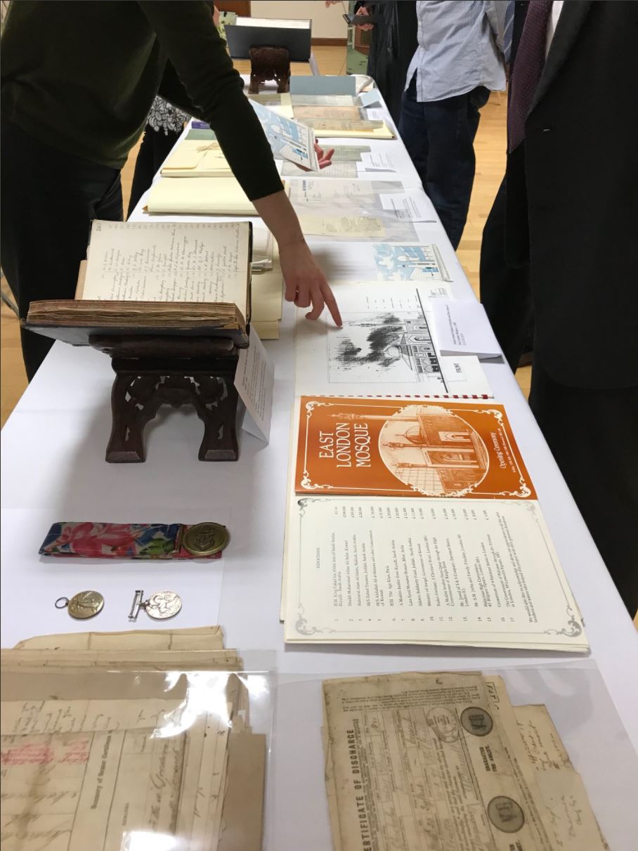
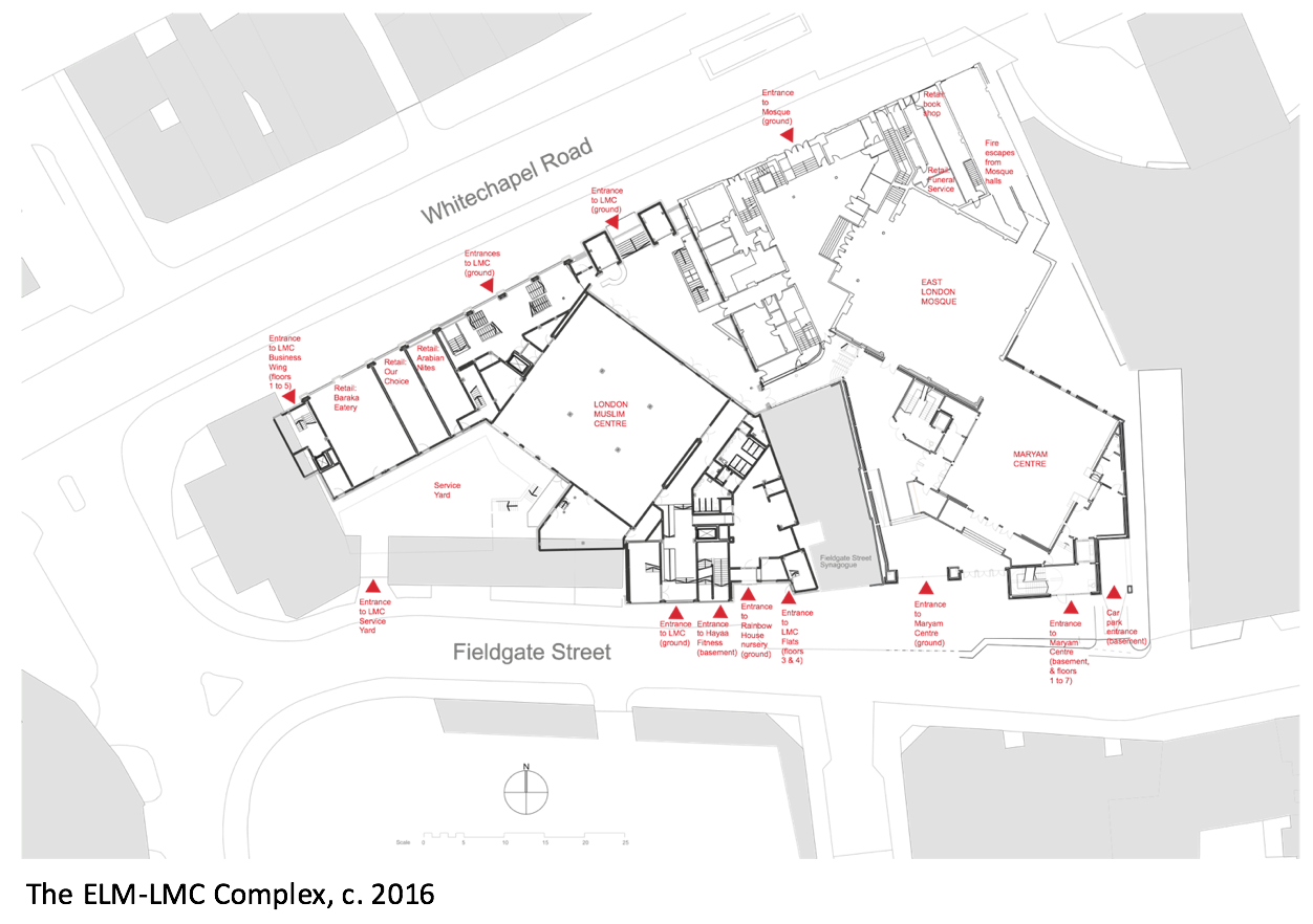
On 22nd November 2017 the East London Mosque Archives' strongroom was inaugurated. The new strongroom provides a stable and securely managed environment for records ranging from the London Mosque Fund Minute Book (from 1911) to photographs of the mosque's pre-fab building on Fieldgate Street in the 1970s. The opening itself was symbolically important, celebrating the first such Muslim archive in the UK. The evening was led by Sufia Alam of the Maryam Centre who has told some of her own Whitechapel story on the Survey's website here and here. Many trustees were in attendance, some of whom have served the mosque for decades and can remember the former building on Commercial Road. Summaries of the lives of Sulaiman Jetha, Haji Taslim and Hajja Mariam Ali (née Josephine Mary Morgan) can be read here.
Photo credit: @ELMarchives
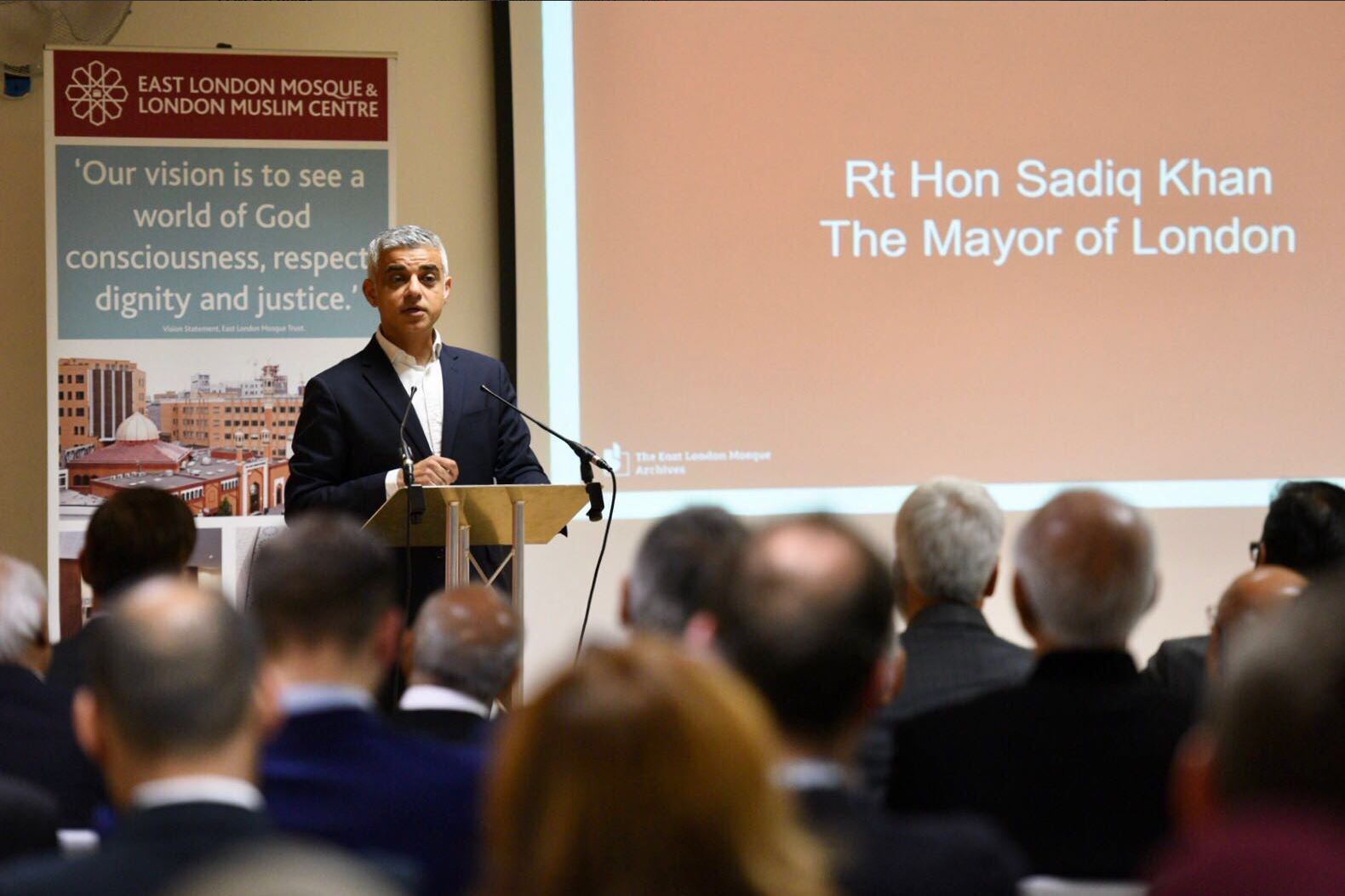
Londoner and British Muslim, Mayor Sadiq Khan formally opened the strongroom with a speech that included the commendation that, "familiarity with our history helps us understand our present...only by chronicling our history can we benefit from the knowledge and wisdom of those that have gone before us." His visit was marked by a commemorative plaque which will be installed outside the strongroom. Other presentations were made by Mayor John Biggs of Tower Hamlets, Dr Valerie Johnson of The National Archives, and Rushanara Ali, MP for Bethal Green and Bow. Shahed Saleem, Senior Research Fellow at the Survey of London Whitechapel, was honoured with an award for his contribution to the ELM Archives project.
Photo credit: @MayorofLondon
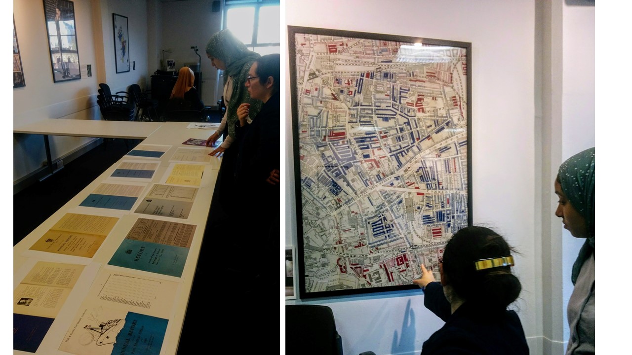
The following day, at London Metropolitan Archives, Abira Hussein led a workshop which focussed on what an archive does and explored ideas of collective memory. She also presented documents relating to the lives of Somali seamen living in East London. The theme was expanded on by Paul Dudman of the Refugee Council Archive (UEL), who considered the issue of forced displacement in the context of the Somalian civil war. With a strong tradition of oral history, British-Somalian heritage is not always easily located in archives and Dudman noted that where "memories of refugees are 'moving', digitalised oral history archives can be seen as 'a project of human rights'".
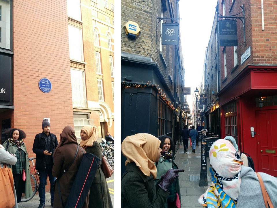
Afterwards, participants gathered in Spitalfields to begin a ‘Hido Raac’ (walk) south through Whitechapel. This was led by Hudda Khaireh and Kinsi Abdulleh of Numbi Arts, however everyone in attedance was invited to share their knowledge, which led to some unusual connections. As the group walked by the former Jewish Soup Kitchen at Brune Street, we learned that Somali soup kitchens once proliferated in the East End, at Calcutta House we stopped to consider the flow of trade between Africa, Asia and the UK during the colonial nineteenth-century, and at St Botolph's Aldgate we heard recent stories of tragic loss in the Somalian community, some of whom had drawn on the charitable services provided at the church.
The day was covered by journalist Hana Bihi for London Live. You can view her audio-visual report featuring Abira and Kinsi here.
The Survey of London would like to share a self-guided walk around the eastern portion of the Royal London Hospital’s estate, bounded roughly by Whitechapel Road north, Cavell Street east, Commercial Road south, and New Road west. Download our route map and guide for a fuller introduction to the history of the hospital and its estate: Guide to a walking tour of the Royal London Hospital Estate
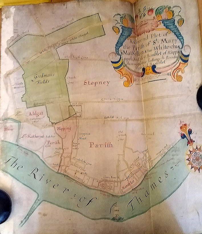
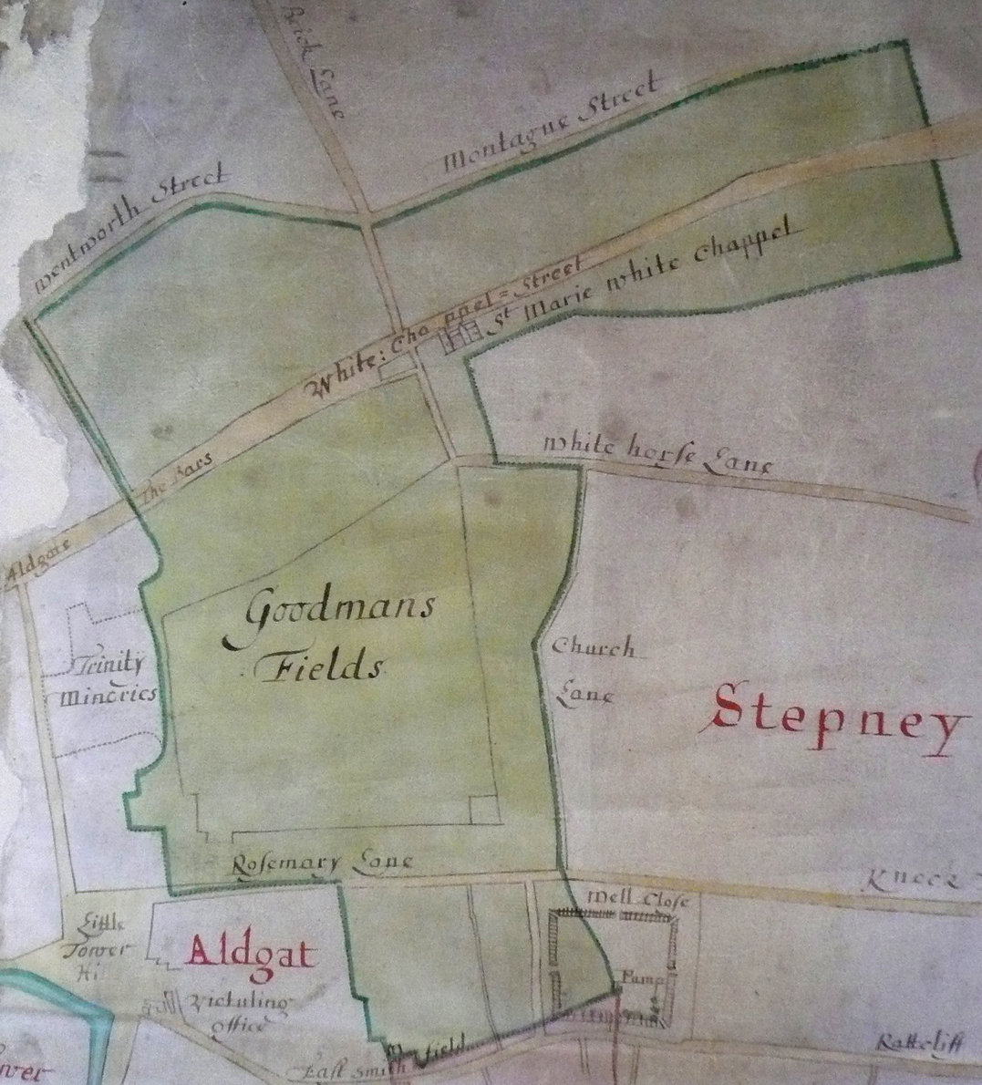
In 1708 Brasenose College, Oxford, purchased the advowson or patronage of the parish of St Mary Matfelon, Whitechapel, from the parish of Stepney. This was confirmed by Act of Parliament in 1710 and gave the College the right to appoint Whitechapel’s rector when vacancies arose. This was controversial, unwelcome to many in Whitechapel. The right was given up in 1864. As a result of this link there is a map of the parish of Whitechapel at Brasenose College Archives (reference B 14.1/44). It is a beautiful thing, painted and drawn on vellum and in an excellent state of preservation, its colours still vivid.
It shows the parish shaded green and extending from Wentworth Street and Montague Street in the north across Whitechapel Street, Goodmans Fields and Rosemary Lane to Well Close, which is depicted as enclosed by what were probably timber palings with a pump in its south-east corner.
There is greater detail to the south as far as ‘The River of Thames’ in the L-shaped area that was known as Wapping-Whitechapel. This separated from Whitechapel in 1694 to become the parish of St John Wapping.
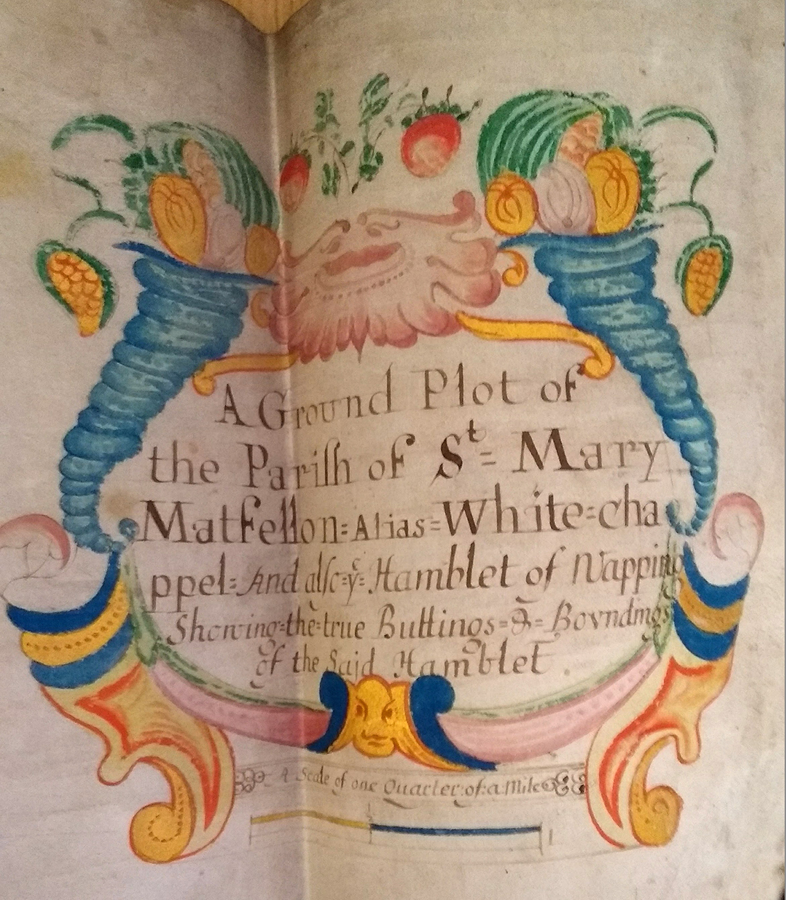
A splendid cartouche (top right), bracketed by cornucopias, titles the map as ‘A Ground Plot of the Parifh of St Mary Matfellon: Alias White-chappel And also ye Hamblet of Wapping Showing the true Buttings & Boundings of the Said Hamblet’.
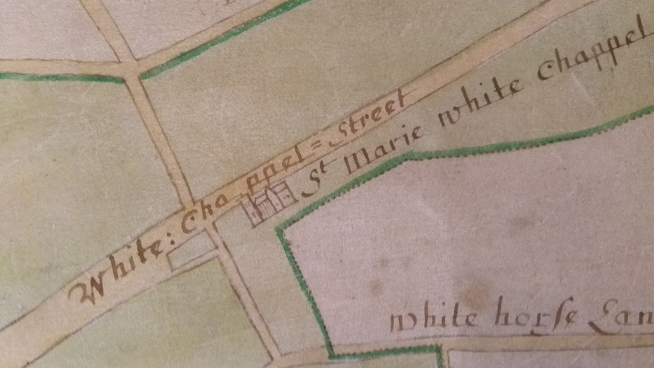
This focus of attention suggests that the map might have been prepared with the separation in prospect. It can be no earlier than 1673 as the parish church of ‘St Marie White Chappel’ is depicted with a transept, a feature it lacked before the rebuilding completed in that year that gave it a cruciform or cross-axial plan.
The Survey of London and Brasenose College Archives would welcome any observations about the more precise dating of this map.
With thanks to The Principal and Fellows of Brasenose College
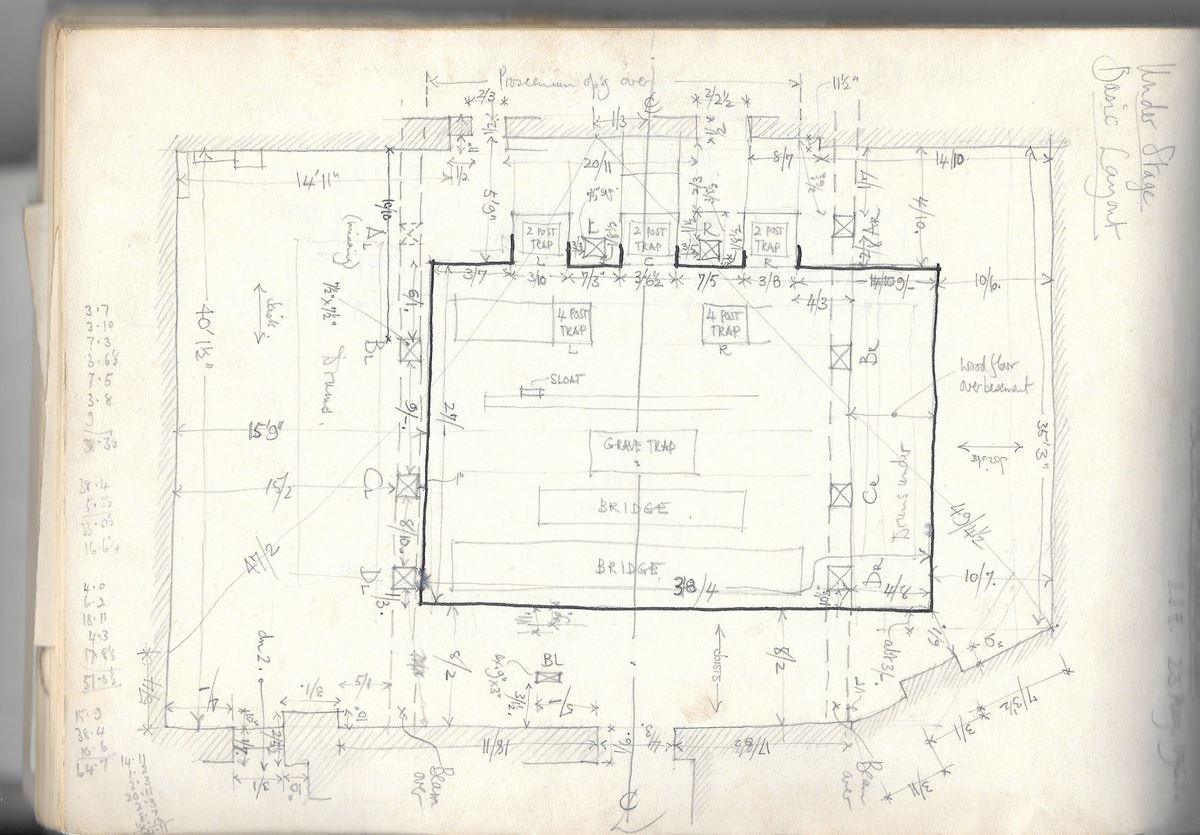
John Earl, doyen among historians of theatres, remembers recording the derelict remains of the Whitechapel Pavilion in 1961:
It was a dauntingly complex task, as to my (then) untrained eye, it appeared to be an impenetrable forest of heavy timbers, movable platforms and hoisting gear, looking like the combined wreckage of half a dozen windmills! I started by chalking an individual number on every stage joist in an attempt to provide myself with a simple skeleton on which to hang the more complicated details. Richard Southern's explanations enabled me to allocate names to the various pieces of apparatus, correcting my guesses. (‘Stage basement’ for example was, I learned, an imprecise way of naming a space with three distinct levels). He also gave me a brilliant introduction to the workings of a traditional wood stage and to the theatric purposes each part fulfilled.
The attached sketch attempts to give a summary view of the entire substage.
It is set at the first level below the stage, with the proscenium wall at the top and the back wall of the stage house at the bottom. In the terminology of the traditional wood stage, this is the ‘mezzanine’, from which level, all the substage machinery was worked by an army of stage hands. In the centre, the heavily outlined rectangle is the ‘cellar’, deeper by about 7ft below the mezzanine floor. Housed in the cellar are a variety of vertically movable platforms designed to move pieces of scenery and complete set pieces.
It may be observed at this point that not all of this apparatus will have resulted from one build. A wood stage had the great advantage that it could be adapted at short notice by the stage carpenter to meet the demands of a particular production. The substage, as seen, represents a particular moment in its active life.
There are five fast rise or ‘star’ traps for the sudden appearance (or disappearance) of individual performers (clowns, etc) through the stage floor. The three traps nearest to the audience are ‘two post’ traps, rather primitive and capable of causing serious injury to an inexpert user. Upstage of these are two of the more advanced and marginally safer ‘four post’ traps. In both types, the performer stood on a box-like counter-weighted platform with his (usually his) head touching the centre of a ’star' of leather-hinged wood segments. Beefy stage hands pulled suddenly (but with split second timing) on the lines supporting the box, shooting him through the star. In an instant, it closed behind him, leaving no visible aperture in the stage surface.
Farther upstage is a row of ’sloats’, designed to hold scenic flats, to be slid up through the stage floor. Next comes a grave trap which, as the name suggests, can provide a rectangular sinking in the stage (‘Alas, poor Yorick’). Finally, a short bridge and a long bridge, to carry heavy set pieces, with or without chorus members, up through (and, when required, a bit above) the stage. These bridges were operated from whopping great drum and shaft mechanisms on the mezzanine.
In order to get all these vertical movements to pass through the stage, its joists, counter-intuitively, have to span from side to side, the long span rather than the more obvious short span. This makes it possible to have removable sections ‘(sliders’) in the stage floor, which are held level position by paddle levers at the ends. When these are released, the slider drops on to runners on the sides of the joists and are then winched off to left and right.
The survey of the Pavilion stage was important at the time because it seemed to be the first time that anything of the kind had been done, however imperfectly. Since then, we have learned of complete surviving complexes at, for example, Her Majesty’s theatre in London, the Citizens in Glasgow and, most importantly, the Tyne theatre in Newcastle, which has been restored to full working order twice (once after a dreadfully destructive fire) by Dr David Wilmore. Nevertheless, the loss of the archaeological evidence of the Pavilion is much to be regretted.
I can have enjoyable fantasies about witnessing an elaborate pantomime transformation scene from the mezzanine of a Victorian theatre. The place is seething with stage hands, dressers and flimsily clad chorus girls climbing on to the bridges, while the stage is shuddering, having been temporarily robbed of rigidity by the drawing off of the sliders. Orders must be observed to the letter and to the very second, but there can be no shouting, however energetically the orchestra plays. Add naked gas flames to the mix…
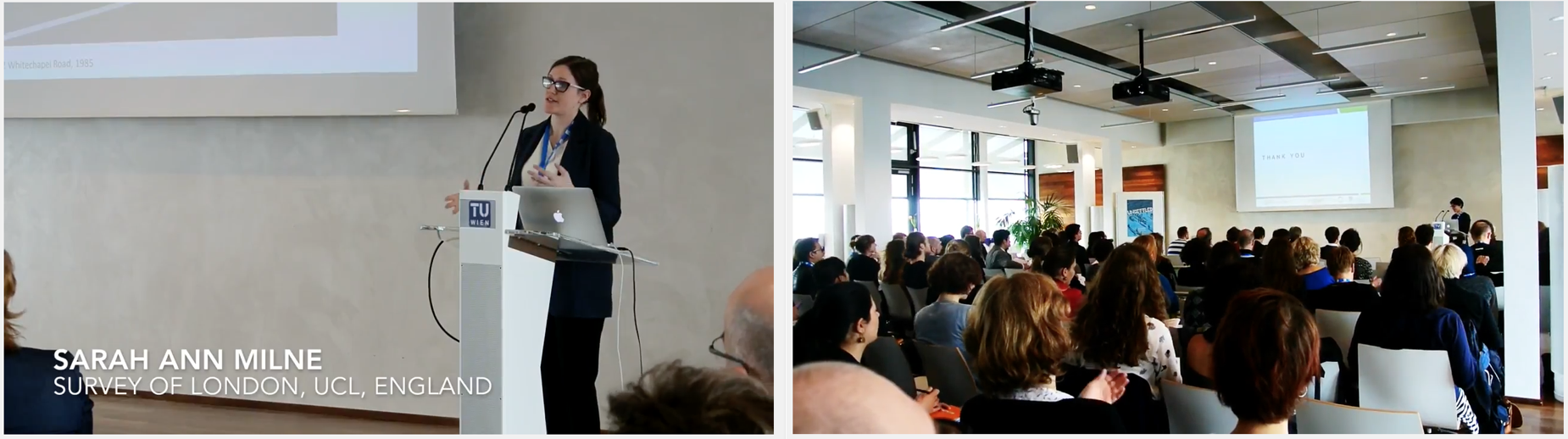
Between 29 - 31 March 2017, an international conference entitled ‘Unsettled – Urban Routines, Temporalities and Contestations’ was hosted by the Technical University, Vienna, Austria. It aimed to explore conditions and conceptions of the unsettled. At this event Sarah Milne and Shahed Saleem presented their paper ‘A Kind of English: The East London Mosque and Whitechapel’s German Churches as Diasporic Religious Spaces’.
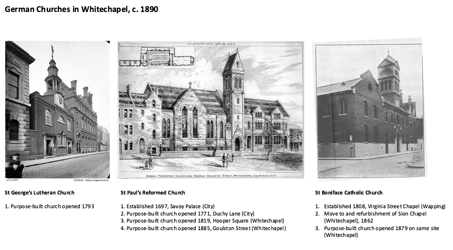
The paper explored the role of religious buildings for migrant communities in Whitechapel, considering how such groups created and connected to conceptions of ‘home’ through their places of worship. Two particular migrant groups were examined as they moved into and dispersed from Whitechapel. The analysis started with the German community (Deutsche Kolonie) in the East End, and its close links to the sugar refining industry in the nineteenth century. Sarah and Shahed then considered the Bangladeshi community who started to settle in large numbers from the 1970s.
Drawing on the Survey’s research into three local German churches (St George’s Lutheran, St Paul’s Reformed and St Boniface Catholic), Sarah and Shahed also interviewed Sigrid Werner, associated to St George’s, and Father Chris Dieckmann of St Boniface to further understand the churches’ funding, sociability, cultural and spatial practices over time.
Utilising research from Shahed’s forthcoming book The British Mosque, the paper then outlined the development of the East London Mosque (ELM) in the context of a growing working class Muslim community in East London. It suggested that there were many more barriers to integration for the first-generation Bengali migrants than for the Germans. It argued that the ELM in fact has served to unite different ethnicities under a pan-Islamic and transnational vision for the mosque. As the present-day Bengali community trickles out of Whitechapel, the mosque’s aspiration to move beyond the local and address regional and perhaps national Muslim needs finds expression organisationally as well as architecturally.
The conference itself thought seriously about the diverse manifestations of urban instability in a range of international situations both past and present. Presentations ranged from ‘Creeping Urban Apartheid’ in Tel Aviv to ‘Unsettling the Sociopolitical Order through Hip Hop Practices’ in Ho Chi Minh City and Hanoi. There were many exciting conversations and propositions for active engagement in places all over the world as a result of the discussions.
In fieldwork carried out in 2011-12 twenty-one interviewees explained the need to preserve the identification of Whitechapel Road with the Sylheti community as a reaction to the gentrification process.
Saba (53) was preoccupied with the possible loss of individual cultural identity and the uprootedness of a society that is more and more like a market in which nothing prevents the stronger from dominating the weaker: "I am worried about an oncoming blending of local culture, as other multinational chains follow Starbucks into the area and attempt to gentrify it with their bland corporate décor and homogenous facades. We must defend our area and culture from taking over".
Puja (34) said: "I see Shoreditch, about a mile from here, that every venue has the same hipster formula applied. There's no place for identity anymore".
Abida (26) claimed: "It feels like the East-End becomes a playground for the rich and Japanese. We are worried that property prices soar pushing us, the original residents, out. We’d better sell inside."
As of 2002, indirect collaborations succeeded in strengthening the Sylheti presence on Whitechapel Road. Collective behaviour thus attracted Sylheti newcomers. The area designated as Sylheti territory was marked by its own market prices, strengthening the community members' sense of place, and improving their ability to cope with local challenges.
This is an extract from a paper titled 'A decision not to decide: A new challenge for planning', to be published in European Planning Studies.
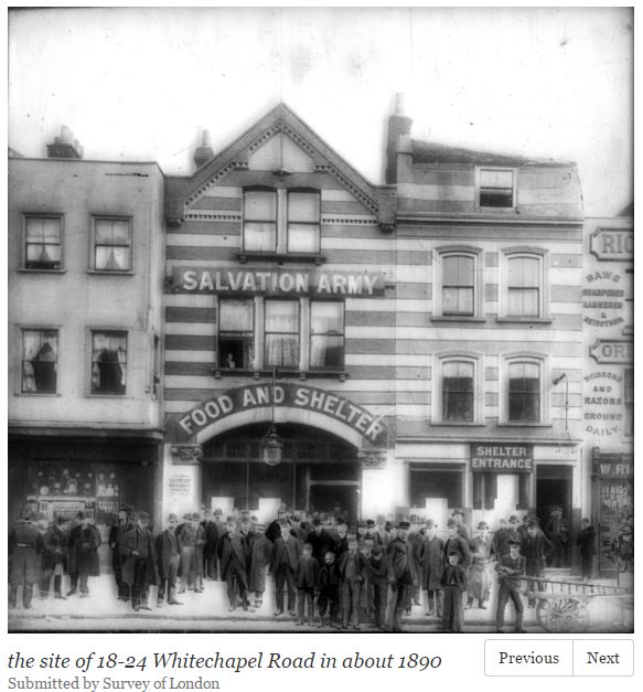
At the beginning of 2017 the late-Victorian pair of shop-houses at this address was demolished, for replacement in replica form as part of a wider development project. The circumstances of the pair's construction in 1893-4 were unusual. An early timber-framed and jettied three-storey pair here was gutted by fire on 20 August 1893. For reconstruction the landlord, Fasham Venables, a linendraper on Whitechapel High Street, employed Henry Hyman Collins as surveyor and Amos Eaton & Co. as builder, the last also based on Whitechapel High Street. The old front walls were retained for the sake of the upper-storey projection, but Arthur Crow, the District Surveyor, objected and took the matter to court, arguing that the work constituted rebuilding so the projection had to be sacrificed. He prevailed, and work with set-back brick front walls was completed in March 1894. Please have a look at the images attached to this site on our map.
Since Dorothy George’s London Life in the Eighteenth Century (1925) historians have sought to explain East London’s poorer standards of building in the context of custom of the manors of Stepney and Hackney, originating before the Reformation when they belonged to the bishops of London. By one particular custom, copyholders (tenants of manorial land) could grant leases for a maximum of only thirty-one years, risking forfeiture of their copyholds by the lord of Stepney manor if they transgressed. Such short building leases would dissuade tenants from building to proper standards. This explanation was broadly accepted by Alan Palmer, for instance, though he pointed to areas such as Wellclose Square and Swedenborg Gardens as exceptions to the usual lack of pattern. ‘The persistence of the ancient copyhold system of tenure ruled out rich rewards for speculative investment on a large scale … So curious a restraint helped to make land cheaper, but it also favoured the spread of small houses, haphazardly packed into narrow streets.’[1] But Derek Morris has recently pointed out that the 31-year leases could be renewed on the payment of a fine to the lord of the manor. What is more, ‘Local historians have known for many years that while [short leases] may have been the original intention of the lord of the manor, the actual practice was very different. Leases were granted of 66, 99 or 500 years in order to obtain the fines.’ [2] If this is so, the lords of Stepney manor, first the Wentworths and then the Colebrookes, were open to corruption, as they could be induced to break their own rules to authorize development.
From April to October 2016 I was part of the Survey of London’s Whitechapel team, cataloguing records at Tower Hamlets Local History Library and Archives describing property in Whitechapel. This was to enable the Survey to have recourse to as much primary source material as possible, and the descriptions are also available to all users of THLHLA’s online catalogue www.thcatalogue.org.uk. During the cataloguing process I certainly found that long lease terms were not uncommon in the manor of Stepney, in which most of the present-day Borough of Tower Hamlets lay, including the parish of Whitechapel. But they would not have been possible on copyhold land. Tenants’ admissions to and surrenders of copyhold land in the manor are recorded in its court rolls and books, which survive with some gaps from 1318, including an uninterrupted sequence of 88 court books at London Metropolitan Archives dating from 1654 to 1925. It would be almost impossible to indicate on a map of Stepney which land was copyhold at any particular date, because it was so fragmented even by early modern times, and the property descriptions in the court roll are rarely precise enough for accurate location. But those of the corresponding deeds held at Tower Hamlets Archives are easily recognizable as they take the form of copies from the court roll. The cornerstone of Tower Hamlets Archives’ holdings of title deeds is those parts of the private collections of J. Coleman and F. Marcham that related to Stepney, which the Metropolitan Borough purchased in 1909. Among these, there are fifty-four titles to Whitechapel land, with deeds dating from 1589 to 1838, and of them only seven are copyholds. During the course of this project about 650 title deeds have been catalogued, and my impression is that the proportion of copyholds among them would be similar. The remainder are for freehold land, which could have been bought and sold, or leased for unlimited periods.
For instance, land at the east end of Whitechapel High Street and on the Thames foreshore at Limehouse was being leased in the 1580s for 500-year terms by Henry lord Wentworth.[3] As he was lord of Stepney, this land might have been part of the manorial desmesne, and there seemed to be no subsequent restriction on the leaseholders assigning these leases for the remainder of the term, nor about private individuals leasing freehold property for even longer terms. Such long leases of copyhold land would have been impossible, though copyholders could express intentions in their wills to keep it in their family, and even entail it. As for the manorial fine, it was a customary payment to the lord whenever a new manorial tenant was admitted to copyhold land. It should not be regarded as punitive, although elsewhere in the country entry fines are known to have increased during the sixteenth and seventeenth centuries, while rents to the lord were set by custom and remained unchanged.
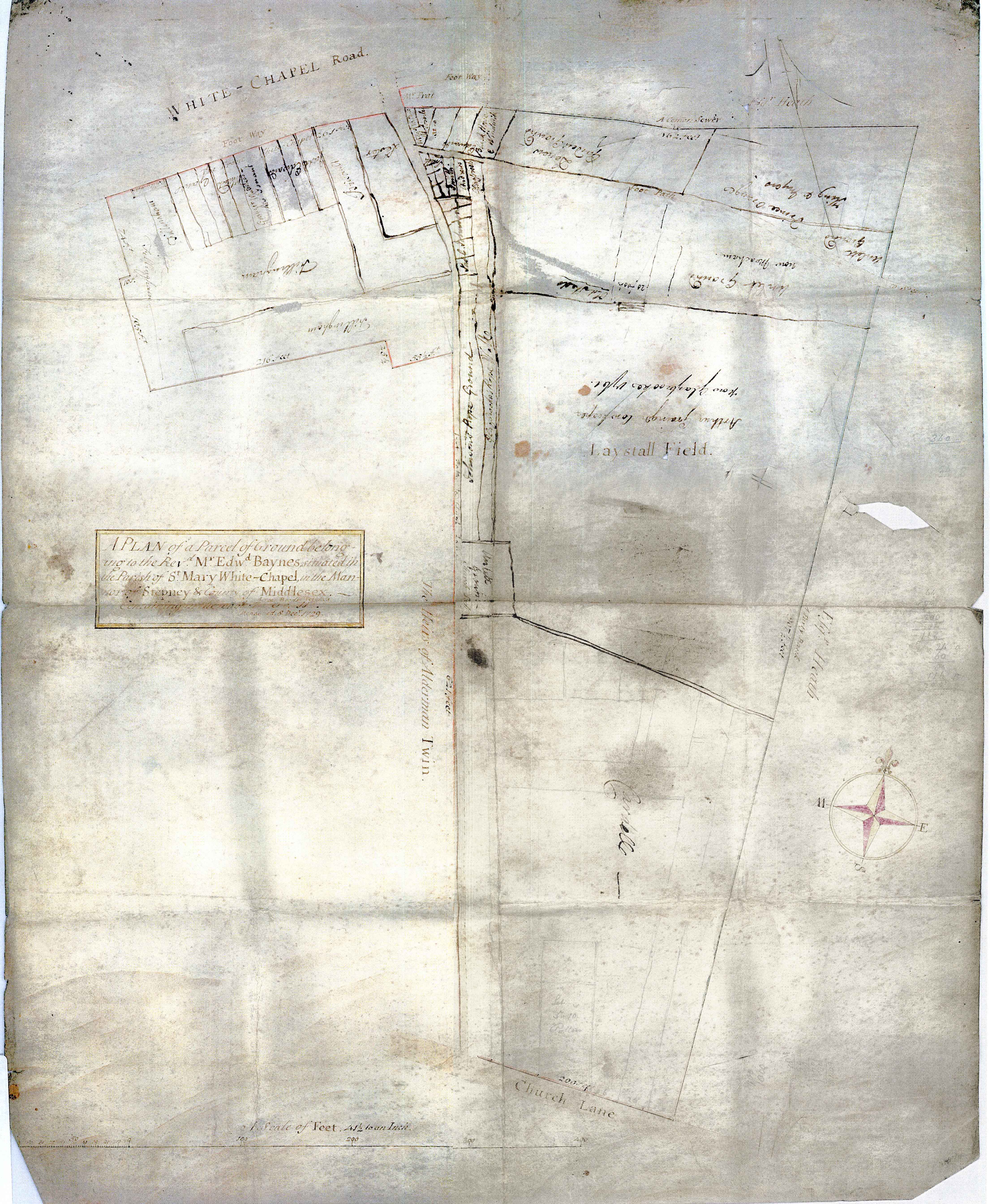
If the lords of Stepney wished or needed to raise cash from copyholders willing to purchase, they could enfranchise copyhold land, that is, convert it to freehold, long before the Copyhold Act of 1852 allowed tenants to demand this. One major copyholder of the mid eighteenth century was Edward Baynes, who held about sixty plots on the south side of Whitechapel Road and Mile End Road, including the ‘Prince of Orange’s Head’ and the ‘George Inn’ (14 Whitechapel Road). On his death in the 1760s his son was admitted to them but soon surrendered a part, to which a ‘gentleman of the Tower of London’, Anthony Foreman, was then admitted. Sir George Colebrooke, lord of Stepney, then enfranchised it, allowing Foreman to purchase the freehold and then to develop the area of Fieldgate Street and Greenfield Street in a succession of leases to builders.[4] The restrictions of copyhold, then, were generally limited to small pockets of Stepney and could be overcome by legal means. More research on this topic is probably needed: I do not claim to have an informed viewpoint, but would suggest that we may have to look to other causes to explain the pattern of development in the East End. If we suspect the lords of Stepney were open to corruption, we need more evidence, and probably comparisons with the degree to which lords of the manor in other London suburbs adhered to manorial custom.
Map of the Baynes Estate in 1729 (Tower Hamlets Local History Library and Archives)
1 - Alan Palmer, The East End: Four Centuries of London Life (London, 1989, rev. edn, 2000), pp. 16–17.
2 - Derek Morris, Whitechapel 1600–1800: a social history of an early modern London inner suburb (East London History Society, 2011), p. 5.
3 - Tower Hamlets Local History Library and Archives (THLHLA), P/SLC/1/17/3–4.
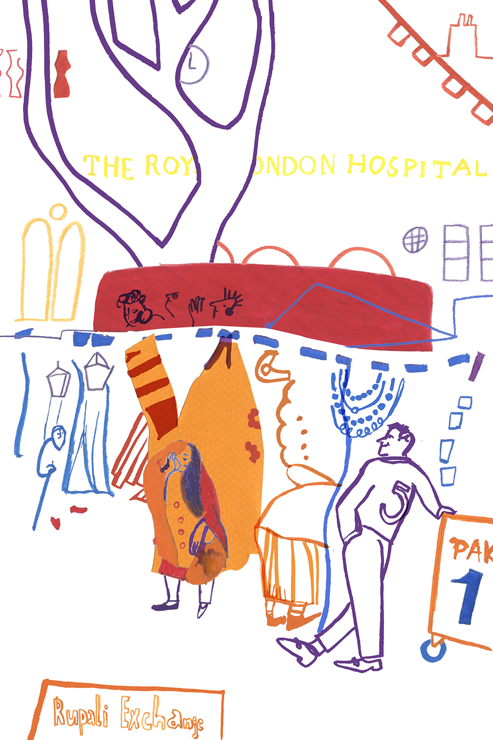
To help to get our website off to a lively start we commissioned Judit Ferencz, a graphic artist and PhD student at the Bartlett School of Architecture, to illustrate some peopled outdoor places in Whitechapel - Altab Ali Park, the market on Whitechapel Road, and the playground at the centre of Whitechapel's Peabody Estate. Judit has given us five beautifully observed images, all to be found in place on our map, and gathered together here. We are pleased in addition to tell our readers that Judit is the recipient of this year’s RIBA LKE Ozolin Award:
One of the quirks of copyright is that even if an old map is well out of its copyright term, reproductions of that map automatically become the copyright of whoever made the copy. So that whilst it’s possible for academics to download and view old maps from the University of Edinburgh’s Digimap collections (https://digimap.edina.ac.uk/) for research purposes, it’s not possible to put them online for others to view. We have two historic map layers available on Histories of Whitechapel: the Rocque map of 1746 and the 1873 Ordnance Survey, donated by the Institute of Historical Research (http://www.history.ac.uk/) and Tower Hamlets Local History Library and Archives (https://www.ideastore.co.uk/local-history) respectively.
The Rocque Map scan was produced for the Locating London’s Past project (https://www.locatinglondon.org/), and the process by which it was created was quite involved due to the age of the map sheets and the way they were made. You can read about the process on their blog https://locatinglondonspast.wordpress.com/2011/06/22/recreating-rocque-london-1746/. We’ve published just a small excerpt on the Histories of Whitechapel map. There are some lovely details: taking a look at the area around East London Mosque, it seems quite likely that Fieldgate Street is so called because it was the street that led to the fields:
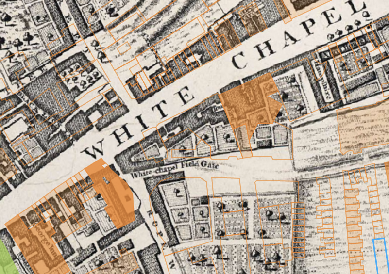
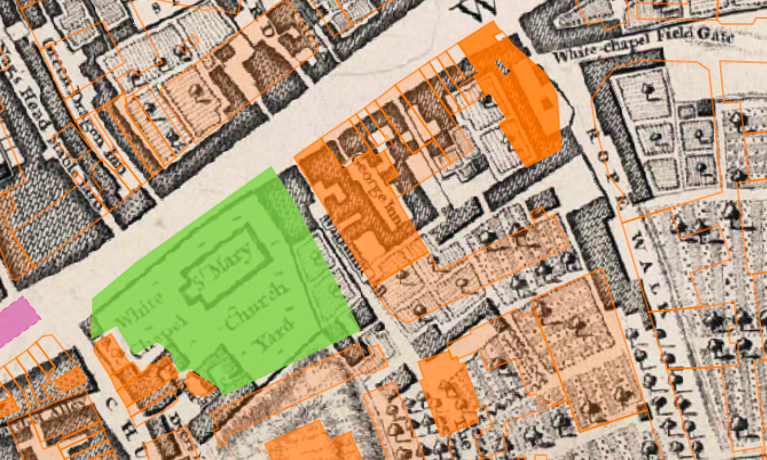
14 Whitechapel Road, Currently Haji Nanna Biryani, which the Survey have identified as formerly being the George public house, constructed c.1881, is on the site of an even older building, the George Inn. This suggests that food and drink have been served on this site for at least 270 years:
The 1873 Ordnance Survey map was provided by Tower Hamlets Local History Library and Archives, who are in possession of a complete set of this edition for the borough. Unlike the Rocque, we had to scan and georeference this ourselves. The map sheets (each around 1000x800mm) were scanned using a sheet-feed map scanner by Nick Mann at UCL, and then retouched in Photoshop. From here they were imported into QGIS (http://www.qgis.org/en/site/) and georeferenced, which involves matching up points on the scan with the contemporary street network. We used our building footprints (see https://surveyoflondon.org/blog/2016/how-we-made-map/) as our reference.
For some areas this was easier than in others: along Whitechapel Road, many of the original shop frontages are still in place, and pubs (easily identified by the 'P.H.' on the OS map), even if no longer being used for their original purpose, are in many cases still there. However, other areas (for example around Aldgate), have seen huge changes since the 1880s, and it’s trickier to align the old map with the new.
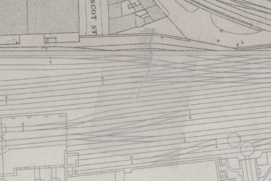
One of the nicest things about our 1873 OS layer is that the particular copies Tower Hamlets Local History Library and Archives lent us have obviously been heavily used. Some of the sheets are in quite poor condition: the south-western area of the study area (around the Royal Mint Estate, towards the Tower of London) in particular is quite tatty, and in places you can see where it’s been torn and taped to hold it together:
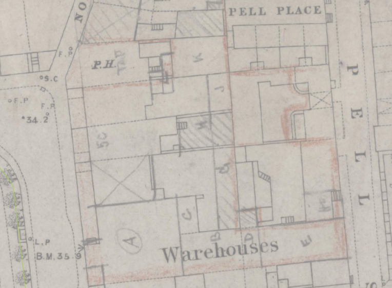
In other places it’s been annotated, for example on this area by Wellclose Square:
The buildings these marks refer to are gone, and we don’t know what the annotations mean, but it’s a nice illustration of the way that the historic maps aren’t just useful in that we can use them to see what’s changed between then and now, but are tangible documents whose condition testifies to their history of ownership and use.