Brasenose College’s map of Whitechapel
Posted by Survey of London on Aug. 14, 2017
In 1708 Brasenose College, Oxford, purchased the advowson or patronage of the parish of St Mary Matfelon, Whitechapel, from the parish of Stepney. This was confirmed by Act of Parliament in 1710 and gave the College the right to appoint Whitechapel’s rector when vacancies arose. This was controversial, unwelcome to many in Whitechapel. The right was given up in 1864. As a result of this link there is a map of the parish of Whitechapel at Brasenose College Archives (reference B 14.1/44). It is a beautiful thing, painted and drawn on vellum and in an excellent state of preservation, its colours still vivid.
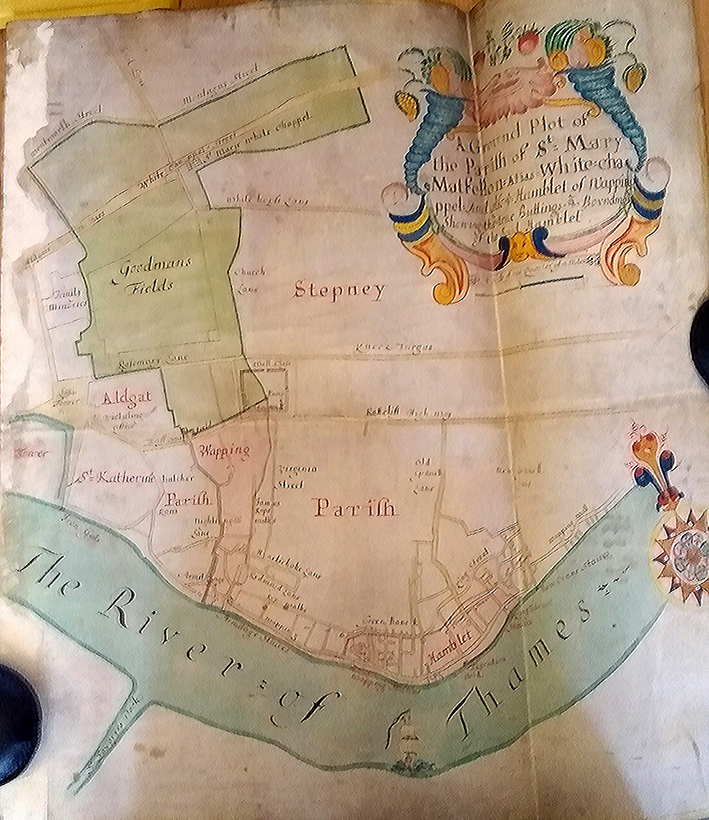
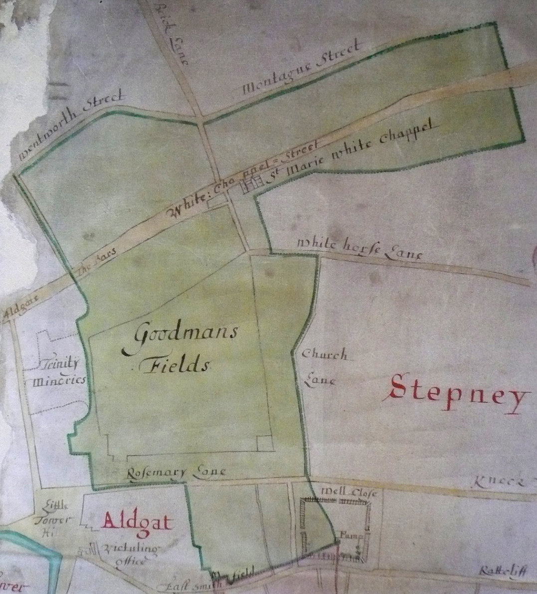
It shows the parish shaded green and extending from Wentworth Street and Montague Street in the north across Whitechapel Street, Goodmans Fields and Rosemary Lane to Well Close, which is depicted as enclosed by what were probably timber palings with a pump in its south-east corner.
There is greater detail to the south as far as ‘The River of Thames’ in the L-shaped area that was known as Wapping-Whitechapel. This separated from Whitechapel in 1694 to become the parish of St John Wapping.
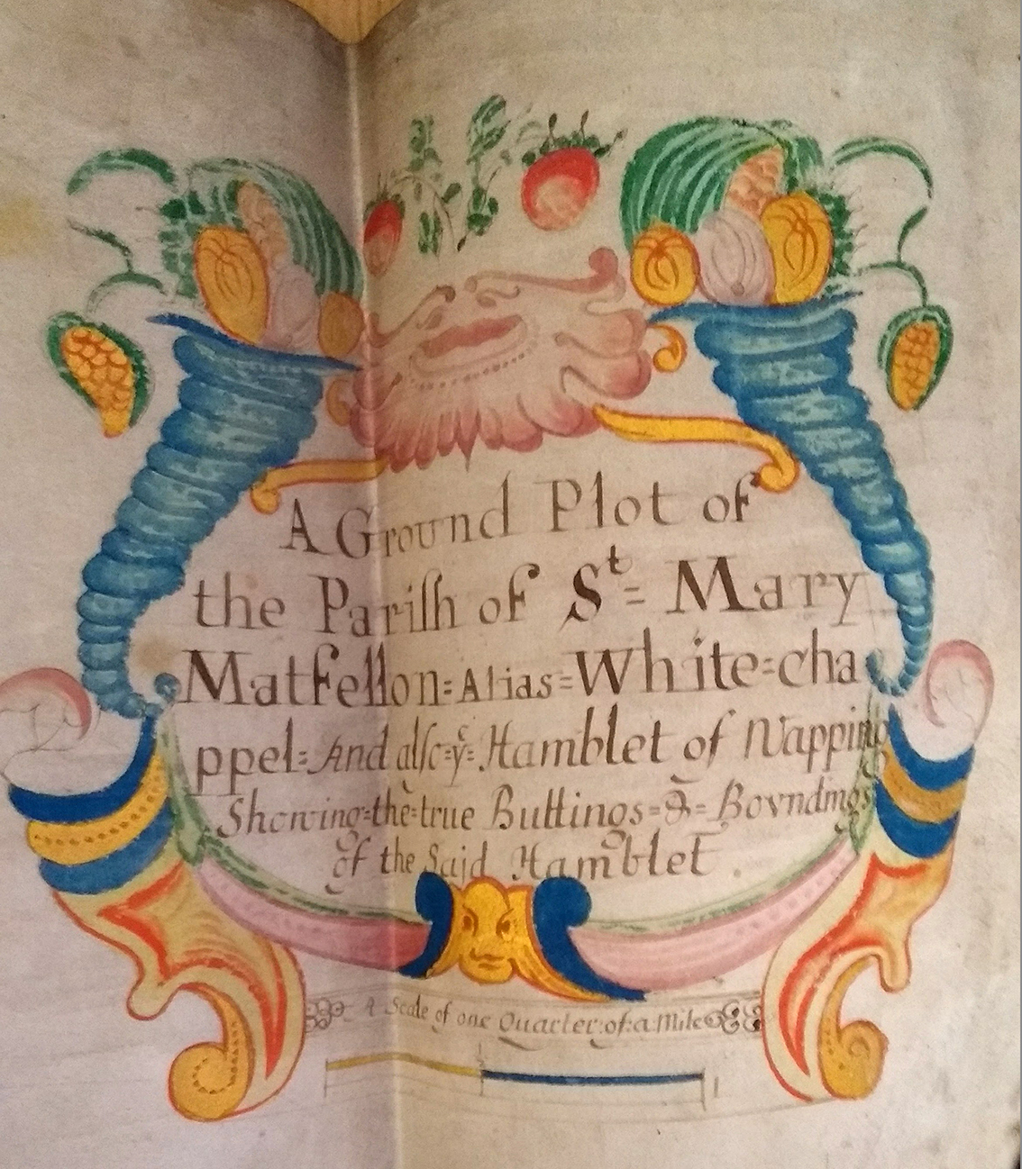
A splendid cartouche (top right), bracketed by cornucopias, titles the map as ‘A Ground Plot of the Parifh of St Mary Matfellon: Alias White-chappel And also ye Hamblet of Wapping Showing the true Buttings & Boundings of the Said Hamblet’.
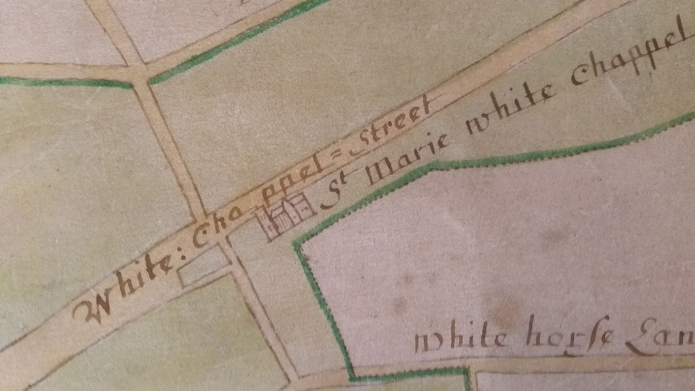
This focus of attention suggests that the map might have been prepared with the separation in prospect. It can be no earlier than 1673 as the parish church of ‘St Marie White Chappel’ is depicted with a transept, a feature it lacked before the rebuilding completed in that year that gave it a cruciform or cross-axial plan.
The Survey of London and Brasenose College Archives would welcome any observations about the more precise dating of this map.
With thanks to The Principal and Fellows of Brasenose College


