Piazza Walk, Goodman's Fields
Open space, grass, water feature and 'Goodman's Fields Horses' sculpture by Hamish Mackie, 2015 | Part of Goodman's Fields
Leman Street's east side, early buildings between Alie Street and Hooper Street
Contributed by Survey of London on May 7, 2020
The east side of Leman Street south of Alie Street and north of Hooper Street is fronted by the Goodman’s Fields housing development and student housing of the early twenty-first century, and, further south, former Co-operative Wholesale Society buildings. This simplicity hides a complex history, traces of which have entirely vanished.
First development, 1680 to 1730
From its beginnings in the 1680s this side of Leman Street was humbler than the west side, lacking grand houses presumably because the backs did not enjoy open space comparable to the Tenter Ground. Instead there was Rupert Street, which filled up with sugarhouses and cottages at an early date. Development began in 1682 when John Hooper took two 62½-year building leases on the whole 780ft frontage between Alie Street and what became Hooper Street (originally part of Hooper’s Square). The division between the two parcels was apparently marked by an alley called Johnson’s Passage or Court, later Leman Passage, which continued eastwards to meet a path leading into the Physick Garden. By the time of his death in 1685, Hooper had developed some Leman Street house plots himself, and sublet others on fifty- and fifty-one-year building leases, some to John Bankes, a timber importer. Bankes took frontages of 62ft and 51ft, near either end of Hooper’s Leman Street frontage, and also acted as a contractor for Hooper, who supplied bricks, putting up four four-storey houses on this frontage in 1683–4. These were probably on the southern parcel, close to Hooper’s Square, where another sub-lessee was Robert Hart, a plasterer. There were eventually nine houses on this holding, apparently fairly uniform and of good size. By 1694 there were at least twenty-five houses on the east side of Leman Street as a whole, generally of a middling kind. They stood north and south of a 286ft stretch of undeveloped ground held by Sir Stephen Evance who had acquired Hooper’s property in 1686.1
This part of the street to the south of Johnson’s Court remained open in 1712 when it was offered as a site for a Commissioners’ church. The property passed on Evance’s death that year to his heir-at-law, Sir Caesar Child, but the inheritance was not resolved until 1722. The open Leman Street frontage was seemingly promptly built up thereafter with seventeen houses. With frontages of about 16ft each, these were more substantial than those to either side, and were raised above basements behind areas. By 1725 William Collier (d. 1742), a citizen Joiner, had a long lease of at least three of these newly built houses. He lived in one and held another two by the time of his death. Captain Jonathan Collet (d. 1746), Child’s trustee, renewed the original Hooper head- lease of 1682 in 1744.2
The three holdings on Leman Street’s east side were discernible in eighteenth- century topography through differences in the forms of its forty-seven houses. North of Johnson’s Court around twenty houses had been developed piecemeal, mostly before 1700. They were somewhat more modest and less uniform than the houses further south of later and similar date. A house that wound up after serial renumberings as No. 59, and which survived until the 1930s, was perhaps typical. It was of three storeys, with a flat red-brick façade with plat bands, flush-frame sashes, a steeply pitched roof to an attic with a hipped dormer, and had two rooms to a floor. A Royal Commission investigator described the interior in 1928: ‘the staircase has moulded continuous string, handrail and balusters. The newels are square and have ball finials.’3 Another early house of similar scale, No. 29 near the Alie Street corner, survived until about 1978. Though probably refronted in the late eighteenth century, it retained a gabled rear wing. Some houses of the 1680s on this northern stretch may originally have had gabled fronts.4
Early occupants and industry
Up to the middle of the eighteenth century, the east side of Leman Street seems to have been largely residential, with commerce increasingly intermixed. Houses were often associated with or extended into industrial premises to the rear on Rupert Street, less so to the north where there was little back development until the later eighteenth century. Leman Street’s status as a thoroughfare was reflected in the presence of public houses from the earliest days. The White Hart alehouse (eventually No. 43) was present by 1689 up to 1931–2. Further north near the Alie Street corner was the George, present by 1693 and less long-lived. Edward Hill (d. 1737) had a brewery just north of Johnson’s Court by 1732, probably earlier, that was subsequently run by his nephew John Hill (d. 1765), who also had an interest in a sugarhouse where Leman Street met Chamber Street.5
Shop use – oil men, linen drapers, corn chandlers, shoemakers, tea dealers, cabinet makers – was widespread to the north and south, but the larger houses of the 1720s in the middle section tended to remain private, with residents of some status, though not of a level with those on the other side of the street. By 1733 one of these houses pertained to Clifford William Phillips, a magistrate, who in 1736 drew his sword to quell anti-Irish riots in Leman Street, put down with the assistance of soldiers from the Tower. Subsequent rewards for Phillips included a larger house in Mansell Street and a knighthood.6 Other residents of note included a trio of affluent Sephardi Jewish widows, Sarah Medina Pereira, Sarah Henriques Samuda and Esther Samuda (_c._1699–1776), the widow of Abraham Samuda and mother of David Samuda, whose house was opposite.7
As elsewhere in Goodman’s Fields, nautical pursuits were well represented with many residents and landholders (including Evance) owning stakes in shipping. There was the usual smatter of captains, and maritime interests frequently intersected with others land-bound and local. Anthony Whiting (d. 1724), a corn factor who inherited a small house near the north end of the street’s east side from his father, Thomas Whiting (d. 1699), illustrates this at a modest level as an investor in shipping.8
Many resident mariners were involved in industry, especially sugar refining, and sugarhouses towered up on Rupert Street behind Leman Street’s respectable three-storey houses. Captain John Partis (1693–1735) had one of the houses of the early 1720s south of Johnson’s Court, next door to Justice Phillips, and was active in this way at a comparatively grand scale. Born in Newcastle, the son of another mariner, Partis was involved in the triangular trade with the Caribbean, shipping what were probably slaves (seventy ‘servants’ insured for £8 each) from London in 1728 to Antigua where he had a base; his will specified wines there should be shipped home.9
Sugar businesses and their buildings were often held in partnerships or shares, and through complex layers of leases and subleases. William Collier, whose Leman Street house was two doors away from Partis’s, held a sugarhouse behind some of the houses he had built in the early 1720s that he had sublet to Edward Wynn (d. 1726), from whom it passed to Partis, who was Wynn’s brother-in-law. This sugarhouse was relatively small, at 25ft square probably just a one-pan facility, but even so it was six or seven storeys high with a second building of similar size to its rear, probably a mill house and warehouse.10 Partis further sublet the sugarhouse to another brother-in- law, William Pringle (d. 1761), and Captain William Lawrence (_c._1668–1748, sometimes Lorance or Lawrance), who had the house between Partis’s and Collier’s by 1733, and who was ‘an experienced and able Commander of the Italian and Turkey Trades’.11
Three more similar-sized sugarhouses adjoined along Rupert Street, all with similar complexities of tenure. These evolved through Lawrence to become the locale’s most extensive sugar refining business until the nineteenth century. Lawrence had a house in Lambert Street by 1701, by when he was perhaps already involved in the sugar trade as his address was ‘at ye bake-house’.12 He had an interest in another sugarhouse in Wapping, and was insuring one in Rupert Street by 1730. At his death in 1748 Lawrence’s Rupert Street sugar business passed to his son Captain Ambrose Lawrence (1696–1750). Occupation of another Rupert Street sugarhouse and a house on Leman Street went to John Long (1706–66), a refiner. He and a succession of partners, including Christian Tielhen, Joseph Hess, Frederick Sporman and John Otto Drost, ran the business while the family retained an interest through Richard Lawrence (1725–85), a citizen Grocer and probably Ambrose Lawrence’s nephew.13
His son, Richard Lawrence (1758–1802), was active from Camberwell in expanding the business at a time when the sugar trade was under pressure. He built a new sugarhouse behind Leman Street in 1786–7, enlarging premises that had been occupied by Hardwick Constantien (d. 1789) and John Bott (1732–1806). Another partner from the 1780s was Lewis Vulliamy (1749–1823) of the eminent clock- making family. After the younger Lawrence’s death in 1802, Lawrence & Co. and Vulliamy and Bott continued in partnership. By 1814 Lawrence & Co. held a large block between Leman Street and Rupert Street, with twelve of the Leman Street houses of the 1720s and the sugarhouses behind.14 The firm continued under Richard Henshaw Lawrence (1786–1849), a director of the Phoenix Fire Office, which had been established by sugar refiners, and Morton William Lawrence (1787–1841), who patented improvements to sugar-refining processes. The freehold of the whole block was sold at auction in 1849.15
Johnson’s Bagnio
One of William Collier’s houses of the early 1720s accommodated a business of very different character for more than fifty years from 1724 when Richard Johnson (d. 1769) leased it and established a bagnio, or bath-house. This was the first of several speculative projects in Whitechapel by Johnson, who later styled himself Captain (of the Tower Hamlets Militia).16 Bagnios had been established in London since the 1670s, after the model of the Turkish bath, notably around Soho and Covent Garden. Many appear to have been brothels that offered bathing opportunities.17
How precisely Johnson’s bagnio was used is unclear, but an unusual range of medicinal treatments, and bathing, swimming and steaming facilities, suggest that it was not principally a brothel. In its first two decades under Johnson it appears to have followed the model of the Royal Bagnio in Newgate Street. It was open six days a week, with Tuesdays and Fridays reserved for women. When it opened in November 1724 a cold bath was said still to be ‘preparing’. The focus initially was on cupping, the application of heated cups to the skin to withdraw impurities, administered by Johnson himself, ‘cupper to His Royal Highness’, the Prince of Wales. A lady cupper attended to female clients, either at the bagnio or at home.18 The cold bath, 20ft in length and ‘continually supplied by a Natural Spring’, was ready by the summer of 1725, followed by a hot ‘pleasure bath’ of similar size the following spring.19 In 1727, upon the accession of George II, the establishment became the King’s Bagnio. Johnson celebrated with a grand fireworks party and, his greatest innovation, the opening of a swimming pool that was the first public covered pool of its kind in London. By 1728, swimming lessons, taught by the waiters, were being offered to ‘gentlemen’ in the pleasure bath. That was increased in length to 43ft in 1741–2, with an entrance from Rupert Street through a court of eight small houses held by Johnson, one among his many other property ventures. Advertisements stressed hygiene, health and wholesomeness, the medical benefits of the treatments, and copious supplies of water. This was not mere promotion; the London Hospital made use of the bagnio’s cold bath for thirty years.20
By 1743 Johnson was seeking a new proprietor for the bagnio. He appears to have retained his lease, but within the decade Thomas Barry had taken over both the bagnio and the attached house, only for the establishment to be condemned in 1750 as ‘notorious, wicked & disorderly’.21 Barry had renamed the establishment the Turk’s Head Bagnio by 1753, a reference perhaps to bagnios of that name in Chancery Lane and Bow Street, Covent Garden. In the late 1760s the Turk’s Head was under the proprietorship for several years of ‘B. Thornton’, sometimes named as ‘Benjamin’, but more likely Barney Thornton (1738–90), the proprietor from 1767 to 1790 of Haddock’s Bagnio in Covent Garden, which featured in court cases involving explicit accusations of prostitution. Cupping and sweating were still being advertised alongside swimming up to the 1770s, but the bagnio did not survive Barry’s death in 1779, and the house reverted to more conventional use.22
This coincided with acquisitions by Edward Hawkins. In 1775 he took a long lease of the whole block between Leman Street, Rupert Street and Hooper Square south of the Lawrence holding. Then in 1779 he secured the freehold of a significant portion of the Leman estate, including eighteen houses on the east side of Leman Street.23
London Bet Holim hospital
At the corner with Little Alie Street there was a substantial house and yard, held in the 1730s by Isaac Arters (d. 1750), a carpenter, and his son James (d. 1742). After James Arters’ death the property passed to John Hill, the brewer and sugar refiner (see above).
In October 1747, as part of a wider effort to support poor Portuguese Sephardi Jewish refugees, who had increased greatly in number in the 1720s, a committee was formed at Bevis Marks synagogue to consider opening a hospital to provide medical care for those who ‘at present often want the common necessaries of life, such as covering, bedding, lodging, a nurse and proper food for their disorders’, this to be paid for from the community’s charitable funds.24 The committee, including Dr Jacob de Castro Sarmento, a physician, and Jacob de Castre, a surgeon, inspected the London Infirmary on Prescot Street and took advice from its steward, Benjamin Gifford. They concluded that a hospital with twenty beds was desirable and produced a scheme for the Jews’ Hospital – Bet Holim.25
By April 1748 more than £780 had been collected, and the Leman Street–Little Alie Street corner premises had been rented from John Hill at £50 a year, the lease later being purchased for £105. Another £100 had been spent on improvements, including a new wash-house, the works being overseen by a surveyor, ‘Sr Cooper’, possibly William Cooper, a bricklayer who had been Master of the Tylers’ and Bricklayers’ Company in 1741–2. Staff had also been appointed, including a dispenser, matron, secretary, apothecary, nurse, watchman, two midwives, cook and housemaid.26
The hospital that opened in 1748 with sixteen beds had a turbulent start, involving accusations of financial impropriety, which de Castro Sarmento had to refute, indecency by the apothecary towards an English girl visitor, and a scurrilous cartoon lampooning the founders. But the hospital settled down to its work and by February 1749 forty-seven patients had been admitted, including pregnant women. This was arguably the first hospital in Britain that from its inception was intended for use as a maternity hospital; a sharp fall in infant mortality among the congregation after its foundation has been noted. The hospital continued without major incident, and with the long-term financial support of wealthy congregants, notably Joseph Jessurun Rodrigues. It sustained an institutional relationship with the London Infirmary’s successor, the London Hospital, into the 1760s. Two adjoining houses in Leman Street, also belonging to Hill, were rented in 1755 to accommodate ‘disabled’ congregants, that is, those unable to work but able to pay for their upkeep. Up to ten such individuals were housed from the early 1770s. As outpatient numbers increased, and costs escalated in 1783 with the arrival of refugees from the siege of Gibraltar, the London Bet Holim hospital struggled to make ends meet. It relaxed its rules to admit non-Sephardim in 1790. With its lease shortly to expire, the hospital moved in 1793 to the east side of the Jewish cemetery in Mile End Road, by this time closed for burials, to new premises with forty beds. Having become more a home for the elderly than a hospital, Bet Holim moved again in 1912 to purpose-built premises at 253 Mile End Road, and again to Wembley in 1977.27
The Leman Street frontage north of Johnson’s Court, including the Jews’ hospital and John Hill’s brewery, was still held on one lease when Edward Hawkins acquired much of the Leman estate in 1779 (see above). The hospital site was redeveloped, probably in 1794 when rental value increased, having come into the ownership of Alexander Raby (1747–1835), an iron founder with mills in Cobham, Surrey, later involved in the development of Llanelli.28
Another Jewish philanthropic institution of a different character was established in 1831 further south, in the middle section of Leman Street’s east side, at what became No. 79, adjoining the houses belonging to the Lawrence & Co. sugarhouses. Here by 1838 the Jews’ Orphan Asylum housed ten boys and ten girls. Samuel Cohen, their schoolmaster, his wife and five children, twenty-four orphans and a servant were recorded as resident in 1841. The Asylum was established by fourteen local men, including Isaac Vallentine (1793–1868), a printer and founder of the original Jewish Chronicle, Henry Myers, and Abraham Green (1793–1852), who raised money from customers as he sold cucumbers in the street. They soon enjoyed the patronage of Queen Adelaide. The Asylum moved in 1844 to the site of No. 78, opposite, and then in 1846 to a purpose-built school on East Tenter Street.29
Nineteenth-century commerce and industry
For most of the nineteenth century Leman Street remained entirely domestic in scale, the disposition of the east side’s houses staying untouched up to the late 1870s. Most were in shop use, some including workrooms, as for Woolf Cohen at No. 77, one of the houses of the 1720s south of Johnson’s Court. A master tailor specialising in juvenile clothing, mostly for Samuel Bros, Cohen employed fourteen here in 1888. Through the second half of the nineteenth century other houses in this group hosted a gun-maker, a watchmaker, a chronometer-maker, a coppersmith, and a scale-maker, as well as professionals, a tide surveyor, an estate agent, and an architect, Henry Robinson Fricker. Over time a growing number of tailors and rag-trade manufacturers moved in, and north of Johnson’s Court the shophouses were dominated by clothing. There such as watchmakers and the occasional vestige of gentility – a surgeon – gave way to food and drink retailers. Sayer & Co., fish curers on Rupert Street, had a shop immediately north of Johnson’s Court by 1890.30
As previously, the houses belonging to Rupert Street’s sugar refiners often housed staff. One of the most enduring of the sugar firms was Sutton & Davis, established by Robert Sutton and William Davis (1766–1854). Davis’s father, William (1732–1817), had been a refinery clerk by 1766 when he lived at 45 Wellclose Square, probably working for Carsten Dirs on the other side of the square; he named another of his sons Carsten. The younger William Davis, founder of the Gower’s Walk Free School, and Sutton occupied what had probably been John Long’s Rupert Street sugarhouse on Lawrence property from 1792. Davis’s son, John (1800–1864), joined the firm in 1822 and married the daughter of John Coope, another refiner, in 1826. Sutton departed in 1828, and John Davis was succeeded by his son, John Coope Davis (1832–81).31
Sutton & Davis owned at least three adjacent Leman Street houses south of Johnson’s Court, two of which lodged labourers and other employees (sixty in number in 1851, mostly German). The other house served as the firm’s office and by 1845 as home to Richard Grace (1811–91), its clerk, with his family and two servants. In 1868 the office and Grace moved a few doors to the south, Grace’s employment trajectory no doubt reflecting the local decline of sugar refining; henceforward he was also employed as a registrar of births, marriages and deaths.32
Around 1835 Emanuel Goodhart (1772–1853), an established refiner with premises in Limehouse and Ratcliff, acquired what was probably the whole site lying south of Lawrence & Co.’s holding that had been leased by Edward Hawkins in 1775, including the nine southerly late seventeenth-century houses on Leman Street, a pub at the Hooper Square corner, and adjoining premises on Rupert Street which may have included a small sugarhouse. Goodhart built another and by 1875 his successors had combined and enlarged them to be a single eight- storey sugarhouse.33
A partnership formed by 1846 between Charles Emanuel Goodhart (1818–1903) and W. B. Patrick, operating as E. Goodhart, Son & Patricks, Hooper Square, had been dissolved in 1855. C. E. Goodhart continued alone from 1860 and carried out works at the Rupert Street refinery in 1862. He had diverse business interests and compiled a fortune greater even than his father’s, yet gave his address as in two of the old Leman Street houses up to 1868.34
Thereafter, as the trade declined, Goodhart leased the sugarhouse and the Leman Street houses to a succession of occupants including, in 1876, to Quintin Hogg (1845–1903), the senior partner in Hogg, Curtis & Campbell, sugar merchants, who is best known for his philanthropy to education. The sugarhouse was renamed the Bel Air Sugar Refinery, Bel Air being a plantation on the Demerara coast in British Guiana where Hogg’s firm had a factory.35 Two years later, however, the site was sold to the Co-operative Wholesale Society (CWS), which adapted the refinery to tea storage and the nine Leman Street houses to other purposes until all was burnt out or demolished in 1885.
Antedating the arrival of the CWS, the first significant breach in the east side of Leman Street’s landscape of small-scale commerce and domesticity came in 1878 with the erection of a pile of five-storey, brick-faced wool warehouses that replaced five Leman Street houses immediately south of Johnson’s Court, an 80ft front, and the Davis and Lawrence & Co. sugarhouses on Rupert Street with a much longer façade. This was built for Michael McSheehan (d. 1888), an agent and developer, by Merritt & Ashby, which partnership was building 1–5 Clerkenwell Road at the same time. It was occupied by Hyatt, Parker & Co., wool warehousemen, whose business was taken over by C. H. Cousens & Co. in 1888. Cousens & Co. remained after the CWS acquired the freehold in 1897 until the northern part of the site was redeveloped by the CWS in 1928. The more southerly warehouses on what had become Goodman Street stood until about 1975.36
To the north, the Alie Street corner property (Nos 21–23) was occupied from 1834 by Joseph Colyer (1796–1867), who lived at No. 29. It was used as coopers’ and back-makers’ premises, probably relying on specialist trade with sugarhouses. The firm continued as Joseph Colyer & Co. until 1894, with shops to the streets. The yard was again redeveloped in 1906 as a four-floor factory, multiply occupied by rag-trade tenants. Adjoining, Nos 25–27 was Woolfray House, a four-storey shop and tenement development of 1893, an early project with a punning name by Nathaniel and Raphael (Ralph) Davis, who were trained as draughtsmen and in their early 20s, working with their father Woolf Davis as financier. Its polychrome-brick frontage had paired windows flanking vestigially Gothic staircase windows, a gabled entrance and a plaque. Clearance came in 1978.37
Behind what became Nos 31–35 there had been a cooperage on Rupert Street, occupied by the Casheer family from the 1720s to the 1820s. It was acquired around 1873 by Mutter & Co., then from about 1893 by Alfred Leftwich & Co., both carmen. The three-storey shophouses and the stables behind were deemed ‘very old’ before the First World War.38
Early twentieth-century rebuildings
The CWS gradually took over most of the east side of Leman Street. The twelve remaining houses of the 1720s (Nos 75–97) were acquired piecemeal between 1898 and 1904 and demolished in 1907 for the CWS’s drapery showroom of 1908–10. Cousens & Co.’s wool warehouses up to Johnson’s Court (renamed Leman Passage in 1909) followed in the late 1920s for its extension, as did Nos 53–63 on the other side of Leman Passage for yet further extension in the 1930s.
Thomas Penny (1805–90) had set up as a printer at No. 53 by 1849, working in partnership with his son and J. W. Hull by 1879. Hull took a ninety-nine-year building lease of Nos 53–57 from E. R. Hawkins in 1904 and put up a four- storey workshop block at Nos 53–55 that housed printing works below rag-trade tenants, and a shophouse at No. 57 in a watery Queen Anne style that sported a shaped gable. By 1920 No. 57 was occupied by the Anchor Co-operative Society and the CWS had acquired Nos 53–55 by 1930.39
Adjoining to the north, a more ambitious development was undertaken in 1915–30 by E. Bennett & Son, heating engineers, which was taken over in 1919 by the American Crane Co. to become Crane-Bennett Ltd in the UK. In 1915 Bennett built a three-storey shop and office building to the designs of J. R. Moore- Smith and Durrant at Nos 45–51 with warehouses to the rear replacing Sayer’s Rupert Street fish-curing premises. Moore-Smith and Colbeck, as they had become, made additions and alterations in 1919–20, 1924 and 1929 to generate a frontage that sported giant-order stone pilasters across five bays, with a southern channelled brick bay for an entrance and staircase to upper-storey offices. An additional frontage at Nos 31–35 gave access to a large yard and stables. The client may have been the Hawkins estate, for which Moore-Smith often acted in the 1920s.40
The Crane-Bennett premises bookended Nos 37–43, all rebuilt in 1905. No. 43 was the White Hart, which had its origins in the 1680s. On a site that widened to the rear, it had extended to have a spacious clubroom where a lodge of the Ancient Order of Druids, a social club with similarities to the Freemasons, was founded in 1885, continuing in 1912 under the landlord, Otto Damm (1858–1913). The rebuilding of 1905, which included a bowling alley, was to designs by Joseph Johnson, architect, for the leaseholder, the London and Burton Brewery Co. Ltd. J. V. Kiddle of Elder Street was the builder. A stone- dressed brick façade featured a large semi-circular window under a scrolled pediment. The White Hart closed in 1931–2, the landlord, Jacob Shulman, turning to tailoring.41
Adjoining was a utilitarian brick block at Nos 37–41 with shops below three floors of flats and attic workshops. This was built in 1905 on a ninety-nine- year lease from the Hawkins estate for Harris Woolf, a cigar manufacturer.42
The whole Leman Street frontage from Alie Street to the CWS buildings was acquired by the National Westminster Bank and cleared in 1978 apart from Nos 37–41, which survived till about 1980, and the corner building, No. 21, which clung on till about 1985. 43
-
Four Shillings in the Pound Assessments, 1693–4 (4s£): East Sussex Record Office, SAS/AB/1098: London Metropolitan Archives (LMA), Land Tax Returns (LT): The National Archives (TNA), C5/79/43; C8/510/32; C8/510/53; C10/519/20; C11/49/29: Ancestry ↩
-
TNA, C11/49/22; PROB11/602/127; PROB11/804/190; PROB11/851/434: Church of England Rrecord Centre, MS2750/65: 4s£: LT: Tower Hamlets Local History Library and Archives (THLHLA), P/SLC/1/17/25: Gazetteer and New Daily Advertiser, 30 June 1769: Ordnance Survey map (OS), 1873: Harper’s Weekly, 9 Jan 1897, p. 36 ↩
-
Historic England Archive (HEA), Royal Comission on Historical Monuments investigator’s card ↩
-
LMA, Collage 118797–9 ↩
-
4s£: Ancestry: TNA, ADM106/386/21; PROB11/683/247; PROB11/905/275: LMA, LT; MR/LV/5/26 1730: Bryan Mawer's sugar database ↩
-
oldbaileyonline.com/t17361013-5; t17400416-25; t17420224-57; t17470429-30; t17720429-36: LT: Ancestry ↩
-
LT: Ancestry: William Popper and Isidore Singer (eds), The Jewish Encyclopedia, vol. 11_: Samson to Talmid Hakam_, 1905, p. 4: TNA, PROB11/858/282 ↩
-
Ancestry: LT: TNA, C111/183; PROB11/868/242; PROB11/765/176; PROB11/600/419 ↩
-
Mawer: LT: Bernard Drew, The London Assurance: a second chronicle, 1949, p. 42: TNA, PROB11/672/169 ↩
-
Mawer: LT: TNA, PROB11/715/429; PROB11/672/169 ↩
-
Whitehall Evening Post, 6–8 Oct 1748 ↩
-
Ancestry: LT: TNA, PROB11/765/176: LMA, SC/GL/PR/S3/WHI/p7491610 ↩
-
TNA, PROB11/672/169: LT: Ancestry: Mawer: Drew, London Assurance, p. 42: Oliver Vere Langford_, The History of the Island of Antigua, one of the Leeward Caribbees in the West Indies, from the first settlement in 1635 to the present time_, 1894, p. 340: Londonroll.org ↩
-
TNA, PROB11/1183/240; PROB11/1441/177; PROB11/1667/118: LT: Ancestry: Oxford Dictionary of National Biography (ODNB) sub _Vulliamy: LMA, SC/GL/PR/S3/WHI/p7491610: Mawer: _London Evening Standard, 9 Aug 1849, p. 1 ↩
-
Chronological List of Patentees and Applicants, 1827, p. 849; 1838, p. 1036: Bell’s Weekly Messenger, 20 Jan 1822, p. 8: London Evening Standard, 9 Aug 1849, p. 1: TNA, PROB11/2088/152: The Royal Kalendar and Court and City Register, 1853, pp. 372–3 ↩
-
TNA, PROB11/715/429; PROB11/951/259: LT: Michael Scott, ‘Captain Richard Johnson and the Royal Bagnio’, in Derek Morris, Whitechapel 1600–1800, 2011, pp. 83–8 ↩
-
Select Trials … from the Old Bailey … from the year 1741 to the present year 1764, 1764, pp. 62–105: E. Beresford Chancellor, The pleasure haunts of London during four centuries, 1925, pp. 181–3: Gordon Williams, A Dictionary of Sexual Language and Imagery in Shakespearean and Stuart Literature, 1994, p. 59 ↩
-
Daily Press, 26 Nov 1724 ↩
-
Daily Post, 1 July 1725: Scott in Morris, Whitechapel, p. 85 ↩
-
Scott in Morris, Whitechapel, pp. 85–6_: Daily Journal_, 13 April 1728: Daily Advertiser, 8 June 1743_: Public Advertiser_, 4 June 1753: LT ↩
-
Janice Turner, ‘An Anatomy of a Disorderly neighbourhood: Rosemary Lane and Rag Fair c._1690–1765’, PhD, University of Hertfordshire, 2014, p.276: LT: _Daily Post, 12 June 1744: Scott in Morris, Whitechapel, pp. 86–7 ↩
-
Public Advertiser, 4 June 1753: Percy Fitzgerald, Principles of Comedy and Dramatic Effect, 1870, p. 331: Turner, ‘Anatomy’, p. 214: ODNB: LT: Ancestry: Daily Advertiser, 26 June 1766: Morning Post, 10 Feb 1778: Morning Post, 9 June 1785: Times, 7 July 1792, p. 3: TNA, PROB11/1195/63: F. H. W. Sheppard (ed.), Survey of London, vol. 36: Covent Garden, 1970, pp. 83–4, 88–9 ↩
-
East Sussex Record Office, SAS/AB/1098 ↩
-
As quoted by Julia R. Lieberman, ‘Few Wealthy and Many Poor: The London Sephardi Community in the Eighteenth-Century’, in José Vicente Serrão (ed.), LER História 74: Portuguese Jews in Europe and the Caribbean, 17th-18th Centuries, 2019, pp. 41-61: LT: Richard Barnett, ‘Dr Jacob de Castro Sarmento and Sephardim in Medical Practice in 18th-Century London’, Transactions and Miscellanies (Jewish Historical Society of England), vol.27, 1978–80, pp. 84–114: Julia R. Lieberman, ‘The founding of the London Bet Holim hospital in 1748 and the secularization of sedaca in the Spanish and Portuguese Jewish community in the eighteenth century’, Jewish Historical Studies, vol. 49/1, 2017, pp. 106–43 ↩
-
John Chamberlayne, Magnae Britannicae: or the Present State of Great Britain: 1748, p. 196; 1755, p. 182: Mathias Mawson, A Sermon Preached before His Grace Charles Duke of Richmond … and the Governors of the London Hospital … at the Parish-Church of St. Lawrence-Jewry, on Friday, April 6, 1750, 1750, p. 32: Barnett, ‘Sephardim’, p. 91: Lieberman, 2017, pp. 117–8 ↩
-
Barnett, ‘Sephardim’ p. 91: Lieberman 2017, p. 130: Howard Colvin, A Biographical Dictionary of British Architects, 1660–1840, (3rd edn), 1995, p. 270 ↩
-
Barnett, ‘Sephardim’, pp. 92–6, 101: Lieberman 2017, pp. 130–4, 139–42: Sharman Kadish, Jewish Heritage in England: An Architectural Guide, 2006, p. 28 ↩
-
G. Crocker (ed.), ‘Alexander Raby, Ironmaster’, Surrey Industrial Heritage Group, 2000: Matt Phelps, Sarah Paynter and David Dungworth, ‘Downside Mill, Cobham, Surrey. Analysis of the Metalworking Remains’, English Heritage Research Department Report Series, No. 43, 2011: www.llanellich.org.uk/files/395-alexander-raby-ironmaster- coalmaster ↩
-
Census: Vivian David Lipman, A Century of Social Service, 1859–1959: The Jewish Board of Guardians, 1959, p. 136: W. D. Rubinstein, M. Jolles and H. L. Rubinstein, The Palgrave Dictionary of Anglo-Jewish History, 2011: Report from the Select Committee on Education of the Poorer Classes in England and Wales, 1838, p. 131: Isidore Harris (ed.), Jewish Yearbook, 1907–8, 1907, p. 86: Alex Jacob, ‘No Ordinary Tradesmen: The Green family in 19th-century Whitechapel’, Jewish Historical Studies, vol. 33, 1992–4, pp. 163–73: Morning Post, 7 Sept 1837, p. 3 ↩
-
British Library of Political and Economic Sciences, BOOTH/A/19: Post Office Directories (POD) ↩
-
Ancestry: LT: J. Montgomery Seaver, Davis Family Records, 1929, p.8: Mawer: LMA, CLC/B/192/F/001/MS11936/387/604119: Gentleman’s Magazine, vol. 197, April 1855, p. 427: Star, 5 March 1828, p. 1 ↩
-
Census: Ancestry: Mawer ↩
-
LMA, CLC/B/192/F/001/MS11936/574/1363270; District Surveyors' Returns (DSR): OS: Ancestry: Gordon S. Maxwell, The Fringe of London, 1925, p.202: William Rubinstein, ‘Jewish top wealth-holders in Britain, 1809–1909’, Jewish Historical Studies, vol. 37, 2001, pp.133–161 (139) ↩
-
German Hospital Dalston, 1846, p. 82: Bell’s Weekly Messenger, 2 April 1855, p. 7: East London Observer( ELO), 18 June 1859, p. 2: Globe, 25 April 1860, p. 4: Metropolitan Board of Works Minutes, 17 Oct 1862, p. 774: Money Market Review, 13 Dec 1862, p. 517: Whitstable Times, 19 Sept 1903, p. 8: Ancestry: POD ↩
-
POD: DSR: Globe, 11 Oct 1860, p. 3: THLHLA, P/GLM/1/5/1: _ODNB_ ↩
-
OS: Goad insurance maps: DSR: LMA, CLC/B/017/MS15627/040; CLC/B/017/MS15627/052: The People’s Yearbook, 1926: TNA, IR58/84815/4748; /5185: THLHLA, L/THL/D/2/30/88; L/THL/D/2/30/70: Ancestry: London Daily News, 17 Nov 1880, p. 8: Morning Post, 3 Jan 1888, p. 3: Hampstead and Highgate Express, 2 March 1889, p. 4: HEA, Aerofilms 250682: Philip Temple (ed.), Survey of London: vol. 46, South and East Clerkenwell, 2008, p. 391 ↩
-
TNA, IR58/84830/4702-4707: DSR: HEA, Aerofilms EAW021448: THLHLA, P04081–2: Isobel Watson, ‘Rebuilding London: Abraham Davis and his Brothers, 1881–1924, London Journal, vol. 29/1, 2004, p. 66: surveyoflondon.org/map/feature/80/detail/#site ↩
-
TNA, IR58/84830/4729-4735: LT: Ancestry: POD: THLHLA, L/THL/D/2/30/88; L/THL/D/2/30/70: Census ↩
-
TNA, IR58/84830/4736-7; IR58/84839/5665: DSR: Goad 1887: OS: POD: Tower Hamlets Independent and East End Local Advertiser, 16 Jan 1909, p. 8: THLHLA, L/THL/D/2/30/88; L/SMB/C/1/3: Old Bailey Online, t19061022-20: LMA, GLC/AR/BR/17/45017 ↩
-
TNA, IR58/84834/5184-5185: DSR: www.hevac- heritage.org/electronic_books/best100/photographs/2-ADS- Radiators.pdf: LMA, GLC/AR/BR/17/45017: HEA, Aerofilms EPW005770; EPW055309; EAW021448 ↩
-
ELO, 30 May 1885, p.2: TNA, IR58/84830/4728: LMA, MR/LV/5/26; MR/LV/6/79; MR/LV/7/49; MR/LV/8/68: Ancestry: POD: DSR: THLHLA, L/THL/D/2/30/88 ↩
-
POD: Ancestry: TNA, IR58/84830/4728: HEA, Aerofilms EAW021448 ↩
-
Tower Hamlets planning applications online: Royal Bank of Scotland Archive, aerial photograph, c._1979: Lloyd’s Register of Shipping, appendix, 1976–7, p. 49: _Estates Gazette, 1978, p. 105 ↩
Rashid Ahmed's thoughts on new housing in the area
Contributed by Survey of London on Feb. 20, 2018
Rashid Ahmed is a Rehab Support Worker at the Royal London Hospital, here he shares his thoughts on the new housing being built in Goodman's Fields, and in the area more generally.
"Housing has always been a problem for people, for residents of Tower Hamlets. Having heard that, "Oh, we're building new properties for the locals", that's not necessarily the case, because Tower Hamlets has always had a burden of a housing list for years.
It's not new, it's not a phenomenon, it's always been the case, but it's never accommodating the community needs. We don't need two, three bedroom flats, luxury flats. We need three to four, maybe even five or six bedroom houses and flats for the large families that need it.
I want to stay here, I want my family to stay here because my family wants to stay here. My friends want to stay here, their children want to stay here, everyone wants to stay. You don't want just to be uprooted because of financial reasons.
Everybody wants a bigger house, everybody wants a garden, no one is going to say no to it. The question is this, is that do you want to be uprooted or moved because you have no option? Do you understand? If you want a garden and a bigger house doesn't mean that you’re going to have to leave London to access that by compromising your family, your social network, all the other services that you have access to, and move into a strange remote area you have no idea what it could provide for you and your children.
Then develop a whole new social network not knowing what type of culture this area might have. Because you might be living in Britain, doesn't mean that there's a culture that's universal from place to place because it isn’t like that.
We know exactly what the future is looking like for us and it's looking bleak, simply because of the fact that we don't know who decided to quadruple or even beyond that the land prices, and alongside the house prices.
Londoners don't have a hope here of surviving or living in Tower Hamlets. For me, I’ve said to myself and I say to young people, “Listen and look at what the demographics is looking like for Londoners who were born and raised here for five to 10 year's time.”
I've heard for years people saying there's no place to build flats, we don't have homes for you. Every time I look and I should be documenting the expansion of new estates and new properties in Tower Hamlets..
..So it depends on how we’re talking about it, because to me it seems that when you start defragmenting people from their neighbours, and the people that they grew up with and they have close ties with as a community. And you start splitting them up, and you start re-housing them, and they start settling down. You’ve broken up -- you’ve taken the power away from the community. It takes generation to develop a community and this is why there isn’t a community anymore, people--
..We’re talking about quality of work, quality of life, and the competition with rent prices we’re not going to survive that. I’m working and I’ll be consistently working. [In] years to come my salary won’t survive my rent, I will struggle. We’re talking about gentrification, I will have no option but to move out.
I think that the fact that you’ve come and you’ve asked me this I feel quite honoured that I can actually voice for vulnerable people. I’m not someone who’s at risk per se at the moment of losing my home, or losing my job. I’m in a secure job I’ve been working at the NHS, I think probably just over eight years now.
But my concern is for people who aren’t in my position, to people who aren’t on the housing list, who are being forced out away from their families and their friends, and their place of work. Even if they re-house you and you have a job here, now you’re talking about an additional cost of having to travel in.
So those people like the nurses, doctors, the junior doctors, and in other departments of the health service who might not be on a higher salary, don't they need protection?
…It’s a fantastic borough. Tower Hamlets, there's no place like Tower Hamlets as it stands. We don't know what it's going to look like in five years, 10 years to come. Tower Hamlets is a vibrant place to live and grow up in, it's a fantastic place to have a child from."
Rashid Ahmed was in conversation with Shahed Saleem on 26.02.16. The interview has been edited for print.
Goodman's Fields - early history
Contributed by Survey of London on May 5, 2020
The area known as Goodman’s Fields since the sixteenth century extends west to east from Mansell Street to close to Gower’s Walk, and from north of Alie Street to south of Chamber Street. An estate of more than forty acres held by generations of Goodmans then Lemans was not much built upon until after 1680 when, under the ownership of Sir William Leman, the major roads were laid out. Houses quickly followed, some very large, with industries and trading mixed in, while significant open spaces survived into the nineteenth century. Railway interventions brought major change, and there have also been major late twentieth- and early twenty-first-century transformations.
Before development
Until the seventeenth century, Goodman’s Fields was an enclave of open pasture. The fields were sandwiched between ribbon development along Whitechapel High Street to the north and Rosemary Lane to the south. Much of the western half of Goodman’s Fields had formed part of what has been denoted the Eastern Roman Cemetery, where thousands of Londoners were buried between the late first and the early fifth centuries. Evidence of burials and cremations was noted by John Strype, who recalled that building work in 1678 unearthed ‘vast quantities of urns and other Roman utensils’.1 Recent archaeological excavations across the cemetery site have confirmed and continued to reveal the extensive scope of Roman activity. Residual memory of the ancient burial ground may have staved off some early development, though limited road access to the fields more likely explains the lack of settlement up to the seventeenth century.2
The Franciscan abbey of St Clare without Aldgate was founded in or by 1293 on the east side of the Minories, which takes its name from the abbey’s nuns, who were known as Minoresses. Fields to the east, which came to be called Homefield, Homefield (described as forty acres in 1343 and fifty acres in 1472), pertained to the Manor of Barnes (or Bernes), a major part of lands held from the Bishop of London by the Trentemars family from the twelfth century, with a large house on the east side of the Minories south of the abbey that was called Bernes in 1395 when an interest in the property was inherited by John Cornwaleys who subsequently consolidated control of the manor. This land in Whitechapel is said to have been used by the Minoresses as a convent garden or farm, that is market garden, before the dissolution of the abbey in the 1530s. Sir John Cornwallis thereafter leased the fields to Rowland Goodman (d. 1544), a merchant and citizen Fishmonger, and his wife Anne. Thomas Goodman (b. 1528), a son and heir, followed with a new Cornwallis lease. It was later said by John Stow (1525–1605), who recalled fetching milk from Goodman’s farm in his youth, that the land was used for grazing horses. It seems that it was from 1574, under the watch of Rowland’s grandson, also Thomas Goodman (d. 1606), that northern and southern sections of the open fields close to Rosemary Lane (Hog Lane up to about 1600) and Whitechapel High Street were divided into parcels, leased and converted into garden plots, tenter yards, and bowling alleys. The manor of Barnes was conveyed from Sir Thomas Cornwallis to William Bromefield in 1560 and then from Catherine Bromefield, his widow, to Thomas Goodman in 1594 when it entailed fifty-four messuages, seventy-two gardens, twenty cottages, a windmill and seventy acres of pasture across Whitechapel, extending into the parish of St Botolph Aldgate. Referred to as ‘Mr Thomas Goodman, esq.’ at the time of his death in 1606, he had profited from development to the extent that he ‘lived like a gentleman thereby’; he had moved out of the City to West Ham, a favoured residence for wealthy City men.3
Around five acres to the south of Whitechapel High Street and north of what later became Alie Street came to be held by Edward Gaunt (d. c.1619). Subdivided as gardens, this property descended to his daughter Katherine (d. 1624), and then to her husband Anthony Botley.4
The main manorial holding was settled on the children of Thomas Goodman the younger, though his widow Beatrice disputed her claim. Two of the children, William Goodman and Anne Carey, sold their lands in 1628 to a former Lord Mayor of London and Prime Warden of the Fishmongers’ Company, Sir John Leman (1544–1632). This estate, now called Goodman’s Fields, then consisted of ten messuages, forty cottages, and forty acres of pasture. It included the capital messuage of Barnes, on the west side of what would become Mansell Street. Leman was the grandson of a refugee from Flanders, whose surname was likely Le Mans. A merchant who moved from Suffolk to London, John Leman initially prospered in the capital as part of a cartel that cornered trade in butter and cheese. He later involved himself in the early ventures of the East India Company. His success enabled him to purchase several estates including Rampton, Cambridgeshire, and Warboys, Huntingdonshire. Unmarried on his death in 1632, Leman bequeathed his estates to his nephew William Leman, a Cheapside linen draper, whose marriage in 1628 to Rebecca Prescot, the daughter of Edward Prescott, a citizen Salter, was to be commemorated in the naming of Prescot Street. A plot of land within Goodman’s Fields was in fact also gifted to Christ’s Hospital, John Leman having acted as its President since 1618. Even in the mid-eighteenth century, rents from land west of Leman Street were used to fund the Hospital. With his uncle’s substantial inheritance, William Leman purchased the seat of Northaw, Hertfordshire, where he lived from 1632 until his death in 1667. Said to have financially supported the future Charles II during his exile, William Leman secured a baronetcy in 1665. This passed to his son, also William Leman (1637–1701).5
In 1655, this younger (Sir) William Leman married Mary Mansell, the daughter of Sir Lewis Mansel and granddaughter of Henry Montagu, Earl of Manchester. Mary’s pedigree was recognised in the naming of their only son, Mansel, and in the most westerly street to be laid out on Goodman’s Fields. Mansel Leman’s wife, Lucy Alie, the daughter of Richard Alie, an Alderman of London, accounts for a further street name. Mansel Leman died as a young man in 1687 and the Leman estate was equally divided in 1701 between one of his three sisters, Theodosia (who married Lewis Newnham of Maresfield, Sussex), and his son, Sir William Leman III (1685–1741). In 1715, William Perris, of St Dunstan in the West, purchased a copyhold interest in Goodman’s Fields, ‘alias Leman’s Fields’, having also involved himself north of Whitechapel High Street in relation to the Goulston estate in 1702.6
Goodman’s Fields were only lightly occupied for most of the seventeenth century, though use for the stretching of cloth on tenters was long-standing, spanning from at least the 1570s until the 1750s. In 1614 Goodman’s Fields was referred to in relation to the spinning of twenty tons of hemp intended for rigging a ship bound for the East Indies. In 1656, several inhabitants of Goodman’s Fields complained of the danger posed to their houses by proximity to the gunpowder stores of local ships’ chandlers. Sir Christopher Myngs, a buccaneering naval officer who had helped to secure control of Jamaica, is said to have died in 1666 at his seven-hearth house in Goodman’s Fields.
Ownership of at least part of the five acres north of the line of Alie Street that were subdivided as gardens had passed by the 1670s from Anthony Botley to Sir Henry Hudson (_c._1609–1690) of Melton Mowbray, who had a baronetcy created in 1660 and who held properties across London’s eastern suburbs. Matthew Penn, a nurseryman, occupied this land, known as Penn’s Garden. The Lemans had at least three other garden plots in this area that were leased ‘with premises thereon’ to William Kendrick, a citizen Cooper, in 1663.There were some buildings, notably an array of what were probably workshops and warehouses on the north side of what was to become Alie Street, to some extent occupied by silk throwsters. However, in the 1670s Goodman’s Fields was still for the most part open fields, gardens and ropeyards.7
Framework of first development
The second Sir William Leman, who inherited in 1667, was responsible for the first wave of proper development. The value of the land for building would have been obvious, with comparative evidence at hand in large mid seventeenth- century developments in Spitalfields and Shadwell, let alone smaller more local initiatives. Strype indicated that some building work at least was underway in 1678 and William Morgan’s map of 1682 shows that what were to become Mansell Street, Alie Street, Lambert (later Lambeth) Street and Chamber Street had been laid out around the margins of the property, with what would be Prescot Street an internal addition as an eastwards continuation of Goodman’s Yard. This layout indicates coherent estate planning on an impressive and ambitious scale. Leman aside, whose mind, energy and designs lay behind this overarching ‘Scheme’, as he referred to it, remains unknown, but it was recorded at the time that Leman, who was granting major building leases in 1682, intended ‘to make great Improvements … by many Houses and Erections to be built … by Lease to be Granted to other persons at long terms of years at small yearly rents under several covenants and agreements for building’.8
There were already some new houses on Mansell Street by 1682, when Leman leased large parts of the fields to John Hooper and John Price. By 1684 Sir Thomas Chamber had seen off and supplanted Price. Hooper laid out Leman Street and lesser streets to its east before his early death in 1685. His leases were taken over by John Bankes and Sir Stephen Evance. Chamber inveigled William Chapman into building Prescot Street’s houses in 1685–9, along with some on Chamber Street. Leman Street was slower to be built up, Alie Street even more so. Thomas Neale had initiated development of the gardens north of Alie Street by 1682, but he sold up and Edward Buckley saw through building on this land from 1683.
John Hooper was a timber merchant and citizen Draper, probably from Devon. As the principal developer of the area east of and including Leman Street up to 1685 he undertook some work directly. He laid out Hooper’s Square, Rupert Street and Lambert Street. Lambert was his well-connected wife Margaret’s surname before their marriage in 1679.
John Bankes (_c._1652–1720) was another timber merchant, a major importer, probably of Scandinavian wood. From 1685 he had former Hooper property on both sides of Leman Street, also on Rupert Street and Hooper’s Square; he had directly overseen building under Hooper, contracting tradesmen at particular rates for brickwork and carpentry. Bankes is known to have worked with Nicholas Barbon in the 1680s on Duke Street in St Margaret’s, Westminster. After 1698 he was active as a builder in Holborn and he rose to become Master of the Haberdasher’s Company in 1717. However, his will recorded nothing more by way of property in Whitechapel than a leasehold estate at George Yard on the north side of Whitechapel High Street.9
Sir Stephen Evance (or Evans) benefitted from being a creditor of Hooper’s. He was assigned forty-five houses and much undeveloped land on the eastern side of Goodman’s Fields in 1686. Born in Virginia in 1652, Evance had amassed a fortune through finance, having arrived in London aged fourteen to serve as an apprentice in a goldsmith’s shop. From the 1680s he involved himself in a range of entrepreneurial schemes, as a banker, bullion dealer and Hudson’s Bay speculator, rising to be a prominent government financier after 1688. Evance’s political and Crown service led to a knighthood in 1690, and he was an MP from 1690 to 1698. He was also a director of the Royal African Company, and thus profited from the slave trade. His business exploits were not without controversy at the time. He was censured for the illegal importation of 100 bales of raw silk worth £14,718 in 1693, and accused of bribery by directors of the East India Company in 1695. A swift fall from grace ensued. Having been declared bankrupt in January 1712, Evance committed suicide in March, dying unmarried and childless. His involvement in developing Goodman’s Fields appears to have been his only activity in building speculation.10
John Price, a citizen Skinner, took several sixty-two-and-a-half-year leases from William Leman in June 1682, agreeing to pay an annual rent of £1,200 for four building plots on the south side of Prescot Street and two on the north side. He also took property on the west side of Leman Street and what had been Kendrick’s three garden plots north of the line of Alie Street where with Thomas Neale he formed and built on Red Lion Street. Price gained financial backing from Chamber, who then, despite further backing from John Methuen (probably the lawyer who was to become Ambassador to Portugal and prime mover of the treaties of 1703 that established Anglo-Portuguese alliance and free trade), forced Price into bankruptcy for non-payment of interest in 1683–4 and took over much of his property.
Sir Thomas Chamber (sometimes Chambers, d. 1692) had been the East India Company’s Agent in Madras from 1658 to 1662, when he was dismissed for insubordination. He stayed on, gained exoneration in 1665, and returned to England to be knighted in 1666. He bought the manor of Hanworth in Feltham, Middlesex, in 1670. Having displaced Price, Chamber was substantially involved with development in Goodman’s Fields from 1685. He collaborated with, or rather manipulated, William Chapman, a carpenter, in the building of houses on Prescot Street and Chamber Street in 1685–9. Chamber is said to have contracted Chapman to build sixty-six houses on Prescot Street, working from west to east along almost its whole length in stages, promising to advance all money needed, and to buy the houses himself if Chapman could not sell them. Chapman got the first ten carcasses up, and was then obliged to reassign the properties to Chamber as a condition of a further loan to enable him to complete. Chamber let the houses and received the rents, while Chapman spent more than he had been loaned. Drawn in and in debt, Chapman was allegedly induced to repeat this several more times, always finding himself obliged to use his own money to complete, and giving up the rents to Chamber in what was recognised at the time as an extraordinary process. Chapman ended up with large debts to many creditors, which Chamber promised to settle in exchange for Chapman signing a general release. He did sign, but Chamber reneged and Chapman absconded.
Around the same time Chamber was engaged in other property speculations, in Shadwell, Wanstead, Montgomeryshire, and on Cornhill in London. When he died in 1692 his only son, Thomas Chamber (usually Chambers, 1668–1736) inherited his extensive estate, large tracts in west Middlesex and property in the City, Westminster, Clerkenwell, Shoreditch, Goodman’s Fields, Shadwell, West Ham, Stratford, Barking and Yorkshire. His widow, Elizabeth, was given use of the manor house in Hanworth and a mansion on Prescot Street.11 The younger Thomas Chambers continued to prosecute development in Goodman’s Fields, including frontages on Leman Street, as well as on Rosemary Lane. He married Lady Mary Berkeley, the daughter of Charles Berkeley, the Second Earl of Berkeley. After his death at Hanworth, it was reported that his two daughters would inherit very great fortunes.12
Thomas Neale (1641–1699), the prominent courtier and speculator, was on the scene by 1681, around when he bought Penn’s Garden from Sir Henry Hudson and planned the laying out of streets and houses between Alie Street and Whitechapel High Street. Neale had acquired great wealth and lands in Shadwell through marriage in 1664, and it was in Shadwell that he cut his teeth as a speculative developer. He had no doubt caught wind of Leman’s intentions for Goodman's Fields and seen an opportunity. Through an agreement of April 1682 he combined with Price in forming Red Lion Street, crucial to the opening up of his Whitechapel property, and he may have started on other preparatory work. However, perhaps foreseeing difficulties, he bailed out later in 1682, prevailing on Edward Buckley, a wealthy citizen Brewer who had been a hearth- tax farmer, whose business was in Old Street and who had residences in St Giles Cripplegate and Putney, to buy his Whitechapel property. One of several brewers to invest in Nicholas Barbon’s Fire Office around 1681, Buckley acquired an estate in St Margaret’s Westminster in 1682 where he or his son became entangled with Barbon’s development of Charles Street and Duke Street. In Whitechapel it transpired that Red Lion Street could not be knocked through to Whitechapel High Street until about 1685, and litigation arising from Price’s debts that chuntered on thereafter led Grace Andrews, proprietor of the newly rebuilt Red Lion Inn, to erect posts and rails across the north end of Red Lion Street that were up to at least 1687, a blockage that must have dampened enthusiasm for investment at the north end of Goodman’s Fields.
Buckley died in August 1683, his son and heir being Edward Buckley (1656–1730), whose inheritance included the brewery, residences and Whitechapel estate. Buckley consolidated the Penn’s Garden holding, seemingly with what had been Price’s garden plots and others perhaps, to permit the laying out of a close grid of roads that included Buckley (soon corrupted to Buckle) Street, Colchester Street (later Braham Street), and Plough Street, all largely built up by the 1690s. He granted long leases, including of ninety-nine years, as to Timothy Salter, a Whitechapel bricklayer.13
The paving of Goodman’s Fields’ roads was completed in 1691, with Red Lion Street (north) and White Lion Street (south) providing important links to Whitechapel High Street and Rosemary Lane as continuations of Leman Street. Archaeological excavations on what was the east side of Red Lion Street have identified a large seventeenth-century brickfield. By 1694 many frontages were built up with houses and occupied, the east side of Mansell Street solidly so with twenty-three mostly substantial houses, Prescot Street and Lambert Street very largely, with seventy-two and eighty houses respectively, and Buckley’s northerly lands extensively with well over a hundred mostly small houses. Leman Street and Alie Street were yet to fill up. Somerset Street connected Mansell Street to Aldgate High Street at the parish boundary.
Edward Hatton remarked on the spaciousness of ‘Aly’, ‘Lemon’, Mansell and Prescot streets in 1708.14 These four main streets roughly formed a large square with houses addressing the streets on both sides, those on the inner sides concealing an unusually extensive central enclosure, not a garden square in the usual sense, but fashioned for both pleasure and for cloth-stretching as a tenter ground. It was to have been called Leman’s Quadrangle, but the name did not stick. The space was surrounded by a tree-lined carriageway entered by a single gate from Prescot Street and to some extent it functioned as mews.
The development of plots backing onto the tenter ground was of a consistently high standard – these were Whitechapel’s best houses. Leases appear generally to have been for sixty-one years or thereabouts. They specified that houses should be brick-built, contiguous and built according to a ‘Scheme’, of which nothing is known. Heights, wall thicknesses and timber scantlings were to follow the specifications for houses of the second ‘Rate’ (‘Sort’) in the Act of 1667 for rebuilding the City of London, that is those fronting streets ‘of note’. Lessees were obliged to pave eight-foot wide footpaths and the streets in front of their takes. Little more is known of the particulars, the processes of estate development remain largely obscure.
It is evident that Mansell Street’s east side and all of Prescot Street were systematically and speedily developed, exceptionally regular for their time, though not standardised, there being considerable variation from house to house. Many East India Company captains, traders with North America, cloth merchants, silk throwsters, and corn factors took up residence in double- fronted mansions on Mansell Street, Alie Street’s south side, Leman Street’s west side, and Prescot Street. Goodman’s Fields had good access to the Thames and the naval depot on the later Royal Mint site; a number of early occupants appear to have had connections to the provisioning of ships and the navy, though such residence was often brief if not transitory. The mercantile and international character of the area’s inhabitants was strongly represented in its early Jewish population, Sephardic and with strong roots in Bevis Marks Synagogue. Dr William Payne, the vicar of St Mary Matfelon from 1681 to 1697, based himself on Alie Street, where a Particular Baptist congregation appears to have gathered from 1698. In 1720 Strype characterized Goodman’s Fields as ‘fair Streets with very good brick Houses well inhabited by several Merchants, and Persons of Repute’.15
Development was far from complete and there was not uniformity. Close to the bustle of Whitechapel High Street, Alie Street lagged, many of its south-side frontages remaining open into the 1720s when Samuel Hawkins (see below) appeared on the scene. Alie Street’s north side remained in parts unreconstructed from the arrangements that antedated 1680. There was also a large gap on the east side of Leman Street until the early 1720s, with completion of that street’s west side perhaps coming no earlier. Buckley had kept an orchard off Red Lion Street. Elsewhere on his holding, open ground called Deans Garden, accessed via Buckle Street, was being used as a riding ground in 1714.
Building work was gradual and ongoing. Gaps continued to be filled under the ownership of Sir William Leman III in the 1730s and beyond when there was work on the north side of Alie Street. Rebuilding at the expiry of first-phase leases was being undertaken on Prescot Street in the 1740s. Away from the prestigious frontages, sugarhouses began to appear in the first decades of the eighteenth century and some larger gardens were built over. There were a number of ‘disorderly’ or ‘Bawdy’ houses in Goodman’s Fields, keepers of which were made to stand in a pillory on Alie Street in 1753.16
Descent of the Leman Estate
Sir William Leman III died childless in 1741, survived by his widow Anna Margareta. His moiety of the Goodman’s Fields estate passed to Richard Alie, a nephew, who took the surname Leman by Act of Parliament in 1745. Richard Leman, however, suffered from gout and did not long survive his uncle, dying in 1749 with no direct heir. The estate fell to his unmarried sister Lucy Alie, who then died in 1753. These misfortunes led to the endorsement of John Granger (who was no relation) to inherit by Act of Parliament on condition he also take on the Leman surname. John Granger Leman’s marriage to Elizabeth Worth, the daughter of East India Commander Captain Philip Worth, was childless. He died in 1779 and two years later his widow Elizabeth married William Strode of Loseley House, Surrey, who assumed claim to the Leman estate. This marriage was also childless and Elizabeth died in 1790. Strode’s second marriage to Mary Finch (née Brouncker) also ended without issue, leading to sale of this half of the estate after Strode’s death in 1809 and consequent litigation. There were auctions of freeholds in 1814 and 1831 and legal complications regarding the remnants of this holding wittered into the 1850s.17
Strode’s portion constituted only half of the original estate. Rights to the other half had passed down through Theodosia (née Leman) and Lewis Newnham to their daughter, Elizabeth Newnham (d. 1767), and son, John Newnham (d. 1765), of Maresfield in Sussex, cousins of Sir William Leman III_. _Division of the estate between John Granger Leman and the Newnhams was confirmed by Act of Parliament in 1756. Following another Act of 1776 enabling a sale, Edward Hawkins bought half the Newnham moiety of the copyhold estate in 1779 and his brother and heir, Samuel Hawkins, bought the other half in 1787.18
Edward Hawkins (1723–1780) was the son of Samuel Hawkins (1690–1771), Master of the Carpenter’s Company in 1745 and a ‘Builder of Goodman’s Fields’ according to his will, who was a major figure in the last stages of the development of Goodman’s Fields. On Samuel’s marriage in 1721 it appears that he moved to Whitechapel, taking a house in Chamber Street, and responsibility for the construction of a number of houses nearby, including on the south side of Alie Street where a row datable to the 1720s survives. He was also active in Spitalfields. He moved to a large house on Leman Street in the 1750s, from where his sons, Edward and Samuel Hawkins (1727–1805), extended their local reach and influence. Edward was another carpenter who became surveyor to the London Hospital, and Samuel, who was in business as a silk throwster, was a magistrate, treasurer of the parish charity school, and chairman of the pavement commissioners for Whitechapel’s Church Lane from 1783. Edward married Ann Schumacker, from a prosperous Leman Street family of German sugar refiners. They had no children so when Edward died in 1780 his brother Samuel took control of the Goodman’s Fields property.
Meanwhile, Major Rohde (1744–1819), another local sugar refiner, had married Mary Hawkins, of Newnham, Gloucestershire, in 1776. She appears to have been the granddaughter of the elder Samuel Hawkins’s brother, Thomas Hawkins (d. 1776), also of Newnham, who had a coalyard on the Severn shipping coal to London. On Samuel Hawkins’ death in 1805, his Goodman’s Fields properties descended, in trust via his sister-in-law Ann (née Schumacker) Hawkins (d. 1812), to his cousin and Thomas’s son, Edward Hawkins (1749–1816), a banker in Neath, Glamorganshire, and then to his son, Edward Hawkins (1780–1867), a keeper of antiquities at the British Museum, who married Eliza Rohde in 1806. The next heir was their son, the architect Major Rohde Hawkins (1821–1884). Parts of the Hawkins’ estate not already sold off were auctioned in 1919.Edward and Samuel Hawkins were lessees of the tenter ground from 1775. Their purchases of the Newnham moiety of the estate thereafter gave them full control of the northern half of this undeveloped land. The southern half had been acquired by the Scarborough family after Strode’s death in 1809. Access roads were formed in 1814–15, which led to the creation of St Mark’s Street, but development that included St Mark’s Church did not follow until the 1830s. The former tenter ground had been built up with rows of humble terraced houses by 1851.19
-
John Strype, A Survey of the Cities of London and Westminster, vol.2/4_, 1720, p.23: Royal Commission on Historical Monuments (England), _An Inventory of the Historical Monuments in London, vol.3: Roman London, 1928, p.157: Agas map, _c._1561: Faithorne and Newcourt map, 1658 ↩
-
www.lparchaeology.com/prescot/journal/: P. Thrale, ‘Goodman’s Fields, London E1: An archaeological evaluation report’, Museum of London Archaeology unpublished report series, 2008: G. Hunt, C. Morse, ‘Archaeological Evaluation Report, Prescot Street, London E1’, 2006 ↩
-
John Stow, A Survey of London, 1603, C. L. Kingsford (ed.), 1908, vol.1, p.126; vol.2, p.288: E. M. Tomlinson, A History of the Minories, London, 1907: G. S. Fry (ed.), Abstracts of Inquisitiones Post Mortem For the City of London: Part 1, 1896, pp.95-110: The National Archives (TNA), C78/4/51; C8/11/36; CP25/2/262/36; CP25/2/526/4: Calendar of the patent rolls preserved in the Public Record Office, Edward VI, vol.5 (1547–53), 1926, p.332: T. F. T. Baker (ed.), A History of the County of Middlesex, vol.11: Stepney, Bethnal Green, 1998, pp.13–19: Tower Hamlets Local History Library and Archives (THLHLA), P/SLC/1/17/20: London Metropolitan Archives (LMA), P69/BOT2/A/015/MS09222/001: Ancestry ↩
-
TNA, WARD5/26: James Bird and G. Topham Forrest (eds), Survey of London, vol.8: The Parish of St Leonard, Shoreditch, 1922, p.10 ↩
-
TNA, C8/11/36; PROB11/161/375; PROB11/325/275; PROB11/133/638: Hertfordshire Archives and Local Studies (HALS), DE/X22/28978: Oxford Dictionary of National Biography (ODNB) sub Leman: www.londonroll.org: LMA, Land Tax Returns (LT); Middlesex Deeds Registry (MDR): History of Parliament Online (HoPO) sub Leman: Henry Stevens, The Dawn of British Trade to the East Indies as recorded in the Court records of the East India Company 1599–1603, 1886, p.254: Rosemary Weinstein, ‘The Making of a Lord Mayor, Sir John Leman: The integration of a stranger family’, Proceedings of the Huguenot Society, vol.24/4, 1986, pp.316–24: A. Wright and C. P. Lewis (eds), A History of the County of Cambridge and the Isle of Ely, vol.9: Chesterton, Northstowe, and Papworth Hundreds, 1989, pp.212–14: W. Page, G. Proby, S. Inskip Ladds (eds), A History of the County of Huntingdon, vol.2,_1932, pp.242–6: W. Page (ed.), _A History of the County of Hertford, vol.2, _1908, pp.357–60: D. J. Keene and Vanessa Harding, _Historical Gazetteer of London Before the Great Fire Cheapside; Parishes of All Hallows Honey Lane, St Martin Pomary, St Mary Le Bow, St Mary Colechurch and St Pancras Soper Lane, 1987, pp.270–5 ↩
-
MDR1715/2/32–3: Parliamentary Archives (PA), HL/PO/JO/10/6/102/2266: THLHLA, P/SLC/1/17/20: Page et al (eds), Huntingdon, pp.242–6: Page (ed.), Hertford, pp.357–60 ↩
-
TNA, C2/Jasl/L11/35; C7/58/2; C8/404/37; PROB11/401/31: LT: Ancestry: W. Noel Sainsbury (ed.), Calendar of State Papers Colonial, East Indies, China and Japan, _vol.2, _1513–1616, 1864, pp.279–89: M. A. E. Green (ed.), Calendar of State Papers Domestic: Interregnum, 1656–7, 1883, pp.146–79: W. A. Shaw (ed.), Calendar of Treasury Books, vol.3, 1669–1672, 1908, pp. 927–38: M. A. E. Green (ed.), Calendar of State Papers Domestic: Charles II, 1664–5, 1863, pp.288–304: ODNB sub Myngs: T. F. T. Baker (ed.), Victoria County History, A History of the County of Middlesex, vol.11: Stepney, Bethnal Green, 1998, p.173 ↩
-
TNA, C11/49/29; C10/544/6 ↩
-
British History Online, Four Shillings in the Pound Assessments, 1693–4 (4s£): TNA, C5/79/43; C7/569/9; PROB11/452/437: haberdashers.co.uk/our-vaults: Frank Kelsall and Timothy Walker, Nicholas Barbon 1640–1698, forthcoming 2021, pre-publication typescript ↩
-
HoPO sub Evance: ODNB sub Evance: Ancestry: 4s£: TNA, PROB11/573/418: Journals of the House of Commons, 12 Feb 1699, p.197: British Mercury, 5–7 March 1712: William A. Shaw, Calendar of Treasury Books, vol.7, 1681–1685, 1916, p.939: Stephen Quinn, ‘Gold, silver, and the Glorious Revolution: arbitrage between bills of exchange and bullion’, Economic History Review, n.s., vol.49/3, 1996, pp.473–90: Agnes C. Laut, The Conquest of the Great Northwest, 1908, pp.193,289–91 ↩
-
TNA, C5/187/11; C5/148/42; C7/58/2; C7/58/14; C7/58/2; C10/225/21; C10/213/24; C7/58/50; C7/64/2; PROB11/408/402; PROB11/490/348: LMA, MDR1715/2/32–3; LMA/4245/01/034: Victoria County History: A History of the County of Middlesex, vol.2, 1911, pp.314–9: Henry Davison Love, Indian Records Series: Vestiges of Old Madras, 1640–1800, vol.1, 1913, pp.199–204 ↩
-
London Evening Post, 17–20 Jan 1736, p.1: General Evening Post, 17–19 July 1735, p.1: LMA, LMA/4245/02/010 ↩
-
TNA, C5/99/23; C7/58/2; C8/404/37; C10/225/21; PROB11/638/2; PROB11/374/202: LMA, ACC/0349/301: Joseph Morgan, The New Political State of Great Britain, 1730, p.326: ODNB sub Neale: Ancestry: Frank Kelsall and Timothy Walker, Nicholas Barbon 1640–1698, forthcoming 2021, pre-publication typescript ↩
-
Edward Hatton, A New View of London, vol.1, 1708, pp.2,46,51,65 ↩
-
Strype, Survey of London, _vol.2/2, p.28: W. J. Hardy (ed.), _Middlesex County Records. Calendar of Sessions Books 1689–1709, 1905, pp.26–105, passim: 4s£: Universal Spectator, 12 April 1732: Historic England, Greater London Historic Environment Record, ELO10294 ↩
-
LMA, ACC/0349/302: 4s£: Mawer: Church of England Record Centre, MS2724, MS2750/68, MS2716: TNA, P/CRV/9: MDR: THLHLA, cuttings 022 ↩
-
TNA, PROB11/771/375; PROB11/805/33; PROB11/1502/116: HoPO sub _Strode: HALS, DE/X22/28997; DE/X22/29006: THLHLA, P/SLC/1/20/34/1–2; P/SLC/1/21/1; LC10995: PA, HL/PO/PB/1/1807/47G3s2n207: _The Jurist, vol. 8/1, 1845, pp.14–15: Page et al (eds), Huntingdon, pp.242–6 ↩
-
East Sussex Record Office, SAS/AB/1098: TNA, C13/652/9;C13/920/9; C13/986/29; C13/987/1 ↩
-
West Sussex Record Office, SAS-F/346: MDR: LMA, P93/MRY1/092, p.19: TNA, C13/920/9; C13/986/29; C13/987/1; PROB11/1026/83; PROB11/1062/209; PROB11/1436/196; PROB11/1531/180; PROB11/1579/122; PROB11/1760/55; PROB11/1803/193; D2957/215/16; IR58/84815/3245; /84816/3207–20; /84823, /84829–31, /84834, /84839–40, passim: THLHLA, L/SMW/C/4/1: Richard Horwood's maps of London, 1792–1819: Ordnance Survey maps: Estates Gazette, 25 Oct 1919, p.558: F. H. W. Sheppard (ed.), Survey of London, vol.27: Spitalfields and Mile End New Town, 1957, pp. 245–51: LT: Ancestry: Electoral Registers ↩
Goodman's Fields redevelopment, 2002 to 2020
Contributed by Survey of London on June 5, 2020
In 2002 the Royal Bank of Scotland (RBS) submitted an outline scheme for redevelopment of the whole site bounded by Alie Street, Leman Street, Gower’s Walk and Hooper Street. Prepared by Sheppard Robson, architects, it proposed reconstructing the NatWest Management Services Centre’s operations building as glass-faced offices and demolishing the office blocks to the north. Two quadrangles of flats were proposed, to the north-east on Alie Street and to the south on Hooper Street. At the north-west corner a new garden (Leman Square) would provide access to the recast operations building and be flanked by blocks of shops and offices on Alie Street and Leman Street. The former CWS headquarters at 99 Leman Street was to be refurbished as flats, while only the façade of the adjacent 75 Leman Street was to be retained in front of new buildings arrayed around a space called Goodman Square. The scheme, which would not have risen higher than eight storeys, was gradually fleshed out and a section 106 agreement provided for twenty-five per cent ‘affordable’ housing (rented and shared ownership).
In the event only the southern part of the Sheppard Robson plan was executed. It took shape on the north side of Hooper Street in 2006–7 as City Quarter, comprising Times Square and 120 Gower’s Walk, four separate five- and six- storey blocks (203 flats) enclosing a garden, with Christopher Court, forty- five more flats in a similar L-plan block to the west adjoining the back of the former CWS headquarters (99 Leman Street), now refurbished as Sugar House for forty-two more flats. The north and east blocks (116 flats) were reserved for key workers, ‘affordable’ rent and shared ownership. The design was typical of its time, bar-code style, with windows offset on alternate floors, glazed cantilevered balconies, and ceramic cladding, light-grey with vari- coloured strips to the set-back top floors.1
In 2005, in a move away from ‘non-core operations’, RBS had disposed of numerous London properties, including the remaining parts of the Goodman’s Fields site, to Morgan Stanley Real Estate Funds (MSREF).
Here MSREF’s first development partner was Omega Land, a wholly owned subsidiary led by RBS’s former head of development. By 2007 Omega was reducing its stake in Goodman’s Fields and gradually being taken over by Exemplar Properties. London’s planning landscape had changed radically following the loosening of restrictions on tall buildings in the London Plan of 2004, since when permissions had been granted for several tall buildings on sites close to Goodman’s Fields.
Exemplar commissioned Liftschutz Davidson Sandilands (LDS), architects, for a radical revision of the Goodman’s Fields scheme. In 2008 permission was sought for this new project which abandoned renovation of the former NatWest complex, now empty and overgrown by the time of its demolition in 2011–12. Meanwhile, and in the context of the backwash of a financial crash, the Berkeley Group, which already owned the City Quarter development, was raising money in 2009 to finance a move out of volume house-building. By the end of 2010 Berkeley had acquired the Goodman’s Fields site for around £90m from BNP Paribas, administrators for MSREF, retaining LDS who were already Berkeley’s architects for the rebuilding of the Ferrier estate in Kidbrooke.2 The LDS scheme retained Sheppard Robson’s motif of quadrangles of flats, but replaced the offices that were to have occupied the operations building with a further residential courtyard and otherwise simplified the overall layout with greater density, both horizontally and vertically, (Ill. – Goodman’s Fields, LDS plan in 2009, to be redrawn). It proposed 722 flats, 650 units of student accommodation, a 351-bed hotel, and retail space. The blocks of flats were to rise six to nine storeys and to be brick-faced, reflecting London’s shifting architectural manners. In addition, six corten-steel clad towers would rise up to twenty-one storeys, inspired, according to the architects, by the towers of San Gimignano. Fanciful though that comparison might be, the scheme did address the urban-design drawbacks of its predecessor, the NatWest Centre, as had been highlighted by Richard MacCormac.3 Berkeley acted as main contractor in the implementation of the LDS plans. Phased building work began in 2011. Numerous amendments and two further planning permissions in 2012 and 2014 expanded the project to encompass more than 1,000 flats, an increased proportion with one and two bedrooms, with extra storeys to some towers, and an additional tower on the Gower’s Walk side of the south-east block.
The first phase of 2011–13 was the residential conversion of the former CWS Drapery Showroom as Sterling Mansions (75 Leman Street), the formation to its rear of Four Seasons square, a garden designed by Fabrik landscape architects, and a block of student housing adjoining to the north at 65 Leman Street, where the CWS drapery extension was demolished. This provides ‘premium accommodation’ for students in five- to ten-storey blocks for 390 en-suite study bedrooms and 227 studio flats. Designed in conjunction with Carey Jones Chapman Tolcher, architects, it features dark-brown brick, grey-clad sections and bronze window surrounds. It was bought from Berkeley in 2012 by Student Castle, a student accommodation provider founded in 2010. It was renamed Liberty Plaza in 2015 when it was acquired by CPPIB Liberty Living, and is now known as Drapery Plaza.
This and the blocks that followed respect, indeed push up to, street frontages except on Gower’s Walk where there is an access road and open space called Chaucer Gardens. Changes in architectural taste saw off the corten cladding, which was superseded by a more monochrome grey. The towers sprout thus from the lower blocks, which are clad in yellow or brown brick broken up by copious square glazed bays and ranks of cantilevered glass-railed balconies. The north-west block, completed in 2015, includes the hotel – a Premier Inn with 250 beds, and two high-rise residential towers (Cashmere House and Satin House) that have a swimming pool, gym, business lounge, private cinema and a £5m penthouse. Similar facilities are available to purchasers of market-value flats in the other blocks which were completed in 2017–19. All the flats had been sold by the end of 2019, while minor works continued into 2020.4
‘Affordable’ housing makes up thirty per cent of the Goodman’s Fields development (calculated by number of rooms, not by floor space). It is more integrated than is often the case elsewhere, though there are separations. It includes Ceylon House in the north-west block, a mix of social-rented housing run by Peabody and shared-ownership flats, and, in the south-east block, Pimento House fronting Gower’s Walk, which is all shared-ownership flats. A mosaic created by local residents through Tower Hamlets’ Society Links project was installed in Ceylon House in 2019.5
Much has been made of the development’s landscaping and biodiversity. Each of the blocks has an internal garden at first-floor level over ground-floor retail spaces, most of the lower blocks have sedum roofs, and there is a ‘sky wildlife reserve’ on the north-east block. The London Wildlife Trust has been involved in the planting and provision of bird and bat boxes, and beehives. Publicly accessible space, designed by Murdoch Wickham, includes Piazza Walk, a deep and narrow way in from Leman Street between 65 Leman Street and the north-west block that continues as a footway through to Gower’s Walk. There is also the more enclosed Four Seasons garden and a footway that runs north–south roughly on the former line of Goodman Street.
Naming has reflected shifting ambitions for Goodman’s Fields, the revival of which place name has endured. In the Sheppard Robson scheme many of the blocks and open spaces reprised names with local associations – Goodman’s Square, Sugar House, Alie Court, Christopher Court and Gower’s Court. This approach continued only much more tangentially under Berkeley Homes; Cashmere House and Satin House seem intended to arouse luxurious association while perhaps also loosely evoking the area’s former silk industry. Similarly vague and non- specific echoes of local history can be discerned in the public art and street names – Bridle Mews, Canter Way, Stable Walk are based on the developer’s narrative that horse-grazing and livery stables were predominant features of the area’s past. Other names have a more generic international tone (Piazza Walk, Four Seasons Gardens), and a number of blocks are named after tropical woods and plants – Meranti, Neroli, Cassia, Kingwood, Marua, and Pimento. Here the evocation is anything but local, and seems rather to reflect the developer’s marketing strategy from 2012, heavy promotion of the high-rise flats in Singapore, Hong Kong and the UAE.6
Art has been installed, most prominently, and pursuing the equine theme, on Piazza Walk in the shape of a group of giant bronze horses leaping through water features, by Hamish Mackie and unveiled in June 2015: ‘the vision was to have a group of horses running loose through the central piazza, dynamically splashing water as they traverse the streets of London, having escaped from their livery stables. Avoiding the crowds and pedestrians, they are finally forced to a halt by the traffic on Leman Street.’7
-
Evening Standard, 9 Jan 2008, p.38: Tower Hamlets planning applications online (THP) ↩
-
The Times, 9 Dec 2006, p. 60; 17 Dec 2010, p. 61: Estates Gazette, 10 Dec 2005, p. 32; 22 April 2006, p. 31; 15 Sept 2007: EGi Web News, 31 Jan 2012: Building Design, 30 Nov 2007, p. 3; 20 July 2011, p. 2: Financial Times, 27 Feb 2009, p. 20: THP: google streetview archive: bing streetside, 20 July 2011: www.sheppardrobson.com/architecture/view/city- quarter ↩
-
City AM, 5 Feb 2016, p. 26 ↩
-
EGi Web News, 31 Jan 2012: Estates Gazette, 31 March 2012: THP: Martketwired, 10 Aug 2015: cjctstudios.com/portfolio/goodmans-field/: www.fabrikuk.com/posts/article/items/fabriks-new-plaza-at-goodmans-fields-is- now-open/ ↩
-
www.pimentoe1.co.uk/: www.peabody.org.uk/news-views/2019/may/new- mosaics-for-whitechapel ↩
-
THP: Islamic Finance, 2 Oct 2012: South China Morning Post, 28 Nov 2012, p. 5: The Straits Times, 18 Nov 2012 ↩
-
www.murdochwickham.com/projects/regeneration/goodmansfields/ ↩
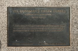
Goodman's Fields Horses plaque
Contributed by Derek Kendall
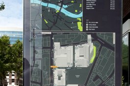
Goodman's Fields site map in 2017
Contributed by Derek Kendall

Goodman's Fields, block plans, as proposed in 2002 and as completed in 2019 (base map 2015, drawing by Helen Jones)
Contributed by Survey of London
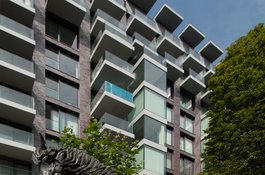
Goodman's Fields Horses, detail from south in 2017
Contributed by Derek Kendall