HTTP 200 OK
Allow: GET, HEAD, OPTIONS
Content-Type: application/json
Vary: Accept
{
"count": 1747,
"next": "https://surveyoflondon.org/api/v1/images/?format=api&page=85",
"previous": "https://surveyoflondon.org/api/v1/images/?format=api&page=83",
"results": [
{
"id": 1702,
"title": "Former Convent and Presbytery of English Martyrs Church",
"author": {
"id": 153,
"username": "danny"
},
"feature": {
"id": 1295,
"type": "Feature",
"geometry": {
"type": "MultiPolygon",
"coordinates": [
[
[
[
-0.071706015667423,
51.51096836077219
],
[
-0.071760673580627,
51.511094407858565
],
[
-0.071694522326586,
51.511107355424194
],
[
-0.071723514638995,
51.51117537716788
],
[
-0.071731537079554,
51.51117404707196
],
[
-0.071738018293242,
51.511187019360314
],
[
-0.071730451789257,
51.511188649356484
],
[
-0.07175065859756,
51.51124278370494
],
[
-0.071880742816297,
51.51122503927087
],
[
-0.071935648282288,
51.51134524228436
],
[
-0.07160179754467,
51.51139998766625
],
[
-0.071526476862373,
51.51122506187527
],
[
-0.071516150035805,
51.511225476853056
],
[
-0.071512034959162,
51.511211958658905
],
[
-0.071521499273981,
51.51120977508156
],
[
-0.07149261831904,
51.51113912349431
],
[
-0.071306734256067,
51.51116881548001
],
[
-0.071247789729444,
51.511033340787506
],
[
-0.071706015667423,
51.51096836077219
]
]
]
]
},
"properties": {
"b_number": "24",
"b_name": "",
"street": "Prescot Street",
"address": "Premier Inn, 24 Prescot Street",
"feature_type": "WHITECHAPEL_BUILDING",
"count": 7,
"search_str": "Premier Inn, 24 Prescot Street"
},
"tags": []
},
"file": "https://surveyoflondon.org/media/uploads/features/1295/Prescot%20Convent.jpg",
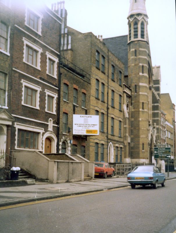
"description": "This is a photograph from the mid-1980s, perhaps early 1980s of the buildings which were on the site of the building that is now the Premier Inn Hotel. English Martyrs Church can be seen and to the left is the original Presbytery (priests house). On the ground floor was the Sacristy where the vestments, chalices, and other items for the saying of mass were kept. The building with the \"Eastgate\" hoarding indicates the future offfice building planned for the site and which ultimately became the Premier Inn.\n\nTo the left of that building is the Catholic Convent at Number 24 Prescot Street which was occupied by the Holy Family Sisters until 1985.",
"copyright": false,
"created": "2020-05-12"
},
{
"id": 1821,
"title": "121 Whitechapel Road, shopfront in 2017",
"author": {
"id": 27,
"username": "DerekKendall"
},
"feature": {
"id": 431,
"type": "Feature",
"geometry": {
"type": "MultiPolygon",
"coordinates": [
[
[
[
-0.066133544670268,
51.5177981662633
],
[
-0.066010012854311,
51.517659527413194
],
[
-0.066062879491561,
51.51764166845661
],
[
-0.06619930279155,
51.51777202994532
],
[
-0.066133544670268,
51.5177981662633
]
]
]
]
},
"properties": {
"b_number": "121",
"b_name": "",
"street": "Whitechapel Road",
"address": "121 Whitechapel Road",
"feature_type": "WHITECHAPEL_BUILDING",
"count": 4,
"search_str": "121 Whitechapel Road"
},
"tags": []
},
"file": "https://surveyoflondon.org/media/uploads/features/431/SoL%20Whitechapel%20102914.jpg",
"description": "",
"copyright": true,
"created": "2021-03-30"
},
{
"id": 1822,
"title": "115–121 Whitechapel Road from the west in 2017",
"author": {
"id": 27,
"username": "DerekKendall"
},
"feature": {
"id": 431,
"type": "Feature",
"geometry": {
"type": "MultiPolygon",
"coordinates": [
[
[
[
-0.066133544670268,
51.5177981662633
],
[
-0.066010012854311,
51.517659527413194
],
[
-0.066062879491561,
51.51764166845661
],
[
-0.06619930279155,
51.51777202994532
],
[
-0.066133544670268,
51.5177981662633
]
]
]
]
},
"properties": {
"b_number": "121",
"b_name": "",
"street": "Whitechapel Road",
"address": "121 Whitechapel Road",
"feature_type": "WHITECHAPEL_BUILDING",
"count": 4,
"search_str": "121 Whitechapel Road"
},
"tags": []
},
"file": "https://surveyoflondon.org/media/uploads/features/431/SoL%20Whitechapel%20102913.jpg",
"description": "",
"copyright": true,
"created": "2021-03-30"
},
{
"id": 1823,
"title": "115–121 Whitechapel Road, from the east in 2017",
"author": {
"id": 27,
"username": "DerekKendall"
},
"feature": {
"id": 431,
"type": "Feature",
"geometry": {
"type": "MultiPolygon",
"coordinates": [
[
[
[
-0.066133544670268,
51.5177981662633
],
[
-0.066010012854311,
51.517659527413194
],
[
-0.066062879491561,
51.51764166845661
],
[
-0.06619930279155,
51.51777202994532
],
[
-0.066133544670268,
51.5177981662633
]
]
]
]
},
"properties": {
"b_number": "121",
"b_name": "",
"street": "Whitechapel Road",
"address": "121 Whitechapel Road",
"feature_type": "WHITECHAPEL_BUILDING",
"count": 4,
"search_str": "121 Whitechapel Road"
},
"tags": []
},
"file": "https://surveyoflondon.org/media/uploads/features/431/SoL%20Whitechapel%20102915.jpg",
"description": "",
"copyright": true,
"created": "2021-03-30"
},
{
"id": 1656,
"title": "Toynbee Hall, staircase detail",
"author": {
"id": 27,
"username": "DerekKendall"
},
"feature": {
"id": 379,
"type": "Feature",
"geometry": {
"type": "MultiPolygon",
"coordinates": [
[
[
[
-0.072397829403071,
51.51669736298538
],
[
-0.072397829775652,
51.51669737370259
],
[
-0.072432640663459,
51.51673265247548
],
[
-0.072358283763003,
51.51675511998594
],
[
-0.072392345089312,
51.51679900052574
],
[
-0.072279169019407,
51.51681120129116
],
[
-0.072260832658385,
51.516791637982884
],
[
-0.07220017871295,
51.51681376750612
],
[
-0.07215893969634,
51.516769768915125
],
[
-0.072119241451839,
51.51677664825232
],
[
-0.071934651446851,
51.5165549241745
],
[
-0.071985260710591,
51.51653955484268
],
[
-0.072028895096668,
51.51652682786407
],
[
-0.072014842692988,
51.516508073517755
],
[
-0.072098254454469,
51.51648373796318
],
[
-0.072052675375786,
51.51643004607134
],
[
-0.072144607110911,
51.516401673048335
],
[
-0.072314904588685,
51.51634652520951
],
[
-0.072358068161013,
51.516398410711595
],
[
-0.072522445522427,
51.51634491903885
],
[
-0.072499976579174,
51.51631804154615
],
[
-0.072499959446261,
51.51631804712155
],
[
-0.072499965346341,
51.51631803831239
],
[
-0.072579515746657,
51.51629075531372
],
[
-0.072667639265209,
51.516403182536045
],
[
-0.072427304765486,
51.5164813923298
],
[
-0.072385415219988,
51.51643128370629
],
[
-0.072387162242999,
51.516433383744854
],
[
-0.072107982084202,
51.516523791132904
],
[
-0.072157544605501,
51.51658336890495
],
[
-0.072272128891629,
51.51654626302576
],
[
-0.072397829403071,
51.51669736298538
]
]
]
]
},
"properties": {
"b_number": "28 ",
"b_name": "Toynbee Hall",
"street": "Commercial Street",
"address": "Toynbee Hall, 28 Commercial Street",
"feature_type": "WHITECHAPEL_BUILDING",
"count": 21,
"search_str": "Toynbee Hall"
},
"tags": []
},
"file": "https://surveyoflondon.org/media/uploads/features/379/SoL%20Whitechapel%20102169.jpg",
"description": "",
"copyright": true,
"created": "2019-09-03"
},
{
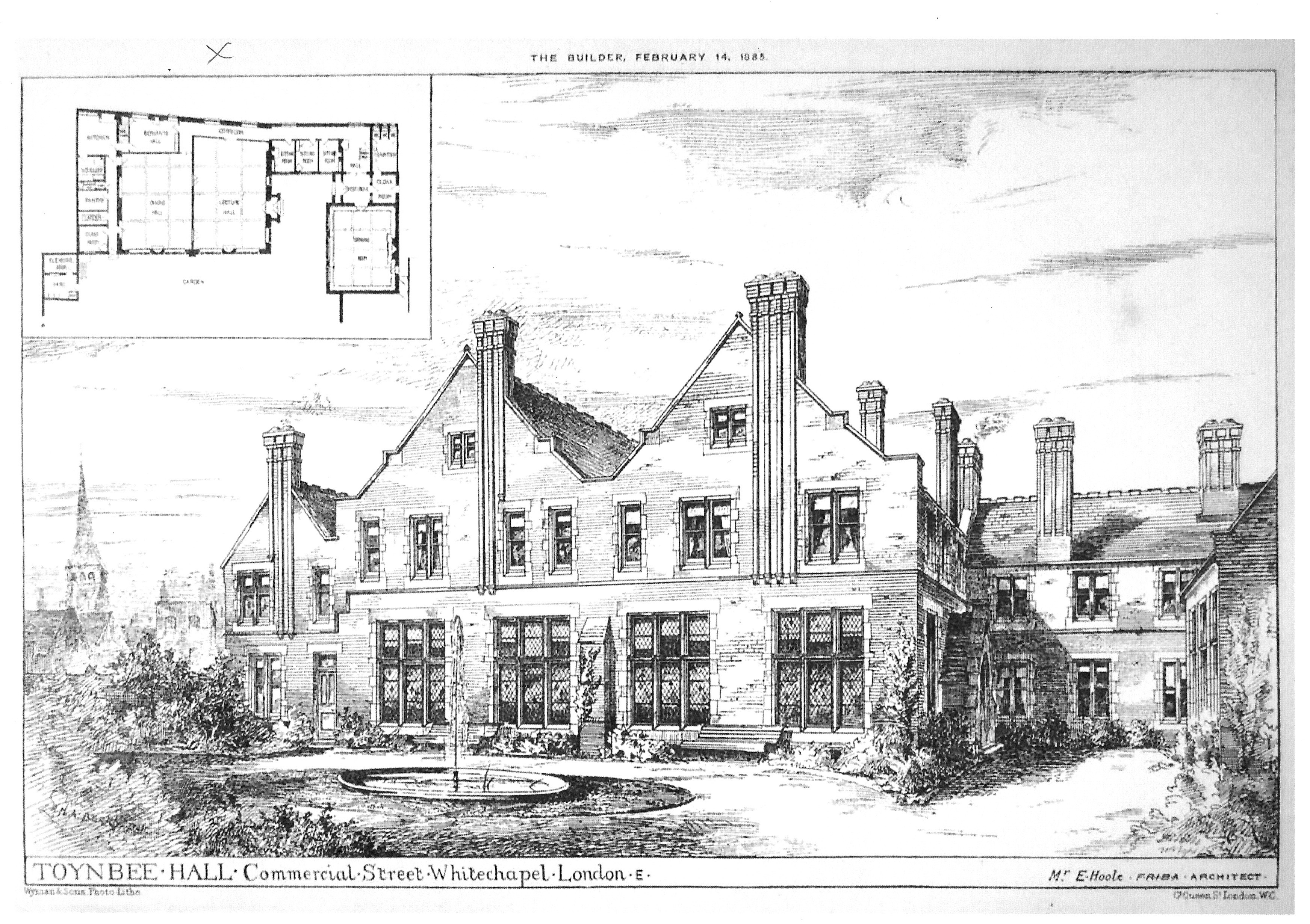
"id": 1831,
"title": "Toynbee Hall, from 'The Builder', 14 February 1885",
"author": {
"id": 2,
"username": "surveyoflondon"
},
"feature": {
"id": 379,
"type": "Feature",
"geometry": {
"type": "MultiPolygon",
"coordinates": [
[
[
[
-0.072397829403071,
51.51669736298538
],
[
-0.072397829775652,
51.51669737370259
],
[
-0.072432640663459,
51.51673265247548
],
[
-0.072358283763003,
51.51675511998594
],
[
-0.072392345089312,
51.51679900052574
],
[
-0.072279169019407,
51.51681120129116
],
[
-0.072260832658385,
51.516791637982884
],
[
-0.07220017871295,
51.51681376750612
],
[
-0.07215893969634,
51.516769768915125
],
[
-0.072119241451839,
51.51677664825232
],
[
-0.071934651446851,
51.5165549241745
],
[
-0.071985260710591,
51.51653955484268
],
[
-0.072028895096668,
51.51652682786407
],
[
-0.072014842692988,
51.516508073517755
],
[
-0.072098254454469,
51.51648373796318
],
[
-0.072052675375786,
51.51643004607134
],
[
-0.072144607110911,
51.516401673048335
],
[
-0.072314904588685,
51.51634652520951
],
[
-0.072358068161013,
51.516398410711595
],
[
-0.072522445522427,
51.51634491903885
],
[
-0.072499976579174,
51.51631804154615
],
[
-0.072499959446261,
51.51631804712155
],
[
-0.072499965346341,
51.51631803831239
],
[
-0.072579515746657,
51.51629075531372
],
[
-0.072667639265209,
51.516403182536045
],
[
-0.072427304765486,
51.5164813923298
],
[
-0.072385415219988,
51.51643128370629
],
[
-0.072387162242999,
51.516433383744854
],
[
-0.072107982084202,
51.516523791132904
],
[
-0.072157544605501,
51.51658336890495
],
[
-0.072272128891629,
51.51654626302576
],
[
-0.072397829403071,
51.51669736298538
]
]
]
]
},
"properties": {
"b_number": "28 ",
"b_name": "Toynbee Hall",
"street": "Commercial Street",
"address": "Toynbee Hall, 28 Commercial Street",
"feature_type": "WHITECHAPEL_BUILDING",
"count": 21,
"search_str": "Toynbee Hall"
},
"tags": []
},
"file": "https://surveyoflondon.org/media/uploads/features/379/10.3%20-%20Toynbee%20Hall%2C%201885.JPG",
"description": "",
"copyright": true,
"created": "2021-05-04"
},
{
"id": 1832,
"title": "Toynbee Hall and related buildings, block plan in 1894 (drawing by Helen Jones)",
"author": {
"id": 2,
"username": "surveyoflondon"
},
"feature": {
"id": 379,
"type": "Feature",
"geometry": {
"type": "MultiPolygon",
"coordinates": [
[
[
[
-0.072397829403071,
51.51669736298538
],
[
-0.072397829775652,
51.51669737370259
],
[
-0.072432640663459,
51.51673265247548
],
[
-0.072358283763003,
51.51675511998594
],
[
-0.072392345089312,
51.51679900052574
],
[
-0.072279169019407,
51.51681120129116
],
[
-0.072260832658385,
51.516791637982884
],
[
-0.07220017871295,
51.51681376750612
],
[
-0.07215893969634,
51.516769768915125
],
[
-0.072119241451839,
51.51677664825232
],
[
-0.071934651446851,
51.5165549241745
],
[
-0.071985260710591,
51.51653955484268
],
[
-0.072028895096668,
51.51652682786407
],
[
-0.072014842692988,
51.516508073517755
],
[
-0.072098254454469,
51.51648373796318
],
[
-0.072052675375786,
51.51643004607134
],
[
-0.072144607110911,
51.516401673048335
],
[
-0.072314904588685,
51.51634652520951
],
[
-0.072358068161013,
51.516398410711595
],
[
-0.072522445522427,
51.51634491903885
],
[
-0.072499976579174,
51.51631804154615
],
[
-0.072499959446261,
51.51631804712155
],
[
-0.072499965346341,
51.51631803831239
],
[
-0.072579515746657,
51.51629075531372
],
[
-0.072667639265209,
51.516403182536045
],
[
-0.072427304765486,
51.5164813923298
],
[
-0.072385415219988,
51.51643128370629
],
[
-0.072387162242999,
51.516433383744854
],
[
-0.072107982084202,
51.516523791132904
],
[
-0.072157544605501,
51.51658336890495
],
[
-0.072272128891629,
51.51654626302576
],
[
-0.072397829403071,
51.51669736298538
]
]
]
]
},
"properties": {
"b_number": "28 ",
"b_name": "Toynbee Hall",
"street": "Commercial Street",
"address": "Toynbee Hall, 28 Commercial Street",
"feature_type": "WHITECHAPEL_BUILDING",
"count": 21,
"search_str": "Toynbee Hall"
},
"tags": []
},
"file": "https://surveyoflondon.org/media/uploads/features/379/10.9%20Toynbee%20Hall%20Block%20plan%20from%202nd%20ed%20os.jpg",
"description": "",
"copyright": true,
"created": "2021-05-04"
},
{
"id": 1833,
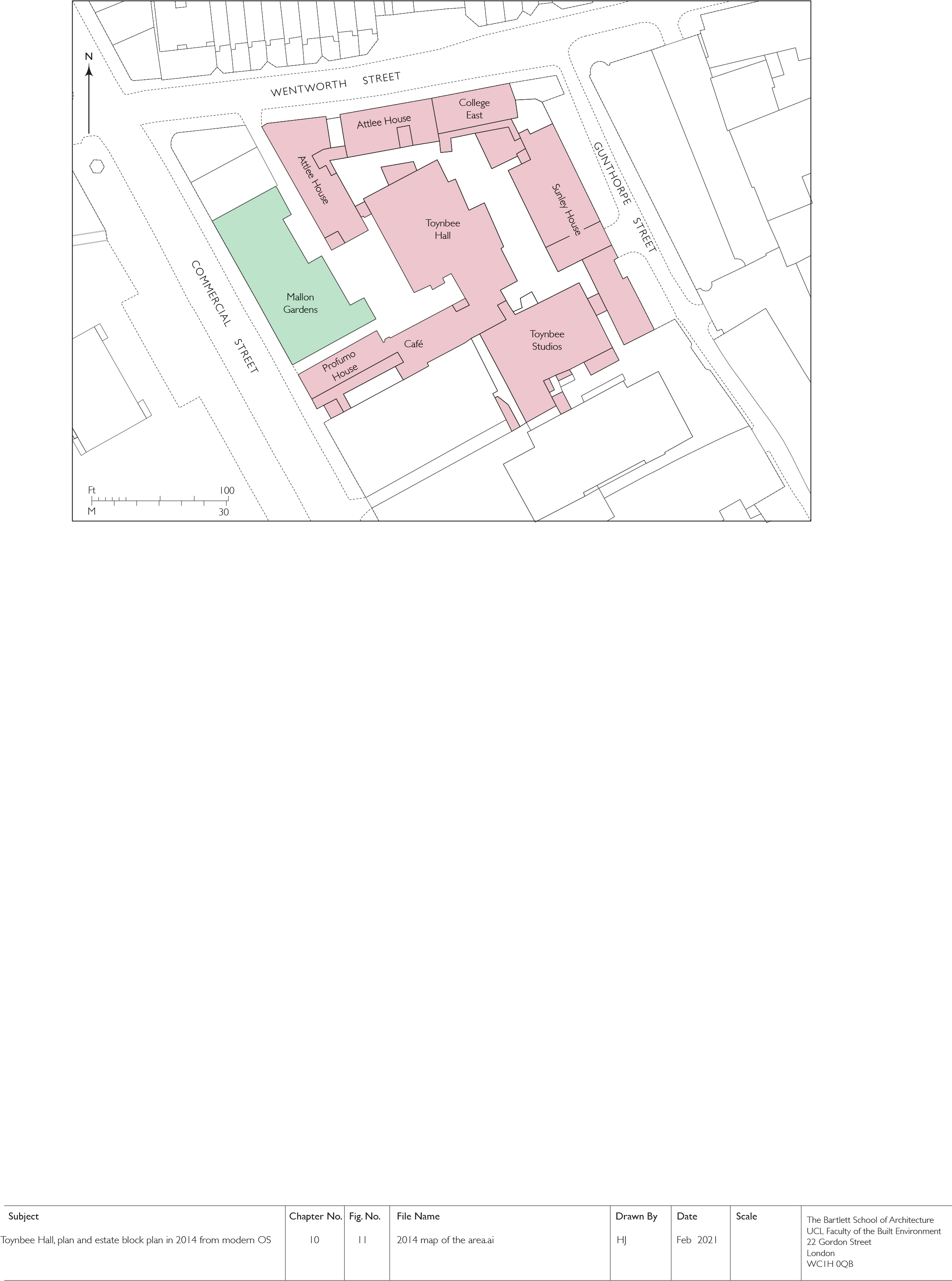
"title": "Toynbee Hall and related buildings, block plan in 2014 (drawing by Helen Jones)",
"author": {
"id": 2,
"username": "surveyoflondon"
},
"feature": {
"id": 379,
"type": "Feature",
"geometry": {
"type": "MultiPolygon",
"coordinates": [
[
[
[
-0.072397829403071,
51.51669736298538
],
[
-0.072397829775652,
51.51669737370259
],
[
-0.072432640663459,
51.51673265247548
],
[
-0.072358283763003,
51.51675511998594
],
[
-0.072392345089312,
51.51679900052574
],
[
-0.072279169019407,
51.51681120129116
],
[
-0.072260832658385,
51.516791637982884
],
[
-0.07220017871295,
51.51681376750612
],
[
-0.07215893969634,
51.516769768915125
],
[
-0.072119241451839,
51.51677664825232
],
[
-0.071934651446851,
51.5165549241745
],
[
-0.071985260710591,
51.51653955484268
],
[
-0.072028895096668,
51.51652682786407
],
[
-0.072014842692988,
51.516508073517755
],
[
-0.072098254454469,
51.51648373796318
],
[
-0.072052675375786,
51.51643004607134
],
[
-0.072144607110911,
51.516401673048335
],
[
-0.072314904588685,
51.51634652520951
],
[
-0.072358068161013,
51.516398410711595
],
[
-0.072522445522427,
51.51634491903885
],
[
-0.072499976579174,
51.51631804154615
],
[
-0.072499959446261,
51.51631804712155
],
[
-0.072499965346341,
51.51631803831239
],
[
-0.072579515746657,
51.51629075531372
],
[
-0.072667639265209,
51.516403182536045
],
[
-0.072427304765486,
51.5164813923298
],
[
-0.072385415219988,
51.51643128370629
],
[
-0.072387162242999,
51.516433383744854
],
[
-0.072107982084202,
51.516523791132904
],
[
-0.072157544605501,
51.51658336890495
],
[
-0.072272128891629,
51.51654626302576
],
[
-0.072397829403071,
51.51669736298538
]
]
]
]
},
"properties": {
"b_number": "28 ",
"b_name": "Toynbee Hall",
"street": "Commercial Street",
"address": "Toynbee Hall, 28 Commercial Street",
"feature_type": "WHITECHAPEL_BUILDING",
"count": 21,
"search_str": "Toynbee Hall"
},
"tags": []
},
"file": "https://surveyoflondon.org/media/uploads/features/379/10.11%202014%20map%20of%20the%20area.jpg",
"description": "",
"copyright": true,
"created": "2021-05-04"
},
{
"id": 1686,
"title": "chopped eels",
"author": {
"id": 27,
"username": "DerekKendall"
},
"feature": {
"id": 1310,
"type": "Feature",
"geometry": {
"type": "MultiPolygon",
"coordinates": [
[
[
[
-0.072640543386628,
51.511126910908146
],
[
-0.072546284627394,
51.51109445750477
],
[
-0.072442870594844,
51.51105766937985
],
[
-0.072212891852196,
51.511015291752464
],
[
-0.071794996225884,
51.51092420910208
],
[
-0.072193476308503,
51.510898011530344
],
[
-0.072292806128645,
51.51091522504932
],
[
-0.072304530237151,
51.510931416638016
],
[
-0.07242778419924,
51.51096443737364
],
[
-0.072431087286307,
51.51095279556461
],
[
-0.072461272416322,
51.51095734673215
],
[
-0.072466091619938,
51.51096214778542
],
[
-0.072488635517089,
51.510966022410706
],
[
-0.072644665703862,
51.511088472040846
],
[
-0.072640543386628,
51.511126910908146
]
]
]
]
},
"properties": {
"b_number": "",
"b_name": "Railway Viaduct Spur",
"street": "Mansell Street / Chamber Street",
"address": "Railway Viaduct Spur, Mansell Street / Chamber Street",
"feature_type": "WHITECHAPEL_BUILDING",
"count": 17,
"search_str": "Railway Viaduct Spur"
},
"tags": []
},
"file": "https://surveyoflondon.org/media/uploads/features/1310/SoL%20Whitechapel%20102803.jpg",
"description": "",
"copyright": true,
"created": "2020-02-18"
},
{
"id": 1687,
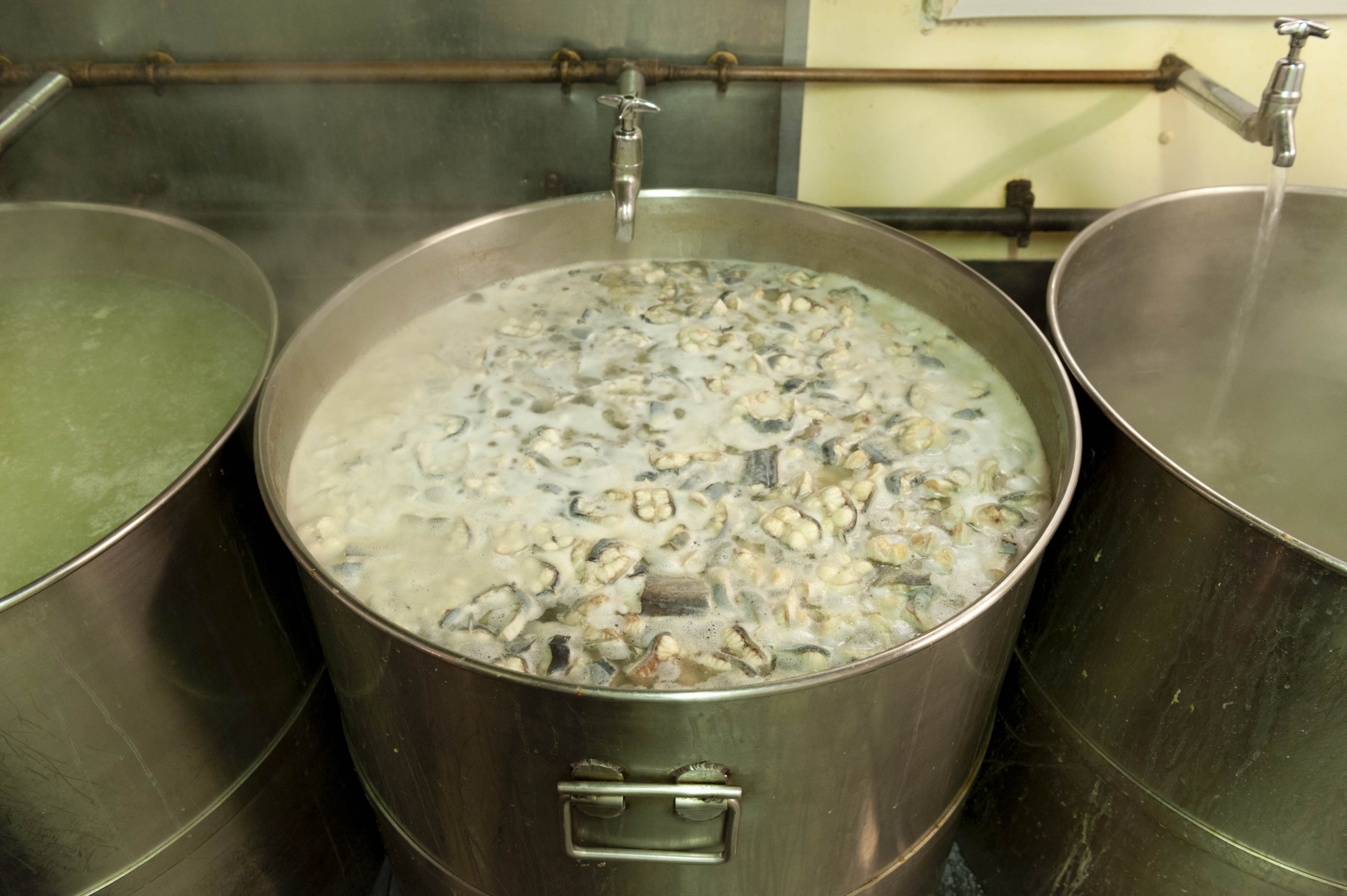
"title": "boiling eels",
"author": {
"id": 27,
"username": "DerekKendall"
},
"feature": {
"id": 1310,
"type": "Feature",
"geometry": {
"type": "MultiPolygon",
"coordinates": [
[
[
[
-0.072640543386628,
51.511126910908146
],
[
-0.072546284627394,
51.51109445750477
],
[
-0.072442870594844,
51.51105766937985
],
[
-0.072212891852196,
51.511015291752464
],
[
-0.071794996225884,
51.51092420910208
],
[
-0.072193476308503,
51.510898011530344
],
[
-0.072292806128645,
51.51091522504932
],
[
-0.072304530237151,
51.510931416638016
],
[
-0.07242778419924,
51.51096443737364
],
[
-0.072431087286307,
51.51095279556461
],
[
-0.072461272416322,
51.51095734673215
],
[
-0.072466091619938,
51.51096214778542
],
[
-0.072488635517089,
51.510966022410706
],
[
-0.072644665703862,
51.511088472040846
],
[
-0.072640543386628,
51.511126910908146
]
]
]
]
},
"properties": {
"b_number": "",
"b_name": "Railway Viaduct Spur",
"street": "Mansell Street / Chamber Street",
"address": "Railway Viaduct Spur, Mansell Street / Chamber Street",
"feature_type": "WHITECHAPEL_BUILDING",
"count": 17,
"search_str": "Railway Viaduct Spur"
},
"tags": []
},
"file": "https://surveyoflondon.org/media/uploads/features/1310/SoL%20Whitechapel%20102806.jpg",
"description": "",
"copyright": true,
"created": "2020-02-18"
},
{
"id": 1688,
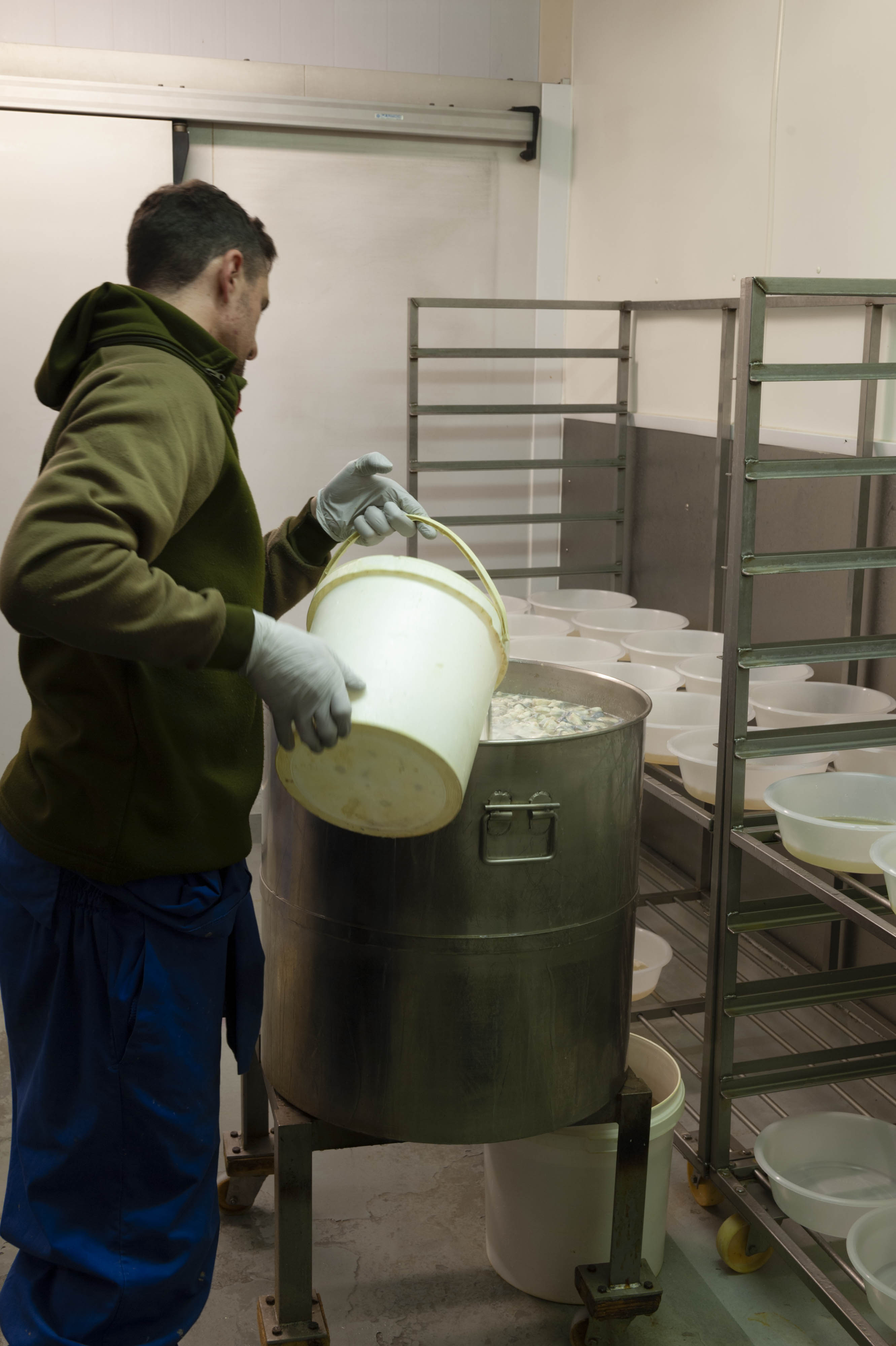
"title": "pouring eel liquor",
"author": {
"id": 27,
"username": "DerekKendall"
},
"feature": {
"id": 1310,
"type": "Feature",
"geometry": {
"type": "MultiPolygon",
"coordinates": [
[
[
[
-0.072640543386628,
51.511126910908146
],
[
-0.072546284627394,
51.51109445750477
],
[
-0.072442870594844,
51.51105766937985
],
[
-0.072212891852196,
51.511015291752464
],
[
-0.071794996225884,
51.51092420910208
],
[
-0.072193476308503,
51.510898011530344
],
[
-0.072292806128645,
51.51091522504932
],
[
-0.072304530237151,
51.510931416638016
],
[
-0.07242778419924,
51.51096443737364
],
[
-0.072431087286307,
51.51095279556461
],
[
-0.072461272416322,
51.51095734673215
],
[
-0.072466091619938,
51.51096214778542
],
[
-0.072488635517089,
51.510966022410706
],
[
-0.072644665703862,
51.511088472040846
],
[
-0.072640543386628,
51.511126910908146
]
]
]
]
},
"properties": {
"b_number": "",
"b_name": "Railway Viaduct Spur",
"street": "Mansell Street / Chamber Street",
"address": "Railway Viaduct Spur, Mansell Street / Chamber Street",
"feature_type": "WHITECHAPEL_BUILDING",
"count": 17,
"search_str": "Railway Viaduct Spur"
},
"tags": []
},
"file": "https://surveyoflondon.org/media/uploads/features/1310/SoL%20Whitechapel%20102811.jpg",
"description": "",
"copyright": true,
"created": "2020-02-18"
},
{
"id": 1694,
"title": "Blitz Damaged Wall",
"author": {
"id": 153,
"username": "danny"
},
"feature": {
"id": 1310,
"type": "Feature",
"geometry": {
"type": "MultiPolygon",
"coordinates": [
[
[
[
-0.072640543386628,
51.511126910908146
],
[
-0.072546284627394,
51.51109445750477
],
[
-0.072442870594844,
51.51105766937985
],
[
-0.072212891852196,
51.511015291752464
],
[
-0.071794996225884,
51.51092420910208
],
[
-0.072193476308503,
51.510898011530344
],
[
-0.072292806128645,
51.51091522504932
],
[
-0.072304530237151,
51.510931416638016
],
[
-0.07242778419924,
51.51096443737364
],
[
-0.072431087286307,
51.51095279556461
],
[
-0.072461272416322,
51.51095734673215
],
[
-0.072466091619938,
51.51096214778542
],
[
-0.072488635517089,
51.510966022410706
],
[
-0.072644665703862,
51.511088472040846
],
[
-0.072640543386628,
51.511126910908146
]
]
]
]
},
"properties": {
"b_number": "",
"b_name": "Railway Viaduct Spur",
"street": "Mansell Street / Chamber Street",
"address": "Railway Viaduct Spur, Mansell Street / Chamber Street",
"feature_type": "WHITECHAPEL_BUILDING",
"count": 17,
"search_str": "Railway Viaduct Spur"
},
"tags": []
},
"file": "https://surveyoflondon.org/media/uploads/features/1310/Mansell%20Street%20Bomb%20damage%201_0aWaf0e.jpg",
"description": "WW2 bomb damage to wall and stones of former railway bridge at Mansell Street / Chamber Street",
"copyright": false,
"created": "2020-05-06"
},
{
"id": 1778,
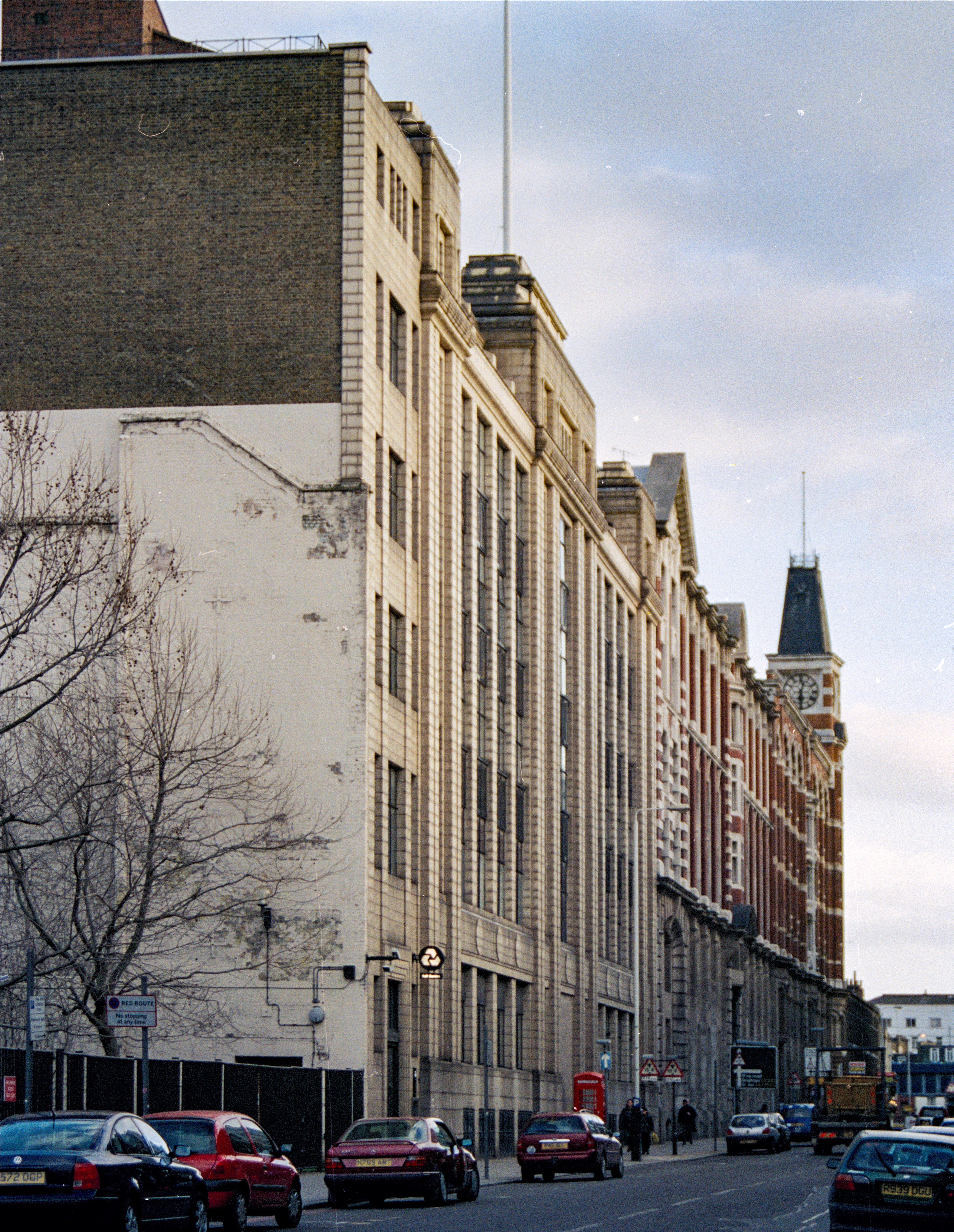
"title": "65–99 Leman Street from the north in the late 1990s, photo by Chris Redgrave",
"author": {
"id": 29,
"username": "CRedgrave"
},
"feature": {
"id": 1046,
"type": "Feature",
"geometry": {
"type": "MultiPolygon",
"coordinates": [
[
[
[
-0.069714718327607,
51.512779796737654
],
[
-0.070041265672745,
51.5131969319805
],
[
-0.069377993137045,
51.51342051283188
],
[
-0.0690271561552,
51.51300045828788
],
[
-0.069714718327607,
51.512779796737654
]
]
]
]
},
"properties": {
"b_number": "65",
"b_name": "",
"street": "Leman Street",
"address": "Drapery Plaza (formerly Student Castle), 65 Leman Street",
"feature_type": "WHITECHAPEL_BUILDING",
"count": 7,
"search_str": "Drapery Plaza (formerly Student Castle), 65 Leman Street"
},
"tags": []
},
"file": "https://surveyoflondon.org/media/uploads/features/1046/65%20Leman%20Street%20Demolished%20faience%20building%20closer%20in.jpg",
"description": "",
"copyright": true,
"created": "2020-10-01"
},
{
"id": 1779,
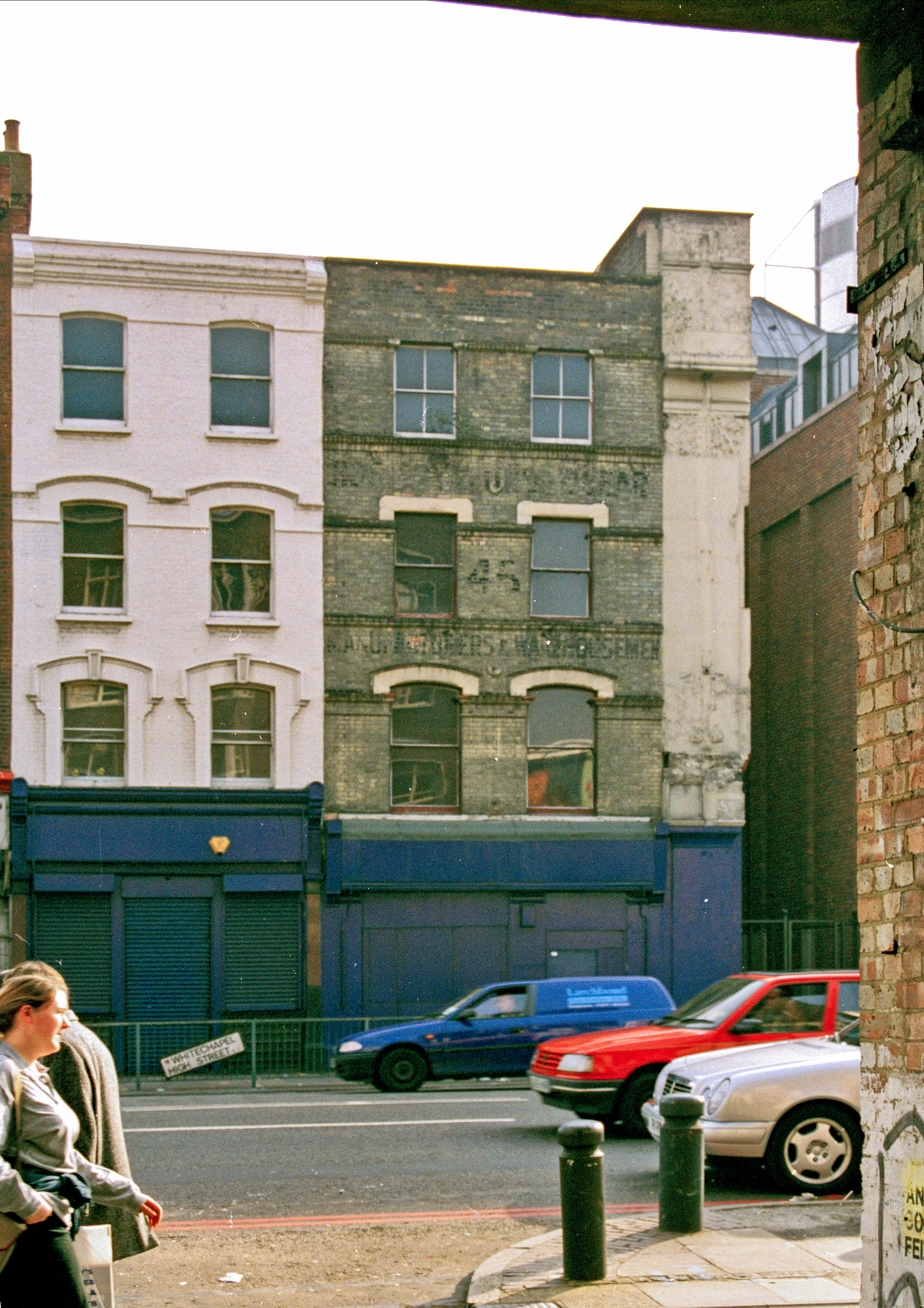
"title": "45 Whitechapel High Street in the late 1990s, photograph by Chris Redgrave",
"author": {
"id": 29,
"username": "CRedgrave"
},
"feature": {
"id": 1439,
"type": "Feature",
"geometry": {
"type": "MultiPolygon",
"coordinates": [
[
[
[
-0.070712047315663,
51.51534654121973
],
[
-0.070512364412945,
51.5151086413272
],
[
-0.070907638509304,
51.51514736151484
],
[
-0.070873047315663,
51.51528644121973
],
[
-0.070712047315663,
51.51534654121973
]
]
]
]
},
"properties": {
"b_number": "",
"b_name": "Central Tower, Aldgate Place",
"street": "Whitechapel High Street",
"address": "Aldgate Place, Whitechapel High Street",
"feature_type": "WHITECHAPEL_BUILDING",
"count": 9,
"search_str": "Central Tower, Aldgate Place"
},
"tags": []
},
"file": "https://surveyoflondon.org/media/uploads/features/1439/Demolished%2045%20Whitechapel%20High%20Street.%20Scan%20from%20negative%20late%20199_0hTfaiT.jpg",
"description": "",
"copyright": true,
"created": "2020-10-01"
},
{
"id": 1780,
"title": "45–46 Whitechapel High Street in the late 1990s, photograph by Chris Redgrave",
"author": {
"id": 29,
"username": "CRedgrave"
},
"feature": {
"id": 1439,
"type": "Feature",
"geometry": {
"type": "MultiPolygon",
"coordinates": [
[
[
[
-0.070712047315663,
51.51534654121973
],
[
-0.070512364412945,
51.5151086413272
],
[
-0.070907638509304,
51.51514736151484
],
[
-0.070873047315663,
51.51528644121973
],
[
-0.070712047315663,
51.51534654121973
]
]
]
]
},
"properties": {
"b_number": "",
"b_name": "Central Tower, Aldgate Place",
"street": "Whitechapel High Street",
"address": "Aldgate Place, Whitechapel High Street",
"feature_type": "WHITECHAPEL_BUILDING",
"count": 9,
"search_str": "Central Tower, Aldgate Place"
},
"tags": []
},
"file": "https://surveyoflondon.org/media/uploads/features/1439/Demolished%2045%20Whitechapel%20High%20Street.%20Scan%20from%20negative%20late%20199_iDKlFIZ.jpg",
"description": "",
"copyright": true,
"created": "2020-10-01"
},
{
"id": 1782,
"title": "View to the site of 30 Commercial Road in the late 1990s, photograph by Chris Redgrave",
"author": {
"id": 29,
"username": "CRedgrave"
},
"feature": {
"id": 988,
"type": "Feature",
"geometry": {
"type": "MultiPolygon",
"coordinates": [
[
[
[
-0.069929882277065,
51.514898995889006
],
[
-0.06979454993523,
51.51489642069944
],
[
-0.069799366606084,
51.51480886354107
],
[
-0.069803307187266,
51.51472759199756
],
[
-0.069898344949967,
51.514708250119945
],
[
-0.069900708055141,
51.514811227052185
],
[
-0.069899767737027,
51.51483346844889
],
[
-0.069932629729256,
51.51483400930735
],
[
-0.069929882277065,
51.514898995889006
]
]
]
]
},
"properties": {
"b_number": "30b",
"b_name": "30b Commercial Road",
"street": "Commercial Road",
"address": "30b Commercial Road",
"feature_type": "WHITECHAPEL_BUILDING",
"count": 2,
"search_str": "30b Commercial Road"
},
"tags": []
},
"file": "https://surveyoflondon.org/media/uploads/features/988/Demolished%20section%20.jpg",
"description": "",
"copyright": true,
"created": "2020-10-01"
},
{
"id": 1777,
"title": "Detail of Lewis London & Sons, 1998, photo by Chris Redgrave",
"author": {
"id": 29,
"username": "CRedgrave"
},
"feature": {
"id": 987,
"type": "Feature",
"geometry": {
"type": "MultiPolygon",
"coordinates": [
[
[
[
-0.070145370299403,
51.51450072634437
],
[
-0.07014611994867,
51.51450455659268
],
[
-0.070144309574274,
51.514509535874474
],
[
-0.070140121750315,
51.51451620267396
],
[
-0.070136623713428,
51.51452004299396
],
[
-0.070132782230155,
51.51452343811338
],
[
-0.07012919823248,
51.51452605003296
],
[
-0.070032329210259,
51.51456074054102
],
[
-0.069888287217447,
51.51461232427546
],
[
-0.069840045190473,
51.514629600448345
],
[
-0.069774452824825,
51.51465322031716
],
[
-0.06976437015771,
51.514657348821736
],
[
-0.069752142738503,
51.51465949508699
],
[
-0.069738751592763,
51.514659184706524
],
[
-0.069727055003321,
51.514656294262764
],
[
-0.069718712135325,
51.51465200744966
],
[
-0.069710007581218,
51.51464360333125
],
[
-0.069703346477841,
51.51462231454975
],
[
-0.069687670795924,
51.5145762148712
],
[
-0.069654908902713,
51.514479867076176
],
[
-0.069639134856717,
51.51444518750716
],
[
-0.069621768125469,
51.51441285371942
],
[
-0.069616967605489,
51.5143964229486
],
[
-0.069618177681695,
51.51438973157497
],
[
-0.069621435653496,
51.51437947349934
],
[
-0.069630708154631,
51.51436447257293
],
[
-0.069646015054674,
51.51435269798059
],
[
-0.069669258695001,
51.51434149605311
],
[
-0.06990815956914,
51.514236930554475
],
[
-0.070061827306772,
51.51416967057941
],
[
-0.070205488914527,
51.51432361317142
],
[
-0.070080560753047,
51.51437793580642
],
[
-0.070064472214771,
51.51438470803152
],
[
-0.070066767405088,
51.51439004684161
],
[
-0.070083931212681,
51.514419269950324
],
[
-0.070132489860627,
51.51448663206476
],
[
-0.070141902651642,
51.514496931909626
],
[
-0.070145370299403,
51.51450072634437
]
]
]
]
},
"properties": {
"b_number": "71",
"b_name": "Altitude Point",
"street": "Alie Street",
"address": "71 (Altitude Point) and 81 Alie Street with 9 Buckle Street (Goldpence Apartments)",
"feature_type": "WHITECHAPEL_BUILDING",
"count": 11,
"search_str": "Altitude Point"
},
"tags": []
},
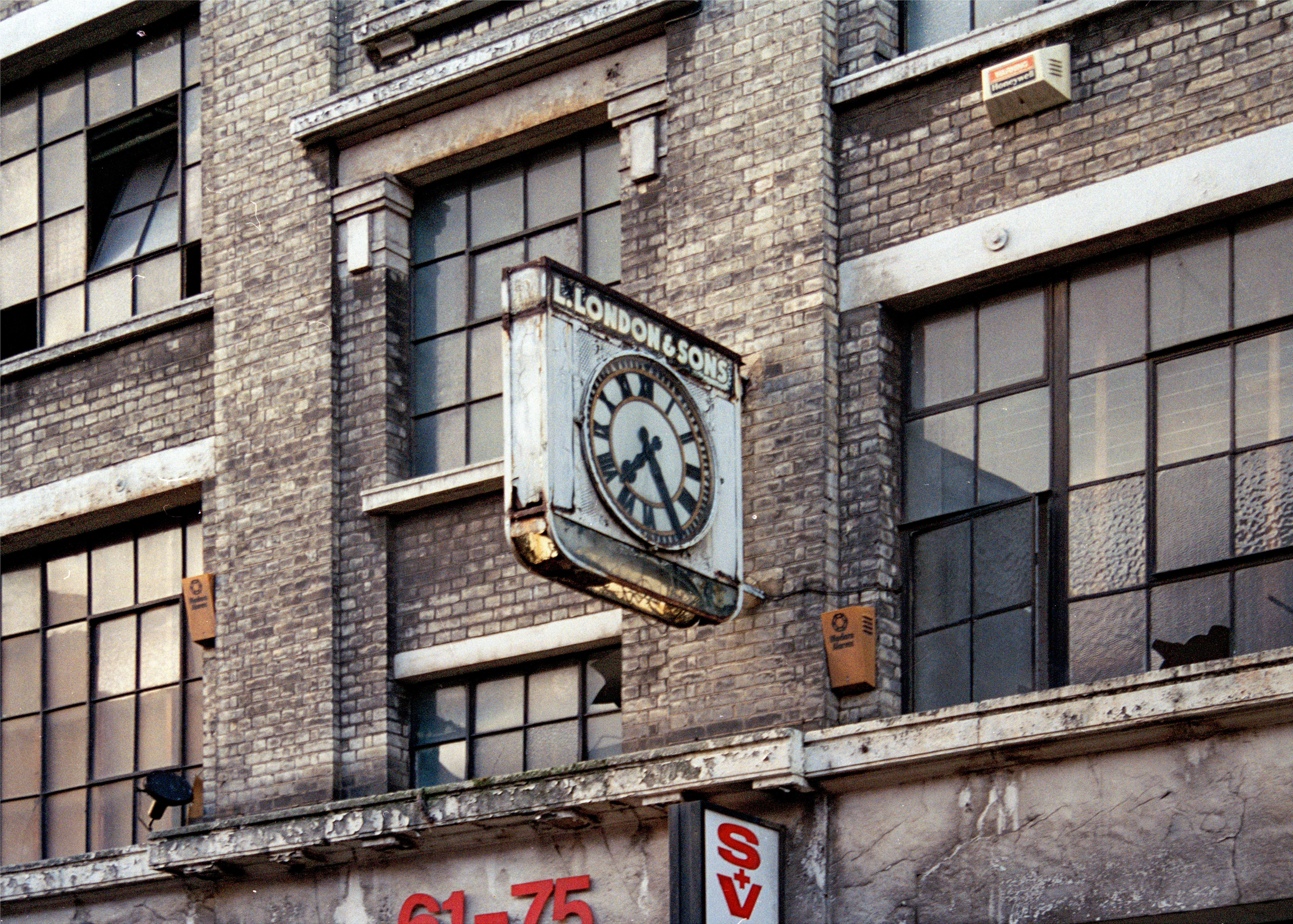
"file": "https://surveyoflondon.org/media/uploads/features/987/61-75%20Allie%20Street%20in%201998.%20Demolished%20Detail%20of%20L.London%20and%20Sons%20Clock%20.jpg",
"description": "",
"copyright": true,
"created": "2020-10-01"
},
{
"id": 1836,
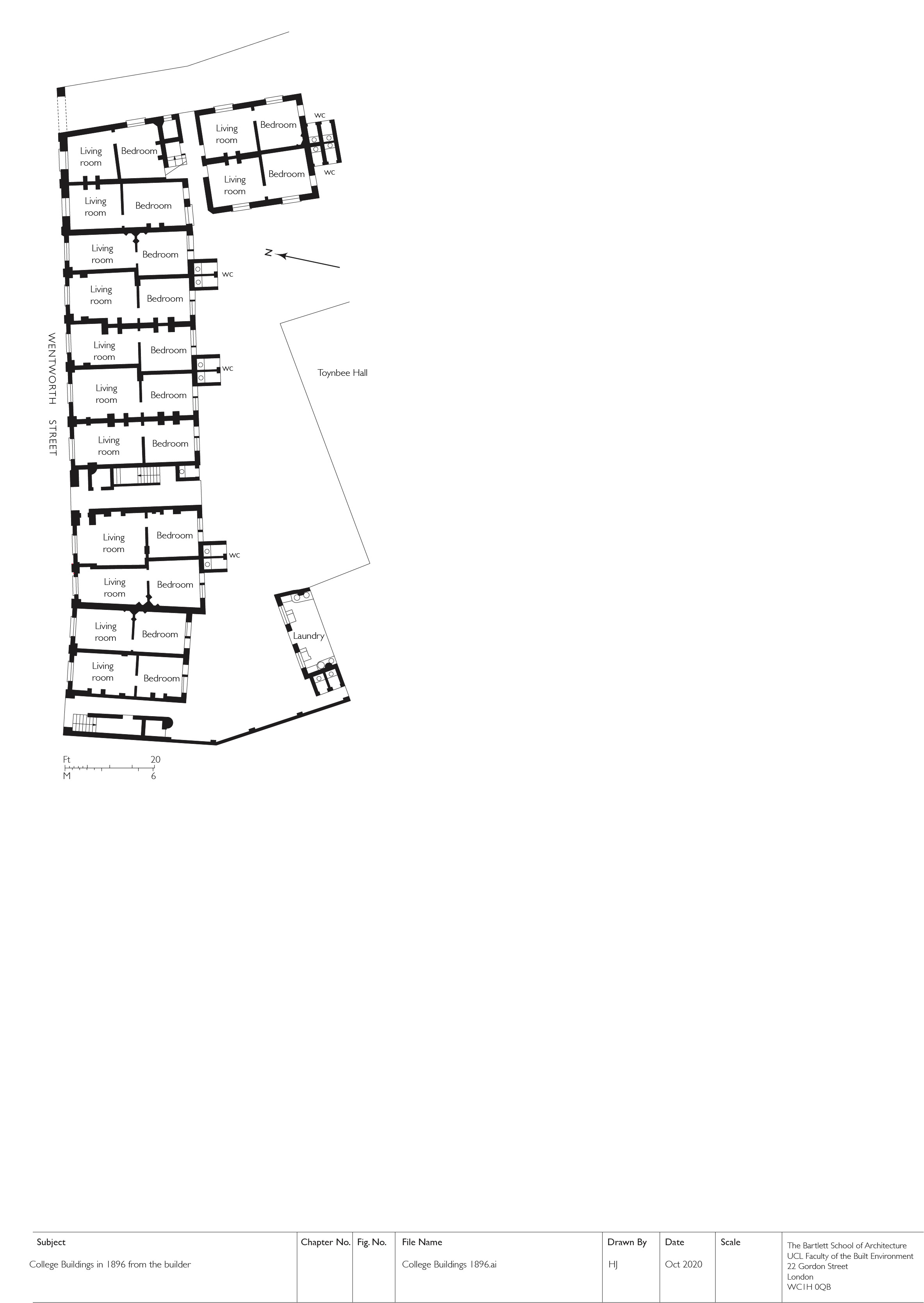
"title": "College Buildings, ground plan in 1886 (drawing by Helen Jones from 'The Builder', 13 November 1886",
"author": {
"id": 2,
"username": "surveyoflondon"
},
"feature": {
"id": 380,
"type": "Feature",
"geometry": {
"type": "MultiPolygon",
"coordinates": [
[
[
[
-0.072206019676478,
51.51693680017776
],
[
-0.07196249597772,
51.51695746576063
],
[
-0.071942669522335,
51.51691176033737
],
[
-0.07193864174443,
51.51687683260662
],
[
-0.0719558598767,
51.51687195131619
],
[
-0.071940018682487,
51.516849661344565
],
[
-0.071948572675229,
51.51684695053907
],
[
-0.071928740996398,
51.51681739256845
],
[
-0.072016766264098,
51.51679133268639
],
[
-0.072069141958081,
51.51685492594651
],
[
-0.072148483627081,
51.51684727546371
],
[
-0.072142511287946,
51.51682066806651
],
[
-0.072177857813757,
51.51681788202521
],
[
-0.072183448760406,
51.51684444436341
],
[
-0.072206188136717,
51.5169328110988
],
[
-0.072206015279985,
51.5169367972863
],
[
-0.072206019676478,
51.51693680017776
]
]
]
]
},
"properties": {
"b_number": "",
"b_name": "College East",
"street": "Gunthorpe Street",
"address": "College East, Gunthorpe Street",
"feature_type": "WHITECHAPEL_BUILDING",
"count": 5,
"search_str": "College East"
},
"tags": []
},
"file": "https://surveyoflondon.org/media/uploads/features/380/10.10%20college%20buildings%201896.jpg",
"description": "",
"copyright": true,
"created": "2021-05-04"
},
{
"id": 1431,
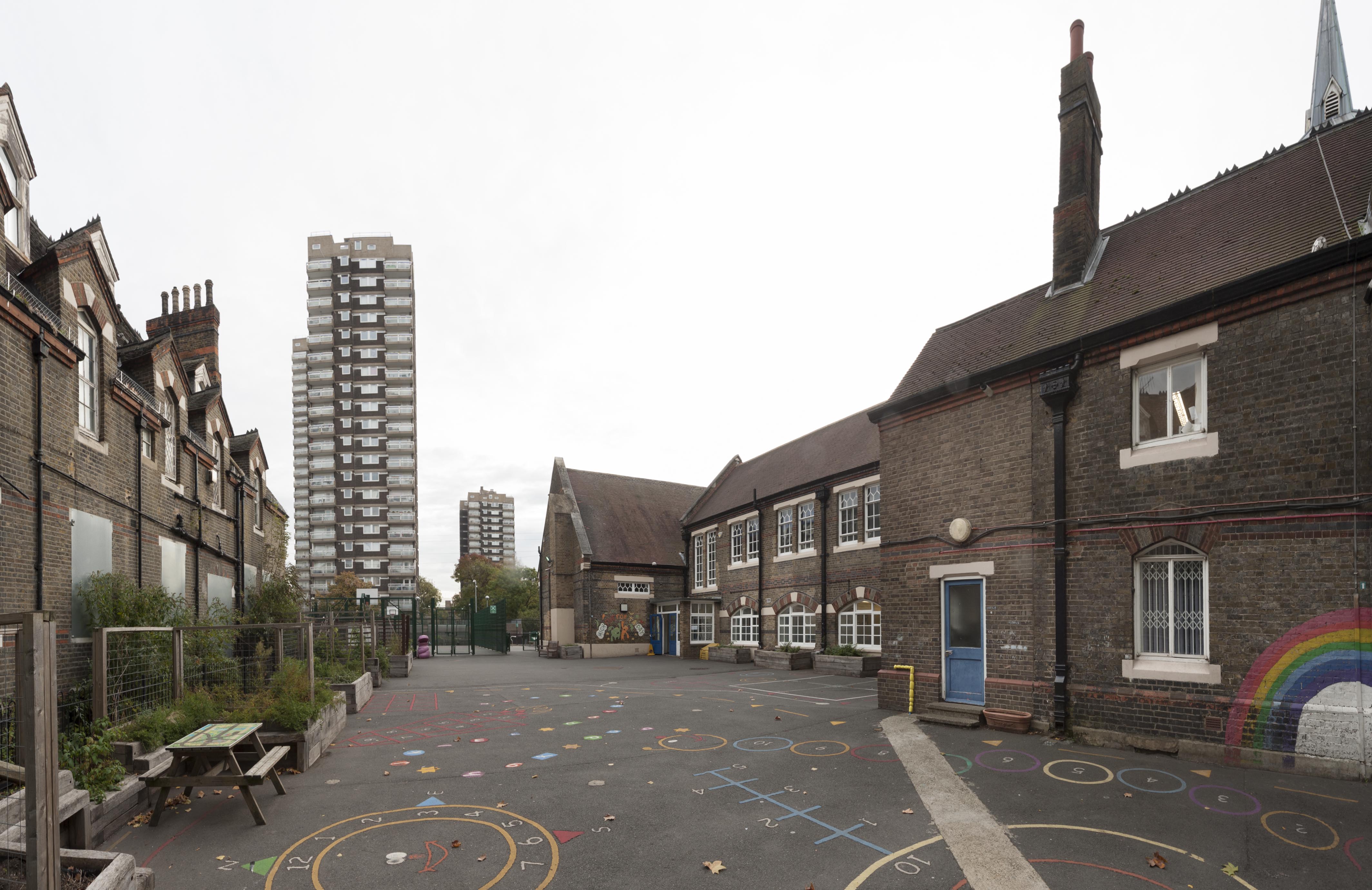
"title": "St Paul's School playground from the west, October 2018",
"author": {
"id": 27,
"username": "DerekKendall"
},
"feature": {
"id": 1399,
"type": "Feature",
"geometry": {
"type": "MultiPolygon",
"coordinates": [
[
[
[
-0.06624311370635,
51.51019072010641
],
[
-0.066077627531148,
51.510204269850675
],
[
-0.066069527116146,
51.510170337345684
],
[
-0.06611551384684,
51.51016638639934
],
[
-0.066109726117682,
51.51014703372793
],
[
-0.065814585354416,
51.5101673738921
],
[
-0.065821533323482,
51.51022330153386
],
[
-0.065683910471039,
51.51023360737856
],
[
-0.065657889334494,
51.51008339520407
],
[
-0.065349361164399,
51.51010853754948
],
[
-0.06532938777826,
51.510008209650636
],
[
-0.065633994165545,
51.509987653756085
],
[
-0.065620188745178,
51.50991765971934
],
[
-0.065722948991599,
51.50991121538507
],
[
-0.065716780377172,
51.509880881568165
],
[
-0.065901817537395,
51.50986765480321
],
[
-0.06593178354119,
51.50999605393065
],
[
-0.066038317356042,
51.509988508785376
],
[
-0.066023042932445,
51.50990918839897
],
[
-0.065998737156917,
51.50991111308007
],
[
-0.065980280001972,
51.50981894970597
],
[
-0.066320560006103,
51.50979200375635
],
[
-0.06632996113982,
51.50983401855985
],
[
-0.066268265775343,
51.50983881506029
],
[
-0.066265082872055,
51.50982597208467
],
[
-0.066214609325215,
51.509829790835916
],
[
-0.066234584593038,
51.50993011860635
],
[
-0.066179431061551,
51.509934441553284
],
[
-0.066189455574639,
51.5099837339709
],
[
-0.066197871962622,
51.509983000685985
],
[
-0.066205558541818,
51.510021498909204
],
[
-0.066199016557763,
51.510021972412325
],
[
-0.066209250254486,
51.51006632649741
],
[
-0.066216245469672,
51.51006615116071
],
[
-0.066221862792188,
51.51009851070753
],
[
-0.066214365136205,
51.51009954983773
],
[
-0.066220460291682,
51.51013162657133
],
[
-0.06623170678327,
51.51013006787535
],
[
-0.06624311370635,
51.51019072010641
]
]
]
]
},
"properties": {
"b_number": "",
"b_name": "St Paul's School",
"street": "Wellclose Square",
"address": "St Paul's School, Wellclose Square",
"feature_type": "WHITECHAPEL_BUILDING",
"count": 22,
"search_str": "St Paul's School"
},
"tags": [
"Rev. Dan Greatorex",
"Thomas F. Ford and Partners",
"Wilby & Burnett"
]
},
"file": "https://surveyoflondon.org/media/uploads/features/1399/SoL%20Whitechapel%20102312.jpg",
"description": "",
"copyright": true,
"created": "2018-11-13"
},
{
"id": 1787,
"title": "65–66 Whitechapel High Street and view to west in the late 1990s, photograph by Chris Redgrave",
"author": {
"id": 29,
"username": "CRedgrave"
},
"feature": {
"id": 165,
"type": "Feature",
"geometry": {
"type": "MultiPolygon",
"coordinates": [
[
[
[
-0.069889119521129,
51.51579713749756
],
[
-0.069830541484445,
51.51582381203128
],
[
-0.069748230427938,
51.51575345083506
],
[
-0.069809844959613,
51.51573576424656
],
[
-0.069889119521129,
51.51579713749756
]
]
]
]
},
"properties": {
"b_number": "65",
"b_name": "",
"street": "Whitechapel High Street",
"address": "65 Whitechapel High Street",
"feature_type": "WHITECHAPEL_BUILDING",
"count": 4,
"search_str": "65 Whitechapel High Street"
},
"tags": []
},
"file": "https://surveyoflondon.org/media/uploads/features/165/Whitechapel%20High%20street%20Scan%20of%20late%2090's%20negative.%20Chris%20R%20picture.jpg",
"description": "",
"copyright": true,
"created": "2020-10-01"
}
]
}