HTTP 200 OK
Allow: GET, HEAD, OPTIONS
Content-Type: application/json
Vary: Accept
{
"count": 1747,
"next": "https://surveyoflondon.org/api/v1/images/?format=api&page=83",
"previous": "https://surveyoflondon.org/api/v1/images/?format=api&page=81",
"results": [
{
"id": 1721,
"title": "52–58 Commercial Road from the north-east in 2017",
"author": {
"id": 27,
"username": "DerekKendall"
},
"feature": {
"id": 996,
"type": "Feature",
"geometry": {
"type": "MultiPolygon",
"coordinates": [
[
[
[
-0.067861838065609,
51.51475347064
],
[
-0.06786453313317,
51.51478234806407
],
[
-0.067585581780586,
51.51476507543967
],
[
-0.067588509051496,
51.51474607517389
],
[
-0.067420739755857,
51.51473600887351
],
[
-0.067418669259981,
51.51475690079008
],
[
-0.067243977243653,
51.51474606363514
],
[
-0.067247831877495,
51.514720711350456
],
[
-0.067148423655411,
51.514715895823834
],
[
-0.067164508046975,
51.51459719968502
],
[
-0.067169468365816,
51.51455902742509
],
[
-0.067267424237092,
51.514565373164125
],
[
-0.067284203490366,
51.51446875999768
],
[
-0.067487888007954,
51.514480206746164
],
[
-0.067487831570817,
51.51448159696675
],
[
-0.067481262401076,
51.514514394275835
],
[
-0.067633797500801,
51.51452521712492
],
[
-0.067640049851402,
51.51449178362331
],
[
-0.067640050183764,
51.51449178093463
],
[
-0.067838967383754,
51.51450488151706
],
[
-0.067828248265366,
51.51461731190957
],
[
-0.067887142834602,
51.51462052176631
],
[
-0.06789972538097,
51.51475577751923
],
[
-0.067861838065609,
51.51475347064
]
]
]
]
},
"properties": {
"b_number": "52 to 58",
"b_name": "52 to 58 Commercial Road",
"street": "Commercial Road",
"address": "52 to 58 Commercial Road",
"feature_type": "WHITECHAPEL_BUILDING",
"count": 10,
"search_str": "52 to 58 Commercial Road"
},
"tags": []
},
"file": "https://surveyoflondon.org/media/uploads/features/996/SoL%20Whitechapel%20101273.jpg",
"description": "",
"copyright": true,
"created": "2020-06-01"
},
{
"id": 865,
"title": "Panel on former St George's German and English School, rear courtyard",
"author": {
"id": 86,
"username": "sarah"
},
"feature": {
"id": 18,
"type": "Feature",
"geometry": {
"type": "MultiPolygon",
"coordinates": [
[
[
[
-0.070376872840044,
51.51411288775777
],
[
-0.070160905948437,
51.51421296101531
],
[
-0.070191890237181,
51.51424342945293
],
[
-0.070147651440662,
51.51426163662261
],
[
-0.070061827306772,
51.5141696705794
],
[
-0.070313812852204,
51.514054169773665
],
[
-0.070376872840044,
51.51411288775777
]
]
]
]
},
"properties": {
"b_number": "55-57",
"b_name": "St George's German and English School",
"street": "Alie Street",
"address": "St George's Schools, 55-57 Alie Street",
"feature_type": "WHITECHAPEL_BUILDING",
"count": 9,
"search_str": "St George's German and English School"
},
"tags": []
},
"file": "https://surveyoflondon.org/media/uploads/features/18/IMG_20170913_162903.jpg",
"description": "",
"copyright": false,
"created": "2017-09-21"
},
{
"id": 1846,
"title": "St Geore's German and English Schools, ground-floor plan as built in 1877–8 (drawing by Helen Jones)",
"author": {
"id": 2,
"username": "surveyoflondon"
},
"feature": {
"id": 18,
"type": "Feature",
"geometry": {
"type": "MultiPolygon",
"coordinates": [
[
[
[
-0.070376872840044,
51.51411288775777
],
[
-0.070160905948437,
51.51421296101531
],
[
-0.070191890237181,
51.51424342945293
],
[
-0.070147651440662,
51.51426163662261
],
[
-0.070061827306772,
51.5141696705794
],
[
-0.070313812852204,
51.514054169773665
],
[
-0.070376872840044,
51.51411288775777
]
]
]
]
},
"properties": {
"b_number": "55-57",
"b_name": "St George's German and English School",
"street": "Alie Street",
"address": "St George's Schools, 55-57 Alie Street",
"feature_type": "WHITECHAPEL_BUILDING",
"count": 9,
"search_str": "St George's German and English School"
},
"tags": []
},
"file": "https://surveyoflondon.org/media/uploads/features/18/33.15%20St%20Georges%20School%20plan%201.jpg",
"description": "",
"copyright": true,
"created": "2021-08-05"
},
{
"id": 1160,
"title": "Tower Hill School - Chamber Street",
"author": {
"id": 153,
"username": "danny"
},
"feature": {
"id": 1296,
"type": "Feature",
"geometry": {
"type": "MultiPolygon",
"coordinates": [
[
[
[
-0.071706015667423,
51.51096836077219
],
[
-0.071841028671068,
51.51094484938125
],
[
-0.07184526721746,
51.510955445567966
],
[
-0.07186219920978,
51.510953969556034
],
[
-0.071872203924443,
51.51098337431844
],
[
-0.07185618379654,
51.51098545013041
],
[
-0.071892753874241,
51.51107377220918
],
[
-0.071760673580627,
51.511094407858565
],
[
-0.071706015667423,
51.51096836077219
]
]
]
]
},
"properties": {
"b_number": "62",
"b_name": "De Mazenod House, 62 Chamber Street",
"street": "Chamber Street",
"address": "De Mazenod House, 62 Chamber Street",
"feature_type": "WHITECHAPEL_BUILDING",
"count": 9,
"search_str": "De Mazenod House, 62 Chamber Street"
},
"tags": []
},
"file": "https://surveyoflondon.org/media/uploads/features/1296/Chamber%20Street%20images.jpg",
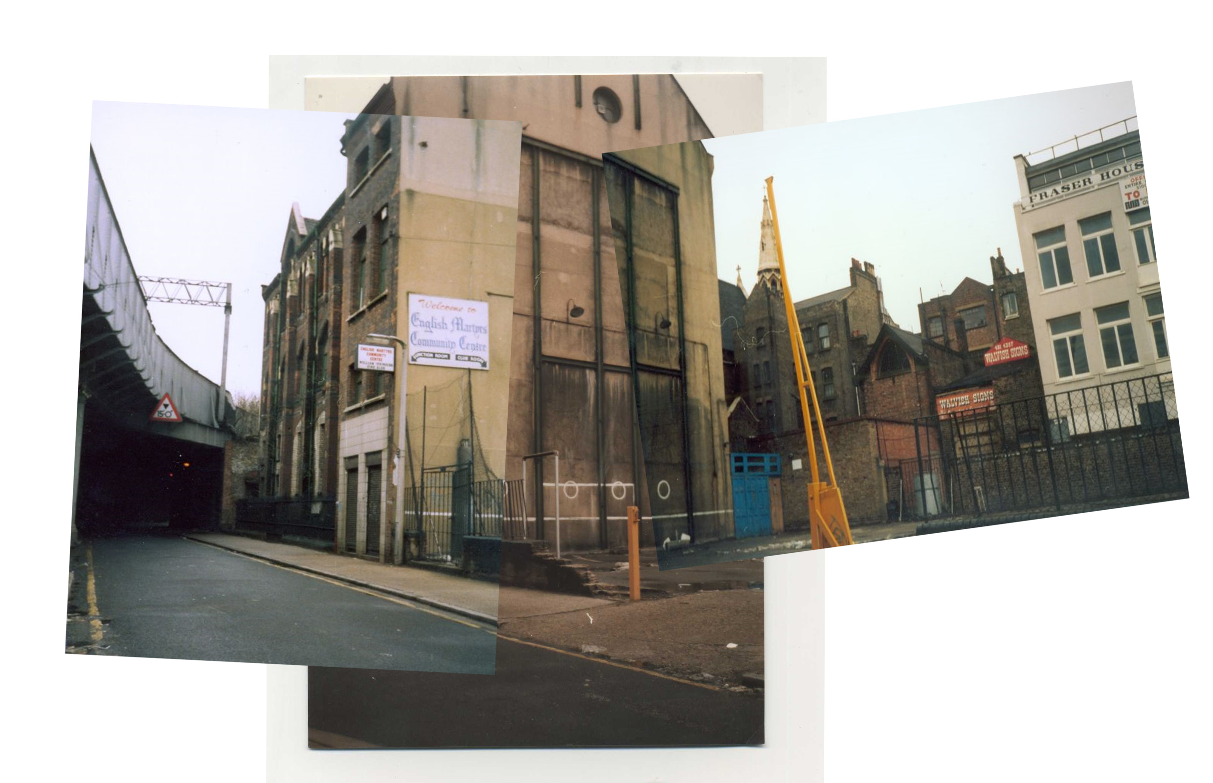
"description": "A mosaic of images showing the old Tower Hill school which later became the English Martyrs Community Centre until its demolition and replacement with offices spanning the site between Chamber Street and Prescot Street. The view shows the old school building and the school playground site which had become a car park.\n\nEvidence of the playground can be seen with the painted goal posts, the white circles and the impromptu cricket wicket painted on the walls. \n\nIn the background can be seen a building which was the chapel of the Holy Family Convent which was situated in Prescot Street close to English Martyrs' Church - which can also be seen in the photograph. \n\nAlso visible is a building called Fraser House and signboards for Walvish Signs.\n\nThe house to the left of the convent was the original presbytery or priests house for English Martyrs Church. After the redevelopment, the presbytery moved to its current building at 30 Prescot Street.\n\nThe school buildings which can be seen close to the railway bridge used to have metal walkways on the exterior face of the building to facilitate the movement of pupils between rooms without disturbing other classes. These were removed when the building was converted into a community centre linked to the Church.\n\nThe railway bridge shows the branching of a spur off the main London, Tilbury and Southend Railway which led to a goods facility along Mansell Street called Haydon's Yard.\n\nThis spur and the original bell on the school building can be seen in the photo visible at this link.\n\nhttp://forum.casebook.org/attachment.php?s=e681eba1870a92efb96648fa40e90dab&attachmentid=13887&d=1335570215\n\n",
"copyright": false,
"created": "2018-03-04"
},
{
"id": 1472,
"title": "Old Tower Hill School",
"author": {
"id": 153,
"username": "danny"
},
"feature": {
"id": 1296,
"type": "Feature",
"geometry": {
"type": "MultiPolygon",
"coordinates": [
[
[
[
-0.071706015667423,
51.51096836077219
],
[
-0.071841028671068,
51.51094484938125
],
[
-0.07184526721746,
51.510955445567966
],
[
-0.07186219920978,
51.510953969556034
],
[
-0.071872203924443,
51.51098337431844
],
[
-0.07185618379654,
51.51098545013041
],
[
-0.071892753874241,
51.51107377220918
],
[
-0.071760673580627,
51.511094407858565
],
[
-0.071706015667423,
51.51096836077219
]
]
]
]
},
"properties": {
"b_number": "62",
"b_name": "De Mazenod House, 62 Chamber Street",
"street": "Chamber Street",
"address": "De Mazenod House, 62 Chamber Street",
"feature_type": "WHITECHAPEL_BUILDING",
"count": 9,
"search_str": "De Mazenod House, 62 Chamber Street"
},
"tags": []
},
"file": "https://surveyoflondon.org/media/uploads/features/1296/Old%20School%206.jpg",
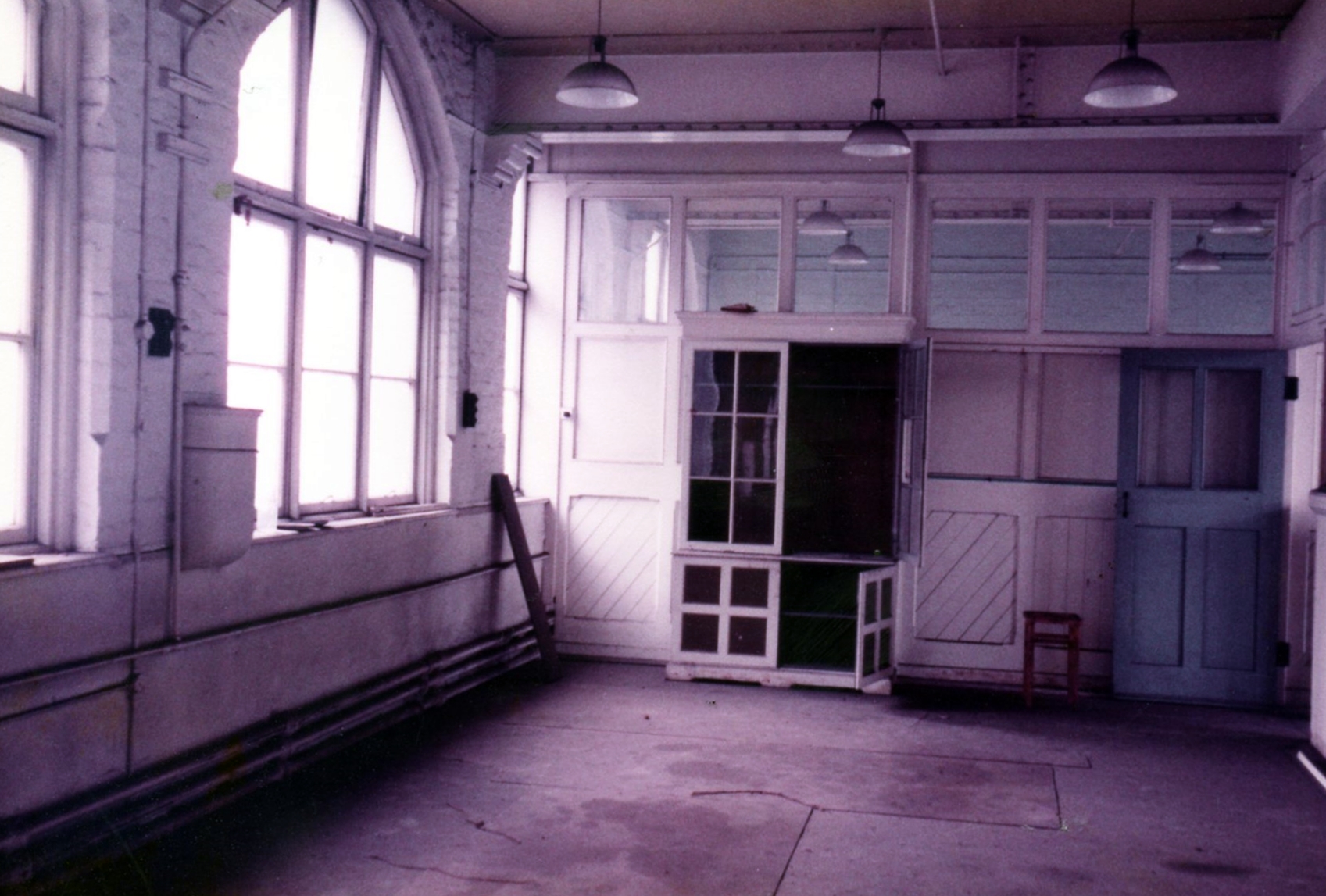
"description": "One of the upper floors inside the original Tower Hill School building. This school was occupied until the school moved to new premises in St Mark's Street and was renamed English Martyrs School in late 1969.",
"copyright": true,
"created": "2018-12-01"
},
{
"id": 1717,
"title": "English Martyrs School, Chamber Street elevation, as built 1872",
"author": {
"id": 2,
"username": "surveyoflondon"
},
"feature": {
"id": 1296,
"type": "Feature",
"geometry": {
"type": "MultiPolygon",
"coordinates": [
[
[
[
-0.071706015667423,
51.51096836077219
],
[
-0.071841028671068,
51.51094484938125
],
[
-0.07184526721746,
51.510955445567966
],
[
-0.07186219920978,
51.510953969556034
],
[
-0.071872203924443,
51.51098337431844
],
[
-0.07185618379654,
51.51098545013041
],
[
-0.071892753874241,
51.51107377220918
],
[
-0.071760673580627,
51.511094407858565
],
[
-0.071706015667423,
51.51096836077219
]
]
]
]
},
"properties": {
"b_number": "62",
"b_name": "De Mazenod House, 62 Chamber Street",
"street": "Chamber Street",
"address": "De Mazenod House, 62 Chamber Street",
"feature_type": "WHITECHAPEL_BUILDING",
"count": 9,
"search_str": "De Mazenod House, 62 Chamber Street"
},
"tags": []
},
"file": "https://surveyoflondon.org/media/uploads/features/1296/English%20Martyrs%20School%20elevation%201872%20reconstructed.jpg",
"description": "Drawing by Helen Jones based on drawing by Norton, Trist & Gilbert, 1949, in English Martyrs Church Archives.",
"copyright": false,
"created": "2020-05-22"
},
{
"id": 1161,
"title": "Catholic Procession - Yeoman's Yard off Chamber Street",
"author": {
"id": 153,
"username": "danny"
},
"feature": {
"id": 1294,
"type": "Feature",
"geometry": {
"type": "MultiPolygon",
"coordinates": [
[
[
[
-0.070916046912067,
51.511099230180704
],
[
-0.071184349341212,
51.51104867187404
],
[
-0.071222101586805,
51.51113116556059
],
[
-0.071235262749937,
51.51113021242196
],
[
-0.071251353948968,
51.51117082864732
],
[
-0.070953565450253,
51.51122554813456
],
[
-0.070928956096472,
51.51117078878672
],
[
-0.070943103214376,
51.51116868228952
],
[
-0.070916046912067,
51.511099230180704
]
]
]
]
},
"properties": {
"b_number": "65–66",
"b_name": "",
"street": "Chamber Street",
"address": "65–66 Chamber Street",
"feature_type": "WHITECHAPEL_BUILDING",
"count": 3,
"search_str": "65–66 Chamber Street"
},
"tags": []
},
"file": "https://surveyoflondon.org/media/uploads/features/1294/Yeoman's%20Yard.jpg",
"description": "An image taken in Chamber Street in the mid 1960s as children from Tower Hill School form up for the annual parish procession from English Martyrs Church around the parish and to the site of execution of some of the English Martyrs at the scaffold site on Tower Hill, in Trinity Gardens.\n\nThis shot shows Yeoman's Yard which ran north off Chamber Street and the dog-leg around the back of the Tower Hill School playground. The boy staring at the camera is Gary Knowles and the blonde child behind him is my sister Carol Bassi, née McLaughlin. Both are of Irish heritage as many, perhaps a majority of the pupils at the school were at this time, reflecting the high levels of Irish immigration to this area from the 1600s through the exodus during the famine to the post-war waves of Irish in the 1950s and 1960s.",
"copyright": false,
"created": "2018-03-04"
},
{
"id": 1162,
"title": "Catholic Procession - Yeoman's Yard and Chamber Street",
"author": {
"id": 153,
"username": "danny"
},
"feature": {
"id": 1294,
"type": "Feature",
"geometry": {
"type": "MultiPolygon",
"coordinates": [
[
[
[
-0.070916046912067,
51.511099230180704
],
[
-0.071184349341212,
51.51104867187404
],
[
-0.071222101586805,
51.51113116556059
],
[
-0.071235262749937,
51.51113021242196
],
[
-0.071251353948968,
51.51117082864732
],
[
-0.070953565450253,
51.51122554813456
],
[
-0.070928956096472,
51.51117078878672
],
[
-0.070943103214376,
51.51116868228952
],
[
-0.070916046912067,
51.511099230180704
]
]
]
]
},
"properties": {
"b_number": "65–66",
"b_name": "",
"street": "Chamber Street",
"address": "65–66 Chamber Street",
"feature_type": "WHITECHAPEL_BUILDING",
"count": 3,
"search_str": "65–66 Chamber Street"
},
"tags": []
},
"file": "https://surveyoflondon.org/media/uploads/features/1294/Sharon%20Yeoman's%20Yard.jpg",
"description": "A shot of the Catholic procession forming up in Chamber Street outside Tower Hill Catholic School in the mid 1960s. In the background, on the site of what is now 67 Chamber Street, can be seen the houses that existed then. A signboard on the wall says Farrugia. This was a Maltese family who lived in the house and who ran a carpentry, joinery and decorating business from here. I was in the same class as one of the sons of the family, Roy Farrugia. The fencing around the school yard can be seen in the picture taken by my Dad, John McLaughlin. The child at the centre of the picture is my sister Sharon McLaughlin.",
"copyright": false,
"created": "2018-03-04"
},
{
"id": 852,
"title": "Facade detail, August 2017",
"author": {
"id": 27,
"username": "DerekKendall"
},
"feature": {
"id": 24,
"type": "Feature",
"geometry": {
"type": "MultiPolygon",
"coordinates": [
[
[
[
-0.070658590061391,
51.512619133471546
],
[
-0.0705337318356,
51.51264639131293
],
[
-0.070414244949403,
51.51248200193594
],
[
-0.070758754155952,
51.51241202384168
],
[
-0.070793852408301,
51.51249117182034
],
[
-0.070598323649052,
51.512525528512604
],
[
-0.070658590061391,
51.512619133471546
]
]
]
]
},
"properties": {
"b_number": "31–39",
"b_name": "Garrick Court",
"street": "Scarborough Street",
"address": "Garrick Court, 31–39 Scarborough Street",
"feature_type": "WHITECHAPEL_BUILDING",
"count": 5,
"search_str": "Garrick Court"
},
"tags": []
},
"file": "https://surveyoflondon.org/media/uploads/features/24/SoL%20Whitechapel%20101594.jpg",
"description": "",
"copyright": true,
"created": "2017-09-12"
},
{
"id": 1753,
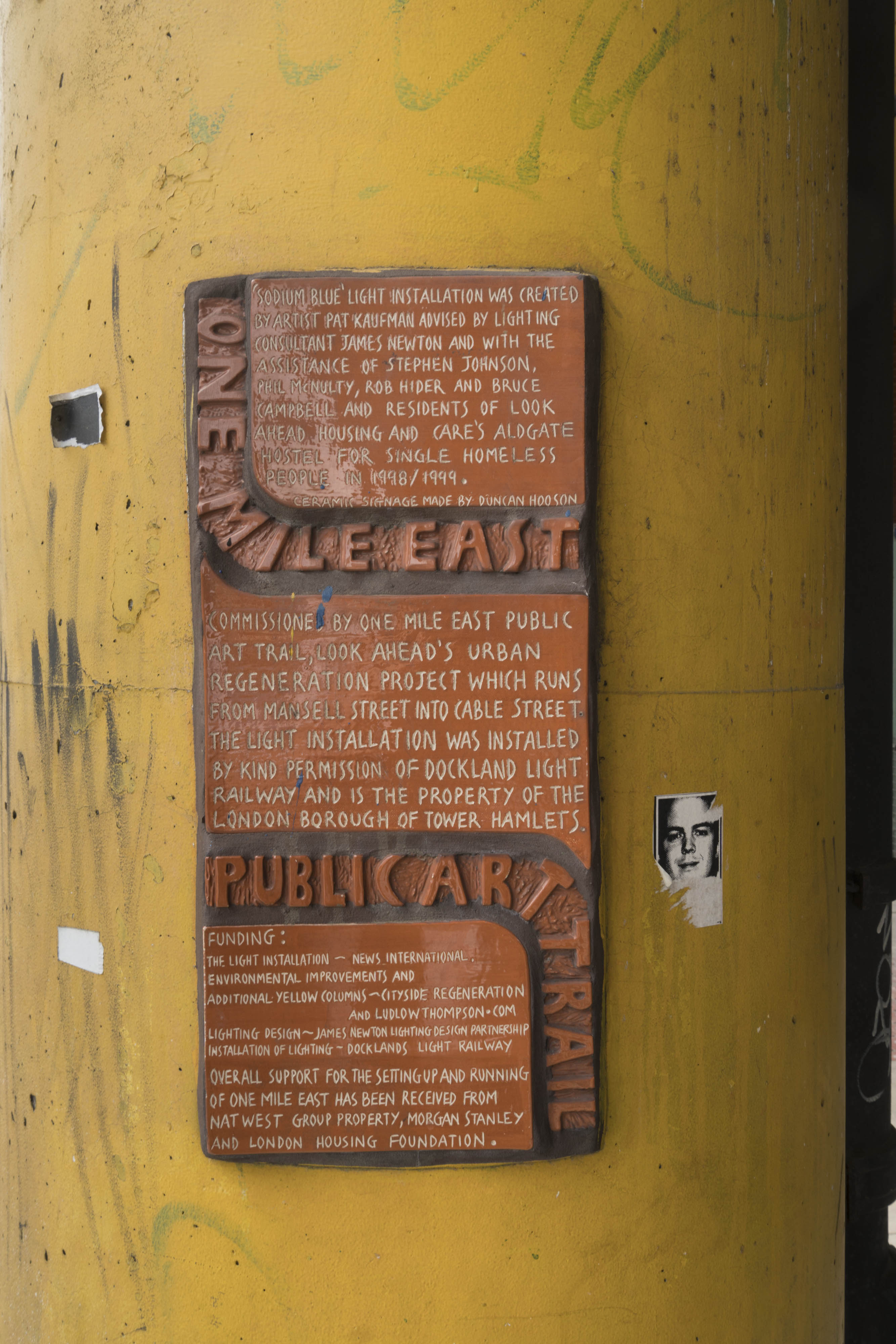
"title": "One Mile East ceramic plaque in 2017",
"author": {
"id": 27,
"username": "DerekKendall"
},
"feature": {
"id": 1284,
"type": "Feature",
"geometry": {
"type": "MultiPolygon",
"coordinates": [
[
[
[
-0.068500275953618,
51.51107508505472
],
[
-0.068478612819023,
51.51106496949243
],
[
-0.068414202464355,
51.51097498722599
],
[
-0.068521626072007,
51.51097035427303
],
[
-0.068532473079143,
51.511074986716515
],
[
-0.068500275953618,
51.51107508505472
]
]
]
]
},
"properties": {
"b_number": "",
"b_name": "",
"street": "Leman Street",
"address": "Pier in middle of Leman Street",
"feature_type": "WHITECHAPEL_BUILDING",
"count": 12,
"search_str": "Pier in middle of Leman Street"
},
"tags": []
},
"file": "https://surveyoflondon.org/media/uploads/features/1284/SoL%20Whitechapel%20101128.jpg",
"description": "",
"copyright": true,
"created": "2020-08-04"
},
{
"id": 1744,
"title": "Merchant House from the north-east in 2017",
"author": {
"id": 27,
"username": "DerekKendall"
},
"feature": {
"id": 341,
"type": "Feature",
"geometry": {
"type": "MultiPolygon",
"coordinates": [
[
[
[
-0.075756372497918,
51.51630759829701
],
[
-0.075832492907812,
51.516372453749725
],
[
-0.075832505230203,
51.51637245650548
],
[
-0.075832504139434,
51.51637245698336
],
[
-0.075533462327354,
51.5164803330596
],
[
-0.075322584851544,
51.51654791373257
],
[
-0.075291822527191,
51.51651052117704
],
[
-0.075307258436179,
51.51650390031411
],
[
-0.075148856743073,
51.51630578374059
],
[
-0.075319288269409,
51.51625050513857
],
[
-0.075502354572911,
51.51619182998281
],
[
-0.075633380984274,
51.51634962782128
],
[
-0.075756372497918,
51.51630759829701
]
]
]
]
},
"properties": {
"b_number": "39",
"b_name": "Merchant House, 39 Goulston Street",
"street": "Goulston Street",
"address": "Merchant House",
"feature_type": "WHITECHAPEL_BUILDING",
"count": 7,
"search_str": "Merchant House, 39 Goulston Street"
},
"tags": []
},
"file": "https://surveyoflondon.org/media/uploads/features/341/SoL%20Whitechapel%20100847.jpg",
"description": "",
"copyright": true,
"created": "2020-08-04"
},
{
"id": 1755,
"title": "28–42 Old Castle Street from the south-west in 2017",
"author": {
"id": 27,
"username": "DerekKendall"
},
"feature": {
"id": 419,
"type": "Feature",
"geometry": {
"type": "MultiPolygon",
"coordinates": [
[
[
[
-0.073912498509202,
51.516349643428086
],
[
-0.073676298509083,
51.516416243428104
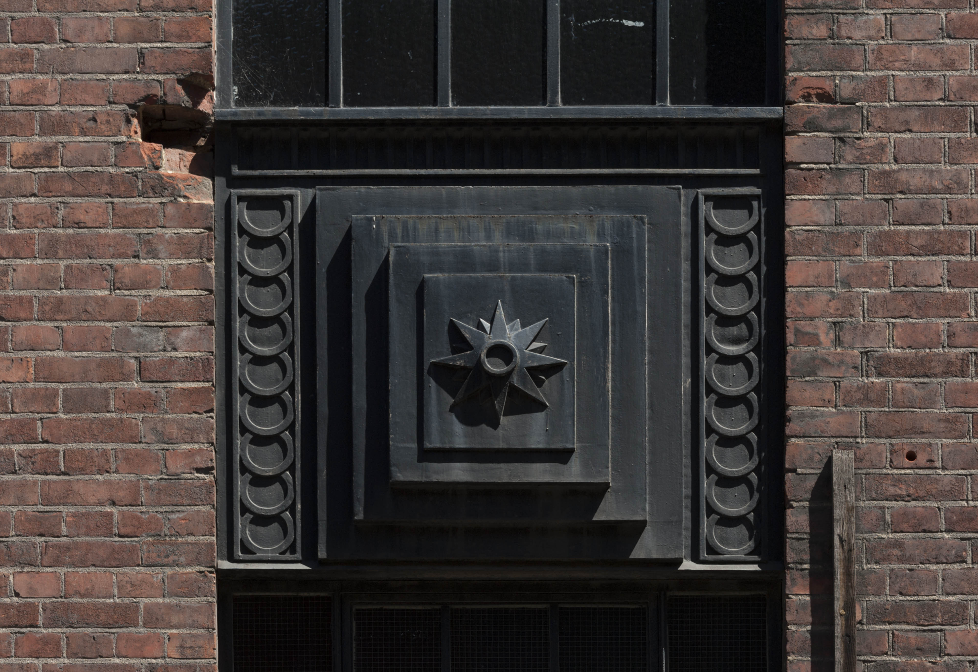
],
[
-0.073540198509107,
51.51626194342803
],
[
-0.07351029850911,
51.516228043428015
],
[
-0.073255698509161,
51.51591574342781
],
[
-0.073521398509294,
51.51584454342777
],
[
-0.073912498509202,
51.516349643428086
]
]
]
]
},
"properties": {
"b_number": "44",
"b_name": "New Evershed House and 28 to 42 Old Castle Street",
"street": "44 Old Castle Street",
"address": "New Evershed House, 44 Old Castle Street, and 28 to 42 Old Castle Street",
"feature_type": "WHITECHAPEL_BUILDING",
"count": 4,
"search_str": "New Evershed House and 28 to 42 Old Castle Street"
},
"tags": []
},
"file": "https://surveyoflondon.org/media/uploads/features/419/SoL%20Whitechapel%20100950.jpg",
"description": "",
"copyright": true,
"created": "2020-08-04"
},
{
"id": 1756,
"title": "Calcutta House from the north-east in 2017",
"author": {
"id": 27,
"username": "DerekKendall"
},
"feature": {
"id": 405,
"type": "Feature",
"geometry": {
"type": "MultiPolygon",
"coordinates": [
[
[
[
-0.073978291920849,
51.515581075868006
],
[
-0.073620345272929,
51.51568885255038
],
[
-0.073380955638186,
51.515461353381355
],
[
-0.073631737839895,
51.51536118144104
],
[
-0.073631738965982,
51.51536117507143
],
[
-0.073631749071862,
51.51536118467535
],
[
-0.073777296847877,
51.515301562785204
],
[
-0.073777291005618,
51.51530155723316
],
[
-0.073950564821505,
51.515227043910336
],
[
-0.074095345892289,
51.51536355445505
],
[
-0.073989551977284,
51.51540723415056
],
[
-0.074055615752804,
51.5154824072535
],
[
-0.074101425140715,
51.515466735247216
],
[
-0.07414978302715,
51.51552176080992
],
[
-0.07414978140901,
51.515521768515015
],
[
-0.074054115992124,
51.515554308575716
],
[
-0.074054080597776,
51.51555514765241
],
[
-0.073978291920849,
51.515581075868006
]
]
]
]
},
"properties": {
"b_number": "",
"b_name": "Calcutta House",
"street": "Goulston Street",
"address": "Calcutta House, London Metropolitan University, Goulston Street",
"feature_type": "WHITECHAPEL_BUILDING",
"count": 6,
"search_str": "Calcutta House"
},
"tags": []
},
"file": "https://surveyoflondon.org/media/uploads/features/405/SoL%20Whitechapel%20100942.jpg",
"description": "",
"copyright": true,
"created": "2020-08-04"
},
{
"id": 1758,
"title": "Times Square from the north-west in 2017",
"author": {
"id": 27,
"username": "DerekKendall"
},
"feature": {
"id": 1009,
"type": "Feature",
"geometry": {
"type": "MultiPolygon",
"coordinates": [
[
[
[
-0.068205789577836,
51.51237579356644
],
[
-0.067741456260696,
51.51244326048929
],
[
-0.067710526289184,
51.512321352717834
],
[
-0.06814668259128,
51.512244756176266
],
[
-0.068205789577836,
51.51237579356644
]
]
]
]
},
"properties": {
"b_number": "113 to 145",
"b_name": "113–145 Times Square, Hooper Street",
"street": "Hooper Street",
"address": "113–145 Times Square, Hooper Street",
"feature_type": "WHITECHAPEL_BUILDING",
"count": 5,
"search_str": "113–145 Times Square, Hooper Street"
},
"tags": []
},
"file": "https://surveyoflondon.org/media/uploads/features/1009/SoL%20Whitechapel%20101013.jpg",
"description": "",
"copyright": true,
"created": "2020-08-04"
},
{
"id": 1759,
"title": "Four Seasons Garden from the south in 2017",
"author": {
"id": 27,
"username": "DerekKendall"
},
"feature": {
"id": 1456,
"type": "Feature",
"geometry": {
"type": "MultiPolygon",
"coordinates": [
[
[
[
-0.069401033322424,
51.512845472872
],
[
-0.069049470836989,
51.51295665537741
],
[
-0.068791684836588,
51.51262417724167
],
[
-0.069146422305013,
51.512517092939504
],
[
-0.069401033322424,
51.512845472872
]
]
]
]
},
"properties": {
"b_number": "",
"b_name": "Four Seasons Garden",
"street": "Leman Street",
"address": "Four Seasons Garden, Leman Street",
"feature_type": "OPEN_SPACE",
"count": 6,
"search_str": "Four Seasons Garden"
},
"tags": []
},
"file": "https://surveyoflondon.org/media/uploads/features/1456/SoL%20Whitechapel%20101017.jpg",
"description": "",
"copyright": true,
"created": "2020-08-04"
},
{
"id": 1751,
"title": "Calcutta House annexe from the north in 2017",
"author": {
"id": 27,
"username": "DerekKendall"
},
"feature": {
"id": 358,
"type": "Feature",
"geometry": {
"type": "MultiPolygon",
"coordinates": [
[
[
[
-0.073301292007031,
51.515600211929396
],
[
-0.073213962675441,
51.51562715962755
],
[
-0.072840800408787,
51.51522217894418
],
[
-0.072928318212048,
51.515190753173876
],
[
-0.073311908683853,
51.51555288300189
],
[
-0.073274093329402,
51.51556391347805
],
[
-0.073282787850232,
51.515575537325454
],
[
-0.073437843405707,
51.51551488351492
],
[
-0.073453284587191,
51.5155300897566
],
[
-0.073295938983894,
51.5155923860951
],
[
-0.073301292007031,
51.515600211929396
]
]
]
]
},
"properties": {
"b_number": "",
"b_name": "Calcutta House annexe, Old Castle Street",
"street": "Old Castle Street",
"address": "Calcutta House Annexe, Old Castle Street",
"feature_type": "WHITECHAPEL_BUILDING",
"count": 8,
"search_str": "Calcutta House annexe, Old Castle Street"
},
"tags": []
},
"file": "https://surveyoflondon.org/media/uploads/features/358/SoL%20Whitechapel%20100939.jpg",
"description": "",
"copyright": true,
"created": "2020-08-04"
},
{
"id": 1754,
"title": "Community Centre from the south-west in 2017",
"author": {
"id": 27,
"username": "DerekKendall"
},
"feature": {
"id": 416,
"type": "Feature",
"geometry": {
"type": "MultiPolygon",
"coordinates": [
[
[
[
-0.074008398509168,
51.51649894342819
],
[
-0.074223298509118,
51.51677594342837
],
[
-0.074160667999642,
51.51678116450384
],
[
-0.07406279493191,
51.51665740746994
],
[
-0.073691098508962,
51.516691743428304
],
[
-0.074008398509168,
51.51649894342819
]
]
]
]
},
"properties": {
"b_number": "52",
"b_name": "The Community Centre",
"street": "Old Castle Street",
"address": "The Community Centre, 52 Old Castle Street",
"feature_type": "WHITECHAPEL_BUILDING",
"count": 5,
"search_str": "The Community Centre"
},
"tags": []
},
"file": "https://surveyoflondon.org/media/uploads/features/416/SoL%20Whitechapel%20100955.jpg",
"description": "",
"copyright": true,
"created": "2020-08-04"
},
{
"id": 1750,
"title": "Calcutta House annexe from the south in 2017",
"author": {
"id": 27,
"username": "DerekKendall"
},
"feature": {
"id": 358,
"type": "Feature",
"geometry": {
"type": "MultiPolygon",
"coordinates": [
[
[
[
-0.073301292007031,
51.515600211929396
],
[
-0.073213962675441,
51.51562715962755
],
[
-0.072840800408787,
51.51522217894418
],
[
-0.072928318212048,
51.515190753173876
],
[
-0.073311908683853,
51.51555288300189
],
[
-0.073274093329402,
51.51556391347805
],
[
-0.073282787850232,
51.515575537325454
],
[
-0.073437843405707,
51.51551488351492
],
[
-0.073453284587191,
51.5155300897566
],
[
-0.073295938983894,
51.5155923860951
],
[
-0.073301292007031,
51.515600211929396
]
]
]
]
},
"properties": {
"b_number": "",
"b_name": "Calcutta House annexe, Old Castle Street",
"street": "Old Castle Street",
"address": "Calcutta House Annexe, Old Castle Street",
"feature_type": "WHITECHAPEL_BUILDING",
"count": 8,
"search_str": "Calcutta House annexe, Old Castle Street"
},
"tags": []
},
"file": "https://surveyoflondon.org/media/uploads/features/358/SoL%20Whitechapel%20100937.jpg",
"description": "",
"copyright": true,
"created": "2020-08-04"
},
{
"id": 1752,
"title": "Calcutta House annexe, detail in 2017",
"author": {
"id": 27,
"username": "DerekKendall"
},
"feature": {
"id": 358,
"type": "Feature",
"geometry": {
"type": "MultiPolygon",
"coordinates": [
[
[
[
-0.073301292007031,
51.515600211929396
],
[
-0.073213962675441,
51.51562715962755
],
[
-0.072840800408787,
51.51522217894418
],
[
-0.072928318212048,
51.515190753173876
],
[
-0.073311908683853,
51.51555288300189
],
[
-0.073274093329402,
51.51556391347805
],
[
-0.073282787850232,
51.515575537325454
],
[
-0.073437843405707,
51.51551488351492
],
[
-0.073453284587191,
51.5155300897566
],
[
-0.073295938983894,
51.5155923860951
],
[
-0.073301292007031,
51.515600211929396
]
]
]
]
},
"properties": {
"b_number": "",
"b_name": "Calcutta House annexe, Old Castle Street",
"street": "Old Castle Street",
"address": "Calcutta House Annexe, Old Castle Street",
"feature_type": "WHITECHAPEL_BUILDING",
"count": 8,
"search_str": "Calcutta House annexe, Old Castle Street"
},
"tags": []
},
"file": "https://surveyoflondon.org/media/uploads/features/358/SoL%20Whitechapel%20100941.jpg",
"description": "",
"copyright": true,
"created": "2020-08-04"
},
{
"id": 1745,
"title": "Market on Wentworth Street in 2017",
"author": {
"id": 27,
"username": "DerekKendall"
},
"feature": {
"id": 1742,
"type": "Feature",
"geometry": {
"type": "MultiPolygon",
"coordinates": [
[
[
[
-0.076387722492951,
51.516257872286374
],
[
-0.07580974439088,
51.51649846859169
],
[
-0.075744693982384,
51.51651411423466
],
[
-0.075332716624042,
51.51665341173461
],
[
-0.075277819023276,
51.516667372076085
],
[
-0.074429584483841,
51.51681699796736
],
[
-0.074402209988697,
51.516763242480046
],
[
-0.075229889371391,
51.51661092868018
],
[
-0.074836715281391,
51.516135055700595
],
[
-0.074917049606191,
51.51611135328064
],
[
-0.075312012611936,
51.51658616747119
],
[
-0.075695505281233,
51.51646463519818
],
[
-0.075779072585588,
51.51644696856364
],
[
-0.076328753388395,
51.516209038390684
],
[
-0.076387722492951,
51.516257872286374
]
]
]
]
},
"properties": {
"b_number": "",
"b_name": "",
"street": "",
"address": "Petticoat Lane Market",
"feature_type": "PLACE",
"count": 39,
"search_str": "Petticoat Lane Market"
},
"tags": []
},
"file": "https://surveyoflondon.org/media/uploads/features/1742/SoL%20Whitechapel%20100854.jpg",
"description": "",
"copyright": true,
"created": "2020-08-04"
}
]
}