HTTP 200 OK
Allow: GET, HEAD, OPTIONS
Content-Type: application/json
Vary: Accept
{
"count": 1747,
"next": "https://surveyoflondon.org/api/v1/images/?format=api&page=75",
"previous": "https://surveyoflondon.org/api/v1/images/?format=api&page=73",
"results": [
{
"id": 548,
"title": "Maersk (formerly Beagle House), north elevation",
"author": {
"id": 27,
"username": "DerekKendall"
},
"feature": {
"id": 31,
"type": "Feature",
"geometry": {
"type": "MultiPolygon",
"coordinates": [
[
[
[
-0.071887127893096,
51.51411332216963
],
[
-0.071969571208431,
51.51419942371175
],
[
-0.071924976063445,
51.5142326534243
],
[
-0.071948658834375,
51.51426657781599
],
[
-0.071835003267539,
51.5143227101345
],
[
-0.071686234045495,
51.5143855464125
],
[
-0.071543425125636,
51.514422007266134
],
[
-0.071435516621411,
51.51444471123646
],
[
-0.071395570736125,
51.51440565693606
],
[
-0.07134776228325,
51.51441310661883
],
[
-0.0712722588033,
51.51434177428325
],
[
-0.071303428297817,
51.51432370241673
],
[
-0.071263213192454,
51.5142868603796
],
[
-0.071374185885124,
51.514224080818835
],
[
-0.071528097019019,
51.51416207230522
],
[
-0.071692419185678,
51.51411901969061
],
[
-0.071795120500786,
51.514091351954804
],
[
-0.071848759931576,
51.5141216554061
],
[
-0.071887127893096,
51.51411332216963
]
]
]
]
},
"properties": {
"b_number": "1",
"b_name": "Maersk House",
"street": "Braham Street",
"address": "Maersk House (formerly Beagle House), 1 Braham Street",
"feature_type": "WHITECHAPEL_BUILDING",
"count": 20,
"search_str": "Maersk House"
},
"tags": []
},
"file": "https://surveyoflondon.org/media/uploads/features/31/SoL%20Whitechapel%20100464.jpg",
"description": "",
"copyright": true,
"created": "2017-04-10"
},
{
"id": 844,
"title": "Looking south down West Tenter Street, August 2017",
"author": {
"id": 27,
"username": "DerekKendall"
},
"feature": {
"id": 53,
"type": "Feature",
"geometry": {
"type": "MultiPolygon",
"coordinates": [
[
[
[
-0.072485061184731,
51.51190593466166
],
[
-0.072928919261596,
51.5118841365536
],
[
-0.072966657695433,
51.51206015611643
],
[
-0.072522936465309,
51.51209913871823
],
[
-0.072485061184731,
51.51190593466166
]
]
]
]
},
"properties": {
"b_number": "77",
"b_name": "Mint House, 77 Mansell Street",
"street": "Mansell Street",
"address": "Mint House, 77 Mansell Street",
"feature_type": "WHITECHAPEL_BUILDING",
"count": 4,
"search_str": "Mint House, 77 Mansell Street"
},
"tags": []
},
"file": "https://surveyoflondon.org/media/uploads/features/53/SoL%20Whitechapel%20101578.jpg",
"description": "",
"copyright": true,
"created": "2017-09-12"
},
{
"id": 1708,
"title": "The old fish shop Royal Mint Street",
"author": {
"id": 153,
"username": "danny"
},
"feature": {
"id": 1355,
"type": "Feature",
"geometry": {
"type": "MultiPolygon",
"coordinates": [
[
[
[
-0.069021887283004,
51.51067095075817
],
[
-0.068911333158757,
51.51068540904317
],
[
-0.06887121360957,
51.510578645708144
],
[
-0.068919922577914,
51.51057043614709
],
[
-0.068926683116691,
51.51058682627254
],
[
-0.068971669187029,
51.51058059044507
],
[
-0.069021887283004,
51.51067095075817
]
]
]
]
},
"properties": {
"b_number": "65",
"b_name": "Guinea Court",
"street": "Royal Mint Street",
"address": "Guinea Court, 65 Royal Mint Street",
"feature_type": "WHITECHAPEL_BUILDING",
"count": 3,
"search_str": "Guinea Court"
},
"tags": []
},
"file": "https://surveyoflondon.org/media/uploads/features/1355/Guinea%20Court.jpg",
"description": "A image taken in the early 1980s from A Block on the Peabody Whitechapel Estate in John Fisher Street looking towards the rear of the old fishmonger's shop on Royal Mint Street with the rear of the former pub, now Simmons Bar to the left. The site of the fishmongers is now occupied by the front of Guinea Court. \n\nThe area with girders shown in the bottom right of the picture was previously roofed over and, in the early 1960s, was stables for horses used to cart goods around the city. My parents lived in A Block from 1959 or early 1960 until around 1962 and they remember hearing the clopping of the horses hooves that were stabled there.",
"copyright": false,
"created": "2020-05-12"
},
{
"id": 1645,
"title": "Black Horse Inn, Leman Street elevation, March 2018",
"author": {
"id": 27,
"username": "DerekKendall"
},
"feature": {
"id": 77,
"type": "Feature",
"geometry": {
"type": "MultiPolygon",
"coordinates": [
[
[
[
-0.070851038094441,
51.51373545505489
],
[
-0.070759329513295,
51.51376181426938
],
[
-0.070651343009654,
51.51364131285701
],
[
-0.070778892983194,
51.51360340085137
],
[
-0.07079674315265,
51.51362732834343
],
[
-0.070777502494091,
51.513632775669016
],
[
-0.070851038094441,
51.51373545505489
]
]
]
]
},
"properties": {
"b_number": "40",
"b_name": "",
"street": "Leman Street",
"address": "The Black Horse, 40 Leman Street",
"feature_type": "WHITECHAPEL_BUILDING",
"count": 2,
"search_str": "The Black Horse, 40 Leman Street"
},
"tags": []
},
"file": "https://surveyoflondon.org/media/uploads/features/77/SoL%20Whitechapel%20101953.jpg",
"description": "",
"copyright": false,
"created": "2019-08-19"
},
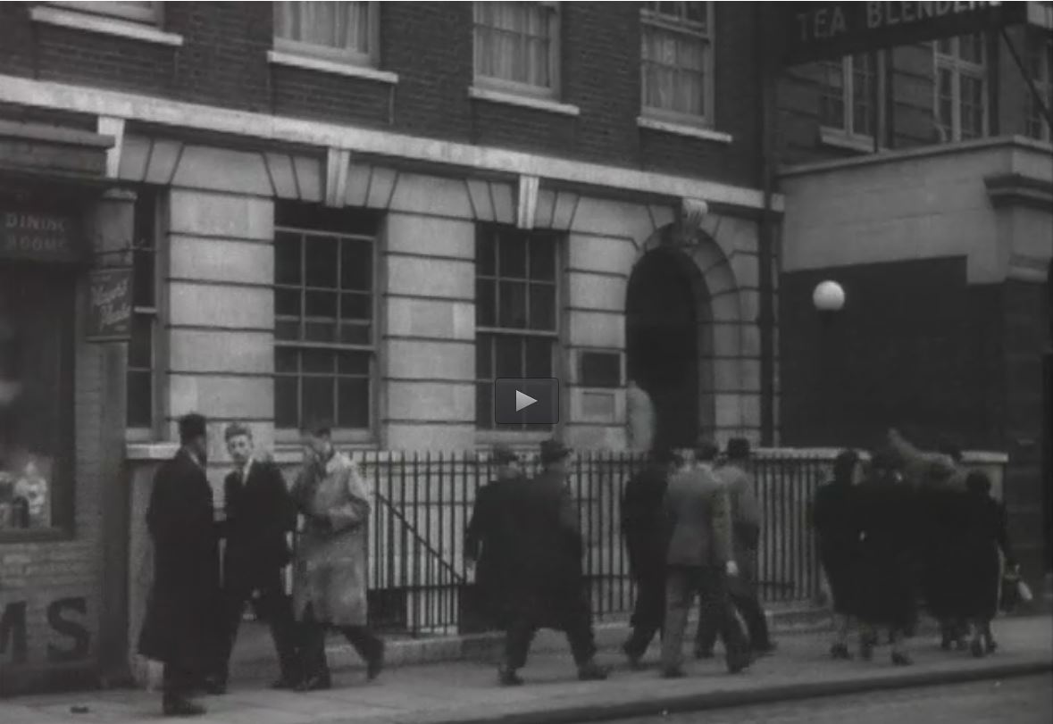
{
"id": 749,
"title": "Film still of Jews' Temporary Shelter, 1938",
"author": {
"id": 2,
"username": "surveyoflondon"
},
"feature": {
"id": 49,
"type": "Feature",
"geometry": {
"type": "MultiPolygon",
"coordinates": [
[
[
[
-0.072923062723342,
51.51243783318541
],
[
-0.072850201036746,
51.51244077684814
],
[
-0.072839975467023,
51.51239464172425
],
[
-0.073023989371249,
51.51238161262953
],
[
-0.073031917055091,
51.5124784765374
],
[
-0.072931301597456,
51.51248162939545
],
[
-0.072923062723342,
51.51243783318541
]
]
]
]
},
"properties": {
"b_number": "63",
"b_name": "",
"street": "Mansell Street",
"address": "63 Mansell Street",
"feature_type": "WHITECHAPEL_BUILDING",
"count": 4,
"search_str": "63 Mansell Street"
},
"tags": []
},
"file": "https://surveyoflondon.org/media/uploads/features/49/63%20Mansell%20Street.JPG",
"description": "Eight minute film of life at the Shelter: https://collections.ushmm.org/search/catalog/irn1000726",
"copyright": false,
"created": "2017-09-06"
},
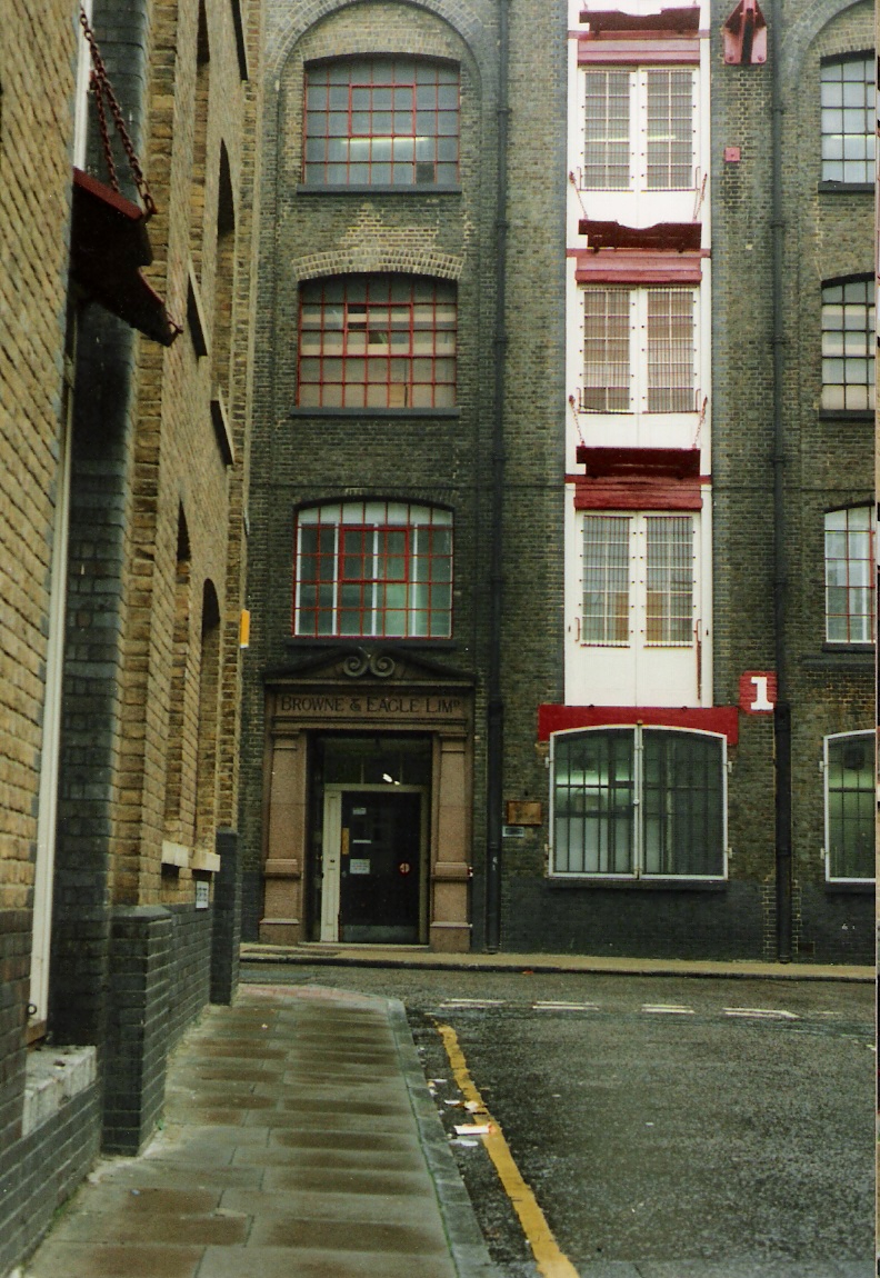
{
"id": 481,
"title": "View of the entrance to Browne & Eagle wool warehouse",
"author": {
"id": 72,
"username": "eric"
},
"feature": {
"id": 1426,
"type": "Feature",
"geometry": {
"type": "MultiPolygon",
"coordinates": [
[
[
[
-0.067065028354526,
51.512085867230155
],
[
-0.067219147027573,
51.51207541596153
],
[
-0.067220976312691,
51.51208798335162
],
[
-0.067318962907451,
51.51212682259167
],
[
-0.067347484117627,
51.51221770682
],
[
-0.067228006372544,
51.512235878115895
],
[
-0.067234013052474,
51.512251974255875
],
[
-0.067164480404023,
51.5122619566626
],
[
-0.067055091215528,
51.512212857733324
],
[
-0.067053001167359,
51.51217665583574
],
[
-0.067075389494963,
51.51217441663721
],
[
-0.067065028354526,
51.512085867230155
]
]
]
]
},
"properties": {
"b_number": "83 and ",
"b_name": "Hooper Square, 31–83 Back Church Lane and 32–52 Hooper Street",
"street": "Back Church Lane and Hooper Street",
"address": "83 and entrance to 31 to 81 Back Church Lane and 32 to 52 Hooper Street",
"feature_type": "WHITECHAPEL_BUILDING",
"count": 4,
"search_str": "Hooper Square, 31–83 Back Church Lane and 32–52 Hooper Street"
},
"tags": []
},
"file": "https://surveyoflondon.org/media/uploads/features/1426/Brown%26Eagle.jpg",
"description": "Image of the 'front entrance' to Browne & Eagle wool importers. The building always had a clean and pleasant look.",
"copyright": false,
"created": "2017-01-15"
},
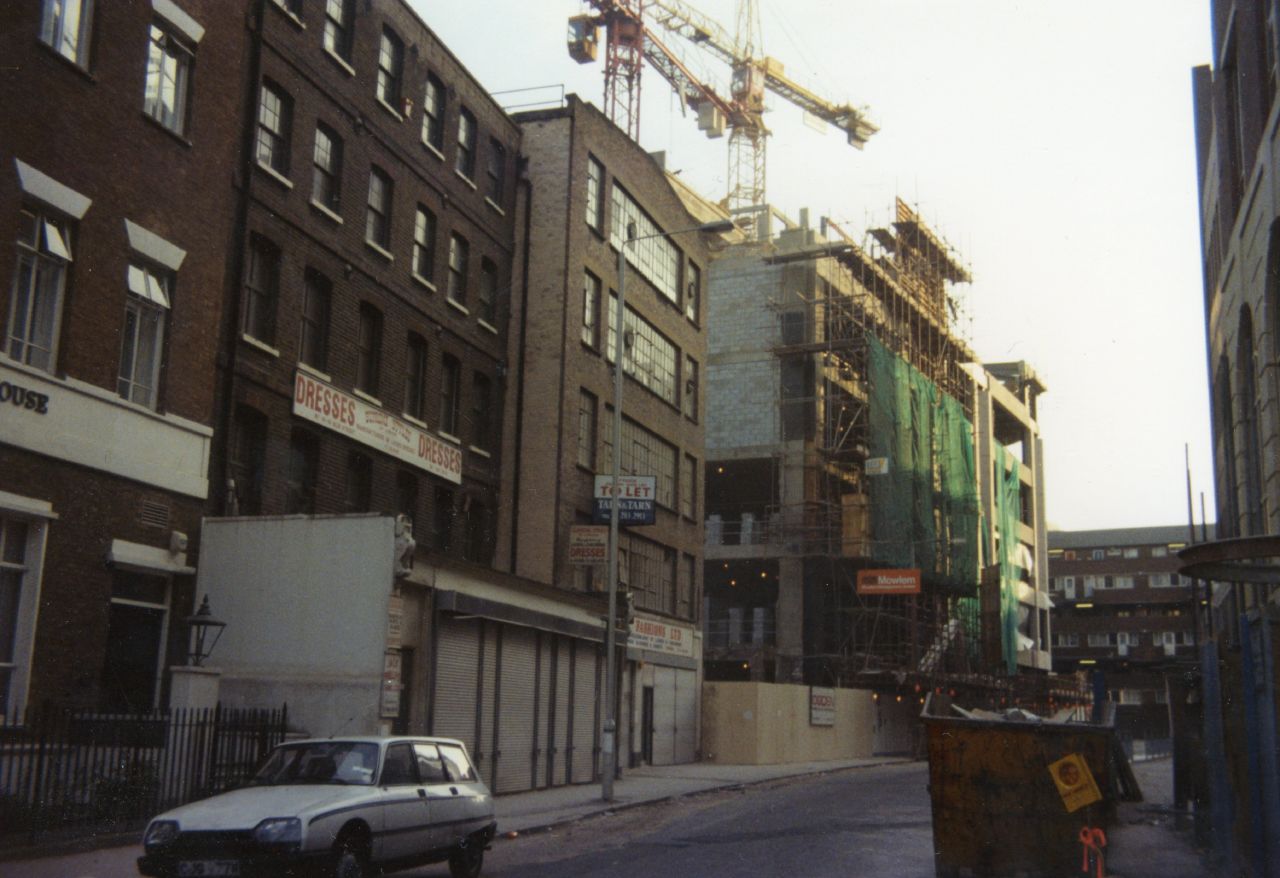
{
"id": 1692,
"title": "Alie Street South Side near junction of Mansell St",
"author": {
"id": 153,
"username": "danny"
},
"feature": {
"id": 38,
"type": "Feature",
"geometry": {
"type": "MultiPolygon",
"coordinates": [
[
[
[
-0.072769869537147,
51.51314834719593
],
[
-0.072478836917296,
51.51321048439805
],
[
-0.072355493685702,
51.51292927094216
],
[
-0.072672904111031,
51.51288088167866
],
[
-0.072771908194299,
51.51314802689543
],
[
-0.072769869537147,
51.51314834719593
]
]
]
]
},
"properties": {
"b_number": "6",
"b_name": "Royal College of Pathologists, 6 Alie Street",
"street": "Alie Street",
"address": "Royal College of Pathologists, 6 Alie Street",
"feature_type": "WHITECHAPEL_BUILDING",
"count": 5,
"search_str": "Royal College of Pathologists, 6 Alie Street"
},
"tags": []
},
"file": "https://surveyoflondon.org/media/uploads/features/38/Alie%20Street%201980s.jpg",
"description": "One of my images of Alie Street - south side taken some time in the early 1980s before redevelopment of the buildings from its junction with Mansell Street",
"copyright": true,
"created": "2020-05-05"
},
{
"id": 696,
"title": "Whitechapel District Board of Works electric-lamp standard, east of Whitechapel Bell Foundry, view to the north in 2017",
"author": {
"id": 27,
"username": "DerekKendall"
},
"feature": {
"id": 155,
"type": "Feature",
"geometry": {
"type": "MultiPolygon",
"coordinates": [
[
[
[
-0.067279828395434,
51.51695705948158
],
[
-0.067093469618443,
51.517032789909806
],
[
-0.067051200483431,
51.516996757810816
],
[
-0.067090391118988,
51.51698039038376
],
[
-0.06706090910812,
51.51695688633854
],
[
-0.067015052606677,
51.51697914860705
],
[
-0.067015052606682,
51.516979148607064
],
[
-0.067015052606675,
51.51697914860705
],
[
-0.066983358160437,
51.516951324364136
],
[
-0.066904378563551,
51.516904192470385
],
[
-0.066814855785544,
51.516858952938556
],
[
-0.066749004017844,
51.51678511344983
],
[
-0.066726651062502,
51.51660623379854
],
[
-0.066916087304028,
51.516542881724156
],
[
-0.067063145906456,
51.51668871217051
],
[
-0.067018758534236,
51.51670613616749
],
[
-0.067108196018859,
51.516794826264736
],
[
-0.067132918133769,
51.516785121743794
],
[
-0.067195489248199,
51.51684716970448
],
[
-0.06716822056742,
51.5168577515391
],
[
-0.067184699138495,
51.51687146748573
],
[
-0.067279828395434,
51.51695705948158
]
],
[
[
-0.067093263845335,
51.516893872671716
],
[
-0.067031009970172,
51.516845232635745
],
[
-0.066988676105,
51.51686586339187
],
[
-0.067034303634964,
51.51688439111608
],
[
-0.067057406216514,
51.51690729267392
],
[
-0.067093263845335,
51.516893872671716
]
]
]
]
},
"properties": {
"b_number": "32-34",
"b_name": "Whitechapel Bell Foundry, 32–34 Whitechapel Road",
"street": "Whitechapel Road",
"address": "32-34 Whitechapel Road",
"feature_type": "WHITECHAPEL_BUILDING",
"count": 26,
"search_str": "Whitechapel Bell Foundry, 32–34 Whitechapel Road"
},
"tags": [
"bells",
"foundry"
]
},
"file": "https://surveyoflondon.org/media/uploads/features/155/SoL%20Whitechapel%20101177.jpg",
"description": "",
"copyright": true,
"created": "2017-07-28"
},
{
"id": 922,
"title": "Last bell to be cast at the Whitechapel Bell Foundry",
"author": {
"id": 167,
"username": "alexander"
},
"feature": {
"id": 155,
"type": "Feature",
"geometry": {
"type": "MultiPolygon",
"coordinates": [
[
[
[
-0.067279828395434,
51.51695705948158
],
[
-0.067093469618443,
51.517032789909806
],
[
-0.067051200483431,
51.516996757810816
],
[
-0.067090391118988,
51.51698039038376
],
[
-0.06706090910812,
51.51695688633854
],
[
-0.067015052606677,
51.51697914860705
],
[
-0.067015052606682,
51.516979148607064
],
[
-0.067015052606675,
51.51697914860705
],
[
-0.066983358160437,
51.516951324364136
],
[
-0.066904378563551,
51.516904192470385
],
[
-0.066814855785544,
51.516858952938556
],
[
-0.066749004017844,
51.51678511344983
],
[
-0.066726651062502,
51.51660623379854
],
[
-0.066916087304028,
51.516542881724156
],
[
-0.067063145906456,
51.51668871217051
],
[
-0.067018758534236,
51.51670613616749
],
[
-0.067108196018859,
51.516794826264736
],
[
-0.067132918133769,
51.516785121743794
],
[
-0.067195489248199,
51.51684716970448
],
[
-0.06716822056742,
51.5168577515391
],
[
-0.067184699138495,
51.51687146748573
],
[
-0.067279828395434,
51.51695705948158
]
],
[
[
-0.067093263845335,
51.516893872671716
],
[
-0.067031009970172,
51.516845232635745
],
[
-0.066988676105,
51.51686586339187
],
[
-0.067034303634964,
51.51688439111608
],
[
-0.067057406216514,
51.51690729267392
],
[
-0.067093263845335,
51.516893872671716
]
]
]
]
},
"properties": {
"b_number": "32-34",
"b_name": "Whitechapel Bell Foundry, 32–34 Whitechapel Road",
"street": "Whitechapel Road",
"address": "32-34 Whitechapel Road",
"feature_type": "WHITECHAPEL_BUILDING",
"count": 26,
"search_str": "Whitechapel Bell Foundry, 32–34 Whitechapel Road"
},
"tags": [
"bells",
"foundry"
]
},
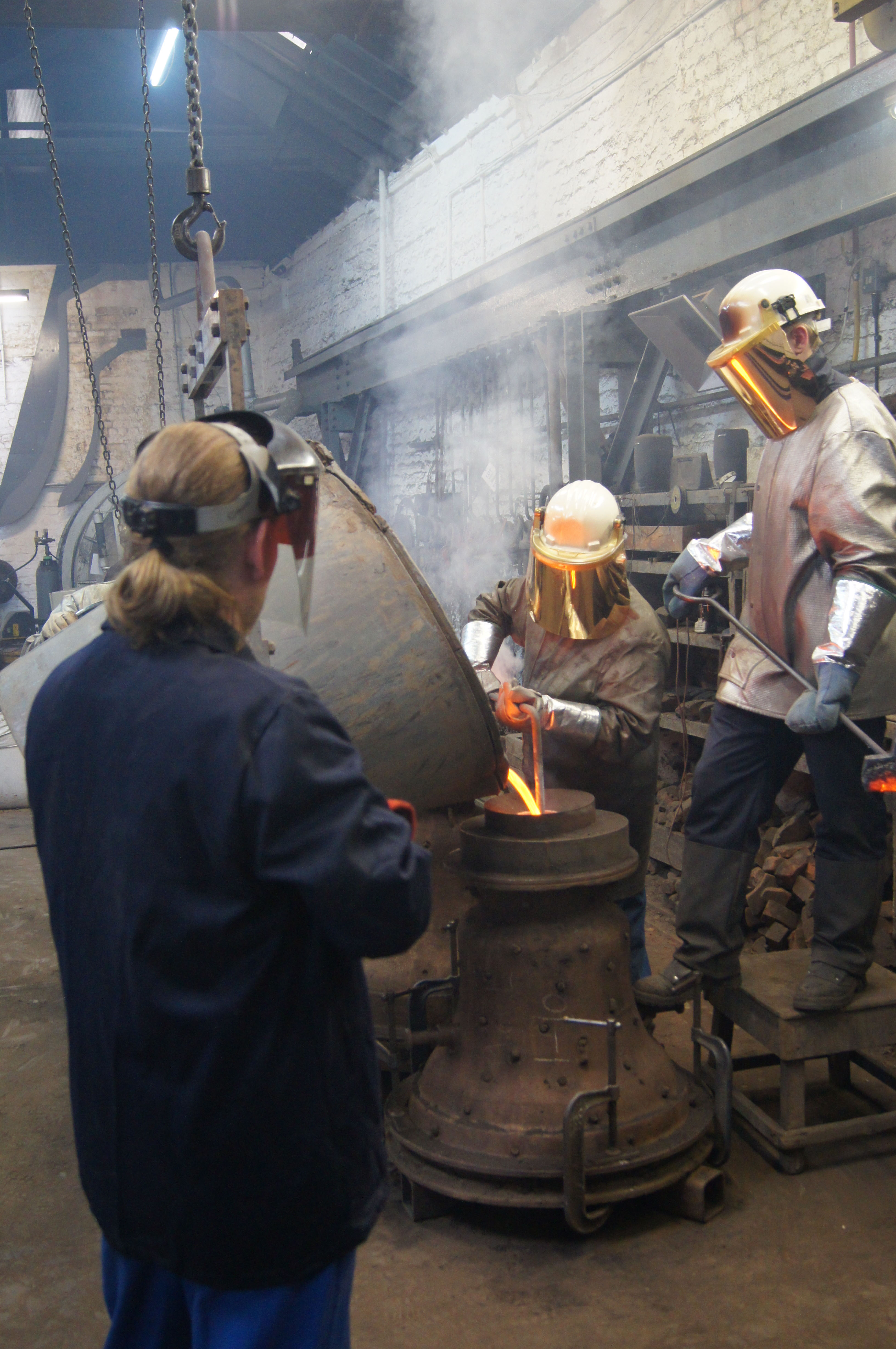
"file": "https://surveyoflondon.org/media/uploads/features/155/last%20bell%20to%20be%20cast%20whitechapel%20bell%20foundry%20copy.jpg",
"description": "The Museum of London commissioned the last bell to be cast at the bell foundry. This photograph shows the moment of casting on Wednesday afternoon, 22 April 2017. ",
"copyright": false,
"created": "2017-10-03"
},
{
"id": 1277,
"title": "Leman Street elevation detail, March 2018",
"author": {
"id": 27,
"username": "DerekKendall"
},
"feature": {
"id": 73,
"type": "Feature",
"geometry": {
"type": "MultiPolygon",
"coordinates": [
[
[
[
-0.070367322342311,
51.51301553237353
],
[
-0.07031474659871,
51.512941993636225
],
[
-0.070151719826248,
51.51298919377999
],
[
-0.069851260574291,
51.512596219574206
],
[
-0.0699963051034,
51.51255612151373
],
[
-0.070235487507054,
51.51287146226293
],
[
-0.070259147169942,
51.51286418127443
],
[
-0.070206642068876,
51.51279125317895
],
[
-0.070282120938765,
51.51276767326361
],
[
-0.070251490920689,
51.51272709430695
],
[
-0.070387507282697,
51.51268328722199
],
[
-0.070537351987533,
51.51287316293096
],
[
-0.070430553866062,
51.51290680513313
],
[
-0.070489489998683,
51.51298392076877
],
[
-0.070367322342311,
51.51301553237353
]
]
]
]
},
"properties": {
"b_number": "74",
"b_name": "",
"street": "Leman Street",
"address": "Leman Street Police Station, 74 Leman Street",
"feature_type": "WHITECHAPEL_BUILDING",
"count": 7,
"search_str": "Leman Street Police Station, 74 Leman Street"
},
"tags": []
},
"file": "https://surveyoflondon.org/media/uploads/features/73/SoL%20Whitechapel%20101978.jpg",
"description": "",
"copyright": true,
"created": "2018-08-07"
},
{
"id": 1278,
"title": "Leman Street elevation looking south, March 2018",
"author": {
"id": 27,
"username": "DerekKendall"
},
"feature": {
"id": 73,
"type": "Feature",
"geometry": {
"type": "MultiPolygon",
"coordinates": [
[
[
[
-0.070367322342311,
51.51301553237353
],
[
-0.07031474659871,
51.512941993636225
],
[
-0.070151719826248,
51.51298919377999
],
[
-0.069851260574291,
51.512596219574206
],
[
-0.0699963051034,
51.51255612151373
],
[
-0.070235487507054,
51.51287146226293
],
[
-0.070259147169942,
51.51286418127443
],
[
-0.070206642068876,
51.51279125317895
],
[
-0.070282120938765,
51.51276767326361
],
[
-0.070251490920689,
51.51272709430695
],
[
-0.070387507282697,
51.51268328722199
],
[
-0.070537351987533,
51.51287316293096
],
[
-0.070430553866062,
51.51290680513313
],
[
-0.070489489998683,
51.51298392076877
],
[
-0.070367322342311,
51.51301553237353
]
]
]
]
},
"properties": {
"b_number": "74",
"b_name": "",
"street": "Leman Street",
"address": "Leman Street Police Station, 74 Leman Street",
"feature_type": "WHITECHAPEL_BUILDING",
"count": 7,
"search_str": "Leman Street Police Station, 74 Leman Street"
},
"tags": []
},
"file": "https://surveyoflondon.org/media/uploads/features/73/SoL%20Whitechapel%20101976.jpg",
"description": "",
"copyright": true,
"created": "2018-08-07"
},
{
"id": 1347,
"title": "2C and 4A Commercial Street from the northwest in 2018",
"author": {
"id": 27,
"username": "DerekKendall"
},
"feature": {
"id": 374,
"type": "Feature",
"geometry": {
"type": "MultiPolygon",
"coordinates": [
[
[
[
-0.072122718131682,
51.51573277413889
],
[
-0.071960912758108,
51.51579721323616
],
[
-0.071910570320506,
51.51574471132171
],
[
-0.071785562876658,
51.51561898838918
],
[
-0.071952630416972,
51.515556297762615
],
[
-0.072122718131682,
51.51573277413889
]
]
]
]
},
"properties": {
"b_number": "2c to 4a",
"b_name": "2c to 4a Commercial Street",
"street": "Commercial Street",
"address": "2c to 4a Commercial Street, London E1 7PT",
"feature_type": "WHITECHAPEL_BUILDING",
"count": 6,
"search_str": "2c to 4a Commercial Street"
},
"tags": []
},
"file": "https://surveyoflondon.org/media/uploads/features/374/SoL%20Whitechapel%20102195.jpg",
"description": "",
"copyright": true,
"created": "2018-10-10"
},
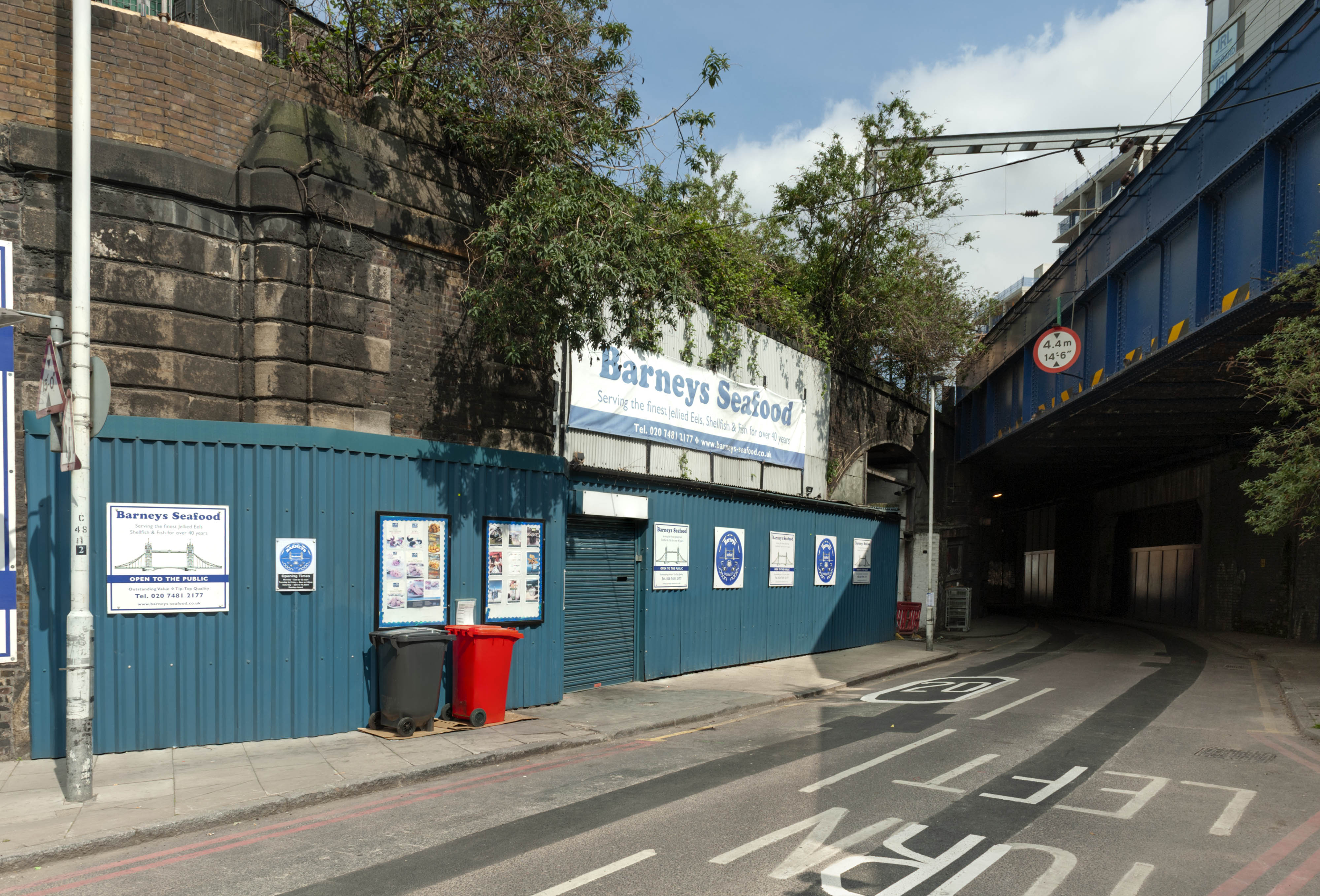
{
"id": 1681,
"title": "Barneys Seafood in railway viaduct arch, from the south-west in 2019",
"author": {
"id": 27,
"username": "DerekKendall"
},
"feature": {
"id": 1310,
"type": "Feature",
"geometry": {
"type": "MultiPolygon",
"coordinates": [
[
[
[
-0.072640543386628,
51.511126910908146
],
[
-0.072546284627394,
51.51109445750477
],
[
-0.072442870594844,
51.51105766937985
],
[
-0.072212891852196,
51.511015291752464
],
[
-0.071794996225884,
51.51092420910208
],
[
-0.072193476308503,
51.510898011530344
],
[
-0.072292806128645,
51.51091522504932
],
[
-0.072304530237151,
51.510931416638016
],
[
-0.07242778419924,
51.51096443737364
],
[
-0.072431087286307,
51.51095279556461
],
[
-0.072461272416322,
51.51095734673215
],
[
-0.072466091619938,
51.51096214778542
],
[
-0.072488635517089,
51.510966022410706
],
[
-0.072644665703862,
51.511088472040846
],
[
-0.072640543386628,
51.511126910908146
]
]
]
]
},
"properties": {
"b_number": "",
"b_name": "Railway Viaduct Spur",
"street": "Mansell Street / Chamber Street",
"address": "Railway Viaduct Spur, Mansell Street / Chamber Street",
"feature_type": "WHITECHAPEL_BUILDING",
"count": 17,
"search_str": "Railway Viaduct Spur"
},
"tags": []
},
"file": "https://surveyoflondon.org/media/uploads/features/1310/SoL%20Whitechapel%20102759.jpg",
"description": "",
"copyright": true,
"created": "2020-02-18"
},
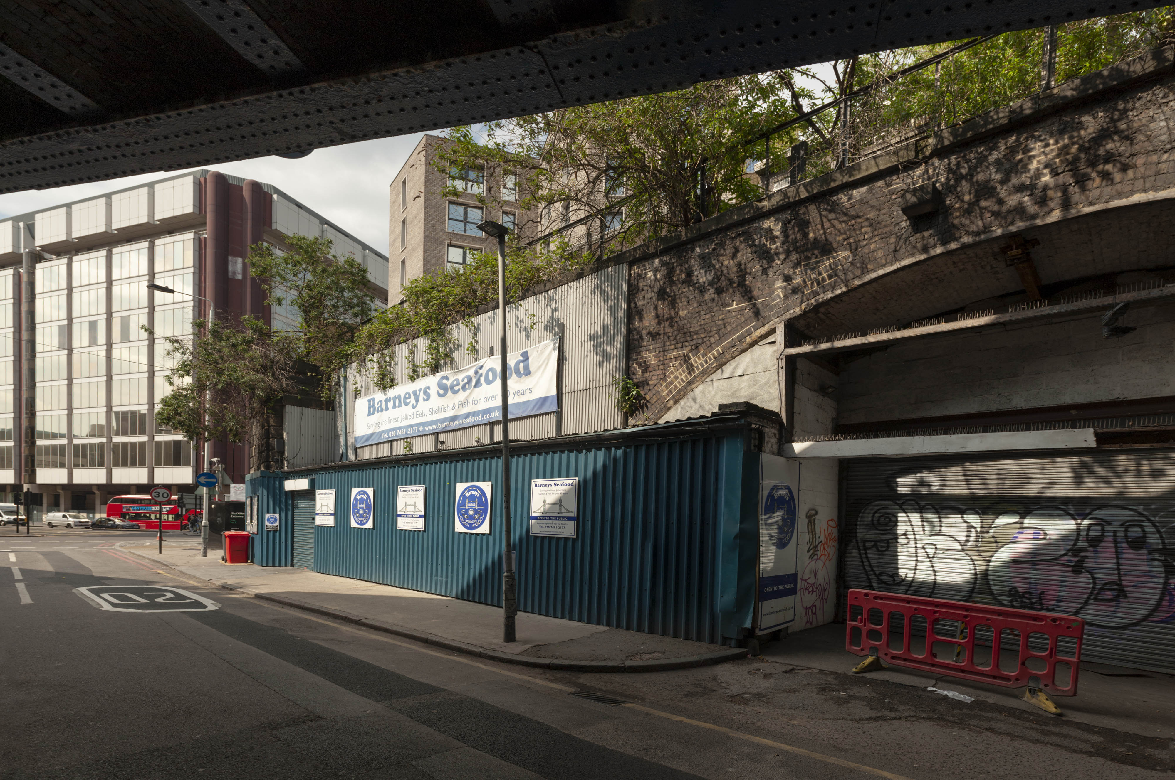
{
"id": 1682,
"title": "Barneys Seafood, exterior from the south-east in 2019",
"author": {
"id": 27,
"username": "DerekKendall"
},
"feature": {
"id": 1310,
"type": "Feature",
"geometry": {
"type": "MultiPolygon",
"coordinates": [
[
[
[
-0.072640543386628,
51.511126910908146
],
[
-0.072546284627394,
51.51109445750477
],
[
-0.072442870594844,
51.51105766937985
],
[
-0.072212891852196,
51.511015291752464
],
[
-0.071794996225884,
51.51092420910208
],
[
-0.072193476308503,
51.510898011530344
],
[
-0.072292806128645,
51.51091522504932
],
[
-0.072304530237151,
51.510931416638016
],
[
-0.07242778419924,
51.51096443737364
],
[
-0.072431087286307,
51.51095279556461
],
[
-0.072461272416322,
51.51095734673215
],
[
-0.072466091619938,
51.51096214778542
],
[
-0.072488635517089,
51.510966022410706
],
[
-0.072644665703862,
51.511088472040846
],
[
-0.072640543386628,
51.511126910908146
]
]
]
]
},
"properties": {
"b_number": "",
"b_name": "Railway Viaduct Spur",
"street": "Mansell Street / Chamber Street",
"address": "Railway Viaduct Spur, Mansell Street / Chamber Street",
"feature_type": "WHITECHAPEL_BUILDING",
"count": 17,
"search_str": "Railway Viaduct Spur"
},
"tags": []
},
"file": "https://surveyoflondon.org/media/uploads/features/1310/SoL%20Whitechapel%20102764.jpg",
"description": "",
"copyright": true,
"created": "2020-02-18"
},
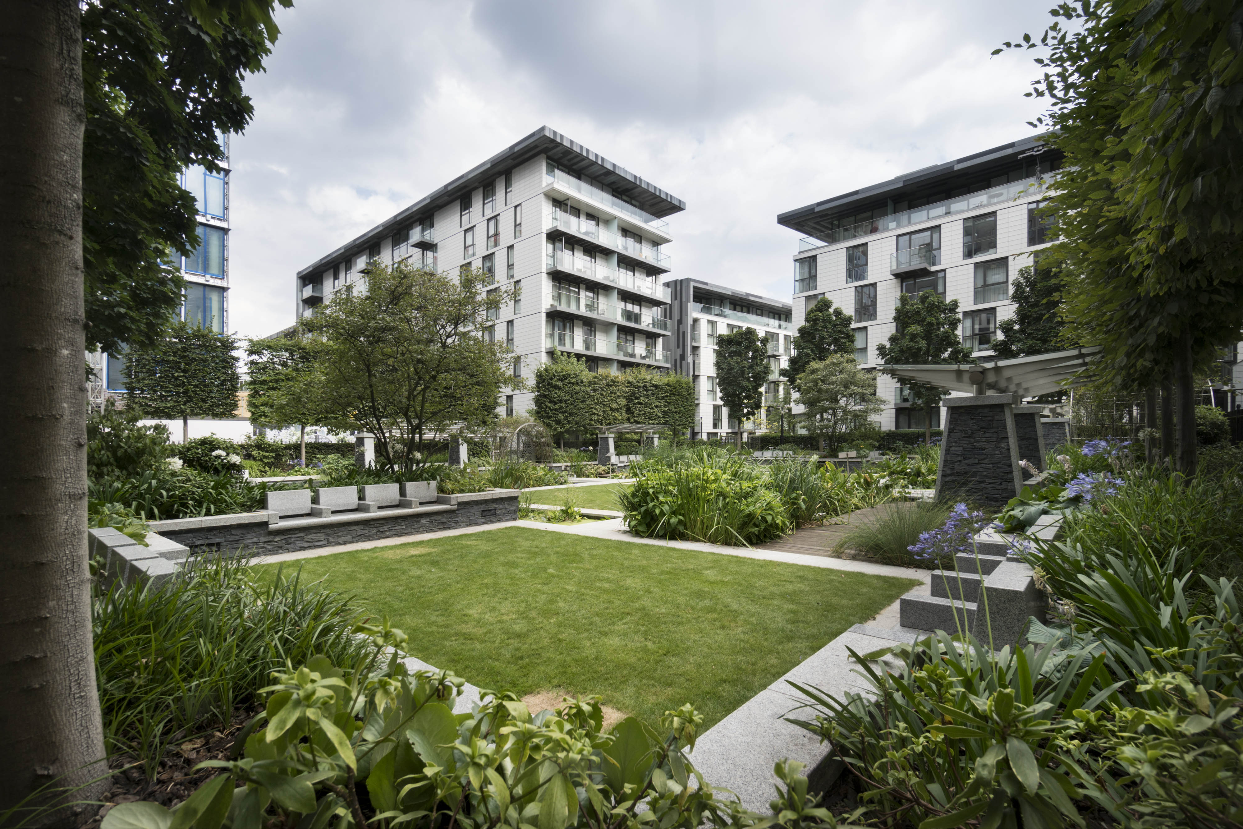
{
"id": 1760,
"title": "Four Seasons Garden from the north-west in 2017",
"author": {
"id": 27,
"username": "DerekKendall"
},
"feature": {
"id": 1456,
"type": "Feature",
"geometry": {
"type": "MultiPolygon",
"coordinates": [
[
[
[
-0.069401033322424,
51.512845472872
],
[
-0.069049470836989,
51.51295665537741
],
[
-0.068791684836588,
51.51262417724167
],
[
-0.069146422305013,
51.512517092939504
],
[
-0.069401033322424,
51.512845472872
]
]
]
]
},
"properties": {
"b_number": "",
"b_name": "Four Seasons Garden",
"street": "Leman Street",
"address": "Four Seasons Garden, Leman Street",
"feature_type": "OPEN_SPACE",
"count": 6,
"search_str": "Four Seasons Garden"
},
"tags": []
},
"file": "https://surveyoflondon.org/media/uploads/features/1456/SoL%20Whitechapel%20101021.jpg",
"description": "",
"copyright": true,
"created": "2020-08-04"
},
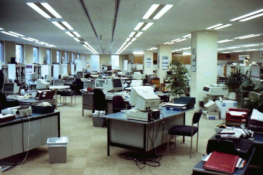
{
"id": 554,
"title": "Open plan layout of ICM in Beagle House in 1991",
"author": {
"id": 22,
"username": "sarahannmilne"
},
"feature": {
"id": 31,
"type": "Feature",
"geometry": {
"type": "MultiPolygon",
"coordinates": [
[
[
[
-0.071887127893096,
51.51411332216963
],
[
-0.071969571208431,
51.51419942371175
],
[
-0.071924976063445,
51.5142326534243
],
[
-0.071948658834375,
51.51426657781599
],
[
-0.071835003267539,
51.5143227101345
],
[
-0.071686234045495,
51.5143855464125
],
[
-0.071543425125636,
51.514422007266134
],
[
-0.071435516621411,
51.51444471123646
],
[
-0.071395570736125,
51.51440565693606
],
[
-0.07134776228325,
51.51441310661883
],
[
-0.0712722588033,
51.51434177428325
],
[
-0.071303428297817,
51.51432370241673
],
[
-0.071263213192454,
51.5142868603796
],
[
-0.071374185885124,
51.514224080818835
],
[
-0.071528097019019,
51.51416207230522
],
[
-0.071692419185678,
51.51411901969061
],
[
-0.071795120500786,
51.514091351954804
],
[
-0.071848759931576,
51.5141216554061
],
[
-0.071887127893096,
51.51411332216963
]
]
]
]
},
"properties": {
"b_number": "1",
"b_name": "Maersk House",
"street": "Braham Street",
"address": "Maersk House (formerly Beagle House), 1 Braham Street",
"feature_type": "WHITECHAPEL_BUILDING",
"count": 20,
"search_str": "Maersk House"
},
"tags": []
},
"file": "https://surveyoflondon.org/media/uploads/features/31/1991%20ICM%20Beagle%20House.jpg",
"description": "Photograph courtesy of Greg Guthrie",
"copyright": false,
"created": "2017-04-25"
},
{
"id": 1348,
"title": "2 to 4A Commercial Street from the west in 2018",
"author": {
"id": 27,
"username": "DerekKendall"
},
"feature": {
"id": 374,
"type": "Feature",
"geometry": {
"type": "MultiPolygon",
"coordinates": [
[
[
[
-0.072122718131682,
51.51573277413889
],
[
-0.071960912758108,
51.51579721323616
],
[
-0.071910570320506,
51.51574471132171
],
[
-0.071785562876658,
51.51561898838918
],
[
-0.071952630416972,
51.515556297762615
],
[
-0.072122718131682,
51.51573277413889
]
]
]
]
},
"properties": {
"b_number": "2c to 4a",
"b_name": "2c to 4a Commercial Street",
"street": "Commercial Street",
"address": "2c to 4a Commercial Street, London E1 7PT",
"feature_type": "WHITECHAPEL_BUILDING",
"count": 6,
"search_str": "2c to 4a Commercial Street"
},
"tags": []
},
"file": "https://surveyoflondon.org/media/uploads/features/374/SoL%20Whitechapel%20102199.jpg",
"description": "",
"copyright": true,
"created": "2018-10-10"
},
{
"id": 450,
"title": "18 Ensign Street in 2015",
"author": {
"id": 18,
"username": "shahedsaleem"
},
"feature": {
"id": 1370,
"type": "Feature",
"geometry": {
"type": "MultiPolygon",
"coordinates": [
[
[
[
-0.067783647338447,
51.51017527172947
],
[
-0.067575803709333,
51.51021492278667
],
[
-0.067558594183028,
51.510218286467044
],
[
-0.067466520880171,
51.51002935056337
],
[
-0.06767269738543,
51.509992670709266
],
[
-0.067723633842387,
51.510108640950456
],
[
-0.067752148490552,
51.510104986424565
],
[
-0.067783647338447,
51.51017527172947
]
]
]
]
},
"properties": {
"b_number": "18",
"b_name": "",
"street": "Ensign Street",
"address": "18 Ensign Street",
"feature_type": "WHITECHAPEL_BUILDING",
"count": 8,
"search_str": "18 Ensign Street"
},
"tags": [
"Board of Trade",
"John Hudson",
"merchant navy",
"Walter Gladding"
]
},
"file": "https://surveyoflondon.org/media/uploads/features/1370/IMG_1636.jpg",
"description": "",
"copyright": false,
"created": "2016-11-15"
},
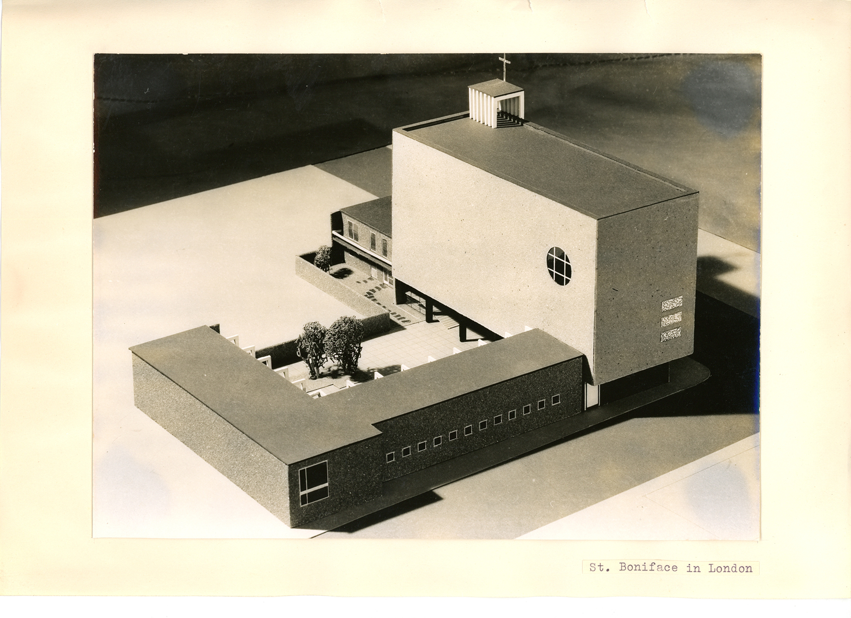
{
"id": 459,
"title": "Toni Hermanns's model for St Boniface, Whitechapel, 1954",
"author": {
"id": 81,
"username": "TUDortmund"
},
"feature": {
"id": 308,
"type": "Feature",
"geometry": {
"type": "MultiPolygon",
"coordinates": [
[
[
[
-0.067496567815311,
51.51589253877067
],
[
-0.067329816922355,
51.51592882147948
],
[
-0.067313994004403,
51.515903740519775
],
[
-0.067285655221522,
51.51591108028059
],
[
-0.067273890464753,
51.51588586669939
],
[
-0.067248552659892,
51.51589046902255
],
[
-0.067167351332256,
51.515743576397455
],
[
-0.067193642426533,
51.51573542676791
],
[
-0.06717129258716,
51.51569502690211
],
[
-0.067371819133296,
51.51564515293278
],
[
-0.067482004602165,
51.515831045103695
],
[
-0.067463735896854,
51.51583606330445
],
[
-0.067496567815311,
51.51589253877067
]
]
]
]
},
"properties": {
"b_number": "47",
"b_name": "",
"street": "Adler Street",
"address": "St Boniface German Church, 47 Adler Street",
"feature_type": "WHITECHAPEL_BUILDING",
"count": 14,
"search_str": "St Boniface German Church, 47 Adler Street"
},
"tags": [
"Catholic Church",
"Germans"
]
},
"file": "https://surveyoflondon.org/media/uploads/features/308/scan425.jpg",
"description": "Copyright Archiv fur Architektur und Ingenieurbaukunst NRW, TU Dortmund",
"copyright": true,
"created": "2016-11-29"
},
{
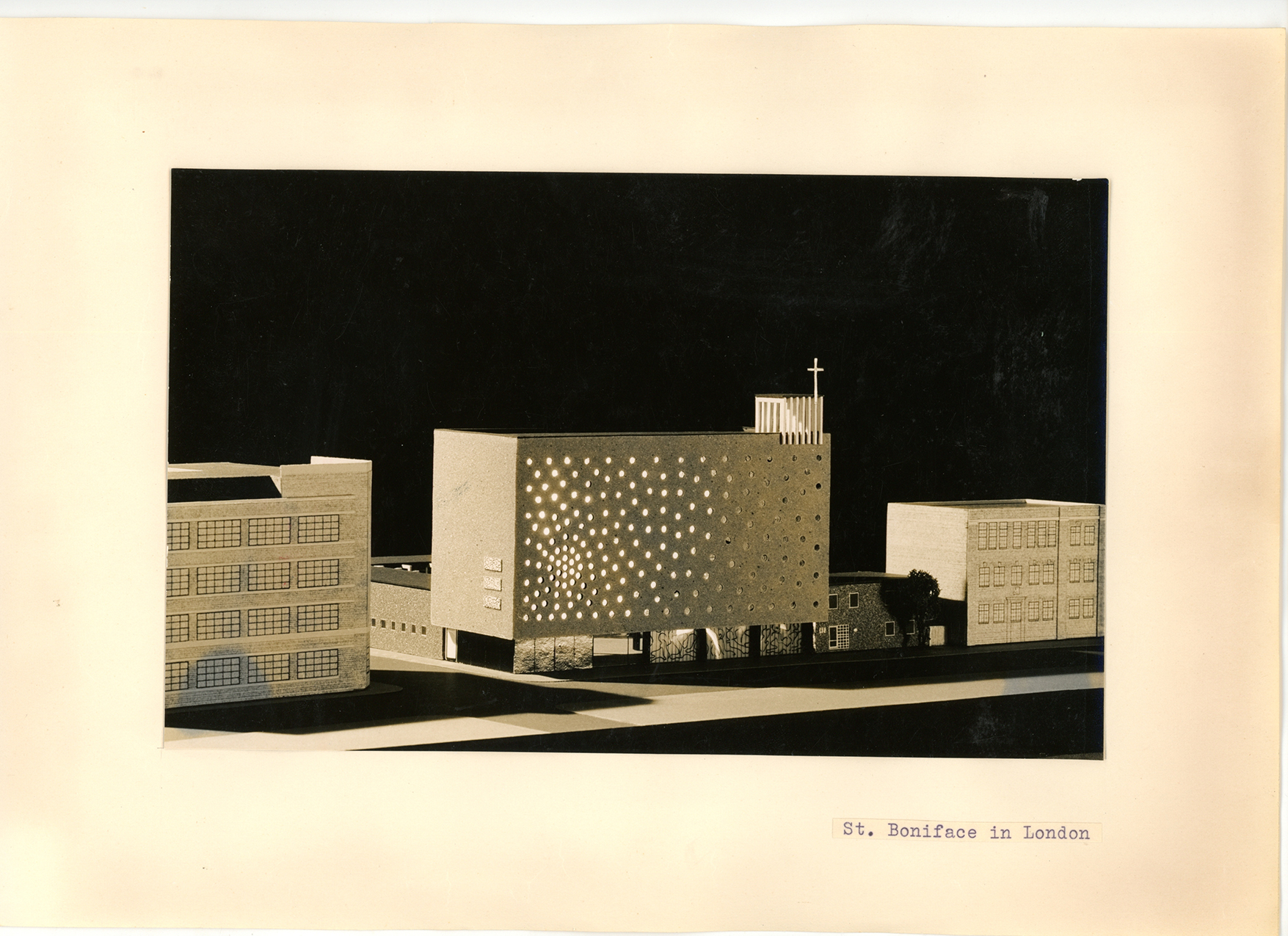
"id": 460,
"title": "Toni Hermann's model for St Boniface, Whitechapel, 1954, showing lit interior",
"author": {
"id": 81,
"username": "TUDortmund"
},
"feature": {
"id": 308,
"type": "Feature",
"geometry": {
"type": "MultiPolygon",
"coordinates": [
[
[
[
-0.067496567815311,
51.51589253877067
],
[
-0.067329816922355,
51.51592882147948
],
[
-0.067313994004403,
51.515903740519775
],
[
-0.067285655221522,
51.51591108028059
],
[
-0.067273890464753,
51.51588586669939
],
[
-0.067248552659892,
51.51589046902255
],
[
-0.067167351332256,
51.515743576397455
],
[
-0.067193642426533,
51.51573542676791
],
[
-0.06717129258716,
51.51569502690211
],
[
-0.067371819133296,
51.51564515293278
],
[
-0.067482004602165,
51.515831045103695
],
[
-0.067463735896854,
51.51583606330445
],
[
-0.067496567815311,
51.51589253877067
]
]
]
]
},
"properties": {
"b_number": "47",
"b_name": "",
"street": "Adler Street",
"address": "St Boniface German Church, 47 Adler Street",
"feature_type": "WHITECHAPEL_BUILDING",
"count": 14,
"search_str": "St Boniface German Church, 47 Adler Street"
},
"tags": [
"Catholic Church",
"Germans"
]
},
"file": "https://surveyoflondon.org/media/uploads/features/308/scan430.jpg",
"description": "Copyright Archiv fur Architektur und Ingenieurbaukunst NRW, TU Dortmund",
"copyright": true,
"created": "2016-11-29"
}
]
}