HTTP 200 OK
Allow: GET, HEAD, OPTIONS
Content-Type: application/json
Vary: Accept
{
"count": 1747,
"next": "https://surveyoflondon.org/api/v1/images/?format=api&page=74",
"previous": "https://surveyoflondon.org/api/v1/images/?format=api&page=72",
"results": [
{
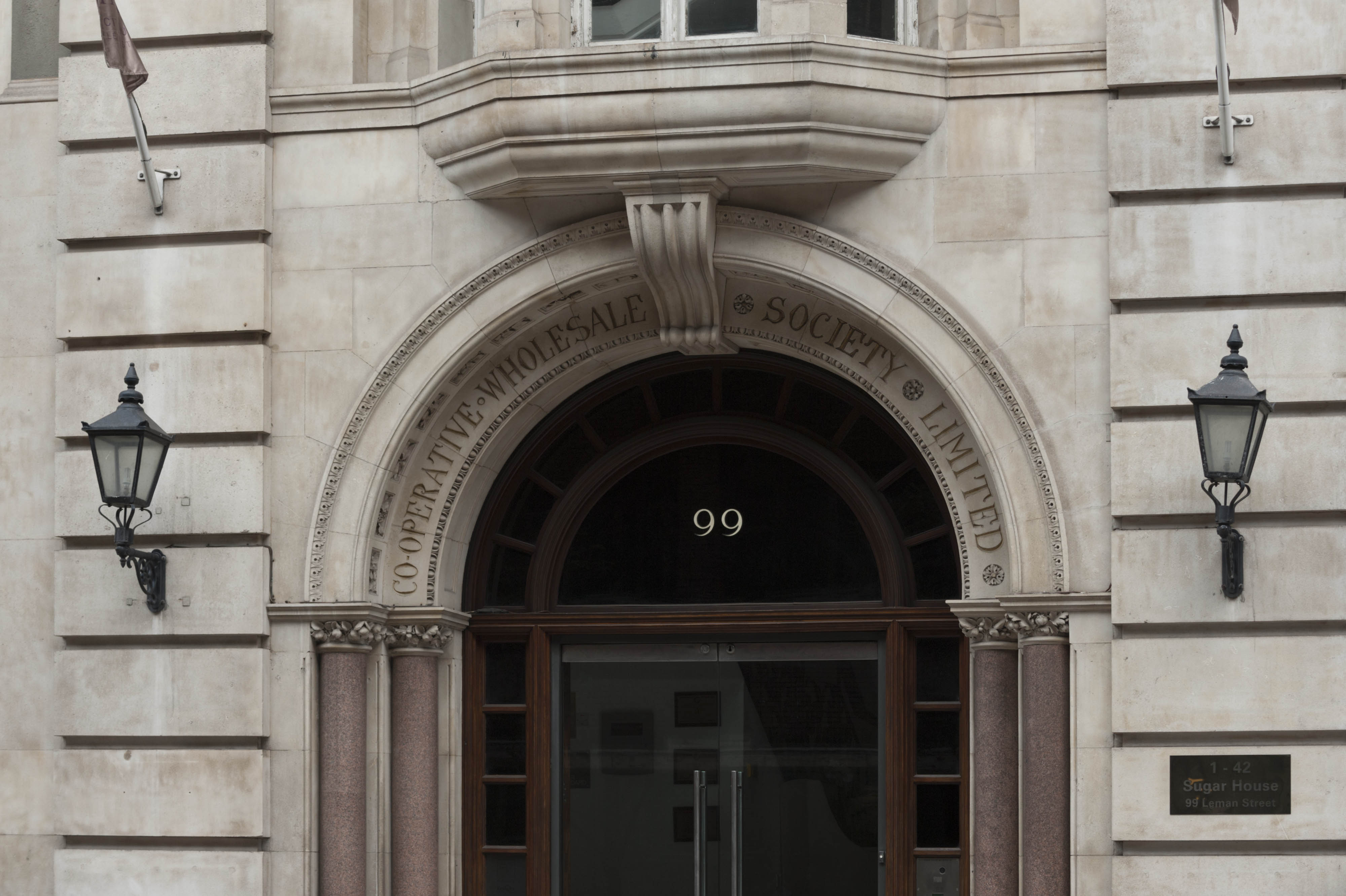
"id": 1771,
"title": "Sugar House, entrance detail in 2017",
"author": {
"id": 27,
"username": "DerekKendall"
},
"feature": {
"id": 1264,
"type": "Feature",
"geometry": {
"type": "MultiPolygon",
"coordinates": [
[
[
[
-0.069331963951854,
51.51229594729769
],
[
-0.069137875560046,
51.512351392206085
],
[
-0.068952695054468,
51.51210160696183
],
[
-0.06877706008966,
51.51212449662561
],
[
-0.068766393531184,
51.5121102580591
],
[
-0.068775926288607,
51.51210689932468
],
[
-0.068782151200721,
51.51209293893689
],
[
-0.068742154431936,
51.5120172780914
],
[
-0.068763790231903,
51.51199419623458
],
[
-0.069027145444056,
51.51193993762725
],
[
-0.06905682792721,
51.51194862974888
],
[
-0.069331963951854,
51.51229594729769
]
]
]
]
},
"properties": {
"b_number": "99",
"b_name": "Sugar House, 99 Leman Street",
"street": "Leman Street",
"address": "Sugar House, 99 Leman Street",
"feature_type": "WHITECHAPEL_BUILDING",
"count": 21,
"search_str": "Sugar House, 99 Leman Street"
},
"tags": [
"Co-operative Wholesale Society"
]
},
"file": "https://surveyoflondon.org/media/uploads/features/1264/SoL%20Whitechapel%20101090_OpYMFbk.jpg",
"description": "",
"copyright": true,
"created": "2020-08-04"
},
{
"id": 1680,
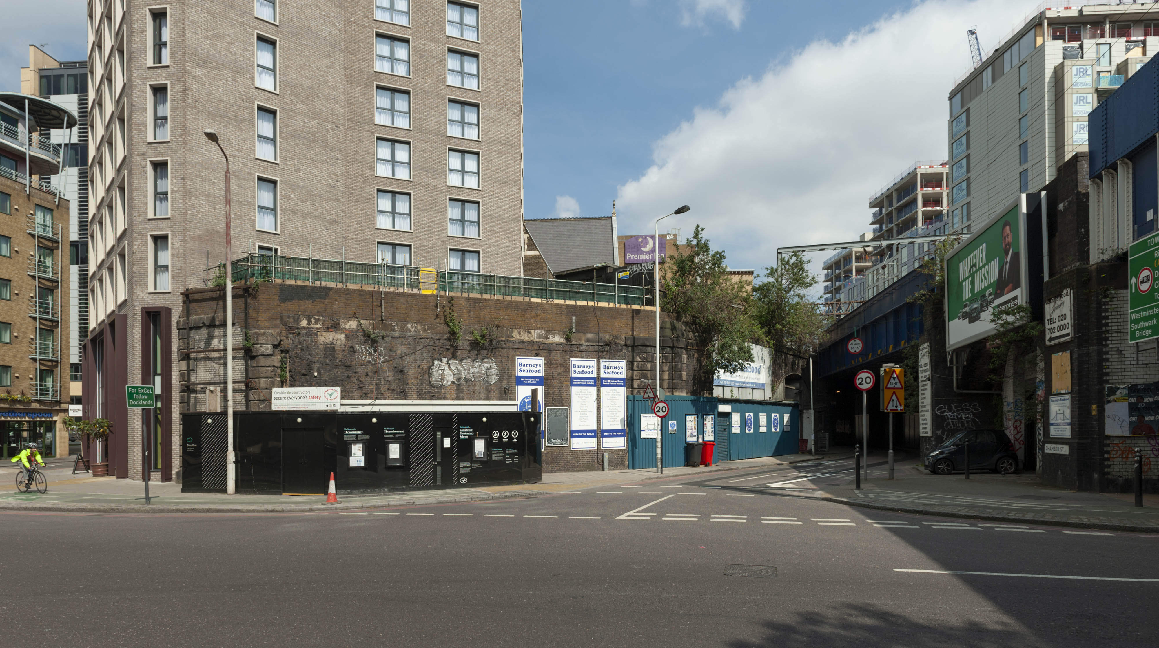
"title": "Haydon Square depot branch line viaduct spur from the south-west in 2019",
"author": {
"id": 27,
"username": "DerekKendall"
},
"feature": {
"id": 1310,
"type": "Feature",
"geometry": {
"type": "MultiPolygon",
"coordinates": [
[
[
[
-0.072640543386628,
51.511126910908146
],
[
-0.072546284627394,
51.51109445750477
],
[
-0.072442870594844,
51.51105766937985
],
[
-0.072212891852196,
51.511015291752464
],
[
-0.071794996225884,
51.51092420910208
],
[
-0.072193476308503,
51.510898011530344
],
[
-0.072292806128645,
51.51091522504932
],
[
-0.072304530237151,
51.510931416638016
],
[
-0.07242778419924,
51.51096443737364
],
[
-0.072431087286307,
51.51095279556461
],
[
-0.072461272416322,
51.51095734673215
],
[
-0.072466091619938,
51.51096214778542
],
[
-0.072488635517089,
51.510966022410706
],
[
-0.072644665703862,
51.511088472040846
],
[
-0.072640543386628,
51.511126910908146
]
]
]
]
},
"properties": {
"b_number": "",
"b_name": "Railway Viaduct Spur",
"street": "Mansell Street / Chamber Street",
"address": "Railway Viaduct Spur, Mansell Street / Chamber Street",
"feature_type": "WHITECHAPEL_BUILDING",
"count": 17,
"search_str": "Railway Viaduct Spur"
},
"tags": []
},
"file": "https://surveyoflondon.org/media/uploads/features/1310/SoL%20Whitechapel%20102757.jpg",
"description": "",
"copyright": true,
"created": "2020-02-18"
},
{
"id": 1046,
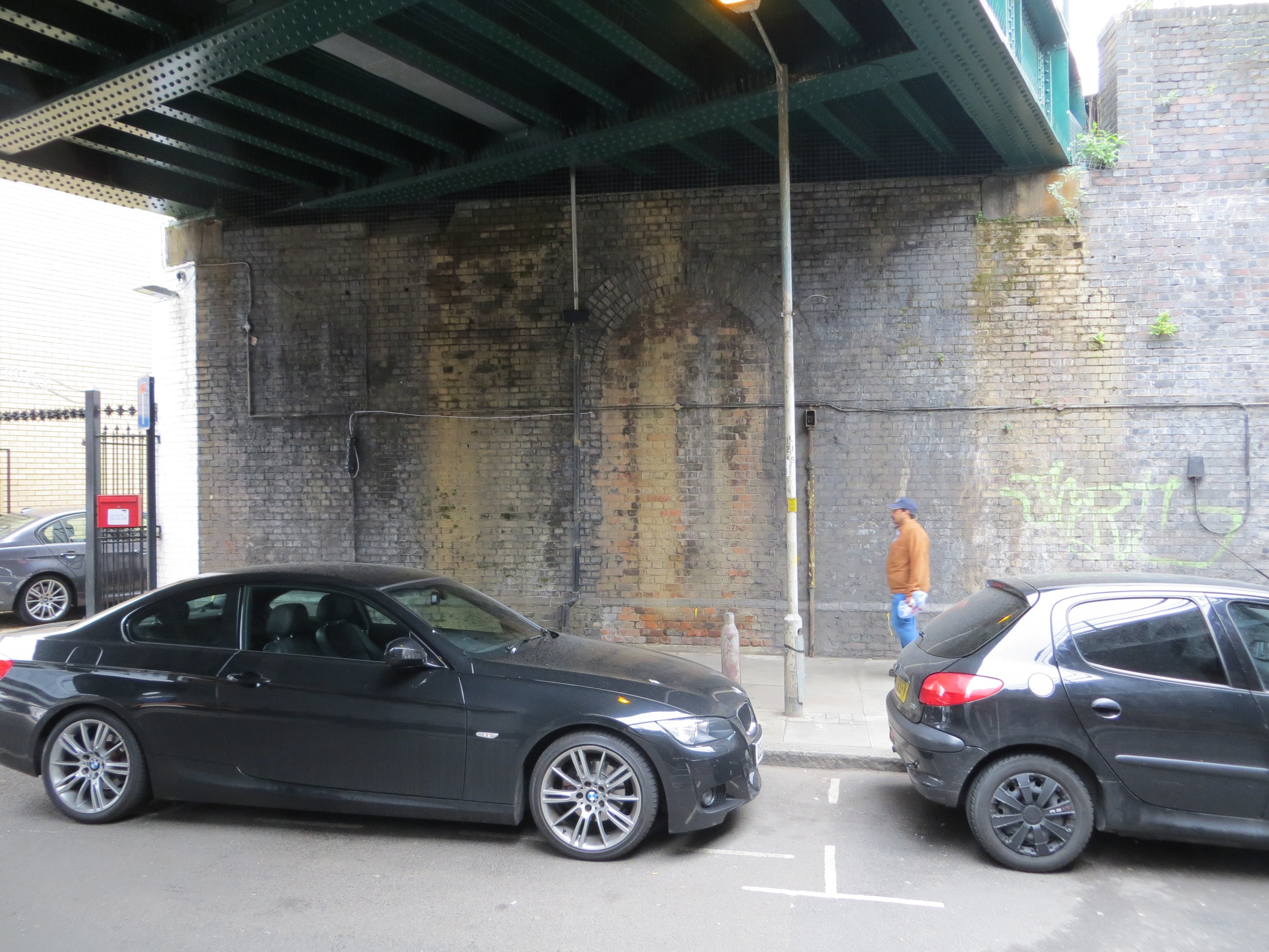
"title": "Former entrance to Leman Street railway station",
"author": {
"id": 216,
"username": "duncan2"
},
"feature": {
"id": 1284,
"type": "Feature",
"geometry": {
"type": "MultiPolygon",
"coordinates": [
[
[
[
-0.068500275953618,
51.51107508505472
],
[
-0.068478612819023,
51.51106496949243
],
[
-0.068414202464355,
51.51097498722599
],
[
-0.068521626072007,
51.51097035427303
],
[
-0.068532473079143,
51.511074986716515
],
[
-0.068500275953618,
51.51107508505472
]
]
]
]
},
"properties": {
"b_number": "",
"b_name": "",
"street": "Leman Street",
"address": "Pier in middle of Leman Street",
"feature_type": "WHITECHAPEL_BUILDING",
"count": 12,
"search_str": "Pier in middle of Leman Street"
},
"tags": []
},
"file": "https://surveyoflondon.org/media/uploads/features/1284/IMG_0620.jpg",
"description": "The bricked-up archway under the railway bridge was formerly the entrance to Leman Street railway station. This served the Fenchurch Street to Blackwall line and was in operation from 1877 to 1941.",
"copyright": false,
"created": "2018-01-18"
},
{
"id": 624,
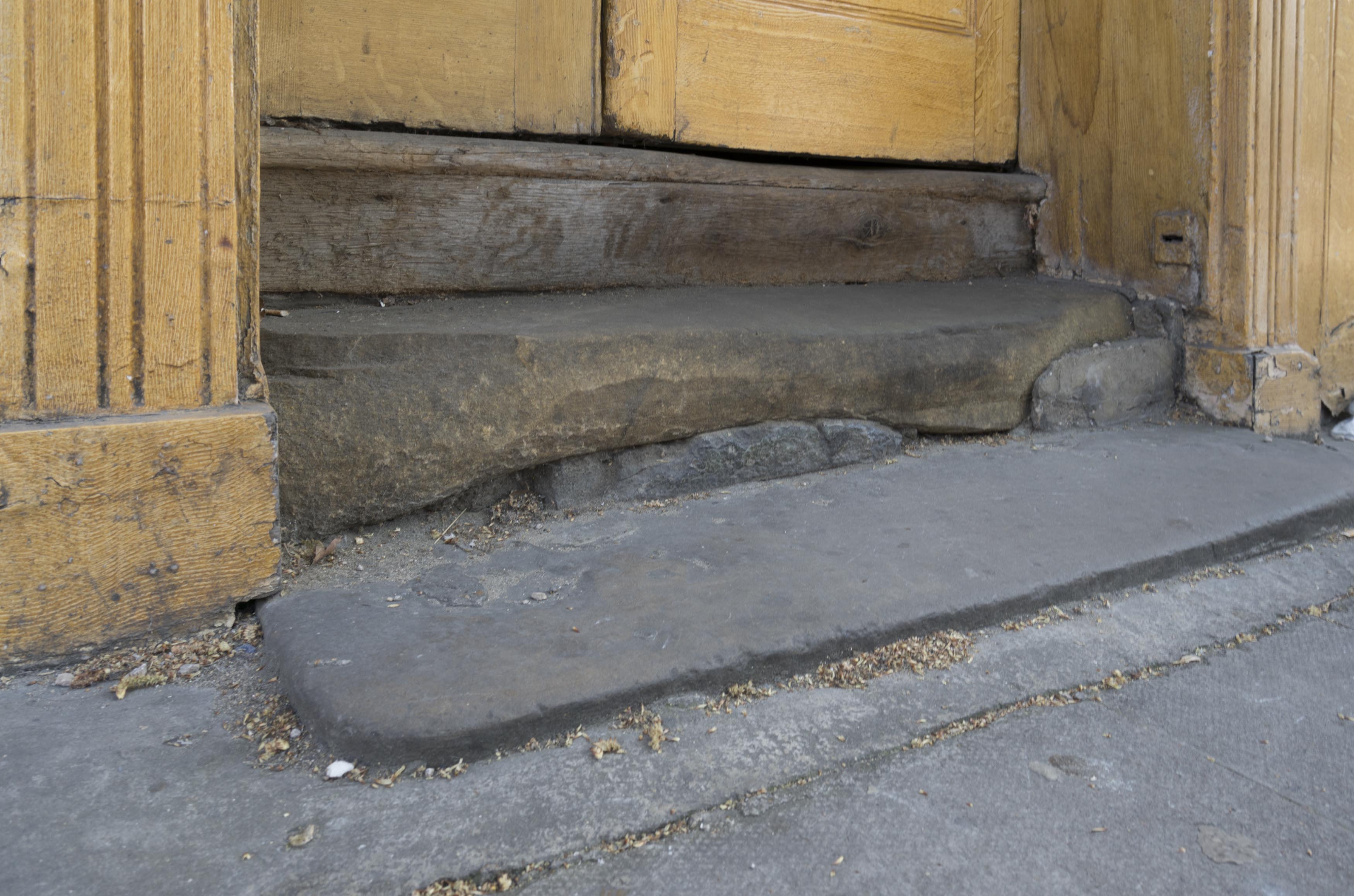
"title": "shop entrance, detail of threshold, April 2017",
"author": {
"id": 27,
"username": "DerekKendall"
},
"feature": {
"id": 155,
"type": "Feature",
"geometry": {
"type": "MultiPolygon",
"coordinates": [
[
[
[
-0.067279828395434,
51.51695705948158
],
[
-0.067093469618443,
51.517032789909806
],
[
-0.067051200483431,
51.516996757810816
],
[
-0.067090391118988,
51.51698039038376
],
[
-0.06706090910812,
51.51695688633854
],
[
-0.067015052606677,
51.51697914860705
],
[
-0.067015052606682,
51.516979148607064
],
[
-0.067015052606675,
51.51697914860705
],
[
-0.066983358160437,
51.516951324364136
],
[
-0.066904378563551,
51.516904192470385
],
[
-0.066814855785544,
51.516858952938556
],
[
-0.066749004017844,
51.51678511344983
],
[
-0.066726651062502,
51.51660623379854
],
[
-0.066916087304028,
51.516542881724156
],
[
-0.067063145906456,
51.51668871217051
],
[
-0.067018758534236,
51.51670613616749
],
[
-0.067108196018859,
51.516794826264736
],
[
-0.067132918133769,
51.516785121743794
],
[
-0.067195489248199,
51.51684716970448
],
[
-0.06716822056742,
51.5168577515391
],
[
-0.067184699138495,
51.51687146748573
],
[
-0.067279828395434,
51.51695705948158
]
],
[
[
-0.067093263845335,
51.516893872671716
],
[
-0.067031009970172,
51.516845232635745
],
[
-0.066988676105,
51.51686586339187
],
[
-0.067034303634964,
51.51688439111608
],
[
-0.067057406216514,
51.51690729267392
],
[
-0.067093263845335,
51.516893872671716
]
]
]
]
},
"properties": {
"b_number": "32-34",
"b_name": "Whitechapel Bell Foundry, 32–34 Whitechapel Road",
"street": "Whitechapel Road",
"address": "32-34 Whitechapel Road",
"feature_type": "WHITECHAPEL_BUILDING",
"count": 26,
"search_str": "Whitechapel Bell Foundry, 32–34 Whitechapel Road"
},
"tags": [
"bells",
"foundry"
]
},
"file": "https://surveyoflondon.org/media/uploads/features/155/SoL%20Whitechapel%20100738.jpg",
"description": "",
"copyright": true,
"created": "2017-05-03"
},
{
"id": 1544,
"title": "Royal Mint Gardens under construction in February 2019, view from the southeast",
"author": {
"id": 27,
"username": "DerekKendall"
},
"feature": {
"id": 1284,
"type": "Feature",
"geometry": {
"type": "MultiPolygon",
"coordinates": [
[
[
[
-0.068500275953618,
51.51107508505472
],
[
-0.068478612819023,
51.51106496949243
],
[
-0.068414202464355,
51.51097498722599
],
[
-0.068521626072007,
51.51097035427303
],
[
-0.068532473079143,
51.511074986716515
],
[
-0.068500275953618,
51.51107508505472
]
]
]
]
},
"properties": {
"b_number": "",
"b_name": "",
"street": "Leman Street",
"address": "Pier in middle of Leman Street",
"feature_type": "WHITECHAPEL_BUILDING",
"count": 12,
"search_str": "Pier in middle of Leman Street"
},
"tags": []
},
"file": "https://surveyoflondon.org/media/uploads/features/1284/SoL%20Whitechapel%20102642.jpg",
"description": "",
"copyright": true,
"created": "2019-03-05"
},
{
"id": 380,
"title": "Shutters on Middlesex Street in 2016",
"author": {
"id": 27,
"username": "DerekKendall"
},
"feature": {
"id": 350,
"type": "Feature",
"geometry": {
"type": "MultiPolygon",
"coordinates": [
[
[
[
-0.074647451142337,
51.51530527967592
],
[
-0.074357471765638,
51.515414167283886
],
[
-0.073990659509213,
51.51505709668585
],
[
-0.074395588069206,
51.514895160577964
],
[
-0.074663489419344,
51.51509835683479
],
[
-0.074491595155131,
51.515179363370244
],
[
-0.074647451142337,
51.51530527967592
]
]
]
]
},
"properties": {
"b_number": "2-14",
"b_name": "United Standard House",
"street": "Middlesex Street",
"address": "2 to 14 Middlesex Street",
"feature_type": "WHITECHAPEL_BUILDING",
"count": 16,
"search_str": "United Standard House"
},
"tags": []
},
"file": "https://surveyoflondon.org/media/uploads/features/350/SoL%20Whitechapel100279.jpg",
"description": "",
"copyright": true,
"created": "2016-09-13"
},
{
"id": 381,
"title": "United Standard House, southwest corner on Middlesex Street in 2016",
"author": {
"id": 27,
"username": "DerekKendall"
},
"feature": {
"id": 350,
"type": "Feature",
"geometry": {
"type": "MultiPolygon",
"coordinates": [
[
[
[
-0.074647451142337,
51.51530527967592
],
[
-0.074357471765638,
51.515414167283886
],
[
-0.073990659509213,
51.51505709668585
],
[
-0.074395588069206,
51.514895160577964
],
[
-0.074663489419344,
51.51509835683479
],
[
-0.074491595155131,
51.515179363370244
],
[
-0.074647451142337,
51.51530527967592
]
]
]
]
},
"properties": {
"b_number": "2-14",
"b_name": "United Standard House",
"street": "Middlesex Street",
"address": "2 to 14 Middlesex Street",
"feature_type": "WHITECHAPEL_BUILDING",
"count": 16,
"search_str": "United Standard House"
},
"tags": []
},
"file": "https://surveyoflondon.org/media/uploads/features/350/SoL%20Whitechapel100281.jpg",
"description": "",
"copyright": true,
"created": "2016-09-13"
},
{
"id": 382,
"title": "United Standard House, entrance on Middlesex Street in 2016",
"author": {
"id": 27,
"username": "DerekKendall"
},
"feature": {
"id": 350,
"type": "Feature",
"geometry": {
"type": "MultiPolygon",
"coordinates": [
[
[
[
-0.074647451142337,
51.51530527967592
],
[
-0.074357471765638,
51.515414167283886
],
[
-0.073990659509213,
51.51505709668585
],
[
-0.074395588069206,
51.514895160577964
],
[
-0.074663489419344,
51.51509835683479
],
[
-0.074491595155131,
51.515179363370244
],
[
-0.074647451142337,
51.51530527967592
]
]
]
]
},
"properties": {
"b_number": "2-14",
"b_name": "United Standard House",
"street": "Middlesex Street",
"address": "2 to 14 Middlesex Street",
"feature_type": "WHITECHAPEL_BUILDING",
"count": 16,
"search_str": "United Standard House"
},
"tags": []
},
"file": "https://surveyoflondon.org/media/uploads/features/350/SoL%20Whitechapel100282.jpg",
"description": "",
"copyright": true,
"created": "2016-09-13"
},
{
"id": 384,
"title": "United Standard House and Cromlech House from the southeast on Goulston Street in 2016",
"author": {
"id": 27,
"username": "DerekKendall"
},
"feature": {
"id": 350,
"type": "Feature",
"geometry": {
"type": "MultiPolygon",
"coordinates": [
[
[
[
-0.074647451142337,
51.51530527967592
],
[
-0.074357471765638,
51.515414167283886
],
[
-0.073990659509213,
51.51505709668585
],
[
-0.074395588069206,
51.514895160577964
],
[
-0.074663489419344,
51.51509835683479
],
[
-0.074491595155131,
51.515179363370244
],
[
-0.074647451142337,
51.51530527967592
]
]
]
]
},
"properties": {
"b_number": "2-14",
"b_name": "United Standard House",
"street": "Middlesex Street",
"address": "2 to 14 Middlesex Street",
"feature_type": "WHITECHAPEL_BUILDING",
"count": 16,
"search_str": "United Standard House"
},
"tags": []
},
"file": "https://surveyoflondon.org/media/uploads/features/350/SoL%20Whitechapel100287.jpg",
"description": "",
"copyright": true,
"created": "2016-09-13"
},
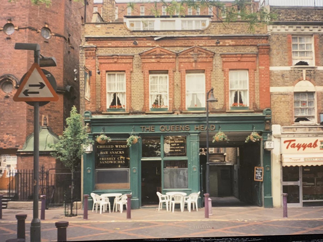
{
"id": 1850,
"title": "The Queens Head in the 1980s",
"author": {
"id": 336,
"username": "LeighD"
},
"feature": {
"id": 840,
"type": "Feature",
"geometry": {
"type": "MultiPolygon",
"coordinates": [
[
[
[
-0.063631886624081,
51.517138950576246
],
[
-0.063668493477288,
51.517259175712894
],
[
-0.063670437423206,
51.517306208245834
],
[
-0.063554648179843,
51.51732290860081
],
[
-0.063511558586676,
51.517153395677255
],
[
-0.063631886624081,
51.517138950576246
]
]
]
]
},
"properties": {
"b_number": "83",
"b_name": "",
"street": "Fieldgate Street",
"address": "Tayyabs (former Queen's Head public house), 83 Fieldgate Street",
"feature_type": "WHITECHAPEL_BUILDING",
"count": 8,
"search_str": "Tayyabs (former Queen's Head public house), 83 Fieldgate Street"
},
"tags": []
},
"file": "https://surveyoflondon.org/media/uploads/features/840/Queens%20Head%20Fieldgate%20Street.jpeg",
"description": "",
"copyright": true,
"created": "2021-08-13"
},
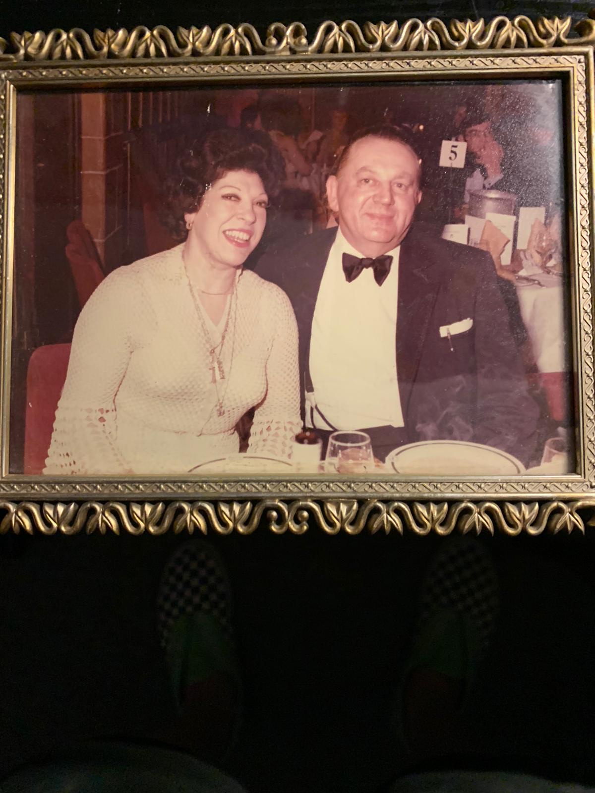
{
"id": 1851,
"title": "George and Eileen Wolozynski, proprietors of the Queen's Head pub, Fieldgate Street, to 2002",
"author": {
"id": 336,
"username": "LeighD"
},
"feature": {
"id": 840,
"type": "Feature",
"geometry": {
"type": "MultiPolygon",
"coordinates": [
[
[
[
-0.063631886624081,
51.517138950576246
],
[
-0.063668493477288,
51.517259175712894
],
[
-0.063670437423206,
51.517306208245834
],
[
-0.063554648179843,
51.51732290860081
],
[
-0.063511558586676,
51.517153395677255
],
[
-0.063631886624081,
51.517138950576246
]
]
]
]
},
"properties": {
"b_number": "83",
"b_name": "",
"street": "Fieldgate Street",
"address": "Tayyabs (former Queen's Head public house), 83 Fieldgate Street",
"feature_type": "WHITECHAPEL_BUILDING",
"count": 8,
"search_str": "Tayyabs (former Queen's Head public house), 83 Fieldgate Street"
},
"tags": []
},
"file": "https://surveyoflondon.org/media/uploads/features/840/George%20and%20Eileen%20Wolozynski.jpeg",
"description": "",
"copyright": true,
"created": "2021-08-13"
},
{
"id": 1083,
"title": "View from the north-west, December 2017",
"author": {
"id": 27,
"username": "DerekKendall"
},
"feature": {
"id": 1063,
"type": "Feature",
"geometry": {
"type": "MultiPolygon",
"coordinates": [
[
[
[
-0.060845062076888,
51.517232461665024
],
[
-0.060858061981046,
51.517297370705585
],
[
-0.060852072355982,
51.51729777282787
],
[
-0.060850777279358,
51.517292038613824
],
[
-0.060836585058279,
51.51723251416014
],
[
-0.060769976187858,
51.51723703364601
],
[
-0.060780310614954,
51.51729938465229
],
[
-0.060851422100426,
51.517294893689865
],
[
-0.060852072355982,
51.51729777282787
],
[
-0.060780756007888,
51.51730231203111
],
[
-0.060433008250066,
51.51733065140396
],
[
-0.060436612097579,
51.51734759826428
],
[
-0.060301835648786,
51.517358754570346
],
[
-0.060301267692063,
51.517334324990614
],
[
-0.060276367898553,
51.517334550322296
],
[
-0.060277606963858,
51.51738784759974
],
[
-0.060240911793285,
51.51738817966408
],
[
-0.060239603561777,
51.51733190531689
],
[
-0.060233709433579,
51.517328890670484
],
[
-0.060224675865392,
51.517324270305814
],
[
-0.06015408706542,
51.51728816646581
],
[
-0.060146994469308,
51.51728968696465
],
[
-0.06013876083629,
51.51729145207641
],
[
-0.060122232338685,
51.51729197252953
],
[
-0.060108489079552,
51.51729240527865
],
[
-0.060095089193358,
51.517291262708895
],
[
-0.060083703724374,
51.51729029190144
],
[
-0.060071883086905,
51.51728644484157
],
[
-0.060064540680754,
51.517282150214506
],
[
-0.060058159323826,
51.51727491549124
],
[
-0.060055164331108,
51.517266693493994
],
[
-0.060055745593556,
51.51725957394812
],
[
-0.060059185744876,
51.51725076287493
],
[
-0.060064720251821,
51.51724301807266
],
[
-0.060073694330703,
51.517237266202336
],
[
-0.060084008477322,
51.51723065542268
],
[
-0.060097749600684,
51.51722563043536
],
[
-0.060110820839004,
51.517222752616206
],
[
-0.060124043459833,
51.517219841466186
],
[
-0.060189323543314,
51.51717326471942
],
[
-0.060230524081512,
51.51717027080275
],
[
-0.060225029840865,
51.51714083975863
],
[
-0.060123966783513,
51.51714818367497
],
[
-0.060109355845798,
51.51706991604146
],
[
-0.060759990305139,
51.51701795039293
],
[
-0.060811901066283,
51.51703520053784
],
[
-0.060831243559519,
51.51714443032851
],
[
-0.060823879564995,
51.51714494230656
],
[
-0.060806280310304,
51.517037602197114
],
[
-0.060758637924026,
51.51702144683871
],
[
-0.060293715895444,
51.517058443881275
],
[
-0.060305285997092,
51.51711767437194
],
[
-0.060380056450023,
51.51711283445328
],
[
-0.060382025685871,
51.5171233828903
],
[
-0.060648003222123,
51.51710939602032
],
[
-0.060636939828746,
51.517031131377244
],
[
-0.060684659737861,
51.51702734366158
],
[
-0.060703670471419,
51.51713214159525
],
[
-0.060746477467265,
51.51712961322092
],
[
-0.060749678508541,
51.517150266791134
],
[
-0.060831225907887,
51.517144845854745
],
[
-0.060845060388772,
51.51723245093664
],
[
-0.060845062076888,
51.517232461665024
]
]
]
]
},
"properties": {
"b_number": "",
"b_name": "",
"street": "Stepney Way",
"address": "St Philip's Church Library and the Royal London Museum",
"feature_type": "WHITECHAPEL_BUILDING",
"count": 52,
"search_str": "St Philip's Church Library and the Royal London Museum"
},
"tags": []
},
"file": "https://surveyoflondon.org/media/uploads/features/1063/SoL%20Whitechapel%20101651.jpg",
"description": "",
"copyright": true,
"created": "2018-01-22"
},
{
"id": 1405,
"title": "Wilton's Music Hall (to the rear) with 1-4 Graces Alley in the early 1970s (photograph by Dan Cruickshank)",
"author": {
"id": 268,
"username": "DanCruickshank"
},
"feature": {
"id": 1392,
"type": "Feature",
"geometry": {
"type": "MultiPolygon",
"coordinates": [
[
[
[
-0.066897382560978,
51.51047185184401
],
[
-0.066897150320887,
51.510543358461234
],
[
-0.066964310871808,
51.51054939761258
],
[
-0.067031736648758,
51.51055546057313
],
[
-0.067033159620775,
51.51054385631446
],
[
-0.067124985785421,
51.51055249759738
],
[
-0.067119646867151,
51.510573278551
],
[
-0.067097006082147,
51.51057630354935
],
[
-0.067064204301052,
51.510690877240464
],
[
-0.066813595729658,
51.51071232706844
],
[
-0.066808845661517,
51.510692481646345
],
[
-0.066750873450789,
51.51069733978511
],
[
-0.066731248551372,
51.51054469318253
],
[
-0.066802206282857,
51.51054121190127
],
[
-0.066805453245557,
51.51046452251118
],
[
-0.066897382560978,
51.51047185184401
]
]
]
]
},
"properties": {
"b_number": "1",
"b_name": "Wilton's Music Hall",
"street": "Graces Alley",
"address": "Wilton's Music Hall, 1 Graces Alley",
"feature_type": "WHITECHAPEL_BUILDING",
"count": 23,
"search_str": "Wilton's Music Hall"
},
"tags": [
"Wilton's Music Hall"
]
},
"file": "https://surveyoflondon.org/media/uploads/features/1392/00410007.jpg",
"description": "",
"copyright": true,
"created": "2018-11-13"
},
{
"id": 1271,
"title": "Leman Street looking south, 1980",
"author": {
"id": 153,
"username": "danny"
},
"feature": {
"id": 30,
"type": "Feature",
"geometry": {
"type": "MultiPolygon",
"coordinates": [
[
[
[
-0.072576965124861,
51.51480414332742
],
[
-0.071902729892604,
51.51504709813925
],
[
-0.071596198352356,
51.51466686280493
],
[
-0.072223318247544,
51.51442704353616
],
[
-0.072576965124861,
51.51480414332742
]
]
]
]
},
"properties": {
"b_number": "2",
"b_name": "Aldgate Tower",
"street": "Leman Street",
"address": "Aldgate Tower, 2 Leman Street",
"feature_type": "WHITECHAPEL_BUILDING",
"count": 13,
"search_str": "Aldgate Tower"
},
"tags": []
},
"file": "https://surveyoflondon.org/media/uploads/features/30/Leman%20Street%20South.jpg",
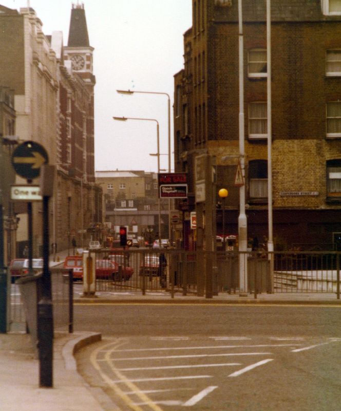
"description": "This is a view looking south from just north of the recently demolished (2018) Beagle House, whose steps can be seen on the right of the photograph. The former Co-operative Wholesale Society (CWS) headquarters at 99 Leman Street, with its prominent clock tower, can be seen. Now-demolished buildings along the southern edge of Camperdown Street can also be seen.\n\nThe Ppicture dates from 1980 and would have been taken roughly where the current main exit from Aldgate East Station on the south side of Whitechapel High Street.",
"copyright": false,
"created": "2018-06-18"
},
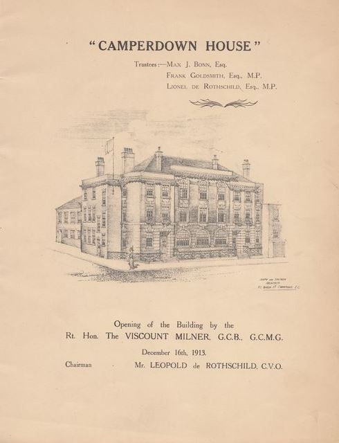
{
"id": 748,
"title": "Camperdown House in 1913",
"author": {
"id": 2,
"username": "surveyoflondon"
},
"feature": {
"id": 1699,
"type": "Feature",
"geometry": {
"type": "MultiPolygon",
"coordinates": [
[
[
[
-0.072807065482267,
51.513937850831965
],
[
-0.072596293900515,
51.51368300957728
],
[
-0.072417852397056,
51.51374436072419
],
[
-0.072390288345081,
51.51374115582855
],
[
-0.072239332134844,
51.5137937043139
],
[
-0.072149100181317,
51.513851220073796
],
[
-0.072375372474216,
51.514090936056476
],
[
-0.072807065482267,
51.513937850831965
]
]
]
]
},
"properties": {
"b_number": "6",
"b_name": "Camperdown House, 6 Braham Street",
"street": "Braham Street",
"address": "Camperdown House, 6 Braham Street",
"feature_type": "WHITECHAPEL_BUILDING",
"count": 9,
"search_str": "Camperdown House, 6 Braham Street"
},
"tags": []
},
"file": "https://surveyoflondon.org/media/uploads/features/1699/Camperdown.JPG",
"description": "Brochure to mark opening of the house. More info here: http://www.jewsfww.london/a-good-jew-and-a-good-englishman-167.php#",
"copyright": false,
"created": "2017-09-05"
},
{
"id": 931,
"title": "Rear of 2c-4a Commercial Street",
"author": {
"id": 18,
"username": "shahedsaleem"
},
"feature": {
"id": 374,
"type": "Feature",
"geometry": {
"type": "MultiPolygon",
"coordinates": [
[
[
[
-0.072122718131682,
51.51573277413889
],
[
-0.071960912758108,
51.51579721323616
],
[
-0.071910570320506,
51.51574471132171
],
[
-0.071785562876658,
51.51561898838918
],
[
-0.071952630416972,
51.515556297762615
],
[
-0.072122718131682,
51.51573277413889
]
]
]
]
},
"properties": {
"b_number": "2c to 4a",
"b_name": "2c to 4a Commercial Street",
"street": "Commercial Street",
"address": "2c to 4a Commercial Street, London E1 7PT",
"feature_type": "WHITECHAPEL_BUILDING",
"count": 6,
"search_str": "2c to 4a Commercial Street"
},
"tags": []
},
"file": "https://surveyoflondon.org/media/uploads/features/374/2017-10-04%2016.31.06.jpg",
"description": "A view of the rear of the block on the corner of Commercial Street, taken in October 2017",
"copyright": false,
"created": "2017-10-06"
},
{
"id": 1276,
"title": "Leman Street Elevation, March 2018",
"author": {
"id": 27,
"username": "DerekKendall"
},
"feature": {
"id": 73,
"type": "Feature",
"geometry": {
"type": "MultiPolygon",
"coordinates": [
[
[
[
-0.070367322342311,
51.51301553237353
],
[
-0.07031474659871,
51.512941993636225
],
[
-0.070151719826248,
51.51298919377999
],
[
-0.069851260574291,
51.512596219574206
],
[
-0.0699963051034,
51.51255612151373
],
[
-0.070235487507054,
51.51287146226293
],
[
-0.070259147169942,
51.51286418127443
],
[
-0.070206642068876,
51.51279125317895
],
[
-0.070282120938765,
51.51276767326361
],
[
-0.070251490920689,
51.51272709430695
],
[
-0.070387507282697,
51.51268328722199
],
[
-0.070537351987533,
51.51287316293096
],
[
-0.070430553866062,
51.51290680513313
],
[
-0.070489489998683,
51.51298392076877
],
[
-0.070367322342311,
51.51301553237353
]
]
]
]
},
"properties": {
"b_number": "74",
"b_name": "",
"street": "Leman Street",
"address": "Leman Street Police Station, 74 Leman Street",
"feature_type": "WHITECHAPEL_BUILDING",
"count": 7,
"search_str": "Leman Street Police Station, 74 Leman Street"
},
"tags": []
},
"file": "https://surveyoflondon.org/media/uploads/features/73/SoL%20Whitechapel%20101977.jpg",
"description": "",
"copyright": true,
"created": "2018-08-07"
},
{
"id": 898,
"title": "83 to 87 Whitechapel High Street, August 2017",
"author": {
"id": 27,
"username": "DerekKendall"
},
"feature": {
"id": 1743,
"type": "Feature",
"geometry": {
"type": "MultiPolygon",
"coordinates": [
[
[
[
-0.073411821699579,
51.51467674446512
],
[
-0.072731355303774,
51.514916811528764
],
[
-0.07188498637862,
51.51521927010499
],
[
-0.071325614752325,
51.51544095498937
],
[
-0.070774639967226,
51.515605952693505
],
[
-0.069847461990603,
51.51600844129137
],
[
-0.069612775522787,
51.51611554197248
],
[
-0.069514933844418,
51.51603777987923
],
[
-0.07062003013613,
51.51555119093597
],
[
-0.071250881804969,
51.51535269561576
],
[
-0.071777920220375,
51.515135083966406
],
[
-0.073328190602561,
51.5145926917498
],
[
-0.073411821699579,
51.51467674446512
]
]
]
]
},
"properties": {
"b_number": "",
"b_name": "",
"street": "",
"address": "Whitechapel High Street",
"feature_type": "PLACE",
"count": 14,
"search_str": "Whitechapel High Street"
},
"tags": []
},
"file": "https://surveyoflondon.org/media/uploads/features/1743/SoL%20Whitechapel%20101359.jpg",
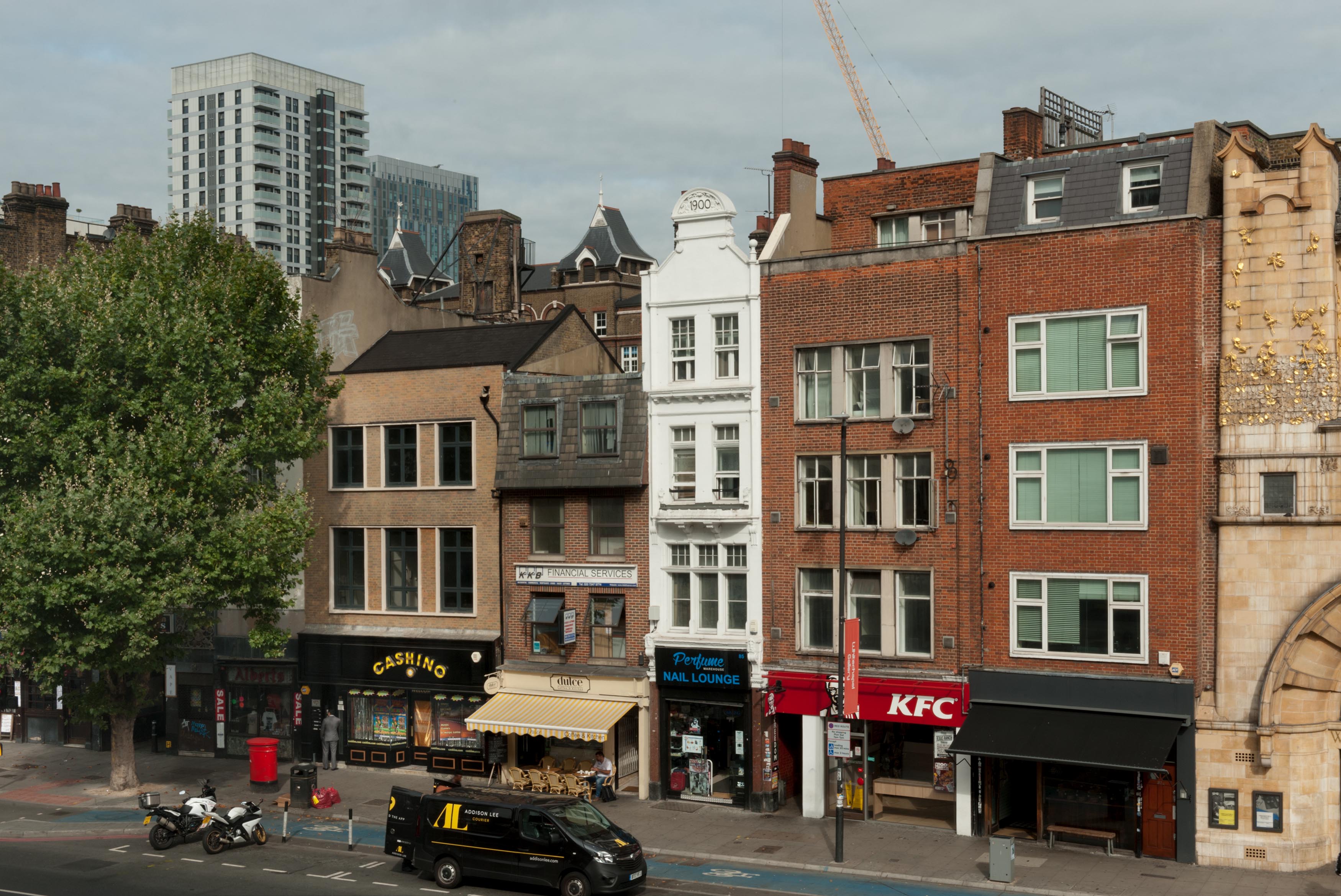
"description": "No 85, currently a perfume shop, was the Olde Angel pub, rebuilt in its present form in 1900 but closed c. 1910",
"copyright": true,
"created": "2017-09-26"
},
{
"id": 413,
"title": "Shop on Wentworth Street",
"author": {
"id": 56,
"username": "tamara"
},
"feature": {
"id": 1742,
"type": "Feature",
"geometry": {
"type": "MultiPolygon",
"coordinates": [
[
[
[
-0.076387722492951,
51.516257872286374
],
[
-0.07580974439088,
51.51649846859169
],
[
-0.075744693982384,
51.51651411423466
],
[
-0.075332716624042,
51.51665341173461
],
[
-0.075277819023276,
51.516667372076085
],
[
-0.074429584483841,
51.51681699796736
],
[
-0.074402209988697,
51.516763242480046
],
[
-0.075229889371391,
51.51661092868018
],
[
-0.074836715281391,
51.516135055700595
],
[
-0.074917049606191,
51.51611135328064
],
[
-0.075312012611936,
51.51658616747119
],
[
-0.075695505281233,
51.51646463519818
],
[
-0.075779072585588,
51.51644696856364
],
[
-0.076328753388395,
51.516209038390684
],
[
-0.076387722492951,
51.516257872286374
]
]
]
]
},
"properties": {
"b_number": "",
"b_name": "",
"street": "",
"address": "Petticoat Lane Market",
"feature_type": "PLACE",
"count": 39,
"search_str": "Petticoat Lane Market"
},
"tags": []
},
"file": "https://surveyoflondon.org/media/uploads/features/1742/tstoll11.jpg",
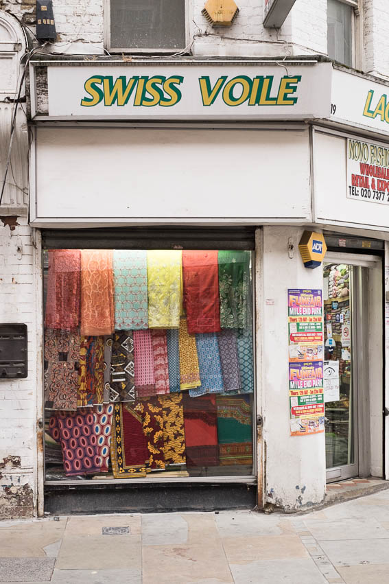
"description": "Documenting the streets of Petticoat Lane market, image taken in 2016 by Tamara Stoll. Detail of 19 Wentworth Street.\n",
"copyright": false,
"created": "2016-09-25"
},
{
"id": 1647,
"title": "42-50 Leman Street, elevation, March 2018",
"author": {
"id": 27,
"username": "DerekKendall"
},
"feature": {
"id": 76,
"type": "Feature",
"geometry": {
"type": "MultiPolygon",
"coordinates": [
[
[
[
-0.070996386486313,
51.51333179876335
],
[
-0.071099327108178,
51.513458286686586
],
[
-0.071023744735946,
51.51348371478463
],
[
-0.071046835404281,
51.51351627025351
],
[
-0.070774821344226,
51.51360499944305
],
[
-0.070751499668445,
51.51361156516122
],
[
-0.070651343009654,
51.51364131285701
],
[
-0.070530031554859,
51.51348166423519
],
[
-0.070690328296805,
51.513425904027294
],
[
-0.070717552072073,
51.513461494908526
],
[
-0.070830835991914,
51.5134247004879
],
[
-0.070799808107294,
51.51339053654499
],
[
-0.070934641607379,
51.51334963856506
],
[
-0.070996386486313,
51.51333179876335
]
]
]
]
},
"properties": {
"b_number": "44–50",
"b_name": "",
"street": "Leman Street",
"address": "44–50 Leman Street",
"feature_type": "WHITECHAPEL_BUILDING",
"count": 2,
"search_str": "44–50 Leman Street"
},
"tags": []
},
"file": "https://surveyoflondon.org/media/uploads/features/76/SoL%20Whitechapel%20101954_wtNLPoV.jpg",
"description": "",
"copyright": false,
"created": "2019-08-19"
}
]
}