HTTP 200 OK
Allow: GET, HEAD, OPTIONS
Content-Type: application/json
Vary: Accept
{
"count": 1747,
"next": "https://surveyoflondon.org/api/v1/images/?format=api&page=73",
"previous": "https://surveyoflondon.org/api/v1/images/?format=api&page=71",
"results": [
{
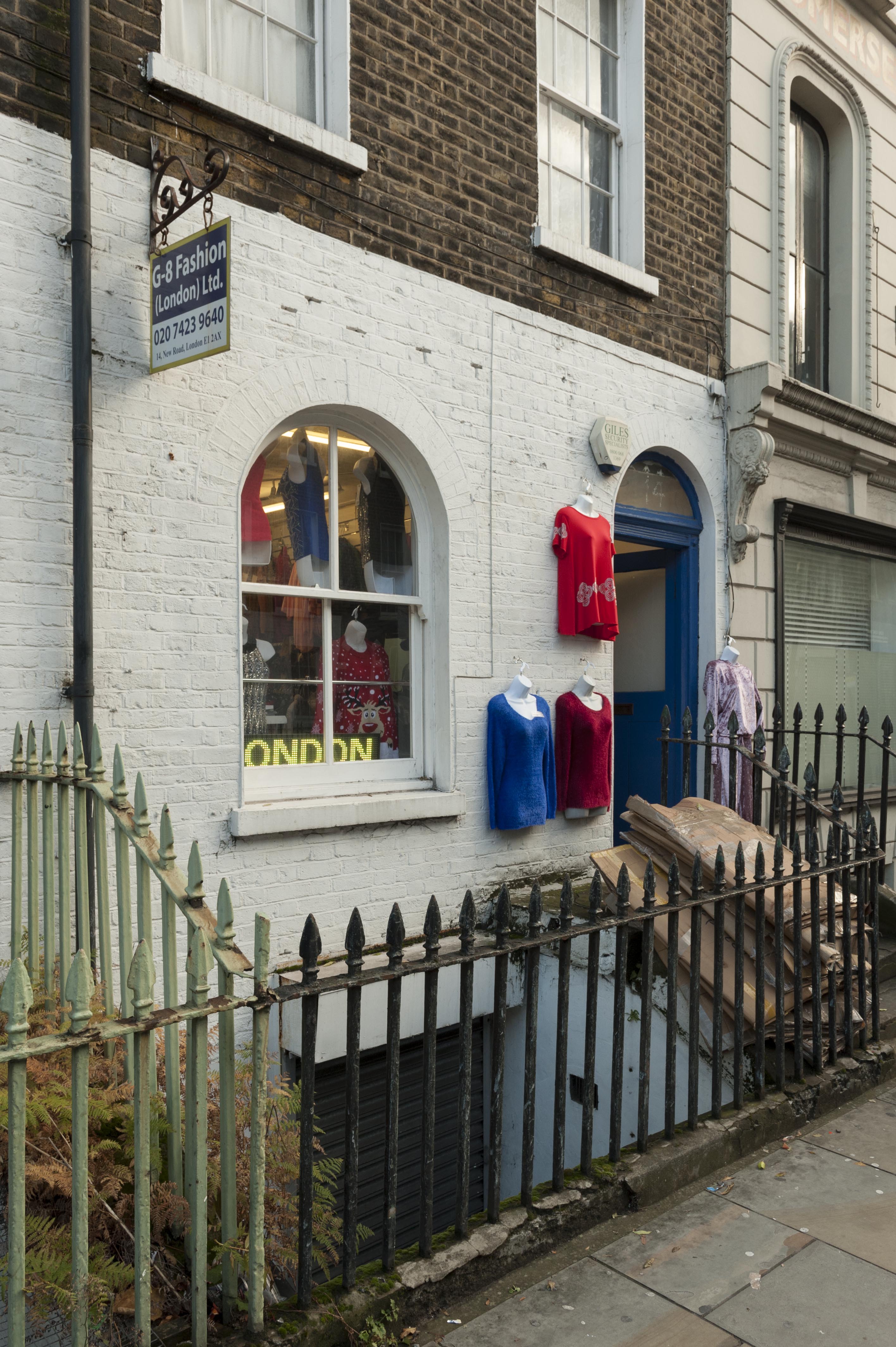
"id": 1459,
"title": "14 New Road in November 2018",
"author": {
"id": 27,
"username": "DerekKendall"
},
"feature": {
"id": 1135,
"type": "Feature",
"geometry": {
"type": "MultiPolygon",
"coordinates": [
[
[
[
-0.061938871316412,
51.51538025540808
],
[
-0.061827847722865,
51.51538932820588
],
[
-0.061824316933417,
51.51537248761009
],
[
-0.061769739293505,
51.515376712236055
],
[
-0.0617652840551,
51.51535363242298
],
[
-0.061819909564877,
51.515349190087086
],
[
-0.06193045363785,
51.51534015647431
],
[
-0.061938871316412,
51.51538025540808
]
]
]
]
},
"properties": {
"b_number": "14",
"b_name": "",
"street": "New Road",
"address": "14 New Road",
"feature_type": "WHITECHAPEL_BUILDING",
"count": 6,
"search_str": "14 New Road"
},
"tags": []
},
"file": "https://surveyoflondon.org/media/uploads/features/1135/SoL%20Whitechapel%20102454.jpg",
"description": "",
"copyright": true,
"created": "2018-11-28"
},
{
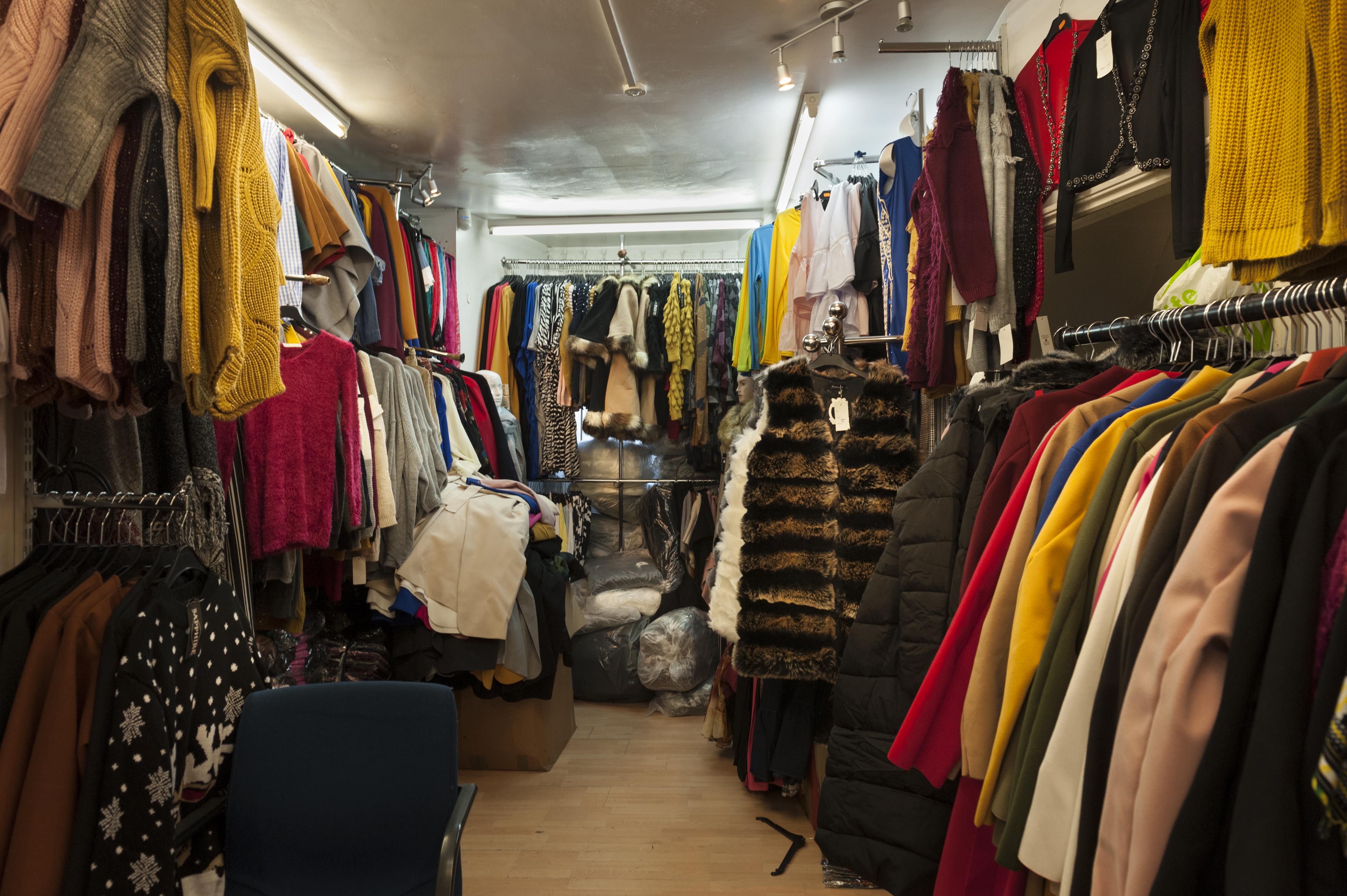
"id": 1460,
"title": "Shop interior, 14 New Road, November 2018",
"author": {
"id": 27,
"username": "DerekKendall"
},
"feature": {
"id": 1135,
"type": "Feature",
"geometry": {
"type": "MultiPolygon",
"coordinates": [
[
[
[
-0.061938871316412,
51.51538025540808
],
[
-0.061827847722865,
51.51538932820588
],
[
-0.061824316933417,
51.51537248761009
],
[
-0.061769739293505,
51.515376712236055
],
[
-0.0617652840551,
51.51535363242298
],
[
-0.061819909564877,
51.515349190087086
],
[
-0.06193045363785,
51.51534015647431
],
[
-0.061938871316412,
51.51538025540808
]
]
]
]
},
"properties": {
"b_number": "14",
"b_name": "",
"street": "New Road",
"address": "14 New Road",
"feature_type": "WHITECHAPEL_BUILDING",
"count": 6,
"search_str": "14 New Road"
},
"tags": []
},
"file": "https://surveyoflondon.org/media/uploads/features/1135/SoL%20Whitechapel%20102457.jpg",
"description": "",
"copyright": true,
"created": "2018-11-28"
},
{
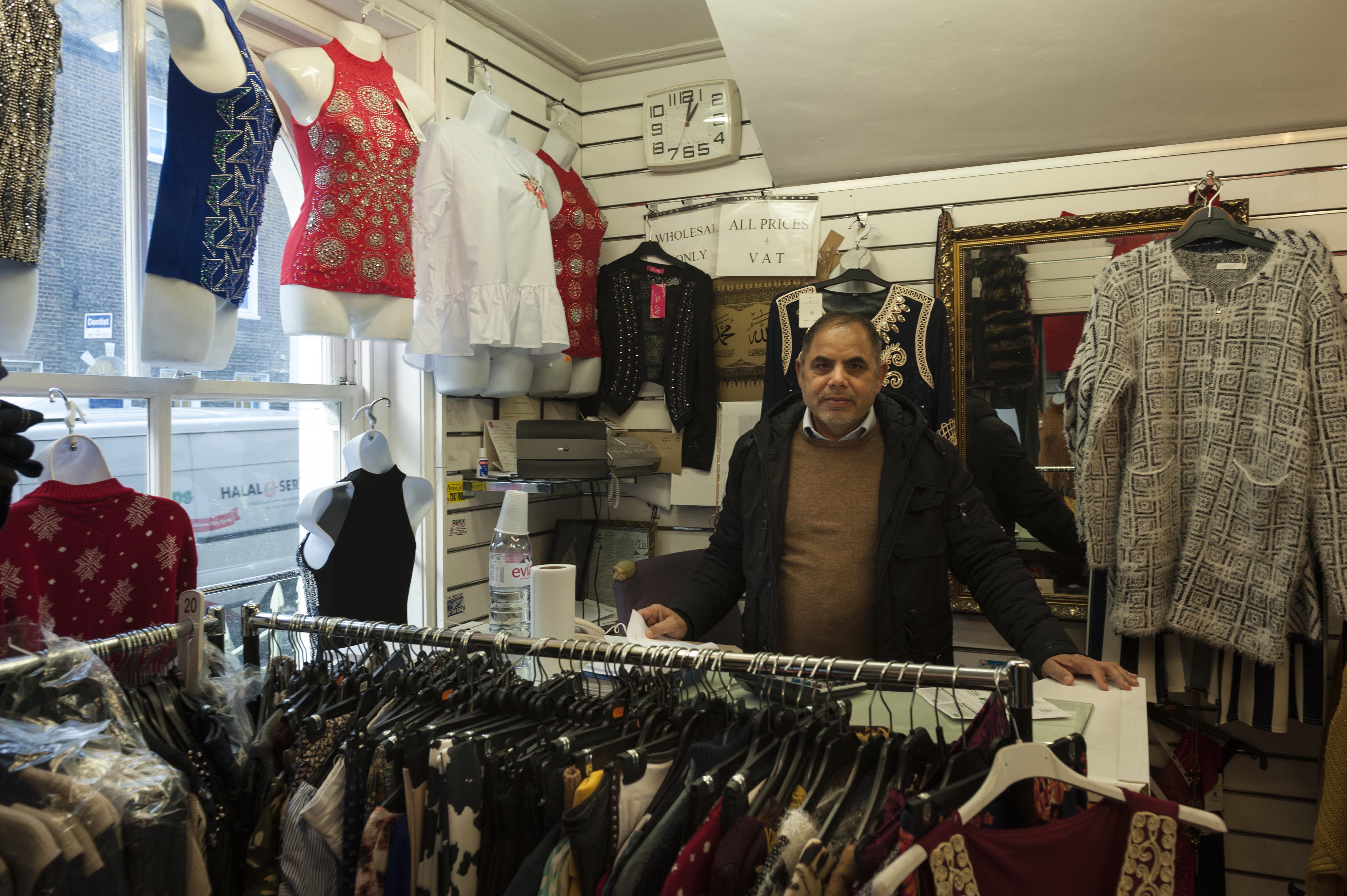
"id": 1461,
"title": "Bashir Khan (proprietor) and shop interior, 14 New Road, November 2018",
"author": {
"id": 27,
"username": "DerekKendall"
},
"feature": {
"id": 1135,
"type": "Feature",
"geometry": {
"type": "MultiPolygon",
"coordinates": [
[
[
[
-0.061938871316412,
51.51538025540808
],
[
-0.061827847722865,
51.51538932820588
],
[
-0.061824316933417,
51.51537248761009
],
[
-0.061769739293505,
51.515376712236055
],
[
-0.0617652840551,
51.51535363242298
],
[
-0.061819909564877,
51.515349190087086
],
[
-0.06193045363785,
51.51534015647431
],
[
-0.061938871316412,
51.51538025540808
]
]
]
]
},
"properties": {
"b_number": "14",
"b_name": "",
"street": "New Road",
"address": "14 New Road",
"feature_type": "WHITECHAPEL_BUILDING",
"count": 6,
"search_str": "14 New Road"
},
"tags": []
},
"file": "https://surveyoflondon.org/media/uploads/features/1135/SoL%20Whitechapel%20102460.jpg",
"description": "",
"copyright": true,
"created": "2018-11-28"
},
{
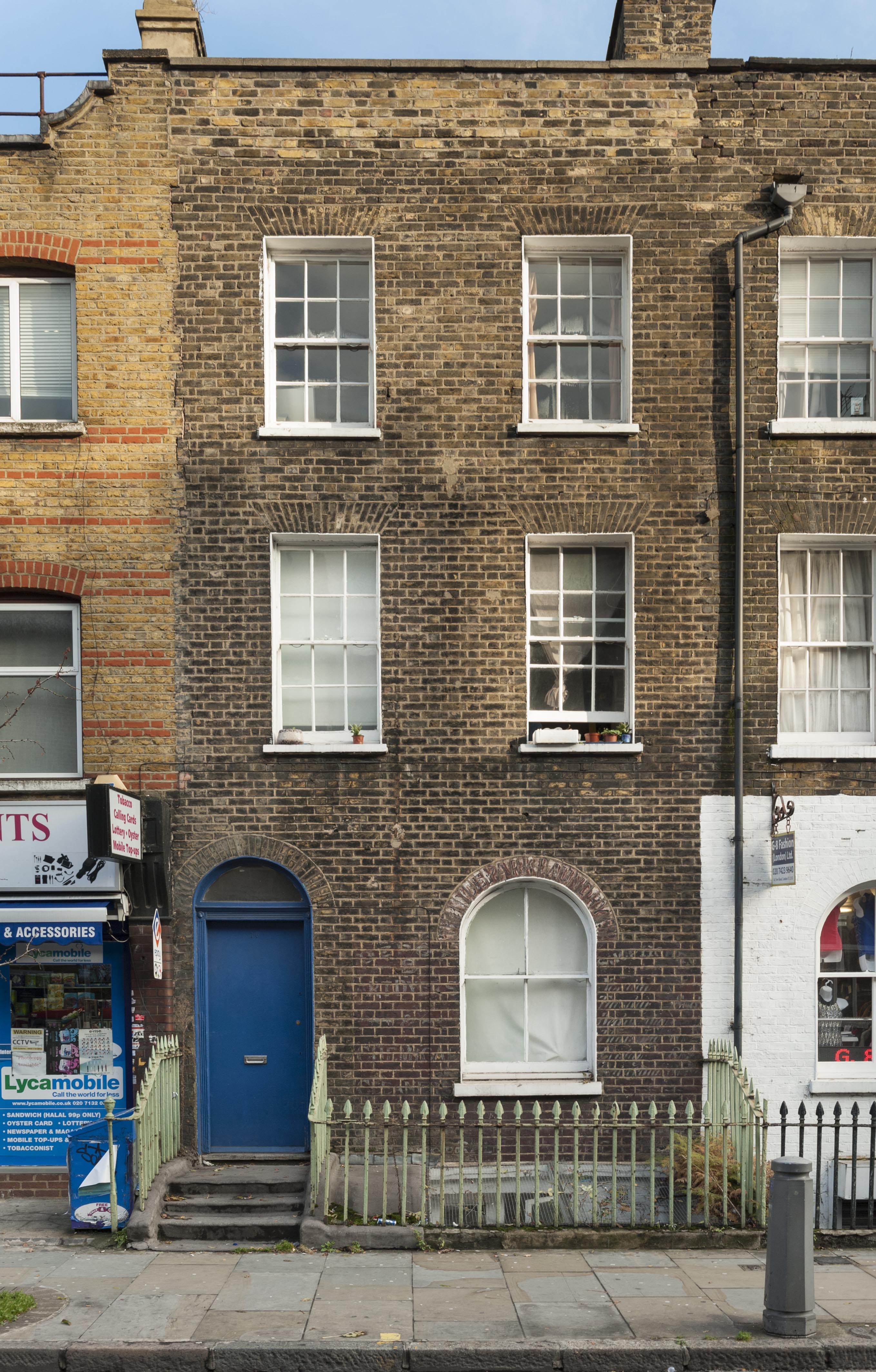
"id": 1462,
"title": "16 New Road in November 2018",
"author": {
"id": 27,
"username": "DerekKendall"
},
"feature": {
"id": 1134,
"type": "Feature",
"geometry": {
"type": "MultiPolygon",
"coordinates": [
[
[
[
-0.061948209172629,
51.51542473767456
],
[
-0.061800702181804,
51.51543679185386
],
[
-0.06179993838925,
51.51543292984464
],
[
-0.061835922966067,
51.51543015940746
],
[
-0.061827847722865,
51.51538932820588
],
[
-0.061938871316412,
51.51538025540808
],
[
-0.061948209172629,
51.51542473767456
]
]
]
]
},
"properties": {
"b_number": "16",
"b_name": "",
"street": "New Road",
"address": "16 New Road",
"feature_type": "WHITECHAPEL_BUILDING",
"count": 3,
"search_str": "16 New Road"
},
"tags": []
},
"file": "https://surveyoflondon.org/media/uploads/features/1134/SoL%20Whitechapel%20102462.jpg",
"description": "",
"copyright": true,
"created": "2018-11-28"
},
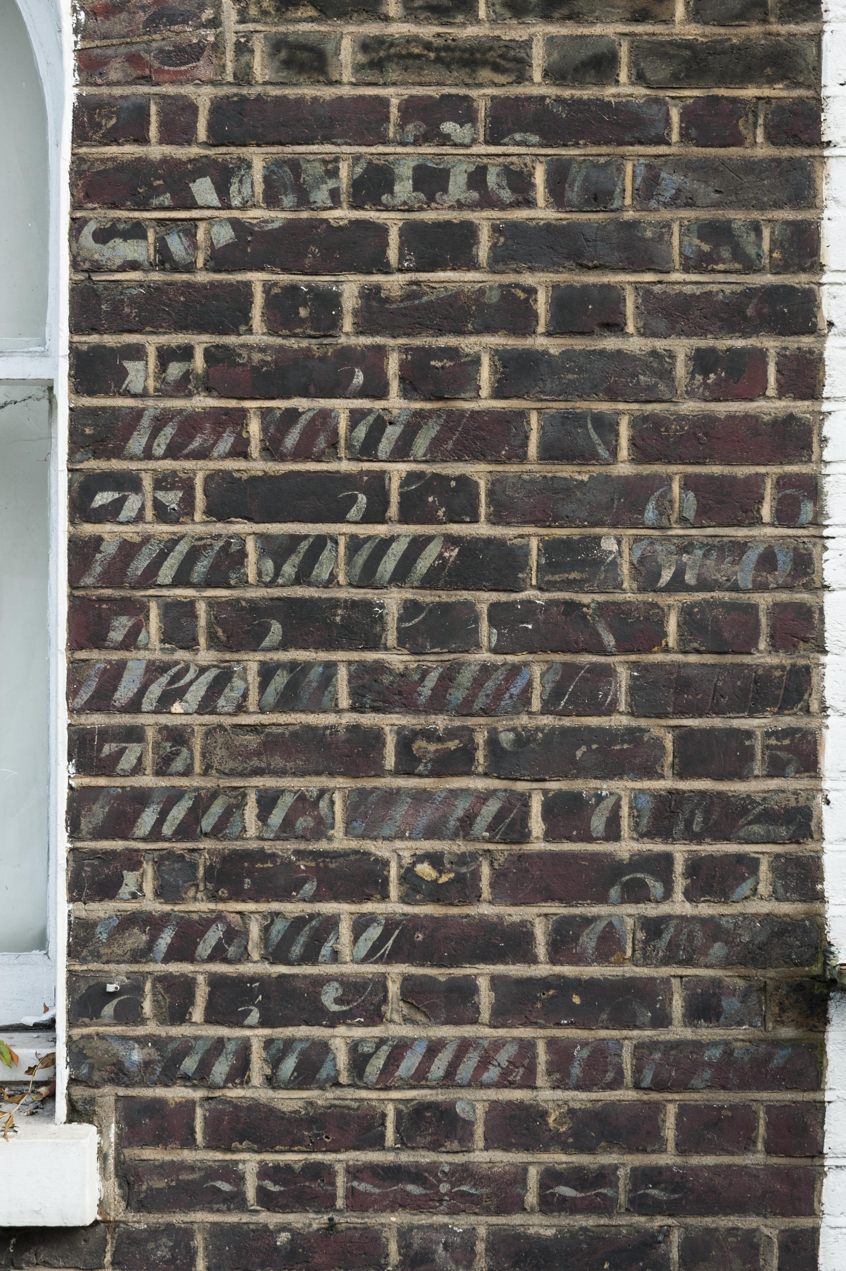
{
"id": 1463,
"title": "Painted advertising on front wall, 16 New Road, November 2018",
"author": {
"id": 27,
"username": "DerekKendall"
},
"feature": {
"id": 1134,
"type": "Feature",
"geometry": {
"type": "MultiPolygon",
"coordinates": [
[
[
[
-0.061948209172629,
51.51542473767456
],
[
-0.061800702181804,
51.51543679185386
],
[
-0.06179993838925,
51.51543292984464
],
[
-0.061835922966067,
51.51543015940746
],
[
-0.061827847722865,
51.51538932820588
],
[
-0.061938871316412,
51.51538025540808
],
[
-0.061948209172629,
51.51542473767456
]
]
]
]
},
"properties": {
"b_number": "16",
"b_name": "",
"street": "New Road",
"address": "16 New Road",
"feature_type": "WHITECHAPEL_BUILDING",
"count": 3,
"search_str": "16 New Road"
},
"tags": []
},
"file": "https://surveyoflondon.org/media/uploads/features/1134/SoL%20Whitechapel%20102465.jpg",
"description": "",
"copyright": true,
"created": "2018-11-28"
},
{
"id": 488,
"title": "19-25 Varden Street (north side)",
"author": {
"id": 21,
"username": "IsobelWatson"
},
"feature": {
"id": 1149,
"type": "Feature",
"geometry": {
"type": "MultiPolygon",
"coordinates": [
[
[
[
-0.061016286658612,
51.51577950915981
],
[
-0.061000205384907,
51.51571136646247
],
[
-0.061069754891917,
51.515705642448395
],
[
-0.061069754891584,
51.515705642450165
],
[
-0.061083236040386,
51.51577345719663
],
[
-0.0610881011122,
51.51580016070438
],
[
-0.061053081273187,
51.5158030161843
],
[
-0.061045857141895,
51.51577704748133
],
[
-0.061016286658612,
51.51577950915981
]
]
]
]
},
"properties": {
"b_number": "23",
"b_name": "",
"street": "Varden Street",
"address": "23 Varden Street",
"feature_type": "WHITECHAPEL_BUILDING",
"count": 3,
"search_str": "23 Varden Street"
},
"tags": []
},
"file": "https://surveyoflondon.org/media/uploads/features/1149/Varden%20St%2019-25%20(odd)%201992.jpg",
"description": "Taken in March 1992. This appears to be the same row of houses as in the earlier photograph, but the building at the end looks oddly different.",
"copyright": false,
"created": "2017-01-23"
},
{
"id": 489,
"title": "19-25 Varden Street (north side)",
"author": {
"id": 21,
"username": "IsobelWatson"
},
"feature": {
"id": 1149,
"type": "Feature",
"geometry": {
"type": "MultiPolygon",
"coordinates": [
[
[
[
-0.061016286658612,
51.51577950915981
],
[
-0.061000205384907,
51.51571136646247
],
[
-0.061069754891917,
51.515705642448395
],
[
-0.061069754891584,
51.515705642450165
],
[
-0.061083236040386,
51.51577345719663
],
[
-0.0610881011122,
51.51580016070438
],
[
-0.061053081273187,
51.5158030161843
],
[
-0.061045857141895,
51.51577704748133
],
[
-0.061016286658612,
51.51577950915981
]
]
]
]
},
"properties": {
"b_number": "23",
"b_name": "",
"street": "Varden Street",
"address": "23 Varden Street",
"feature_type": "WHITECHAPEL_BUILDING",
"count": 3,
"search_str": "23 Varden Street"
},
"tags": []
},
"file": "https://surveyoflondon.org/media/uploads/features/1149/Varden%20St%2019-25%20(odd)%201980s.jpg",
"description": "Taken in the mid-1980s, with some differences from the picture from 1992.",
"copyright": false,
"created": "2017-01-23"
},
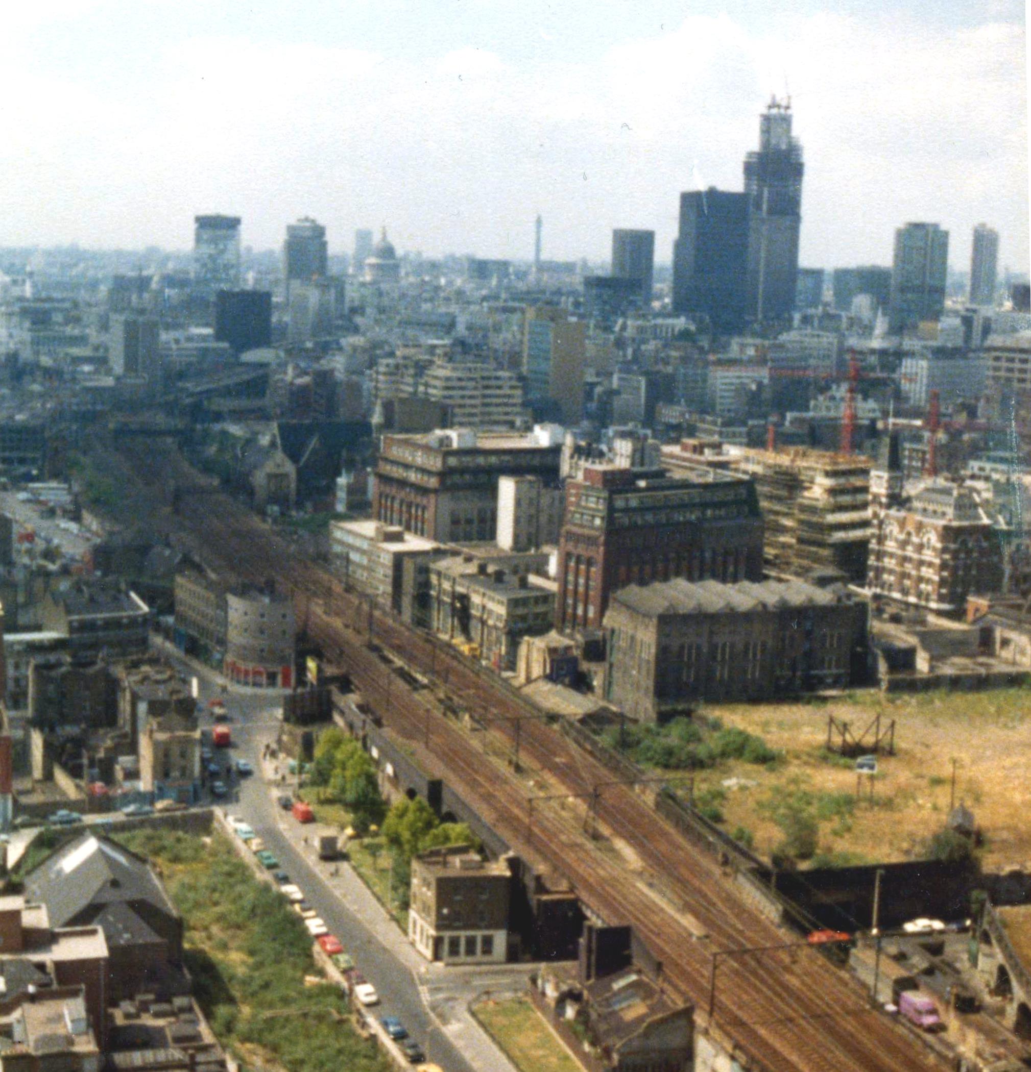
{
"id": 752,
"title": "View of Cable Street, Royal Mint Street and Leman Street 1977",
"author": {
"id": 153,
"username": "danny"
},
"feature": {
"id": 1283,
"type": "Feature",
"geometry": {
"type": "MultiPolygon",
"coordinates": [
[
[
[
-0.066934129072224,
51.511315105222415
],
[
-0.066925938692792,
51.51126457812059
],
[
-0.067975076192187,
51.51121506910428
],
[
-0.067969637757211,
51.511254824404666
],
[
-0.067581927793215,
51.511274218014805
],
[
-0.06757362758025,
51.51129283177907
],
[
-0.066934129072224,
51.511315105222415
]
]
]
]
},
"properties": {
"b_number": "Unit 73a, 25",
"b_name": "Unit 73a, 25 Cable Street",
"street": "",
"address": "Unit 73a, 25 Cable Street",
"feature_type": "WHITECHAPEL_BUILDING",
"count": 4,
"search_str": "Unit 73a, 25 Cable Street"
},
"tags": []
},
"file": "https://surveyoflondon.org/media/uploads/features/1283/Cable%20Street%201977.jpg",
"description": "An image taken from one of the penthouse flats at the top of Shearsmith House on the St George's Estate, Cable Street in 1977. The flat was occupied by my late uncle, Dan McLaughlin, who had moved there after the planned demolition of the Royal Mint Square Estate in the early 1970s. He had lived at 178 Royal Mint Square. \n\nThis view shows the skyline of the City of London before the radical new builds like the Gherkin, the Walkie Talkie and the Cheesegrater. In this photograph, Tower 42 (then the NatWest Tower) is still under construction. Remnants of the elevated land which took railway tracks into the Tilbury Terminal on Alie Street are still visible. The Post Office at the junction of Cable Street and Backchurch Lane was still in operation and most notably, the viaduct of the Docklands Light Railway (DLR ) had not yet been built.\n\nA link to an annotated version of this picture on Flickr is here: https://flic.kr/p/3v6p5Y\n\n",
"copyright": false,
"created": "2017-09-08"
},
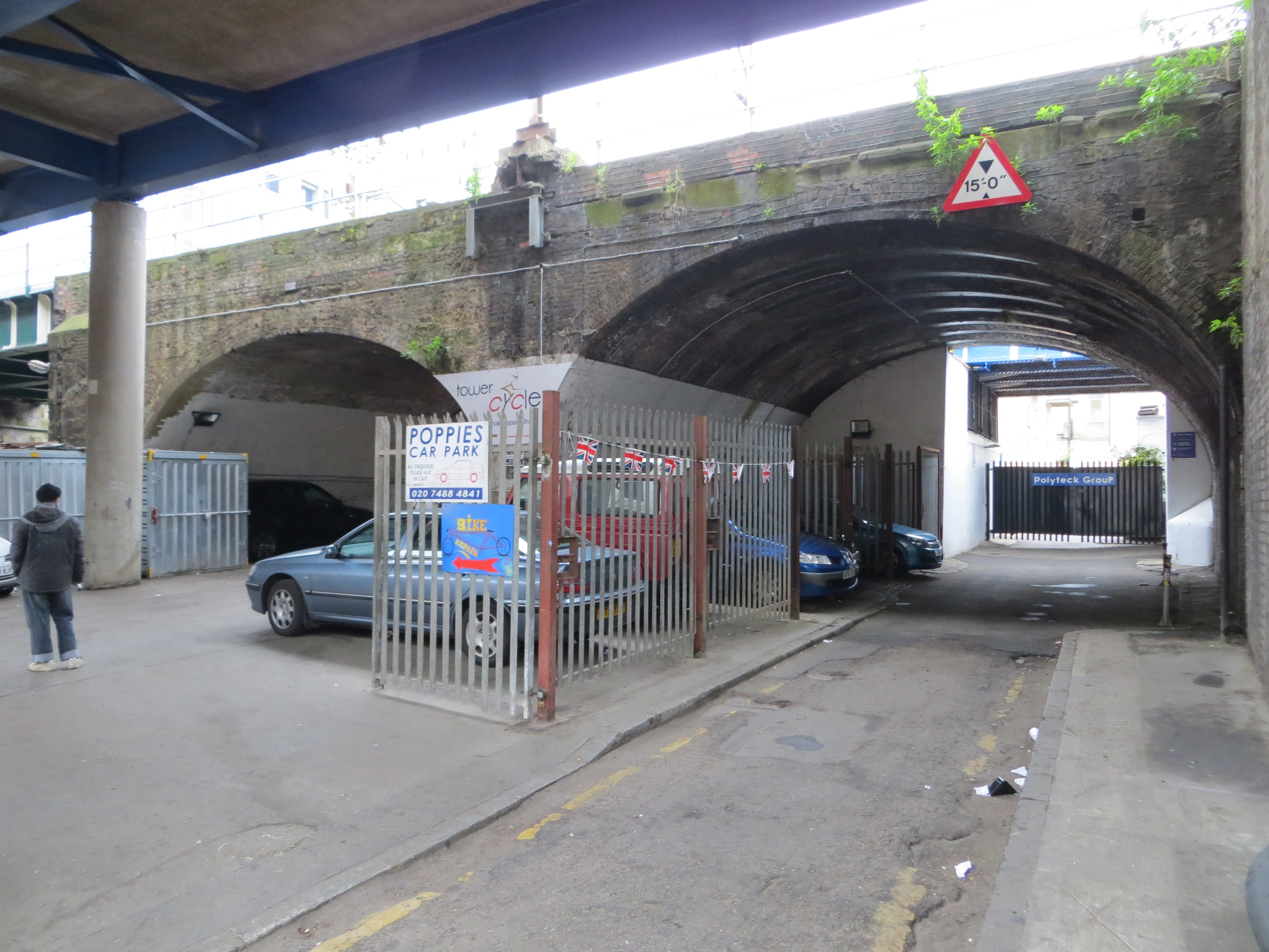
{
"id": 1047,
"title": "Mill Yard railway arches",
"author": {
"id": 216,
"username": "duncan2"
},
"feature": {
"id": 1283,
"type": "Feature",
"geometry": {
"type": "MultiPolygon",
"coordinates": [
[
[
[
-0.066934129072224,
51.511315105222415
],
[
-0.066925938692792,
51.51126457812059
],
[
-0.067975076192187,
51.51121506910428
],
[
-0.067969637757211,
51.511254824404666
],
[
-0.067581927793215,
51.511274218014805
],
[
-0.06757362758025,
51.51129283177907
],
[
-0.066934129072224,
51.511315105222415
]
]
]
]
},
"properties": {
"b_number": "Unit 73a, 25",
"b_name": "Unit 73a, 25 Cable Street",
"street": "",
"address": "Unit 73a, 25 Cable Street",
"feature_type": "WHITECHAPEL_BUILDING",
"count": 4,
"search_str": "Unit 73a, 25 Cable Street"
},
"tags": []
},
"file": "https://surveyoflondon.org/media/uploads/features/1283/IMG_0643.jpg",
"description": "This is a view north from Cable Street, up Mill Yard, through the railway arches",
"copyright": false,
"created": "2018-01-18"
},
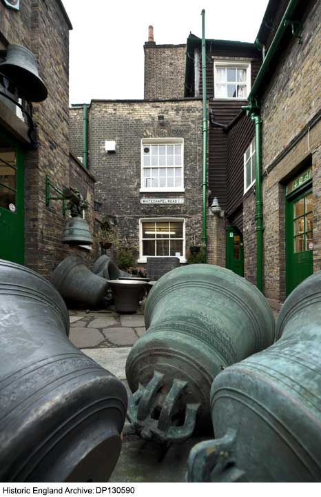
{
"id": 323,
"title": "Whitechapel Bell Foundry, internal yard from the south in 2010",
"author": {
"id": 37,
"username": "HistoricEngland"
},
"feature": {
"id": 155,
"type": "Feature",
"geometry": {
"type": "MultiPolygon",
"coordinates": [
[
[
[
-0.067279828395434,
51.51695705948158
],
[
-0.067093469618443,
51.517032789909806
],
[
-0.067051200483431,
51.516996757810816
],
[
-0.067090391118988,
51.51698039038376
],
[
-0.06706090910812,
51.51695688633854
],
[
-0.067015052606677,
51.51697914860705
],
[
-0.067015052606682,
51.516979148607064
],
[
-0.067015052606675,
51.51697914860705
],
[
-0.066983358160437,
51.516951324364136
],
[
-0.066904378563551,
51.516904192470385
],
[
-0.066814855785544,
51.516858952938556
],
[
-0.066749004017844,
51.51678511344983
],
[
-0.066726651062502,
51.51660623379854
],
[
-0.066916087304028,
51.516542881724156
],
[
-0.067063145906456,
51.51668871217051
],
[
-0.067018758534236,
51.51670613616749
],
[
-0.067108196018859,
51.516794826264736
],
[
-0.067132918133769,
51.516785121743794
],
[
-0.067195489248199,
51.51684716970448
],
[
-0.06716822056742,
51.5168577515391
],
[
-0.067184699138495,
51.51687146748573
],
[
-0.067279828395434,
51.51695705948158
]
],
[
[
-0.067093263845335,
51.516893872671716
],
[
-0.067031009970172,
51.516845232635745
],
[
-0.066988676105,
51.51686586339187
],
[
-0.067034303634964,
51.51688439111608
],
[
-0.067057406216514,
51.51690729267392
],
[
-0.067093263845335,
51.516893872671716
]
]
]
]
},
"properties": {
"b_number": "32-34",
"b_name": "Whitechapel Bell Foundry, 32–34 Whitechapel Road",
"street": "Whitechapel Road",
"address": "32-34 Whitechapel Road",
"feature_type": "WHITECHAPEL_BUILDING",
"count": 26,
"search_str": "Whitechapel Bell Foundry, 32–34 Whitechapel Road"
},
"tags": [
"bells",
"foundry"
]
},
"file": "https://surveyoflondon.org/media/uploads/features/155/DP130590.jpg",
"description": "Photograph by Derek Kendall. Copyright Historic England Archive (see archive.HistoricEngland.org.uk)",
"copyright": true,
"created": "2016-09-02"
},
{
"id": 1837,
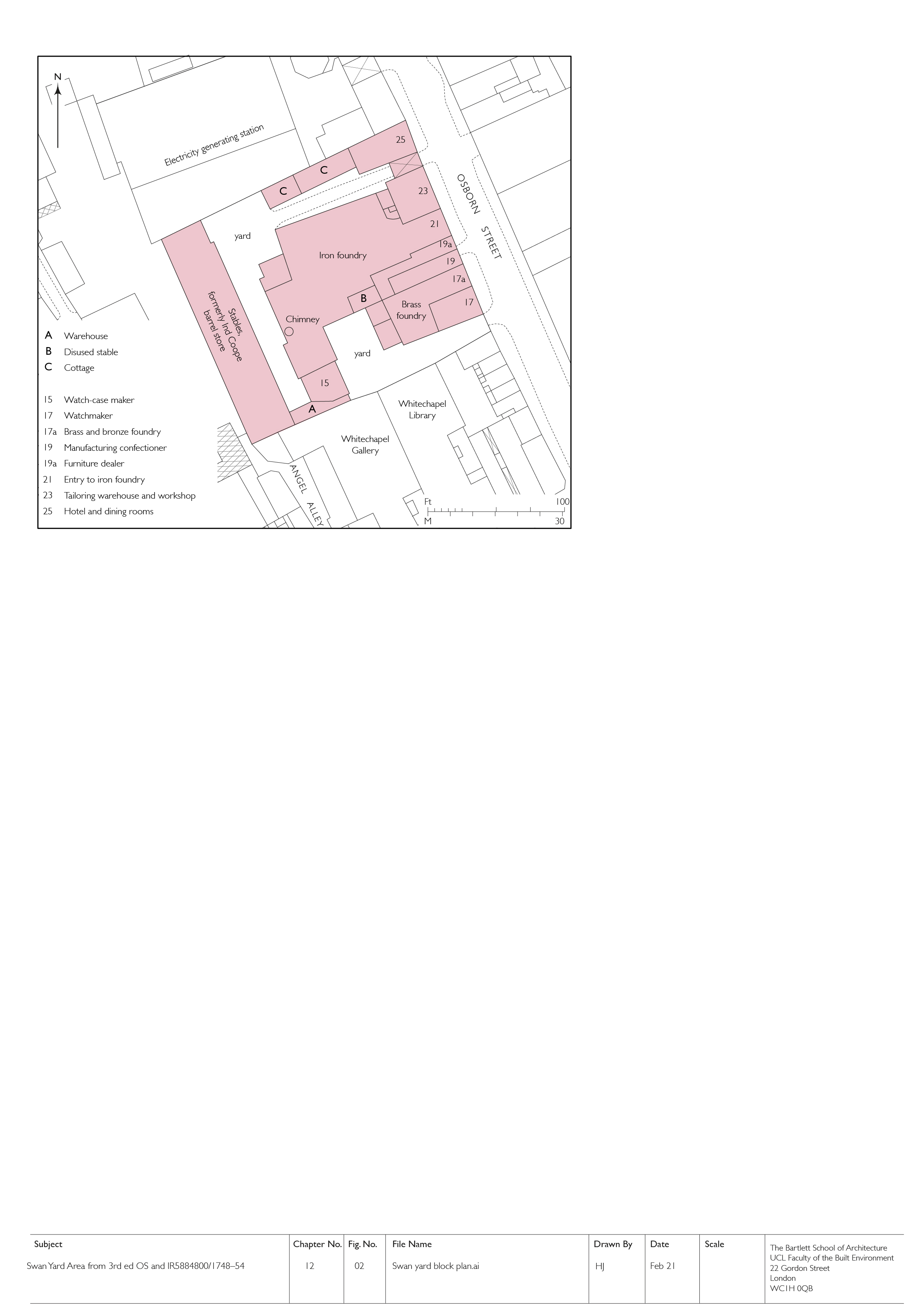
"title": "Swan Yard, block plan in 1914 (drawing by Helen Jones)",
"author": {
"id": 2,
"username": "surveyoflondon"
},
"feature": {
"id": 367,
"type": "Feature",
"geometry": {
"type": "MultiPolygon",
"coordinates": [
[
[
[
-0.070208788307576,
51.51671304296634
],
[
-0.070168698474152,
51.516642176924165
],
[
-0.070328598606914,
51.51659775292492
],
[
-0.070233638934197,
51.51643169469593
],
[
-0.07040277854452,
51.516389321672
],
[
-0.070427796874914,
51.516431704260015
],
[
-0.070531482057751,
51.51640852908396
],
[
-0.070495583452263,
51.516357381859585
],
[
-0.070624394552914,
51.51632218024373
],
[
-0.070775232954332,
51.51657790057318
],
[
-0.070374697197082,
51.51666834737638
],
[
-0.070349845537708,
51.516633207223116
],
[
-0.070314268571881,
51.51664150653588
],
[
-0.070338037036976,
51.51668116844782
],
[
-0.070208788307576,
51.51671304296634
]
]
]
]
},
"properties": {
"b_number": "19 to 23",
"b_name": "19 to 23 Osborn Street",
"street": "Osborn Street",
"address": "19-23 Osborn Street",
"feature_type": "WHITECHAPEL_BUILDING",
"count": 7,
"search_str": "19 to 23 Osborn Street"
},
"tags": []
},
"file": "https://surveyoflondon.org/media/uploads/features/367/12.2%20Swan%20Yard%20block%20plan.jpg",
"description": "",
"copyright": true,
"created": "2021-05-04"
},
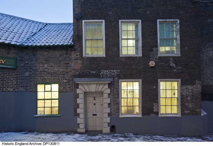
{
"id": 326,
"title": "2 Fieldgate Street in 2010",
"author": {
"id": 37,
"username": "HistoricEngland"
},
"feature": {
"id": 155,
"type": "Feature",
"geometry": {
"type": "MultiPolygon",
"coordinates": [
[
[
[
-0.067279828395434,
51.51695705948158
],
[
-0.067093469618443,
51.517032789909806
],
[
-0.067051200483431,
51.516996757810816
],
[
-0.067090391118988,
51.51698039038376
],
[
-0.06706090910812,
51.51695688633854
],
[
-0.067015052606677,
51.51697914860705
],
[
-0.067015052606682,
51.516979148607064
],
[
-0.067015052606675,
51.51697914860705
],
[
-0.066983358160437,
51.516951324364136
],
[
-0.066904378563551,
51.516904192470385
],
[
-0.066814855785544,
51.516858952938556
],
[
-0.066749004017844,
51.51678511344983
],
[
-0.066726651062502,
51.51660623379854
],
[
-0.066916087304028,
51.516542881724156
],
[
-0.067063145906456,
51.51668871217051
],
[
-0.067018758534236,
51.51670613616749
],
[
-0.067108196018859,
51.516794826264736
],
[
-0.067132918133769,
51.516785121743794
],
[
-0.067195489248199,
51.51684716970448
],
[
-0.06716822056742,
51.5168577515391
],
[
-0.067184699138495,
51.51687146748573
],
[
-0.067279828395434,
51.51695705948158
]
],
[
[
-0.067093263845335,
51.516893872671716
],
[
-0.067031009970172,
51.516845232635745
],
[
-0.066988676105,
51.51686586339187
],
[
-0.067034303634964,
51.51688439111608
],
[
-0.067057406216514,
51.51690729267392
],
[
-0.067093263845335,
51.516893872671716
]
]
]
]
},
"properties": {
"b_number": "32-34",
"b_name": "Whitechapel Bell Foundry, 32–34 Whitechapel Road",
"street": "Whitechapel Road",
"address": "32-34 Whitechapel Road",
"feature_type": "WHITECHAPEL_BUILDING",
"count": 26,
"search_str": "Whitechapel Bell Foundry, 32–34 Whitechapel Road"
},
"tags": [
"bells",
"foundry"
]
},
"file": "https://surveyoflondon.org/media/uploads/features/155/DP130811.jpg",
"description": "Photograph by Derek Kendall. Copyright Historic England Archive (see archive.HistoricEngland.org.uk)",
"copyright": true,
"created": "2016-09-02"
},
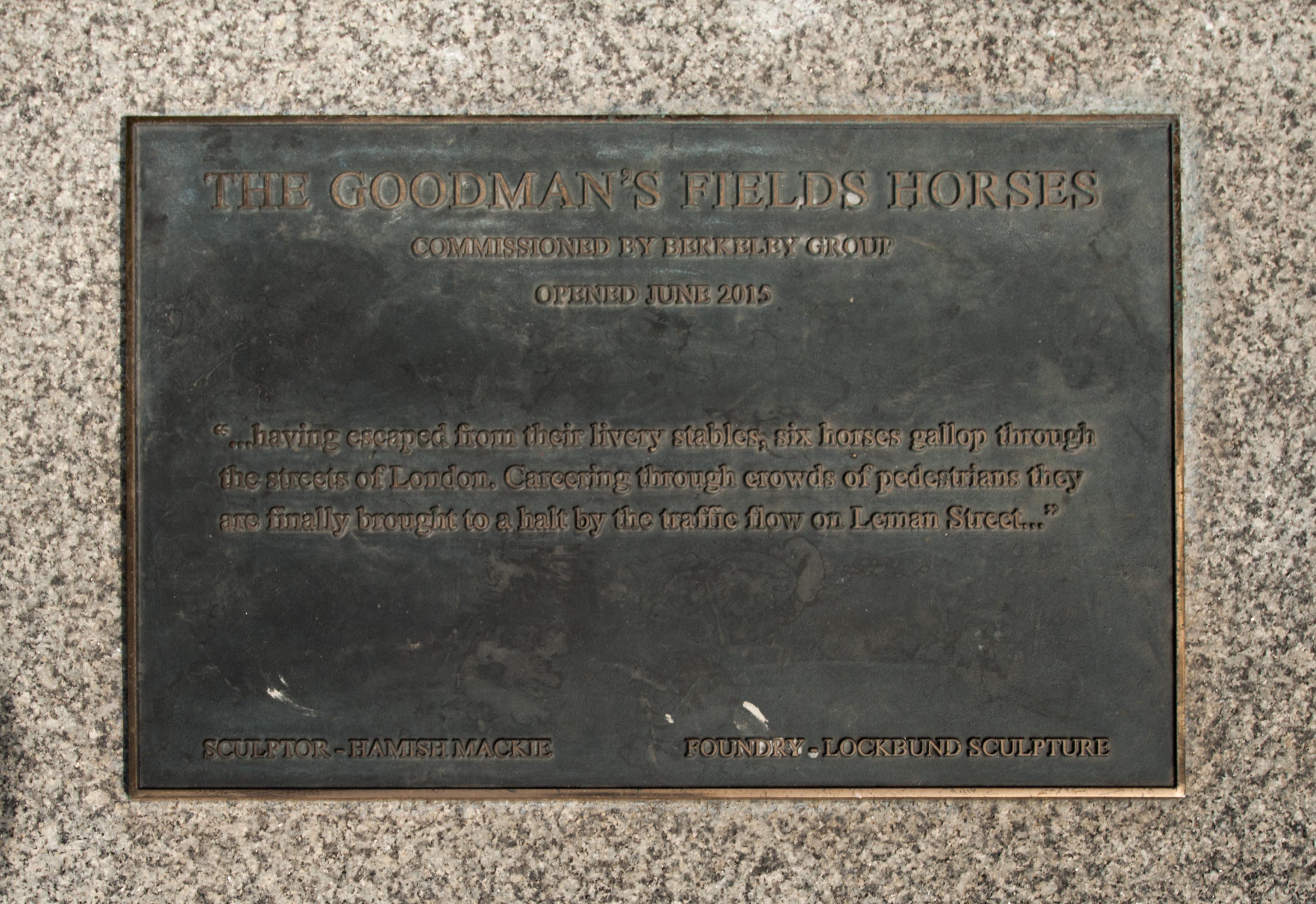
{
"id": 1726,
"title": "Goodman's Fields Horses plaque",
"author": {
"id": 27,
"username": "DerekKendall"
},
"feature": {
"id": 1457,
"type": "Feature",
"geometry": {
"type": "MultiPolygon",
"coordinates": [
[
[
[
-0.070203073964938,
51.51342219546891
],
[
-0.069147493837327,
51.51381196963451
],
[
-0.068970962595089,
51.51361513736259
],
[
-0.070053986774662,
51.51323697832119
],
[
-0.070203073964938,
51.51342219546891
]
]
]
]
},
"properties": {
"b_number": "",
"b_name": "Piazza Walk, Goodman's Fields",
"street": "Leman Street",
"address": "Piazza Walk, Goodman's Fields",
"feature_type": "OPEN_SPACE",
"count": 8,
"search_str": "Piazza Walk, Goodman's Fields"
},
"tags": []
},
"file": "https://surveyoflondon.org/media/uploads/features/1457/SoL%20Whitechapel%20101548.jpg",
"description": "",
"copyright": true,
"created": "2020-06-01"
},
{
"id": 1727,
"title": "Goodman's Fields site map in 2017",
"author": {
"id": 27,
"username": "DerekKendall"
},
"feature": {
"id": 1457,
"type": "Feature",
"geometry": {
"type": "MultiPolygon",
"coordinates": [
[
[
[
-0.070203073964938,
51.51342219546891
],
[
-0.069147493837327,
51.51381196963451
],
[
-0.068970962595089,
51.51361513736259
],
[
-0.070053986774662,
51.51323697832119
],
[
-0.070203073964938,
51.51342219546891
]
]
]
]
},
"properties": {
"b_number": "",
"b_name": "Piazza Walk, Goodman's Fields",
"street": "Leman Street",
"address": "Piazza Walk, Goodman's Fields",
"feature_type": "OPEN_SPACE",
"count": 8,
"search_str": "Piazza Walk, Goodman's Fields"
},
"tags": []
},
"file": "https://surveyoflondon.org/media/uploads/features/1457/SoL%20Whitechapel%20101549.jpg",
"description": "",
"copyright": true,
"created": "2020-06-01"
},
{
"id": 1848,
"title": "English Martyrs, block plan, c.1890 (drawing by Helen Jones)",
"author": {
"id": 2,
"username": "surveyoflondon"
},
"feature": {
"id": 1297,
"type": "Feature",
"geometry": {
"type": "MultiPolygon",
"coordinates": [
[
[
[
-0.071935648282288,
51.51134524228436
],
[
-0.071874729442993,
51.51121363108998
],
[
-0.071816144948546,
51.51122339231668
],
[
-0.071776588646252,
51.51120578254433
],
[
-0.071762024560661,
51.51117337877791
],
[
-0.07177649375904,
51.511141452410264
],
[
-0.071834141993347,
51.51113011940239
],
[
-0.071816329795347,
51.51108571239466
],
[
-0.072075019832766,
51.51104549229583
],
[
-0.072193056743033,
51.51130853787665
],
[
-0.072151551976597,
51.51131487321276
],
[
-0.072147312228886,
51.51132649961524
],
[
-0.072142333320455,
51.51133343542439
],
[
-0.072015847069243,
51.5113547481352
],
[
-0.071996105248008,
51.51135617797319
],
[
-0.071982278923131,
51.511350687404345
],
[
-0.071975230627282,
51.51134004502751
],
[
-0.071935648282288,
51.51134524228436
]
]
]
]
},
"properties": {
"b_number": "",
"b_name": "Roman Catholic Church of the English Martyrs",
"street": "Prescot Street",
"address": "Roman Catholic Church of the English Martyrs",
"feature_type": "WHITECHAPEL_BUILDING",
"count": 20,
"search_str": "Roman Catholic Church of the English Martyrs"
},
"tags": []
},
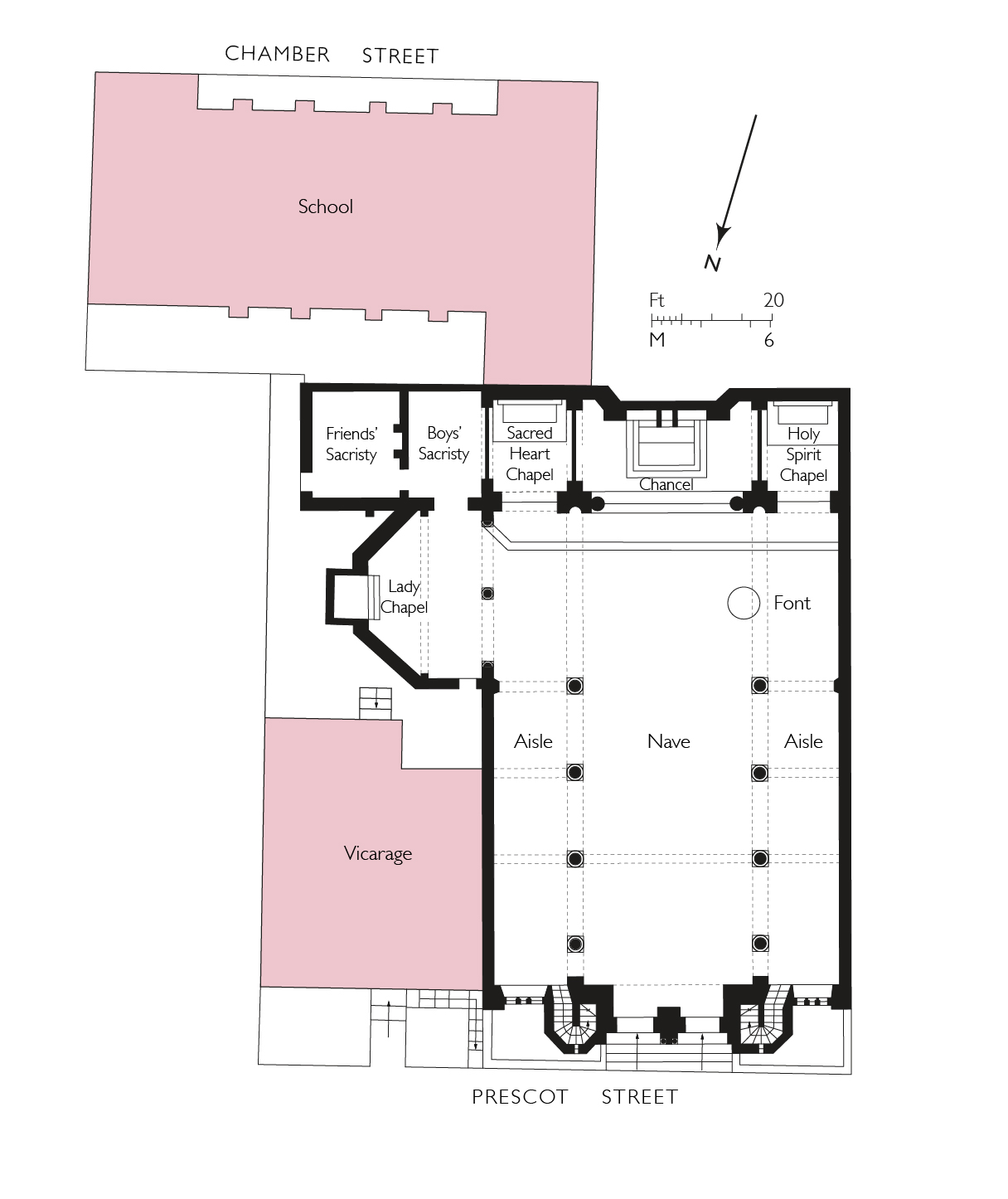
"file": "https://surveyoflondon.org/media/uploads/features/1297/34.9%20English%20Martyrs%20final.jpg",
"description": "",
"copyright": true,
"created": "2021-08-05"
},
{
"id": 447,
"title": "Whitechapel Bell Foundry, ground-floor front room in Master Founder's house in 1946",
"author": {
"id": 37,
"username": "HistoricEngland"
},
"feature": {
"id": 155,
"type": "Feature",
"geometry": {
"type": "MultiPolygon",
"coordinates": [
[
[
[
-0.067279828395434,
51.51695705948158
],
[
-0.067093469618443,
51.517032789909806
],
[
-0.067051200483431,
51.516996757810816
],
[
-0.067090391118988,
51.51698039038376
],
[
-0.06706090910812,
51.51695688633854
],
[
-0.067015052606677,
51.51697914860705
],
[
-0.067015052606682,
51.516979148607064
],
[
-0.067015052606675,
51.51697914860705
],
[
-0.066983358160437,
51.516951324364136
],
[
-0.066904378563551,
51.516904192470385
],
[
-0.066814855785544,
51.516858952938556
],
[
-0.066749004017844,
51.51678511344983
],
[
-0.066726651062502,
51.51660623379854
],
[
-0.066916087304028,
51.516542881724156
],
[
-0.067063145906456,
51.51668871217051
],
[
-0.067018758534236,
51.51670613616749
],
[
-0.067108196018859,
51.516794826264736
],
[
-0.067132918133769,
51.516785121743794
],
[
-0.067195489248199,
51.51684716970448
],
[
-0.06716822056742,
51.5168577515391
],
[
-0.067184699138495,
51.51687146748573
],
[
-0.067279828395434,
51.51695705948158
]
],
[
[
-0.067093263845335,
51.516893872671716
],
[
-0.067031009970172,
51.516845232635745
],
[
-0.066988676105,
51.51686586339187
],
[
-0.067034303634964,
51.51688439111608
],
[
-0.067057406216514,
51.51690729267392
],
[
-0.067093263845335,
51.516893872671716
]
]
]
]
},
"properties": {
"b_number": "32-34",
"b_name": "Whitechapel Bell Foundry, 32–34 Whitechapel Road",
"street": "Whitechapel Road",
"address": "32-34 Whitechapel Road",
"feature_type": "WHITECHAPEL_BUILDING",
"count": 26,
"search_str": "Whitechapel Bell Foundry, 32–34 Whitechapel Road"
},
"tags": [
"bells",
"foundry"
]
},
"file": "https://surveyoflondon.org/media/uploads/features/155/32-34%20Whitechapel%20Road%2C%20gr%20fl%20front%2C%2022-2-1946%2C%20HELR%20F3027%20copy.jpg",
"description": "",
"copyright": true,
"created": "2016-11-15"
},
{
"id": 461,
"title": "Whitechapel Bell Foundry, ground-floor plan in 2016",
"author": {
"id": 2,
"username": "surveyoflondon"
},
"feature": {
"id": 155,
"type": "Feature",
"geometry": {
"type": "MultiPolygon",
"coordinates": [
[
[
[
-0.067279828395434,
51.51695705948158
],
[
-0.067093469618443,
51.517032789909806
],
[
-0.067051200483431,
51.516996757810816
],
[
-0.067090391118988,
51.51698039038376
],
[
-0.06706090910812,
51.51695688633854
],
[
-0.067015052606677,
51.51697914860705
],
[
-0.067015052606682,
51.516979148607064
],
[
-0.067015052606675,
51.51697914860705
],
[
-0.066983358160437,
51.516951324364136
],
[
-0.066904378563551,
51.516904192470385
],
[
-0.066814855785544,
51.516858952938556
],
[
-0.066749004017844,
51.51678511344983
],
[
-0.066726651062502,
51.51660623379854
],
[
-0.066916087304028,
51.516542881724156
],
[
-0.067063145906456,
51.51668871217051
],
[
-0.067018758534236,
51.51670613616749
],
[
-0.067108196018859,
51.516794826264736
],
[
-0.067132918133769,
51.516785121743794
],
[
-0.067195489248199,
51.51684716970448
],
[
-0.06716822056742,
51.5168577515391
],
[
-0.067184699138495,
51.51687146748573
],
[
-0.067279828395434,
51.51695705948158
]
],
[
[
-0.067093263845335,
51.516893872671716
],
[
-0.067031009970172,
51.516845232635745
],
[
-0.066988676105,
51.51686586339187
],
[
-0.067034303634964,
51.51688439111608
],
[
-0.067057406216514,
51.51690729267392
],
[
-0.067093263845335,
51.516893872671716
]
]
]
]
},
"properties": {
"b_number": "32-34",
"b_name": "Whitechapel Bell Foundry, 32–34 Whitechapel Road",
"street": "Whitechapel Road",
"address": "32-34 Whitechapel Road",
"feature_type": "WHITECHAPEL_BUILDING",
"count": 26,
"search_str": "Whitechapel Bell Foundry, 32–34 Whitechapel Road"
},
"tags": [
"bells",
"foundry"
]
},
"file": "https://surveyoflondon.org/media/uploads/features/155/bell%20foundry%20ground%20floor%20plan.jpg",
"description": "Drawing by Helen Jones based on measured survey and archives",
"copyright": false,
"created": "2016-12-02"
},
{
"id": 1733,
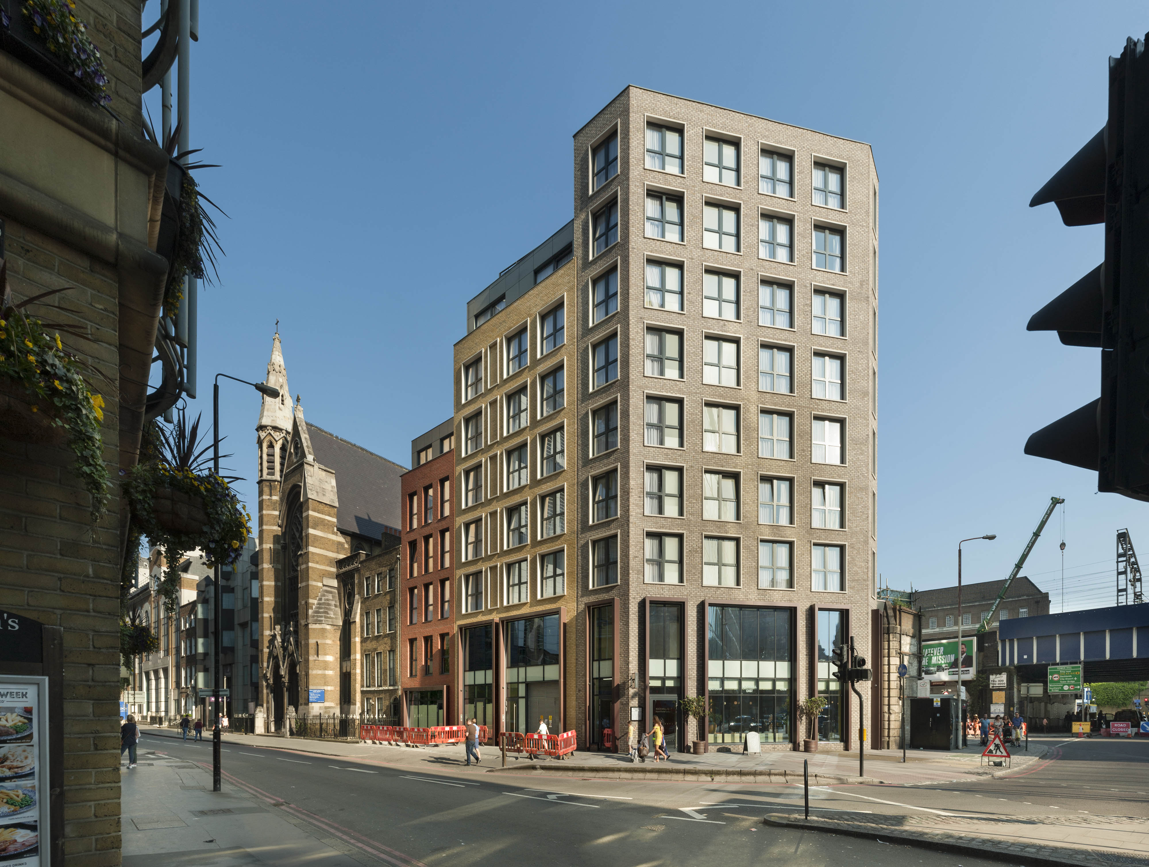
"title": "Rockwell East Aparthotel, 31–33 Prescot Street from the north-west in 2019",
"author": {
"id": 27,
"username": "DerekKendall"
},
"feature": {
"id": 1303,
"type": "Feature",
"geometry": {
"type": "MultiPolygon",
"coordinates": [
[
[
[
-0.072498168381798,
51.51125741207528
],
[
-0.072456864858681,
51.511170182001216
],
[
-0.072368980409212,
51.51107633816818
],
[
-0.072442870594844,
51.51105766937985
],
[
-0.072491766994021,
51.5110982398522
],
[
-0.072508723691447,
51.5110961793476
],
[
-0.072521588778258,
51.51110223886019
],
[
-0.072546284627394,
51.51109445750477
],
[
-0.072640543386628,
51.511126910908146
],
[
-0.072631903381239,
51.51115317565467
],
[
-0.072552883565181,
51.51124895452964
],
[
-0.072498168381798,
51.51125741207528
]
]
]
]
},
"properties": {
"b_number": "99",
"b_name": "",
"street": "Mansell Street",
"address": "99 Mansell Street",
"feature_type": "WHITECHAPEL_BUILDING",
"count": 2,
"search_str": "99 Mansell Street"
},
"tags": []
},
"file": "https://surveyoflondon.org/media/uploads/features/1303/SoL%20Whitechapel%20102742.jpg",
"description": "",
"copyright": true,
"created": "2020-06-05"
},
{
"id": 1808,
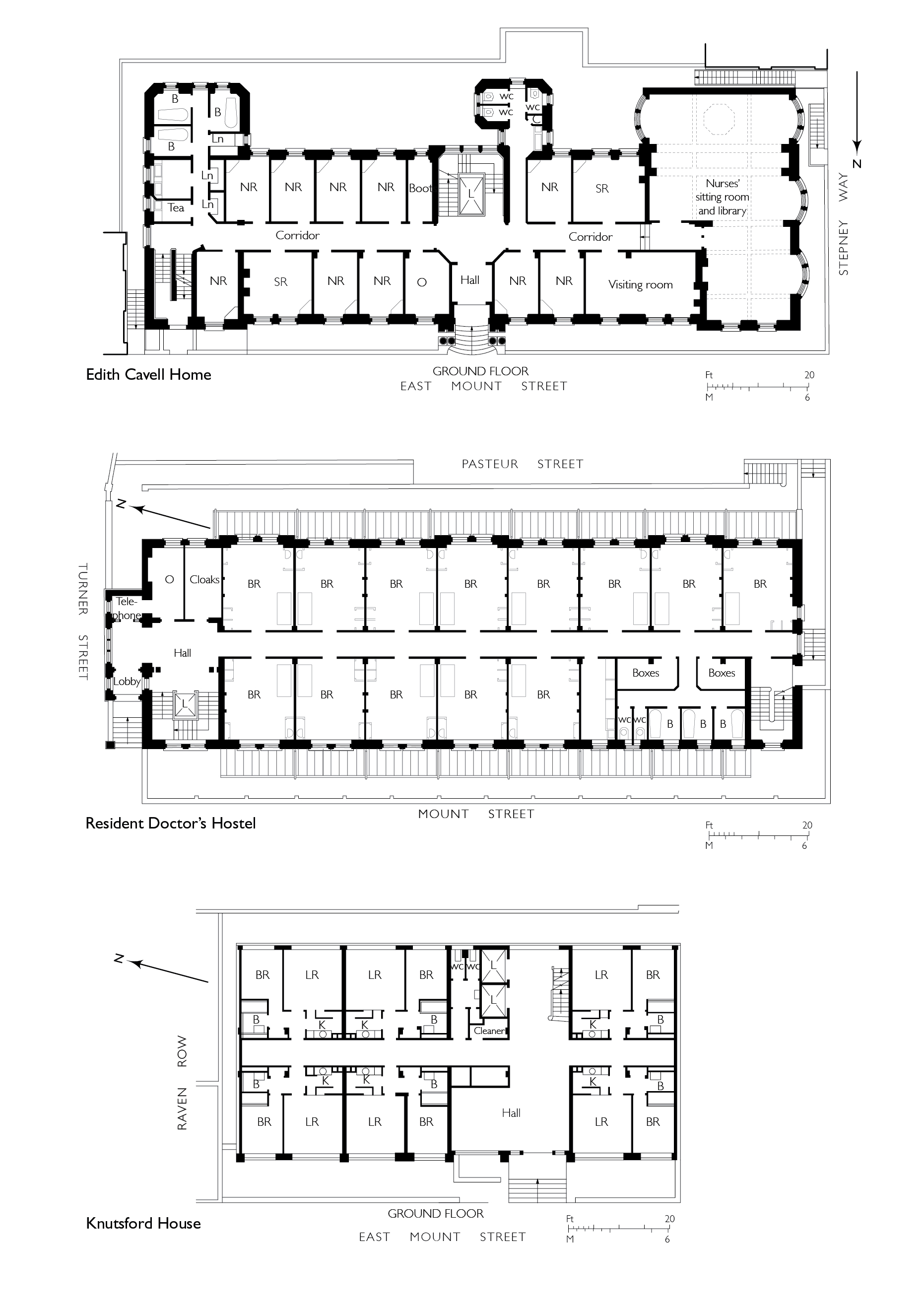
"title": "Plans of staff housing including the Resident Doctors' Hostel - drawing by Helen Jones",
"author": {
"id": 2,
"username": "surveyoflondon"
},
"feature": {
"id": 1187,
"type": "Feature",
"geometry": {
"type": "MultiPolygon",
"coordinates": [
[
[
[
-0.061853613587725,
51.51795357347482
],
[
-0.061311298322689,
51.518075049965745
],
[
-0.061297685346835,
51.51805160774173
],
[
-0.061269622596728,
51.518057950858406
],
[
-0.061233454788416,
51.51799566789858
],
[
-0.061263609210615,
51.517988851994616
],
[
-0.061253110770819,
51.517970773090006
],
[
-0.061797911851981,
51.51784762820333
],
[
-0.061853613587725,
51.51795357347482
]
]
]
]
},
"properties": {
"b_number": "",
"b_name": "",
"street": "Turner Street",
"address": "Ambrose King Centre and Grahame Hayton Unit",
"feature_type": "WHITECHAPEL_BUILDING",
"count": 5,
"search_str": "Ambrose King Centre and Grahame Hayton Unit"
},
"tags": []
},
"file": "https://surveyoflondon.org/media/uploads/features/1187/Nurses%20Homes%202%20combined%202.jpg",
"description": "",
"copyright": true,
"created": "2021-02-23"
},
{
"id": 1816,
"title": "Altab Ali Park from the south-east in 2021",
"author": {
"id": 27,
"username": "DerekKendall"
},
"feature": {
"id": 296,
"type": "Feature",
"geometry": {
"type": "MultiPolygon",
"coordinates": [
[
[
[
-0.069238538289603,
51.51610506120929
],
[
-0.069007097235987,
51.5162239535272
],
[
-0.068282200256798,
51.51654369745104
],
[
-0.068157401560378,
51.51641994527148
],
[
-0.067807959279103,
51.51600137496063
],
[
-0.068541180339468,
51.515783257348254
],
[
-0.068555919008956,
51.51580580160597
],
[
-0.068713893455475,
51.515872451567986
],
[
-0.068778503699218,
51.51586114158782
],
[
-0.068817146392177,
51.515922550138725
],
[
-0.068888047037903,
51.51596428315636
],
[
-0.069016085124709,
51.515921053627785
],
[
-0.069107698271647,
51.51601562404751
],
[
-0.069243279190738,
51.515974904669626
],
[
-0.069238538289603,
51.51610506120929
]
]
]
]
},
"properties": {
"b_number": "",
"b_name": "Altab Ali Park, including the site of the parish church of St Mary Matfelon",
"street": "Whitechapel Road",
"address": "Altab Ali Park",
"feature_type": "OPEN_SPACE",
"count": 32,
"search_str": "Altab Ali Park, including the site of the parish church of St Mary Matfelon"
},
"tags": []
},
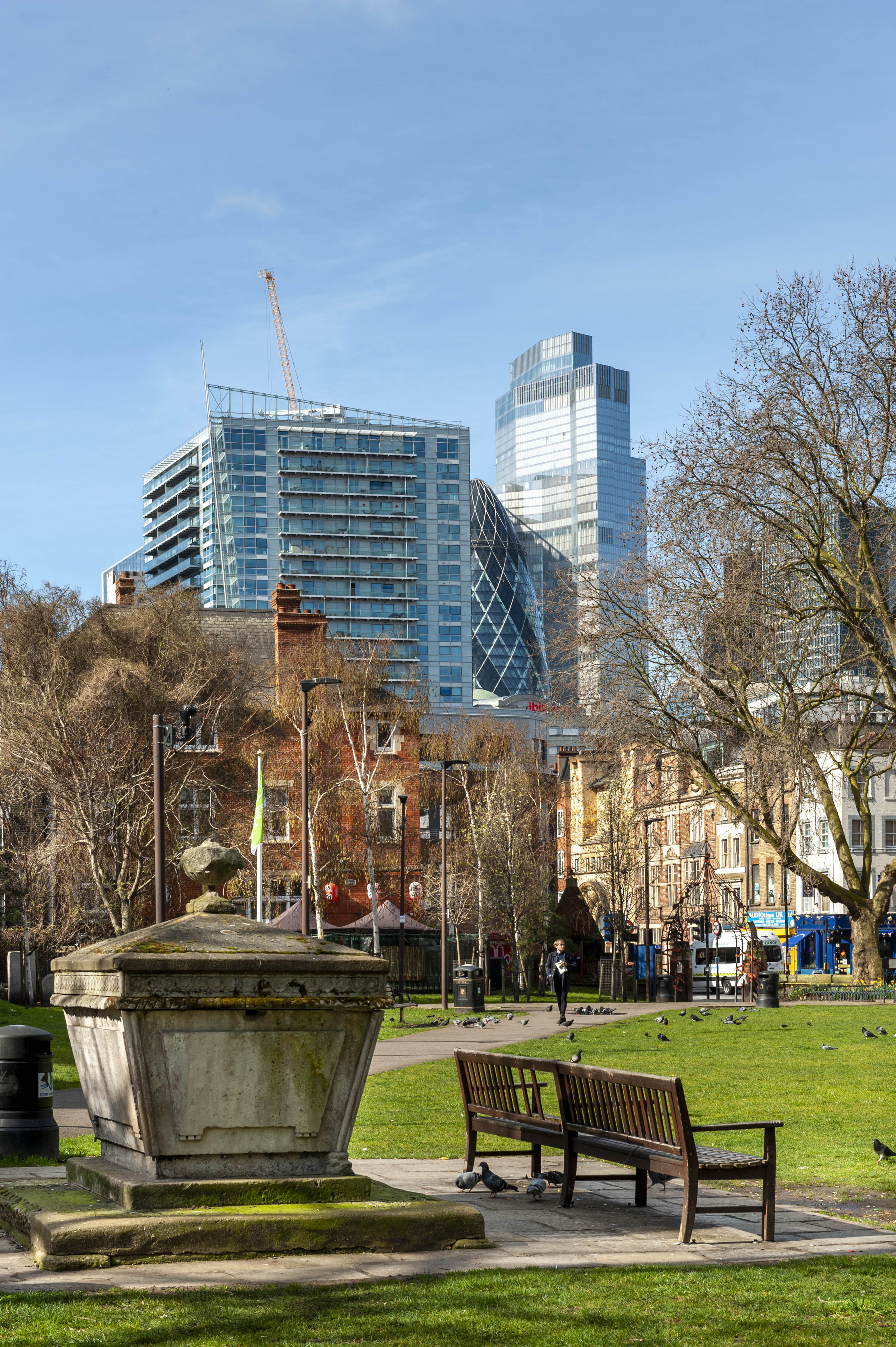
"file": "https://surveyoflondon.org/media/uploads/features/296/SoL%20Whitechapel%20102888.jpg",
"description": "",
"copyright": true,
"created": "2021-03-30"
}
]
}
%201992.jpg)
%201980s.jpg)