HTTP 200 OK
Allow: GET, HEAD, OPTIONS
Content-Type: application/json
Vary: Accept
{
"count": 1747,
"next": "https://surveyoflondon.org/api/v1/images/?format=api&page=70",
"previous": "https://surveyoflondon.org/api/v1/images/?format=api&page=68",
"results": [
{
"id": 1612,
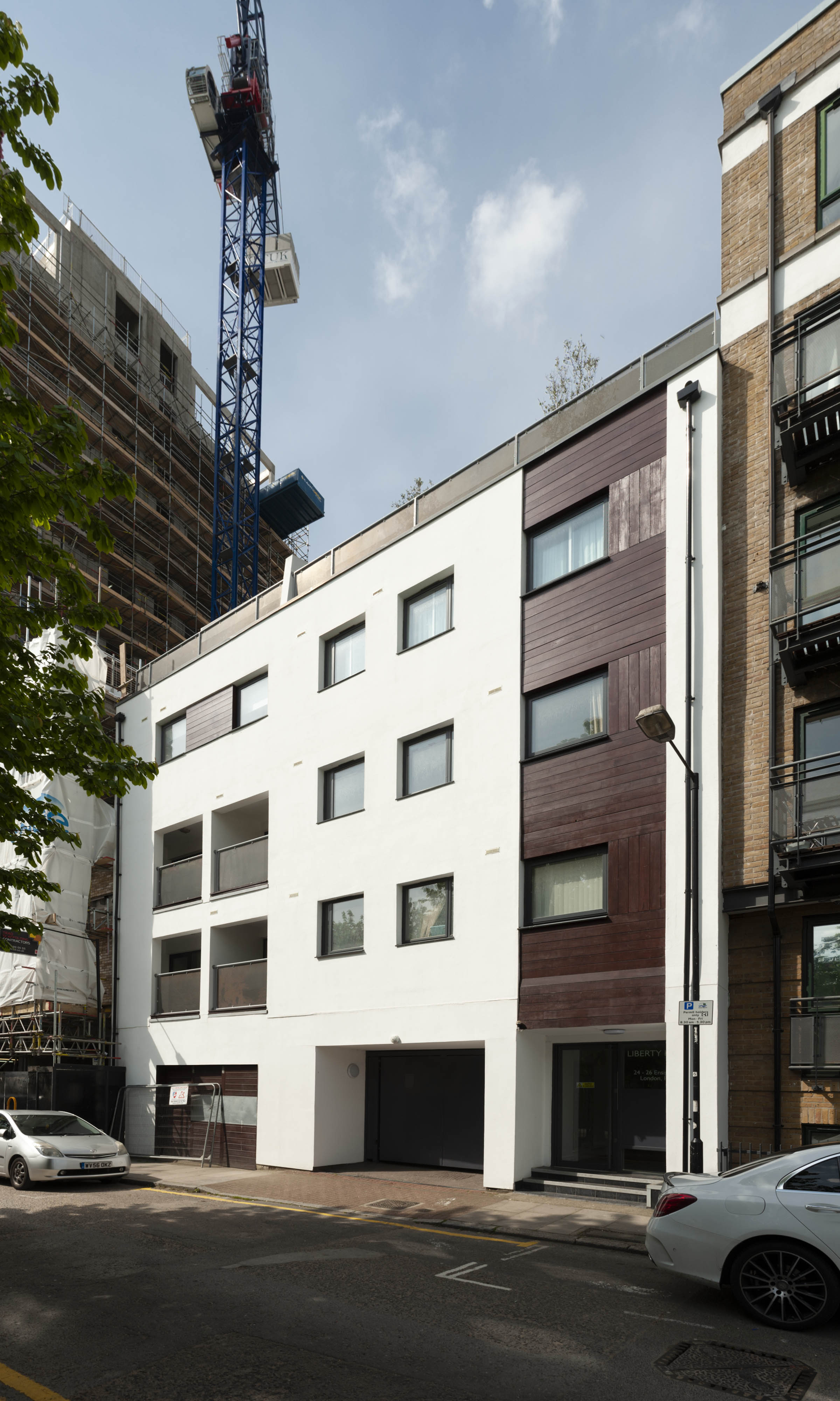
"title": "24–26 Ensign Street in 2019",
"author": {
"id": 27,
"username": "DerekKendall"
},
"feature": {
"id": 1387,
"type": "Feature",
"geometry": {
"type": "MultiPolygon",
"coordinates": [
[
[
[
-0.06731547066097,
51.50970186651237
],
[
-0.067259136553283,
51.509580009792224
],
[
-0.067518613194427,
51.50952498481481
],
[
-0.067594107114137,
51.50965772934067
],
[
-0.067573542753321,
51.50966353310232
],
[
-0.067604583698083,
51.509726498522014
],
[
-0.06746573474414,
51.509751671019316
],
[
-0.067432002579979,
51.50967820608599
],
[
-0.06731547066097,
51.50970186651237
]
]
]
]
},
"properties": {
"b_number": "24-26",
"b_name": "",
"street": "Ensign Street",
"address": "Liberty House, 24-26 Ensign Street",
"feature_type": "WHITECHAPEL_BUILDING",
"count": 2,
"search_str": "Liberty House, 24-26 Ensign Street"
},
"tags": []
},
"file": "https://surveyoflondon.org/media/uploads/features/1387/SoL%20Whitechapel%20102846.jpg",
"description": "",
"copyright": true,
"created": "2019-05-16"
},
{
"id": 1613,
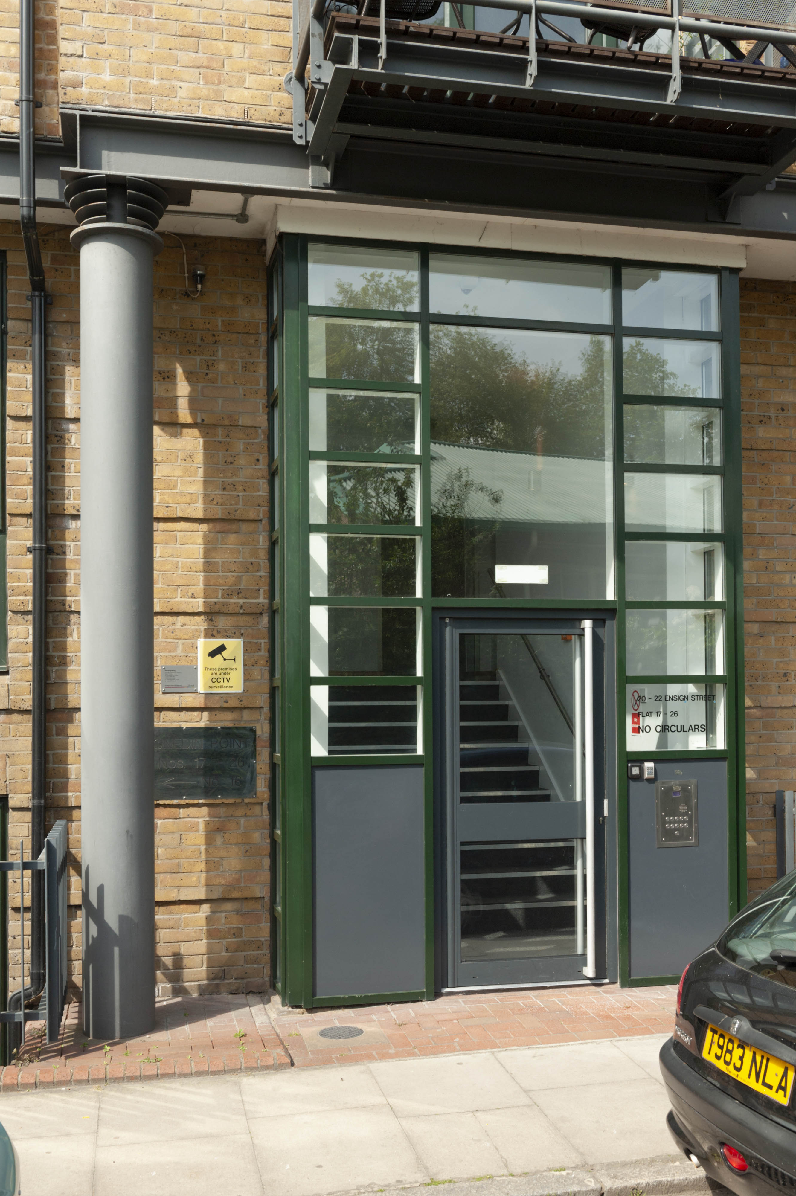
"title": "20–22 Ensign Street from the northeast in 2019",
"author": {
"id": 27,
"username": "DerekKendall"
},
"feature": {
"id": 1386,
"type": "Feature",
"geometry": {
"type": "MultiPolygon",
"coordinates": [
[
[
[
-0.067466520880171,
51.51002935056337
],
[
-0.06731547066097,
51.50970186651237
],
[
-0.067432002579979,
51.50967820608599
],
[
-0.067491717222797,
51.50980825782902
],
[
-0.067600604228492,
51.50978912233297
],
[
-0.067614074968522,
51.509823064688625
],
[
-0.067595306427154,
51.5098262437185
],
[
-0.067629600252411,
51.50990115014562
],
[
-0.067671382271042,
51.509894899589455
],
[
-0.067680019118692,
51.509916010296564
],
[
-0.067639688806714,
51.50992232234636
],
[
-0.06767269738543,
51.509992670709266
],
[
-0.067466520880171,
51.51002935056337
]
]
]
]
},
"properties": {
"b_number": "20-22",
"b_name": "",
"street": "Ensign Street",
"address": "Onedin Point, 20-22 Ensign Street",
"feature_type": "WHITECHAPEL_BUILDING",
"count": 4,
"search_str": "Onedin Point, 20-22 Ensign Street"
},
"tags": []
},
"file": "https://surveyoflondon.org/media/uploads/features/1386/SoL%20Whitechapel%20102847.jpg",
"description": "",
"copyright": true,
"created": "2019-05-16"
},
{
"id": 1614,
"title": "20–22 Ensign Street, door detail in 2019",
"author": {
"id": 27,
"username": "DerekKendall"
},
"feature": {
"id": 1386,
"type": "Feature",
"geometry": {
"type": "MultiPolygon",
"coordinates": [
[
[
[
-0.067466520880171,
51.51002935056337
],
[
-0.06731547066097,
51.50970186651237
],
[
-0.067432002579979,
51.50967820608599
],
[
-0.067491717222797,
51.50980825782902
],
[
-0.067600604228492,
51.50978912233297
],
[
-0.067614074968522,
51.509823064688625
],
[
-0.067595306427154,
51.5098262437185
],
[
-0.067629600252411,
51.50990115014562
],
[
-0.067671382271042,
51.509894899589455
],
[
-0.067680019118692,
51.509916010296564
],
[
-0.067639688806714,
51.50992232234636
],
[
-0.06767269738543,
51.509992670709266
],
[
-0.067466520880171,
51.51002935056337
]
]
]
]
},
"properties": {
"b_number": "20-22",
"b_name": "",
"street": "Ensign Street",
"address": "Onedin Point, 20-22 Ensign Street",
"feature_type": "WHITECHAPEL_BUILDING",
"count": 4,
"search_str": "Onedin Point, 20-22 Ensign Street"
},
"tags": []
},
"file": "https://surveyoflondon.org/media/uploads/features/1386/SoL%20Whitechapel%20102848.jpg",
"description": "",
"copyright": true,
"created": "2019-05-16"
},
{
"id": 1602,
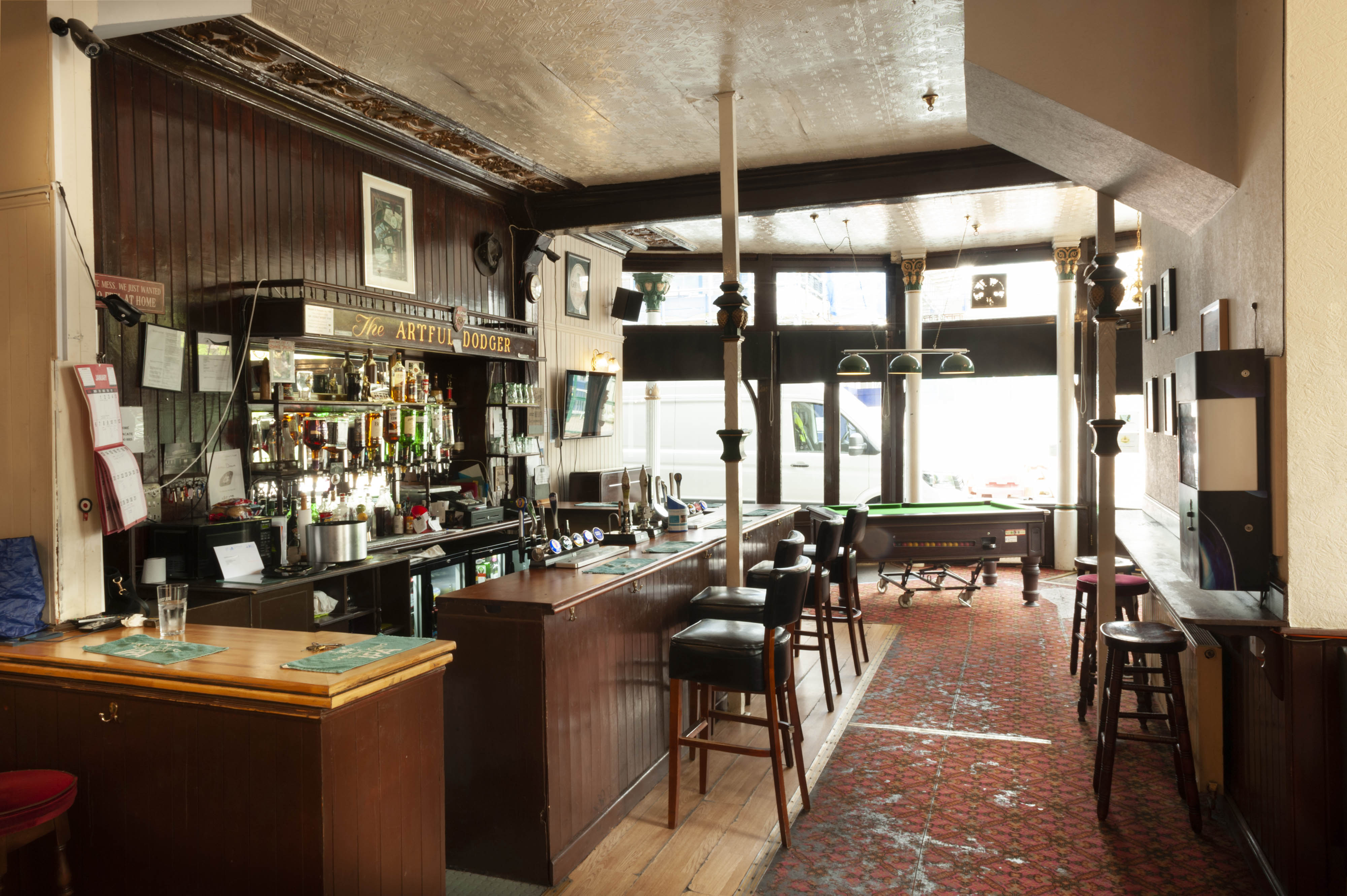
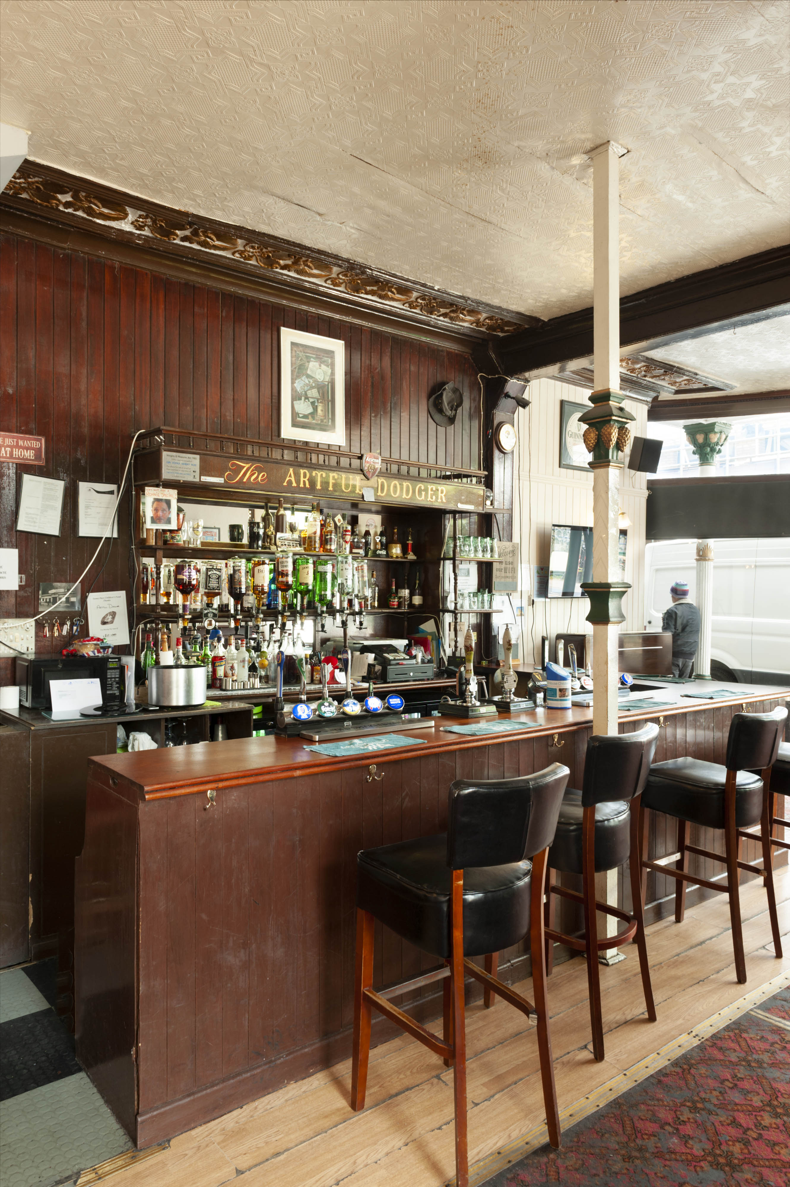
"title": "Artful Dodger, interior from the south in 2019",
"author": {
"id": 27,
"username": "DerekKendall"
},
"feature": {
"id": 1340,
"type": "Feature",
"geometry": {
"type": "MultiPolygon",
"coordinates": [
[
[
[
-0.070218201553316,
51.51043094496562
],
[
-0.070222558344686,
51.51044247916505
],
[
-0.070109328735508,
51.510468828661644
],
[
-0.070060850905555,
51.51038509713018
],
[
-0.070073091733693,
51.510382337633246
],
[
-0.070050463039811,
51.51034325297067
],
[
-0.070066633176381,
51.51033960767238
],
[
-0.070054353255101,
51.510318397568625
],
[
-0.070157621726522,
51.510295117279824
],
[
-0.070179031681174,
51.51033209678496
],
[
-0.070158959927667,
51.51033794396246
],
[
-0.07017205837987,
51.510360032186526
],
[
-0.070184201425816,
51.510378368893306
],
[
-0.070218201553316,
51.51043094496562
]
]
]
]
},
"properties": {
"b_number": "47",
"b_name": "The Artful Dodger (formerly the Crown and Seven Stars)",
"street": "Royal Mint Street",
"address": "The Artful Dodger (formerly the Crown and Seven Stars) public house, 47 Royal Mint Street",
"feature_type": "WHITECHAPEL_BUILDING",
"count": 18,
"search_str": "The Artful Dodger (formerly the Crown and Seven Stars)"
},
"tags": []
},
"file": "https://surveyoflondon.org/media/uploads/features/1340/SoL%20Whitechapel%20102751.jpg",
"description": "",
"copyright": true,
"created": "2019-05-02"
},
{
"id": 1603,
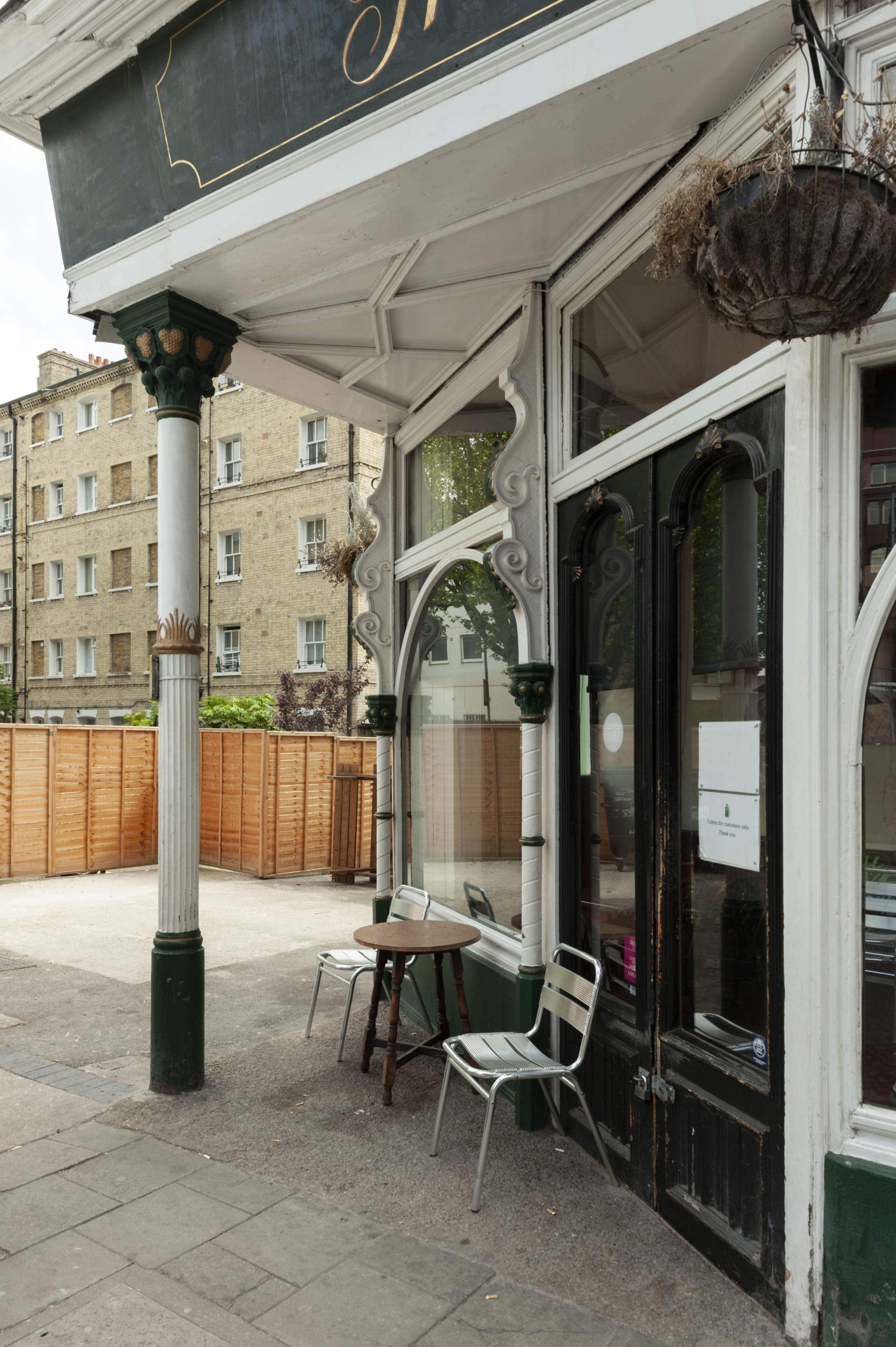
"title": "Artful Dodger, detail of northeast corner in 2019",
"author": {
"id": 27,
"username": "DerekKendall"
},
"feature": {
"id": 1340,
"type": "Feature",
"geometry": {
"type": "MultiPolygon",
"coordinates": [
[
[
[
-0.070218201553316,
51.51043094496562
],
[
-0.070222558344686,
51.51044247916505
],
[
-0.070109328735508,
51.510468828661644
],
[
-0.070060850905555,
51.51038509713018
],
[
-0.070073091733693,
51.510382337633246
],
[
-0.070050463039811,
51.51034325297067
],
[
-0.070066633176381,
51.51033960767238
],
[
-0.070054353255101,
51.510318397568625
],
[
-0.070157621726522,
51.510295117279824
],
[
-0.070179031681174,
51.51033209678496
],
[
-0.070158959927667,
51.51033794396246
],
[
-0.07017205837987,
51.510360032186526
],
[
-0.070184201425816,
51.510378368893306
],
[
-0.070218201553316,
51.51043094496562
]
]
]
]
},
"properties": {
"b_number": "47",
"b_name": "The Artful Dodger (formerly the Crown and Seven Stars)",
"street": "Royal Mint Street",
"address": "The Artful Dodger (formerly the Crown and Seven Stars) public house, 47 Royal Mint Street",
"feature_type": "WHITECHAPEL_BUILDING",
"count": 18,
"search_str": "The Artful Dodger (formerly the Crown and Seven Stars)"
},
"tags": []
},
"file": "https://surveyoflondon.org/media/uploads/features/1340/SoL%20Whitechapel%20102749.jpg",
"description": "",
"copyright": true,
"created": "2019-05-02"
},
{
"id": 1604,
"title": "Artful Dodger, interior view of bar in 2019",
"author": {
"id": 27,
"username": "DerekKendall"
},
"feature": {
"id": 1340,
"type": "Feature",
"geometry": {
"type": "MultiPolygon",
"coordinates": [
[
[
[
-0.070218201553316,
51.51043094496562
],
[
-0.070222558344686,
51.51044247916505
],
[
-0.070109328735508,
51.510468828661644
],
[
-0.070060850905555,
51.51038509713018
],
[
-0.070073091733693,
51.510382337633246
],
[
-0.070050463039811,
51.51034325297067
],
[
-0.070066633176381,
51.51033960767238
],
[
-0.070054353255101,
51.510318397568625
],
[
-0.070157621726522,
51.510295117279824
],
[
-0.070179031681174,
51.51033209678496
],
[
-0.070158959927667,
51.51033794396246
],
[
-0.07017205837987,
51.510360032186526
],
[
-0.070184201425816,
51.510378368893306
],
[
-0.070218201553316,
51.51043094496562
]
]
]
]
},
"properties": {
"b_number": "47",
"b_name": "The Artful Dodger (formerly the Crown and Seven Stars)",
"street": "Royal Mint Street",
"address": "The Artful Dodger (formerly the Crown and Seven Stars) public house, 47 Royal Mint Street",
"feature_type": "WHITECHAPEL_BUILDING",
"count": 18,
"search_str": "The Artful Dodger (formerly the Crown and Seven Stars)"
},
"tags": []
},
"file": "https://surveyoflondon.org/media/uploads/features/1340/SoL%20Whitechapel%20102752.jpg",
"description": "",
"copyright": true,
"created": "2019-05-02"
},
{
"id": 1605,
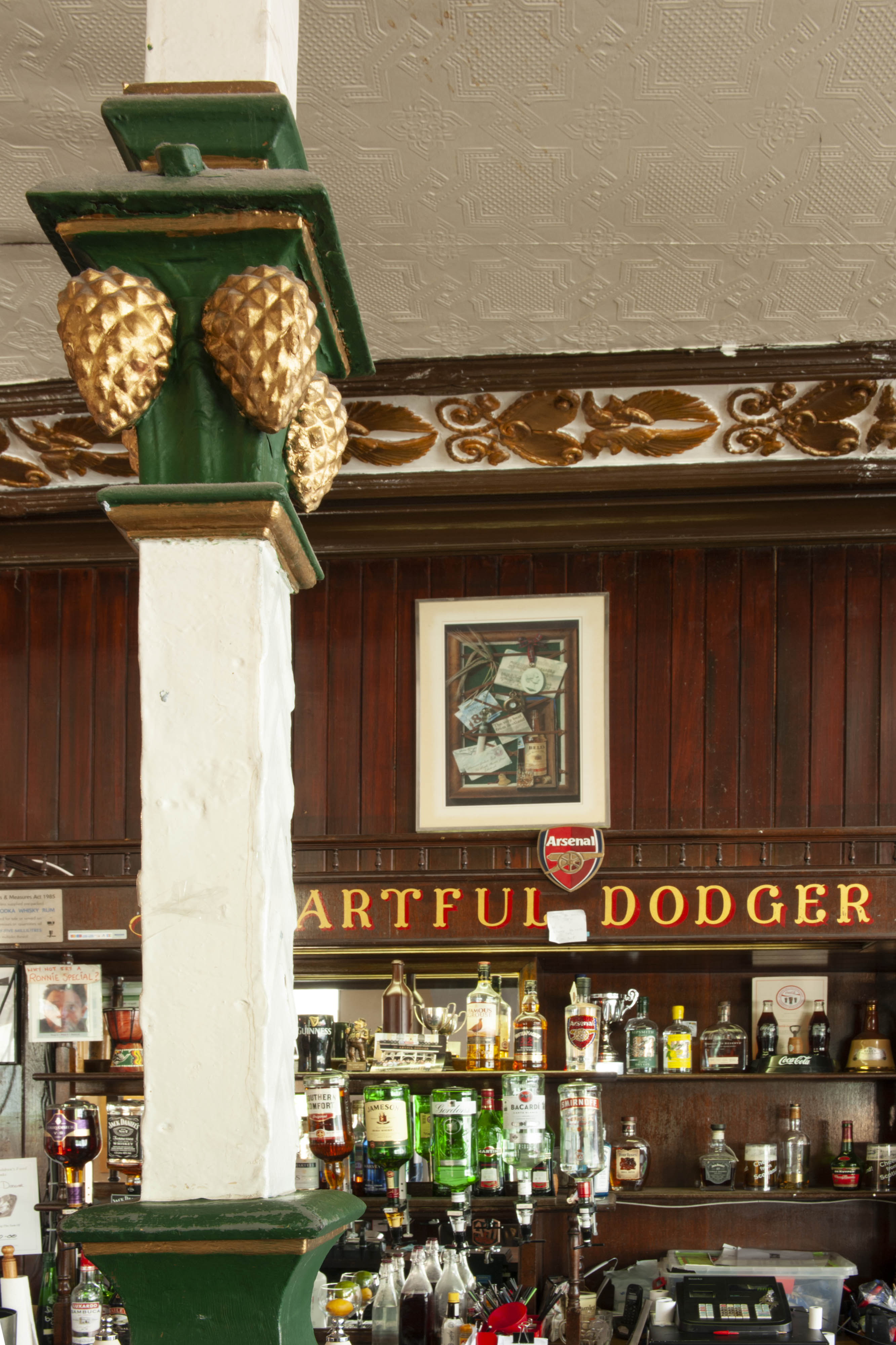
"title": "Artful Dodger, interior details in 2019",
"author": {
"id": 27,
"username": "DerekKendall"
},
"feature": {
"id": 1340,
"type": "Feature",
"geometry": {
"type": "MultiPolygon",
"coordinates": [
[
[
[
-0.070218201553316,
51.51043094496562
],
[
-0.070222558344686,
51.51044247916505
],
[
-0.070109328735508,
51.510468828661644
],
[
-0.070060850905555,
51.51038509713018
],
[
-0.070073091733693,
51.510382337633246
],
[
-0.070050463039811,
51.51034325297067
],
[
-0.070066633176381,
51.51033960767238
],
[
-0.070054353255101,
51.510318397568625
],
[
-0.070157621726522,
51.510295117279824
],
[
-0.070179031681174,
51.51033209678496
],
[
-0.070158959927667,
51.51033794396246
],
[
-0.07017205837987,
51.510360032186526
],
[
-0.070184201425816,
51.510378368893306
],
[
-0.070218201553316,
51.51043094496562
]
]
]
]
},
"properties": {
"b_number": "47",
"b_name": "The Artful Dodger (formerly the Crown and Seven Stars)",
"street": "Royal Mint Street",
"address": "The Artful Dodger (formerly the Crown and Seven Stars) public house, 47 Royal Mint Street",
"feature_type": "WHITECHAPEL_BUILDING",
"count": 18,
"search_str": "The Artful Dodger (formerly the Crown and Seven Stars)"
},
"tags": []
},
"file": "https://surveyoflondon.org/media/uploads/features/1340/SoL%20Whitechapel%20102753.jpg",
"description": "",
"copyright": true,
"created": "2019-05-02"
},
{
"id": 1155,
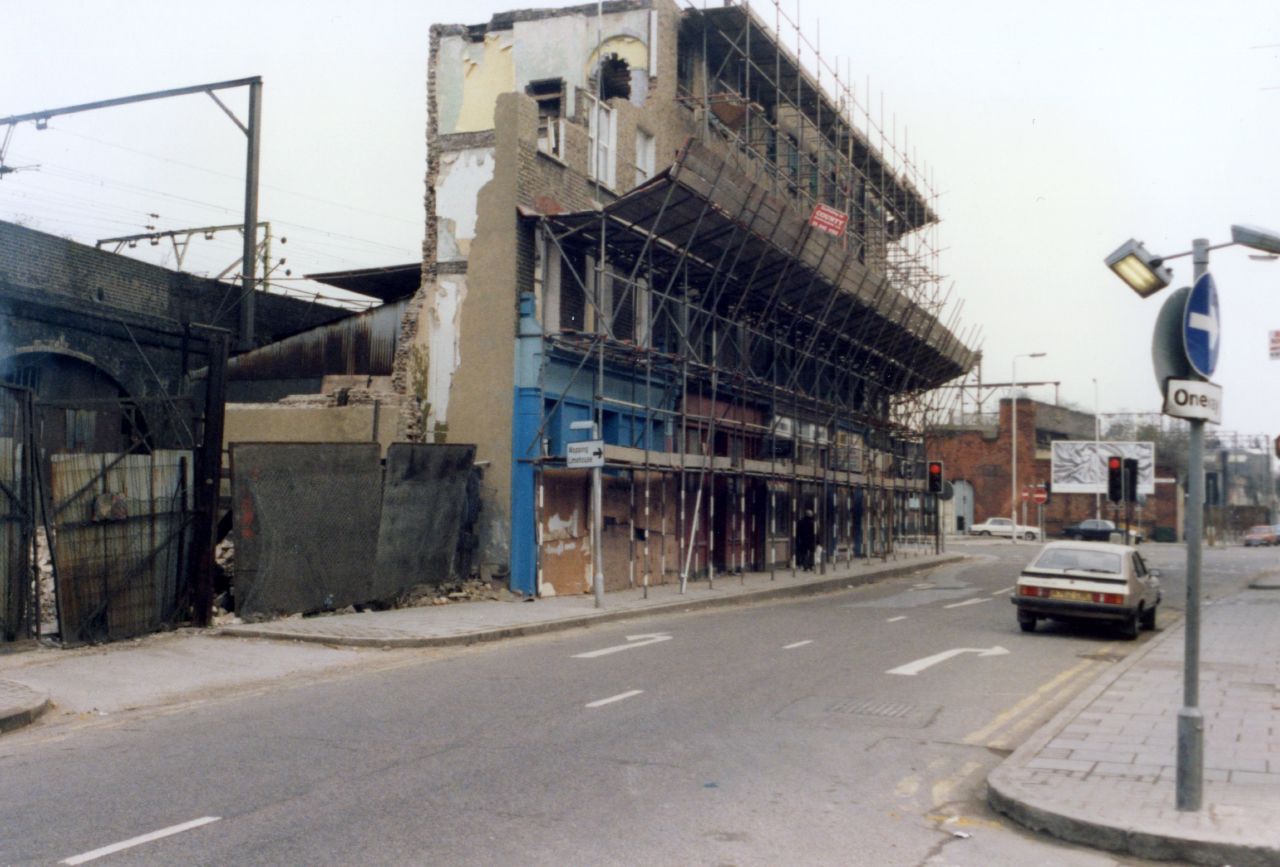
"title": "Demolition for DLR in Royal Mint Street, mid 1980s",
"author": {
"id": 153,
"username": "danny"
},
"feature": {
"id": 1356,
"type": "Feature",
"geometry": {
"type": "MultiPolygon",
"coordinates": [
[
[
[
-0.068858573135575,
51.51054500766111
],
[
-0.068911333158757,
51.51068540904317
],
[
-0.06868410041276,
51.510704922264615
],
[
-0.068650975113834,
51.51069507453173
],
[
-0.068604119477972,
51.510588218458984
],
[
-0.068858573135575,
51.51054500766111
]
]
]
]
},
"properties": {
"b_number": "66",
"b_name": "",
"street": "Royal Mint Street",
"address": "66 Royal Mint Street",
"feature_type": "WHITECHAPEL_BUILDING",
"count": 7,
"search_str": "66 Royal Mint Street"
},
"tags": []
},
"file": "https://surveyoflondon.org/media/uploads/features/1356/Royal%20MInt%20Street%20demolition%201980s.jpg",
"description": "This photo shows the demolition of former shops and houses along the northern edge of Royal Mint Street towards that street's junction with Leman Street, approx mid 1980s. Prior to the vacation of these premises, at least until the 1970s, there had been a café - named Andrew's - here, a Maltese café, too, and a dry cleaners. ",
"copyright": false,
"created": "2018-03-04"
},
{
"id": 940,
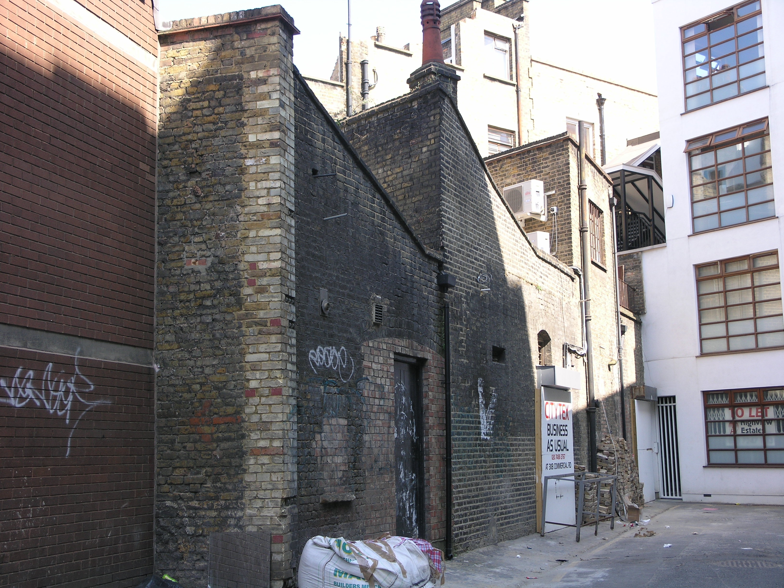
"title": "Buckle Street",
"author": {
"id": 201,
"username": "stephen"
},
"feature": {
"id": 1049,
"type": "Feature",
"geometry": {
"type": "MultiPolygon",
"coordinates": [
[
[
[
-0.069799366606084,
51.51480886354107
],
[
-0.069632104158215,
51.51480622201106
],
[
-0.069633882810961,
51.51476108422261
],
[
-0.069803307187266,
51.51472759199756
],
[
-0.069799366606084,
51.51480886354107
]
]
]
]
},
"properties": {
"b_number": "30 and 30a",
"b_name": "30 and 30a Commercial Road",
"street": "Commercial Road",
"address": "30 and 30a Commercial Road",
"feature_type": "WHITECHAPEL_BUILDING",
"count": 2,
"search_str": "30 and 30a Commercial Road"
},
"tags": []
},
"file": "https://surveyoflondon.org/media/uploads/features/1448/P4153618.jpg",
"description": "The rear of Victorian industrial premises in Commercial Road, seen from Buckle Street in 2007. My Great-Great Grandparents lived at 1 Buckle Street in 1851, having arrived as immigrants from Germany in 1848. ",
"copyright": false,
"created": "2017-10-19"
},
{
"id": 314,
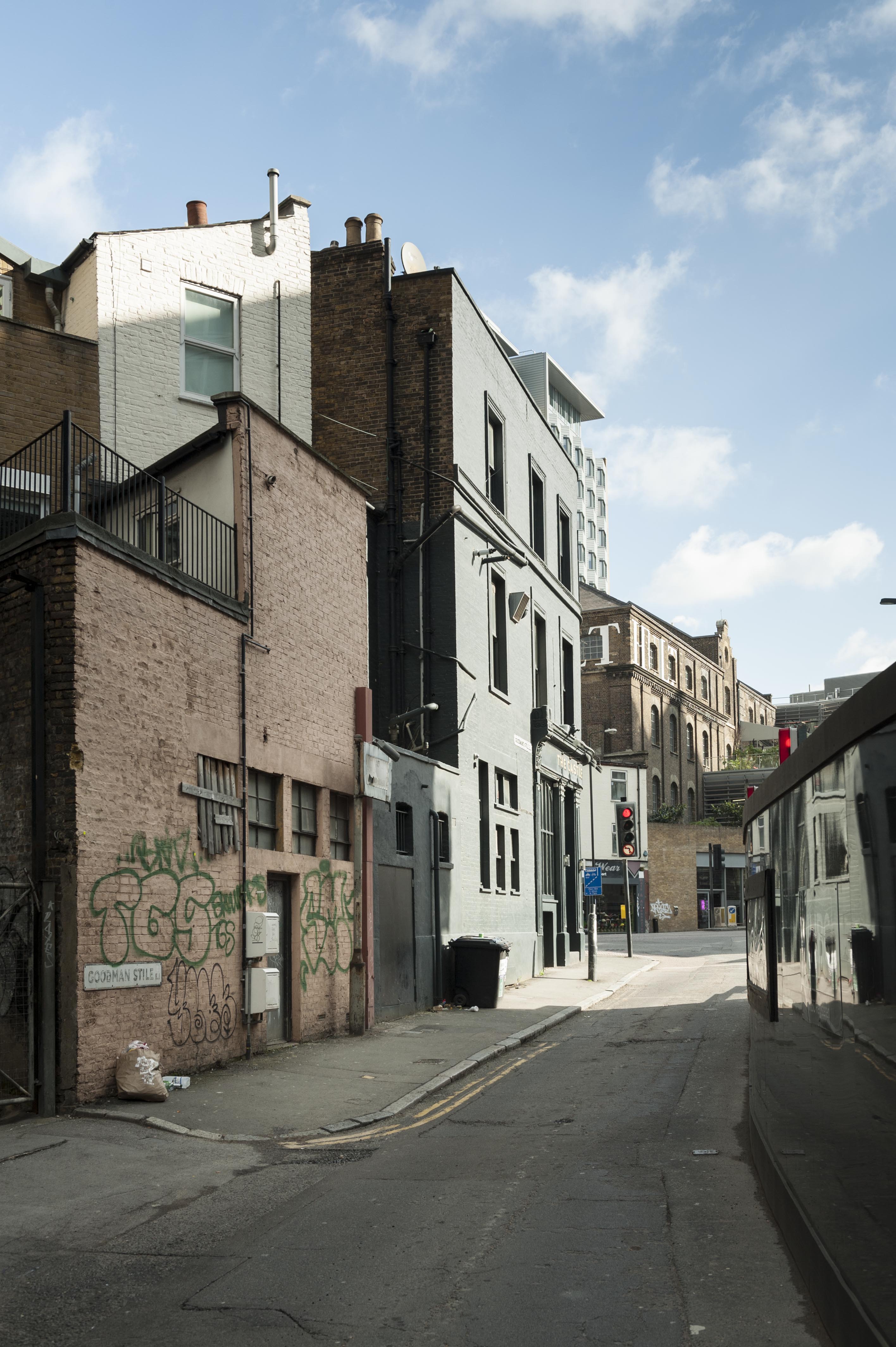
"title": "View up Goodman's Stile past the back of 38-40, 42 and 44 Commercial Road",
"author": {
"id": 27,
"username": "DerekKendall"
},
"feature": {
"id": 993,
"type": "Feature",
"geometry": {
"type": "MultiPolygon",
"coordinates": [
[
[
[
-0.068895167190577,
51.514860878437695
],
[
-0.068760655825139,
51.51485866333621
],
[
-0.068737262545948,
51.51485827808541
],
[
-0.068726200071843,
51.51485627014273
],
[
-0.068716731782714,
51.51485281045747
],
[
-0.068710495548716,
51.514848708472066
],
[
-0.068706349838489,
51.514844597444295
],
[
-0.068703953888128,
51.51484029788058
],
[
-0.068702679254102,
51.51483584290172
],
[
-0.068703191133048,
51.514830330583116
],
[
-0.068705229200405,
51.514824973810406
],
[
-0.068709081135292,
51.51481955996893
],
[
-0.068717528591467,
51.514810918054636
],
[
-0.068726726984643,
51.514804288147886
],
[
-0.068738530611514,
51.514798657495035
],
[
-0.068855121182719,
51.51475675928784
],
[
-0.068900257529749,
51.51474053892435
],
[
-0.068895167190577,
51.514860878437695
]
]
]
]
},
"properties": {
"b_number": "44",
"b_name": "The Castle, 44 Commercial Road",
"street": "Commercial Road",
"address": "The Castle, 44 Commercial Road",
"feature_type": "WHITECHAPEL_BUILDING",
"count": 3,
"search_str": "The Castle, 44 Commercial Road"
},
"tags": [
"Thomas Ennor"
]
},
"file": "https://surveyoflondon.org/media/uploads/features/993/SoL%20Whitechapel100196.jpg",
"description": "photographed by Derek Kendall, 2016",
"copyright": true,
"created": "2016-08-31"
},
{
"id": 246,
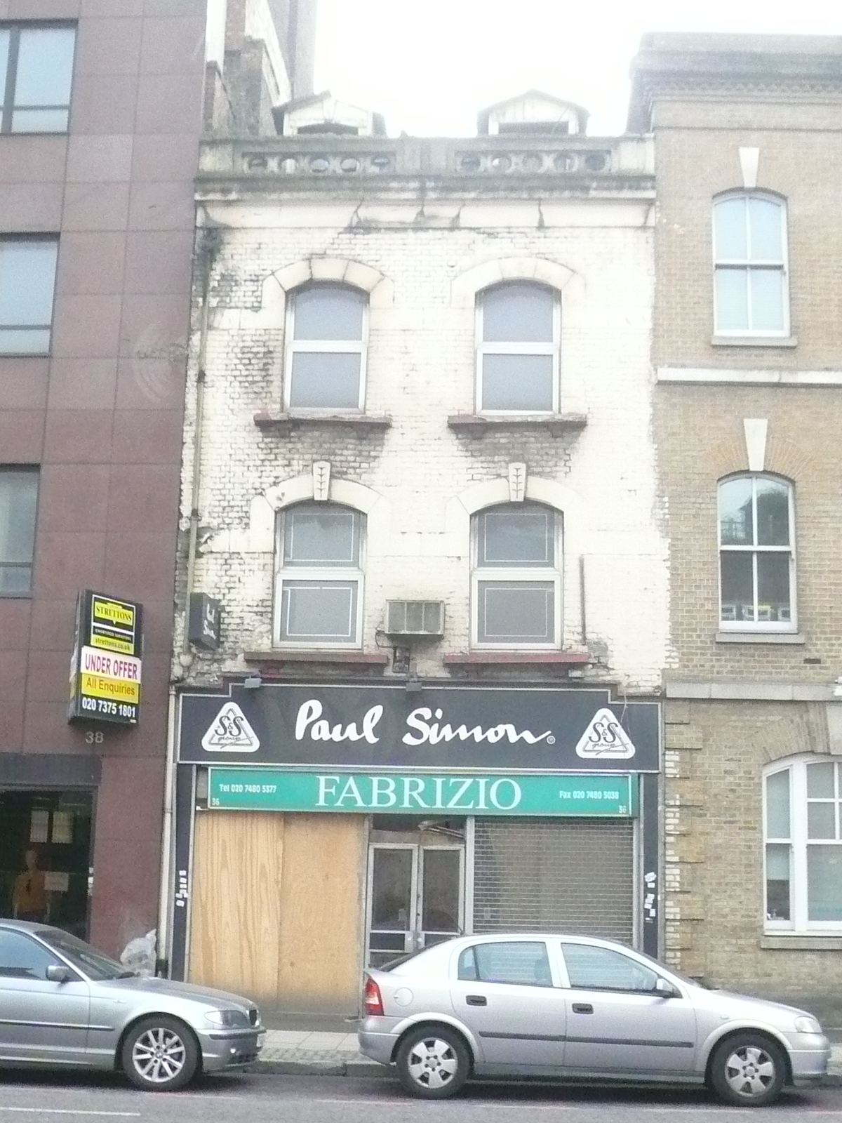
"title": "36 Commercial Road, demolished 2015",
"author": {
"id": 25,
"username": "Aileen"
},
"feature": {
"id": 990,
"type": "Feature",
"geometry": {
"type": "MultiPolygon",
"coordinates": [
[
[
[
-0.069362132148477,
51.51487917389963
],
[
-0.069281000521374,
51.51487668621795
],
[
-0.069289505883149,
51.51466961442712
],
[
-0.069341398264972,
51.514647378296736
],
[
-0.069339585806488,
51.51467888512518
],
[
-0.069372878473079,
51.514688139311076
],
[
-0.069362132148477,
51.51487917389963
]
]
]
]
},
"properties": {
"b_number": "36",
"b_name": "36 Commercial Road",
"street": "Commercial Road",
"address": "36 Commercial Road",
"feature_type": "WHITECHAPEL_BUILDING",
"count": 2,
"search_str": "36 Commercial Road"
},
"tags": []
},
"file": "https://surveyoflondon.org/media/uploads/features/990/P1150808.JPG",
"description": "Victorian shop-house, built soon after road widening in Commercial Road in the 1870s, demolished for redevelopment in 2015",
"copyright": false,
"created": "2016-08-15"
},
{
"id": 1650,
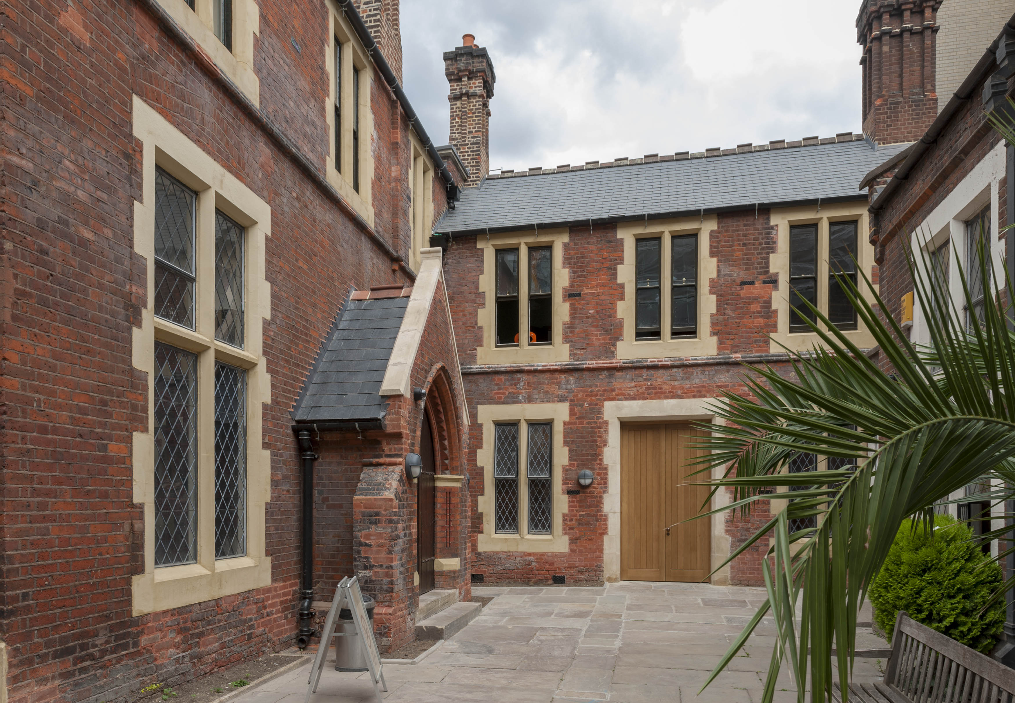
"title": "Toynbee Hall, entrances from the west in 2018",
"author": {
"id": 27,
"username": "DerekKendall"
},
"feature": {
"id": 379,
"type": "Feature",
"geometry": {
"type": "MultiPolygon",
"coordinates": [
[
[
[
-0.072397829403071,
51.51669736298538
],
[
-0.072397829775652,
51.51669737370259
],
[
-0.072432640663459,
51.51673265247548
],
[
-0.072358283763003,
51.51675511998594
],
[
-0.072392345089312,
51.51679900052574
],
[
-0.072279169019407,
51.51681120129116
],
[
-0.072260832658385,
51.516791637982884
],
[
-0.07220017871295,
51.51681376750612
],
[
-0.07215893969634,
51.516769768915125
],
[
-0.072119241451839,
51.51677664825232
],
[
-0.071934651446851,
51.5165549241745
],
[
-0.071985260710591,
51.51653955484268
],
[
-0.072028895096668,
51.51652682786407
],
[
-0.072014842692988,
51.516508073517755
],
[
-0.072098254454469,
51.51648373796318
],
[
-0.072052675375786,
51.51643004607134
],
[
-0.072144607110911,
51.516401673048335
],
[
-0.072314904588685,
51.51634652520951
],
[
-0.072358068161013,
51.516398410711595
],
[
-0.072522445522427,
51.51634491903885
],
[
-0.072499976579174,
51.51631804154615
],
[
-0.072499959446261,
51.51631804712155
],
[
-0.072499965346341,
51.51631803831239
],
[
-0.072579515746657,
51.51629075531372
],
[
-0.072667639265209,
51.516403182536045
],
[
-0.072427304765486,
51.5164813923298
],
[
-0.072385415219988,
51.51643128370629
],
[
-0.072387162242999,
51.516433383744854
],
[
-0.072107982084202,
51.516523791132904
],
[
-0.072157544605501,
51.51658336890495
],
[
-0.072272128891629,
51.51654626302576
],
[
-0.072397829403071,
51.51669736298538
]
]
]
]
},
"properties": {
"b_number": "28 ",
"b_name": "Toynbee Hall",
"street": "Commercial Street",
"address": "Toynbee Hall, 28 Commercial Street",
"feature_type": "WHITECHAPEL_BUILDING",
"count": 21,
"search_str": "Toynbee Hall"
},
"tags": []
},
"file": "https://surveyoflondon.org/media/uploads/features/379/SoL%20Whitechapel%20102155.jpg",
"description": "",
"copyright": true,
"created": "2019-09-03"
},
{
"id": 1610,
"title": "Sugar House, Hooper Street elevation in 2019 showing the remnant of the earlier CWS building at the corner",
"author": {
"id": 27,
"username": "DerekKendall"
},
"feature": {
"id": 1264,
"type": "Feature",
"geometry": {
"type": "MultiPolygon",
"coordinates": [
[
[
[
-0.069331963951854,
51.51229594729769
],
[
-0.069137875560046,
51.512351392206085
],
[
-0.068952695054468,
51.51210160696183
],
[
-0.06877706008966,
51.51212449662561
],
[
-0.068766393531184,
51.5121102580591
],
[
-0.068775926288607,
51.51210689932468
],
[
-0.068782151200721,
51.51209293893689
],
[
-0.068742154431936,
51.5120172780914
],
[
-0.068763790231903,
51.51199419623458
],
[
-0.069027145444056,
51.51193993762725
],
[
-0.06905682792721,
51.51194862974888
],
[
-0.069331963951854,
51.51229594729769
]
]
]
]
},
"properties": {
"b_number": "99",
"b_name": "Sugar House, 99 Leman Street",
"street": "Leman Street",
"address": "Sugar House, 99 Leman Street",
"feature_type": "WHITECHAPEL_BUILDING",
"count": 21,
"search_str": "Sugar House, 99 Leman Street"
},
"tags": [
"Co-operative Wholesale Society"
]
},
"file": "https://surveyoflondon.org/media/uploads/features/1264/SoL%20Whitechapel%20102842.jpg",
"description": "",
"copyright": true,
"created": "2019-05-16"
},
{
"id": 1611,
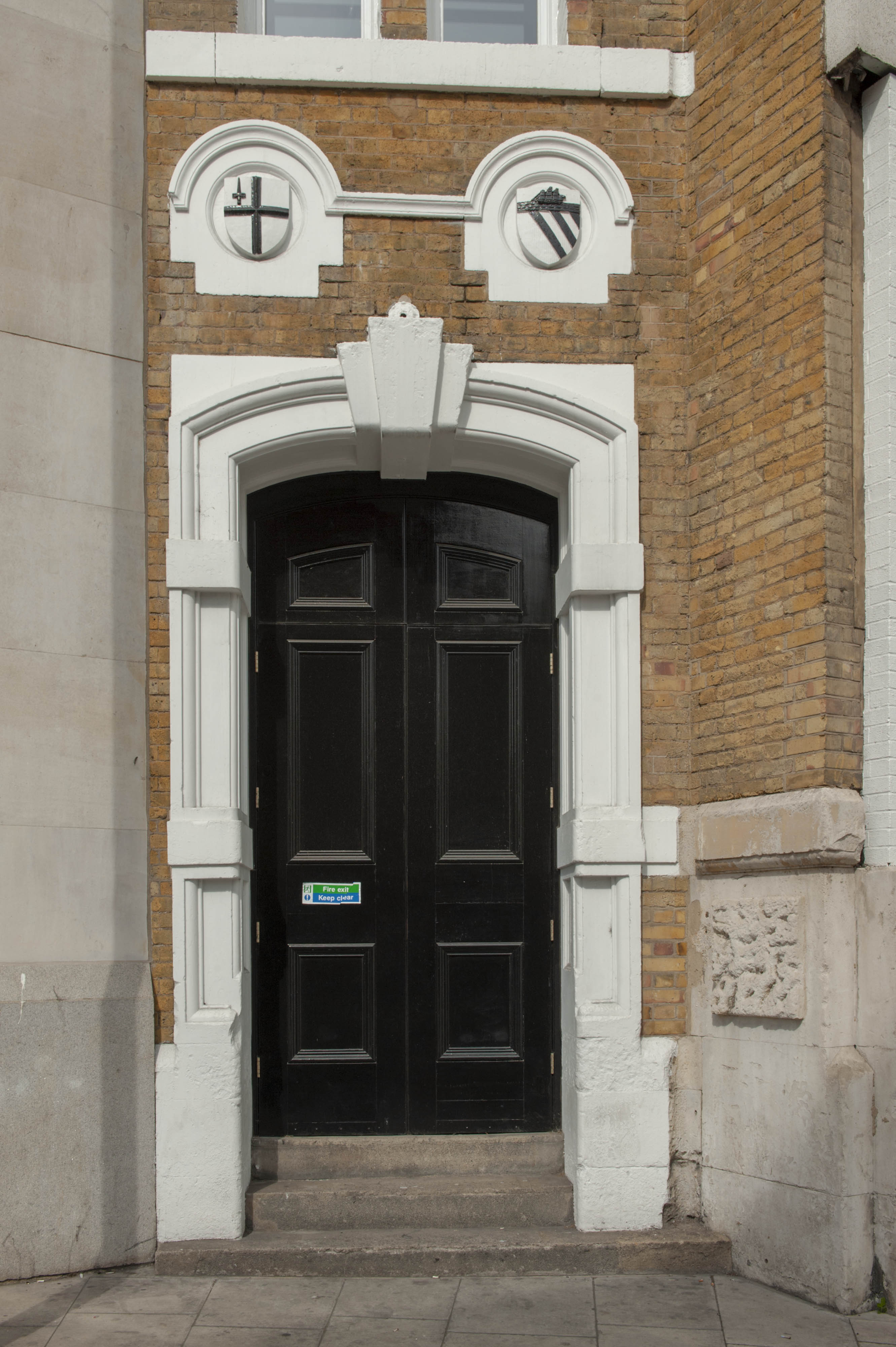
"title": "The doorway of the CWS building of 1881 on Hooper Street",
"author": {
"id": 27,
"username": "DerekKendall"
},
"feature": {
"id": 1264,
"type": "Feature",
"geometry": {
"type": "MultiPolygon",
"coordinates": [
[
[
[
-0.069331963951854,
51.51229594729769
],
[
-0.069137875560046,
51.512351392206085
],
[
-0.068952695054468,
51.51210160696183
],
[
-0.06877706008966,
51.51212449662561
],
[
-0.068766393531184,
51.5121102580591
],
[
-0.068775926288607,
51.51210689932468
],
[
-0.068782151200721,
51.51209293893689
],
[
-0.068742154431936,
51.5120172780914
],
[
-0.068763790231903,
51.51199419623458
],
[
-0.069027145444056,
51.51193993762725
],
[
-0.06905682792721,
51.51194862974888
],
[
-0.069331963951854,
51.51229594729769
]
]
]
]
},
"properties": {
"b_number": "99",
"b_name": "Sugar House, 99 Leman Street",
"street": "Leman Street",
"address": "Sugar House, 99 Leman Street",
"feature_type": "WHITECHAPEL_BUILDING",
"count": 21,
"search_str": "Sugar House, 99 Leman Street"
},
"tags": [
"Co-operative Wholesale Society"
]
},
"file": "https://surveyoflondon.org/media/uploads/features/1264/SoL%20Whitechapel%20102845.jpg",
"description": "",
"copyright": true,
"created": "2019-05-16"
},
{
"id": 1651,
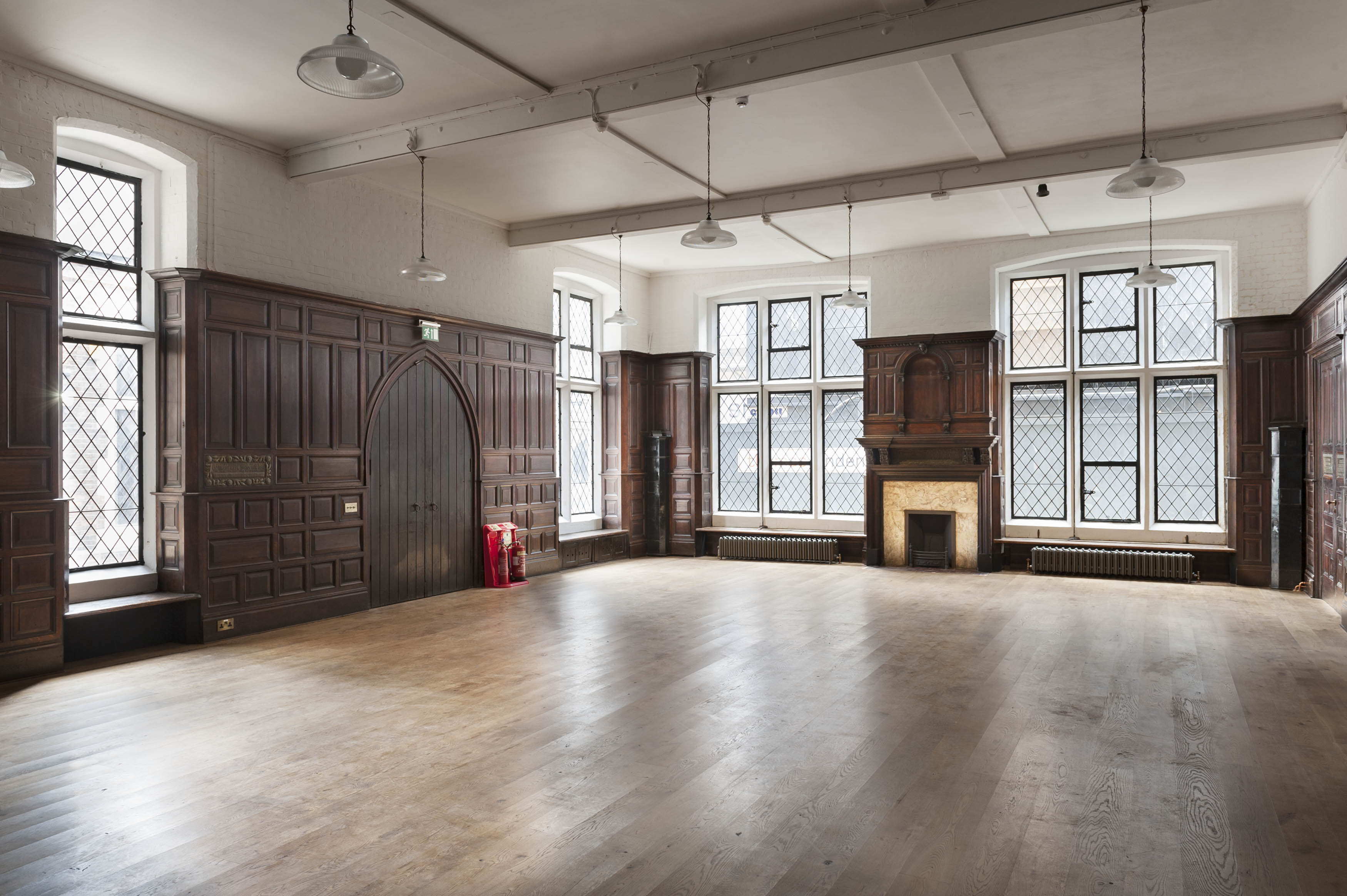
"title": "Toynbee Hall, lecture room in 2018",
"author": {
"id": 27,
"username": "DerekKendall"
},
"feature": {
"id": 379,
"type": "Feature",
"geometry": {
"type": "MultiPolygon",
"coordinates": [
[
[
[
-0.072397829403071,
51.51669736298538
],
[
-0.072397829775652,
51.51669737370259
],
[
-0.072432640663459,
51.51673265247548
],
[
-0.072358283763003,
51.51675511998594
],
[
-0.072392345089312,
51.51679900052574
],
[
-0.072279169019407,
51.51681120129116
],
[
-0.072260832658385,
51.516791637982884
],
[
-0.07220017871295,
51.51681376750612
],
[
-0.07215893969634,
51.516769768915125
],
[
-0.072119241451839,
51.51677664825232
],
[
-0.071934651446851,
51.5165549241745
],
[
-0.071985260710591,
51.51653955484268
],
[
-0.072028895096668,
51.51652682786407
],
[
-0.072014842692988,
51.516508073517755
],
[
-0.072098254454469,
51.51648373796318
],
[
-0.072052675375786,
51.51643004607134
],
[
-0.072144607110911,
51.516401673048335
],
[
-0.072314904588685,
51.51634652520951
],
[
-0.072358068161013,
51.516398410711595
],
[
-0.072522445522427,
51.51634491903885
],
[
-0.072499976579174,
51.51631804154615
],
[
-0.072499959446261,
51.51631804712155
],
[
-0.072499965346341,
51.51631803831239
],
[
-0.072579515746657,
51.51629075531372
],
[
-0.072667639265209,
51.516403182536045
],
[
-0.072427304765486,
51.5164813923298
],
[
-0.072385415219988,
51.51643128370629
],
[
-0.072387162242999,
51.516433383744854
],
[
-0.072107982084202,
51.516523791132904
],
[
-0.072157544605501,
51.51658336890495
],
[
-0.072272128891629,
51.51654626302576
],
[
-0.072397829403071,
51.51669736298538
]
]
]
]
},
"properties": {
"b_number": "28 ",
"b_name": "Toynbee Hall",
"street": "Commercial Street",
"address": "Toynbee Hall, 28 Commercial Street",
"feature_type": "WHITECHAPEL_BUILDING",
"count": 21,
"search_str": "Toynbee Hall"
},
"tags": []
},
"file": "https://surveyoflondon.org/media/uploads/features/379/SoL%20Whitechapel%20102160.jpg",
"description": "",
"copyright": true,
"created": "2019-09-03"
},
{
"id": 778,
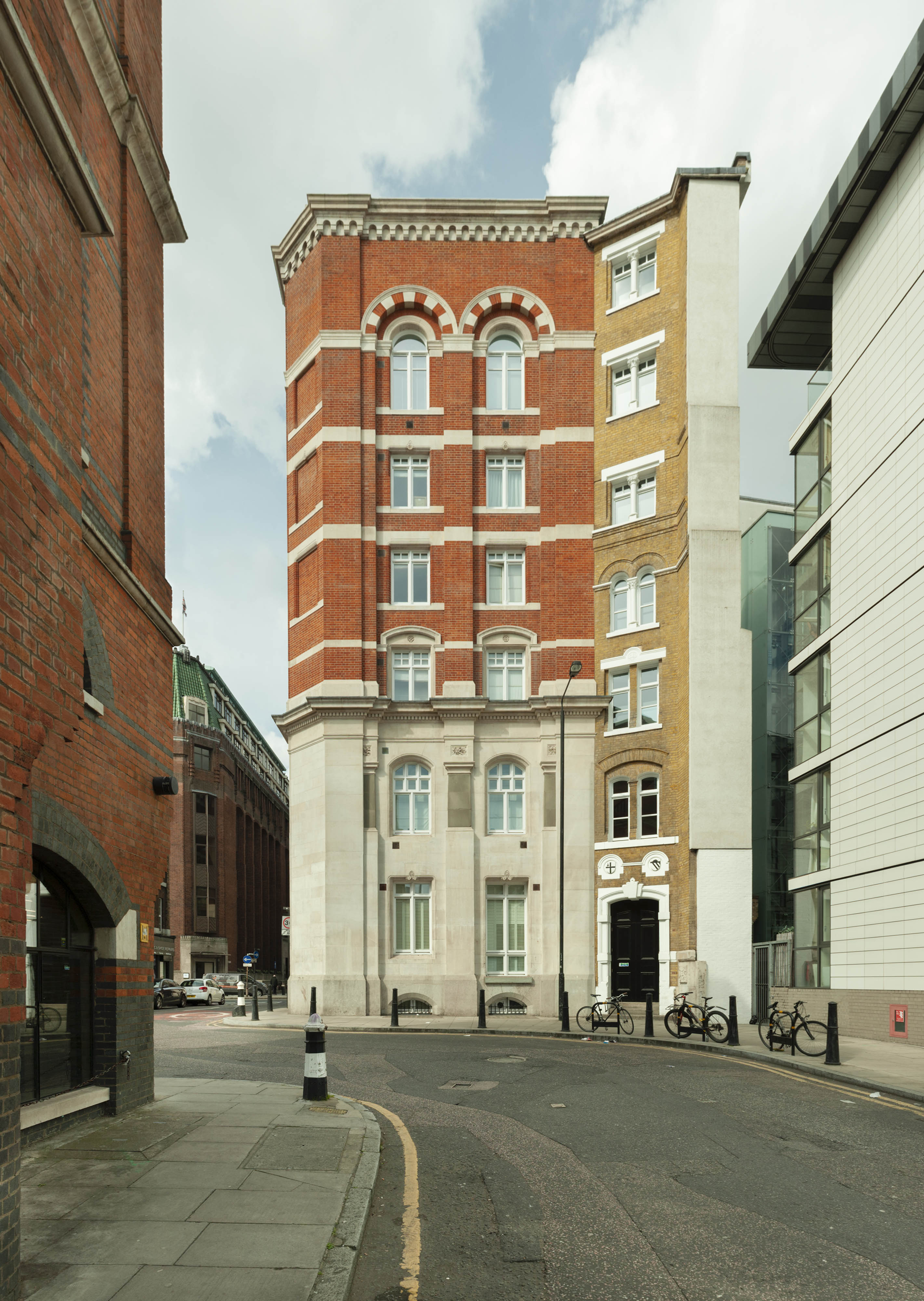
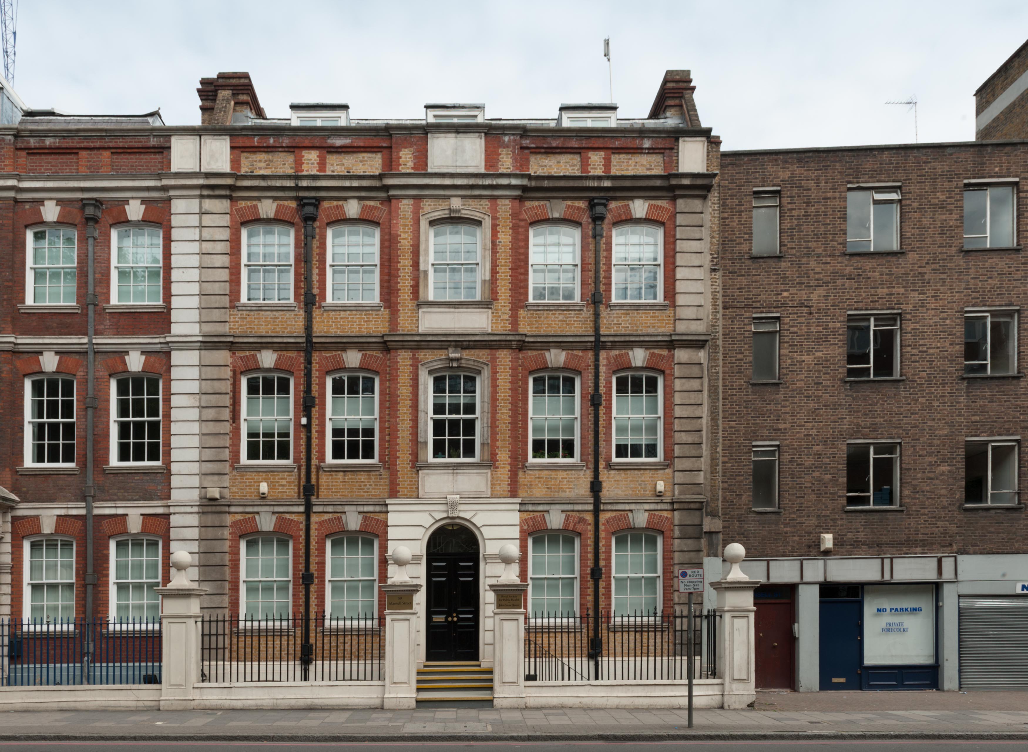
"title": "Elevation to Mansell Street, August 2017",
"author": {
"id": 27,
"username": "DerekKendall"
},
"feature": {
"id": 45,
"type": "Feature",
"geometry": {
"type": "MultiPolygon",
"coordinates": [
[
[
[
-0.07288530915275,
51.512691065335744
],
[
-0.072877677432715,
51.51264110408871
],
[
-0.072908498656505,
51.512639606471225
],
[
-0.072902552737033,
51.51258301425536
],
[
-0.073049810679383,
51.512574442709884
],
[
-0.073069277085111,
51.51268422010561
],
[
-0.07288530915275,
51.512691065335744
]
]
]
]
},
"properties": {
"b_number": "59",
"b_name": "John Snow House, 59 Mansell Street",
"street": "Mansell Street",
"address": "John Snow House, 59 Mansell Street",
"feature_type": "WHITECHAPEL_BUILDING",
"count": 4,
"search_str": "John Snow House, 59 Mansell Street"
},
"tags": []
},
"file": "https://surveyoflondon.org/media/uploads/features/45/SoL%20Whitechapel%20101503.jpg",
"description": "",
"copyright": true,
"created": "2017-09-12"
},
{
"id": 779,
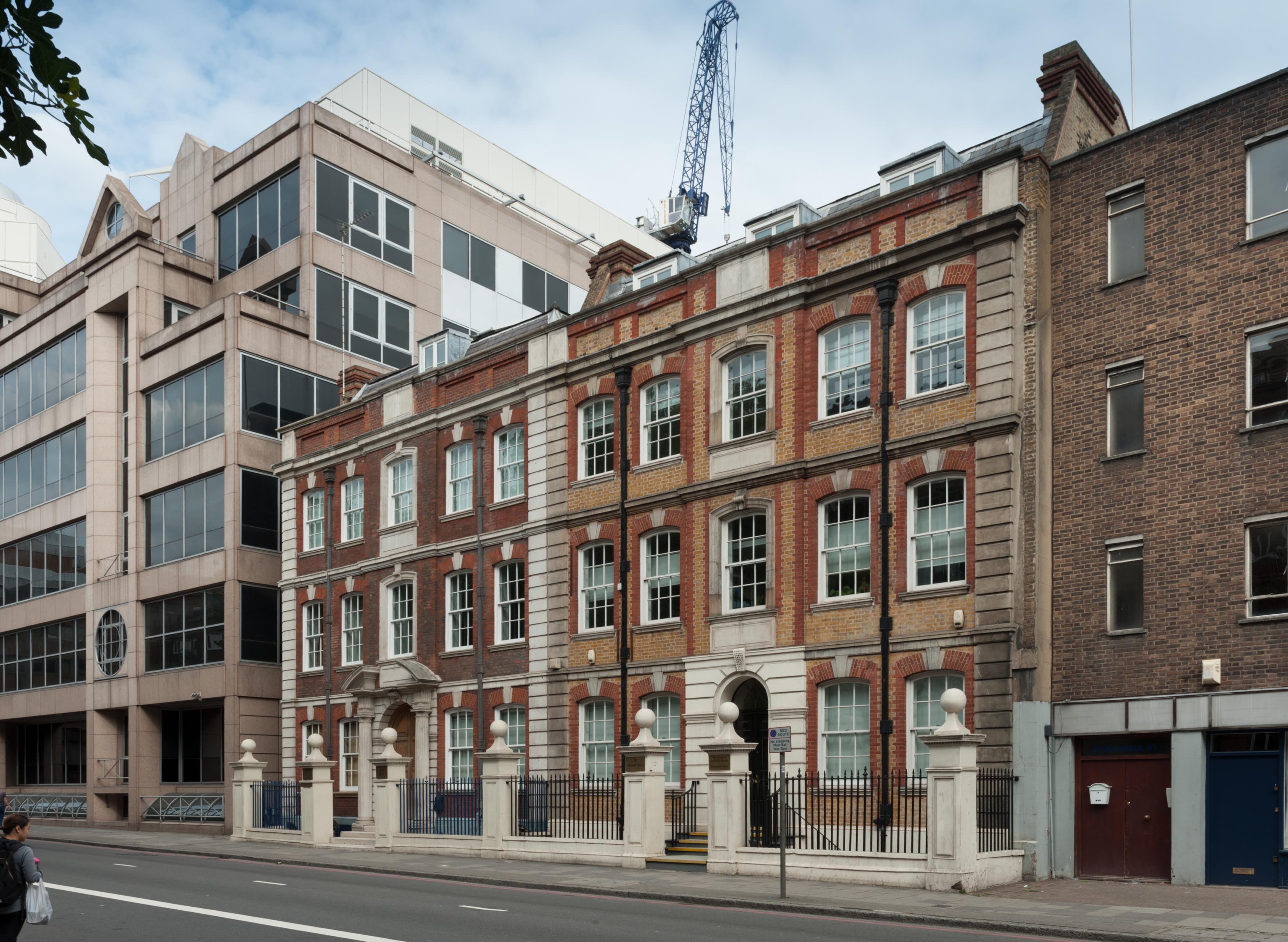
"title": "Looking north east up Mansell Street",
"author": {
"id": 27,
"username": "DerekKendall"
},
"feature": {
"id": 45,
"type": "Feature",
"geometry": {
"type": "MultiPolygon",
"coordinates": [
[
[
[
-0.07288530915275,
51.512691065335744
],
[
-0.072877677432715,
51.51264110408871
],
[
-0.072908498656505,
51.512639606471225
],
[
-0.072902552737033,
51.51258301425536
],
[
-0.073049810679383,
51.512574442709884
],
[
-0.073069277085111,
51.51268422010561
],
[
-0.07288530915275,
51.512691065335744
]
]
]
]
},
"properties": {
"b_number": "59",
"b_name": "John Snow House, 59 Mansell Street",
"street": "Mansell Street",
"address": "John Snow House, 59 Mansell Street",
"feature_type": "WHITECHAPEL_BUILDING",
"count": 4,
"search_str": "John Snow House, 59 Mansell Street"
},
"tags": []
},
"file": "https://surveyoflondon.org/media/uploads/features/45/SoL%20Whitechapel%20101504.jpg",
"description": "",
"copyright": true,
"created": "2017-09-12"
},
{
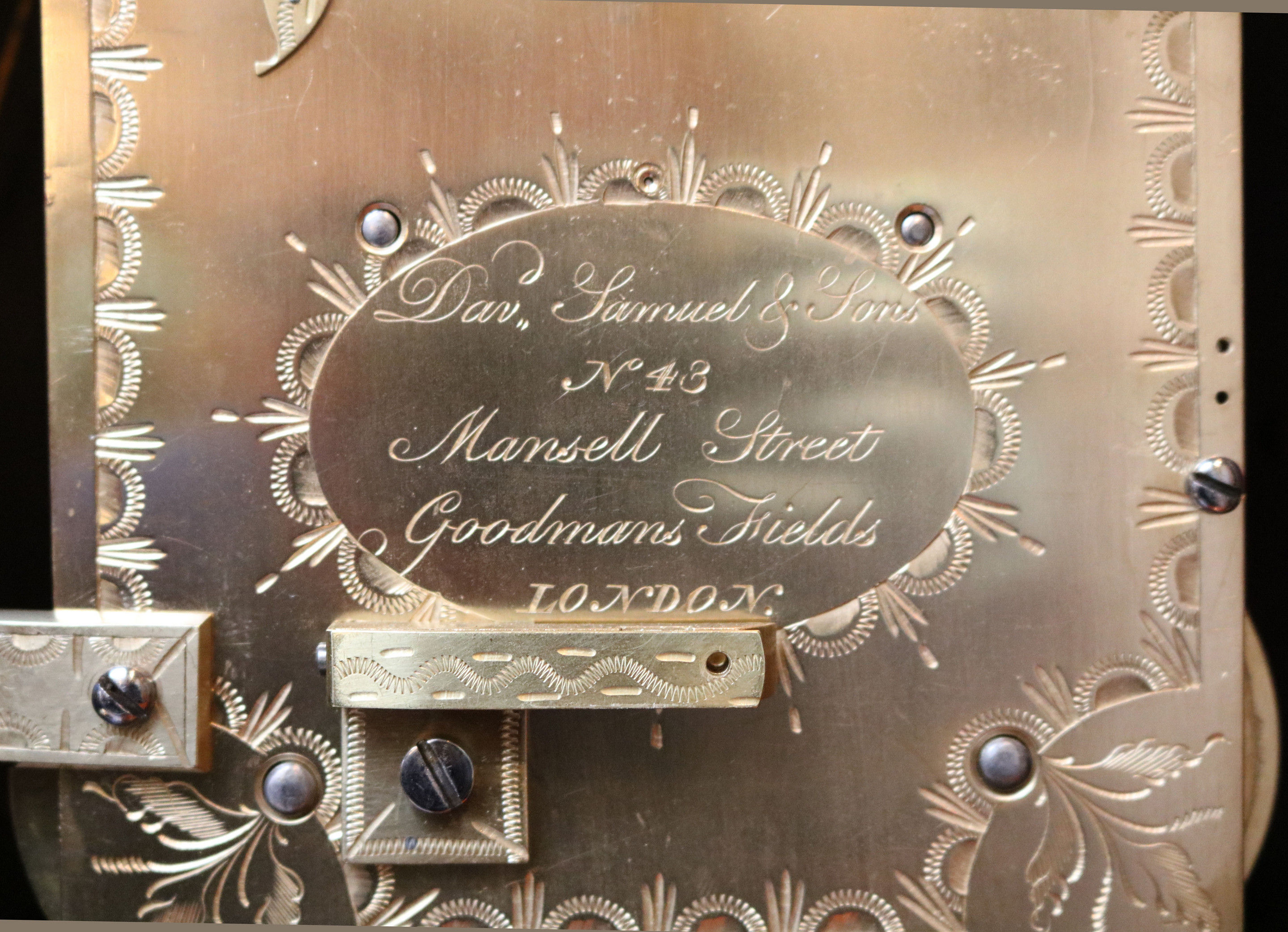
"id": 1671,
"title": "Late 18th Century English Bracket Clock sold by David Samuel, 43 Mansell Street",
"author": {
"id": 2,
"username": "surveyoflondon"
},
"feature": {
"id": 45,
"type": "Feature",
"geometry": {
"type": "MultiPolygon",
"coordinates": [
[
[
[
-0.07288530915275,
51.512691065335744
],
[
-0.072877677432715,
51.51264110408871
],
[
-0.072908498656505,
51.512639606471225
],
[
-0.072902552737033,
51.51258301425536
],
[
-0.073049810679383,
51.512574442709884
],
[
-0.073069277085111,
51.51268422010561
],
[
-0.07288530915275,
51.512691065335744
]
]
]
]
},
"properties": {
"b_number": "59",
"b_name": "John Snow House, 59 Mansell Street",
"street": "Mansell Street",
"address": "John Snow House, 59 Mansell Street",
"feature_type": "WHITECHAPEL_BUILDING",
"count": 4,
"search_str": "John Snow House, 59 Mansell Street"
},
"tags": []
},
"file": "https://surveyoflondon.org/media/uploads/features/45/worboysantiques-1047257.jpg",
"description": "Clock dated c.1780, lists original retailer as David Samuel on backplate. Sold more recently by Warboys Antiques and Clocks: https://worboysantiques.co.uk/late-18th-century-english-bracket-clock",
"copyright": false,
"created": "2020-02-11"
},
{
"id": 433,
"title": "Rear of 52-58 Commercial Road, c.2002",
"author": {
"id": 68,
"username": "dcartwright"
},
"feature": {
"id": 996,
"type": "Feature",
"geometry": {
"type": "MultiPolygon",
"coordinates": [
[
[
[
-0.067861838065609,
51.51475347064
],
[
-0.06786453313317,
51.51478234806407
],
[
-0.067585581780586,
51.51476507543967
],
[
-0.067588509051496,
51.51474607517389
],
[
-0.067420739755857,
51.51473600887351
],
[
-0.067418669259981,
51.51475690079008
],
[
-0.067243977243653,
51.51474606363514
],
[
-0.067247831877495,
51.514720711350456
],
[
-0.067148423655411,
51.514715895823834
],
[
-0.067164508046975,
51.51459719968502
],
[
-0.067169468365816,
51.51455902742509
],
[
-0.067267424237092,
51.514565373164125
],
[
-0.067284203490366,
51.51446875999768
],
[
-0.067487888007954,
51.514480206746164
],
[
-0.067487831570817,
51.51448159696675
],
[
-0.067481262401076,
51.514514394275835
],
[
-0.067633797500801,
51.51452521712492
],
[
-0.067640049851402,
51.51449178362331
],
[
-0.067640050183764,
51.51449178093463
],
[
-0.067838967383754,
51.51450488151706
],
[
-0.067828248265366,
51.51461731190957
],
[
-0.067887142834602,
51.51462052176631
],
[
-0.06789972538097,
51.51475577751923
],
[
-0.067861838065609,
51.51475347064
]
]
]
]
},
"properties": {
"b_number": "52 to 58",
"b_name": "52 to 58 Commercial Road",
"street": "Commercial Road",
"address": "52 to 58 Commercial Road",
"feature_type": "WHITECHAPEL_BUILDING",
"count": 10,
"search_str": "52 to 58 Commercial Road"
},
"tags": []
},
"file": "https://surveyoflondon.org/media/uploads/features/996/54CommercialRoadRear.jpg",
"description": "",
"copyright": false,
"created": "2016-10-23"
},
{
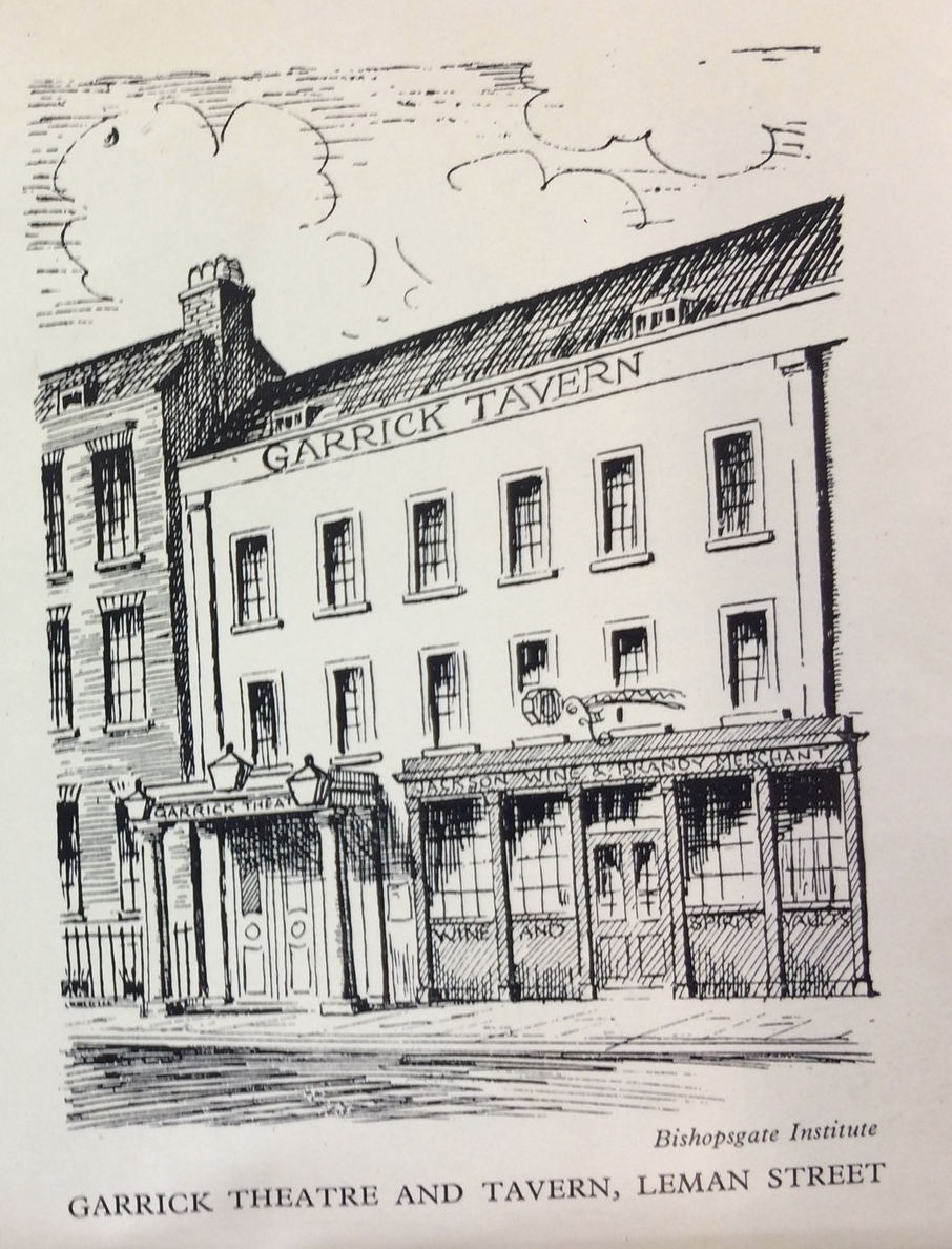
"id": 1670,
"title": "The Garrick Tavern, undated sketch",
"author": {
"id": 2,
"username": "surveyoflondon"
},
"feature": {
"id": 94,
"type": "Feature",
"geometry": {
"type": "MultiPolygon",
"coordinates": [
[
[
[
-0.070151719826271,
51.512989193779966
],
[
-0.070290186868449,
51.51294878984353
],
[
-0.070349984351699,
51.513025727473
],
[
-0.070212927713261,
51.5130643426255
],
[
-0.070151719826271,
51.512989193779966
]
]
]
]
},
"properties": {
"b_number": "70",
"b_name": "",
"street": "Leman Street",
"address": "The Oliver Conquest, 70 Leman Street",
"feature_type": "WHITECHAPEL_BUILDING",
"count": 5,
"search_str": "The Oliver Conquest, 70 Leman Street"
},
"tags": []
},
"file": "https://surveyoflondon.org/media/uploads/features/94/Screen%20Shot%202020-02-07%20at%2016.11.30.png",
"description": "Image reproduced from A. E. Wilson, 'East End Entertainment', 1954",
"copyright": true,
"created": "2020-02-07"
}
]
}