HTTP 200 OK
Allow: GET, HEAD, OPTIONS
Content-Type: application/json
Vary: Accept
{
"count": 1747,
"next": "https://surveyoflondon.org/api/v1/images/?format=api&page=68",
"previous": "https://surveyoflondon.org/api/v1/images/?format=api&page=66",
"results": [
{
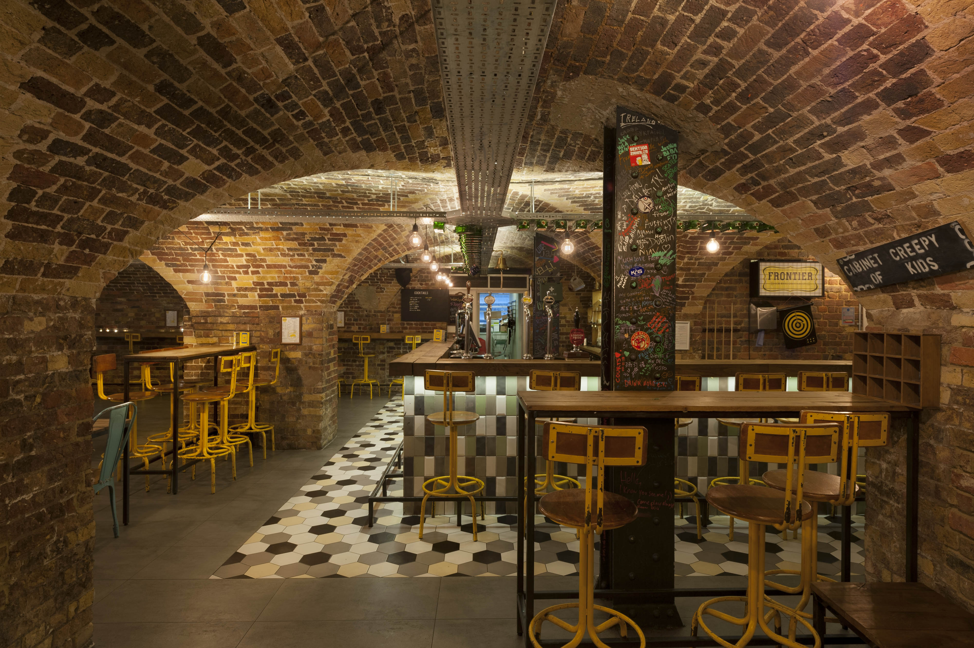
"id": 1534,
"title": "Wombat's, basement bar with vaults from the 1830s, in 2019",
"author": {
"id": 27,
"username": "DerekKendall"
},
"feature": {
"id": 1385,
"type": "Feature",
"geometry": {
"type": "MultiPolygon",
"coordinates": [
[
[
[
-0.067575803709333,
51.51021492278667
],
[
-0.067783647338447,
51.51017527172947
],
[
-0.067828706900756,
51.510167293395675
],
[
-0.067884358000762,
51.51028332470727
],
[
-0.068021222270461,
51.51026117174896
],
[
-0.068027105232624,
51.51027869995762
],
[
-0.068059007104689,
51.51027341168682
],
[
-0.068045803249401,
51.51025517119752
],
[
-0.068185711037114,
51.51022956959143
],
[
-0.068302205657116,
51.51049311218949
],
[
-0.068154065018083,
51.51051508999573
],
[
-0.068142111677326,
51.51048931210634
],
[
-0.068158013519995,
51.51048782991857
],
[
-0.0680993992664,
51.51035372697415
],
[
-0.068063773094401,
51.51035895389879
],
[
-0.068055396596396,
51.510336723241444
],
[
-0.067963562571312,
51.510349163498944
],
[
-0.067961653646245,
51.510339150568754
],
[
-0.067909585576321,
51.510347692789416
],
[
-0.067933270683552,
51.5104044774377
],
[
-0.067674158297256,
51.51045078856997
],
[
-0.067629160671485,
51.51036923447038
],
[
-0.067652633918951,
51.51036497018876
],
[
-0.067575803709333,
51.51021492278667
]
]
]
]
},
"properties": {
"b_number": "7",
"b_name": "",
"street": "Dock Street",
"address": "Wombat's City Hostel, 7 Dock Street",
"feature_type": "WHITECHAPEL_BUILDING",
"count": 25,
"search_str": "Wombat's City Hostel, 7 Dock Street"
},
"tags": []
},
"file": "https://surveyoflondon.org/media/uploads/features/1385/SoL%20Whitechapel%20102628.jpg",
"description": "",
"copyright": true,
"created": "2019-03-05"
},
{
"id": 1535,
"title": "Wombat's, corridor in 1860s range, view to the west in 2019",
"author": {
"id": 27,
"username": "DerekKendall"
},
"feature": {
"id": 1385,
"type": "Feature",
"geometry": {
"type": "MultiPolygon",
"coordinates": [
[
[
[
-0.067575803709333,
51.51021492278667
],
[
-0.067783647338447,
51.51017527172947
],
[
-0.067828706900756,
51.510167293395675
],
[
-0.067884358000762,
51.51028332470727
],
[
-0.068021222270461,
51.51026117174896
],
[
-0.068027105232624,
51.51027869995762
],
[
-0.068059007104689,
51.51027341168682
],
[
-0.068045803249401,
51.51025517119752
],
[
-0.068185711037114,
51.51022956959143
],
[
-0.068302205657116,
51.51049311218949
],
[
-0.068154065018083,
51.51051508999573
],
[
-0.068142111677326,
51.51048931210634
],
[
-0.068158013519995,
51.51048782991857
],
[
-0.0680993992664,
51.51035372697415
],
[
-0.068063773094401,
51.51035895389879
],
[
-0.068055396596396,
51.510336723241444
],
[
-0.067963562571312,
51.510349163498944
],
[
-0.067961653646245,
51.510339150568754
],
[
-0.067909585576321,
51.510347692789416
],
[
-0.067933270683552,
51.5104044774377
],
[
-0.067674158297256,
51.51045078856997
],
[
-0.067629160671485,
51.51036923447038
],
[
-0.067652633918951,
51.51036497018876
],
[
-0.067575803709333,
51.51021492278667
]
]
]
]
},
"properties": {
"b_number": "7",
"b_name": "",
"street": "Dock Street",
"address": "Wombat's City Hostel, 7 Dock Street",
"feature_type": "WHITECHAPEL_BUILDING",
"count": 25,
"search_str": "Wombat's City Hostel, 7 Dock Street"
},
"tags": []
},
"file": "https://surveyoflondon.org/media/uploads/features/1385/SoL%20Whitechapel%20102632.jpg",
"description": "",
"copyright": true,
"created": "2019-03-05"
},
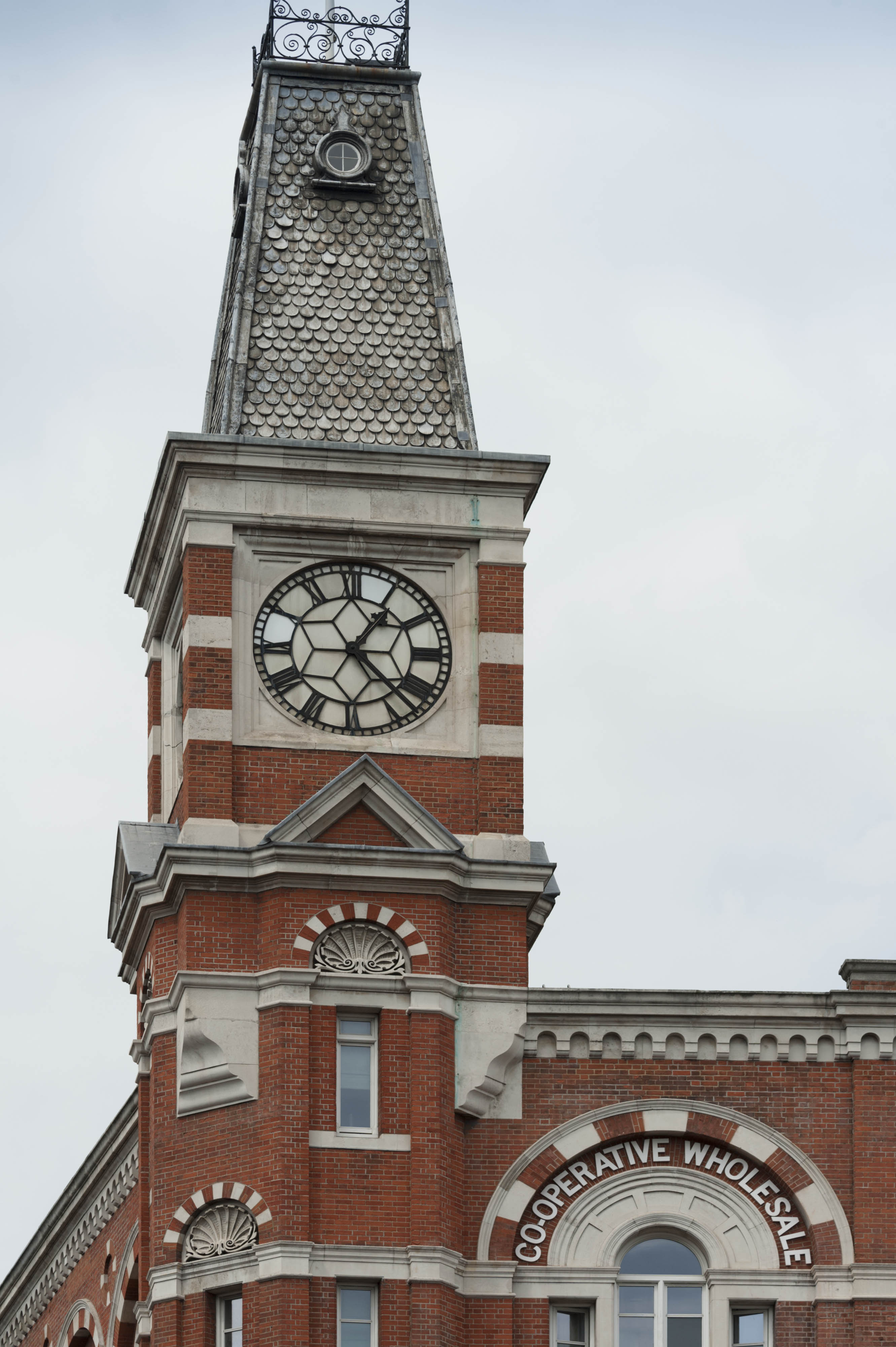
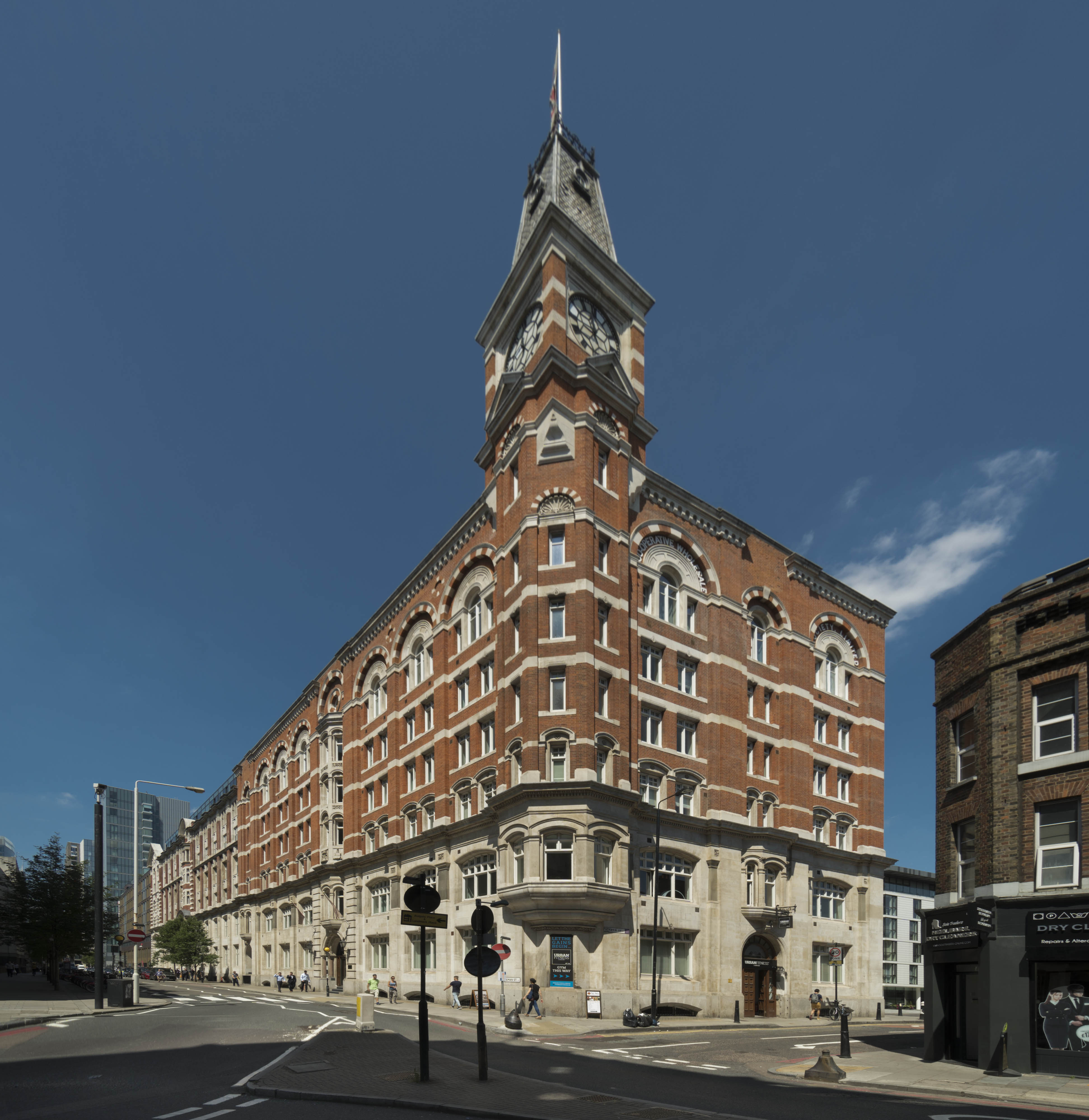
{
"id": 1563,
"title": "Sugar House, clock tower from the south in 2017",
"author": {
"id": 27,
"username": "DerekKendall"
},
"feature": {
"id": 1264,
"type": "Feature",
"geometry": {
"type": "MultiPolygon",
"coordinates": [
[
[
[
-0.069331963951854,
51.51229594729769
],
[
-0.069137875560046,
51.512351392206085
],
[
-0.068952695054468,
51.51210160696183
],
[
-0.06877706008966,
51.51212449662561
],
[
-0.068766393531184,
51.5121102580591
],
[
-0.068775926288607,
51.51210689932468
],
[
-0.068782151200721,
51.51209293893689
],
[
-0.068742154431936,
51.5120172780914
],
[
-0.068763790231903,
51.51199419623458
],
[
-0.069027145444056,
51.51193993762725
],
[
-0.06905682792721,
51.51194862974888
],
[
-0.069331963951854,
51.51229594729769
]
]
]
]
},
"properties": {
"b_number": "99",
"b_name": "Sugar House, 99 Leman Street",
"street": "Leman Street",
"address": "Sugar House, 99 Leman Street",
"feature_type": "WHITECHAPEL_BUILDING",
"count": 21,
"search_str": "Sugar House, 99 Leman Street"
},
"tags": [
"Co-operative Wholesale Society"
]
},
"file": "https://surveyoflondon.org/media/uploads/features/1264/SoL%20Whitechapel%20101075.jpg",
"description": "",
"copyright": true,
"created": "2019-03-20"
},
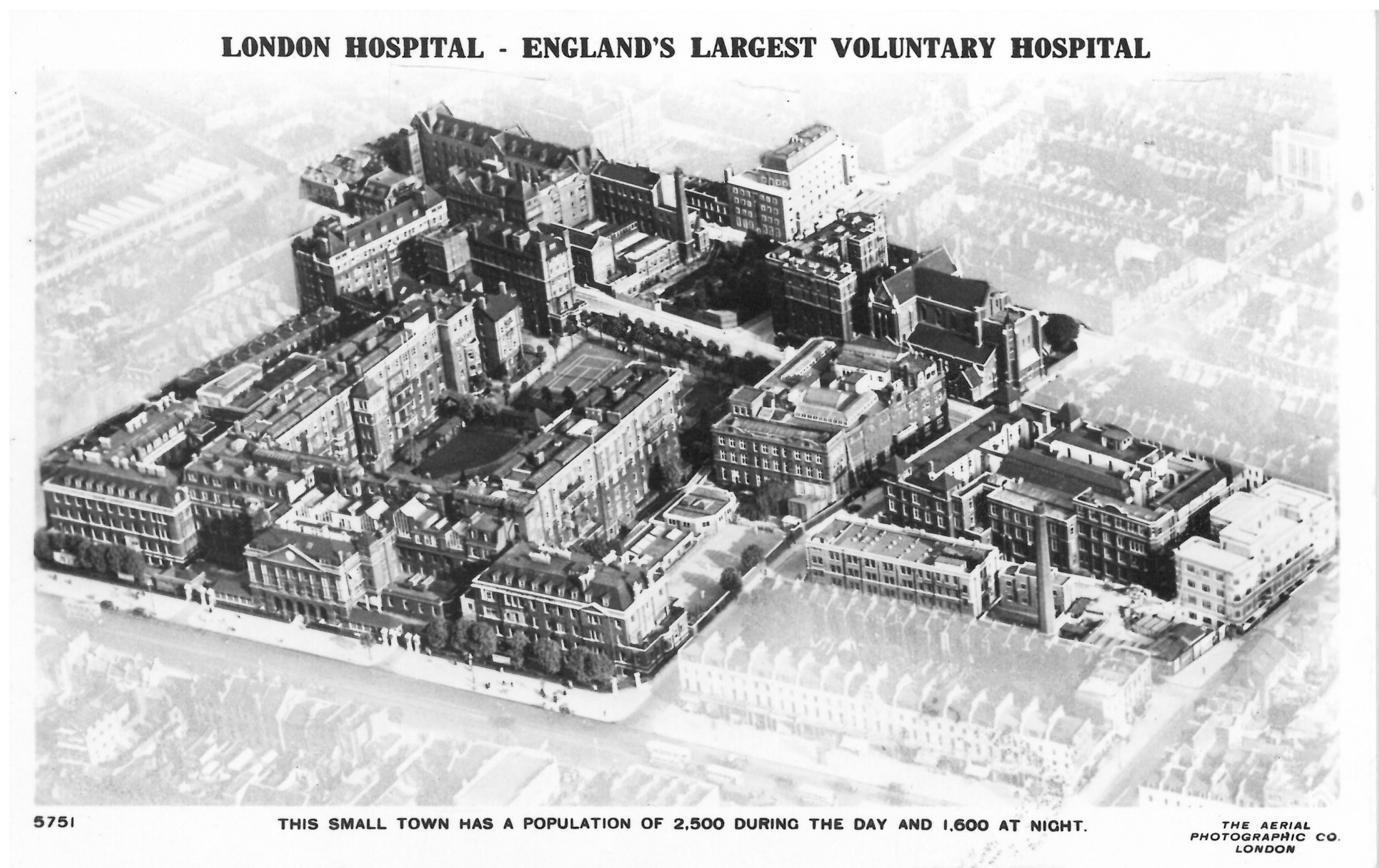
{
"id": 245,
"title": "'London Hospital - England's largest voluntary hospital', 1936",
"author": {
"id": 11,
"username": "amyspencer"
},
"feature": {
"id": 1230,
"type": "Feature",
"geometry": {
"type": "MultiPolygon",
"coordinates": [
[
[
[
-0.06071898744648,
51.51847914149303
],
[
-0.060743358937849,
51.518529899918775
],
[
-0.060362148562617,
51.518618013153
],
[
-0.060404024127419,
51.51868851949335
],
[
-0.060356952993906,
51.51869974522794
],
[
-0.060399234817198,
51.51877056309998
],
[
-0.060042469531136,
51.5188530372297
],
[
-0.060006551123239,
51.51879256032364
],
[
-0.05997171006068,
51.51880061452483
],
[
-0.059923949522789,
51.51872019830377
],
[
-0.059602716389847,
51.51879445706454
],
[
-0.059631951693606,
51.51884368227145
],
[
-0.059135089420495,
51.51895853862307
],
[
-0.059031394281591,
51.51878393727422
],
[
-0.059075483581288,
51.51877374555587
],
[
-0.05923306113512,
51.518737319626666
],
[
-0.059261815633844,
51.518785736083466
],
[
-0.059453095208379,
51.51874286661955
],
[
-0.059437777096903,
51.51871791341666
],
[
-0.059509844762857,
51.518701022201654
],
[
-0.059472510825189,
51.51863713193043
],
[
-0.059893693119402,
51.51853565124978
],
[
-0.059897251108141,
51.51854177905041
],
[
-0.060406197614306,
51.5184267554985
],
[
-0.060388475186227,
51.51839623334771
],
[
-0.060226549751936,
51.51811735804654
],
[
-0.060490662909997,
51.51805857683586
],
[
-0.060500593175314,
51.518078725457706
],
[
-0.06071898744648,
51.51847914149303
]
]
]
]
},
"properties": {
"b_number": "",
"b_name": "Former Royal London Hospital",
"street": "",
"address": "Former Royal London Hospital ",
"feature_type": "WHITECHAPEL_BUILDING",
"count": 53,
"search_str": "Former Royal London Hospital"
},
"tags": []
},
"file": "https://surveyoflondon.org/media/uploads/features/1230/Postcard%2C%20c.1940.jpg",
"description": "Postcard showing the London Hospital and the sprawl of hospital buildings from the north-west. At the left side of the image is the main hospital building, built between 1752 and 1778, and extended in the nineteenth century. It is possible to see the Church of St Philip and Augustine in Newark Street (1888-92, designed by Arthur Cawston). In front of the church is the London Hospital Medical College (1886-7), which faces the Outpatients Department of c.1903; both designed by Rowland Plumbe, hospital surveyor. The postcard also shows the Students Hostel in Philpot Street (1934, designed by Edward Maufe) and the Outpatients Department in New Road (1930s, designed by Adams, Holden and Pearson). ",
"copyright": false,
"created": "2016-08-15"
},
{
"id": 1129,
"title": "Garden behind the Royal London Hospital, c.1982, looking south towards the statue of Queen Alexandra and dining rooms",
"author": {
"id": 217,
"username": "sarahrogers"
},
"feature": {
"id": 1230,
"type": "Feature",
"geometry": {
"type": "MultiPolygon",
"coordinates": [
[
[
[
-0.06071898744648,
51.51847914149303
],
[
-0.060743358937849,
51.518529899918775
],
[
-0.060362148562617,
51.518618013153
],
[
-0.060404024127419,
51.51868851949335
],
[
-0.060356952993906,
51.51869974522794
],
[
-0.060399234817198,
51.51877056309998
],
[
-0.060042469531136,
51.5188530372297
],
[
-0.060006551123239,
51.51879256032364
],
[
-0.05997171006068,
51.51880061452483
],
[
-0.059923949522789,
51.51872019830377
],
[
-0.059602716389847,
51.51879445706454
],
[
-0.059631951693606,
51.51884368227145
],
[
-0.059135089420495,
51.51895853862307
],
[
-0.059031394281591,
51.51878393727422
],
[
-0.059075483581288,
51.51877374555587
],
[
-0.05923306113512,
51.518737319626666
],
[
-0.059261815633844,
51.518785736083466
],
[
-0.059453095208379,
51.51874286661955
],
[
-0.059437777096903,
51.51871791341666
],
[
-0.059509844762857,
51.518701022201654
],
[
-0.059472510825189,
51.51863713193043
],
[
-0.059893693119402,
51.51853565124978
],
[
-0.059897251108141,
51.51854177905041
],
[
-0.060406197614306,
51.5184267554985
],
[
-0.060388475186227,
51.51839623334771
],
[
-0.060226549751936,
51.51811735804654
],
[
-0.060490662909997,
51.51805857683586
],
[
-0.060500593175314,
51.518078725457706
],
[
-0.06071898744648,
51.51847914149303
]
]
]
]
},
"properties": {
"b_number": "",
"b_name": "Former Royal London Hospital",
"street": "",
"address": "Former Royal London Hospital ",
"feature_type": "WHITECHAPEL_BUILDING",
"count": 53,
"search_str": "Former Royal London Hospital"
},
"tags": []
},
"file": "https://surveyoflondon.org/media/uploads/features/1230/SR9.jpeg",
"description": "",
"copyright": true,
"created": "2018-02-14"
},
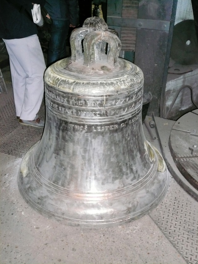
{
"id": 400,
"title": "Liberty Bell Replica",
"author": {
"id": 51,
"username": "stuart"
},
"feature": {
"id": 155,
"type": "Feature",
"geometry": {
"type": "MultiPolygon",
"coordinates": [
[
[
[
-0.067279828395434,
51.51695705948158
],
[
-0.067093469618443,
51.517032789909806
],
[
-0.067051200483431,
51.516996757810816
],
[
-0.067090391118988,
51.51698039038376
],
[
-0.06706090910812,
51.51695688633854
],
[
-0.067015052606677,
51.51697914860705
],
[
-0.067015052606682,
51.516979148607064
],
[
-0.067015052606675,
51.51697914860705
],
[
-0.066983358160437,
51.516951324364136
],
[
-0.066904378563551,
51.516904192470385
],
[
-0.066814855785544,
51.516858952938556
],
[
-0.066749004017844,
51.51678511344983
],
[
-0.066726651062502,
51.51660623379854
],
[
-0.066916087304028,
51.516542881724156
],
[
-0.067063145906456,
51.51668871217051
],
[
-0.067018758534236,
51.51670613616749
],
[
-0.067108196018859,
51.516794826264736
],
[
-0.067132918133769,
51.516785121743794
],
[
-0.067195489248199,
51.51684716970448
],
[
-0.06716822056742,
51.5168577515391
],
[
-0.067184699138495,
51.51687146748573
],
[
-0.067279828395434,
51.51695705948158
]
],
[
[
-0.067093263845335,
51.516893872671716
],
[
-0.067031009970172,
51.516845232635745
],
[
-0.066988676105,
51.51686586339187
],
[
-0.067034303634964,
51.51688439111608
],
[
-0.067057406216514,
51.51690729267392
],
[
-0.067093263845335,
51.516893872671716
]
]
]
]
},
"properties": {
"b_number": "32-34",
"b_name": "Whitechapel Bell Foundry, 32–34 Whitechapel Road",
"street": "Whitechapel Road",
"address": "32-34 Whitechapel Road",
"feature_type": "WHITECHAPEL_BUILDING",
"count": 26,
"search_str": "Whitechapel Bell Foundry, 32–34 Whitechapel Road"
},
"tags": [
"bells",
"foundry"
]
},
"file": "https://surveyoflondon.org/media/uploads/features/306/P1000138.jpg",
"description": "In 2001, on the 250th anniversary of the original casting in Whitechapel the foundry cast this replica of the Liberty Bell. The original, which had long since cracked, had come to symbolise United States' independence and the abolition of slavery. ",
"copyright": false,
"created": "2016-09-18"
},
{
"id": 622,
"title": "Whitechapel Bell Foundry, 32-24 Whitechapel Road, April 2017",
"author": {
"id": 27,
"username": "DerekKendall"
},
"feature": {
"id": 155,
"type": "Feature",
"geometry": {
"type": "MultiPolygon",
"coordinates": [
[
[
[
-0.067279828395434,
51.51695705948158
],
[
-0.067093469618443,
51.517032789909806
],
[
-0.067051200483431,
51.516996757810816
],
[
-0.067090391118988,
51.51698039038376
],
[
-0.06706090910812,
51.51695688633854
],
[
-0.067015052606677,
51.51697914860705
],
[
-0.067015052606682,
51.516979148607064
],
[
-0.067015052606675,
51.51697914860705
],
[
-0.066983358160437,
51.516951324364136
],
[
-0.066904378563551,
51.516904192470385
],
[
-0.066814855785544,
51.516858952938556
],
[
-0.066749004017844,
51.51678511344983
],
[
-0.066726651062502,
51.51660623379854
],
[
-0.066916087304028,
51.516542881724156
],
[
-0.067063145906456,
51.51668871217051
],
[
-0.067018758534236,
51.51670613616749
],
[
-0.067108196018859,
51.516794826264736
],
[
-0.067132918133769,
51.516785121743794
],
[
-0.067195489248199,
51.51684716970448
],
[
-0.06716822056742,
51.5168577515391
],
[
-0.067184699138495,
51.51687146748573
],
[
-0.067279828395434,
51.51695705948158
]
],
[
[
-0.067093263845335,
51.516893872671716
],
[
-0.067031009970172,
51.516845232635745
],
[
-0.066988676105,
51.51686586339187
],
[
-0.067034303634964,
51.51688439111608
],
[
-0.067057406216514,
51.51690729267392
],
[
-0.067093263845335,
51.516893872671716
]
]
]
]
},
"properties": {
"b_number": "32-34",
"b_name": "Whitechapel Bell Foundry, 32–34 Whitechapel Road",
"street": "Whitechapel Road",
"address": "32-34 Whitechapel Road",
"feature_type": "WHITECHAPEL_BUILDING",
"count": 26,
"search_str": "Whitechapel Bell Foundry, 32–34 Whitechapel Road"
},
"tags": [
"bells",
"foundry"
]
},
"file": "https://surveyoflondon.org/media/uploads/features/155/SoL%20Whitechapel%20100735.jpg",
"description": "",
"copyright": false,
"created": "2017-05-03"
},
{
"id": 1536,
"title": "Drinking fountain and plaque on wall of former waiting hall",
"author": {
"id": 27,
"username": "DerekKendall"
},
"feature": {
"id": 1385,
"type": "Feature",
"geometry": {
"type": "MultiPolygon",
"coordinates": [
[
[
[
-0.067575803709333,
51.51021492278667
],
[
-0.067783647338447,
51.51017527172947
],
[
-0.067828706900756,
51.510167293395675
],
[
-0.067884358000762,
51.51028332470727
],
[
-0.068021222270461,
51.51026117174896
],
[
-0.068027105232624,
51.51027869995762
],
[
-0.068059007104689,
51.51027341168682
],
[
-0.068045803249401,
51.51025517119752
],
[
-0.068185711037114,
51.51022956959143
],
[
-0.068302205657116,
51.51049311218949
],
[
-0.068154065018083,
51.51051508999573
],
[
-0.068142111677326,
51.51048931210634
],
[
-0.068158013519995,
51.51048782991857
],
[
-0.0680993992664,
51.51035372697415
],
[
-0.068063773094401,
51.51035895389879
],
[
-0.068055396596396,
51.510336723241444
],
[
-0.067963562571312,
51.510349163498944
],
[
-0.067961653646245,
51.510339150568754
],
[
-0.067909585576321,
51.510347692789416
],
[
-0.067933270683552,
51.5104044774377
],
[
-0.067674158297256,
51.51045078856997
],
[
-0.067629160671485,
51.51036923447038
],
[
-0.067652633918951,
51.51036497018876
],
[
-0.067575803709333,
51.51021492278667
]
]
]
]
},
"properties": {
"b_number": "7",
"b_name": "",
"street": "Dock Street",
"address": "Wombat's City Hostel, 7 Dock Street",
"feature_type": "WHITECHAPEL_BUILDING",
"count": 25,
"search_str": "Wombat's City Hostel, 7 Dock Street"
},
"tags": []
},
"file": "https://surveyoflondon.org/media/uploads/features/1385/SoL%20Whitechapel%20102633.jpg",
"description": "",
"copyright": true,
"created": "2019-03-05"
},
{
"id": 1542,
"title": "Sugar House from the south looking across the Docklands Light Railway in 2019",
"author": {
"id": 27,
"username": "DerekKendall"
},
"feature": {
"id": 1264,
"type": "Feature",
"geometry": {
"type": "MultiPolygon",
"coordinates": [
[
[
[
-0.069331963951854,
51.51229594729769
],
[
-0.069137875560046,
51.512351392206085
],
[
-0.068952695054468,
51.51210160696183
],
[
-0.06877706008966,
51.51212449662561
],
[
-0.068766393531184,
51.5121102580591
],
[
-0.068775926288607,
51.51210689932468
],
[
-0.068782151200721,
51.51209293893689
],
[
-0.068742154431936,
51.5120172780914
],
[
-0.068763790231903,
51.51199419623458
],
[
-0.069027145444056,
51.51193993762725
],
[
-0.06905682792721,
51.51194862974888
],
[
-0.069331963951854,
51.51229594729769
]
]
]
]
},
"properties": {
"b_number": "99",
"b_name": "Sugar House, 99 Leman Street",
"street": "Leman Street",
"address": "Sugar House, 99 Leman Street",
"feature_type": "WHITECHAPEL_BUILDING",
"count": 21,
"search_str": "Sugar House, 99 Leman Street"
},
"tags": [
"Co-operative Wholesale Society"
]
},
"file": "https://surveyoflondon.org/media/uploads/features/1264/SoL%20Whitechapel%20102646.jpg",
"description": "",
"copyright": true,
"created": "2019-03-05"
},
{
"id": 514,
"title": "Garrod Building, view of the main staircase from the first floor",
"author": {
"id": 27,
"username": "DerekKendall"
},
"feature": {
"id": 1189,
"type": "Feature",
"geometry": {
"type": "MultiPolygon",
"coordinates": [
[
[
[
-0.060957318414032,
51.51782190843071
],
[
-0.060536358742238,
51.517916494366496
],
[
-0.06042382559955,
51.5177169757099
],
[
-0.060423392052643,
51.517716267459285
],
[
-0.06037583590265,
51.51772558880798
],
[
-0.060352091559155,
51.517682266082666
],
[
-0.060399184829325,
51.5176714337657
],
[
-0.060382136461735,
51.517636775872596
],
[
-0.060366794729858,
51.51763667842599
],
[
-0.060353568375337,
51.517633521256826
],
[
-0.060340249107007,
51.51762886391949
],
[
-0.060331431296148,
51.51762072004323
],
[
-0.060328691457909,
51.51761554771857
],
[
-0.060326999079391,
51.517611443342886
],
[
-0.060327382221525,
51.517606284181284
],
[
-0.060329047985828,
51.51760203725169
],
[
-0.060331232366157,
51.517597910289986
],
[
-0.060333234968373,
51.517593887621835
],
[
-0.0603394749266,
51.51758477508556
],
[
-0.060343650894546,
51.51757832358151
],
[
-0.060315667444656,
51.51752195768432
],
[
-0.060339055445574,
51.51749626222509
],
[
-0.06039972958586,
51.51748509401273
],
[
-0.060844270778094,
51.51743888994093
],
[
-0.060875340433462,
51.517555246058656
],
[
-0.060894657489377,
51.517564918111205
],
[
-0.060905236784801,
51.51757830806902
],
[
-0.060907454524091,
51.51759005281749
],
[
-0.060906490522428,
51.51760128121761
],
[
-0.060896928755295,
51.51761642472545
],
[
-0.060890333226028,
51.51762687042926
],
[
-0.060957318414032,
51.51782190843071
]
]
]
]
},
"properties": {
"b_number": "",
"b_name": "Garrod Building",
"street": "Stepney Way",
"address": "Garrod Building",
"feature_type": "WHITECHAPEL_BUILDING",
"count": 31,
"search_str": "Garrod Building"
},
"tags": []
},
"file": "https://surveyoflondon.org/media/uploads/features/1189/SoL%20Whitechapel%20100496.jpg",
"description": "",
"copyright": true,
"created": "2017-03-09"
},
{
"id": 1561,
"title": "Sugar House from the south in 2017",
"author": {
"id": 27,
"username": "DerekKendall"
},
"feature": {
"id": 1264,
"type": "Feature",
"geometry": {
"type": "MultiPolygon",
"coordinates": [
[
[
[
-0.069331963951854,
51.51229594729769
],
[
-0.069137875560046,
51.512351392206085
],
[
-0.068952695054468,
51.51210160696183
],
[
-0.06877706008966,
51.51212449662561
],
[
-0.068766393531184,
51.5121102580591
],
[
-0.068775926288607,
51.51210689932468
],
[
-0.068782151200721,
51.51209293893689
],
[
-0.068742154431936,
51.5120172780914
],
[
-0.068763790231903,
51.51199419623458
],
[
-0.069027145444056,
51.51193993762725
],
[
-0.06905682792721,
51.51194862974888
],
[
-0.069331963951854,
51.51229594729769
]
]
]
]
},
"properties": {
"b_number": "99",
"b_name": "Sugar House, 99 Leman Street",
"street": "Leman Street",
"address": "Sugar House, 99 Leman Street",
"feature_type": "WHITECHAPEL_BUILDING",
"count": 21,
"search_str": "Sugar House, 99 Leman Street"
},
"tags": [
"Co-operative Wholesale Society"
]
},
"file": "https://surveyoflondon.org/media/uploads/features/1264/SoL%20Whitechapel%20101071.jpg",
"description": "",
"copyright": true,
"created": "2019-03-20"
},
{
"id": 1571,
"title": "Co-operative Wholesale Society Tea Warehouse from the south-east c.1930",
"author": {
"id": 14,
"username": "rebecca.preston"
},
"feature": {
"id": 1304,
"type": "Feature",
"geometry": {
"type": "MultiPolygon",
"coordinates": [
[
[
[
-0.069869457142711,
51.51258378865529
],
[
-0.06950660421144,
51.512121667706516
],
[
-0.069478111577185,
51.512130555532515
],
[
-0.069341094752535,
51.511957536645845
],
[
-0.069486122416778,
51.51189676528385
],
[
-0.069527178527717,
51.51194539520137
],
[
-0.069585888426032,
51.5119311567419
],
[
-0.069559567943928,
51.511910840078386
],
[
-0.069569328998767,
51.5119016438785
],
[
-0.069825289223036,
51.51185497911268
],
[
-0.069930830059169,
51.51200246852669
],
[
-0.069714923949871,
51.51207129486504
],
[
-0.069748586678379,
51.512117463780626
],
[
-0.069782896356969,
51.51210399319554
],
[
-0.070024013079544,
51.51238632902739
],
[
-0.070141581896045,
51.51235434519941
],
[
-0.070216203746602,
51.51245148127667
],
[
-0.070170852543001,
51.512460091841156
],
[
-0.070181004677215,
51.512485990340465
],
[
-0.07007117524811,
51.51251225352792
],
[
-0.070078075053951,
51.512526402406536
],
[
-0.069869457142711,
51.51258378865529
]
]
]
]
},
"properties": {
"b_number": "100",
"b_name": "",
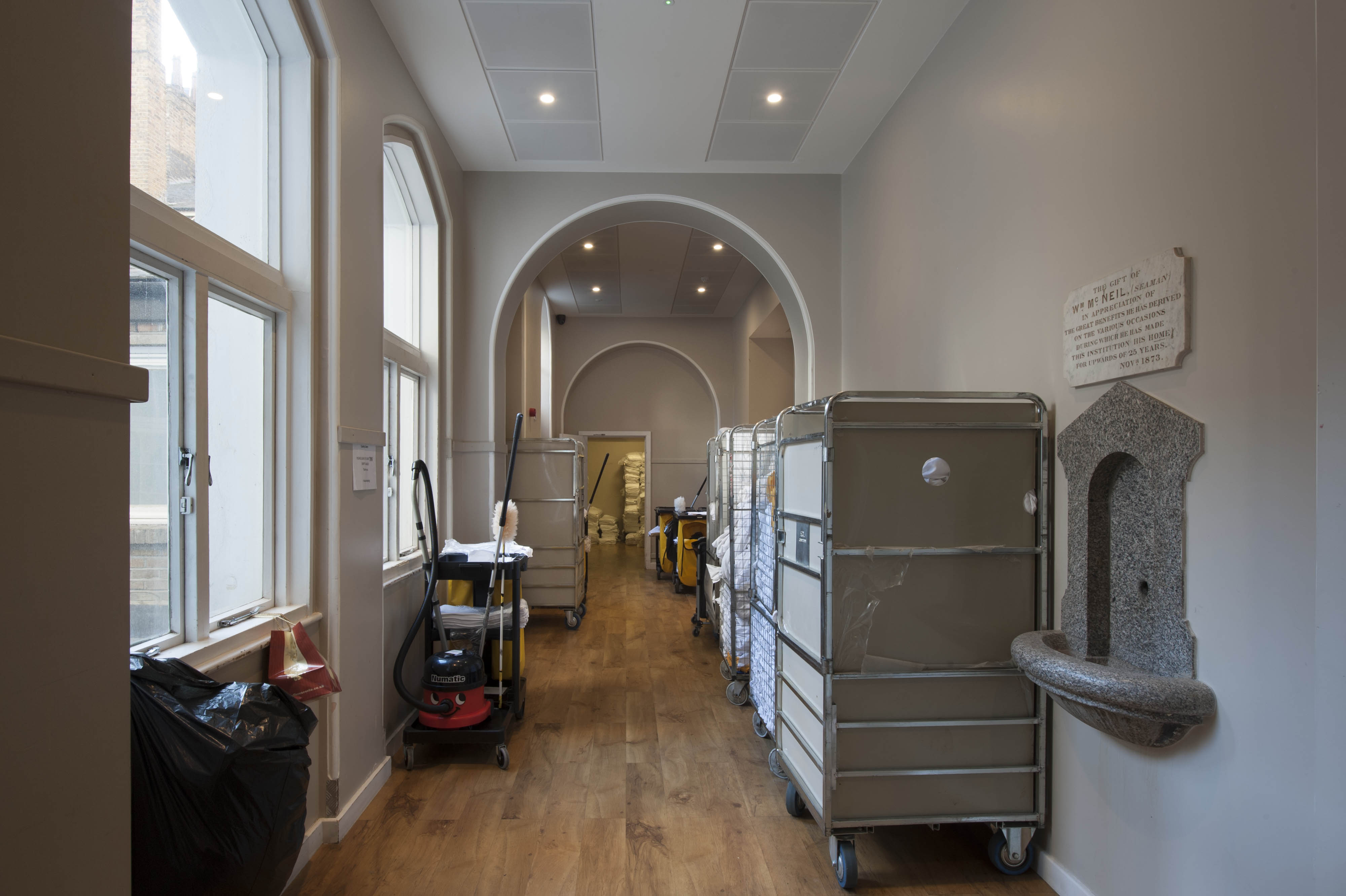
"street": "Leman Street",
"address": "100 Leman Street (Minet House)",
"feature_type": "WHITECHAPEL_BUILDING",
"count": 13,
"search_str": "100 Leman Street (Minet House)"
},
"tags": []
},
"file": "https://surveyoflondon.org/media/uploads/features/1304/1930c%20Tea%20Warehouse%20card.jpg",
"description": "",
"copyright": false,
"created": "2019-03-29"
},
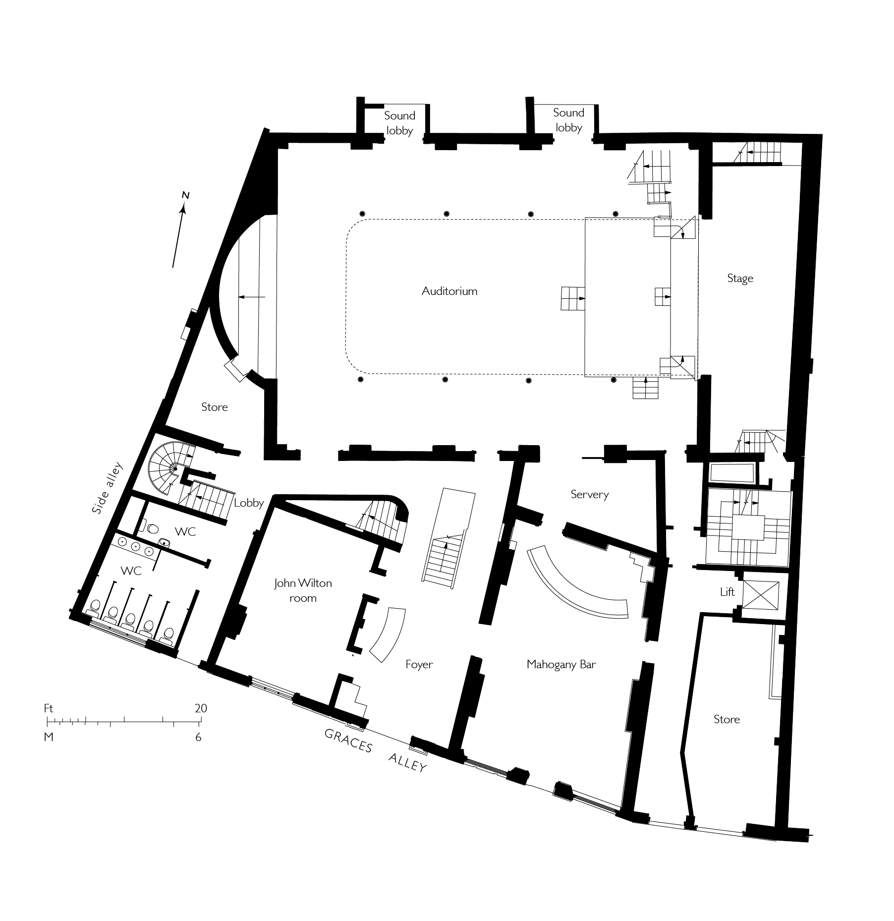
{
"id": 1548,
"title": "Wilton's Music Hall, ground-floor plan in 2015",
"author": {
"id": 82,
"username": "HelenJones"
},
"feature": {
"id": 1392,
"type": "Feature",
"geometry": {
"type": "MultiPolygon",
"coordinates": [
[
[
[
-0.066897382560978,
51.51047185184401
],
[
-0.066897150320887,
51.510543358461234
],
[
-0.066964310871808,
51.51054939761258
],
[
-0.067031736648758,
51.51055546057313
],
[
-0.067033159620775,
51.51054385631446
],
[
-0.067124985785421,
51.51055249759738
],
[
-0.067119646867151,
51.510573278551
],
[
-0.067097006082147,
51.51057630354935
],
[
-0.067064204301052,
51.510690877240464
],
[
-0.066813595729658,
51.51071232706844
],
[
-0.066808845661517,
51.510692481646345
],
[
-0.066750873450789,
51.51069733978511
],
[
-0.066731248551372,
51.51054469318253
],
[
-0.066802206282857,
51.51054121190127
],
[
-0.066805453245557,
51.51046452251118
],
[
-0.066897382560978,
51.51047185184401
]
]
]
]
},
"properties": {
"b_number": "1",
"b_name": "Wilton's Music Hall",
"street": "Graces Alley",
"address": "Wilton's Music Hall, 1 Graces Alley",
"feature_type": "WHITECHAPEL_BUILDING",
"count": 23,
"search_str": "Wilton's Music Hall"
},
"tags": [
"Wilton's Music Hall"
]
},
"file": "https://surveyoflondon.org/media/uploads/features/1392/wiltons%20ground%20floor%20plan%201updated.jpg",
"description": "(based on drawings by Tim Ronalds Architects and site survey)",
"copyright": false,
"created": "2019-03-19"
},
{
"id": 1562,
"title": "Sugar House from the southwest in 2017",
"author": {
"id": 27,
"username": "DerekKendall"
},
"feature": {
"id": 1264,
"type": "Feature",
"geometry": {
"type": "MultiPolygon",
"coordinates": [
[
[
[
-0.069331963951854,
51.51229594729769
],
[
-0.069137875560046,
51.512351392206085
],
[
-0.068952695054468,
51.51210160696183
],
[
-0.06877706008966,
51.51212449662561
],
[
-0.068766393531184,
51.5121102580591
],
[
-0.068775926288607,
51.51210689932468
],
[
-0.068782151200721,
51.51209293893689
],
[
-0.068742154431936,
51.5120172780914
],
[
-0.068763790231903,
51.51199419623458
],
[
-0.069027145444056,
51.51193993762725
],
[
-0.06905682792721,
51.51194862974888
],
[
-0.069331963951854,
51.51229594729769
]
]
]
]
},
"properties": {
"b_number": "99",
"b_name": "Sugar House, 99 Leman Street",
"street": "Leman Street",
"address": "Sugar House, 99 Leman Street",
"feature_type": "WHITECHAPEL_BUILDING",
"count": 21,
"search_str": "Sugar House, 99 Leman Street"
},
"tags": [
"Co-operative Wholesale Society"
]
},
"file": "https://surveyoflondon.org/media/uploads/features/1264/SoL%20Whitechapel%20101073.jpg",
"description": "",
"copyright": true,
"created": "2019-03-20"
},
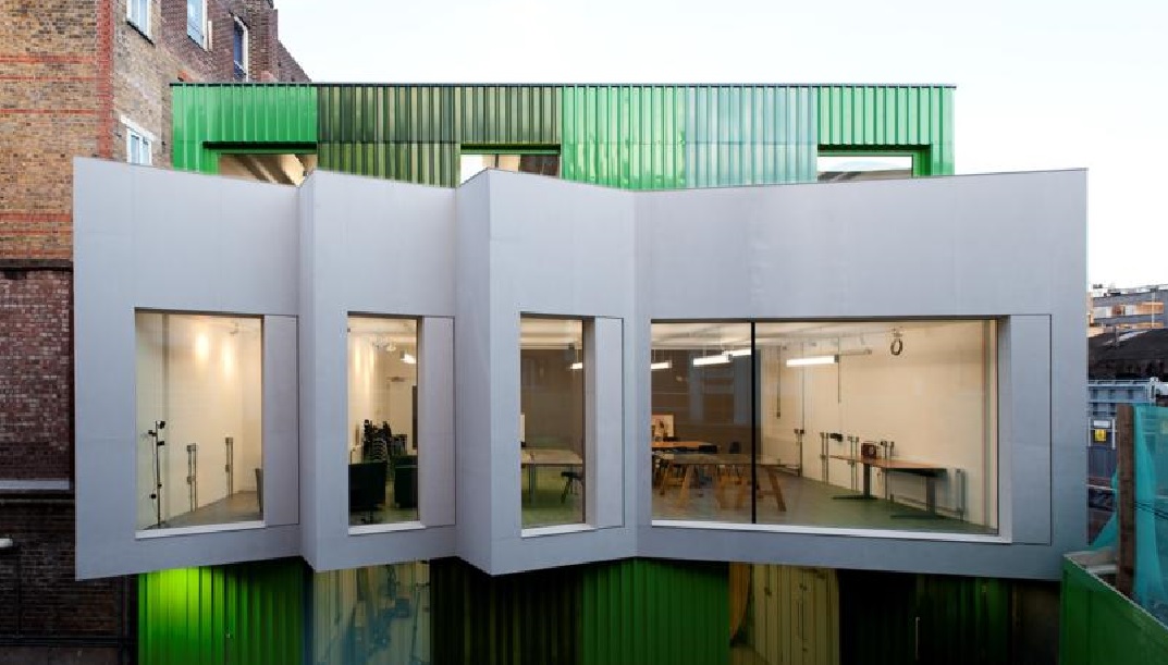
{
"id": 1519,
"title": "New building for Providence Row",
"author": {
"id": 2,
"username": "surveyoflondon"
},
"feature": {
"id": 364,
"type": "Feature",
"geometry": {
"type": "MultiPolygon",
"coordinates": [
[
[
[
-0.071489806542886,
51.517023172539695
],
[
-0.071243898612021,
51.51660982272529
],
[
-0.071190306454479,
51.516576885746375
],
[
-0.071306299769721,
51.51654960254589
],
[
-0.071326638948875,
51.51652155453997
],
[
-0.071374403242583,
51.5165233420156
],
[
-0.07170710495994,
51.516972518185476
],
[
-0.071689530249958,
51.51699956808665
],
[
-0.071662895989952,
51.51700659921577
],
[
-0.071622347338577,
51.51700294482352
],
[
-0.071489806542886,
51.517023172539695
]
]
]
]
},
"properties": {
"b_number": "82",
"b_name": "The Dellow Centre",
"street": "Wentworth Street",
"address": "Providence Row, The Dellow Centre, 82 Wentworth Street",
"feature_type": "WHITECHAPEL_BUILDING",
"count": 13,
"search_str": "The Dellow Centre"
},
"tags": []
},
"file": "https://surveyoflondon.org/media/uploads/features/364/Art%20room.jpg",
"description": "A new building for Providence Row built on the opposite side of the courtyard of the Dellow Centre, designed by Featherstone Associates and gained planning permission in 2009. The 3-storey building provides storage, laundry, staff offices and activity space for homeless users and residents.",
"copyright": false,
"created": "2019-01-09"
},
{
"id": 1592,
"title": "Royal Mint Green from the southwest in April 2019",
"author": {
"id": 27,
"username": "DerekKendall"
},
"feature": {
"id": 1696,
"type": "Feature",
"geometry": {
"type": "MultiPolygon",
"coordinates": [
[
[
[
-0.070757877460671,
51.509704781845734
],
[
-0.070336266038682,
51.509780523572594
],
[
-0.070160800693106,
51.50939470250228
],
[
-0.07059267797467,
51.50932348184877
],
[
-0.070757877460671,
51.509704781845734
]
]
]
]
},
"properties": {
"b_number": "",
"b_name": "",
"street": "",
"address": "Royal Mint Green",
"feature_type": "OPEN_SPACE",
"count": 10,
"search_str": "Royal Mint Green"
},
"tags": []
},
"file": "https://surveyoflondon.org/media/uploads/features/1696/SoL%20Whitechapel%20102718.jpg",
"description": "",
"copyright": true,
"created": "2019-04-30"
},
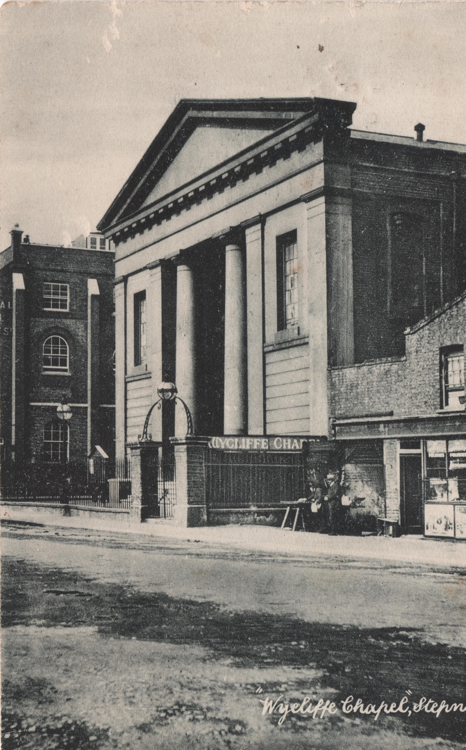
{
"id": 528,
"title": "Wycliffe Chapel, later Philpot Street Great Synagogue, c. 1905",
"author": {
"id": 2,
"username": "surveyoflondon"
},
"feature": {
"id": 1061,
"type": "Feature",
"geometry": {
"type": "MultiPolygon",
"coordinates": [
[
[
[
-0.058715070758662,
51.51632047838213
],
[
-0.058538688189915,
51.51633644323949
],
[
-0.058503743799575,
51.51618882954332
],
[
-0.058299432828153,
51.51620738920249
],
[
-0.058276305780072,
51.51610727415779
],
[
-0.058533032283052,
51.516083107505835
],
[
-0.05866858619558,
51.515962957572825
],
[
-0.058805326314088,
51.516025024731846
],
[
-0.058671142666155,
51.516139234479695
],
[
-0.058715070758662,
51.51632047838213
]
]
]
]
},
"properties": {
"b_number": "",
"b_name": "",
"street": "",
"address": "John Harrison House",
"feature_type": "WHITECHAPEL_BUILDING",
"count": 2,
"search_str": "John Harrison House"
},
"tags": []
},
"file": "https://surveyoflondon.org/media/uploads/features/1061/Wycliffe%20chapel%20Philpot%20Street%20reduced%20c%201905.jpg",
"description": "This photograph shows the Wycliffe Chapel, a congregational church built in 1831 on the portion of Philpot Street that was turned into gardens probably in the 1970s. The church is said to have originated in an Independent congregation that met in the Minories in the 1640s and in a chapel in Cannon Street Road which opened in 1780. The Wycliffe chapel in Philpot Street became the Philpot Street Great Synagogue in 1908, shortly after this photograph was taken, and closed c. 1957, the congregation merging with the Nelson Street Synagogue. The building was demolished c. 1967 and John Harrison house built on the site soon after. The church had a large graveyard to its north and east sides, long disused and then occupied by tennis courts after John Harrison House was built.",
"copyright": false,
"created": "2017-03-16"
},
{
"id": 1582,
"title": "273-279 Whitechapel Road in April 2019",
"author": {
"id": 27,
"username": "DerekKendall"
},
"feature": {
"id": 497,
"type": "Feature",
"geometry": {
"type": "MultiPolygon",
"coordinates": [
[
[
[
-0.059738898782278,
51.51937822218193
],
[
-0.059753664168125,
51.519374801396815
],
[
-0.059860261012373,
51.519436897257755
],
[
-0.059678799167797,
51.51954933684866
],
[
-0.059623043880068,
51.519460220443136
],
[
-0.059592946555481,
51.51941486628688
],
[
-0.059543133323744,
51.51933524687723
],
[
-0.059692244149982,
51.519300912836506
],
[
-0.059738898782278,
51.51937822218193
]
]
]
]
},
"properties": {
"b_number": "277",
"b_name": "Whitechapel Station",
"street": "Whitechapel Road",
"address": "Whitechapel Station, 277 Whitechapel Road",
"feature_type": "WHITECHAPEL_BUILDING",
"count": 11,
"search_str": "Whitechapel Station"
},
"tags": []
},
"file": "https://surveyoflondon.org/media/uploads/features/497/SoL%20Whitechapel%20102678.jpg",
"description": "",
"copyright": true,
"created": "2019-04-30"
},
{
"id": 1583,
"title": "Bollard in Woods Buildings in 2019",
"author": {
"id": 27,
"username": "DerekKendall"
},
"feature": {
"id": 494,
"type": "Feature",
"geometry": {
"type": "MultiPolygon",
"coordinates": [
[
[
[
-0.060251837714749,
51.519317343249824
],
[
-0.060165411787242,
51.519190402358625
],
[
-0.060238726288127,
51.519173839072245
],
[
-0.06028924014634,
51.51924555561384
],
[
-0.060268093215861,
51.51925097618777
],
[
-0.060398005074838,
51.51944324570046
],
[
-0.060283974910042,
51.51947265814605
],
[
-0.060210245560487,
51.519357672502494
],
[
-0.060257849352005,
51.51934639671303
],
[
-0.060244556996051,
51.519319571781445
],
[
-0.060251837714749,
51.519317343249824
]
]
]
]
},
"properties": {
"b_number": "265",
"b_name": "",
"street": "Whitechapel Road",
"address": "265 Whitechapel Road",
"feature_type": "WHITECHAPEL_BUILDING",
"count": 5,
"search_str": "265 Whitechapel Road"
},
"tags": []
},
"file": "https://surveyoflondon.org/media/uploads/features/494/SoL%20Whitechapel%20102680.jpg",
"description": "",
"copyright": true,
"created": "2019-04-30"
},
{
"id": 1584,
"title": "Mosaic panel in Woods Buildings in 2019",
"author": {
"id": 27,
"username": "DerekKendall"
},
"feature": {
"id": 494,
"type": "Feature",
"geometry": {
"type": "MultiPolygon",
"coordinates": [
[
[
[
-0.060251837714749,
51.519317343249824
],
[
-0.060165411787242,
51.519190402358625
],
[
-0.060238726288127,
51.519173839072245
],
[
-0.06028924014634,
51.51924555561384
],
[
-0.060268093215861,
51.51925097618777
],
[
-0.060398005074838,
51.51944324570046
],
[
-0.060283974910042,
51.51947265814605
],
[
-0.060210245560487,
51.519357672502494
],
[
-0.060257849352005,
51.51934639671303
],
[
-0.060244556996051,
51.519319571781445
],
[
-0.060251837714749,
51.519317343249824
]
]
]
]
},
"properties": {
"b_number": "265",
"b_name": "",
"street": "Whitechapel Road",
"address": "265 Whitechapel Road",
"feature_type": "WHITECHAPEL_BUILDING",
"count": 5,
"search_str": "265 Whitechapel Road"
},
"tags": []
},
"file": "https://surveyoflondon.org/media/uploads/features/494/SoL%20Whitechapel%20102683.jpg",
"description": "",
"copyright": true,
"created": "2019-04-30"
}
]
}