HTTP 200 OK
Allow: GET, HEAD, OPTIONS
Content-Type: application/json
Vary: Accept
{
"count": 1747,
"next": "https://surveyoflondon.org/api/v1/images/?format=api&page=66",
"previous": "https://surveyoflondon.org/api/v1/images/?format=api&page=64",
"results": [
{
"id": 1499,
"title": "View west along Wentworth Street",
"author": {
"id": 27,
"username": "DerekKendall"
},
"feature": {
"id": 1742,
"type": "Feature",
"geometry": {
"type": "MultiPolygon",
"coordinates": [
[
[
[
-0.076387722492951,
51.516257872286374
],
[
-0.07580974439088,
51.51649846859169
],
[
-0.075744693982384,
51.51651411423466
],
[
-0.075332716624042,
51.51665341173461
],
[
-0.075277819023276,
51.516667372076085
],
[
-0.074429584483841,
51.51681699796736
],
[
-0.074402209988697,
51.516763242480046
],
[
-0.075229889371391,
51.51661092868018
],
[
-0.074836715281391,
51.516135055700595
],
[
-0.074917049606191,
51.51611135328064
],
[
-0.075312012611936,
51.51658616747119
],
[
-0.075695505281233,
51.51646463519818
],
[
-0.075779072585588,
51.51644696856364
],
[
-0.076328753388395,
51.516209038390684
],
[
-0.076387722492951,
51.516257872286374
]
]
]
]
},
"properties": {
"b_number": "",
"b_name": "",
"street": "",
"address": "Petticoat Lane Market",
"feature_type": "PLACE",
"count": 39,
"search_str": "Petticoat Lane Market"
},
"tags": []
},
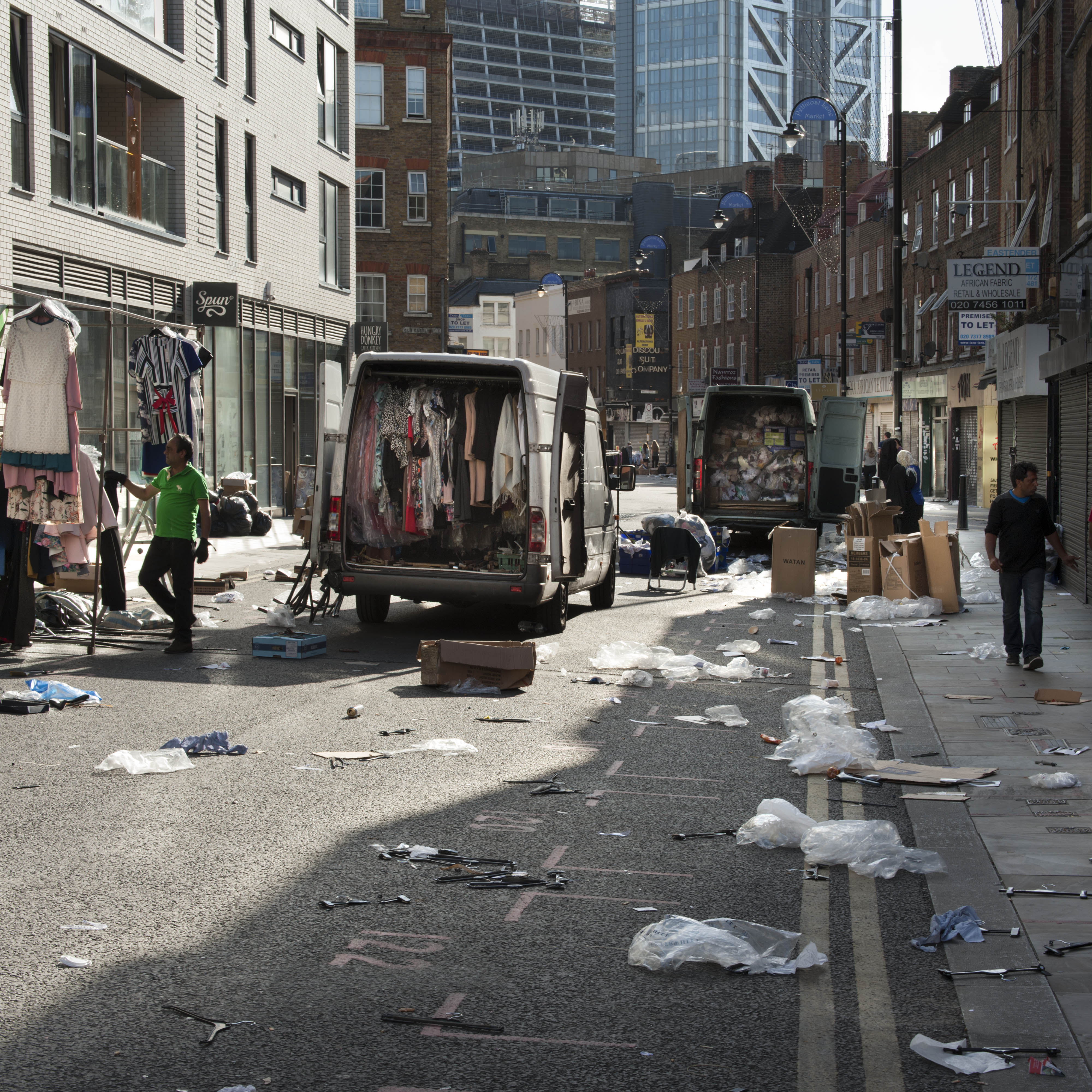
"file": "https://surveyoflondon.org/media/uploads/features/1742/SoL%20Whitechapel%20100862.jpg",
"description": "View of Petticoat Lane market in Wentworth Street from near the junction with Commercial Street, June 2017.",
"copyright": true,
"created": "2019-01-07"
},
{
"id": 918,
"title": "Retained frontage of College Buildings during redevelopment, August 2017",
"author": {
"id": 27,
"username": "DerekKendall"
},
"feature": {
"id": 380,
"type": "Feature",
"geometry": {
"type": "MultiPolygon",
"coordinates": [
[
[
[
-0.072206019676478,
51.51693680017776
],
[
-0.07196249597772,
51.51695746576063
],
[
-0.071942669522335,
51.51691176033737
],
[
-0.07193864174443,
51.51687683260662
],
[
-0.0719558598767,
51.51687195131619
],
[
-0.071940018682487,
51.516849661344565
],
[
-0.071948572675229,
51.51684695053907
],
[
-0.071928740996398,
51.51681739256845
],
[
-0.072016766264098,
51.51679133268639
],
[
-0.072069141958081,
51.51685492594651
],
[
-0.072148483627081,
51.51684727546371
],
[
-0.072142511287946,
51.51682066806651
],
[
-0.072177857813757,
51.51681788202521
],
[
-0.072183448760406,
51.51684444436341
],
[
-0.072206188136717,
51.5169328110988
],
[
-0.072206015279985,
51.5169367972863
],
[
-0.072206019676478,
51.51693680017776
]
]
]
]
},
"properties": {
"b_number": "",
"b_name": "College East",
"street": "Gunthorpe Street",
"address": "College East, Gunthorpe Street",
"feature_type": "WHITECHAPEL_BUILDING",
"count": 5,
"search_str": "College East"
},
"tags": []
},
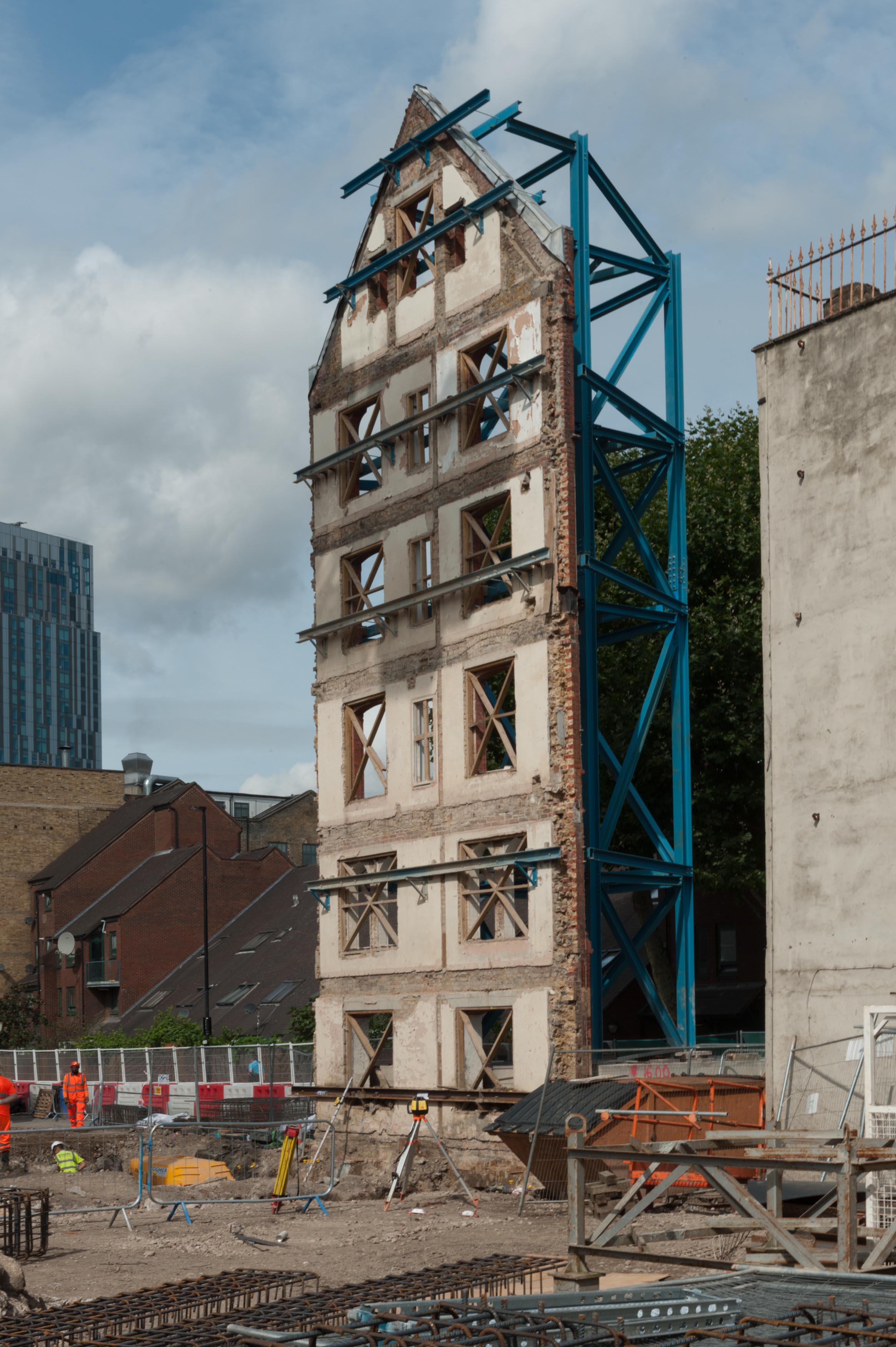
"file": "https://surveyoflondon.org/media/uploads/features/380/SoL%20Whitechapel%20101460.jpg",
"description": "Th erest of College Buildings was demolished in the 1980s, when this part of its frontage was retained during redevelopment. When the 1980s buildings were demolished in 2017, this frontage was retained once more.",
"copyright": true,
"created": "2017-09-26"
},
{
"id": 1498,
"title": "Arcadia Court and shops in Wentworth and Goulston Streets from the north-west in 2017",
"author": {
"id": 27,
"username": "DerekKendall"
},
"feature": {
"id": 359,
"type": "Feature",
"geometry": {
"type": "MultiPolygon",
"coordinates": [
[
[
[
-0.074396169724534,
51.51674677293217
],
[
-0.074344918245201,
51.51668771806432
],
[
-0.074415391815644,
51.51667127366158
],
[
-0.074407427802984,
51.51665783673676
],
[
-0.074464842346045,
51.51664692918775
],
[
-0.074451564815962,
51.516627570285934
],
[
-0.074484845350984,
51.516618730970194
],
[
-0.074449462429928,
51.5165697349019
],
[
-0.074495929828979,
51.51655683248676
],
[
-0.074450946678382,
51.516491607819624
],
[
-0.074715152431625,
51.51642099545545
],
[
-0.074553943007666,
51.516244787362865
],
[
-0.074798574993366,
51.51616849501834
],
[
-0.075086564069636,
51.51652796045754
],
[
-0.075099913362563,
51.51652379724113
],
[
-0.075167749140884,
51.51660846832082
],
[
-0.074396169724534,
51.51674677293217
]
]
]
]
},
"properties": {
"b_number": "",
"b_name": "Arcadia Court, formerly 90 to 222 Wentworth Dwellings",
"street": "Goulston Street",
"address": "Arcadia Court, formerly 90 to 222 Wentworth Dwellings",
"feature_type": "WHITECHAPEL_BUILDING",
"count": 8,
"search_str": "Arcadia Court, formerly 90 to 222 Wentworth Dwellings"
},
"tags": []
},
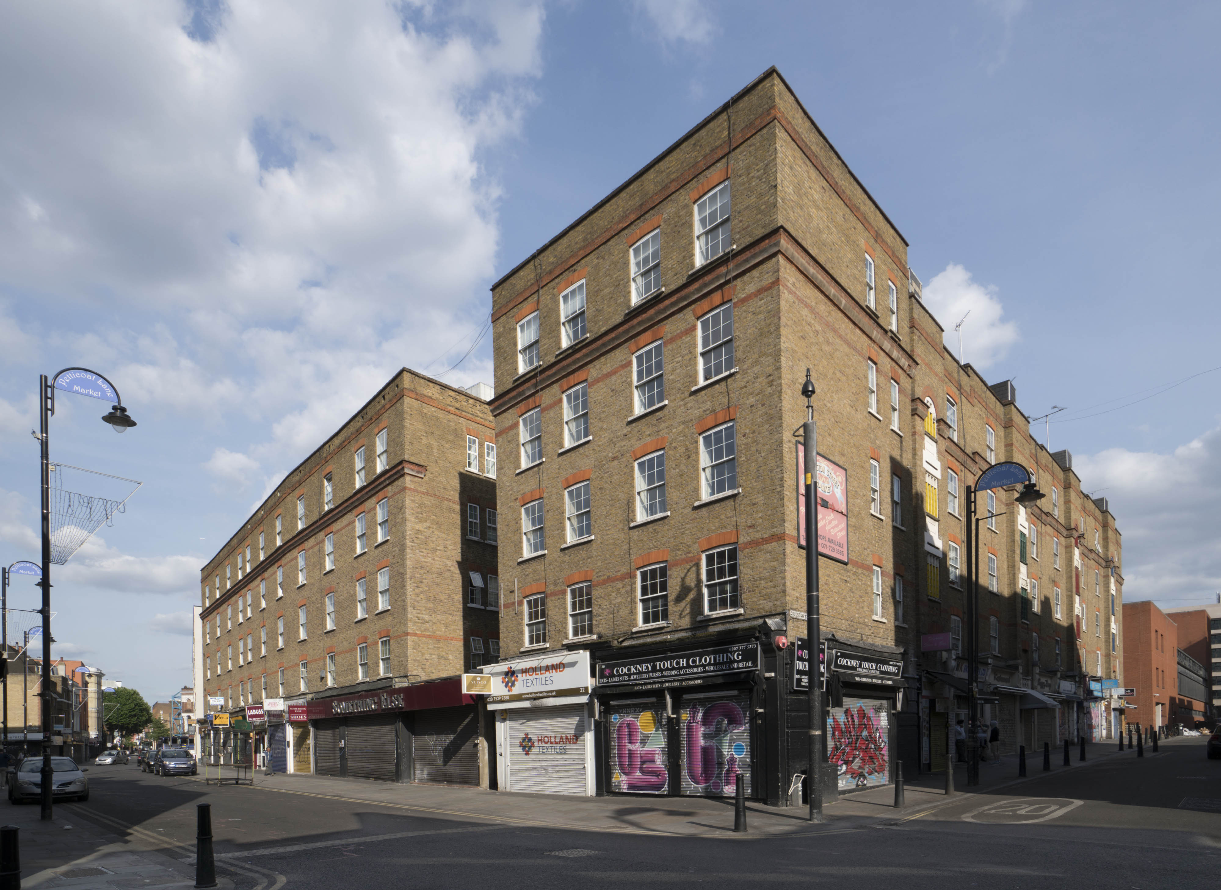
"file": "https://surveyoflondon.org/media/uploads/features/359/SoL%20Whitechapel%20100843.jpg",
"description": "View east along Wentworth Street and south down Goulston Street of Arcadia Court, and the shops at 30 to 50 Wentworth Street and 36 to 48 Goulston Street",
"copyright": true,
"created": "2019-01-07"
},
{
"id": 1521,
"title": "Tony Passa, sewing machine mechanic",
"author": {
"id": 281,
"username": "toni"
},
"feature": {
"id": 164,
"type": "Feature",
"geometry": {
"type": "MultiPolygon",
"coordinates": [
[
[
[
-0.069933654614942,
51.51577271778849
],
[
-0.0699313270692,
51.515777354399376
],
[
-0.069889130754686,
51.515797140731685
],
[
-0.069809844959613,
51.51573576424652
],
[
-0.069885170960789,
51.51571635476265
],
[
-0.069933654614942,
51.51577271778849
]
]
]
]
},
"properties": {
"b_number": "65A",
"b_name": "",
"street": "Whitechapel High Street",
"address": "65A Whitechapel High Street",
"feature_type": "WHITECHAPEL_BUILDING",
"count": 5,
"search_str": "65A Whitechapel High Street"
},
"tags": []
},
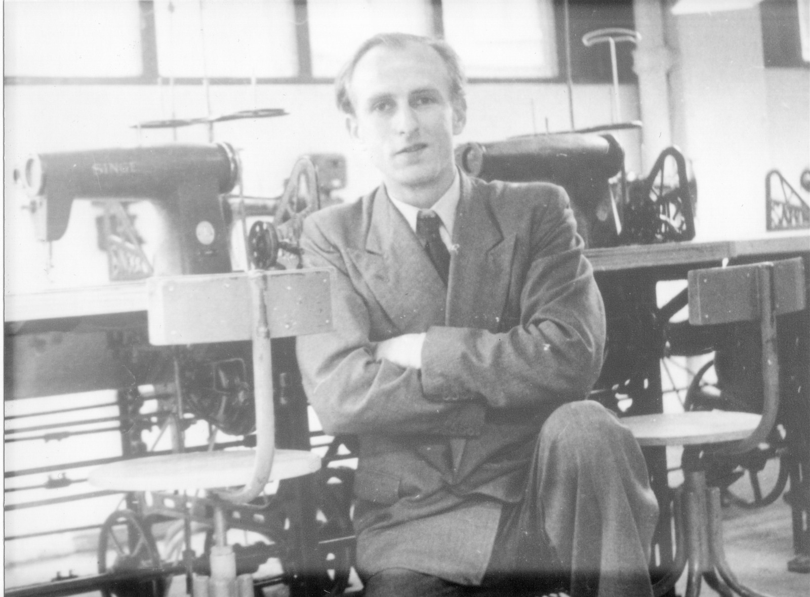
"file": "https://surveyoflondon.org/media/uploads/features/164/IMG-20190116-WA0000.jpg",
"description": "This is Tony Passa (Pasavitch) in the late 1940s (by the cut of his suit) in the workshop. This could be at the yet unknown first location of the SMEM workshop in Brick Lane/Osborn Street or at the last known location, 65A Whitechapel High Street.",
"copyright": false,
"created": "2019-01-16"
},
{
"id": 1520,
"title": "Spital Shop, Old Montague Street",
"author": {
"id": 280,
"username": "PMarriage"
},
"feature": {
"id": 445,
"type": "Feature",
"geometry": {
"type": "MultiPolygon",
"coordinates": [
[
[
[
-0.065696620480763,
51.518442064867784
],
[
-0.065838697735255,
51.51837739041402
],
[
-0.065889620228583,
51.5184234331181
],
[
-0.065880306050648,
51.51842814993107
],
[
-0.065894754263113,
51.51844079695577
],
[
-0.066006756669929,
51.518391950359685
],
[
-0.066101602490852,
51.51847659929861
],
[
-0.065855825913196,
51.51858399549335
],
[
-0.065696620480763,
51.518442064867784
]
]
]
]
},
"properties": {
"b_number": "",
"b_name": "Block A, Don Gratton House",
"street": "Old Montague Street and Davenant Street",
"address": "Block A, Don Gratton House, Old Montague Street and Davenant Street",
"feature_type": "WHITECHAPEL_BUILDING",
"count": 2,
"search_str": "Block A, Don Gratton House"
},
"tags": []
},
"file": "https://surveyoflondon.org/media/uploads/features/396/1970_0500_SpitalShop_Survey_1.jpg",
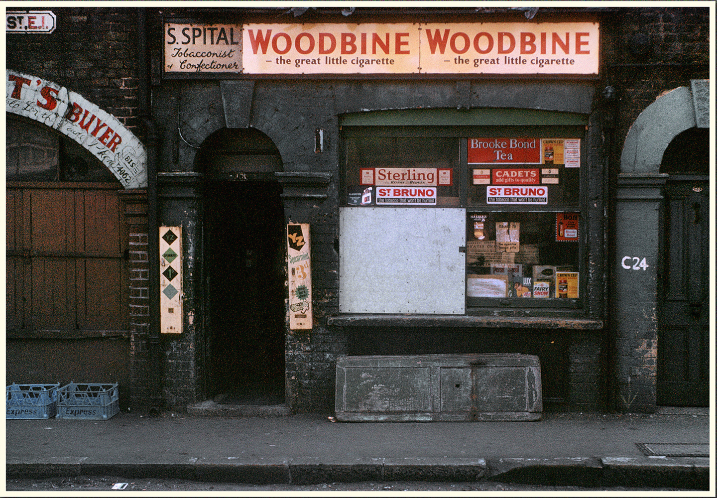
"description": "This was one of a handful of photos I took on a walk out from Liverpool Street in May 1970, however as time went by I became unsure from where it had been taken. However this photo was generously published by 'the gentle author' on the 'Spitalfields Life' web site and reader Terry Baynard suggested this might be Old Montague Street and I now know from other research this is correct. However what I have not been able to establish is where in Old Montague Street? I do know that there was a shop 'Connors' next door.\n\nSurvey of London note: It is 136 Old Montague Street, where Simon Spital was resident in the 1960s, according to the electoral roll. It was opposite the entrance to Kingward Street, previously King Edward Street, a street lost to later development of Bloomfield House and Spring Walk. The site of the shop was the gap between the main Don Grattan House building, and Block A. ",
"copyright": false,
"created": "2019-01-13"
},
{
"id": 1402,
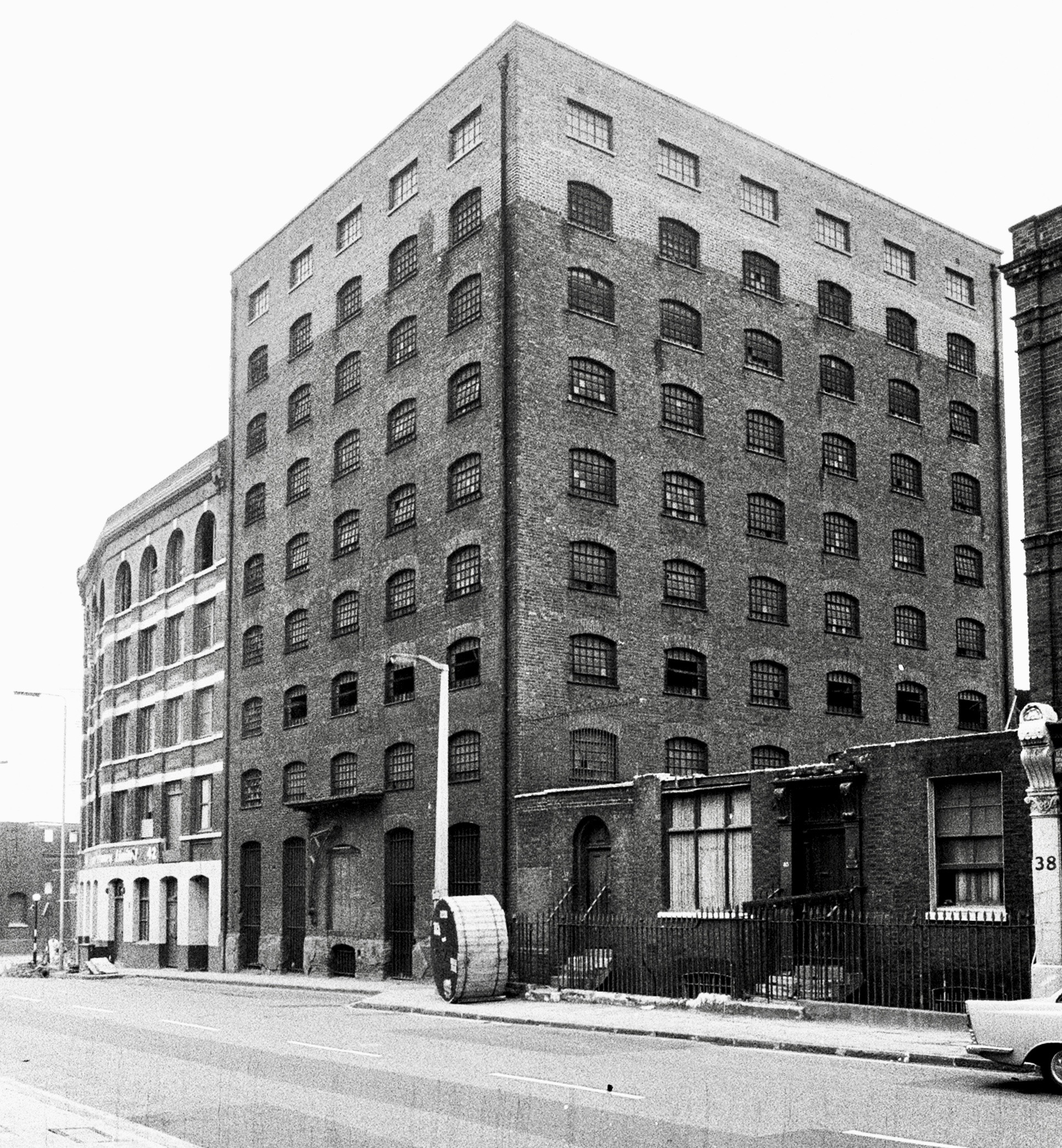
"title": "Former sugarhouse (later Monastery Bonded Tea Warehouse) from the northeast in the early 1970s (photograph by Dan Cruickshank)",
"author": {
"id": 268,
"username": "DanCruickshank"
},
"feature": {
"id": 1364,
"type": "Feature",
"geometry": {
"type": "MultiPolygon",
"coordinates": [
[
[
[
-0.068111447111593,
51.50952754577392
],
[
-0.06795711646976,
51.50918584981313
],
[
-0.068366784850446,
51.50910422814398
],
[
-0.06852193076641,
51.50944515016825
],
[
-0.068111447111593,
51.50952754577392
]
]
]
]
},
"properties": {
"b_number": "40",
"b_name": "",
"street": "Dock Street",
"address": "40 Dock Street",
"feature_type": "WHITECHAPEL_BUILDING",
"count": 6,
"search_str": "40 Dock Street"
},
"tags": [
"Vodafone"
]
},
"file": "https://surveyoflondon.org/media/uploads/features/1364/00440003.jpg",
"description": "",
"copyright": true,
"created": "2018-11-13"
},
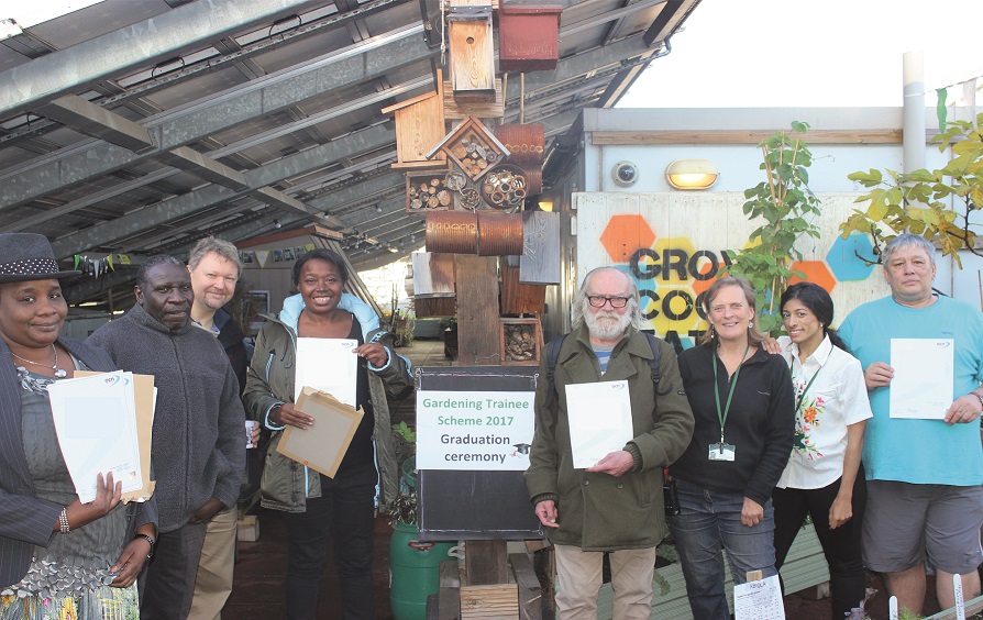
{
"id": 1513,
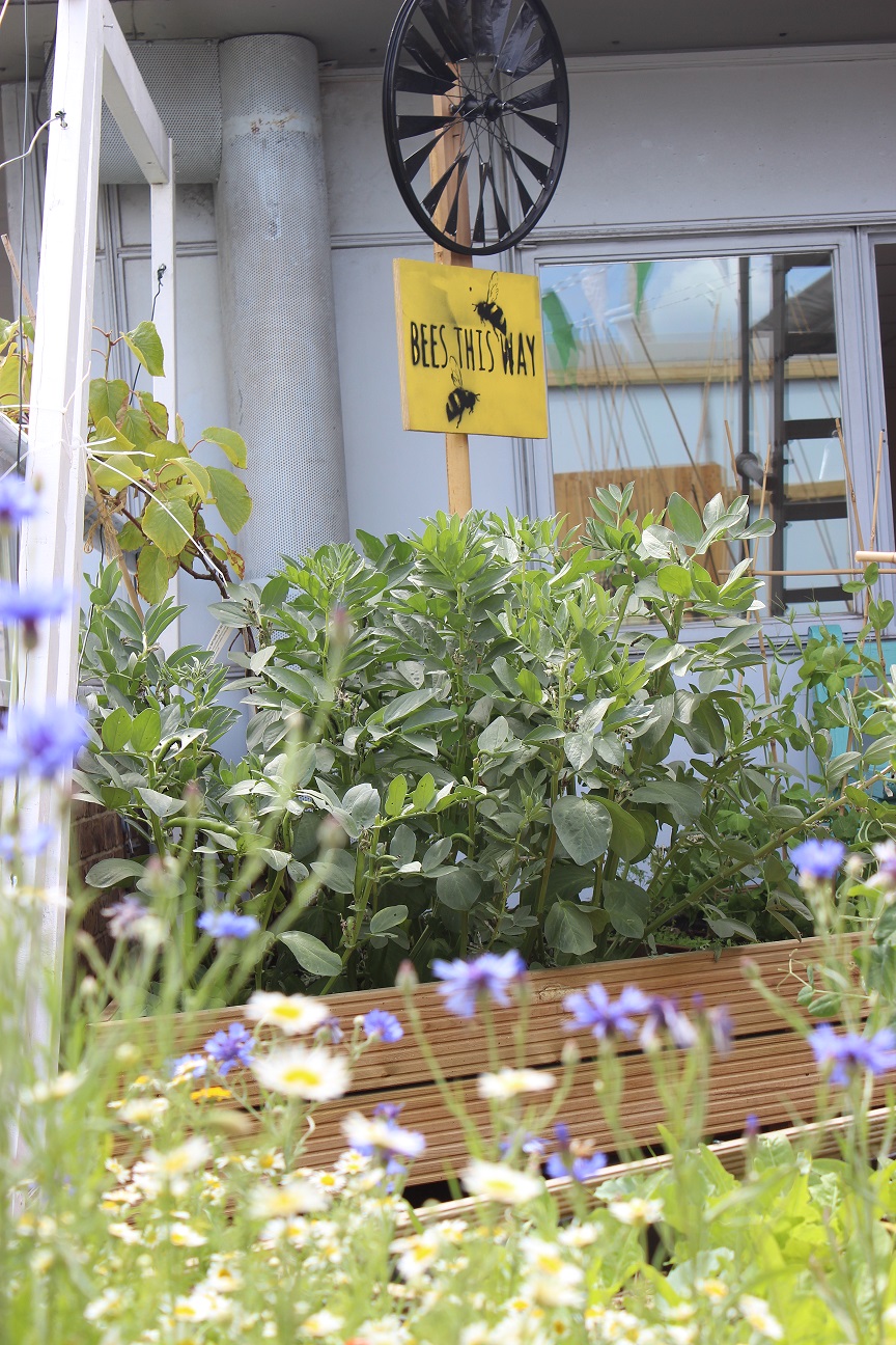
"title": "Rooftop garden on the Dellow Centre",
"author": {
"id": 2,
"username": "surveyoflondon"
},
"feature": {
"id": 364,
"type": "Feature",
"geometry": {
"type": "MultiPolygon",
"coordinates": [
[
[
[
-0.071489806542886,
51.517023172539695
],
[
-0.071243898612021,
51.51660982272529
],
[
-0.071190306454479,
51.516576885746375
],
[
-0.071306299769721,
51.51654960254589
],
[
-0.071326638948875,
51.51652155453997
],
[
-0.071374403242583,
51.5165233420156
],
[
-0.07170710495994,
51.516972518185476
],
[
-0.071689530249958,
51.51699956808665
],
[
-0.071662895989952,
51.51700659921577
],
[
-0.071622347338577,
51.51700294482352
],
[
-0.071489806542886,
51.517023172539695
]
]
]
]
},
"properties": {
"b_number": "82",
"b_name": "The Dellow Centre",
"street": "Wentworth Street",
"address": "Providence Row, The Dellow Centre, 82 Wentworth Street",
"feature_type": "WHITECHAPEL_BUILDING",
"count": 13,
"search_str": "The Dellow Centre"
},
"tags": []
},
"file": "https://surveyoflondon.org/media/uploads/features/364/img_4035_18701134434_o.jpg",
"description": "The rooftop is used to grow plants and herbs, many of which are used in the kitchen. Photo by kind permission of Providence Row",
"copyright": false,
"created": "2019-01-09"
},
{
"id": 1514,
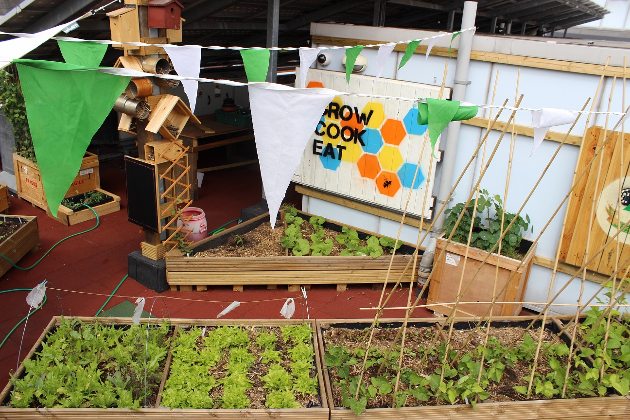
"title": "The rooftop garden of the Dellow Centre",
"author": {
"id": 2,
"username": "surveyoflondon"
},
"feature": {
"id": 364,
"type": "Feature",
"geometry": {
"type": "MultiPolygon",
"coordinates": [
[
[
[
-0.071489806542886,
51.517023172539695
],
[
-0.071243898612021,
51.51660982272529
],
[
-0.071190306454479,
51.516576885746375
],
[
-0.071306299769721,
51.51654960254589
],
[
-0.071326638948875,
51.51652155453997
],
[
-0.071374403242583,
51.5165233420156
],
[
-0.07170710495994,
51.516972518185476
],
[
-0.071689530249958,
51.51699956808665
],
[
-0.071662895989952,
51.51700659921577
],
[
-0.071622347338577,
51.51700294482352
],
[
-0.071489806542886,
51.517023172539695
]
]
]
]
},
"properties": {
"b_number": "82",
"b_name": "The Dellow Centre",
"street": "Wentworth Street",
"address": "Providence Row, The Dellow Centre, 82 Wentworth Street",
"feature_type": "WHITECHAPEL_BUILDING",
"count": 13,
"search_str": "The Dellow Centre"
},
"tags": []
},
"file": "https://surveyoflondon.org/media/uploads/features/364/IMG_4038.JPG",
"description": "The rooftop garden of the Dellow Centre. Photo by kind permission of Providence Row",
"copyright": false,
"created": "2019-01-09"
},
{
"id": 1403,
"title": "40 Dock Street in the early 1970s (photograph by Dan Cruickshank)",
"author": {
"id": 268,
"username": "DanCruickshank"
},
"feature": {
"id": 1364,
"type": "Feature",
"geometry": {
"type": "MultiPolygon",
"coordinates": [
[
[
[
-0.068111447111593,
51.50952754577392
],
[
-0.06795711646976,
51.50918584981313
],
[
-0.068366784850446,
51.50910422814398
],
[
-0.06852193076641,
51.50944515016825
],
[
-0.068111447111593,
51.50952754577392
]
]
]
]
},
"properties": {
"b_number": "40",
"b_name": "",
"street": "Dock Street",
"address": "40 Dock Street",
"feature_type": "WHITECHAPEL_BUILDING",
"count": 6,
"search_str": "40 Dock Street"
},
"tags": [
"Vodafone"
]
},
"file": "https://surveyoflondon.org/media/uploads/features/1364/00220002.jpg",
"description": "",
"copyright": true,
"created": "2018-11-13"
},
{
"id": 1515,
"title": "The rooftop garden of the Dellow Centre",
"author": {
"id": 2,
"username": "surveyoflondon"
},
"feature": {
"id": 364,
"type": "Feature",
"geometry": {
"type": "MultiPolygon",
"coordinates": [
[
[
[
-0.071489806542886,
51.517023172539695
],
[
-0.071243898612021,
51.51660982272529
],
[
-0.071190306454479,
51.516576885746375
],
[
-0.071306299769721,
51.51654960254589
],
[
-0.071326638948875,
51.51652155453997
],
[
-0.071374403242583,
51.5165233420156
],
[
-0.07170710495994,
51.516972518185476
],
[
-0.071689530249958,
51.51699956808665
],
[
-0.071662895989952,
51.51700659921577
],
[
-0.071622347338577,
51.51700294482352
],
[
-0.071489806542886,
51.517023172539695
]
]
]
]
},
"properties": {
"b_number": "82",
"b_name": "The Dellow Centre",
"street": "Wentworth Street",
"address": "Providence Row, The Dellow Centre, 82 Wentworth Street",
"feature_type": "WHITECHAPEL_BUILDING",
"count": 13,
"search_str": "The Dellow Centre"
},
"tags": []
},
"file": "https://surveyoflondon.org/media/uploads/features/364/IMG_4038_hm4UEiI.JPG",
"description": "The rooftop garden of the Dellow Centre. Photo by kind permission of Providence Row",
"copyright": false,
"created": "2019-01-09"
},
{
"id": 1516,
"title": "The rooftop garden of the Dellow Centre",
"author": {
"id": 2,
"username": "surveyoflondon"
},
"feature": {
"id": 364,
"type": "Feature",
"geometry": {
"type": "MultiPolygon",
"coordinates": [
[
[
[
-0.071489806542886,
51.517023172539695
],
[
-0.071243898612021,
51.51660982272529
],
[
-0.071190306454479,
51.516576885746375
],
[
-0.071306299769721,
51.51654960254589
],
[
-0.071326638948875,
51.51652155453997
],
[
-0.071374403242583,
51.5165233420156
],
[
-0.07170710495994,
51.516972518185476
],
[
-0.071689530249958,
51.51699956808665
],
[
-0.071662895989952,
51.51700659921577
],
[
-0.071622347338577,
51.51700294482352
],
[
-0.071489806542886,
51.517023172539695
]
]
]
]
},
"properties": {
"b_number": "82",
"b_name": "The Dellow Centre",
"street": "Wentworth Street",
"address": "Providence Row, The Dellow Centre, 82 Wentworth Street",
"feature_type": "WHITECHAPEL_BUILDING",
"count": 13,
"search_str": "The Dellow Centre"
},
"tags": []
},
"file": "https://surveyoflondon.org/media/uploads/features/364/print_26823588439_o.jpg",
"description": "Gardeners on the rooftop of the Dellow Centre. Photo by kind permission of Providence Row",
"copyright": false,
"created": "2019-01-09"
},
{
"id": 1517,
"title": "The kitchen of Providence Row",
"author": {
"id": 2,
"username": "surveyoflondon"
},
"feature": {
"id": 364,
"type": "Feature",
"geometry": {
"type": "MultiPolygon",
"coordinates": [
[
[
[
-0.071489806542886,
51.517023172539695
],
[
-0.071243898612021,
51.51660982272529
],
[
-0.071190306454479,
51.516576885746375
],
[
-0.071306299769721,
51.51654960254589
],
[
-0.071326638948875,
51.51652155453997
],
[
-0.071374403242583,
51.5165233420156
],
[
-0.07170710495994,
51.516972518185476
],
[
-0.071689530249958,
51.51699956808665
],
[
-0.071662895989952,
51.51700659921577
],
[
-0.071622347338577,
51.51700294482352
],
[
-0.071489806542886,
51.517023172539695
]
]
]
]
},
"properties": {
"b_number": "82",
"b_name": "The Dellow Centre",
"street": "Wentworth Street",
"address": "Providence Row, The Dellow Centre, 82 Wentworth Street",
"feature_type": "WHITECHAPEL_BUILDING",
"count": 13,
"search_str": "The Dellow Centre"
},
"tags": []
},
"file": "https://surveyoflondon.org/media/uploads/features/364/fried-rice-ingredients_44188118942_o.jpg",
"description": "The kitchen of Providence Row is run by residents and provides food for homeless users of the centre. Photo by kind permission of Providence Row.",
"copyright": false,
"created": "2019-01-09"
},
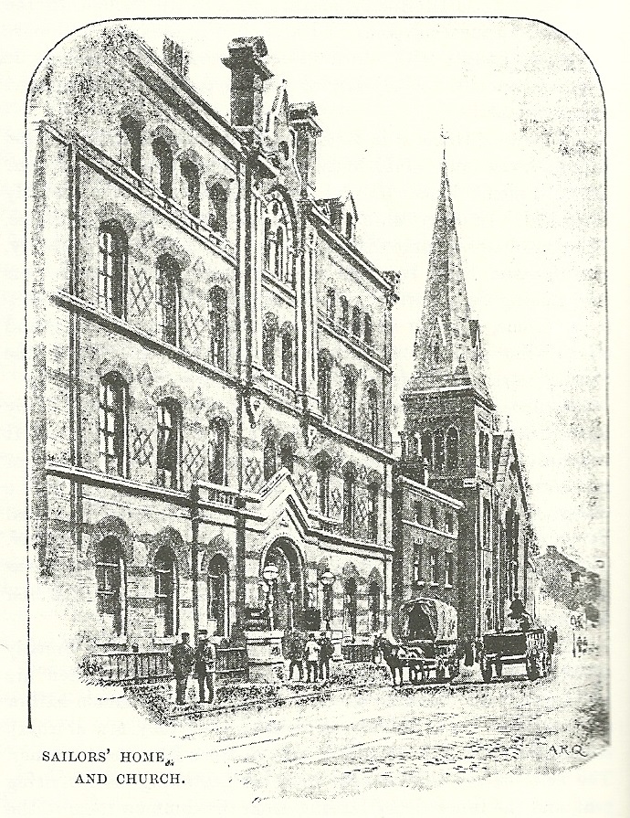
{
"id": 1483,
"title": "1896 - Dock Street Frontage of the Sailors' Home",
"author": {
"id": 33,
"username": "Charno"
},
"feature": {
"id": 1385,
"type": "Feature",
"geometry": {
"type": "MultiPolygon",
"coordinates": [
[
[
[
-0.067575803709333,
51.51021492278667
],
[
-0.067783647338447,
51.51017527172947
],
[
-0.067828706900756,
51.510167293395675
],
[
-0.067884358000762,
51.51028332470727
],
[
-0.068021222270461,
51.51026117174896
],
[
-0.068027105232624,
51.51027869995762
],
[
-0.068059007104689,
51.51027341168682
],
[
-0.068045803249401,
51.51025517119752
],
[
-0.068185711037114,
51.51022956959143
],
[
-0.068302205657116,
51.51049311218949
],
[
-0.068154065018083,
51.51051508999573
],
[
-0.068142111677326,
51.51048931210634
],
[
-0.068158013519995,
51.51048782991857
],
[
-0.0680993992664,
51.51035372697415
],
[
-0.068063773094401,
51.51035895389879
],
[
-0.068055396596396,
51.510336723241444
],
[
-0.067963562571312,
51.510349163498944
],
[
-0.067961653646245,
51.510339150568754
],
[
-0.067909585576321,
51.510347692789416
],
[
-0.067933270683552,
51.5104044774377
],
[
-0.067674158297256,
51.51045078856997
],
[
-0.067629160671485,
51.51036923447038
],
[
-0.067652633918951,
51.51036497018876
],
[
-0.067575803709333,
51.51021492278667
]
]
]
]
},
"properties": {
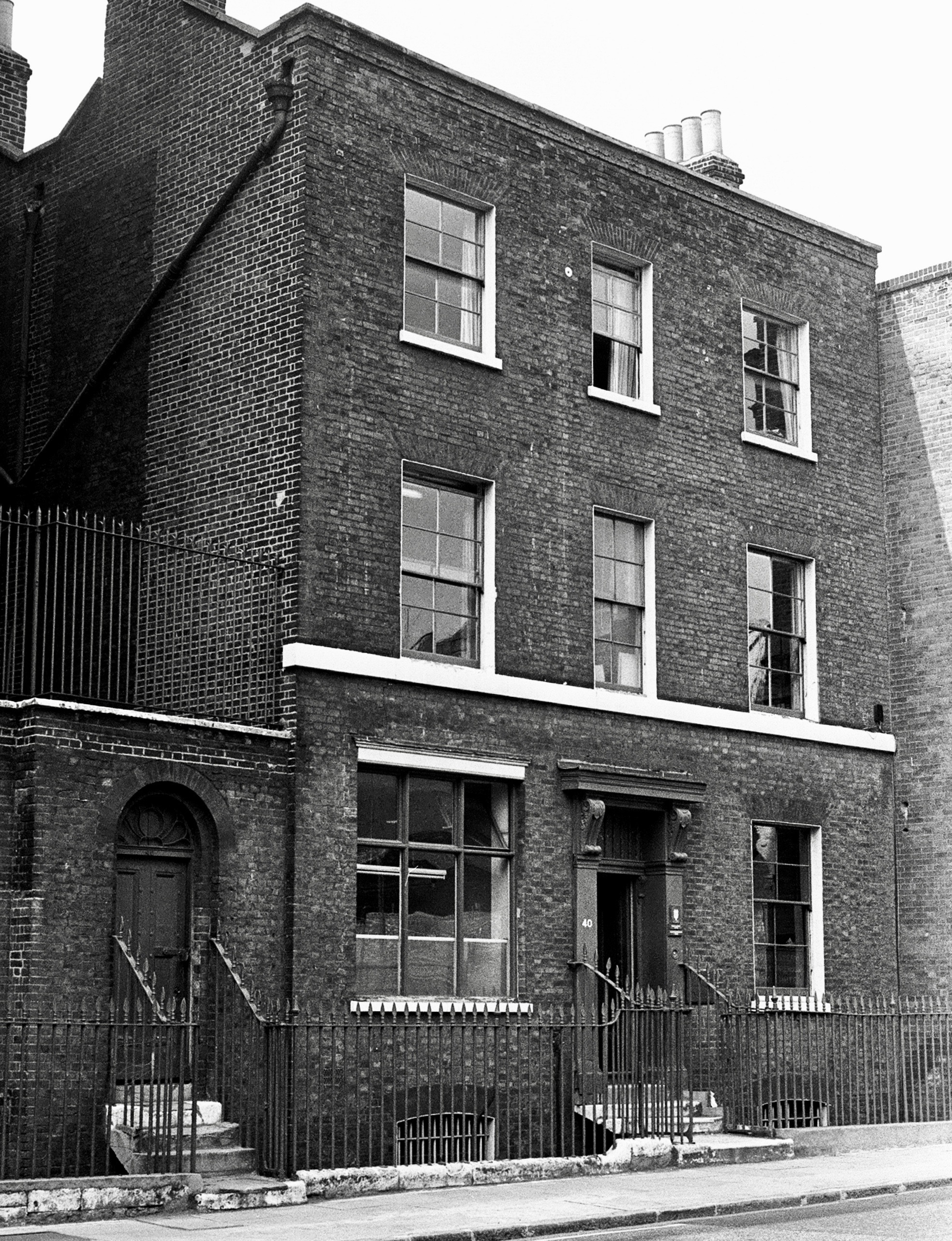
"b_number": "7",
"b_name": "",
"street": "Dock Street",
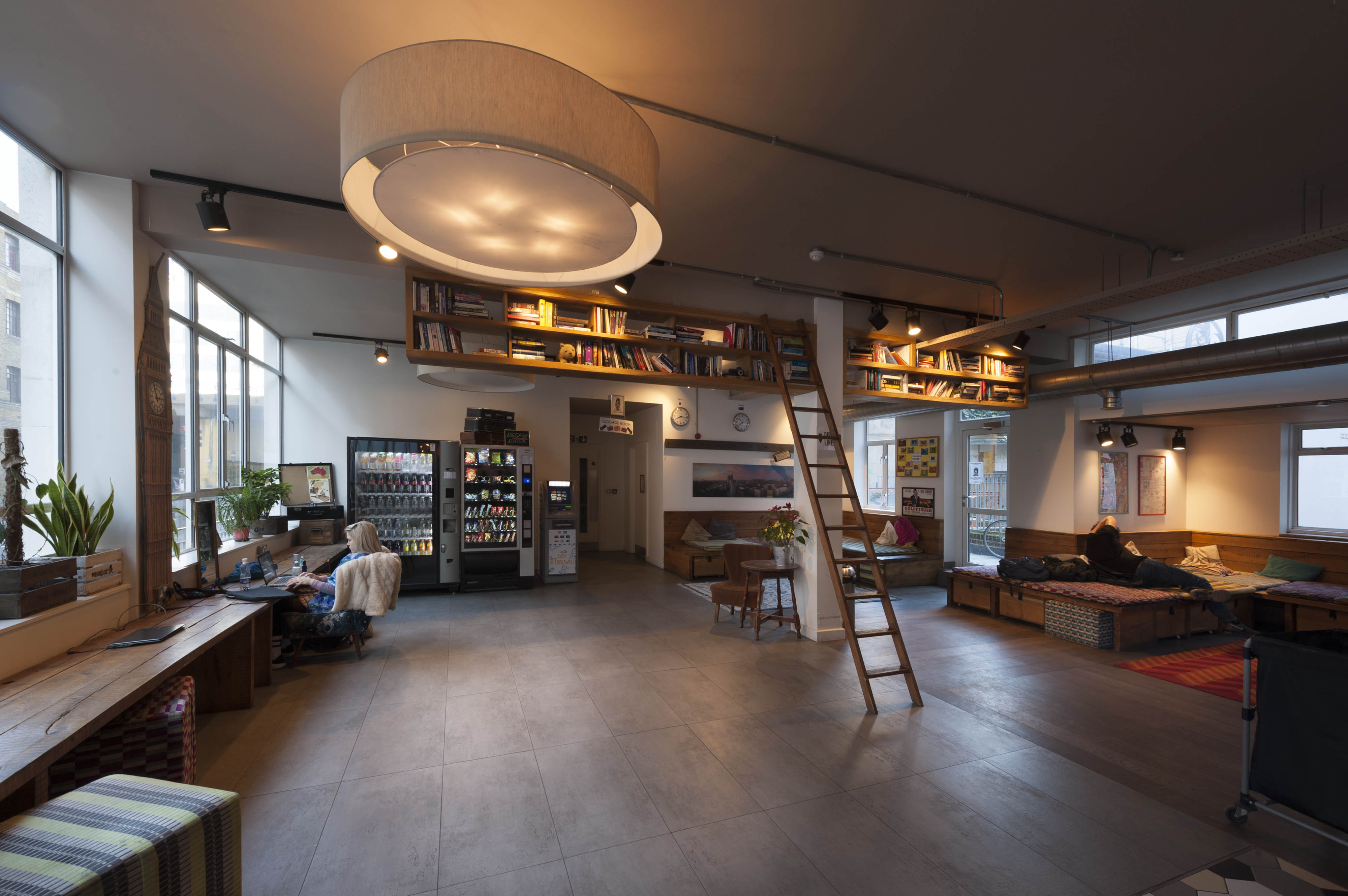
"address": "Wombat's City Hostel, 7 Dock Street",
"feature_type": "WHITECHAPEL_BUILDING",
"count": 25,
"search_str": "Wombat's City Hostel, 7 Dock Street"
},
"tags": []
},
"file": "https://surveyoflondon.org/media/uploads/features/1385/1896%20-%20Dock%20Street%20Sailors%20Home_7BMCkaB.jpg",
"description": "This is the Dock Street frontage to the Sailors' Home (formerly Brunswick Maritime Establishment) as featured in Henry Walker's East London: Sketches of Christian Work and Workers published in 1896.",
"copyright": false,
"created": "2019-01-02"
},
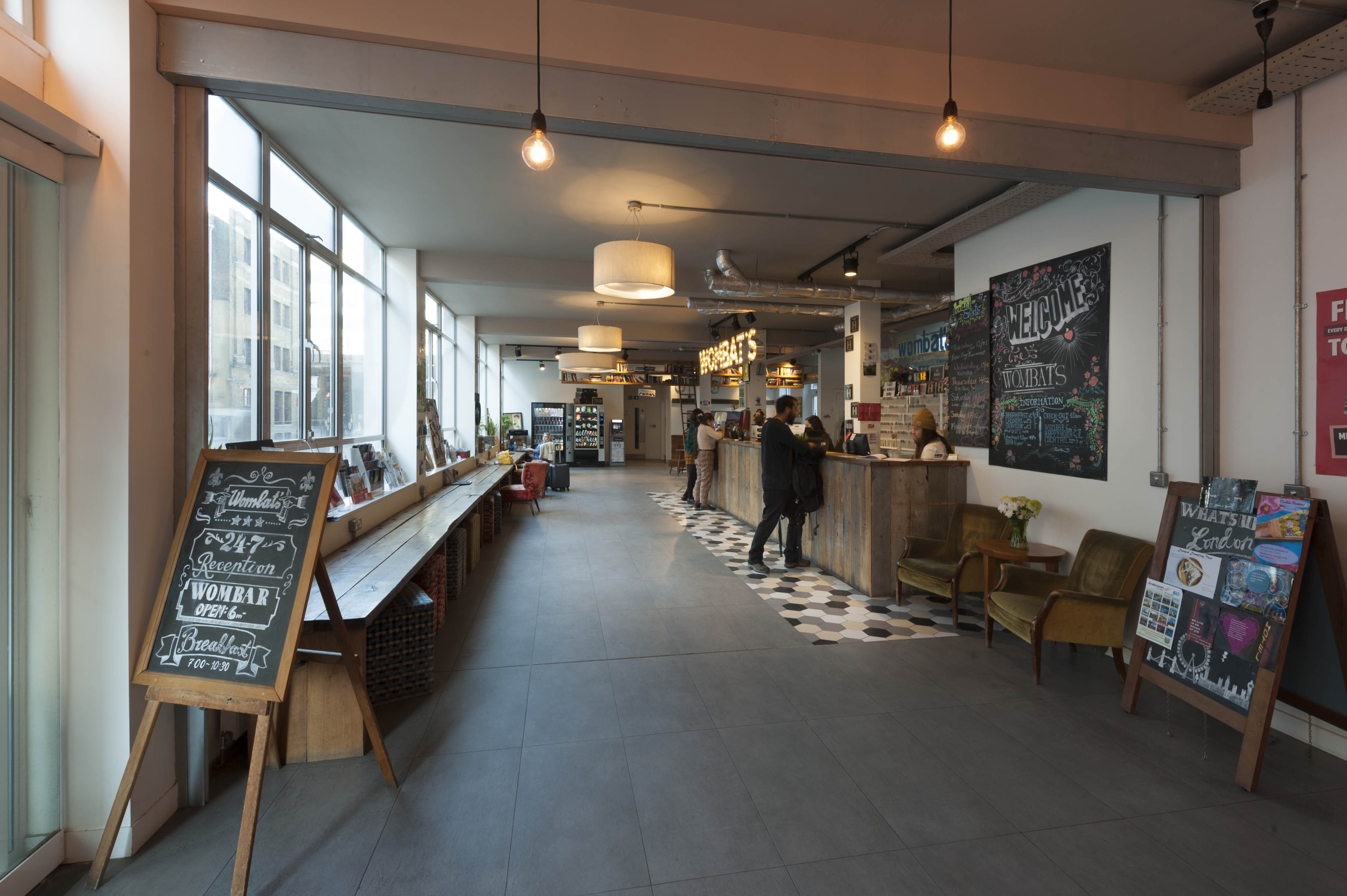
{
"id": 1528,
"title": "Wombat's, entrance lobby from the south in 2019",
"author": {
"id": 27,
"username": "DerekKendall"
},
"feature": {
"id": 1385,
"type": "Feature",
"geometry": {
"type": "MultiPolygon",
"coordinates": [
[
[
[
-0.067575803709333,
51.51021492278667
],
[
-0.067783647338447,
51.51017527172947
],
[
-0.067828706900756,
51.510167293395675
],
[
-0.067884358000762,
51.51028332470727
],
[
-0.068021222270461,
51.51026117174896
],
[
-0.068027105232624,
51.51027869995762
],
[
-0.068059007104689,
51.51027341168682
],
[
-0.068045803249401,
51.51025517119752
],
[
-0.068185711037114,
51.51022956959143
],
[
-0.068302205657116,
51.51049311218949
],
[
-0.068154065018083,
51.51051508999573
],
[
-0.068142111677326,
51.51048931210634
],
[
-0.068158013519995,
51.51048782991857
],
[
-0.0680993992664,
51.51035372697415
],
[
-0.068063773094401,
51.51035895389879
],
[
-0.068055396596396,
51.510336723241444
],
[
-0.067963562571312,
51.510349163498944
],
[
-0.067961653646245,
51.510339150568754
],
[
-0.067909585576321,
51.510347692789416
],
[
-0.067933270683552,
51.5104044774377
],
[
-0.067674158297256,
51.51045078856997
],
[
-0.067629160671485,
51.51036923447038
],
[
-0.067652633918951,
51.51036497018876
],
[
-0.067575803709333,
51.51021492278667
]
]
]
]
},
"properties": {
"b_number": "7",
"b_name": "",
"street": "Dock Street",
"address": "Wombat's City Hostel, 7 Dock Street",
"feature_type": "WHITECHAPEL_BUILDING",
"count": 25,
"search_str": "Wombat's City Hostel, 7 Dock Street"
},
"tags": []
},
"file": "https://surveyoflondon.org/media/uploads/features/1385/SoL%20Whitechapel%20102611.jpg",
"description": "",
"copyright": true,
"created": "2019-03-05"
},
{
"id": 1529,
"title": "Wombat's, entrance lobby north end in 2019",
"author": {
"id": 27,
"username": "DerekKendall"
},
"feature": {
"id": 1385,
"type": "Feature",
"geometry": {
"type": "MultiPolygon",
"coordinates": [
[
[
[
-0.067575803709333,
51.51021492278667
],
[
-0.067783647338447,
51.51017527172947
],
[
-0.067828706900756,
51.510167293395675
],
[
-0.067884358000762,
51.51028332470727
],
[
-0.068021222270461,
51.51026117174896
],
[
-0.068027105232624,
51.51027869995762
],
[
-0.068059007104689,
51.51027341168682
],
[
-0.068045803249401,
51.51025517119752
],
[
-0.068185711037114,
51.51022956959143
],
[
-0.068302205657116,
51.51049311218949
],
[
-0.068154065018083,
51.51051508999573
],
[
-0.068142111677326,
51.51048931210634
],
[
-0.068158013519995,
51.51048782991857
],
[
-0.0680993992664,
51.51035372697415
],
[
-0.068063773094401,
51.51035895389879
],
[
-0.068055396596396,
51.510336723241444
],
[
-0.067963562571312,
51.510349163498944
],
[
-0.067961653646245,
51.510339150568754
],
[
-0.067909585576321,
51.510347692789416
],
[
-0.067933270683552,
51.5104044774377
],
[
-0.067674158297256,
51.51045078856997
],
[
-0.067629160671485,
51.51036923447038
],
[
-0.067652633918951,
51.51036497018876
],
[
-0.067575803709333,
51.51021492278667
]
]
]
]
},
"properties": {
"b_number": "7",
"b_name": "",
"street": "Dock Street",
"address": "Wombat's City Hostel, 7 Dock Street",
"feature_type": "WHITECHAPEL_BUILDING",
"count": 25,
"search_str": "Wombat's City Hostel, 7 Dock Street"
},
"tags": []
},
"file": "https://surveyoflondon.org/media/uploads/features/1385/SoL%20Whitechapel%20102613.jpg",
"description": "",
"copyright": true,
"created": "2019-03-05"
},
{
"id": 1526,
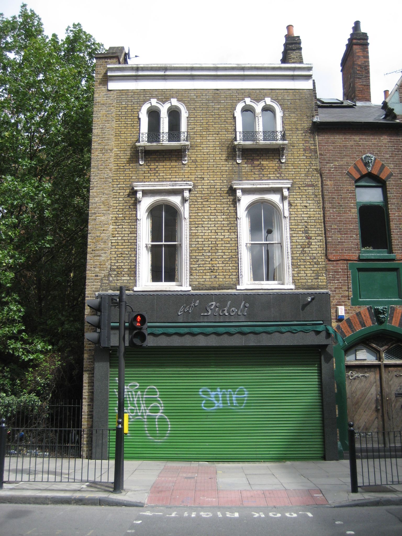
"title": "Sidoli's in Leman Street, now demolished",
"author": {
"id": 153,
"username": "danny"
},
"feature": {
"id": 1448,
"type": "Feature",
"geometry": {
"type": "MultiPolygon",
"coordinates": [
[
[
[
-0.070578995059682,
51.51446641575787
],
[
-0.070916294099672,
51.514341722525785
],
[
-0.071028314716768,
51.51446581892952
],
[
-0.070692872229902,
51.51458286029582
],
[
-0.070578995059682,
51.51446641575787
]
]
]
]
},
"properties": {
"b_number": "",
"b_name": "Leman Locke",
"street": "Leman Street",
"address": "Leman Locke, 15–17 Leman Street",
"feature_type": "WHITECHAPEL_BUILDING",
"count": 12,
"search_str": "Leman Locke"
},
"tags": []
},
"file": "https://surveyoflondon.org/media/uploads/features/1448/Sidolis.jpg",
"description": "A picture of one of the two buildings, now demolished, used as a café and wine bar by the Sidoli family in Leman Street, photographed on 2 Sept 2007.",
"copyright": false,
"created": "2019-02-01"
},
{
"id": 1527,
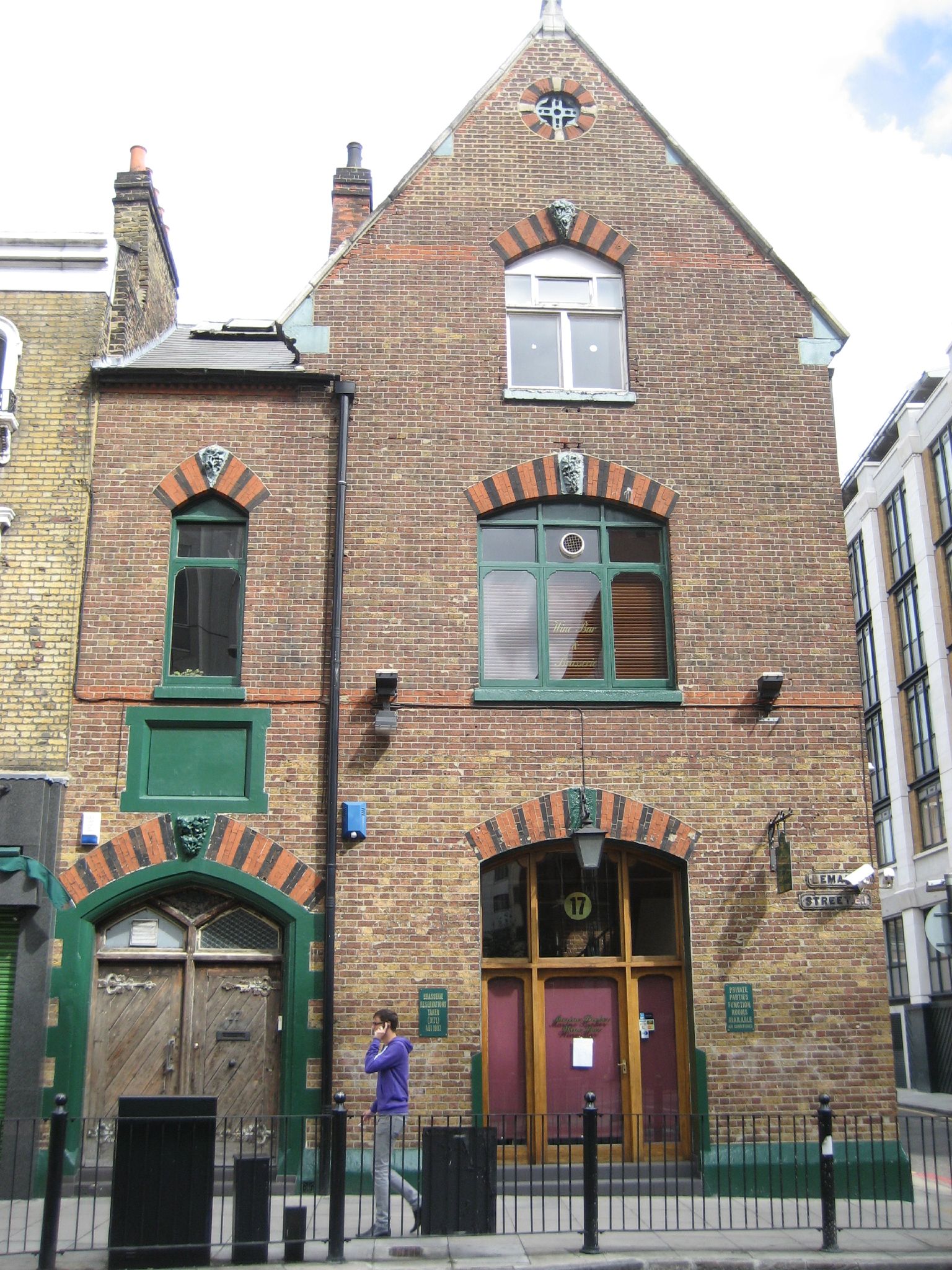
"title": "Sidoli's in Leman Street in 2007",
"author": {
"id": 153,
"username": "danny"
},
"feature": {
"id": 1448,
"type": "Feature",
"geometry": {
"type": "MultiPolygon",
"coordinates": [
[
[
[
-0.070578995059682,
51.51446641575787
],
[
-0.070916294099672,
51.514341722525785
],
[
-0.071028314716768,
51.51446581892952
],
[
-0.070692872229902,
51.51458286029582
],
[
-0.070578995059682,
51.51446641575787
]
]
]
]
},
"properties": {
"b_number": "",
"b_name": "Leman Locke",
"street": "Leman Street",
"address": "Leman Locke, 15–17 Leman Street",
"feature_type": "WHITECHAPEL_BUILDING",
"count": 12,
"search_str": "Leman Locke"
},
"tags": []
},
"file": "https://surveyoflondon.org/media/uploads/features/1448/Sidolis%202.jpg",
"description": "Sidoli's Wine Bar in Leman Street, photographed on 2 Sept 2007, in the premises of what I believe was a former school building.",
"copyright": false,
"created": "2019-02-01"
},
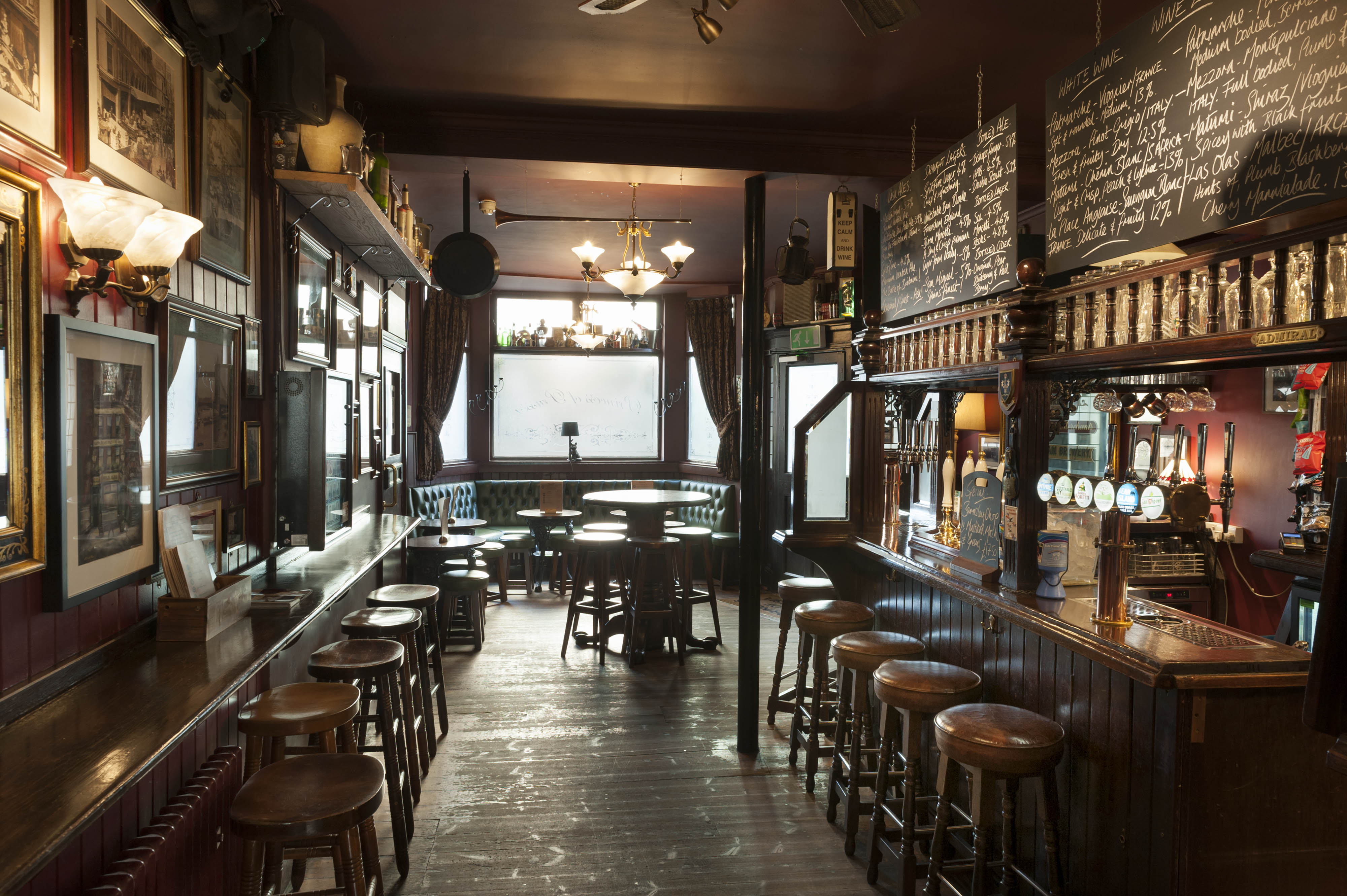
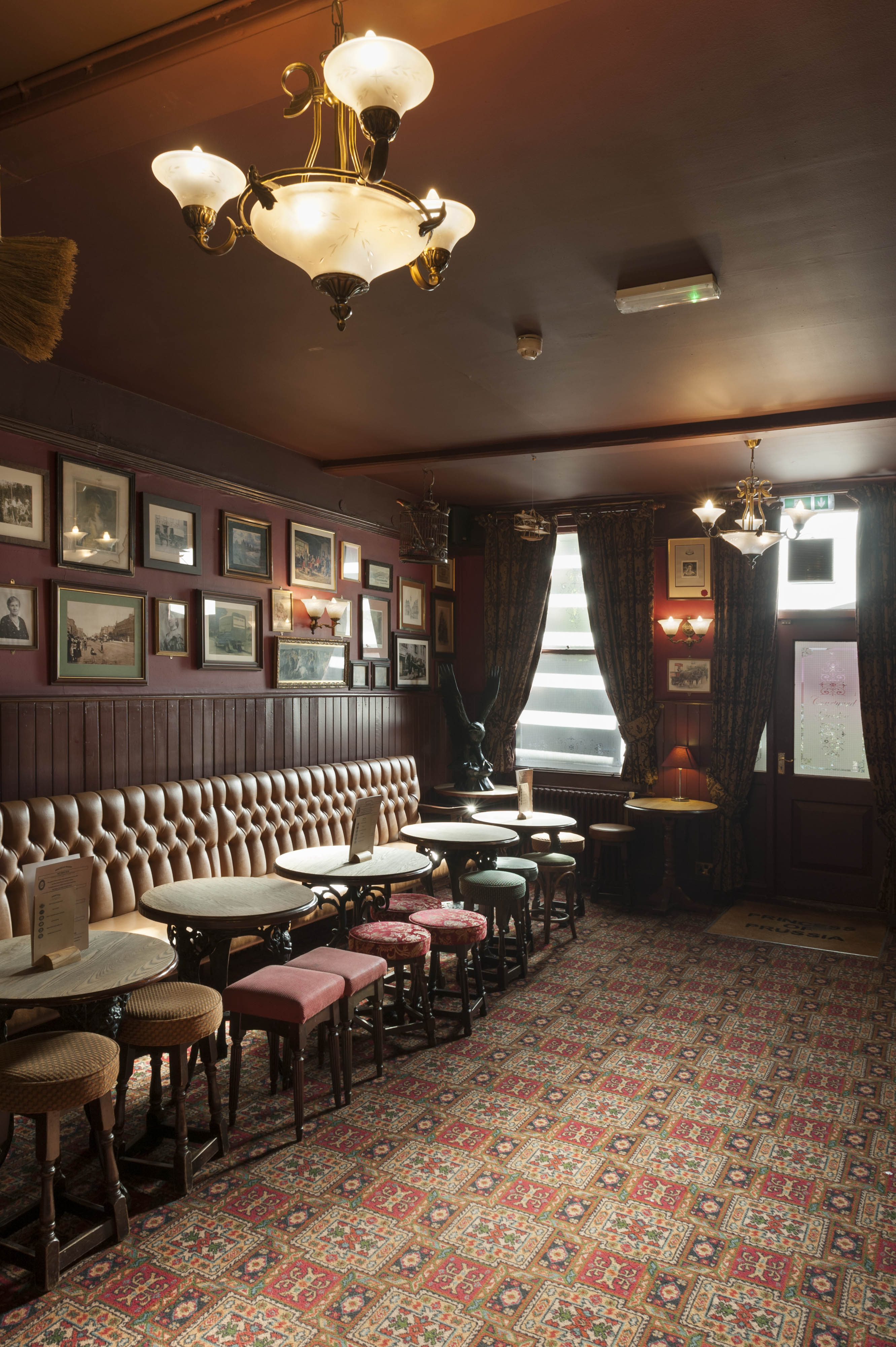
{
"id": 1537,
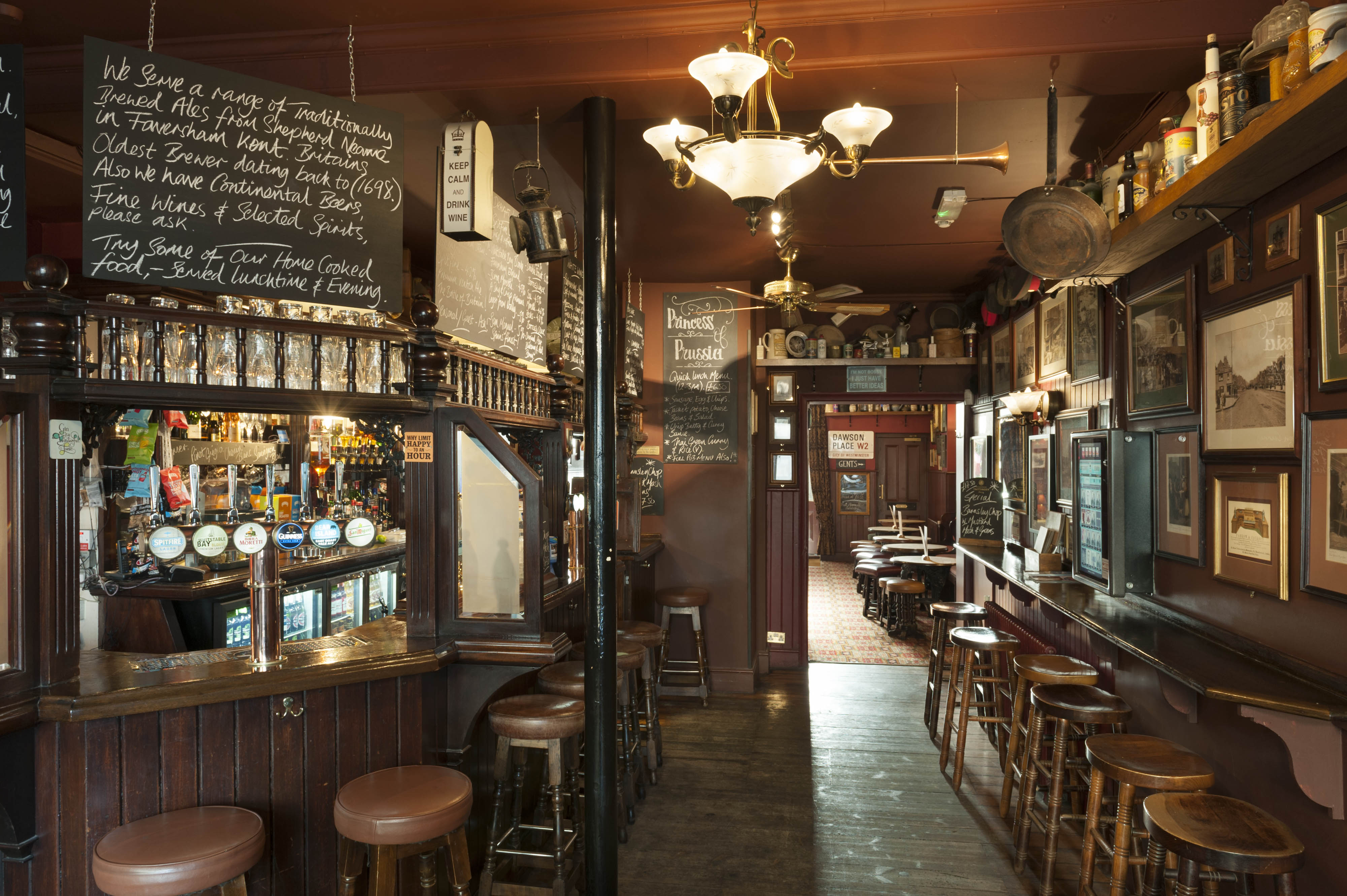
"title": "Princess of Prussia, interior looking south in 2019",
"author": {
"id": 27,
"username": "DerekKendall"
},
"feature": {
"id": 1290,
"type": "Feature",
"geometry": {
"type": "MultiPolygon",
"coordinates": [
[
[
[
-0.070515351299897,
51.511581845779865
],
[
-0.070458535269443,
51.51143123442822
],
[
-0.0705009342948,
51.51142400353988
],
[
-0.070490018512607,
51.51139399886158
],
[
-0.07051545384739,
51.51139090854125
],
[
-0.070583746192274,
51.51157127501072
],
[
-0.070564771642518,
51.51157434131644
],
[
-0.070561921194683,
51.511577641177794
],
[
-0.070540207323307,
51.51158137754552
],
[
-0.070534920857582,
51.51157895134292
],
[
-0.070515351299897,
51.511581845779865
]
]
]
]
},
"properties": {
"b_number": "15",
"b_name": "",
"street": "Prescot Street",
"address": "Princess Of Prussia, 15 Prescot Street",
"feature_type": "WHITECHAPEL_BUILDING",
"count": 7,
"search_str": "Princess Of Prussia, 15 Prescot Street"
},
"tags": []
},
"file": "https://surveyoflondon.org/media/uploads/features/1290/SoL%20Whitechapel%20102634.jpg",
"description": "",
"copyright": true,
"created": "2019-03-05"
},
{
"id": 1538,
"title": "Princess of Prussia, interior looking north in 2019",
"author": {
"id": 27,
"username": "DerekKendall"
},
"feature": {
"id": 1290,
"type": "Feature",
"geometry": {
"type": "MultiPolygon",
"coordinates": [
[
[
[
-0.070515351299897,
51.511581845779865
],
[
-0.070458535269443,
51.51143123442822
],
[
-0.0705009342948,
51.51142400353988
],
[
-0.070490018512607,
51.51139399886158
],
[
-0.07051545384739,
51.51139090854125
],
[
-0.070583746192274,
51.51157127501072
],
[
-0.070564771642518,
51.51157434131644
],
[
-0.070561921194683,
51.511577641177794
],
[
-0.070540207323307,
51.51158137754552
],
[
-0.070534920857582,
51.51157895134292
],
[
-0.070515351299897,
51.511581845779865
]
]
]
]
},
"properties": {
"b_number": "15",
"b_name": "",
"street": "Prescot Street",
"address": "Princess Of Prussia, 15 Prescot Street",
"feature_type": "WHITECHAPEL_BUILDING",
"count": 7,
"search_str": "Princess Of Prussia, 15 Prescot Street"
},
"tags": []
},
"file": "https://surveyoflondon.org/media/uploads/features/1290/SoL%20Whitechapel%20102635.jpg",
"description": "",
"copyright": true,
"created": "2019-03-05"
},
{
"id": 1539,
"title": "Princess of Prussia, interior south end in 2019",
"author": {
"id": 27,
"username": "DerekKendall"
},
"feature": {
"id": 1290,
"type": "Feature",
"geometry": {
"type": "MultiPolygon",
"coordinates": [
[
[
[
-0.070515351299897,
51.511581845779865
],
[
-0.070458535269443,
51.51143123442822
],
[
-0.0705009342948,
51.51142400353988
],
[
-0.070490018512607,
51.51139399886158
],
[
-0.07051545384739,
51.51139090854125
],
[
-0.070583746192274,
51.51157127501072
],
[
-0.070564771642518,
51.51157434131644
],
[
-0.070561921194683,
51.511577641177794
],
[
-0.070540207323307,
51.51158137754552
],
[
-0.070534920857582,
51.51157895134292
],
[
-0.070515351299897,
51.511581845779865
]
]
]
]
},
"properties": {
"b_number": "15",
"b_name": "",
"street": "Prescot Street",
"address": "Princess Of Prussia, 15 Prescot Street",
"feature_type": "WHITECHAPEL_BUILDING",
"count": 7,
"search_str": "Princess Of Prussia, 15 Prescot Street"
},
"tags": []
},
"file": "https://surveyoflondon.org/media/uploads/features/1290/SoL%20Whitechapel%20102636.jpg",
"description": "",
"copyright": true,
"created": "2019-03-05"
}
]
}