HTTP 200 OK
Allow: GET, HEAD, OPTIONS
Content-Type: application/json
Vary: Accept
{
"count": 1747,
"next": "https://surveyoflondon.org/api/v1/images/?format=api&page=64",
"previous": "https://surveyoflondon.org/api/v1/images/?format=api&page=62",
"results": [
{
"id": 1182,
"title": "Wilton's Music Hall in early 2018, from the south-east",
"author": {
"id": 27,
"username": "DerekKendall"
},
"feature": {
"id": 1392,
"type": "Feature",
"geometry": {
"type": "MultiPolygon",
"coordinates": [
[
[
[
-0.066897382560978,
51.51047185184401
],
[
-0.066897150320887,
51.510543358461234
],
[
-0.066964310871808,
51.51054939761258
],
[
-0.067031736648758,
51.51055546057313
],
[
-0.067033159620775,
51.51054385631446
],
[
-0.067124985785421,
51.51055249759738
],
[
-0.067119646867151,
51.510573278551
],
[
-0.067097006082147,
51.51057630354935
],
[
-0.067064204301052,
51.510690877240464
],
[
-0.066813595729658,
51.51071232706844
],
[
-0.066808845661517,
51.510692481646345
],
[
-0.066750873450789,
51.51069733978511
],
[
-0.066731248551372,
51.51054469318253
],
[
-0.066802206282857,
51.51054121190127
],
[
-0.066805453245557,
51.51046452251118
],
[
-0.066897382560978,
51.51047185184401
]
]
]
]
},
"properties": {
"b_number": "1",
"b_name": "Wilton's Music Hall",
"street": "Graces Alley",
"address": "Wilton's Music Hall, 1 Graces Alley",
"feature_type": "WHITECHAPEL_BUILDING",
"count": 23,
"search_str": "Wilton's Music Hall"
},
"tags": [
"Wilton's Music Hall"
]
},
"file": "https://surveyoflondon.org/media/uploads/features/1392/SoL%20Whitechapel%20101800.jpg",
"description": "",
"copyright": true,
"created": "2018-03-05"
},
{
"id": 1301,
"title": "The Artful Dodger in 2018",
"author": {
"id": 27,
"username": "DerekKendall"
},
"feature": {
"id": 1340,
"type": "Feature",
"geometry": {
"type": "MultiPolygon",
"coordinates": [
[
[
[
-0.070218201553316,
51.51043094496562
],
[
-0.070222558344686,
51.51044247916505
],
[
-0.070109328735508,
51.510468828661644
],
[
-0.070060850905555,
51.51038509713018
],
[
-0.070073091733693,
51.510382337633246
],
[
-0.070050463039811,
51.51034325297067
],
[
-0.070066633176381,
51.51033960767238
],
[
-0.070054353255101,
51.510318397568625
],
[
-0.070157621726522,
51.510295117279824
],
[
-0.070179031681174,
51.51033209678496
],
[
-0.070158959927667,
51.51033794396246
],
[
-0.07017205837987,
51.510360032186526
],
[
-0.070184201425816,
51.510378368893306
],
[
-0.070218201553316,
51.51043094496562
]
]
]
]
},
"properties": {
"b_number": "47",
"b_name": "The Artful Dodger (formerly the Crown and Seven Stars)",
"street": "Royal Mint Street",
"address": "The Artful Dodger (formerly the Crown and Seven Stars) public house, 47 Royal Mint Street",
"feature_type": "WHITECHAPEL_BUILDING",
"count": 18,
"search_str": "The Artful Dodger (formerly the Crown and Seven Stars)"
},
"tags": []
},
"file": "https://surveyoflondon.org/media/uploads/features/1340/SoL%20Whitechapel%20102047.jpg",
"description": "",
"copyright": true,
"created": "2018-08-13"
},
{
"id": 1596,
"title": "Former Crown and Seven Stars, detail of facade in 2019",
"author": {
"id": 27,
"username": "DerekKendall"
},
"feature": {
"id": 1340,
"type": "Feature",
"geometry": {
"type": "MultiPolygon",
"coordinates": [
[
[
[
-0.070218201553316,
51.51043094496562
],
[
-0.070222558344686,
51.51044247916505
],
[
-0.070109328735508,
51.510468828661644
],
[
-0.070060850905555,
51.51038509713018
],
[
-0.070073091733693,
51.510382337633246
],
[
-0.070050463039811,
51.51034325297067
],
[
-0.070066633176381,
51.51033960767238
],
[
-0.070054353255101,
51.510318397568625
],
[
-0.070157621726522,
51.510295117279824
],
[
-0.070179031681174,
51.51033209678496
],
[
-0.070158959927667,
51.51033794396246
],
[
-0.07017205837987,
51.510360032186526
],
[
-0.070184201425816,
51.510378368893306
],
[
-0.070218201553316,
51.51043094496562
]
]
]
]
},
"properties": {
"b_number": "47",
"b_name": "The Artful Dodger (formerly the Crown and Seven Stars)",
"street": "Royal Mint Street",
"address": "The Artful Dodger (formerly the Crown and Seven Stars) public house, 47 Royal Mint Street",
"feature_type": "WHITECHAPEL_BUILDING",
"count": 18,
"search_str": "The Artful Dodger (formerly the Crown and Seven Stars)"
},
"tags": []
},
"file": "https://surveyoflondon.org/media/uploads/features/1340/SoL%20Whitechapel%20102744.jpg",
"description": "",
"copyright": true,
"created": "2019-04-30"
},
{
"id": 1476,
"title": "Entrance to New Road Hotel",
"author": {
"id": 242,
"username": "louisberk"
},
"feature": {
"id": 849,
"type": "Feature",
"geometry": {
"type": "MultiPolygon",
"coordinates": [
[
[
[
-0.062609929785488,
51.51738959779921
],
[
-0.062716406528659,
51.51737667042908
],
[
-0.062723861521385,
51.51740458896256
],
[
-0.062817127286198,
51.51739512872249
],
[
-0.062863455061319,
51.51757291139632
],
[
-0.062766096607894,
51.517621918848995
],
[
-0.062677693069574,
51.517634076942514
],
[
-0.062609929785488,
51.51738959779921
]
]
]
]
},
"properties": {
"b_number": "101-107",
"b_name": "",
"street": "New Road",
"address": "New Road Hotel (formerly Service House), 101-107 New Road",
"feature_type": "WHITECHAPEL_BUILDING",
"count": 9,
"search_str": "New Road Hotel (formerly Service House), 101-107 New Road"
},
"tags": [
"H. Victor Kerr"
]
},
"file": "https://surveyoflondon.org/media/uploads/features/849/_DSF4406-Edit-Edit.jpg",
"description": "Entrance to the recently renovated and re-opened, former Service House, now New Road Hotel - original architect H V Kerr, also responsible for Empire House, Zyclone House and Gwynne House, all nearby.",
"copyright": false,
"created": "2018-12-17"
},
{
"id": 1477,
"title": "Former Vine Court synagogue additional view",
"author": {
"id": 242,
"username": "louisberk"
},
"feature": {
"id": 1461,
"type": "Feature",
"geometry": {
"type": "MultiPolygon",
"coordinates": [
[
[
[
-0.063835930486713,
51.51792418677794
],
[
-0.0637089382797,
51.51796483346984
],
[
-0.063645211926788,
51.51787976147331
],
[
-0.063605607582737,
51.517826891168035
],
[
-0.063734824121299,
51.517789214473716
],
[
-0.063835930486713,
51.51792418677794
]
]
]
]
},
"properties": {
"b_number": "17",
"b_name": "",
"street": "Vine Court",
"address": "Former Wilcox's New Music Hall and Vine Court synagogue",
"feature_type": "WHITECHAPEL_BUILDING",
"count": 2,
"search_str": "Former Wilcox's New Music Hall and Vine Court synagogue"
},
"tags": [
"music hall",
"synagogue",
"Vine Court Synagogue",
"Wilcox's New Music Hall"
]
},
"file": "https://surveyoflondon.org/media/uploads/features/1461/_DSF4399.jpg",
"description": "Alternative view of the former music hall and synagogue",
"copyright": false,
"created": "2018-12-17"
},
{
"id": 890,
"title": "Kensington Apartments with Bradbury Court beyond, August 2017",
"author": {
"id": 27,
"username": "DerekKendall"
},
"feature": {
"id": 417,
"type": "Feature",
"geometry": {
"type": "MultiPolygon",
"coordinates": [
[
[
[
-0.072579098508925,
51.51588574342777
],
[
-0.072804098509042,
51.515812043427744
],
[
-0.07310819850918,
51.5157573434277
],
[
-0.073255698509161,
51.51591574342781
],
[
-0.072960598509013,
51.51600294342786
],
[
-0.072746598508902,
51.51606954342789
],
[
-0.072579098508925,
51.51588574342777
]
]
]
]
},
"properties": {
"b_number": "",
"b_name": "Kensington Apartments, 11 Commercial Street",
"street": "11 Commercial Street",
"address": "Kensington Apartments, 11 Commercial Street, London 6LW and 6NE",
"feature_type": "WHITECHAPEL_BUILDING",
"count": 9,
"search_str": "Kensington Apartments, 11 Commercial Street"
},
"tags": []
},
"file": "https://surveyoflondon.org/media/uploads/features/417/SoL%20Whitechapel%20101315.jpg",
"description": "",
"copyright": true,
"created": "2017-09-26"
},
{
"id": 239,
"title": "Commercial Street Baptist Chapel, built 1854-5, dem. c. 1910",
"author": {
"id": 25,
"username": "Aileen"
},
"feature": {
"id": 417,
"type": "Feature",
"geometry": {
"type": "MultiPolygon",
"coordinates": [
[
[
[
-0.072579098508925,
51.51588574342777
],
[
-0.072804098509042,
51.515812043427744
],
[
-0.07310819850918,
51.5157573434277
],
[
-0.073255698509161,
51.51591574342781
],
[
-0.072960598509013,
51.51600294342786
],
[
-0.072746598508902,
51.51606954342789
],
[
-0.072579098508925,
51.51588574342777
]
]
]
]
},
"properties": {
"b_number": "",
"b_name": "Kensington Apartments, 11 Commercial Street",
"street": "11 Commercial Street",
"address": "Kensington Apartments, 11 Commercial Street, London 6LW and 6NE",
"feature_type": "WHITECHAPEL_BUILDING",
"count": 9,
"search_str": "Kensington Apartments, 11 Commercial Street"
},
"tags": []
},
"file": "https://surveyoflondon.org/media/uploads/features/417/Baptist%20chapel%20from%20book_NbBiRTw.jpg",
"description": "An illustration from Ernest F. Kevan, 'London's Oldest Baptist Church' (1933), of the imposing Commercial Street Baptist chapel, built when the site of the old chapel in Prescot Street was needed for railway development. Changing demographic meant that by the end of the 19th century the Commercial Street chapel's congregation was too small to justify such a large building and it was closed, the building sold to the Metropolitan Police who built a section house (accommodation for single police officers) on the site to the designs of the Metropolitan Police architect, J. Dixon Butler. That building, a plain red brick block with atypical Butler feature, a prominent hooded door surround, survived incendiary damage in the Second World War. It was demolished in the 1960s as part of the major redevelopment (known originally as the Tyne Street or New Holland estate development) of the block bounded by Wentworth Street, Commercial Street, Pomell Way and Old Castle Street, dominated by the Denning Point tower block. A low-rise block, Bradbury House, occupied the former site of the chapel/section house and was in turn demolished c. 2013 for the Holland estate redevelopment and the building of Kensington Apartments on the site. The name Bradbury Court has been used for a new block on Old Castle Street. ",
"copyright": false,
"created": "2016-08-10"
},
{
"id": 1495,
"title": "52 to 72 Middlesex Street",
"author": {
"id": 27,
"username": "DerekKendall"
},
"feature": {
"id": 328,
"type": "Feature",
"geometry": {
"type": "MultiPolygon",
"coordinates": [
[
[
[
-0.076188584615496,
51.516231715246875
],
[
-0.076163758093209,
51.51620775818292
],
[
-0.076236728804259,
51.51616902092471
],
[
-0.076264094750682,
51.516187017102794
],
[
-0.076256723134832,
51.516196739797564
],
[
-0.076188584615496,
51.516231715246875
]
]
]
]
},
"properties": {
"b_number": "72",
"b_name": "72 Middlesex Street, London E1 7EZ",
"street": "Middlesex Street",
"address": "72 Middlesex Street",
"feature_type": "WHITECHAPEL_BUILDING",
"count": 6,
"search_str": "72 Middlesex Street, London E1 7EZ"
},
"tags": []
},
"file": "https://surveyoflondon.org/media/uploads/features/328/SoL%20Whitechapel%20100891.jpg",
"description": "View south in June 2017",
"copyright": true,
"created": "2019-01-07"
},
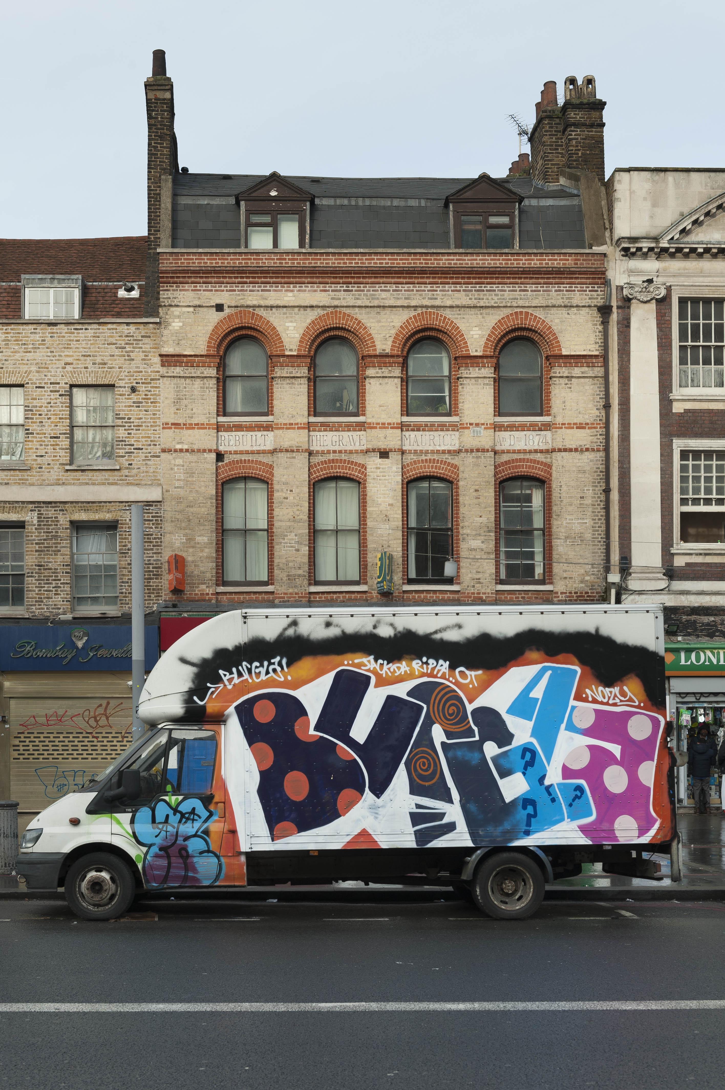
{
"id": 1504,
"title": "269 Whitechapel Road with van, December 2018",
"author": {
"id": 27,
"username": "DerekKendall"
},
"feature": {
"id": 496,
"type": "Feature",
"geometry": {
"type": "MultiPolygon",
"coordinates": [
[
[
[
-0.060071633969903,
51.51936604849084
],
[
-0.059977916919255,
51.519232761124464
],
[
-0.06009954482173,
51.5192052830406
],
[
-0.060195494903185,
51.519337366967875
],
[
-0.060071633969903,
51.51936604849084
]
]
]
]
},
"properties": {
"b_number": "269",
"b_name": "",
"street": "Whitechapel Road",
"address": "Former Grave Maurice public house, 269 Whitechapel Road",
"feature_type": "WHITECHAPEL_BUILDING",
"count": 9,
"search_str": "Former Grave Maurice public house, 269 Whitechapel Road"
},
"tags": []
},
"file": "https://surveyoflondon.org/media/uploads/features/496/SoL%20Whitechapel%20102555.jpg",
"description": "",
"copyright": true,
"created": "2019-01-09"
},
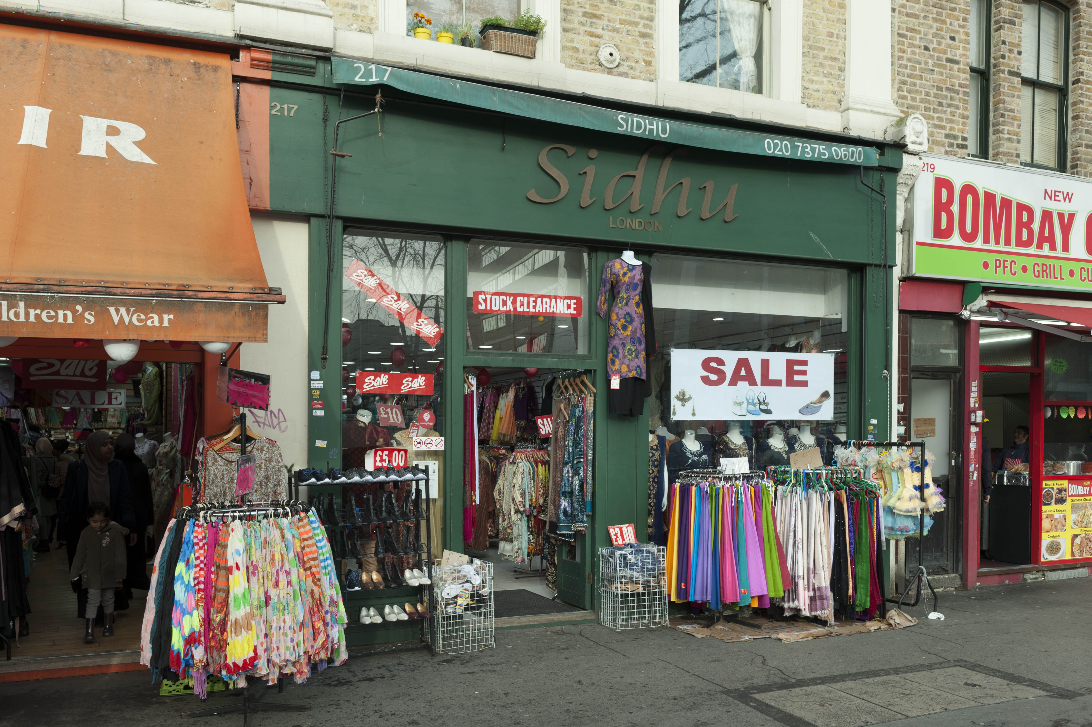
{
"id": 1508,
"title": "Shopfront at 217 Whitechapel Road, December 2018",
"author": {
"id": 27,
"username": "DerekKendall"
},
"feature": {
"id": 479,
"type": "Feature",
"geometry": {
"type": "MultiPolygon",
"coordinates": [
[
[
[
-0.062012923245552,
51.518773774940634
],
[
-0.062132379354576,
51.51896430028482
],
[
-0.062141906179134,
51.51897961819531
],
[
-0.062066093132837,
51.51899936118055
],
[
-0.061975859557661,
51.51885074660028
],
[
-0.061940896344357,
51.51878860459413
],
[
-0.062012923245552,
51.518773774940634
]
]
]
]
},
"properties": {
"b_number": "217",
"b_name": "",
"street": "Whitechapel Road",
"address": "217 Whitechapel Road (formerly the Old Red Lion public house)",
"feature_type": "WHITECHAPEL_BUILDING",
"count": 3,
"search_str": "217 Whitechapel Road (formerly the Old Red Lion public house)"
},
"tags": [
"Old Red Lion public house"
]
},
"file": "https://surveyoflondon.org/media/uploads/features/479/SoL%20Whitechapel%20102563.jpg",
"description": "",
"copyright": true,
"created": "2019-01-09"
},
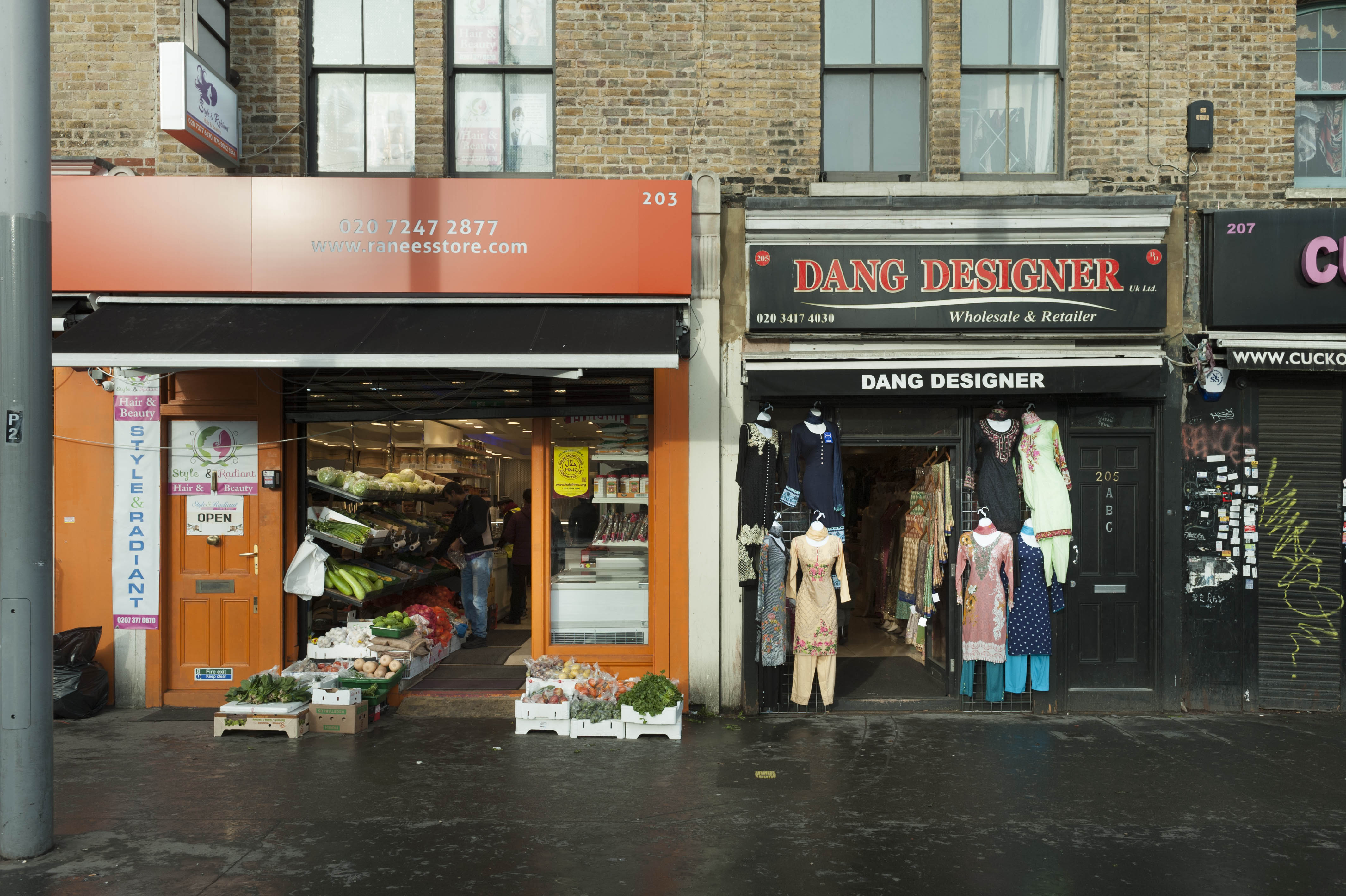
{
"id": 1510,
"title": "Shopfronts at 205 and 207 Whitechapel Road, December 2018",
"author": {
"id": 27,
"username": "DerekKendall"
},
"feature": {
"id": 475,
"type": "Feature",
"geometry": {
"type": "MultiPolygon",
"coordinates": [
[
[
[
-0.062341232872999,
51.51887335350374
],
[
-0.062261628049113,
51.518721850742374
],
[
-0.062324882909735,
51.51870814339838
],
[
-0.062402319479318,
51.51884685468848
],
[
-0.062341232872999,
51.51887335350374
]
]
]
]
},
"properties": {
"b_number": "207",
"b_name": "",
"street": "Whitechapel Road",
"address": "207 Whitechapel Road",
"feature_type": "WHITECHAPEL_BUILDING",
"count": 2,
"search_str": "207 Whitechapel Road"
},
"tags": [
"Henry and William Brandum"
]
},
"file": "https://surveyoflondon.org/media/uploads/features/475/SoL%20Whitechapel%20102569.jpg",
"description": "",
"copyright": true,
"created": "2019-01-09"
},
{
"id": 1338,
"title": "St Paul, Dock Street, detail of west window, August 2018",
"author": {
"id": 27,
"username": "DerekKendall"
},
"feature": {
"id": 1371,
"type": "Feature",
"geometry": {
"type": "MultiPolygon",
"coordinates": [
[
[
[
-0.068057208494737,
51.50994707934026
],
[
-0.068128144074089,
51.510098245489516
],
[
-0.067833383002716,
51.510150364911766
],
[
-0.0678086195768,
51.51009705078618
],
[
-0.067791713048129,
51.51010026052854
],
[
-0.067768418439094,
51.51005627276704
],
[
-0.06778532495294,
51.510053063027875
],
[
-0.06776230081429,
51.510002684478415
],
[
-0.068057208494737,
51.50994707934026
]
]
]
]
},
"properties": {
"b_number": "",
"b_name": "St Paul's Church",
"street": "Dock Street",
"address": "Former Church of St Paul, Dock Street",
"feature_type": "WHITECHAPEL_BUILDING",
"count": 16,
"search_str": "St Paul's Church"
},
"tags": [
"Capt. Robert J. Elliot",
"Henry Roberts",
"James Pennethorne",
"Rev. Dan Greatorex",
"Rev. Joseph Williamson",
"William Cubitt"
]
},
"file": "https://surveyoflondon.org/media/uploads/features/1371/SoL%20Whitechapel%20102118.jpg",
"description": "",
"copyright": true,
"created": "2018-08-13"
},
{
"id": 1339,
"title": "St Paul, Dock Street, detail of west window, August 2018",
"author": {
"id": 27,
"username": "DerekKendall"
},
"feature": {
"id": 1371,
"type": "Feature",
"geometry": {
"type": "MultiPolygon",
"coordinates": [
[
[
[
-0.068057208494737,
51.50994707934026
],
[
-0.068128144074089,
51.510098245489516
],
[
-0.067833383002716,
51.510150364911766
],
[
-0.0678086195768,
51.51009705078618
],
[
-0.067791713048129,
51.51010026052854
],
[
-0.067768418439094,
51.51005627276704
],
[
-0.06778532495294,
51.510053063027875
],
[
-0.06776230081429,
51.510002684478415
],
[
-0.068057208494737,
51.50994707934026
]
]
]
]
},
"properties": {
"b_number": "",
"b_name": "St Paul's Church",
"street": "Dock Street",
"address": "Former Church of St Paul, Dock Street",
"feature_type": "WHITECHAPEL_BUILDING",
"count": 16,
"search_str": "St Paul's Church"
},
"tags": [
"Capt. Robert J. Elliot",
"Henry Roberts",
"James Pennethorne",
"Rev. Dan Greatorex",
"Rev. Joseph Williamson",
"William Cubitt"
]
},
"file": "https://surveyoflondon.org/media/uploads/features/1371/Sol%20Whitechapel%20102123.jpg",
"description": "",
"copyright": true,
"created": "2018-08-13"
},
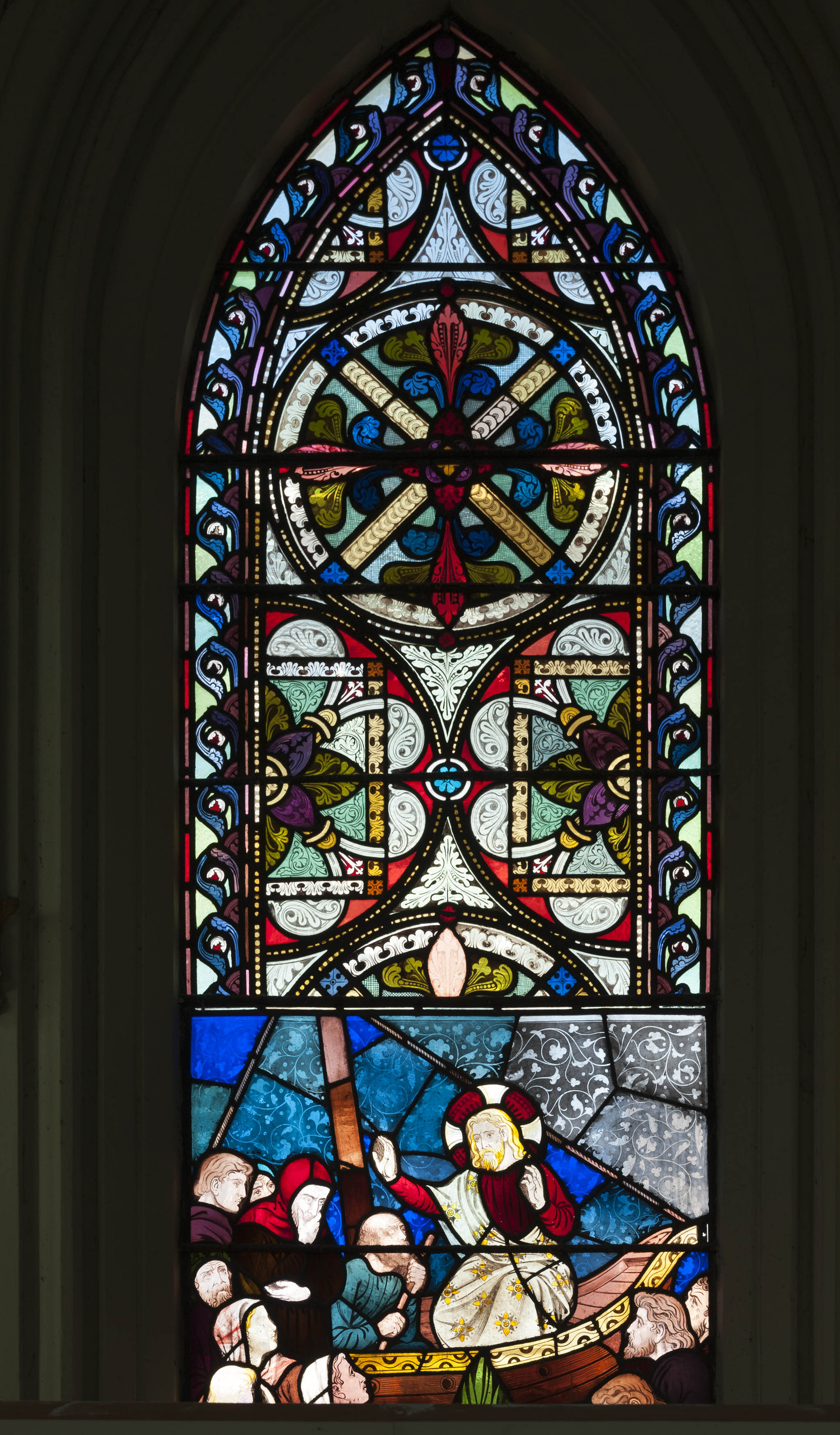
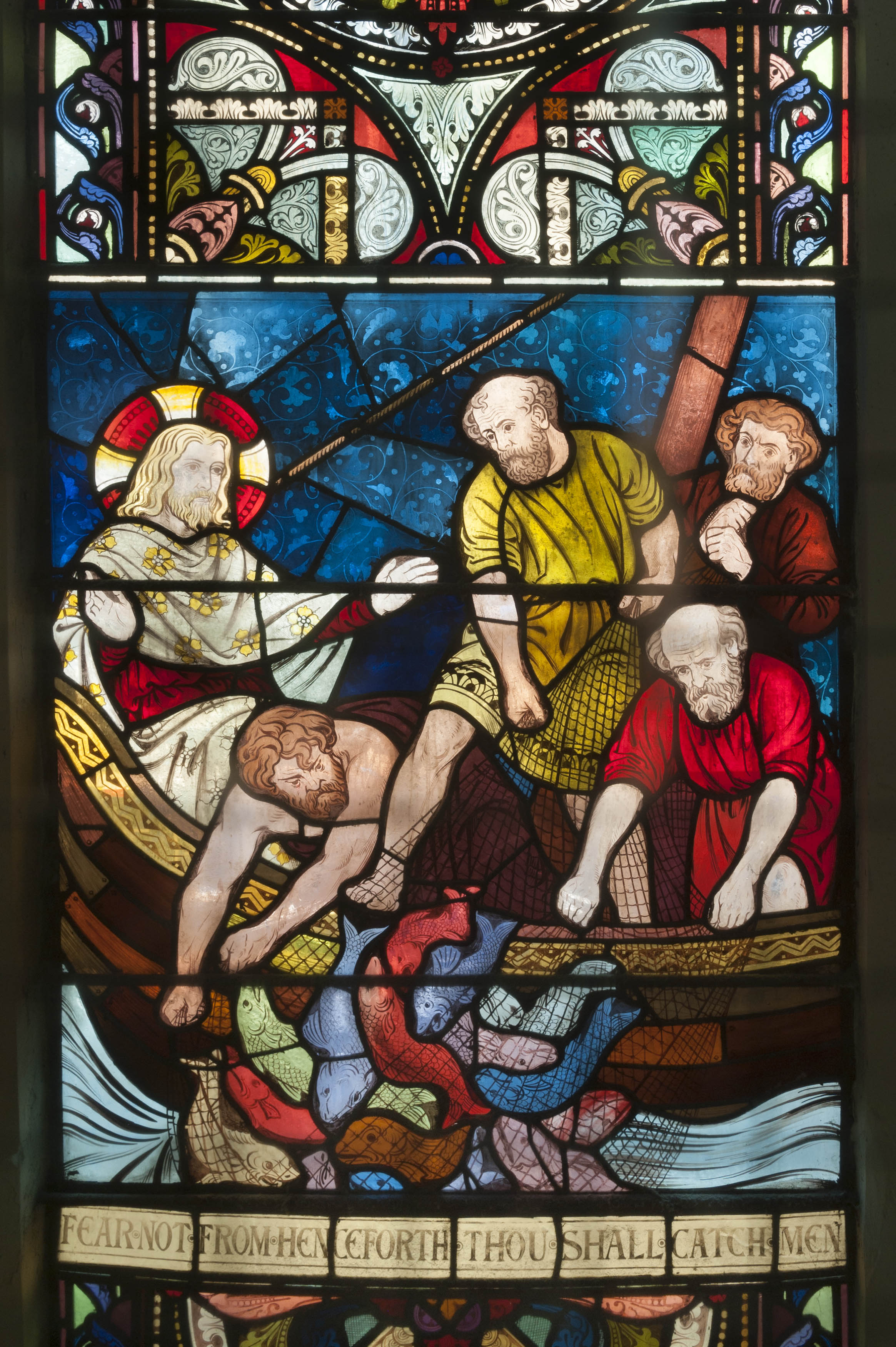
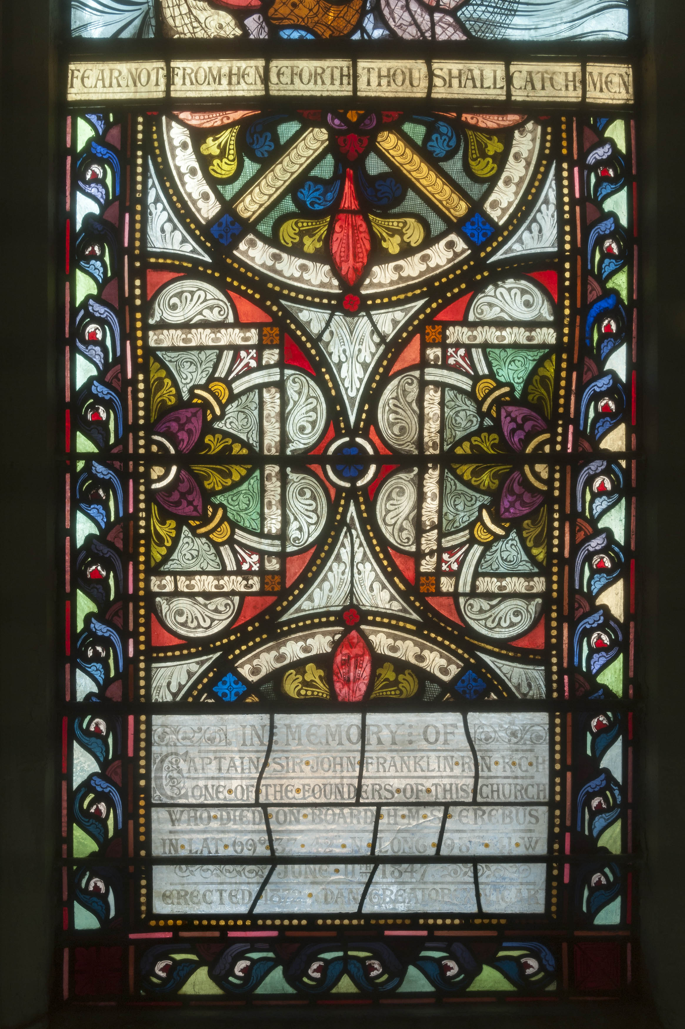
{
"id": 1341,
"title": "St Paul, Dock Street, detail from west window including Franklin inscription, August 2018",
"author": {
"id": 27,
"username": "DerekKendall"
},
"feature": {
"id": 1371,
"type": "Feature",
"geometry": {
"type": "MultiPolygon",
"coordinates": [
[
[
[
-0.068057208494737,
51.50994707934026
],
[
-0.068128144074089,
51.510098245489516
],
[
-0.067833383002716,
51.510150364911766
],
[
-0.0678086195768,
51.51009705078618
],
[
-0.067791713048129,
51.51010026052854
],
[
-0.067768418439094,
51.51005627276704
],
[
-0.06778532495294,
51.510053063027875
],
[
-0.06776230081429,
51.510002684478415
],
[
-0.068057208494737,
51.50994707934026
]
]
]
]
},
"properties": {
"b_number": "",
"b_name": "St Paul's Church",
"street": "Dock Street",
"address": "Former Church of St Paul, Dock Street",
"feature_type": "WHITECHAPEL_BUILDING",
"count": 16,
"search_str": "St Paul's Church"
},
"tags": [
"Capt. Robert J. Elliot",
"Henry Roberts",
"James Pennethorne",
"Rev. Dan Greatorex",
"Rev. Joseph Williamson",
"William Cubitt"
]
},
"file": "https://surveyoflondon.org/media/uploads/features/1371/SoL%20Whitechapel%20102126.jpg",
"description": "",
"copyright": true,
"created": "2018-08-13"
},
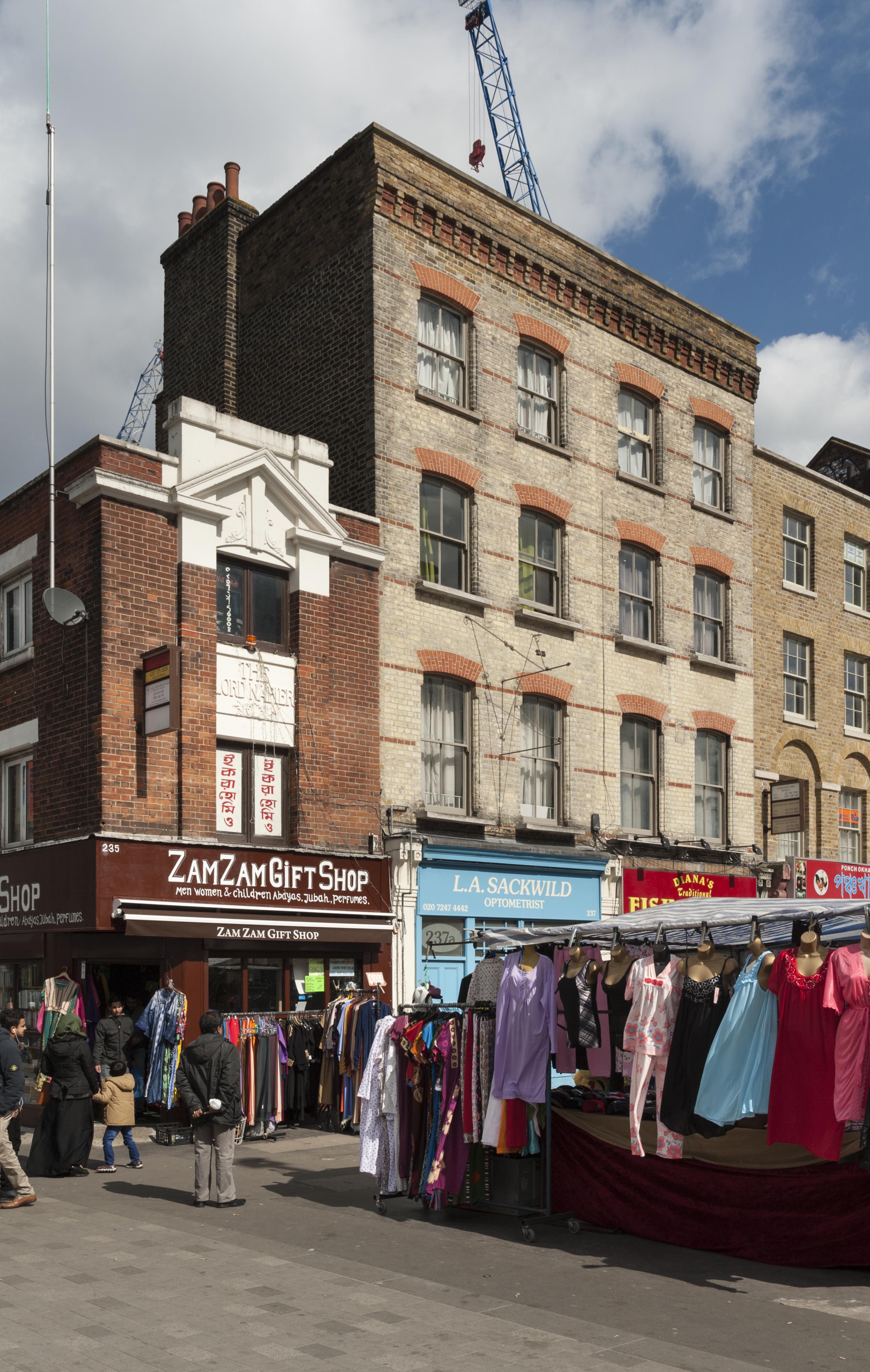
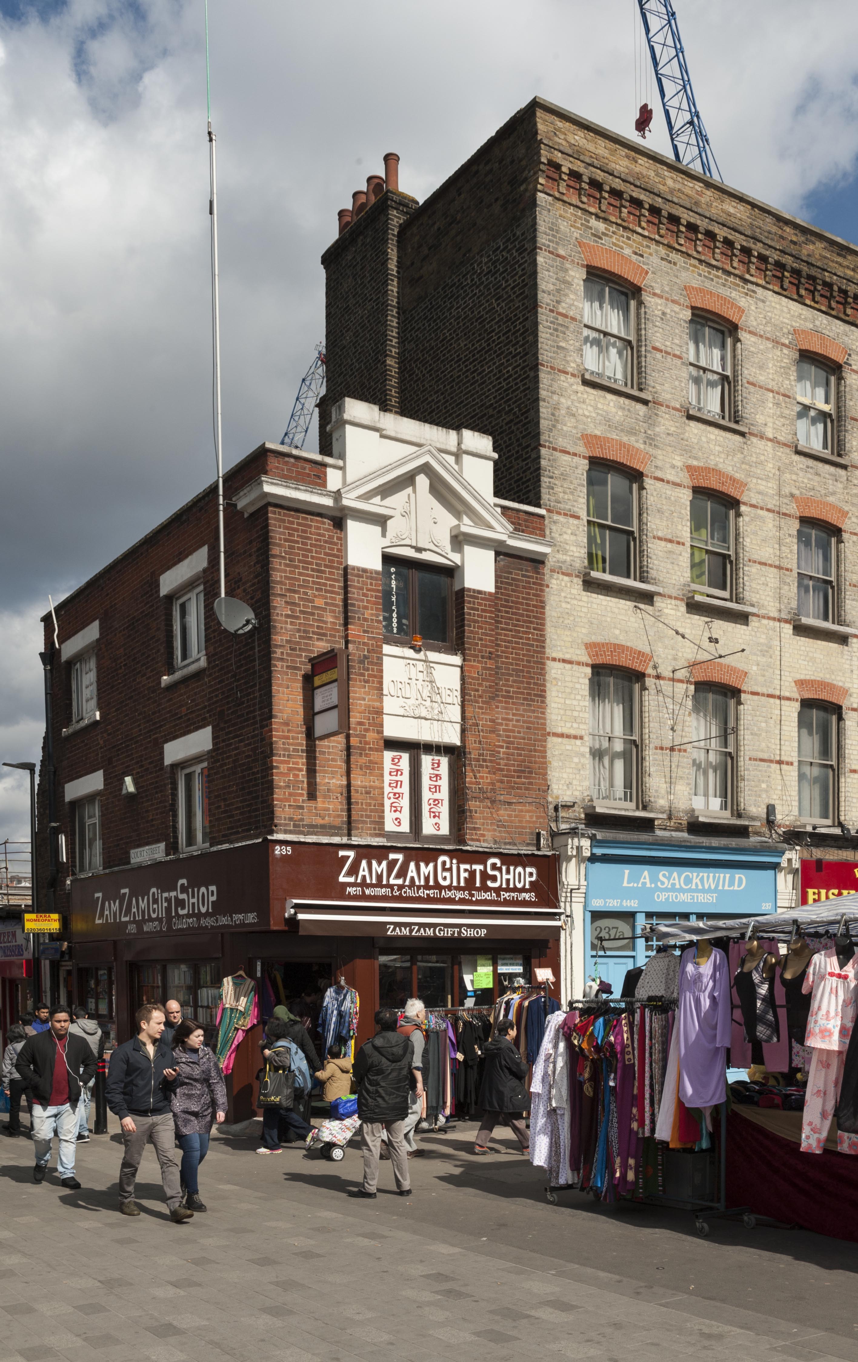
{
"id": 190,
"title": "235-239 Whitechapel Road in 2016",
"author": {
"id": 27,
"username": "DerekKendall"
},
"feature": {
"id": 511,
"type": "Feature",
"geometry": {
"type": "MultiPolygon",
"coordinates": [
[
[
[
-0.061158839374764,
51.51901890806152
],
[
-0.061124847287167,
51.518969189064066
],
[
-0.061173563089729,
51.51895737027033
],
[
-0.061193305729985,
51.518964077607194
],
[
-0.061256113642657,
51.51905699979579
],
[
-0.061196914867139,
51.51907433313947
],
[
-0.061158839374764,
51.51901890806152
]
]
]
]
},
"properties": {
"b_number": "235",
"b_name": "",
"street": "Whitechapel Road",
"address": "Zam Zam Gift Shop (formerly the Lord Napier public house), 235 Whitechapel Road",
"feature_type": "WHITECHAPEL_BUILDING",
"count": 13,
"search_str": "Zam Zam Gift Shop (formerly the Lord Napier public house), 235 Whitechapel Road"
},
"tags": [
"Grodzinski",
"Kossoff's",
"Lord Napier public house",
"S. A. S. Yeo"
]
},
"file": "https://surveyoflondon.org/media/uploads/features/511/SoL%20Whitechapel100320.jpg",
"description": "",
"copyright": true,
"created": "2016-07-28"
},
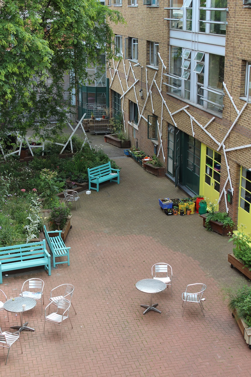
{
"id": 1512,
"title": "The courtyard of the Dellow Centre",
"author": {
"id": 2,
"username": "surveyoflondon"
},
"feature": {
"id": 364,
"type": "Feature",
"geometry": {
"type": "MultiPolygon",
"coordinates": [
[
[
[
-0.071489806542886,
51.517023172539695
],
[
-0.071243898612021,
51.51660982272529
],
[
-0.071190306454479,
51.516576885746375
],
[
-0.071306299769721,
51.51654960254589
],
[
-0.071326638948875,
51.51652155453997
],
[
-0.071374403242583,
51.5165233420156
],
[
-0.07170710495994,
51.516972518185476
],
[
-0.071689530249958,
51.51699956808665
],
[
-0.071662895989952,
51.51700659921577
],
[
-0.071622347338577,
51.51700294482352
],
[
-0.071489806542886,
51.517023172539695
]
]
]
]
},
"properties": {
"b_number": "82",
"b_name": "The Dellow Centre",
"street": "Wentworth Street",
"address": "Providence Row, The Dellow Centre, 82 Wentworth Street",
"feature_type": "WHITECHAPEL_BUILDING",
"count": 13,
"search_str": "The Dellow Centre"
},
"tags": []
},
"file": "https://surveyoflondon.org/media/uploads/features/364/img_1291_14498429735_o_UrkwRgH.jpg",
"description": "The courtyard of the Dellow Centre, where the homeless charity Providence Row is located. Photo by kind permission of Providence Row",
"copyright": false,
"created": "2019-01-09"
},
{
"id": 1518,
"title": "The kitchen of Providence Row",
"author": {
"id": 2,
"username": "surveyoflondon"
},
"feature": {
"id": 364,
"type": "Feature",
"geometry": {
"type": "MultiPolygon",
"coordinates": [
[
[
[
-0.071489806542886,
51.517023172539695
],
[
-0.071243898612021,
51.51660982272529
],
[
-0.071190306454479,
51.516576885746375
],
[
-0.071306299769721,
51.51654960254589
],
[
-0.071326638948875,
51.51652155453997
],
[
-0.071374403242583,
51.5165233420156
],
[
-0.07170710495994,
51.516972518185476
],
[
-0.071689530249958,
51.51699956808665
],
[
-0.071662895989952,
51.51700659921577
],
[
-0.071622347338577,
51.51700294482352
],
[
-0.071489806542886,
51.517023172539695
]
]
]
]
},
"properties": {
"b_number": "82",
"b_name": "The Dellow Centre",
"street": "Wentworth Street",
"address": "Providence Row, The Dellow Centre, 82 Wentworth Street",
"feature_type": "WHITECHAPEL_BUILDING",
"count": 13,
"search_str": "The Dellow Centre"
},
"tags": []
},
"file": "https://surveyoflondon.org/media/uploads/features/364/26244614428_50709c037c_o%20(3).jpg",
"description": "Participants in the kitchen of Providence Row",
"copyright": false,
"created": "2019-01-09"
},
{
"id": 191,
"title": "235-239 Whitechapel Road in 2016",
"author": {
"id": 27,
"username": "DerekKendall"
},
"feature": {
"id": 511,
"type": "Feature",
"geometry": {
"type": "MultiPolygon",
"coordinates": [
[
[
[
-0.061158839374764,
51.51901890806152
],
[
-0.061124847287167,
51.518969189064066
],
[
-0.061173563089729,
51.51895737027033
],
[
-0.061193305729985,
51.518964077607194
],
[
-0.061256113642657,
51.51905699979579
],
[
-0.061196914867139,
51.51907433313947
],
[
-0.061158839374764,
51.51901890806152
]
]
]
]
},
"properties": {
"b_number": "235",
"b_name": "",
"street": "Whitechapel Road",
"address": "Zam Zam Gift Shop (formerly the Lord Napier public house), 235 Whitechapel Road",
"feature_type": "WHITECHAPEL_BUILDING",
"count": 13,
"search_str": "Zam Zam Gift Shop (formerly the Lord Napier public house), 235 Whitechapel Road"
},
"tags": [
"Grodzinski",
"Kossoff's",
"Lord Napier public house",
"S. A. S. Yeo"
]
},
"file": "https://surveyoflondon.org/media/uploads/features/511/SoL%20Whitechapel100321.jpg",
"description": "",
"copyright": true,
"created": "2016-07-28"
},
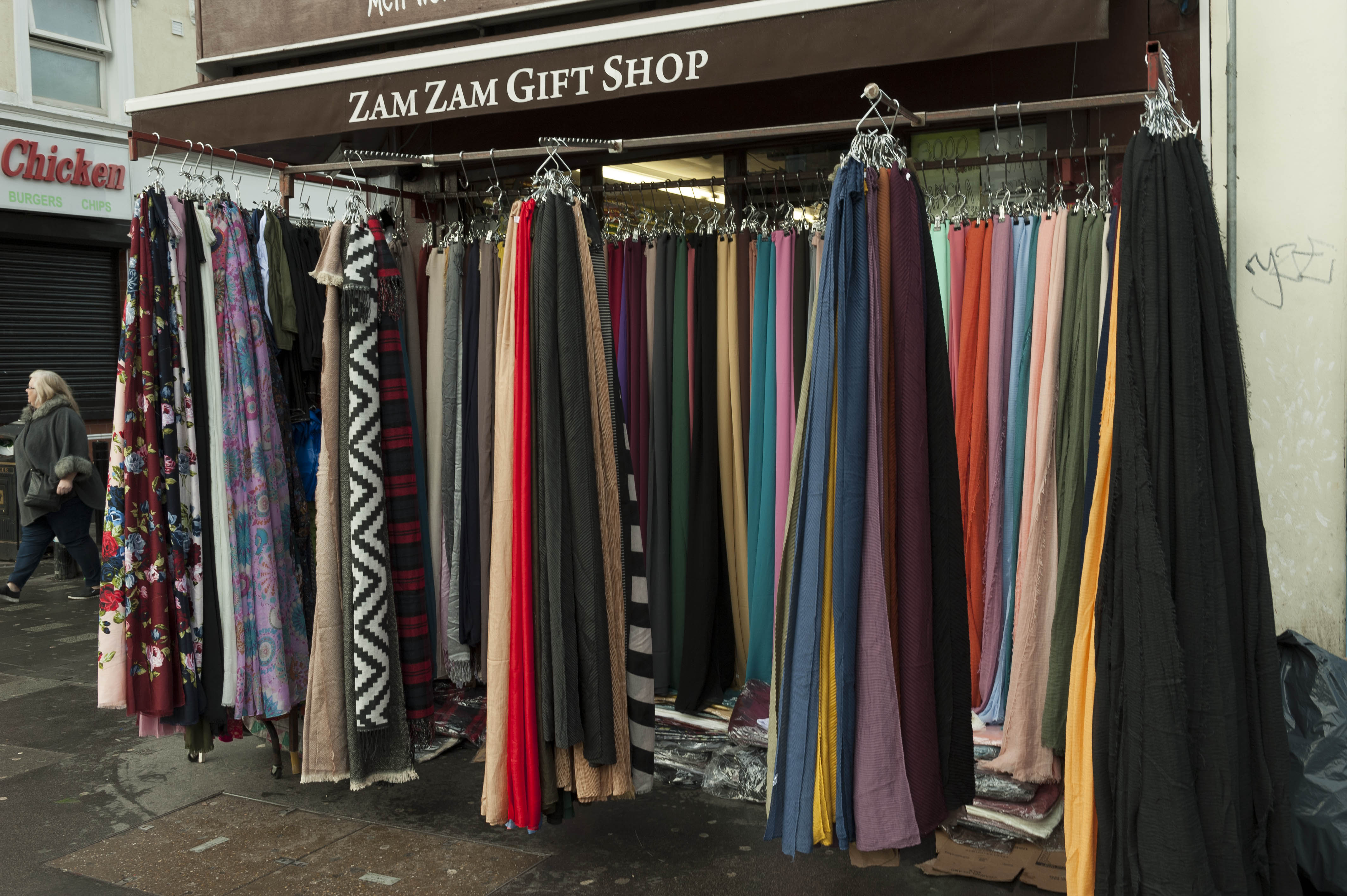
{
"id": 1506,
"title": "Display in front of 235 Whitechapel Road, December 2018",
"author": {
"id": 27,
"username": "DerekKendall"
},
"feature": {
"id": 511,
"type": "Feature",
"geometry": {
"type": "MultiPolygon",
"coordinates": [
[
[
[
-0.061158839374764,
51.51901890806152
],
[
-0.061124847287167,
51.518969189064066
],
[
-0.061173563089729,
51.51895737027033
],
[
-0.061193305729985,
51.518964077607194
],
[
-0.061256113642657,
51.51905699979579
],
[
-0.061196914867139,
51.51907433313947
],
[
-0.061158839374764,
51.51901890806152
]
]
]
]
},
"properties": {
"b_number": "235",
"b_name": "",
"street": "Whitechapel Road",
"address": "Zam Zam Gift Shop (formerly the Lord Napier public house), 235 Whitechapel Road",
"feature_type": "WHITECHAPEL_BUILDING",
"count": 13,
"search_str": "Zam Zam Gift Shop (formerly the Lord Napier public house), 235 Whitechapel Road"
},
"tags": [
"Grodzinski",
"Kossoff's",
"Lord Napier public house",
"S. A. S. Yeo"
]
},
"file": "https://surveyoflondon.org/media/uploads/features/511/SoL%20Whitechapel%20102558.jpg",
"description": "",
"copyright": true,
"created": "2019-01-09"
},
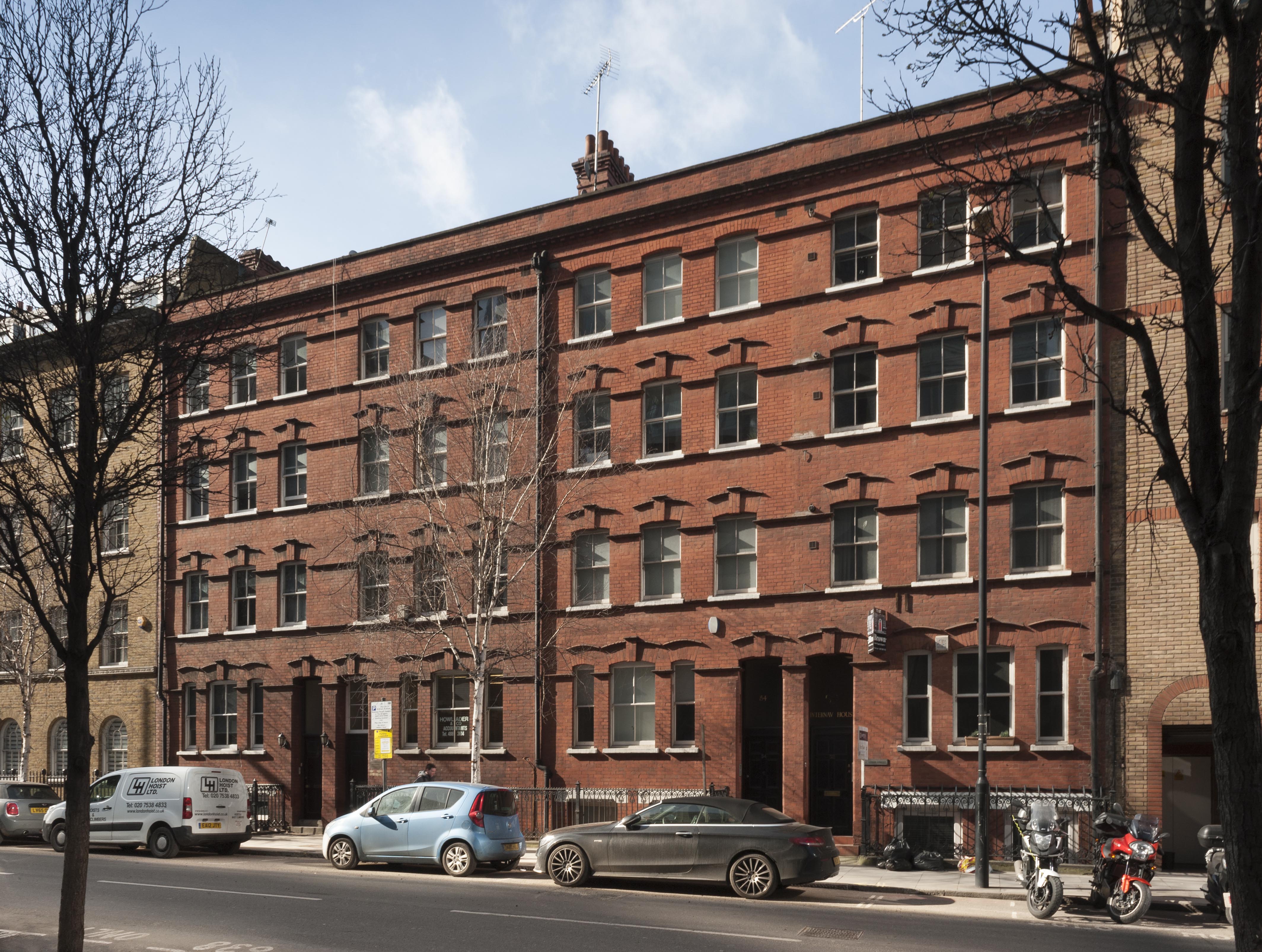
{
"id": 1644,
"title": "Leman Street elevation, March 2018",
"author": {
"id": 27,
"username": "DerekKendall"
},
"feature": {
"id": 80,
"type": "Feature",
"geometry": {
"type": "MultiPolygon",
"coordinates": [
[
[
[
-0.070480319567424,
51.51316219967591
],
[
-0.070497408610846,
51.51318542424707
],
[
-0.070459109439509,
51.51319590303715
],
[
-0.070657936445733,
51.51343717176088
],
[
-0.070530031554859,
51.51348166423519
],
[
-0.070306484946654,
51.513189629390844
],
[
-0.070434842793584,
51.51315160862411
],
[
-0.070447707728908,
51.51317044404114
],
[
-0.070480319567424,
51.51316219967591
]
]
]
]
},
"properties": {
"b_number": "52–58",
"b_name": "",
"street": "Leman Street",
"address": "52–58 Leman Street",
"feature_type": "WHITECHAPEL_BUILDING",
"count": 4,
"search_str": "52–58 Leman Street"
},
"tags": [
"builder",
"Davis brothers",
"East Tenter Street",
"Leman Street",
"Nathaniel Davis",
"Raphael Davis"
]
},
"file": "https://surveyoflondon.org/media/uploads/features/80/SoL%20Whitechapel%20101956.jpg",
"description": "",
"copyright": false,
"created": "2019-08-19"
}
]
}
.jpg)