HTTP 200 OK
Allow: GET, HEAD, OPTIONS
Content-Type: application/json
Vary: Accept
{
"count": 1747,
"next": "https://surveyoflondon.org/api/v1/images/?format=api&page=61",
"previous": "https://surveyoflondon.org/api/v1/images/?format=api&page=59",
"results": [
{
"id": 414,
"title": "Shop on Wentworth Street",
"author": {
"id": 56,
"username": "tamara"
},
"feature": {
"id": 1742,
"type": "Feature",
"geometry": {
"type": "MultiPolygon",
"coordinates": [
[
[
[
-0.076387722492951,
51.516257872286374
],
[
-0.07580974439088,
51.51649846859169
],
[
-0.075744693982384,
51.51651411423466
],
[
-0.075332716624042,
51.51665341173461
],
[
-0.075277819023276,
51.516667372076085
],
[
-0.074429584483841,
51.51681699796736
],
[
-0.074402209988697,
51.516763242480046
],
[
-0.075229889371391,
51.51661092868018
],
[
-0.074836715281391,
51.516135055700595
],
[
-0.074917049606191,
51.51611135328064
],
[
-0.075312012611936,
51.51658616747119
],
[
-0.075695505281233,
51.51646463519818
],
[
-0.075779072585588,
51.51644696856364
],
[
-0.076328753388395,
51.516209038390684
],
[
-0.076387722492951,
51.516257872286374
]
]
]
]
},
"properties": {
"b_number": "",
"b_name": "",
"street": "",
"address": "Petticoat Lane Market",
"feature_type": "PLACE",
"count": 39,
"search_str": "Petticoat Lane Market"
},
"tags": []
},
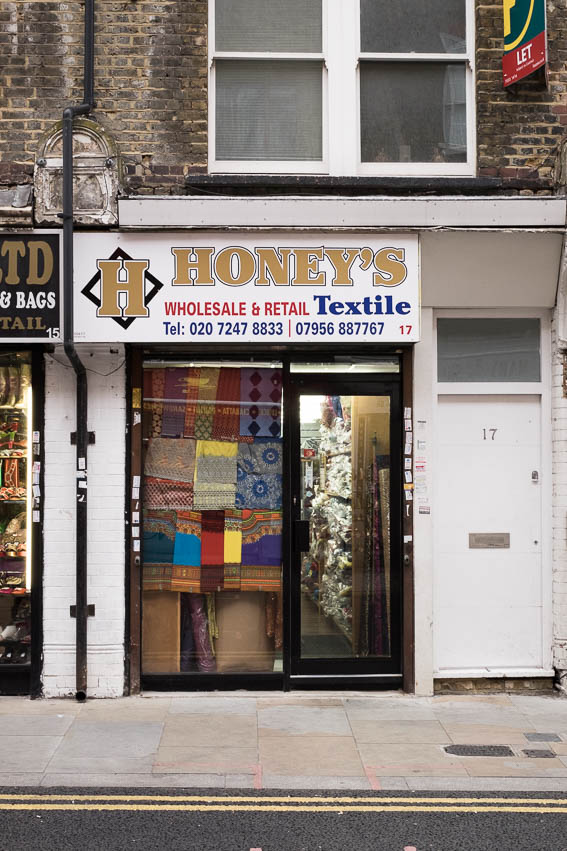
"file": "https://surveyoflondon.org/media/uploads/features/1742/tstoll12.jpg",
"description": "Documenting the streets of Petticoat Lane market, image taken in 2016 by Tamara Stoll. The shop at 17 Wentworth Street.\n",
"copyright": false,
"created": "2016-09-25"
},
{
"id": 1380,
"title": "Golda Levy at work in Marks of the Lane deli, 1975",
"author": {
"id": 252,
"username": "mark3"
},
"feature": {
"id": 1742,
"type": "Feature",
"geometry": {
"type": "MultiPolygon",
"coordinates": [
[
[
[
-0.076387722492951,
51.516257872286374
],
[
-0.07580974439088,
51.51649846859169
],
[
-0.075744693982384,
51.51651411423466
],
[
-0.075332716624042,
51.51665341173461
],
[
-0.075277819023276,
51.516667372076085
],
[
-0.074429584483841,
51.51681699796736
],
[
-0.074402209988697,
51.516763242480046
],
[
-0.075229889371391,
51.51661092868018
],
[
-0.074836715281391,
51.516135055700595
],
[
-0.074917049606191,
51.51611135328064
],
[
-0.075312012611936,
51.51658616747119
],
[
-0.075695505281233,
51.51646463519818
],
[
-0.075779072585588,
51.51644696856364
],
[
-0.076328753388395,
51.516209038390684
],
[
-0.076387722492951,
51.516257872286374
]
]
]
]
},
"properties": {
"b_number": "",
"b_name": "",
"street": "",
"address": "Petticoat Lane Market",
"feature_type": "PLACE",
"count": 39,
"search_str": "Petticoat Lane Market"
},
"tags": []
},
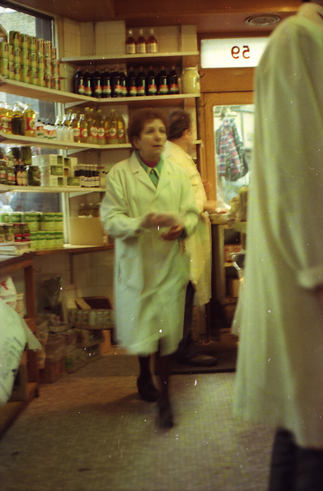
"file": "https://surveyoflondon.org/media/uploads/features/1742/Marks%20Deli%20Golda.jpg",
"description": "My grandmother Golda who worked alongside her brother Mossy Marks (Palkowski) at Marks of the Lane.",
"copyright": false,
"created": "2018-10-28"
},
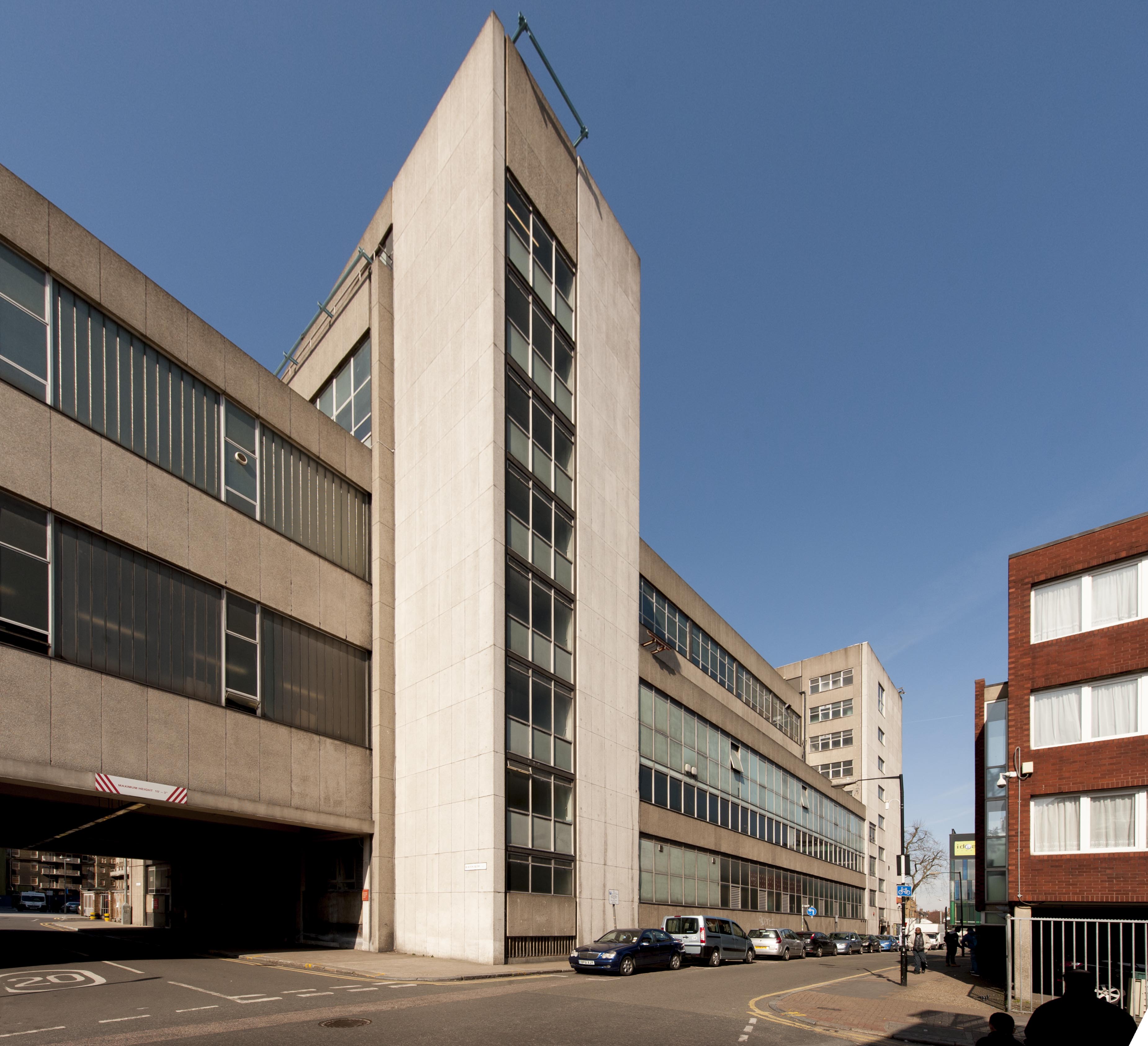
{
"id": 474,
"title": "Maersk (formerly Beagle) House in December 2016, from the north-west",
"author": {
"id": 27,
"username": "DerekKendall"
},
"feature": {
"id": 31,
"type": "Feature",
"geometry": {
"type": "MultiPolygon",
"coordinates": [
[
[
[
-0.071887127893096,
51.51411332216963
],
[
-0.071969571208431,
51.51419942371175
],
[
-0.071924976063445,
51.5142326534243
],
[
-0.071948658834375,
51.51426657781599
],
[
-0.071835003267539,
51.5143227101345
],
[
-0.071686234045495,
51.5143855464125
],
[
-0.071543425125636,
51.514422007266134
],
[
-0.071435516621411,
51.51444471123646
],
[
-0.071395570736125,
51.51440565693606
],
[
-0.07134776228325,
51.51441310661883
],
[
-0.0712722588033,
51.51434177428325
],
[
-0.071303428297817,
51.51432370241673
],
[
-0.071263213192454,
51.5142868603796
],
[
-0.071374185885124,
51.514224080818835
],
[
-0.071528097019019,
51.51416207230522
],
[
-0.071692419185678,
51.51411901969061
],
[
-0.071795120500786,
51.514091351954804
],
[
-0.071848759931576,
51.5141216554061
],
[
-0.071887127893096,
51.51411332216963
]
]
]
]
},
"properties": {
"b_number": "1",
"b_name": "Maersk House",
"street": "Braham Street",
"address": "Maersk House (formerly Beagle House), 1 Braham Street",
"feature_type": "WHITECHAPEL_BUILDING",
"count": 20,
"search_str": "Maersk House"
},
"tags": []
},
"file": "https://surveyoflondon.org/media/uploads/features/31/SoL%20Whitechapel%20100471.jpg",
"description": "",
"copyright": true,
"created": "2017-01-03"
},
{
"id": 151,
"title": "The former Eastern Dispensary in context",
"author": {
"id": 27,
"username": "DerekKendall"
},
"feature": {
"id": 16,
"type": "Feature",
"geometry": {
"type": "MultiPolygon",
"coordinates": [
[
[
[
-0.07073271347526,
51.51412601920421
],
[
-0.07063554499044,
51.514165253062664
],
[
-0.070469168765051,
51.51398880154131
],
[
-0.07056792326348,
51.51394938941929
],
[
-0.07073271347526,
51.51412601920421
]
]
]
]
},
"properties": {
"b_number": "19a-19b",
"b_name": "The Dispensary",
"street": "Leman Street",
"address": "The Dispensary (former Eastern Dispensary), 19a-19b Leman Street",
"feature_type": "WHITECHAPEL_BUILDING",
"count": 7,
"search_str": "The Dispensary"
},
"tags": []
},
"file": "https://surveyoflondon.org/media/uploads/features/16/SoL%20Whitechapel100355.jpg",
"description": "",
"copyright": true,
"created": "2016-07-19"
},
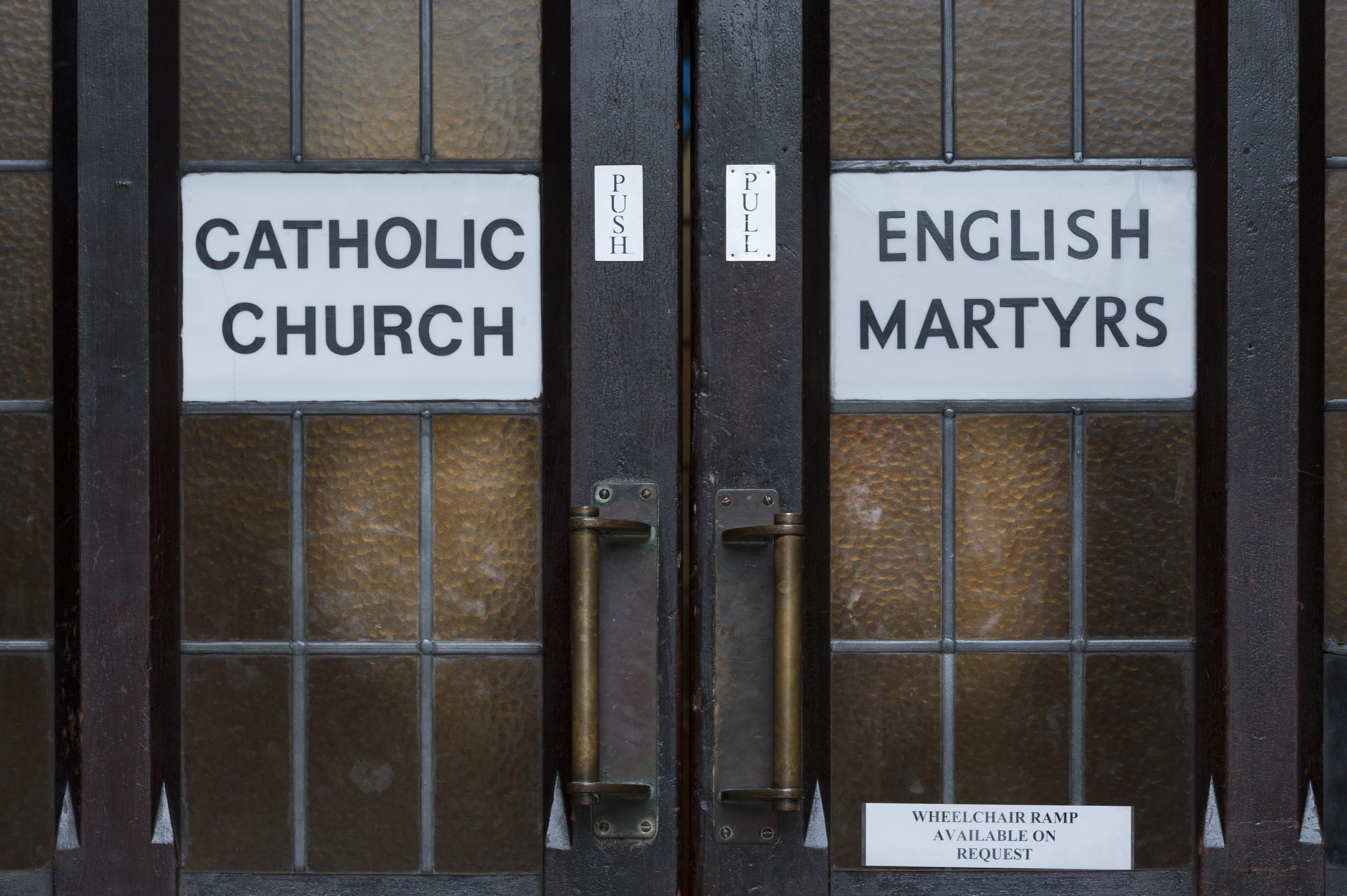
{
"id": 1230,
"title": "Church doors",
"author": {
"id": 27,
"username": "DerekKendall"
},
"feature": {
"id": 1297,
"type": "Feature",
"geometry": {
"type": "MultiPolygon",
"coordinates": [
[
[
[
-0.071935648282288,
51.51134524228436
],
[
-0.071874729442993,
51.51121363108998
],
[
-0.071816144948546,
51.51122339231668
],
[
-0.071776588646252,
51.51120578254433
],
[
-0.071762024560661,
51.51117337877791
],
[
-0.07177649375904,
51.511141452410264
],
[
-0.071834141993347,
51.51113011940239
],
[
-0.071816329795347,
51.51108571239466
],
[
-0.072075019832766,
51.51104549229583
],
[
-0.072193056743033,
51.51130853787665
],
[
-0.072151551976597,
51.51131487321276
],
[
-0.072147312228886,
51.51132649961524
],
[
-0.072142333320455,
51.51133343542439
],
[
-0.072015847069243,
51.5113547481352
],
[
-0.071996105248008,
51.51135617797319
],
[
-0.071982278923131,
51.511350687404345
],
[
-0.071975230627282,
51.51134004502751
],
[
-0.071935648282288,
51.51134524228436
]
]
]
]
},
"properties": {
"b_number": "",
"b_name": "Roman Catholic Church of the English Martyrs",
"street": "Prescot Street",
"address": "Roman Catholic Church of the English Martyrs",
"feature_type": "WHITECHAPEL_BUILDING",
"count": 20,
"search_str": "Roman Catholic Church of the English Martyrs"
},
"tags": []
},
"file": "https://surveyoflondon.org/media/uploads/features/1297/SoL%20Whitechapel%20101894.jpg",
"description": "",
"copyright": true,
"created": "2018-03-27"
},
{
"id": 76,
"title": "East London Mail Centre and E1 Delivery Office, Cavell Street elevation, 2016",
"author": {
"id": 27,
"username": "DerekKendall"
},
"feature": {
"id": 1227,
"type": "Feature",
"geometry": {
"type": "MultiPolygon",
"coordinates": [
[
[
[
-0.058796596412285,
51.51912310433929
],
[
-0.057896913703648,
51.51929776742821
],
[
-0.057646155790783,
51.51878891291734
],
[
-0.057726960269829,
51.518773414154225
],
[
-0.057663251646104,
51.51864413103036
],
[
-0.058003630287349,
51.51857884372657
],
[
-0.058058858263524,
51.51869091551577
],
[
-0.058183402152667,
51.518667026720365
],
[
-0.058192757854339,
51.51868601168758
],
[
-0.058228318266828,
51.5186791908066
],
[
-0.058378536493976,
51.518984017000164
],
[
-0.058419330251411,
51.51897619228836
],
[
-0.058450444692009,
51.51903932977383
],
[
-0.05871794555232,
51.51898801961153
],
[
-0.058796596412285,
51.51912310433929
]
]
]
]
},
"properties": {
"b_number": "180–206",
"b_name": "East London Mail Centre and E1 Delivery Office",
"street": "Whitechapel Road",
"address": "East London Mail Centre and E1 Delivery Office",
"feature_type": "WHITECHAPEL_BUILDING",
"count": 14,
"search_str": "East London Mail Centre and E1 Delivery Office"
},
"tags": []
},
"file": "https://surveyoflondon.org/media/uploads/features/1227/SoL%20Whitechapel100039.jpg",
"description": "",
"copyright": true,
"created": "2016-06-23"
},
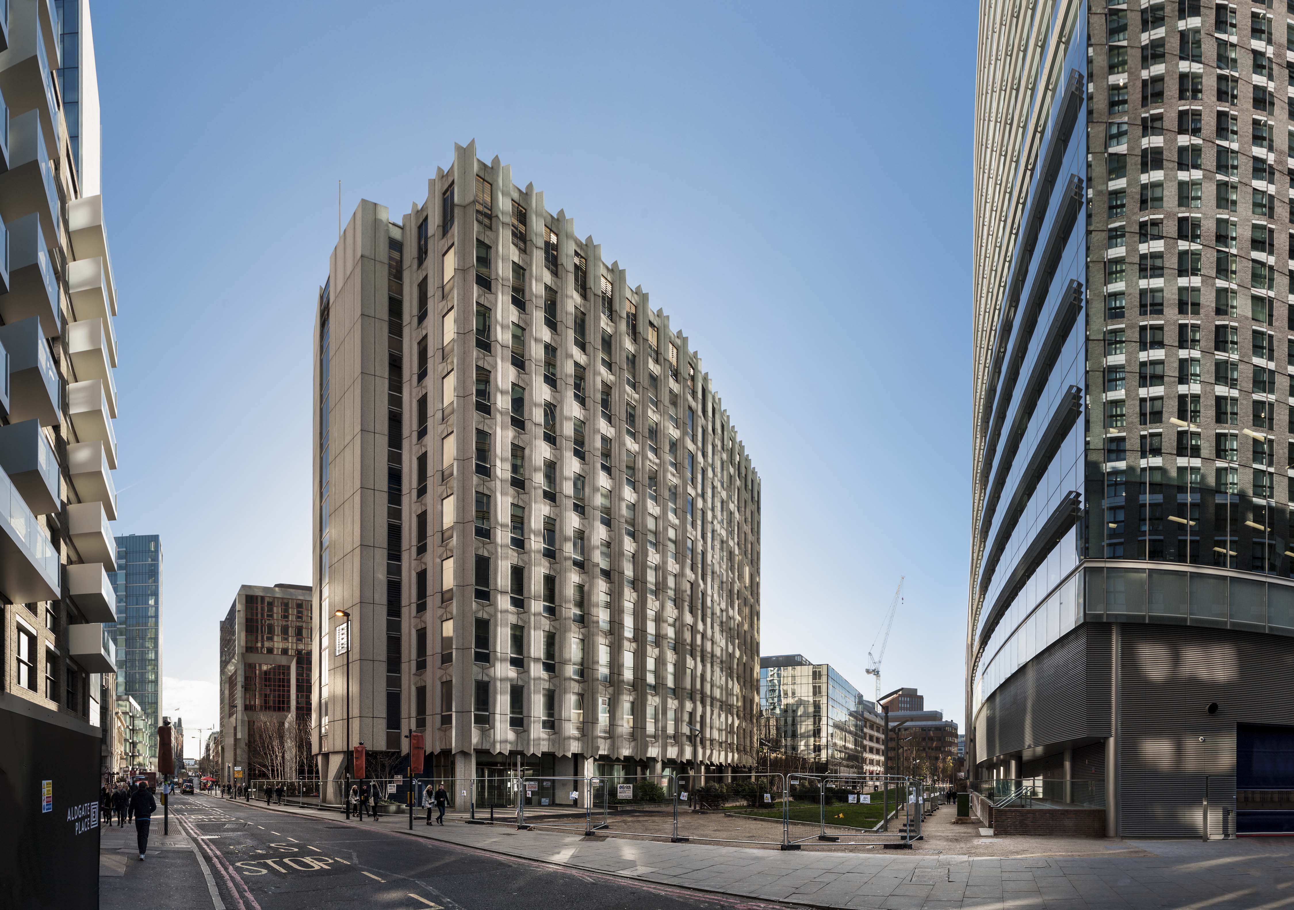
{
"id": 475,
"title": "Maersk (formerly Beagle) House in December 2016, from the north-east",
"author": {
"id": 27,
"username": "DerekKendall"
},
"feature": {
"id": 31,
"type": "Feature",
"geometry": {
"type": "MultiPolygon",
"coordinates": [
[
[
[
-0.071887127893096,
51.51411332216963
],
[
-0.071969571208431,
51.51419942371175
],
[
-0.071924976063445,
51.5142326534243
],
[
-0.071948658834375,
51.51426657781599
],
[
-0.071835003267539,
51.5143227101345
],
[
-0.071686234045495,
51.5143855464125
],
[
-0.071543425125636,
51.514422007266134
],
[
-0.071435516621411,
51.51444471123646
],
[
-0.071395570736125,
51.51440565693606
],
[
-0.07134776228325,
51.51441310661883
],
[
-0.0712722588033,
51.51434177428325
],
[
-0.071303428297817,
51.51432370241673
],
[
-0.071263213192454,
51.5142868603796
],
[
-0.071374185885124,
51.514224080818835
],
[
-0.071528097019019,
51.51416207230522
],
[
-0.071692419185678,
51.51411901969061
],
[
-0.071795120500786,
51.514091351954804
],
[
-0.071848759931576,
51.5141216554061
],
[
-0.071887127893096,
51.51411332216963
]
]
]
]
},
"properties": {
"b_number": "1",
"b_name": "Maersk House",
"street": "Braham Street",
"address": "Maersk House (formerly Beagle House), 1 Braham Street",
"feature_type": "WHITECHAPEL_BUILDING",
"count": 20,
"search_str": "Maersk House"
},
"tags": []
},
"file": "https://surveyoflondon.org/media/uploads/features/31/SoL%20Whitechapel%20100461.jpg",
"description": "",
"copyright": true,
"created": "2017-01-03"
},
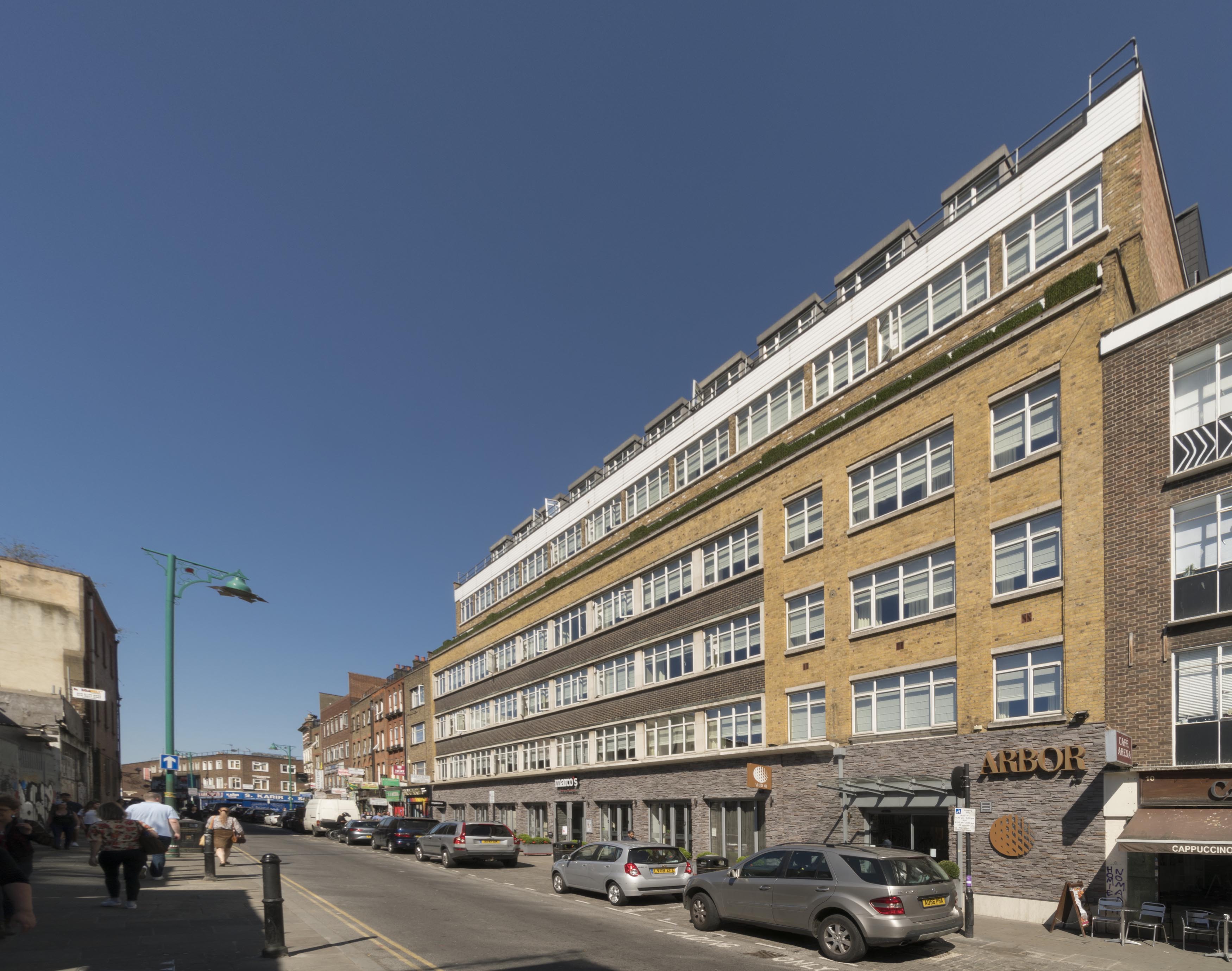
{
"id": 602,
"title": "12-20 Osborn Street from the south-west in April 2017",
"author": {
"id": 27,
"username": "DerekKendall"
},
"feature": {
"id": 105,
"type": "Feature",
"geometry": {
"type": "MultiPolygon",
"coordinates": [
[
[
[
-0.070065621617059,
51.51678224032084
],
[
-0.069967253218652,
51.51680966491183
],
[
-0.069986073792892,
51.51683594289044
],
[
-0.069929332859543,
51.5168517618956
],
[
-0.069908557891993,
51.516822755068496
],
[
-0.069872598030862,
51.51683278043064
],
[
-0.069872596565606,
51.51683278080442
],
[
-0.069791299084404,
51.51685351965192
],
[
-0.069714791133048,
51.51673394440634
],
[
-0.06975393887805,
51.51672441059794
],
[
-0.069600487037771,
51.51649542041513
],
[
-0.069691492553569,
51.516465111629685
],
[
-0.069691489123815,
51.51646510616357
],
[
-0.069835601234806,
51.51642388297715
],
[
-0.069841700470821,
51.516433232652595
],
[
-0.070065621617059,
51.51678224032084
]
]
]
]
},
"properties": {
"b_number": "12-20",
"b_name": "",
"street": "Osborn Street",
"address": "12-20 Osborn Street (Arbor City Hotel)",
"feature_type": "WHITECHAPEL_BUILDING",
"count": 5,
"search_str": "12-20 Osborn Street (Arbor City Hotel)"
},
"tags": []
},
"file": "https://surveyoflondon.org/media/uploads/features/105/SoL%20Whitechapel%20100686.jpg",
"description": "",
"copyright": true,
"created": "2017-05-03"
},
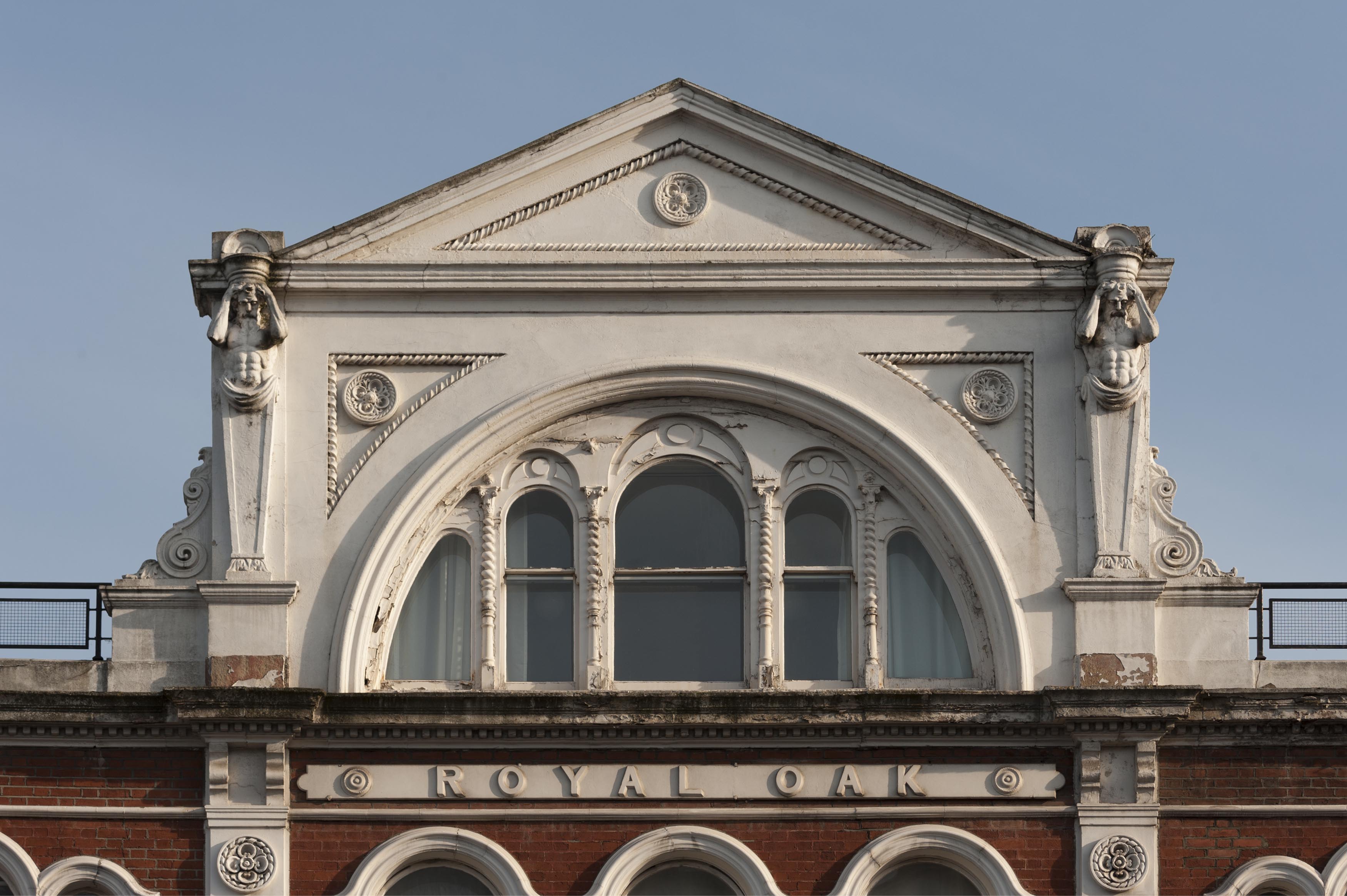
{
"id": 958,
"title": "Former Royal Oak public house, facade detail, March 2017",
"author": {
"id": 27,
"username": "DerekKendall"
},
"feature": {
"id": 873,
"type": "Feature",
"geometry": {
"type": "MultiPolygon",
"coordinates": [
[
[
[
-0.063739503777729,
51.51804861845898
],
[
-0.063683451117025,
51.51797300209851
],
[
-0.0637089382797,
51.51796483346984
],
[
-0.063836182144524,
51.51792452272944
],
[
-0.063835842009052,
51.51792462190747
],
[
-0.063877274830691,
51.51791330545044
],
[
-0.063934479931202,
51.51800468952643
],
[
-0.063739503777729,
51.51804861845898
]
]
]
]
},
"properties": {
"b_number": "118-120",
"b_name": "Former Royal Oak public house",
"street": "Whitechapel Road",
"address": "Former Royal Oak public house, 118-120 Whitechapel Road",
"feature_type": "WHITECHAPEL_BUILDING",
"count": 9,
"search_str": "Former Royal Oak public house"
},
"tags": [
"Royal Oak"
]
},
"file": "https://surveyoflondon.org/media/uploads/features/873/SoL%20Whitechapel%20100757.jpg",
"description": "",
"copyright": true,
"created": "2017-11-30"
},
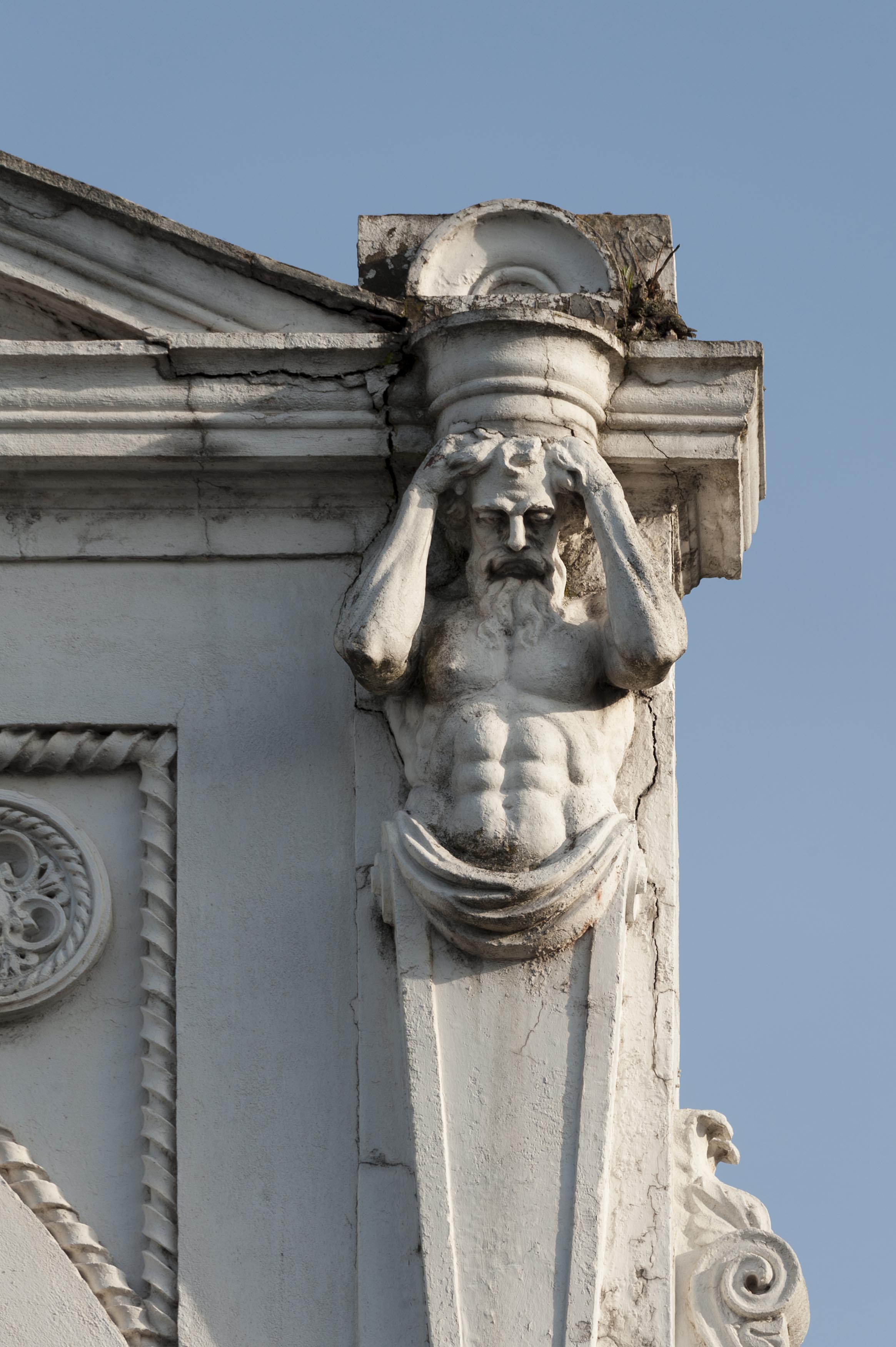
{
"id": 959,
"title": "Former Royal Oak public house, facade detail, March 2017",
"author": {
"id": 27,
"username": "DerekKendall"
},
"feature": {
"id": 873,
"type": "Feature",
"geometry": {
"type": "MultiPolygon",
"coordinates": [
[
[
[
-0.063739503777729,
51.51804861845898
],
[
-0.063683451117025,
51.51797300209851
],
[
-0.0637089382797,
51.51796483346984
],
[
-0.063836182144524,
51.51792452272944
],
[
-0.063835842009052,
51.51792462190747
],
[
-0.063877274830691,
51.51791330545044
],
[
-0.063934479931202,
51.51800468952643
],
[
-0.063739503777729,
51.51804861845898
]
]
]
]
},
"properties": {
"b_number": "118-120",
"b_name": "Former Royal Oak public house",
"street": "Whitechapel Road",
"address": "Former Royal Oak public house, 118-120 Whitechapel Road",
"feature_type": "WHITECHAPEL_BUILDING",
"count": 9,
"search_str": "Former Royal Oak public house"
},
"tags": [
"Royal Oak"
]
},
"file": "https://surveyoflondon.org/media/uploads/features/873/SoL%20Whitechapel%20100760.jpg",
"description": "",
"copyright": true,
"created": "2017-11-30"
},
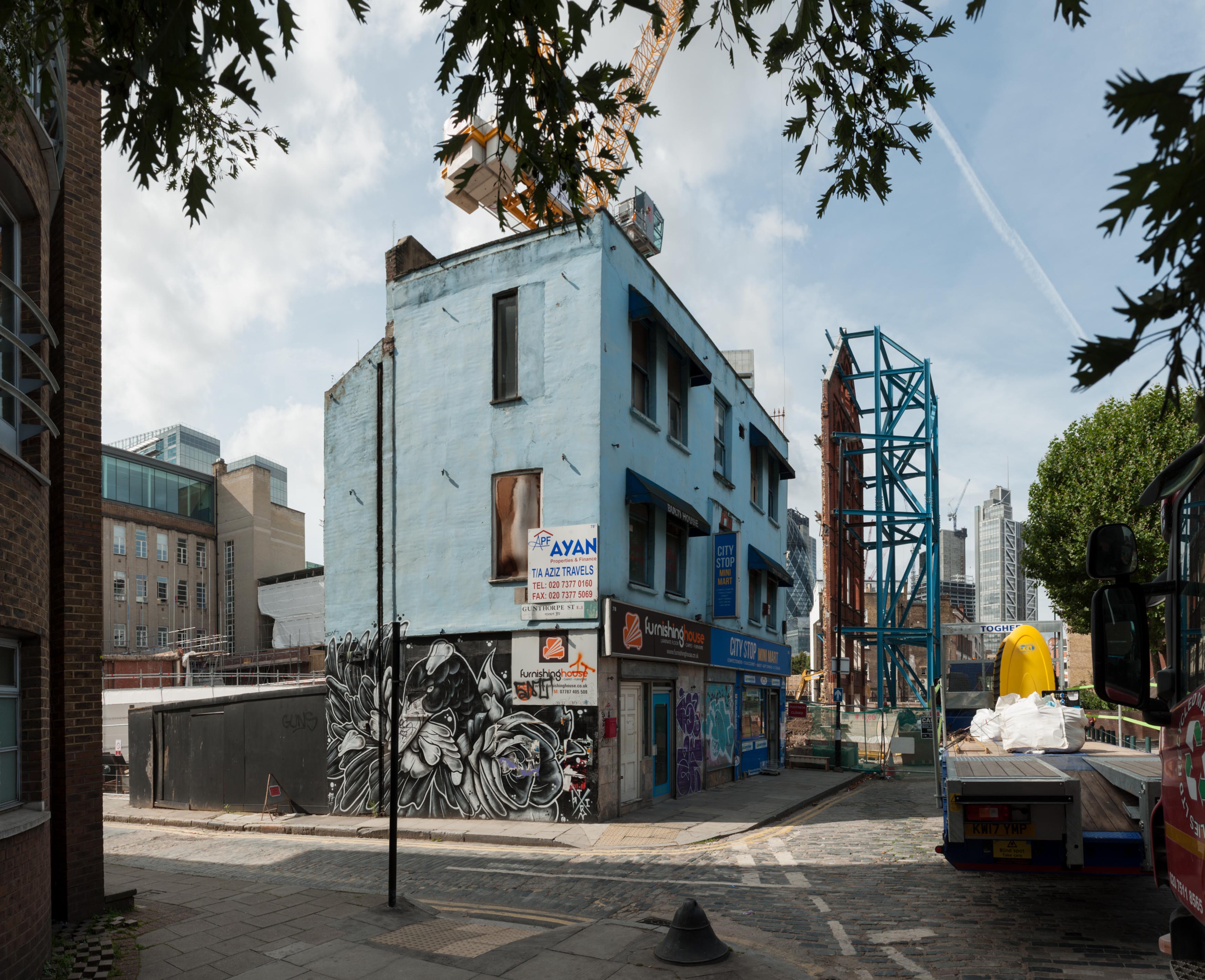
{
"id": 917,
"title": "78 Wentworth Street, with street art, August 2017",
"author": {
"id": 27,
"username": "DerekKendall"
},
"feature": {
"id": 1747,
"type": "Feature",
"geometry": {
"type": "MultiPolygon",
"coordinates": [
[
[
[
-0.071962494139082,
51.516957470075766
],
[
-0.071942669522335,
51.51691176033737
],
[
-0.071873739233108,
51.5169127981307
],
[
-0.071859421270025,
51.51690338148685
],
[
-0.071779249601687,
51.51692419875967
],
[
-0.071823398675256,
51.51696952526368
],
[
-0.071962494139082,
51.516957470075766
]
]
]
]
},
"properties": {
"b_number": "",
"b_name": "",
"street": "",
"address": "78 Wentworth Street",
"feature_type": "WHITECHAPEL_BUILDING",
"count": 3,
"search_str": "78 Wentworth Street"
},
"tags": []
},
"file": "https://surveyoflondon.org/media/uploads/features/1747/SoL%20Whitechapel%20101455.jpg",
"description": "",
"copyright": true,
"created": "2017-09-26"
},
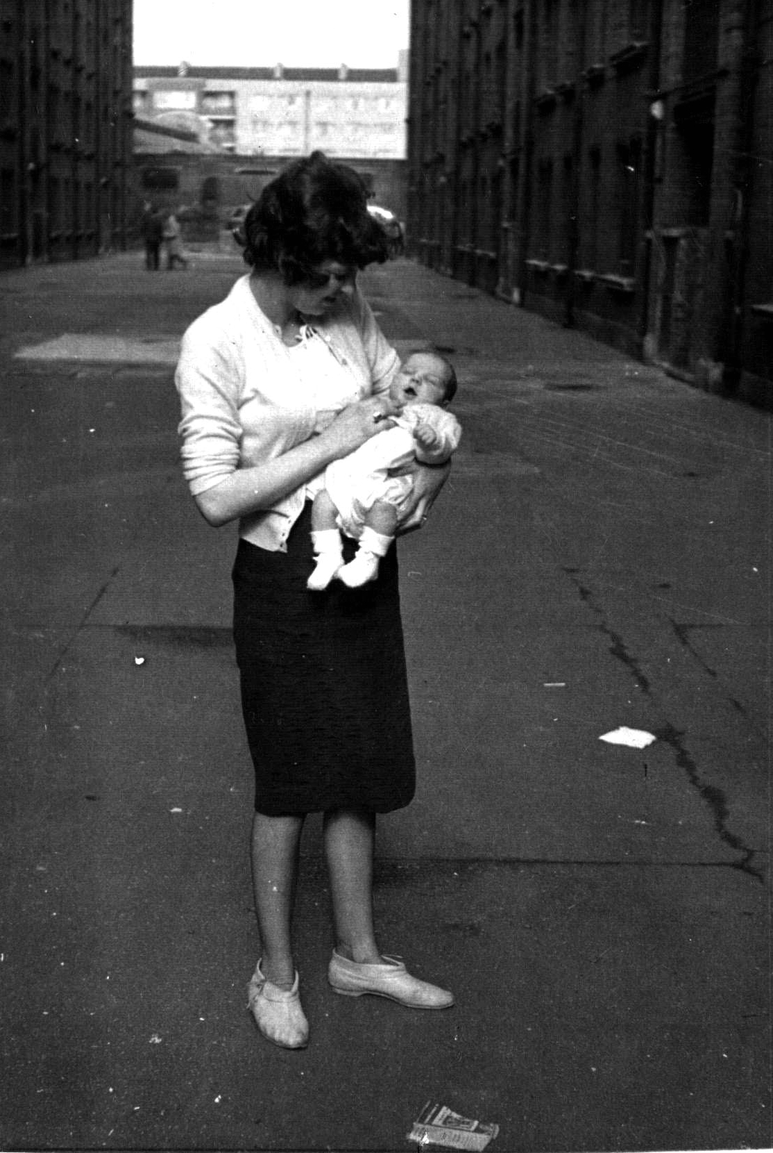
{
"id": 730,
"title": "Brady Street Dwellings",
"author": {
"id": 181,
"username": "mick"
},
"feature": {
"id": 611,
"type": "Feature",
"geometry": {
"type": "MultiPolygon",
"coordinates": [
[
[
[
-0.061071171968994,
51.52081854756523
],
[
-0.060751914384132,
51.520910345673705
],
[
-0.060670800177771,
51.520804404847986
],
[
-0.060468455213489,
51.52086122248221
],
[
-0.060450699740395,
51.52083834953325
],
[
-0.060348963469709,
51.52086716970229
],
[
-0.060327054268411,
51.52084002855742
],
[
-0.060218088338048,
51.52087362145146
],
[
-0.060181870551264,
51.52082767044763
],
[
-0.059888941340425,
51.5209177401419
],
[
-0.059906837511582,
51.520944348074295
],
[
-0.059794155620414,
51.52097953029167
],
[
-0.059832243956796,
51.521028790808174
],
[
-0.059621239031678,
51.52108457365709
],
[
-0.059750656156039,
51.521261628315195
],
[
-0.060092261050819,
51.521162518995624
],
[
-0.060201267294625,
51.5213109827491
],
[
-0.059711284021543,
51.521455446025634
],
[
-0.059608494153443,
51.52131130869682
],
[
-0.059508393196664,
51.521340050168135
],
[
-0.059253117703057,
51.52099166668332
],
[
-0.059256033768267,
51.5209595242491
],
[
-0.059159886666936,
51.520817675044256
],
[
-0.059263515528805,
51.520783743654874
],
[
-0.059005942108209,
51.52046133162211
],
[
-0.059340108320742,
51.520363660572684
],
[
-0.059350977165626,
51.520379010450526
],
[
-0.059653760593448,
51.52029256187745
],
[
-0.059732700862836,
51.52040478191169
],
[
-0.059399004206541,
51.520507265410146
],
[
-0.059386008017351,
51.52050099774739
],
[
-0.059330111279166,
51.52051942249526
],
[
-0.059427473319942,
51.520650551502136
],
[
-0.059335113114943,
51.52067740335036
],
[
-0.059393880270447,
51.52075719296283
],
[
-0.059578966698866,
51.52070547069434
],
[
-0.059521505013312,
51.5206204479455
],
[
-0.059633019030968,
51.52058917356787
],
[
-0.05965569761926,
51.52061535612946
],
[
-0.059758050698807,
51.52058539506149
],
[
-0.059784825395434,
51.520617287071275
],
[
-0.059896250945807,
51.520586175310825
],
[
-0.059905010512797,
51.5206001008183
],
[
-0.060207891820099,
51.520512562603464
],
[
-0.060152819128302,
51.52043377382353
],
[
-0.060255799218263,
51.520404384952066
],
[
-0.060243948876997,
51.520387831372716
],
[
-0.060374285949892,
51.52035112116383
],
[
-0.06040163767932,
51.52038826992398
],
[
-0.060493821347423,
51.520361732013576
],
[
-0.060585729284775,
51.52048450453705
],
[
-0.060667847773396,
51.520461046936504
],
[
-0.060740712007704,
51.520573214734334
],
[
-0.060789668351451,
51.52055928381185
],
[
-0.060862533037535,
51.52067145153698
],
[
-0.060908498405939,
51.52065859991671
],
[
-0.06094600415928,
51.52070981388415
],
[
-0.060904572245245,
51.52072152762277
],
[
-0.060915563003104,
51.5207389782457
],
[
-0.06100155865022,
51.52071591478786
],
[
-0.061071171968994,
51.52081854756523
]
]
]
]
},
"properties": {
"b_number": "",
"b_name": "Swanlea Secondary School",
"street": "Brady Street",
"address": "Swanlea Secondary School, Brady Street and Durward Street",
"feature_type": "WHITECHAPEL_BUILDING",
"count": 20,
"search_str": "Swanlea Secondary School"
},
"tags": []
},
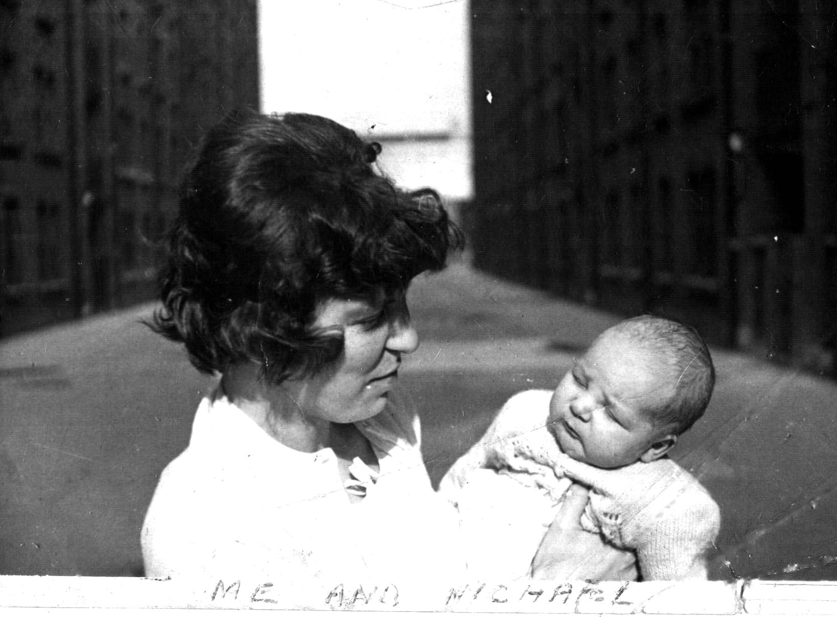
"file": "https://surveyoflondon.org/media/uploads/features/611/1961%20with%20mum%20again.JPG",
"description": "My mum carrying me in the yard in 1961.",
"copyright": false,
"created": "2017-08-09"
},
{
"id": 731,
"title": "Brady Street Dwellings",
"author": {
"id": 181,
"username": "mick"
},
"feature": {
"id": 611,
"type": "Feature",
"geometry": {
"type": "MultiPolygon",
"coordinates": [
[
[
[
-0.061071171968994,
51.52081854756523
],
[
-0.060751914384132,
51.520910345673705
],
[
-0.060670800177771,
51.520804404847986
],
[
-0.060468455213489,
51.52086122248221
],
[
-0.060450699740395,
51.52083834953325
],
[
-0.060348963469709,
51.52086716970229
],
[
-0.060327054268411,
51.52084002855742
],
[
-0.060218088338048,
51.52087362145146
],
[
-0.060181870551264,
51.52082767044763
],
[
-0.059888941340425,
51.5209177401419
],
[
-0.059906837511582,
51.520944348074295
],
[
-0.059794155620414,
51.52097953029167
],
[
-0.059832243956796,
51.521028790808174
],
[
-0.059621239031678,
51.52108457365709
],
[
-0.059750656156039,
51.521261628315195
],
[
-0.060092261050819,
51.521162518995624
],
[
-0.060201267294625,
51.5213109827491
],
[
-0.059711284021543,
51.521455446025634
],
[
-0.059608494153443,
51.52131130869682
],
[
-0.059508393196664,
51.521340050168135
],
[
-0.059253117703057,
51.52099166668332
],
[
-0.059256033768267,
51.5209595242491
],
[
-0.059159886666936,
51.520817675044256
],
[
-0.059263515528805,
51.520783743654874
],
[
-0.059005942108209,
51.52046133162211
],
[
-0.059340108320742,
51.520363660572684
],
[
-0.059350977165626,
51.520379010450526
],
[
-0.059653760593448,
51.52029256187745
],
[
-0.059732700862836,
51.52040478191169
],
[
-0.059399004206541,
51.520507265410146
],
[
-0.059386008017351,
51.52050099774739
],
[
-0.059330111279166,
51.52051942249526
],
[
-0.059427473319942,
51.520650551502136
],
[
-0.059335113114943,
51.52067740335036
],
[
-0.059393880270447,
51.52075719296283
],
[
-0.059578966698866,
51.52070547069434
],
[
-0.059521505013312,
51.5206204479455
],
[
-0.059633019030968,
51.52058917356787
],
[
-0.05965569761926,
51.52061535612946
],
[
-0.059758050698807,
51.52058539506149
],
[
-0.059784825395434,
51.520617287071275
],
[
-0.059896250945807,
51.520586175310825
],
[
-0.059905010512797,
51.5206001008183
],
[
-0.060207891820099,
51.520512562603464
],
[
-0.060152819128302,
51.52043377382353
],
[
-0.060255799218263,
51.520404384952066
],
[
-0.060243948876997,
51.520387831372716
],
[
-0.060374285949892,
51.52035112116383
],
[
-0.06040163767932,
51.52038826992398
],
[
-0.060493821347423,
51.520361732013576
],
[
-0.060585729284775,
51.52048450453705
],
[
-0.060667847773396,
51.520461046936504
],
[
-0.060740712007704,
51.520573214734334
],
[
-0.060789668351451,
51.52055928381185
],
[
-0.060862533037535,
51.52067145153698
],
[
-0.060908498405939,
51.52065859991671
],
[
-0.06094600415928,
51.52070981388415
],
[
-0.060904572245245,
51.52072152762277
],
[
-0.060915563003104,
51.5207389782457
],
[
-0.06100155865022,
51.52071591478786
],
[
-0.061071171968994,
51.52081854756523
]
]
]
]
},
"properties": {
"b_number": "",
"b_name": "Swanlea Secondary School",
"street": "Brady Street",
"address": "Swanlea Secondary School, Brady Street and Durward Street",
"feature_type": "WHITECHAPEL_BUILDING",
"count": 20,
"search_str": "Swanlea Secondary School"
},
"tags": []
},
"file": "https://surveyoflondon.org/media/uploads/features/611/1961%20with%20mum.JPG",
"description": "Another photo of my mum carrying me in the yard in 1961.",
"copyright": false,
"created": "2017-08-09"
},
{
"id": 1453,
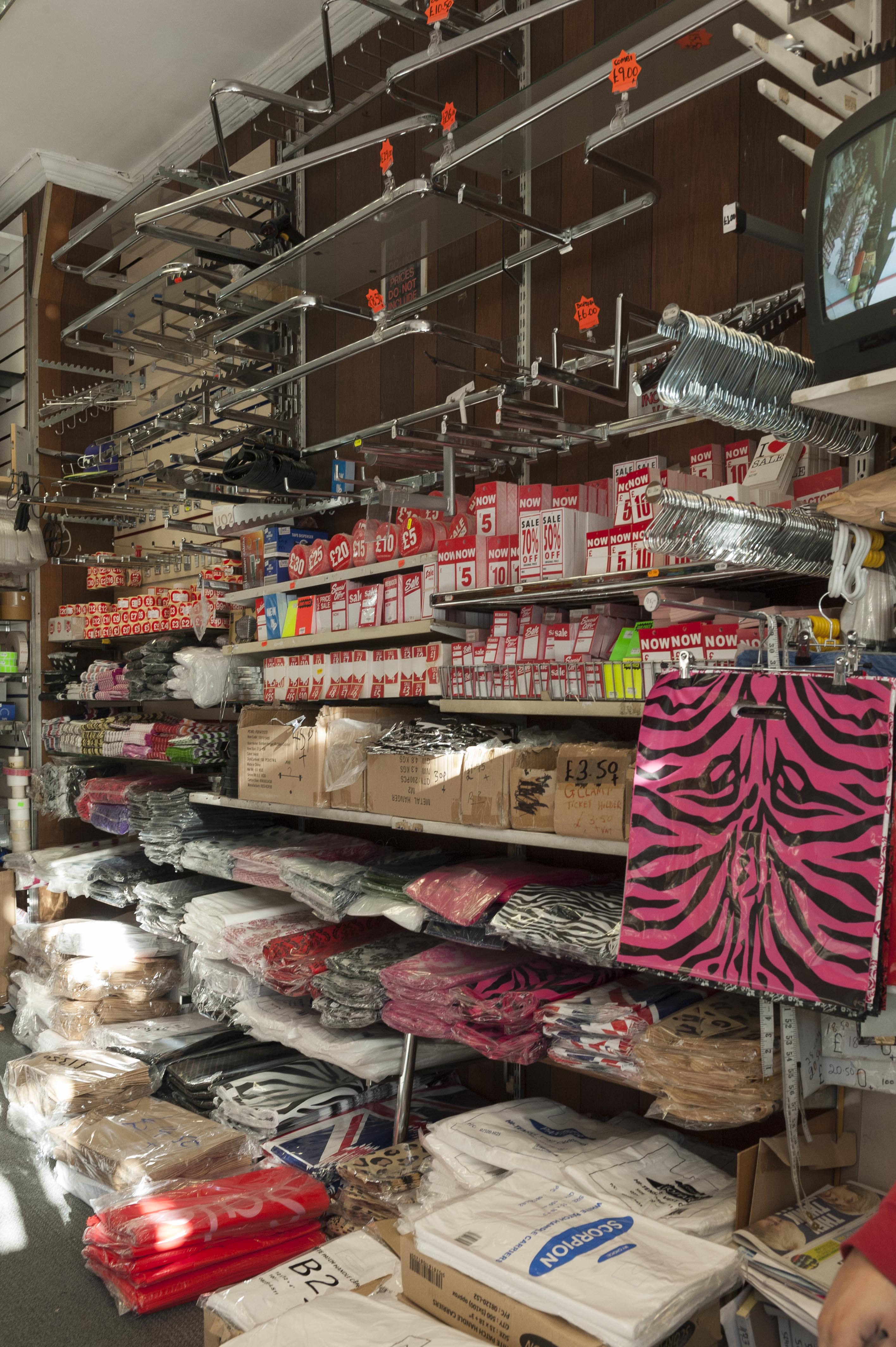
"title": "shop display, 79 Commercial Road, November 2018",
"author": {
"id": 27,
"username": "DerekKendall"
},
"feature": {
"id": 766,
"type": "Feature",
"geometry": {
"type": "MultiPolygon",
"coordinates": [
[
[
[
-0.06479636918847,
51.514849127060785
],
[
-0.064796380423472,
51.51484913029562
],
[
-0.064801696545098,
51.51501893523036
],
[
-0.064802160253748,
51.515044626500355
],
[
-0.064750929669421,
51.515043969450474
],
[
-0.064737668986278,
51.51485040214179
],
[
-0.06479636918847,
51.514849127060785
]
]
]
]
},
"properties": {
"b_number": "79",
"b_name": "",
"street": "Commercial Road",
"address": "79 Commercial Road",
"feature_type": "WHITECHAPEL_BUILDING",
"count": 11,
"search_str": "79 Commercial Road"
},
"tags": []
},
"file": "https://surveyoflondon.org/media/uploads/features/766/SoL%20Whitechapel%20102353.jpg",
"description": "",
"copyright": true,
"created": "2018-11-28"
},
{
"id": 1454,
"title": "shop interior from the rear, 79 Commercial Road, November 2018",
"author": {
"id": 27,
"username": "DerekKendall"
},
"feature": {
"id": 766,
"type": "Feature",
"geometry": {
"type": "MultiPolygon",
"coordinates": [
[
[
[
-0.06479636918847,
51.514849127060785
],
[
-0.064796380423472,
51.51484913029562
],
[
-0.064801696545098,
51.51501893523036
],
[
-0.064802160253748,
51.515044626500355
],
[
-0.064750929669421,
51.515043969450474
],
[
-0.064737668986278,
51.51485040214179
],
[
-0.06479636918847,
51.514849127060785
]
]
]
]
},
"properties": {
"b_number": "79",
"b_name": "",
"street": "Commercial Road",
"address": "79 Commercial Road",
"feature_type": "WHITECHAPEL_BUILDING",
"count": 11,
"search_str": "79 Commercial Road"
},
"tags": []
},
"file": "https://surveyoflondon.org/media/uploads/features/766/SoL%20Whitechapel%20102370.jpg",
"description": "",
"copyright": true,
"created": "2018-11-28"
},
{
"id": 1245,
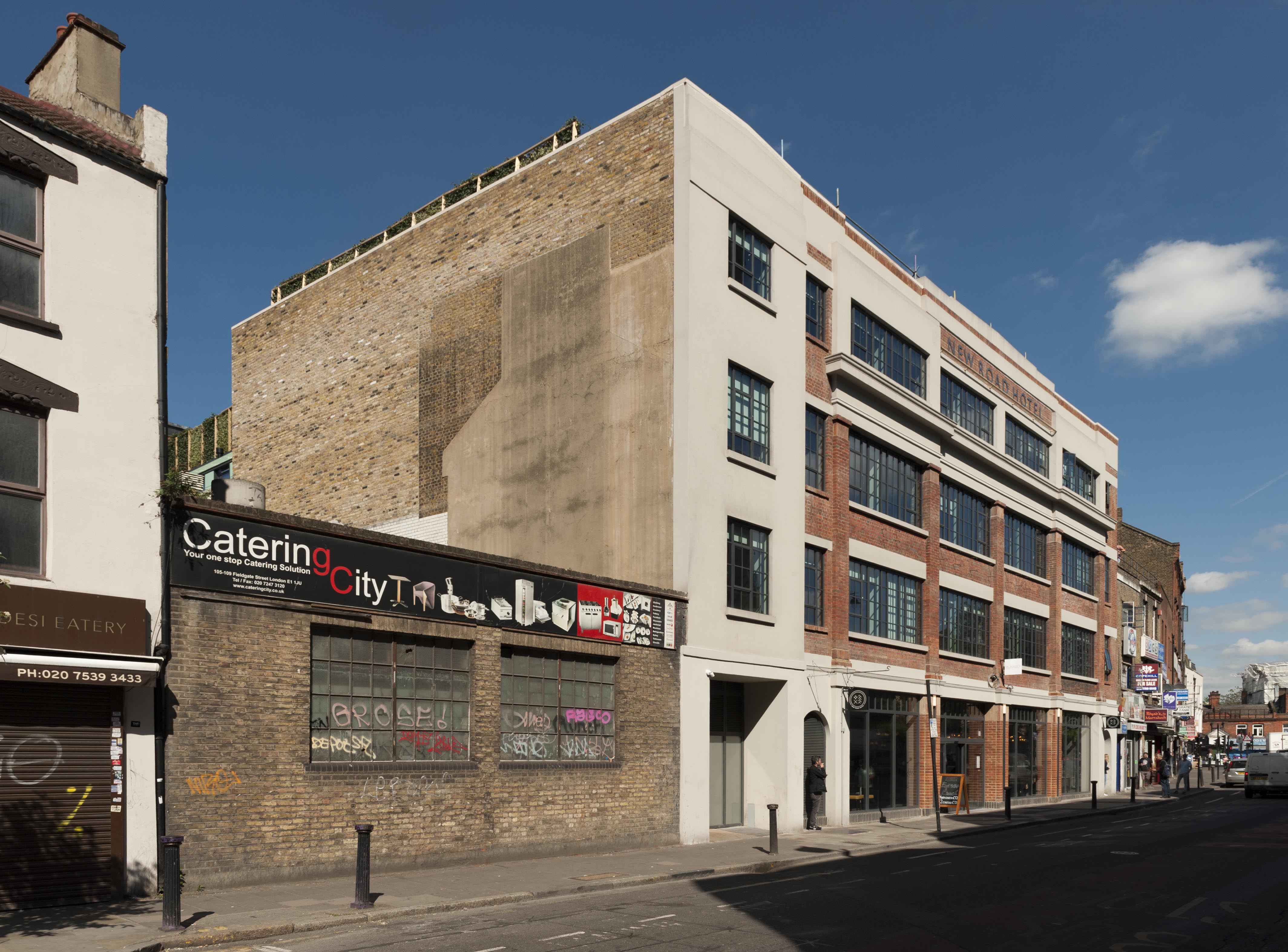
"title": "New Road Hotel (101-107 New Road), from the south-east in May 2018",
"author": {
"id": 27,
"username": "DerekKendall"
},
"feature": {
"id": 849,
"type": "Feature",
"geometry": {
"type": "MultiPolygon",
"coordinates": [
[
[
[
-0.062609929785488,
51.51738959779921
],
[
-0.062716406528659,
51.51737667042908
],
[
-0.062723861521385,
51.51740458896256
],
[
-0.062817127286198,
51.51739512872249
],
[
-0.062863455061319,
51.51757291139632
],
[
-0.062766096607894,
51.517621918848995
],
[
-0.062677693069574,
51.517634076942514
],
[
-0.062609929785488,
51.51738959779921
]
]
]
]
},
"properties": {
"b_number": "101-107",
"b_name": "",
"street": "New Road",
"address": "New Road Hotel (formerly Service House), 101-107 New Road",
"feature_type": "WHITECHAPEL_BUILDING",
"count": 9,
"search_str": "New Road Hotel (formerly Service House), 101-107 New Road"
},
"tags": [
"H. Victor Kerr"
]
},
"file": "https://surveyoflondon.org/media/uploads/features/849/SoL%20Whitechapel%20101994.jpg",
"description": "",
"copyright": true,
"created": "2018-05-10"
},
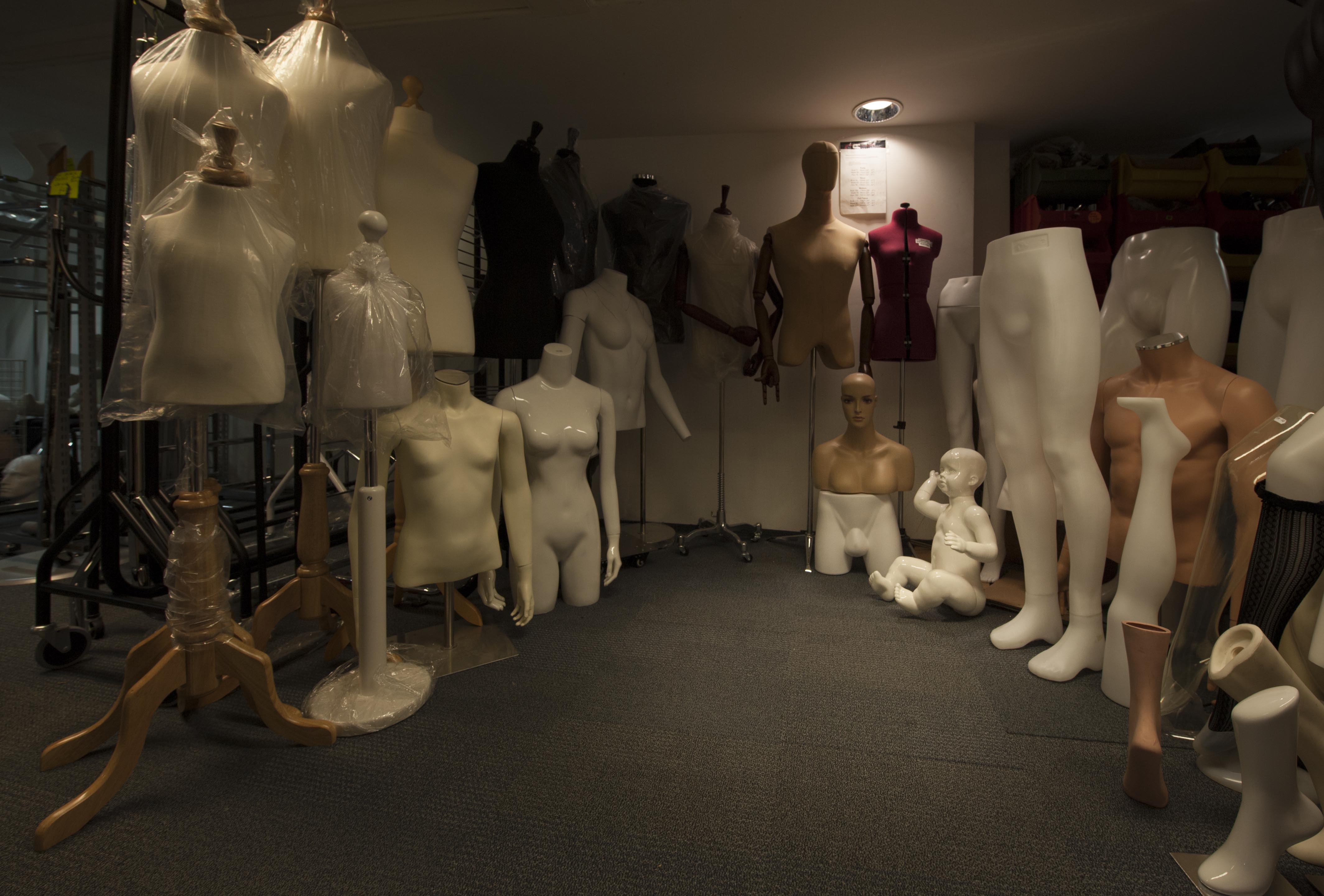
{
"id": 1455,
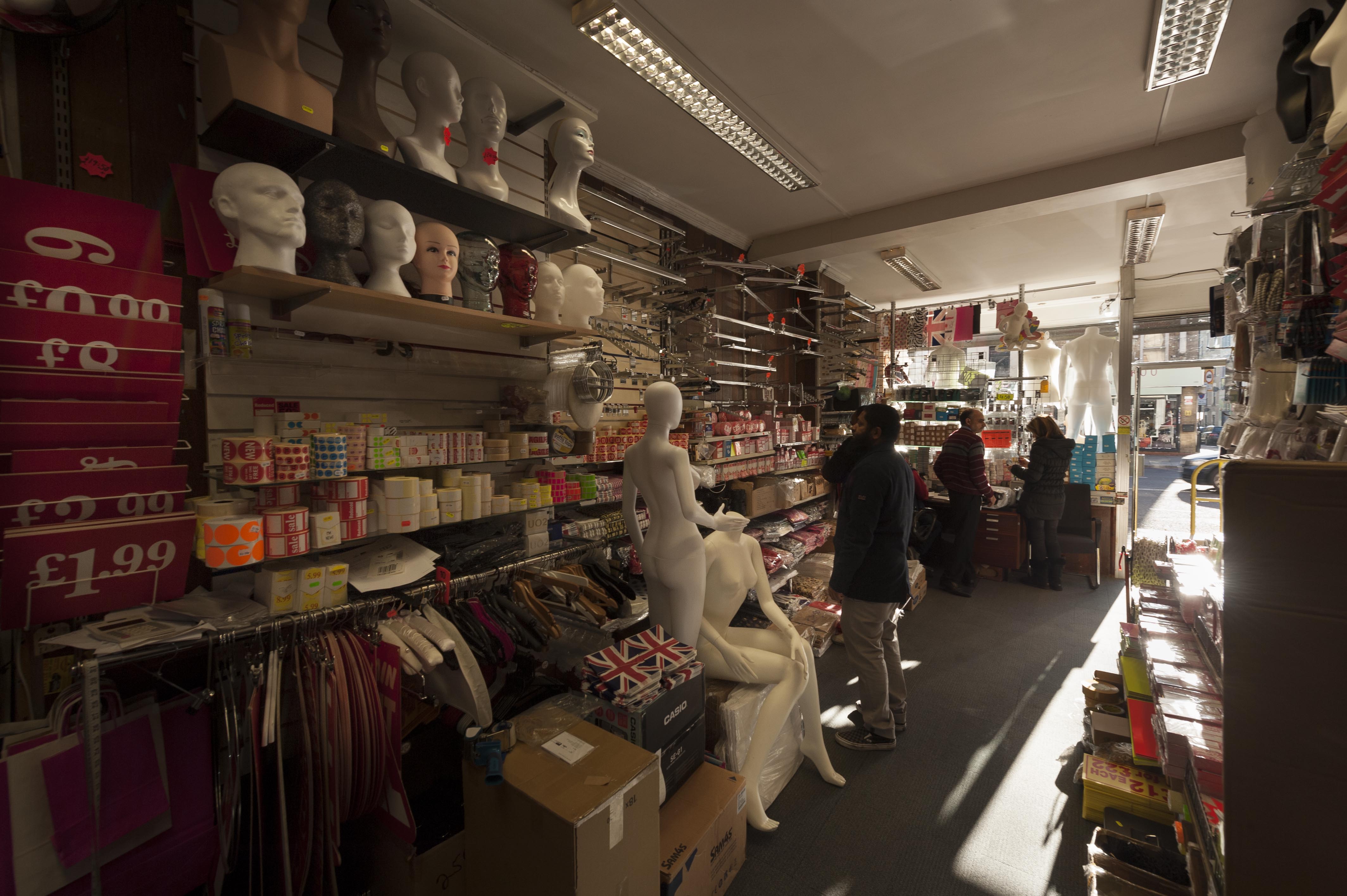
"title": "Mannequins in storage, 79 Commercial Road, November 2018",
"author": {
"id": 27,
"username": "DerekKendall"
},
"feature": {
"id": 766,
"type": "Feature",
"geometry": {
"type": "MultiPolygon",
"coordinates": [
[
[
[
-0.06479636918847,
51.514849127060785
],
[
-0.064796380423472,
51.51484913029562
],
[
-0.064801696545098,
51.51501893523036
],
[
-0.064802160253748,
51.515044626500355
],
[
-0.064750929669421,
51.515043969450474
],
[
-0.064737668986278,
51.51485040214179
],
[
-0.06479636918847,
51.514849127060785
]
]
]
]
},
"properties": {
"b_number": "79",
"b_name": "",
"street": "Commercial Road",
"address": "79 Commercial Road",
"feature_type": "WHITECHAPEL_BUILDING",
"count": 11,
"search_str": "79 Commercial Road"
},
"tags": []
},
"file": "https://surveyoflondon.org/media/uploads/features/766/SoL%20Whitechapel%20102379.jpg",
"description": "",
"copyright": true,
"created": "2018-11-28"
},
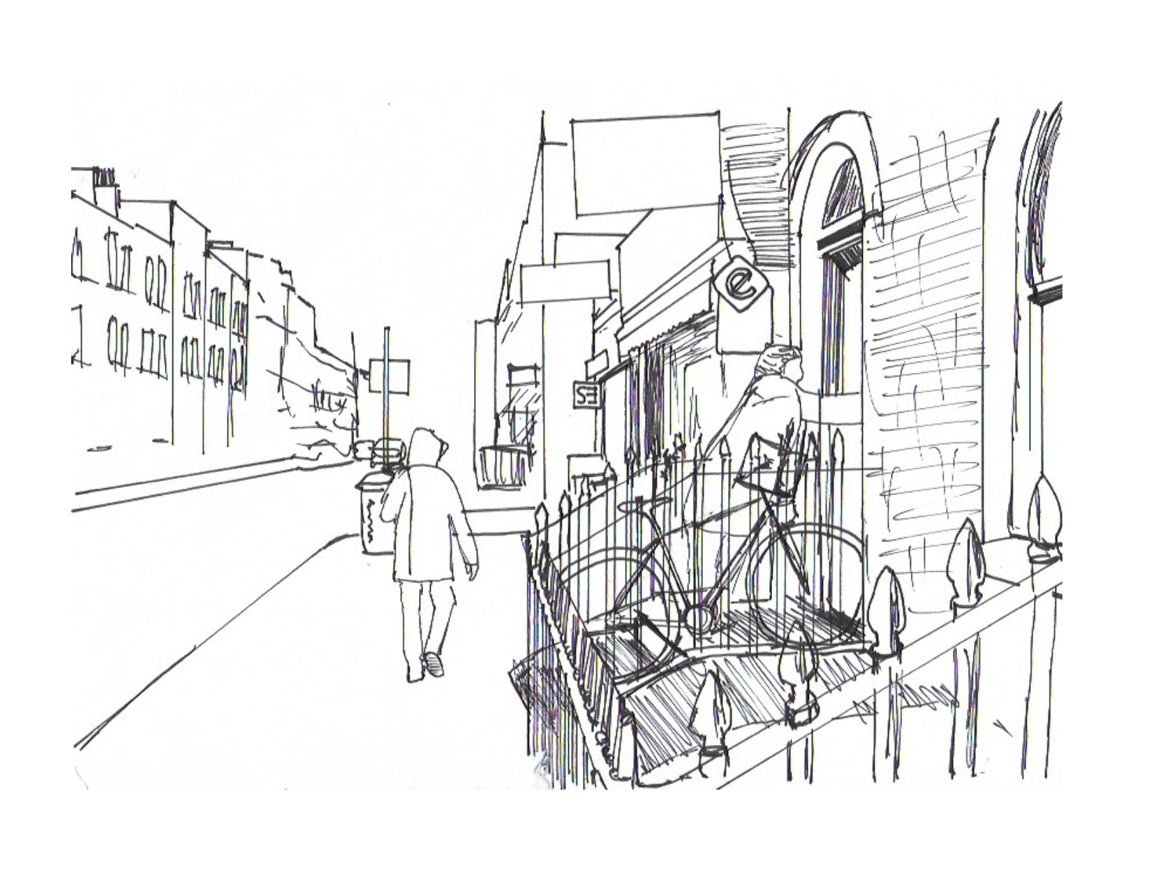
{
"id": 1255,
"title": "Entrance to a house on New Road",
"author": {
"id": 232,
"username": "Sebastian_Dawber"
},
"feature": {
"id": 919,
"type": "Feature",
"geometry": {
"type": "MultiPolygon",
"coordinates": [
[
[
[
-0.06237465566076,
51.515730743950314
],
[
-0.062253612993711,
51.515740136539584
],
[
-0.062243724738792,
51.51569944900359
],
[
-0.062364263296309,
51.51569009552462
],
[
-0.06237465566076,
51.515730743950314
]
]
]
]
},
"properties": {
"b_number": "39",
"b_name": "",
"street": "New Road",
"address": "39 New Road",
"feature_type": "WHITECHAPEL_BUILDING",
"count": 5,
"search_str": "39 New Road"
},
"tags": []
},
"file": "https://surveyoflondon.org/media/uploads/features/919/Screen%20Shot%202018-05-23%20at%2017.45.27.png",
"description": "This is an observational sketch made in 2018 by Sebastian Dawber, a first year architecture student at the University of Westminster.",
"copyright": true,
"created": "2018-05-23"
},
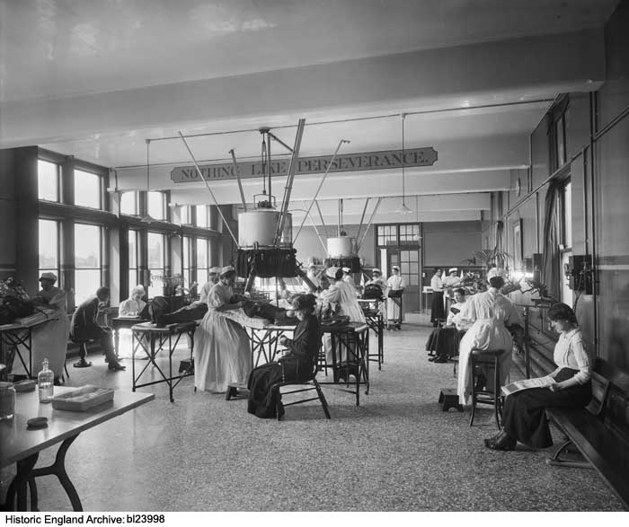
{
"id": 354,
"title": "Lupus patients being treated in the Finsen Light Department at the London Hospital in 1917",
"author": {
"id": 37,
"username": "HistoricEngland"
},
"feature": {
"id": 1188,
"type": "Feature",
"geometry": {
"type": "MultiPolygon",
"coordinates": [
[
[
[
-0.062135521845015,
51.51764176709899
],
[
-0.061842202698012,
51.517670085745486
],
[
-0.061848902036134,
51.51769938896618
],
[
-0.061550919793822,
51.51772590607731
],
[
-0.061559977080333,
51.51776552415219
],
[
-0.061447064288193,
51.51777557192973
],
[
-0.061449635978695,
51.51778682104097
],
[
-0.06118390946889,
51.51781046681395
],
[
-0.061173470769467,
51.517768252329546
],
[
-0.0611656045837,
51.517762055237526
],
[
-0.061159583649328,
51.517735562574764
],
[
-0.061165991378992,
51.51772693239806
],
[
-0.061115835114599,
51.517494904849876
],
[
-0.061108055251476,
51.51749055594055
],
[
-0.061100533853466,
51.51745850319045
],
[
-0.061102936626612,
51.5174532736114
],
[
-0.061094280097356,
51.517413095299034
],
[
-0.061827243127089,
51.517348112870636
],
[
-0.061830552360161,
51.517362587728314
],
[
-0.062066885754417,
51.51734155598123
],
[
-0.062135521845015,
51.51764176709899
]
]
]
]
},
"properties": {
"b_number": "",
"b_name": "",
"street": "Stepney Way",
"address": "Outpatients Department",
"feature_type": "WHITECHAPEL_BUILDING",
"count": 9,
"search_str": "Outpatients Department"
},
"tags": []
},
"file": "https://surveyoflondon.org/media/uploads/features/1230/bl23998.jpg",
"description": "Photograph by Bedford Lemere & Co., reproduced by permission of the Historic England Archive (see archive.HistoricEngland.org.uk). ",
"copyright": true,
"created": "2016-09-05"
},
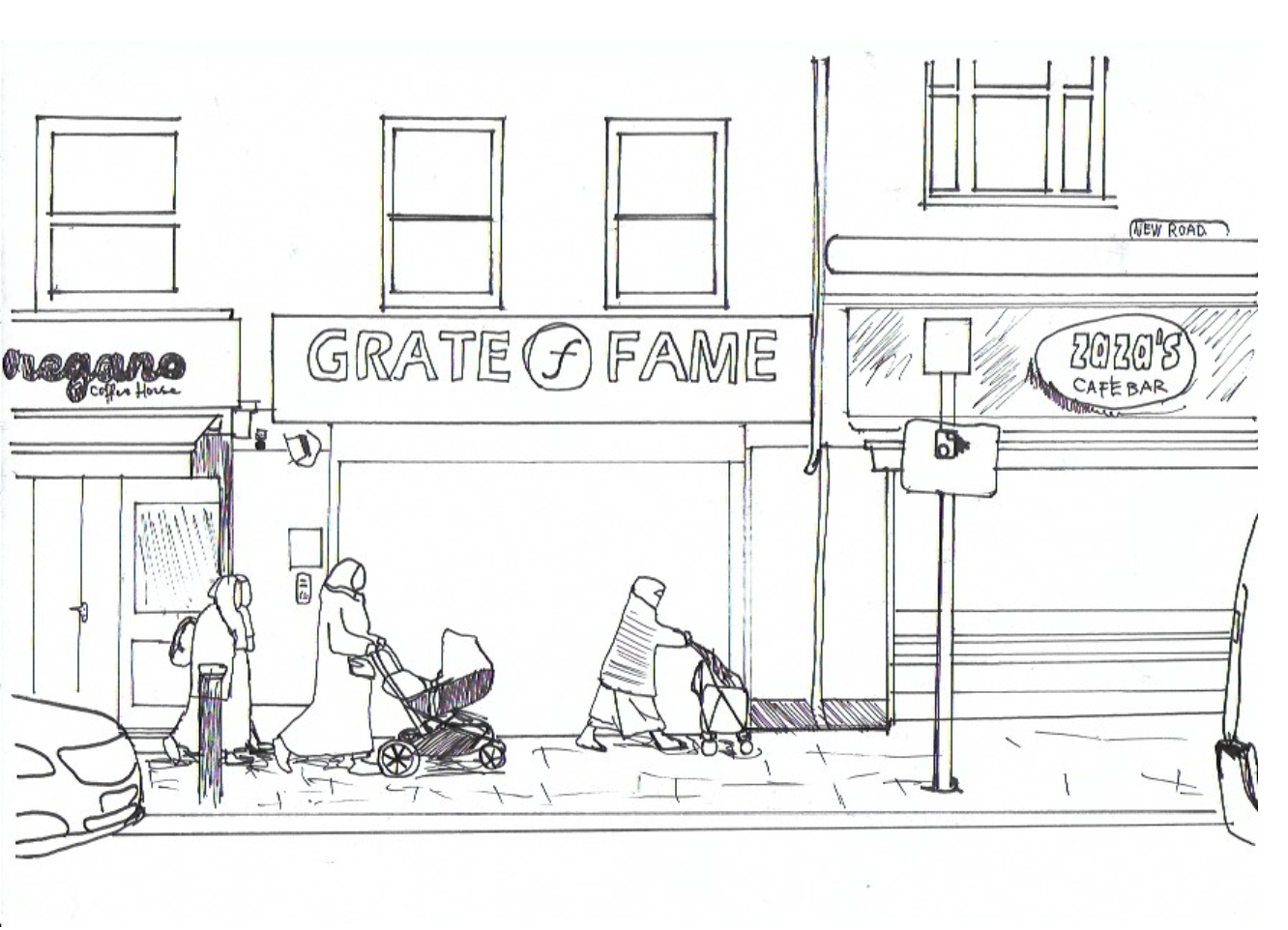
{
"id": 1256,
"title": "Elevation of 115 New Road",
"author": {
"id": 232,
"username": "Sebastian_Dawber"
},
"feature": {
"id": 1463,
"type": "Feature",
"geometry": {
"type": "MultiPolygon",
"coordinates": [
[
[
[
-0.063134492360364,
51.51782738505861
],
[
-0.063025709537606,
51.51764418006528
],
[
-0.062931156135412,
51.51766686232899
],
[
-0.062954889604093,
51.51770900962472
],
[
-0.062726482458675,
51.517765079903484
],
[
-0.062748999276863,
51.51780173726752
],
[
-0.062973174374441,
51.51774578529897
],
[
-0.063032903202825,
51.51784972503275
],
[
-0.063134492360364,
51.51782738505861
]
]
]
]
},
"properties": {
"b_number": "115",
"b_name": "",
"street": "New Road",
"address": "115 New Road and the former New Road Synagogue",
"feature_type": "WHITECHAPEL_BUILDING",
"count": 9,
"search_str": "115 New Road and the former New Road Synagogue"
},
"tags": [
"Lewis Solomon",
"Samuel Montagu"
]
},
"file": "https://surveyoflondon.org/media/uploads/features/1463/Screen%20Shot%202018-05-23%20at%2018.00.07.png",
"description": "This is an observational sketch made in 2018 by Sebastian Dawber, a first year architecture student at the University of Westminster.",
"copyright": true,
"created": "2018-05-23"
}
]
}