HTTP 200 OK
Allow: GET, HEAD, OPTIONS
Content-Type: application/json
Vary: Accept
{
"count": 1747,
"next": "https://surveyoflondon.org/api/v1/images/?format=api&page=58",
"previous": "https://surveyoflondon.org/api/v1/images/?format=api&page=56",
"results": [
{
"id": 1640,
"title": "New Castle Street area (Barnes Estate) in 1849",
"author": {
"id": 82,
"username": "HelenJones"
},
"feature": {
"id": 420,
"type": "Feature",
"geometry": {
"type": "MultiPolygon",
"coordinates": [
[
[
[
-0.073255698509161,
51.51591574342781
],
[
-0.07310819850918,
51.5157573434277
],
[
-0.07336639850931,
51.515683843427674
],
[
-0.073521398509294,
51.51584454342777
],
[
-0.073255698509161,
51.51591574342781
]
]
]
]
},
"properties": {
"b_number": "24",
"b_name": "Bradbury Court, 24 Old Castle Street",
"street": "Old Castle Street",
"address": "Bradbury Court, 24 Old Castle Street. London E1 7AH",
"feature_type": "WHITECHAPEL_BUILDING",
"count": 4,
"search_str": "Bradbury Court, 24 Old Castle Street"
},
"tags": []
},
"file": "https://surveyoflondon.org/media/uploads/features/420/Pemberton-barnes%20estate.jpg",
"description": "",
"copyright": true,
"created": "2019-08-06"
},
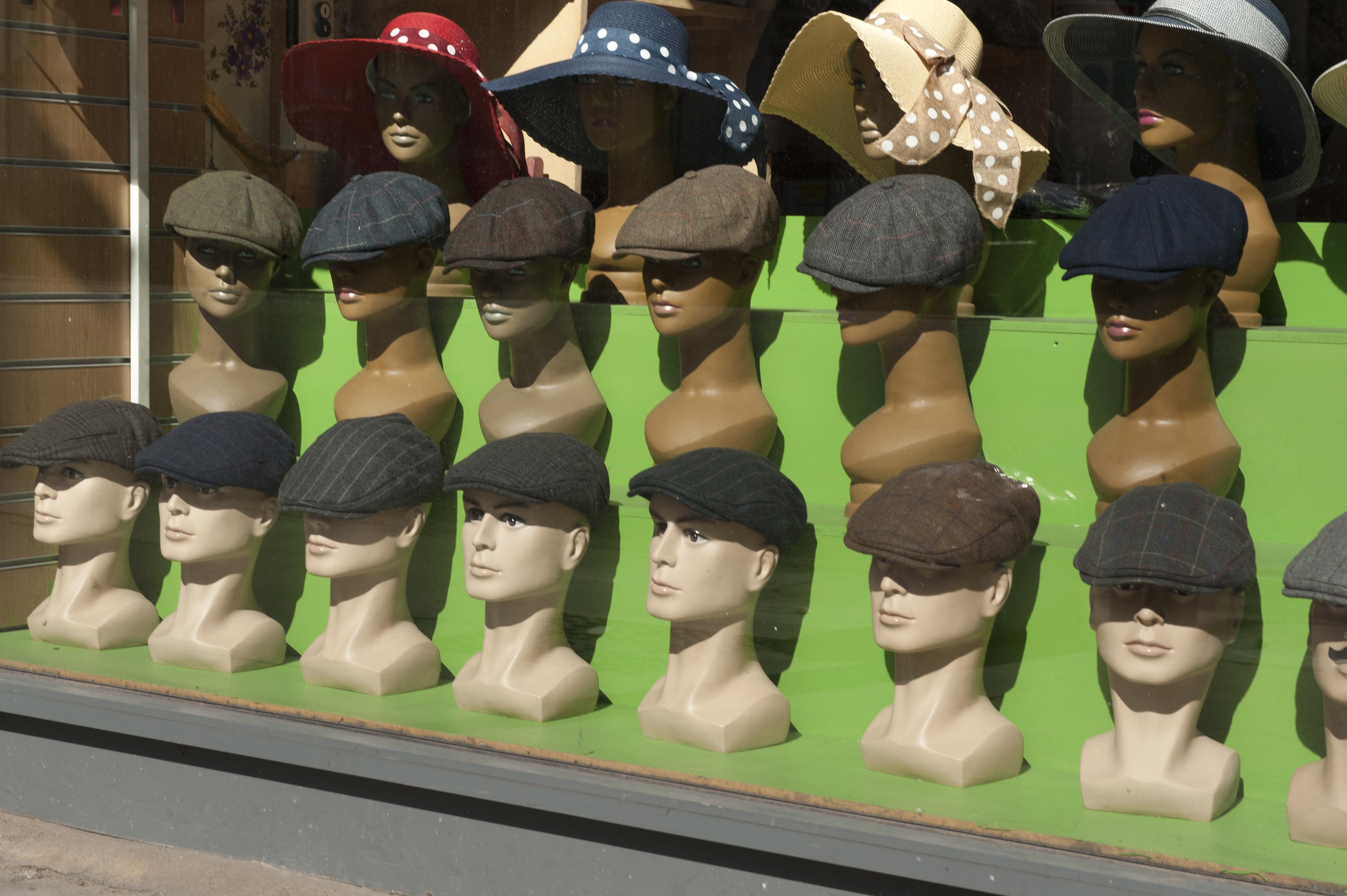
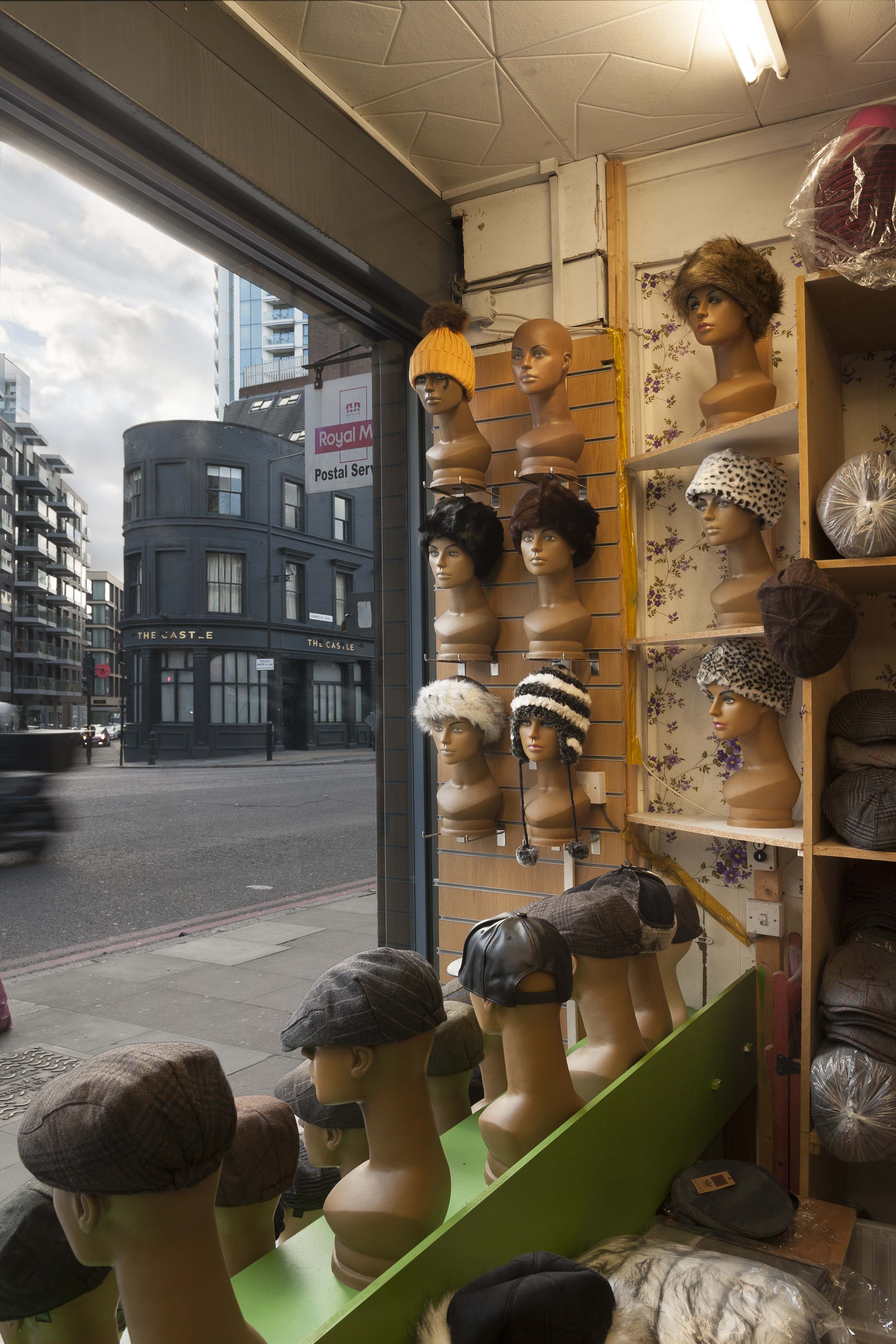
{
"id": 590,
"title": "31A Commercial Road, shopwindow display in April 2017",
"author": {
"id": 27,
"username": "DerekKendall"
},
"feature": {
"id": 183,
"type": "Feature",
"geometry": {
"type": "MultiPolygon",
"coordinates": [
[
[
[
-0.068397668552997,
51.51503158302935
],
[
-0.068417163866567,
51.51511498503746
],
[
-0.068417192787229,
51.51511498918578
],
[
-0.068368184337877,
51.51513215824459
],
[
-0.068296238211336,
51.51502991235345
],
[
-0.068397668552997,
51.51503158302935
]
]
]
]
},
"properties": {
"b_number": "31A",
"b_name": "",
"street": "Commercial Road",
"address": "31A Commercial Road",
"feature_type": "WHITECHAPEL_BUILDING",
"count": 12,
"search_str": "31A Commercial Road"
},
"tags": []
},
"file": "https://surveyoflondon.org/media/uploads/features/183/SoL%20Whitechapel%20100625.jpg",
"description": "",
"copyright": true,
"created": "2017-05-03"
},
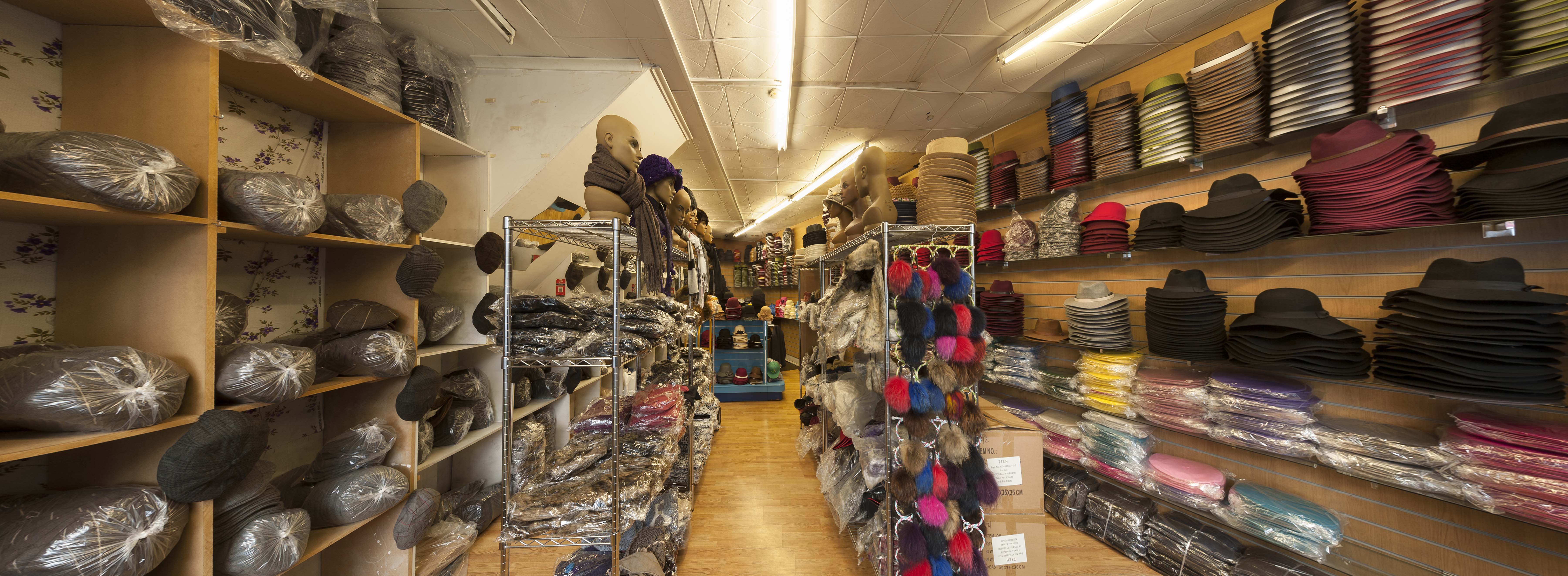
{
"id": 1208,
"title": "31A Commercial Road, interior in early 2018",
"author": {
"id": 27,
"username": "DerekKendall"
},
"feature": {
"id": 183,
"type": "Feature",
"geometry": {
"type": "MultiPolygon",
"coordinates": [
[
[
[
-0.068397668552997,
51.51503158302935
],
[
-0.068417163866567,
51.51511498503746
],
[
-0.068417192787229,
51.51511498918578
],
[
-0.068368184337877,
51.51513215824459
],
[
-0.068296238211336,
51.51502991235345
],
[
-0.068397668552997,
51.51503158302935
]
]
]
]
},
"properties": {
"b_number": "31A",
"b_name": "",
"street": "Commercial Road",
"address": "31A Commercial Road",
"feature_type": "WHITECHAPEL_BUILDING",
"count": 12,
"search_str": "31A Commercial Road"
},
"tags": []
},
"file": "https://surveyoflondon.org/media/uploads/features/183/SoL%20Whitechapel%20101875.jpg",
"description": "",
"copyright": true,
"created": "2018-03-05"
},
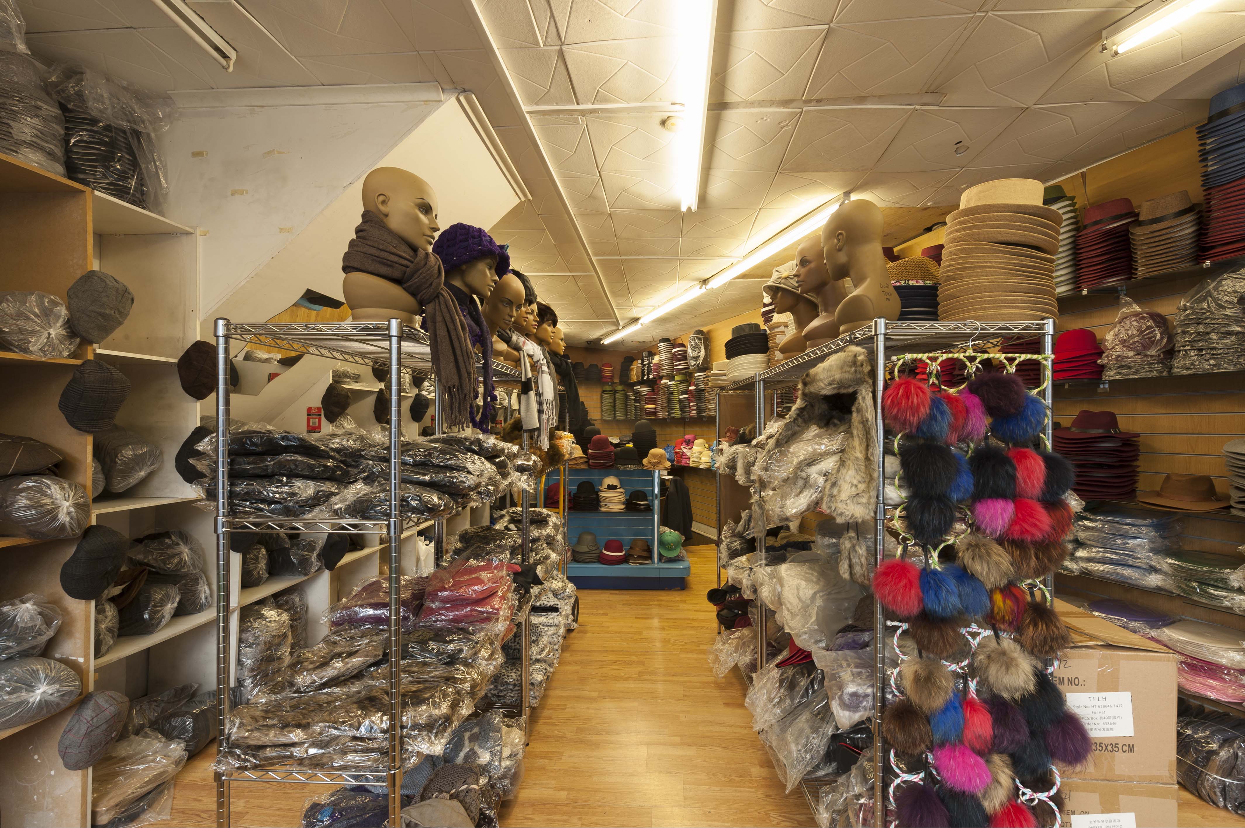
{
"id": 1209,
"title": "31A Commercial Road, interior in early 2018",
"author": {
"id": 27,
"username": "DerekKendall"
},
"feature": {
"id": 183,
"type": "Feature",
"geometry": {
"type": "MultiPolygon",
"coordinates": [
[
[
[
-0.068397668552997,
51.51503158302935
],
[
-0.068417163866567,
51.51511498503746
],
[
-0.068417192787229,
51.51511498918578
],
[
-0.068368184337877,
51.51513215824459
],
[
-0.068296238211336,
51.51502991235345
],
[
-0.068397668552997,
51.51503158302935
]
]
]
]
},
"properties": {
"b_number": "31A",
"b_name": "",
"street": "Commercial Road",
"address": "31A Commercial Road",
"feature_type": "WHITECHAPEL_BUILDING",
"count": 12,
"search_str": "31A Commercial Road"
},
"tags": []
},
"file": "https://surveyoflondon.org/media/uploads/features/183/SoL%20Whitechapel%20101876.jpg",
"description": "",
"copyright": true,
"created": "2018-03-05"
},
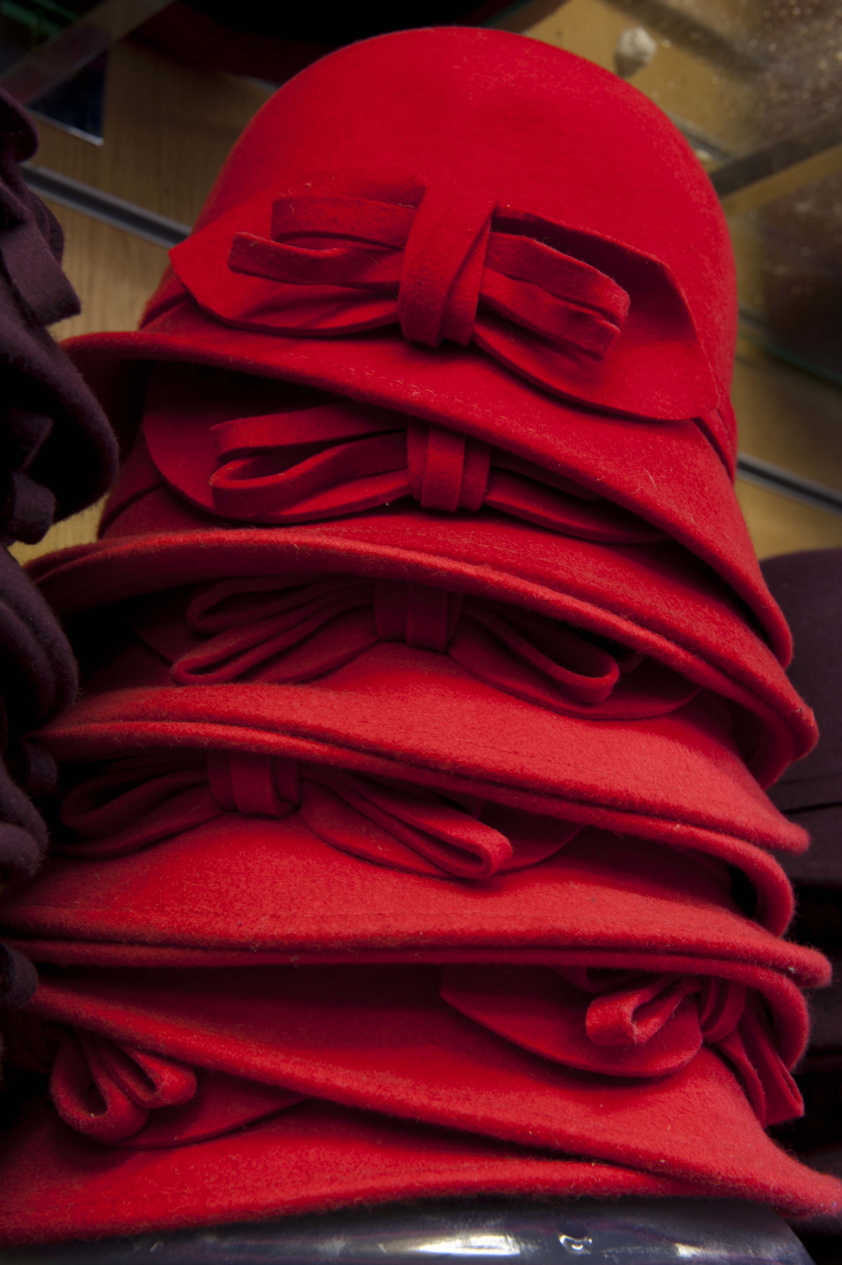
{
"id": 1210,
"title": "31A Commercial Road, a stack of red hats",
"author": {
"id": 27,
"username": "DerekKendall"
},
"feature": {
"id": 183,
"type": "Feature",
"geometry": {
"type": "MultiPolygon",
"coordinates": [
[
[
[
-0.068397668552997,
51.51503158302935
],
[
-0.068417163866567,
51.51511498503746
],
[
-0.068417192787229,
51.51511498918578
],
[
-0.068368184337877,
51.51513215824459
],
[
-0.068296238211336,
51.51502991235345
],
[
-0.068397668552997,
51.51503158302935
]
]
]
]
},
"properties": {
"b_number": "31A",
"b_name": "",
"street": "Commercial Road",
"address": "31A Commercial Road",
"feature_type": "WHITECHAPEL_BUILDING",
"count": 12,
"search_str": "31A Commercial Road"
},
"tags": []
},
"file": "https://surveyoflondon.org/media/uploads/features/183/SoL%20Whitechapel%20101880.jpg",
"description": "",
"copyright": true,
"created": "2018-03-05"
},
{
"id": 1211,
"title": "31A Commercial Road, view from within across Commercial Road in early 2018",
"author": {
"id": 27,
"username": "DerekKendall"
},
"feature": {
"id": 183,
"type": "Feature",
"geometry": {
"type": "MultiPolygon",
"coordinates": [
[
[
[
-0.068397668552997,
51.51503158302935
],
[
-0.068417163866567,
51.51511498503746
],
[
-0.068417192787229,
51.51511498918578
],
[
-0.068368184337877,
51.51513215824459
],
[
-0.068296238211336,
51.51502991235345
],
[
-0.068397668552997,
51.51503158302935
]
]
]
]
},
"properties": {
"b_number": "31A",
"b_name": "",
"street": "Commercial Road",
"address": "31A Commercial Road",
"feature_type": "WHITECHAPEL_BUILDING",
"count": 12,
"search_str": "31A Commercial Road"
},
"tags": []
},
"file": "https://surveyoflondon.org/media/uploads/features/183/SoL%20Whitechapel%20101883.jpg",
"description": "",
"copyright": true,
"created": "2018-03-05"
},
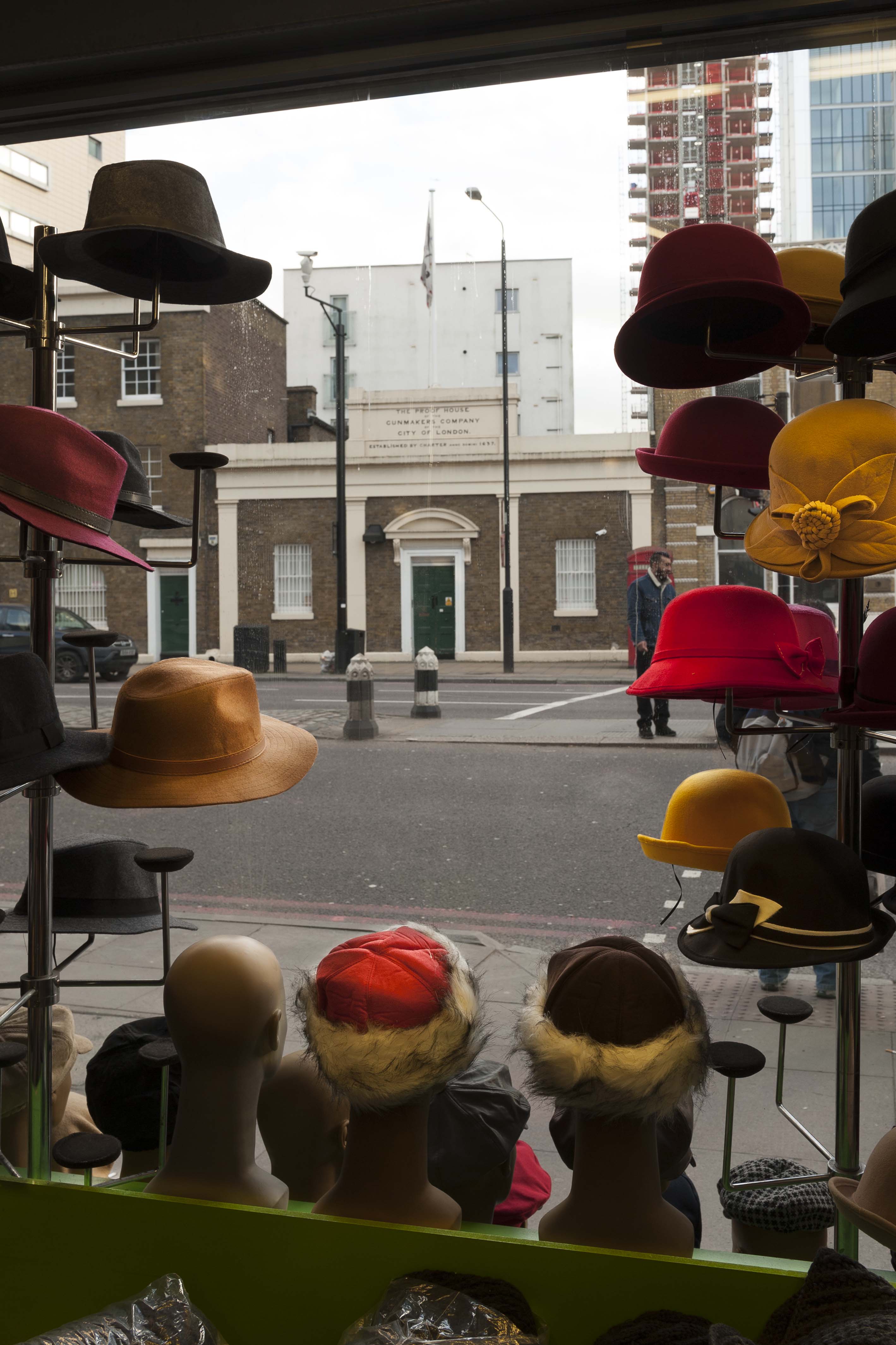
{
"id": 1212,
"title": "31A Commercial Road, view across to the Proof House in early 2018",
"author": {
"id": 27,
"username": "DerekKendall"
},
"feature": {
"id": 183,
"type": "Feature",
"geometry": {
"type": "MultiPolygon",
"coordinates": [
[
[
[
-0.068397668552997,
51.51503158302935
],
[
-0.068417163866567,
51.51511498503746
],
[
-0.068417192787229,
51.51511498918578
],
[
-0.068368184337877,
51.51513215824459
],
[
-0.068296238211336,
51.51502991235345
],
[
-0.068397668552997,
51.51503158302935
]
]
]
]
},
"properties": {
"b_number": "31A",
"b_name": "",
"street": "Commercial Road",
"address": "31A Commercial Road",
"feature_type": "WHITECHAPEL_BUILDING",
"count": 12,
"search_str": "31A Commercial Road"
},
"tags": []
},
"file": "https://surveyoflondon.org/media/uploads/features/183/SoL%20Whitechapel%20101884.jpg",
"description": "",
"copyright": true,
"created": "2018-03-05"
},
{
"id": 1203,
"title": "8A Vine Court from the north-west in early 2018",
"author": {
"id": 27,
"username": "DerekKendall"
},
"feature": {
"id": 870,
"type": "Feature",
"geometry": {
"type": "MultiPolygon",
"coordinates": [
[
[
[
-0.063385893765643,
51.51778446185495
],
[
-0.0634324540283,
51.517850472512215
],
[
-0.063293039645917,
51.51788979057599
],
[
-0.063272564861112,
51.51785697615977
],
[
-0.063245695503641,
51.51786423848478
],
[
-0.06322157111954,
51.51783003604606
],
[
-0.063285888955072,
51.51781237754567
],
[
-0.063285888955065,
51.51781237754567
],
[
-0.063385893765643,
51.51778446185495
]
]
]
]
},
"properties": {
"b_number": "8A",
"b_name": "",
"street": "Vine Court",
"address": "8A Vine Court",
"feature_type": "WHITECHAPEL_BUILDING",
"count": 3,
"search_str": "8A Vine Court"
},
"tags": []
},
"file": "https://surveyoflondon.org/media/uploads/features/870/SoL%20Whitechapel%20101855.jpg",
"description": "",
"copyright": true,
"created": "2018-03-05"
},
{
"id": 1204,
"title": "176-178 Whitechapel Road and East Mount Street in early 2018",
"author": {
"id": 27,
"username": "DerekKendall"
},
"feature": {
"id": 1231,
"type": "Feature",
"geometry": {
"type": "MultiPolygon",
"coordinates": [
[
[
[
-0.058999857002125,
51.518957100386174
],
[
-0.059048592228483,
51.519036675524816
],
[
-0.059042002286964,
51.5190605621672
],
[
-0.058864726926981,
51.51910678355749
],
[
-0.058822200523125,
51.51902777962813
],
[
-0.058802097602954,
51.51899416748291
],
[
-0.058712070836869,
51.51884364184363
],
[
-0.058774083983596,
51.518828793526126
],
[
-0.058821128899218,
51.51890526890926
],
[
-0.058783587749907,
51.518914257701724
],
[
-0.058783583000377,
51.51891425883895
],
[
-0.058824025690886,
51.51898280999364
],
[
-0.058823998639063,
51.518982764140226
],
[
-0.058880213224576,
51.51896985673114
],
[
-0.058889131635543,
51.518984974852245
],
[
-0.058999857002125,
51.518957100386174
]
]
]
]
},
"properties": {
"b_number": "176",
"b_name": "",
"street": "Whitechapel Road",
"address": "Former London Hospital Tavern",
"feature_type": "WHITECHAPEL_BUILDING",
"count": 5,
"search_str": "Former London Hospital Tavern"
},
"tags": []
},
"file": "https://surveyoflondon.org/media/uploads/features/1231/SoL%20Whitechapel%20101856.jpg",
"description": "",
"copyright": true,
"created": "2018-03-05"
},
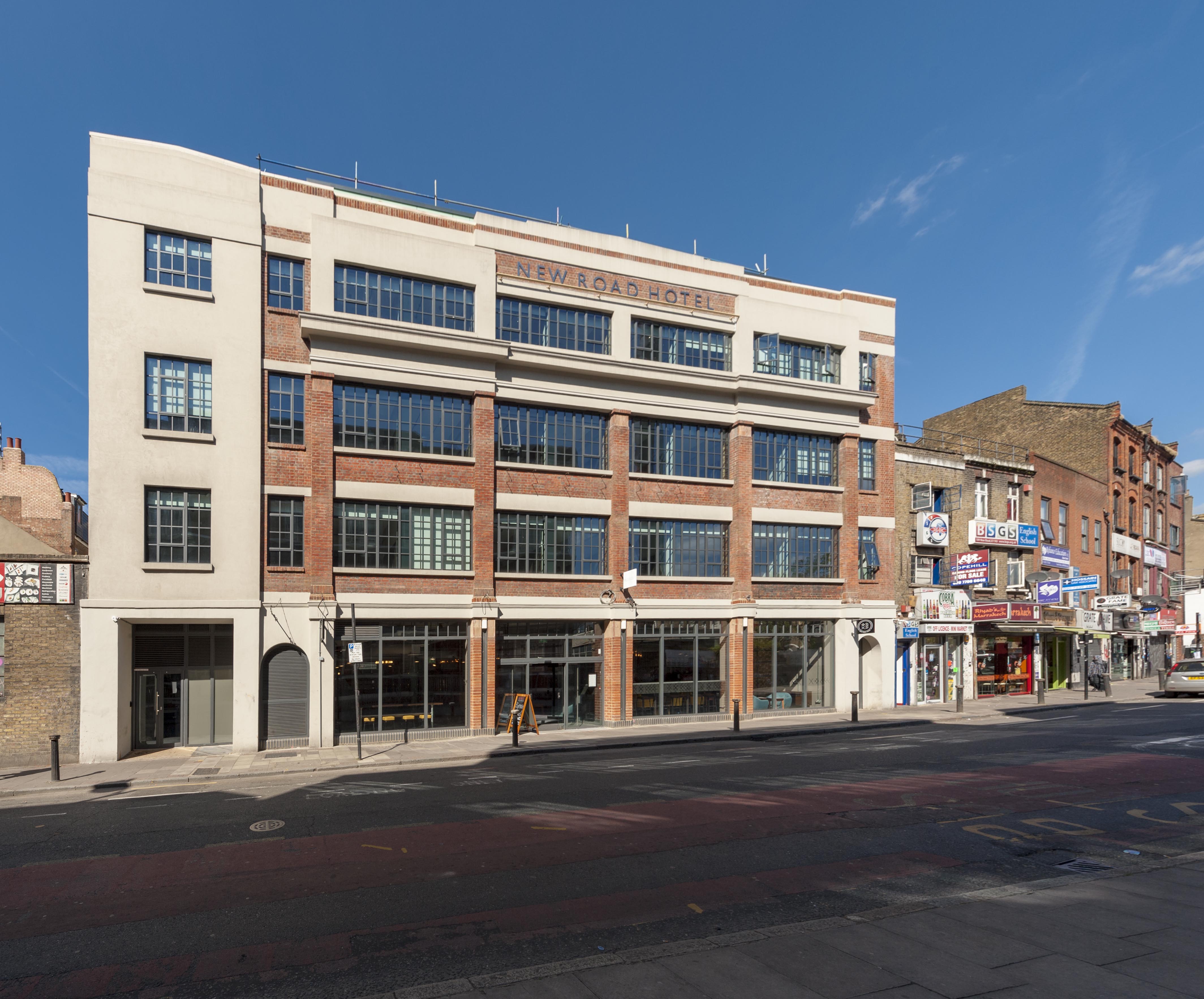
{
"id": 1246,
"title": "101-119 New Road in May 2018",
"author": {
"id": 27,
"username": "DerekKendall"
},
"feature": {
"id": 849,
"type": "Feature",
"geometry": {
"type": "MultiPolygon",
"coordinates": [
[
[
[
-0.062609929785488,
51.51738959779921
],
[
-0.062716406528659,
51.51737667042908
],
[
-0.062723861521385,
51.51740458896256
],
[
-0.062817127286198,
51.51739512872249
],
[
-0.062863455061319,
51.51757291139632
],
[
-0.062766096607894,
51.517621918848995
],
[
-0.062677693069574,
51.517634076942514
],
[
-0.062609929785488,
51.51738959779921
]
]
]
]
},
"properties": {
"b_number": "101-107",
"b_name": "",
"street": "New Road",
"address": "New Road Hotel (formerly Service House), 101-107 New Road",
"feature_type": "WHITECHAPEL_BUILDING",
"count": 9,
"search_str": "New Road Hotel (formerly Service House), 101-107 New Road"
},
"tags": [
"H. Victor Kerr"
]
},
"file": "https://surveyoflondon.org/media/uploads/features/849/SoL%20Whitechapel%20101996.jpg",
"description": "",
"copyright": true,
"created": "2018-05-10"
},
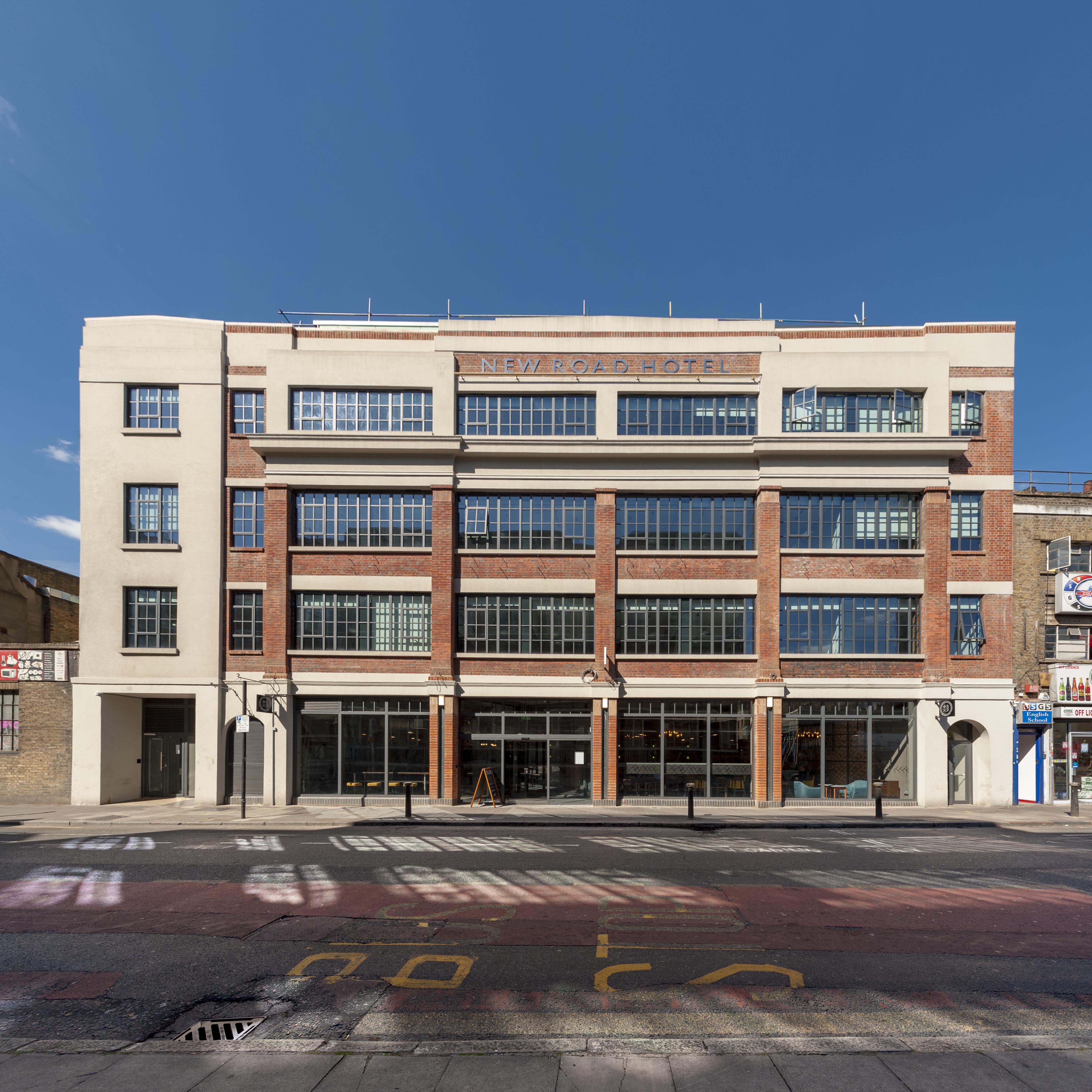
{
"id": 1247,
"title": "New Road Hotel (101-107 New Road) in May 2018",
"author": {
"id": 27,
"username": "DerekKendall"
},
"feature": {
"id": 849,
"type": "Feature",
"geometry": {
"type": "MultiPolygon",
"coordinates": [
[
[
[
-0.062609929785488,
51.51738959779921
],
[
-0.062716406528659,
51.51737667042908
],
[
-0.062723861521385,
51.51740458896256
],
[
-0.062817127286198,
51.51739512872249
],
[
-0.062863455061319,
51.51757291139632
],
[
-0.062766096607894,
51.517621918848995
],
[
-0.062677693069574,
51.517634076942514
],
[
-0.062609929785488,
51.51738959779921
]
]
]
]
},
"properties": {
"b_number": "101-107",
"b_name": "",
"street": "New Road",
"address": "New Road Hotel (formerly Service House), 101-107 New Road",
"feature_type": "WHITECHAPEL_BUILDING",
"count": 9,
"search_str": "New Road Hotel (formerly Service House), 101-107 New Road"
},
"tags": [
"H. Victor Kerr"
]
},
"file": "https://surveyoflondon.org/media/uploads/features/849/SoL%20Whitechapel%20101997.jpg",
"description": "",
"copyright": true,
"created": "2018-05-10"
},
{
"id": 219,
"title": "From 281 Whitechapel Road looking west in 2016",
"author": {
"id": 27,
"username": "DerekKendall"
},
"feature": {
"id": 498,
"type": "Feature",
"geometry": {
"type": "MultiPolygon",
"coordinates": [
[
[
[
-0.059543133323744,
51.51933524687723
],
[
-0.059592946555481,
51.51941486628688
],
[
-0.05957130319769,
51.519420136686996
],
[
-0.059599906353514,
51.51946585469083
],
[
-0.059623043880068,
51.519460220443136
],
[
-0.059678799167797,
51.51954933684866
],
[
-0.059557913775928,
51.51958140180363
],
[
-0.0594203198542,
51.51936363764333
],
[
-0.059543133323744,
51.51933524687723
]
]
]
]
},
"properties": {
"b_number": "279-281",
"b_name": "Former Working Lads' Institute",
"street": "",
"address": "Former Working Lads' Institute, 279-281 Whitechapel Road",
"feature_type": "WHITECHAPEL_BUILDING",
"count": 9,
"search_str": "Former Working Lads' Institute"
},
"tags": [
"Frank A. Bevan",
"George Baines",
"Henry Hill",
"Primitive Methodists",
"Thomas Jackson"
]
},
"file": "https://surveyoflondon.org/media/uploads/features/498/SoL%20Whitechapel100027.jpg",
"description": "",
"copyright": true,
"created": "2016-08-01"
},
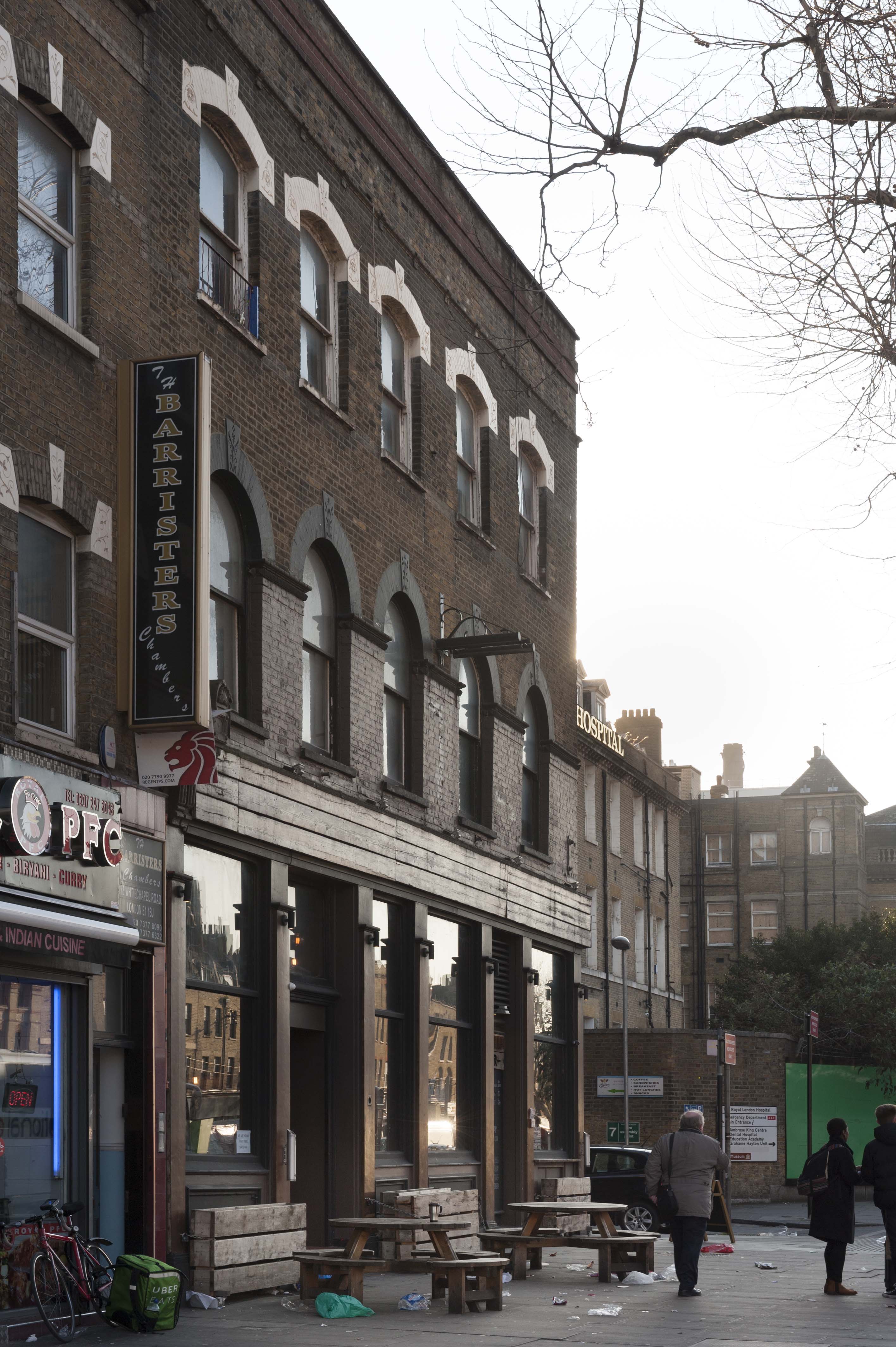
{
"id": 1205,
"title": "Urban Bar, 176 Whitechapel Road, from the north-east in early 2018",
"author": {
"id": 27,
"username": "DerekKendall"
},
"feature": {
"id": 1231,
"type": "Feature",
"geometry": {
"type": "MultiPolygon",
"coordinates": [
[
[
[
-0.058999857002125,
51.518957100386174
],
[
-0.059048592228483,
51.519036675524816
],
[
-0.059042002286964,
51.5190605621672
],
[
-0.058864726926981,
51.51910678355749
],
[
-0.058822200523125,
51.51902777962813
],
[
-0.058802097602954,
51.51899416748291
],
[
-0.058712070836869,
51.51884364184363
],
[
-0.058774083983596,
51.518828793526126
],
[
-0.058821128899218,
51.51890526890926
],
[
-0.058783587749907,
51.518914257701724
],
[
-0.058783583000377,
51.51891425883895
],
[
-0.058824025690886,
51.51898280999364
],
[
-0.058823998639063,
51.518982764140226
],
[
-0.058880213224576,
51.51896985673114
],
[
-0.058889131635543,
51.518984974852245
],
[
-0.058999857002125,
51.518957100386174
]
]
]
]
},
"properties": {
"b_number": "176",
"b_name": "",
"street": "Whitechapel Road",
"address": "Former London Hospital Tavern",
"feature_type": "WHITECHAPEL_BUILDING",
"count": 5,
"search_str": "Former London Hospital Tavern"
},
"tags": []
},
"file": "https://surveyoflondon.org/media/uploads/features/1231/SoL%20Whitechapel%20101857.jpg",
"description": "",
"copyright": true,
"created": "2018-03-05"
},
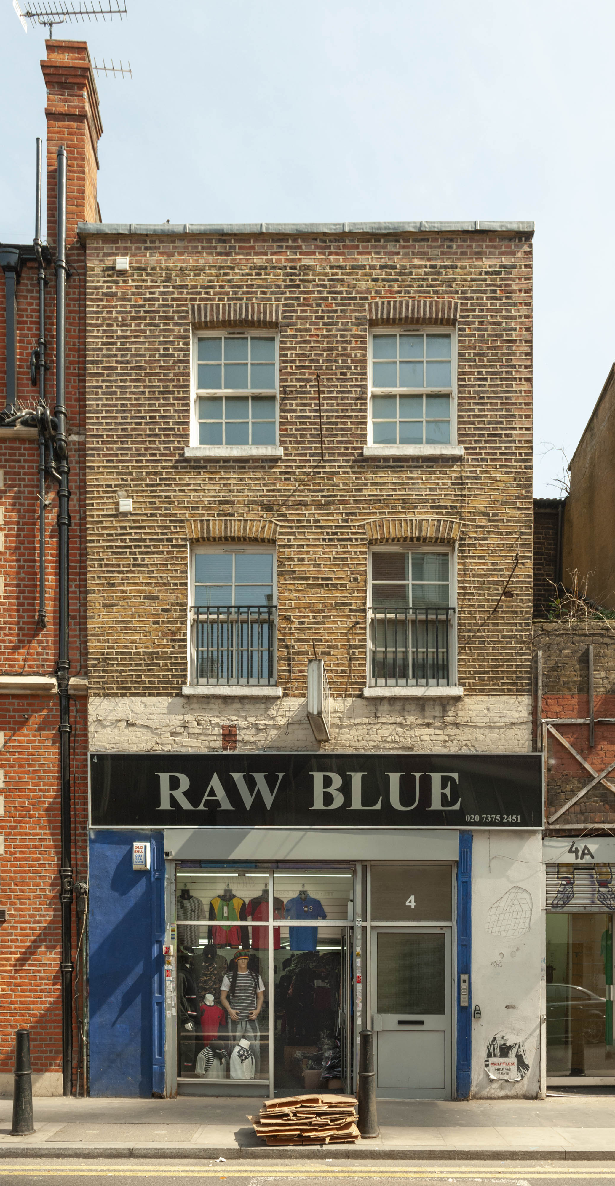
{
"id": 1590,
"title": "4 White Church Lane in 2019",
"author": {
"id": 27,
"username": "DerekKendall"
},
"feature": {
"id": 157,
"type": "Feature",
"geometry": {
"type": "MultiPolygon",
"coordinates": [
[
[
[
-0.069144690600672,
51.515845810444475
],
[
-0.069039952977969,
51.515887892128475
],
[
-0.06902408749862,
51.515893460019775
],
[
-0.068980292761505,
51.51585556277966
],
[
-0.06910842825712,
51.51579791995394
],
[
-0.069144690600672,
51.515845810444475
]
]
]
]
},
"properties": {
"b_number": "4",
"b_name": "",
"street": "White Church Lane",
"address": "Tip Top Casual Wear, 4 White Church Lane",
"feature_type": "WHITECHAPEL_BUILDING",
"count": 5,
"search_str": "Tip Top Casual Wear, 4 White Church Lane"
},
"tags": [
"street art"
]
},
"file": "https://surveyoflondon.org/media/uploads/features/157/SoL%20Whitechapel%20102695.jpg",
"description": "",
"copyright": true,
"created": "2019-04-30"
},
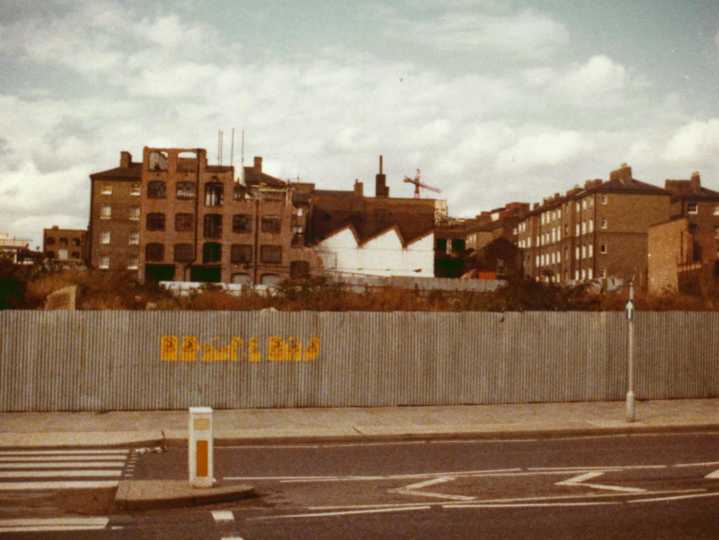
{
"id": 1163,
"title": "Peabody Whitechapel Estate from East Smithfield 1977",
"author": {
"id": 153,
"username": "danny"
},
"feature": {
"id": 1738,
"type": "Feature",
"geometry": {
"type": "MultiPolygon",
"coordinates": [
[
[
[
-0.068990656771172,
51.50884640798922
],
[
-0.069054414424792,
51.50883556698219
],
[
-0.06902878701335,
51.50877414854664
],
[
-0.068965053814777,
51.50878515401215
],
[
-0.068990656771172,
51.50884640798922
]
]
]
]
},
"properties": {
"b_number": "52",
"b_name": "",
"street": "East Smithfield",
"address": "52 East Smithfield, Royal Mint Estate",
"feature_type": "WHITECHAPEL_BUILDING",
"count": 7,
"search_str": "52 East Smithfield, Royal Mint Estate"
},
"tags": []
},
"file": "https://surveyoflondon.org/media/uploads/features/1738/East%20Smithfield%201977.jpg",
"description": "A view from East Smithfield north towards the Peabody Whitechapel Estate in John Fisher Street. This is before the construction of the new Royal Mint Estate which spanned the area between Cartwright Street and John Fisher Street. Prior to this, the site had contained a large rail terminal on Blue Anchor Yard with a railway bridge that crossed East Smithfield into the London Dock though that (the bridge) had already gone when I was a kid in the sixties.",
"copyright": false,
"created": "2018-03-04"
},
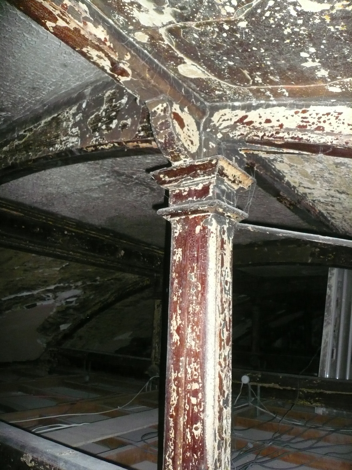
{
"id": 1241,
"title": "Former New Road Synagogue, roofspace, detail of a queen-post, April 2018",
"author": {
"id": 10,
"username": "PGuillery"
},
"feature": {
"id": 1463,
"type": "Feature",
"geometry": {
"type": "MultiPolygon",
"coordinates": [
[
[
[
-0.063134492360364,
51.51782738505861
],
[
-0.063025709537606,
51.51764418006528
],
[
-0.062931156135412,
51.51766686232899
],
[
-0.062954889604093,
51.51770900962472
],
[
-0.062726482458675,
51.517765079903484
],
[
-0.062748999276863,
51.51780173726752
],
[
-0.062973174374441,
51.51774578529897
],
[
-0.063032903202825,
51.51784972503275
],
[
-0.063134492360364,
51.51782738505861
]
]
]
]
},
"properties": {
"b_number": "115",
"b_name": "",
"street": "New Road",
"address": "115 New Road and the former New Road Synagogue",
"feature_type": "WHITECHAPEL_BUILDING",
"count": 9,
"search_str": "115 New Road and the former New Road Synagogue"
},
"tags": [
"Lewis Solomon",
"Samuel Montagu"
]
},
"file": "https://surveyoflondon.org/media/uploads/features/1463/P1200310.JPG",
"description": "",
"copyright": true,
"created": "2018-04-17"
},
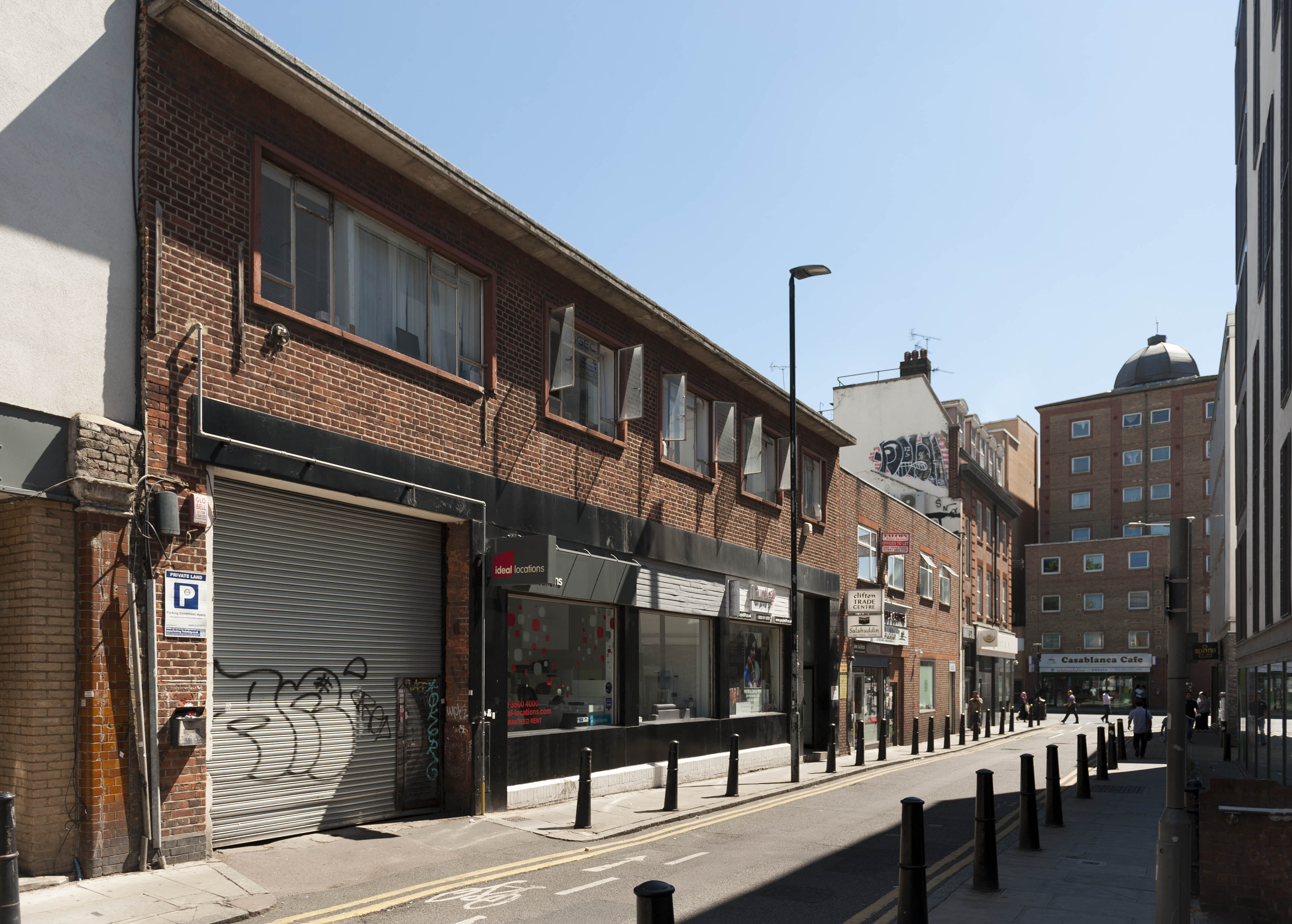
{
"id": 1328,
"title": "8–10 Greatorex Street in 2018",
"author": {
"id": 27,
"username": "DerekKendall"
},
"feature": {
"id": 442,
"type": "Feature",
"geometry": {
"type": "MultiPolygon",
"coordinates": [
[
[
[
-0.066931741930423,
51.51783144911425
],
[
-0.066622224954662,
51.517963605738565
],
[
-0.066594018903949,
51.51797548229212
],
[
-0.066076636626661,
51.51820072540386
],
[
-0.066056525173727,
51.51818387500057
],
[
-0.065919478439883,
51.51807143405586
],
[
-0.065915849030395,
51.518066008897044
],
[
-0.065902523536916,
51.518054844035944
],
[
-0.066000379683973,
51.51801717318487
],
[
-0.066043209842979,
51.517999766286565
],
[
-0.066537431268959,
51.51779890425784
],
[
-0.06671784449577,
51.517725579541874
],
[
-0.066710856901496,
51.517718568312816
],
[
-0.066946429866983,
51.517634618639484
],
[
-0.067075868810343,
51.517774022771334
],
[
-0.066931741930423,
51.51783144911425
]
],
[
[
-0.066921004155458,
51.517787900224945
],
[
-0.066875657807192,
51.517743600465174
],
[
-0.066763167223498,
51.517789403065365
],
[
-0.066810175257519,
51.517832170483416
],
[
-0.066921004155458,
51.517787900224945
]
]
]
]
},
"properties": {
"b_number": "8-10",
"b_name": "",
"street": "Greatorex Street",
"address": "Greatorex Business Centre, 8-10 Greatorex Street",
"feature_type": "WHITECHAPEL_BUILDING",
"count": 3,
"search_str": "Greatorex Business Centre, 8-10 Greatorex Street"
},
"tags": []
},
"file": "https://surveyoflondon.org/media/uploads/features/442/SoL%20Whitechapel%20102097.jpg",
"description": "",
"copyright": true,
"created": "2018-08-13"
},
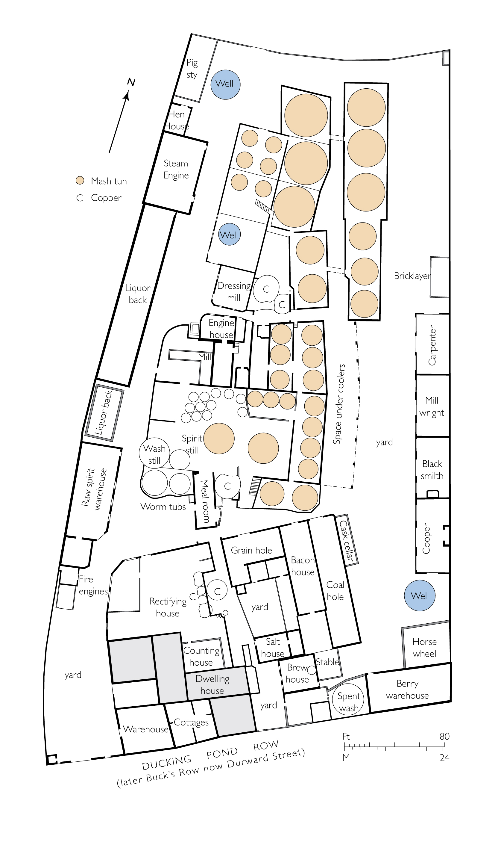
{
"id": 1213,
"title": "Whitechapel Distillery in 1817, drawn from a survey at London Metropolitan Archives (SC/PM/ST/01/002)",
"author": {
"id": 82,
"username": "HelenJones"
},
"feature": {
"id": 615,
"type": "Feature",
"geometry": {
"type": "MultiPolygon",
"coordinates": [
[
[
[
-0.061912426696935,
51.520202313072325
],
[
-0.061874785965162,
51.52020632400268
],
[
-0.061889838776397,
51.520270600539185
],
[
-0.061772606596072,
51.52027912769503
],
[
-0.061761274604345,
51.52022643741218
],
[
-0.061628238435086,
51.52023839485955
],
[
-0.061602171287638,
51.52013104478763
],
[
-0.061573162136184,
51.520127096195324
],
[
-0.061544517048737,
51.52011514494444
],
[
-0.061534860531212,
51.52010343868477
],
[
-0.061529168139568,
51.52006888501374
],
[
-0.061526425989946,
51.520048706748355
],
[
-0.061514408930299,
51.52003660718366
],
[
-0.061495102107996,
51.52002913056525
],
[
-0.061475241885438,
51.52002590044315
],
[
-0.061460589950224,
51.52002438689717
],
[
-0.061438363000579,
51.52002476509692
],
[
-0.061426370471038,
51.52003077384237
],
[
-0.0614153485846,
51.52003879812201
],
[
-0.061405729871782,
51.520049304430415
],
[
-0.061402315101561,
51.52005856401746
],
[
-0.061402724606023,
51.52007404708882
],
[
-0.061405755392364,
51.52008528050189
],
[
-0.061122177806162,
51.52022899048914
],
[
-0.061091504623702,
51.520085764968634
],
[
-0.060963368011847,
51.51993513884966
],
[
-0.060938560956953,
51.51990598454681
],
[
-0.061198284937537,
51.519823605100925
],
[
-0.061528142251785,
51.51970437567786
],
[
-0.061544781135941,
51.51969783671064
],
[
-0.061556075859584,
51.51969339795934
],
[
-0.061560863910158,
51.519688671562044
],
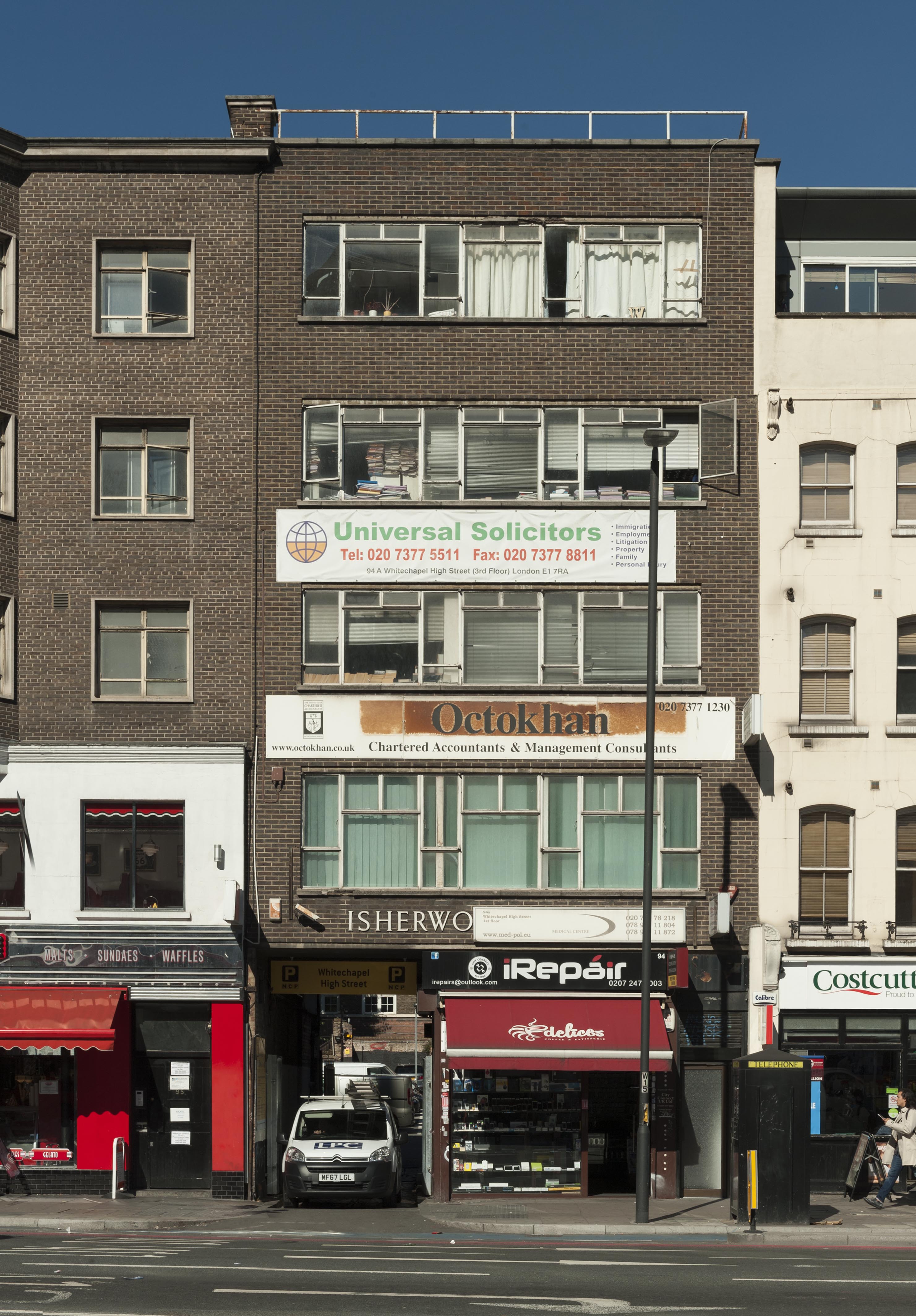
[
-0.061562478644049,
51.51968225561496
],
[
-0.061562600959662,
51.51965870894303
],
[
-0.061734852890324,
51.51964663949438
],
[
-0.061767969632807,
51.519786788205614
],
[
-0.061805132613926,
51.51978453796883
],
[
-0.061827146831599,
51.519876199669575
],
[
-0.061912426696935,
51.520202313072325
]
]
]
]
},
"properties": {
"b_number": "",
"b_name": "",
"street": "Durward Street",
"address": "Whitechapel Sports Centre, Durward Street",
"feature_type": "WHITECHAPEL_BUILDING",
"count": 7,
"search_str": "Whitechapel Sports Centre, Durward Street"
},
"tags": []
},
"file": "https://surveyoflondon.org/media/uploads/features/615/Whitechapel%20distillery%201.jpg",
"description": "",
"copyright": true,
"created": "2018-03-09"
},
{
"id": 1356,
"title": "94 Whitechapel High Street in 2018",
"author": {
"id": 27,
"username": "DerekKendall"
},
"feature": {
"id": 384,
"type": "Feature",
"geometry": {
"type": "MultiPolygon",
"coordinates": [
[
[
[
-0.071127166728351,
51.515725506171414
],
[
-0.071127164071961,
51.51572549942702
],
[
-0.071045385181981,
51.51564522716393
],
[
-0.071143174809878,
51.515605203446455
],
[
-0.071221521925884,
51.51567779628602
],
[
-0.07117480682288,
51.51569691609548
],
[
-0.071205644751936,
51.51572624690164
],
[
-0.071151330117538,
51.51574847699307
],
[
-0.071127175305027,
51.51572550266116
],
[
-0.071127166728351,
51.515725506171414
]
]
]
]
},
"properties": {
"b_number": "94",
"b_name": "94 Whitechapel High Street",
"street": "Whitechapel High Street",
"address": "94 Whitechapel High Street, London E1 7RA",
"feature_type": "WHITECHAPEL_BUILDING",
"count": 3,
"search_str": "94 Whitechapel High Street"
},
"tags": []
},
"file": "https://surveyoflondon.org/media/uploads/features/384/SoL%20Whitechapel%20102212.jpg",
"description": "",
"copyright": true,
"created": "2018-10-10"
},
{
"id": 1591,
"title": "6 Whitechurch Lane in 2019",
"author": {
"id": 27,
"username": "DerekKendall"
},
"feature": {
"id": 158,
"type": "Feature",
"geometry": {
"type": "MultiPolygon",
"coordinates": [
[
[
[
-0.069108417023273,
51.51579791671978
],
[
-0.068980281527584,
51.51585555954552
],
[
-0.068943307527969,
51.51587302395605
],
[
-0.068947555405622,
51.51587761386649
],
[
-0.068928377129436,
51.51588660182272
],
[
-0.06892285737537,
51.51588077925893
],
[
-0.068843696180412,
51.51591389365507
],
[
-0.068782370351196,
51.51585435755515
],
[
-0.069058804654726,
51.51574351219571
],
[
-0.069108417023273,
51.51579791671978
]
]
]
]
},
"properties": {
"b_number": "4A and 6",
"b_name": "",
"street": "White Church Lane",
"address": "4A and 6 White Church Lane",
"feature_type": "WHITECHAPEL_BUILDING",
"count": 5,
"search_str": "4A and 6 White Church Lane"
},
"tags": [
"street art"
]
},
"file": "https://surveyoflondon.org/media/uploads/features/158/SoL%20Whitechapel%20102696.jpg",
"description": "",
"copyright": true,
"created": "2019-04-30"
}
]
}