HTTP 200 OK
Allow: GET, HEAD, OPTIONS
Content-Type: application/json
Vary: Accept
{
"count": 1747,
"next": "https://surveyoflondon.org/api/v1/images/?format=api&page=56",
"previous": "https://surveyoflondon.org/api/v1/images/?format=api&page=54",
"results": [
{
"id": 1352,
"title": "101 Whitechapel High Street in 2018",
"author": {
"id": 27,
"username": "DerekKendall"
},
"feature": {
"id": 383,
"type": "Feature",
"geometry": {
"type": "MultiPolygon",
"coordinates": [
[
[
[
-0.071609813826012,
51.515448044408664
],
[
-0.071785562876674,
51.51561898838919
],
[
-0.071814008411836,
51.51564670243522
],
[
-0.071773741644205,
51.515662401930555
],
[
-0.071802650381169,
51.51569269732485
],
[
-0.071686217392417,
51.51573360377317
],
[
-0.071631683823236,
51.51567673015191
],
[
-0.071539953805845,
51.51558106397151
],
[
-0.071464278591544,
51.515502141045
],
[
-0.071609813826012,
51.515448044408664
]
]
]
]
},
"properties": {
"b_number": "101",
"b_name": "101 Whitechapel High Street",
"street": "Whitechapel High Street",
"address": "101 Whitechapel High Street, London E1 7RA",
"feature_type": "WHITECHAPEL_BUILDING",
"count": 6,
"search_str": "101 Whitechapel High Street"
},
"tags": []
},
"file": "https://surveyoflondon.org/media/uploads/features/383/SoL%20Whitechapel%20102208.jpg",
"description": "",
"copyright": true,
"created": "2018-10-10"
},
{
"id": 1282,
"title": "Elevation looking north west, March 2018",
"author": {
"id": 27,
"username": "DerekKendall"
},
"feature": {
"id": 90,
"type": "Feature",
"geometry": {
"type": "MultiPolygon",
"coordinates": [
[
[
[
-0.070392617547194,
51.513051214743115
],
[
-0.070236734466932,
51.51309567357582
],
[
-0.070212927713261,
51.5130643426255
],
[
-0.070370487777156,
51.513019950696446
],
[
-0.070392617547194,
51.513051214743115
]
]
]
]
},
"properties": {
"b_number": "68",
"b_name": "",
"street": "Leman Street",
"address": "68 Leman Street",
"feature_type": "WHITECHAPEL_BUILDING",
"count": 3,
"search_str": "68 Leman Street"
},
"tags": []
},
"file": "https://surveyoflondon.org/media/uploads/features/90/SoL%20Whitechapel%20101972.jpg",
"description": "",
"copyright": true,
"created": "2018-08-07"
},
{
"id": 1200,
"title": "Bar Indo, 133 Whitechapel Road, detail of the bar in early 2018",
"author": {
"id": 27,
"username": "DerekKendall"
},
"feature": {
"id": 437,
"type": "Feature",
"geometry": {
"type": "MultiPolygon",
"coordinates": [
[
[
[
-0.065795294340421,
51.51786534440968
],
[
-0.065746488420915,
51.517884201539125
],
[
-0.065653063212912,
51.517780108099075
],
[
-0.065725498229974,
51.51775563906246
],
[
-0.065813903711342,
51.517858154302715
],
[
-0.065795294340421,
51.51786534440968
]
]
]
]
},
"properties": {
"b_number": "133",
"b_name": "",
"street": "Whitechapel Road",
"address": "Bar Indo (formerly the Blue Anchor Public House), 133 Whitechapel Road",
"feature_type": "WHITECHAPEL_BUILDING",
"count": 10,
"search_str": "Bar Indo (formerly the Blue Anchor Public House), 133 Whitechapel Road"
},
"tags": []
},
"file": "https://surveyoflondon.org/media/uploads/features/437/SoL%20Whitechapel%20101848.jpg",
"description": "",
"copyright": true,
"created": "2018-03-05"
},
{
"id": 1201,
"title": "Bar Indo, 133 Whitechapel Road, in early 2018",
"author": {
"id": 27,
"username": "DerekKendall"
},
"feature": {
"id": 437,
"type": "Feature",
"geometry": {
"type": "MultiPolygon",
"coordinates": [
[
[
[
-0.065795294340421,
51.51786534440968
],
[
-0.065746488420915,
51.517884201539125
],
[
-0.065653063212912,
51.517780108099075
],
[
-0.065725498229974,
51.51775563906246
],
[
-0.065813903711342,
51.517858154302715
],
[
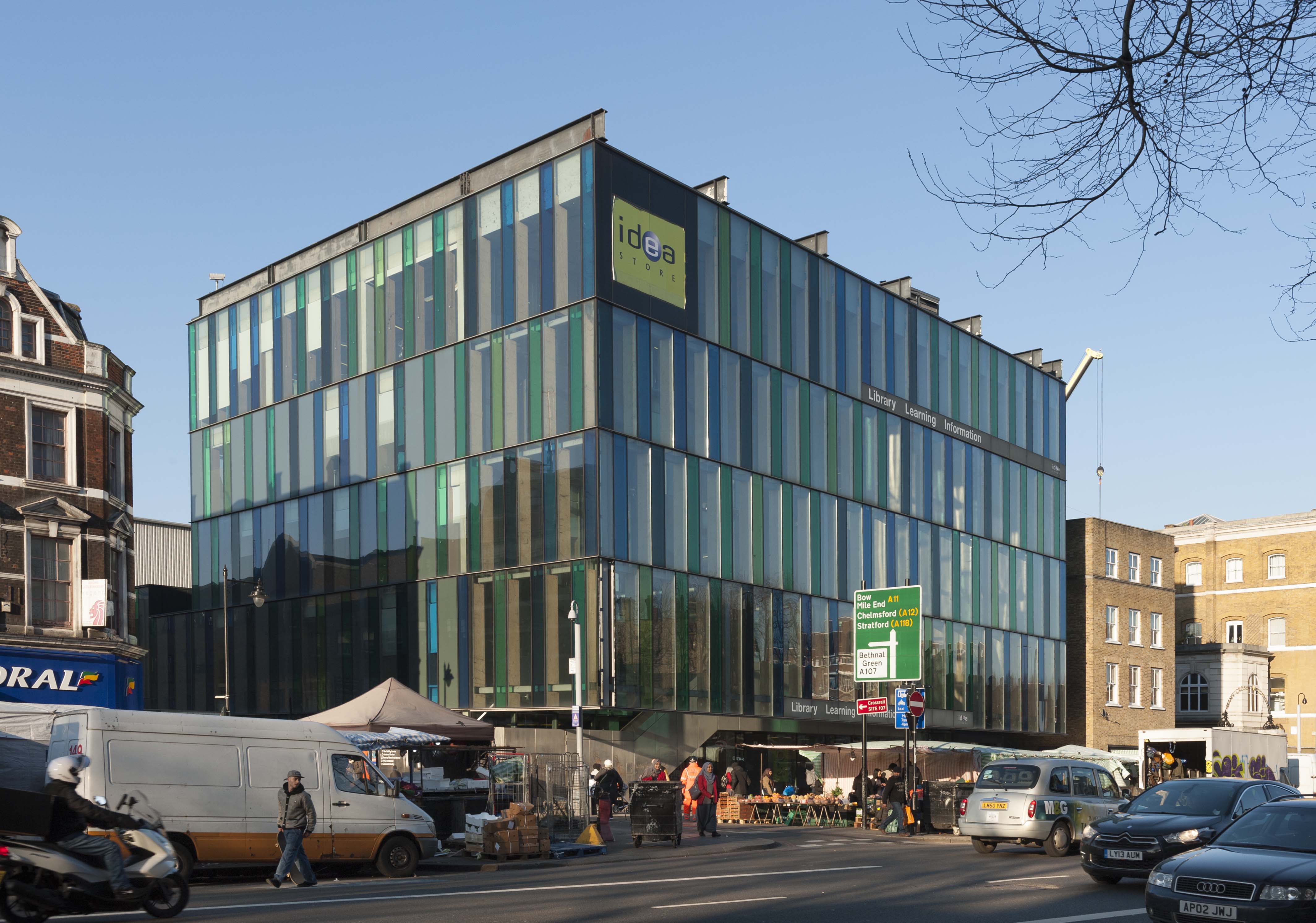
-0.065795294340421,
51.51786534440968
]
]
]
]
},
"properties": {
"b_number": "133",
"b_name": "",
"street": "Whitechapel Road",
"address": "Bar Indo (formerly the Blue Anchor Public House), 133 Whitechapel Road",
"feature_type": "WHITECHAPEL_BUILDING",
"count": 10,
"search_str": "Bar Indo (formerly the Blue Anchor Public House), 133 Whitechapel Road"
},
"tags": []
},
"file": "https://surveyoflondon.org/media/uploads/features/437/SoL%20Whitechapel%20101851.jpg",
"description": "",
"copyright": true,
"created": "2018-03-05"
},
{
"id": 561,
"title": "The ruin of St Paul's German church in 1960, shortly before demolition",
"author": {
"id": 2,
"username": "surveyoflondon"
},
"feature": {
"id": 353,
"type": "Feature",
"geometry": {
"type": "MultiPolygon",
"coordinates": [
[
[
[
-0.073950564821505,
51.515227043910336
],
[
-0.073777291005618,
51.51530155723316
],
[
-0.073739087584621,
51.515265251545756
],
[
-0.073726131772122,
51.515269772297955
],
[
-0.073742123748763,
51.51528796077325
],
[
-0.073643619369477,
51.51532443503333
],
[
-0.073465102911811,
51.515128756556074
],
[
-0.073581472314096,
51.515072529979086
],
[
-0.073629565574407,
51.515051068480155
],
[
-0.073501621234921,
51.514936838521024
],
[
-0.073588235846331,
51.51489498850516
],
[
-0.073950564821505,
51.515227043910336
]
]
]
]
},
"properties": {
"b_number": "4-10",
"b_name": "part of Calcutta House",
"street": "Goulston Street",
"address": "London Metropolitan University student services building, 4-10 Goulston Street,",
"feature_type": "WHITECHAPEL_BUILDING",
"count": 10,
"search_str": "part of Calcutta House"
},
"tags": []
},
"file": "https://surveyoflondon.org/media/uploads/features/353/St%20Pauls%20etc%201960%20THLHLA.jpg",
"description": "This view of part of Petticoat Lane market looking north up Goulston Street shows a glimpse at the right of the ruin of St Paul's church in 1960, shortly before it was demolished. At the left is the portion of Brunswick Buildings that survived the war, and beyond it Davis Mansions, all soon to be demolished. Beyond the church is the original part of Calcutta House, which survives. From a colour slide in the Tower Hamlets Local History Library and Archives.",
"copyright": false,
"created": "2017-05-03"
},
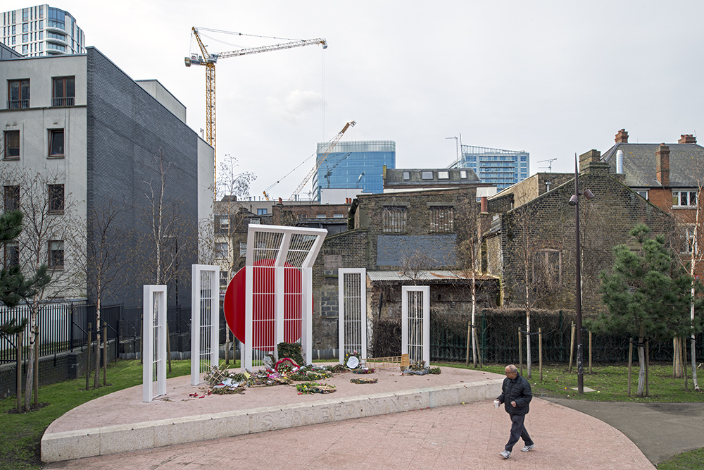
{
"id": 95,
"title": "Altab Ali Park",
"author": {
"id": 31,
"username": "LucyMW"
},
"feature": {
"id": 296,
"type": "Feature",
"geometry": {
"type": "MultiPolygon",
"coordinates": [
[
[
[
-0.069238538289603,
51.51610506120929
],
[
-0.069007097235987,
51.5162239535272
],
[
-0.068282200256798,
51.51654369745104
],
[
-0.068157401560378,
51.51641994527148
],
[
-0.067807959279103,
51.51600137496063
],
[
-0.068541180339468,
51.515783257348254
],
[
-0.068555919008956,
51.51580580160597
],
[
-0.068713893455475,
51.515872451567986
],
[
-0.068778503699218,
51.51586114158782
],
[
-0.068817146392177,
51.515922550138725
],
[
-0.068888047037903,
51.51596428315636
],
[
-0.069016085124709,
51.515921053627785
],
[
-0.069107698271647,
51.51601562404751
],
[
-0.069243279190738,
51.515974904669626
],
[
-0.069238538289603,
51.51610506120929
]
]
]
]
},
"properties": {
"b_number": "",
"b_name": "Altab Ali Park, including the site of the parish church of St Mary Matfelon",
"street": "Whitechapel Road",
"address": "Altab Ali Park",
"feature_type": "OPEN_SPACE",
"count": 32,
"search_str": "Altab Ali Park, including the site of the parish church of St Mary Matfelon"
},
"tags": []
},
"file": "https://surveyoflondon.org/media/uploads/features/296/DP179973.jpg",
"description": "",
"copyright": true,
"created": "2016-06-27"
},
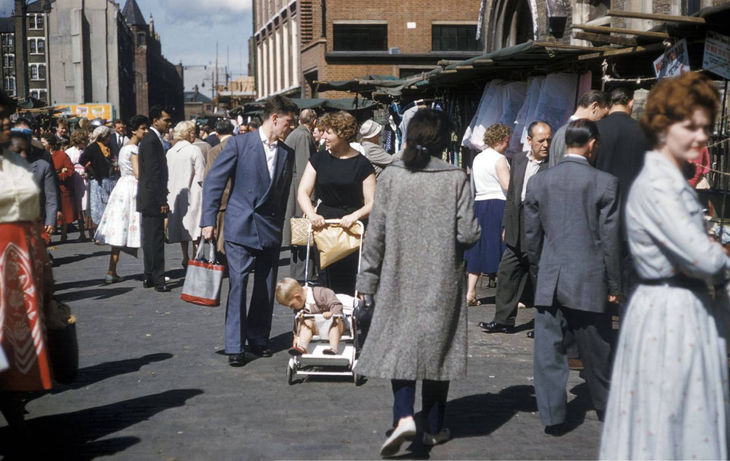
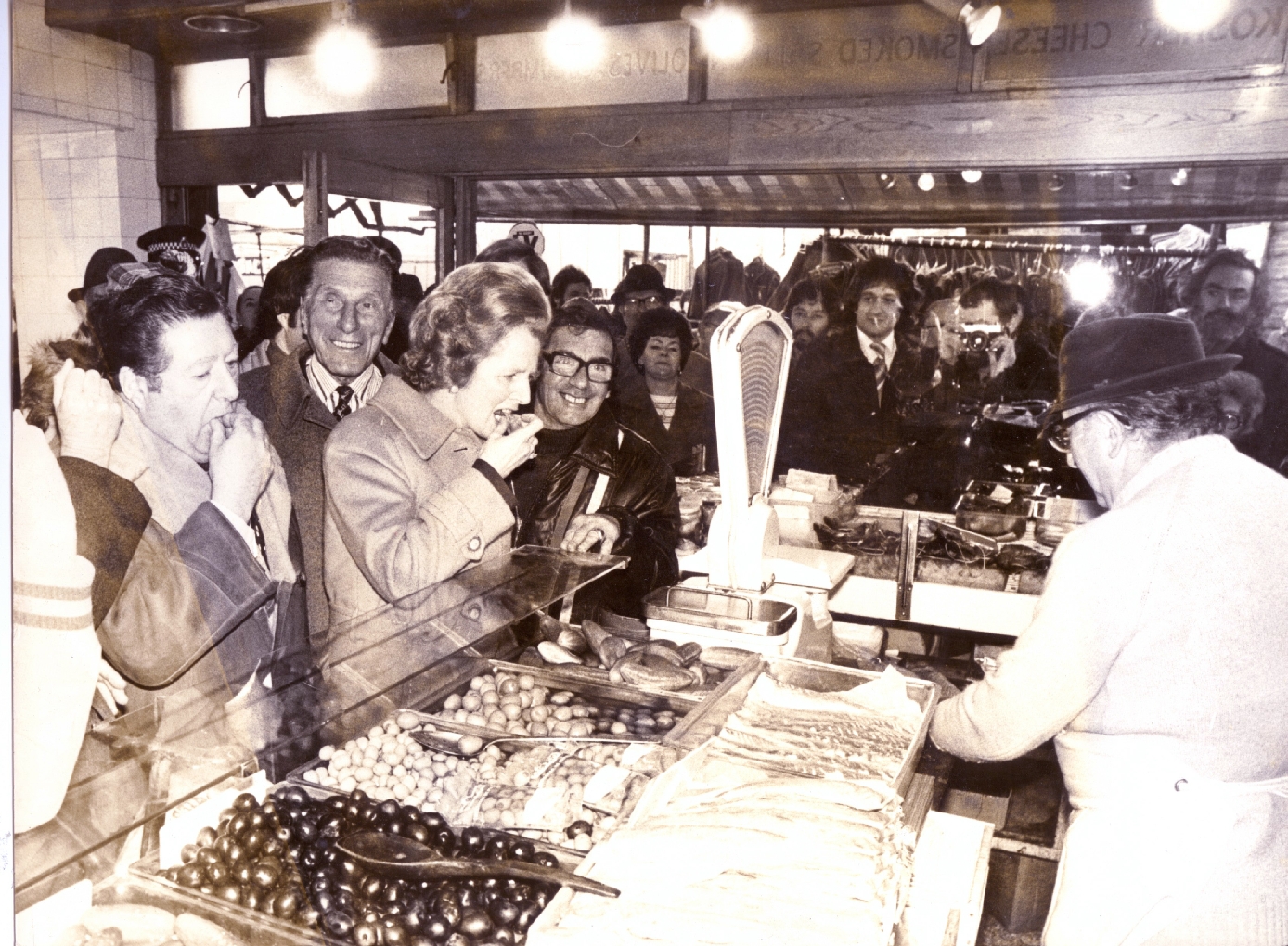
{
"id": 1377,
"title": "Marks of the Lane deli, c. 1974",
"author": {
"id": 252,
"username": "mark3"
},
"feature": {
"id": 1742,
"type": "Feature",
"geometry": {
"type": "MultiPolygon",
"coordinates": [
[
[
[
-0.076387722492951,
51.516257872286374
],
[
-0.07580974439088,
51.51649846859169
],
[
-0.075744693982384,
51.51651411423466
],
[
-0.075332716624042,
51.51665341173461
],
[
-0.075277819023276,
51.516667372076085
],
[
-0.074429584483841,
51.51681699796736
],
[
-0.074402209988697,
51.516763242480046
],
[
-0.075229889371391,
51.51661092868018
],
[
-0.074836715281391,
51.516135055700595
],
[
-0.074917049606191,
51.51611135328064
],
[
-0.075312012611936,
51.51658616747119
],
[
-0.075695505281233,
51.51646463519818
],
[
-0.075779072585588,
51.51644696856364
],
[
-0.076328753388395,
51.516209038390684
],
[
-0.076387722492951,
51.516257872286374
]
]
]
]
},
"properties": {
"b_number": "",
"b_name": "",
"street": "",
"address": "Petticoat Lane Market",
"feature_type": "PLACE",
"count": 39,
"search_str": "Petticoat Lane Market"
},
"tags": []
},
"file": "https://surveyoflondon.org/media/uploads/features/1742/Mossy%20Marks%20and%20friends.jpg",
"description": "Margaret Thatcher and Monty Modlin visiting my great uncle's deli during her pre-election tour of Petticoat Lane. ",
"copyright": false,
"created": "2018-10-28"
},
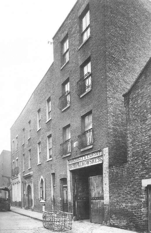
{
"id": 1379,
"title": "The Palkowski warehouse on Old Castle Steet",
"author": {
"id": 252,
"username": "mark3"
},
"feature": {
"id": 1742,
"type": "Feature",
"geometry": {
"type": "MultiPolygon",
"coordinates": [
[
[
[
-0.076387722492951,
51.516257872286374
],
[
-0.07580974439088,
51.51649846859169
],
[
-0.075744693982384,
51.51651411423466
],
[
-0.075332716624042,
51.51665341173461
],
[
-0.075277819023276,
51.516667372076085
],
[
-0.074429584483841,
51.51681699796736
],
[
-0.074402209988697,
51.516763242480046
],
[
-0.075229889371391,
51.51661092868018
],
[
-0.074836715281391,
51.516135055700595
],
[
-0.074917049606191,
51.51611135328064
],
[
-0.075312012611936,
51.51658616747119
],
[
-0.075695505281233,
51.51646463519818
],
[
-0.075779072585588,
51.51644696856364
],
[
-0.076328753388395,
51.516209038390684
],
[
-0.076387722492951,
51.516257872286374
]
]
]
]
},
"properties": {
"b_number": "",
"b_name": "",
"street": "",
"address": "Petticoat Lane Market",
"feature_type": "PLACE",
"count": 39,
"search_str": "Petticoat Lane Market"
},
"tags": []
},
"file": "https://surveyoflondon.org/media/uploads/features/1742/old_castle_street_synagogue_whitechapel.jpg",
"description": "This view looking towards Wentworth Street and the later site of family's Marks Delicatessen (57-59 Wentworth Street) is from around 1900",
"copyright": false,
"created": "2018-10-28"
},
{
"id": 96,
"title": "Altab Ali Park",
"author": {
"id": 31,
"username": "LucyMW"
},
"feature": {
"id": 296,
"type": "Feature",
"geometry": {
"type": "MultiPolygon",
"coordinates": [
[
[
[
-0.069238538289603,
51.51610506120929
],
[
-0.069007097235987,
51.5162239535272
],
[
-0.068282200256798,
51.51654369745104
],
[
-0.068157401560378,
51.51641994527148
],
[
-0.067807959279103,
51.51600137496063
],
[
-0.068541180339468,
51.515783257348254
],
[
-0.068555919008956,
51.51580580160597
],
[
-0.068713893455475,
51.515872451567986
],
[
-0.068778503699218,
51.51586114158782
],
[
-0.068817146392177,
51.515922550138725
],
[
-0.068888047037903,
51.51596428315636
],
[
-0.069016085124709,
51.515921053627785
],
[
-0.069107698271647,
51.51601562404751
],
[
-0.069243279190738,
51.515974904669626
],
[
-0.069238538289603,
51.51610506120929
]
]
]
]
},
"properties": {
"b_number": "",
"b_name": "Altab Ali Park, including the site of the parish church of St Mary Matfelon",
"street": "Whitechapel Road",
"address": "Altab Ali Park",
"feature_type": "OPEN_SPACE",
"count": 32,
"search_str": "Altab Ali Park, including the site of the parish church of St Mary Matfelon"
},
"tags": []
},
"file": "https://surveyoflondon.org/media/uploads/features/296/DP179974.jpg",
"description": "",
"copyright": true,
"created": "2016-06-27"
},
{
"id": 97,
"title": "Altab Ali Park",
"author": {
"id": 27,
"username": "DerekKendall"
},
"feature": {
"id": 296,
"type": "Feature",
"geometry": {
"type": "MultiPolygon",
"coordinates": [
[
[
[
-0.069238538289603,
51.51610506120929
],
[
-0.069007097235987,
51.5162239535272
],
[
-0.068282200256798,
51.51654369745104
],
[
-0.068157401560378,
51.51641994527148
],
[
-0.067807959279103,
51.51600137496063
],
[
-0.068541180339468,
51.515783257348254
],
[
-0.068555919008956,
51.51580580160597
],
[
-0.068713893455475,
51.515872451567986
],
[
-0.068778503699218,
51.51586114158782
],
[
-0.068817146392177,
51.515922550138725
],
[
-0.068888047037903,
51.51596428315636
],
[
-0.069016085124709,
51.515921053627785
],
[
-0.069107698271647,
51.51601562404751
],
[
-0.069243279190738,
51.515974904669626
],
[
-0.069238538289603,
51.51610506120929
]
]
]
]
},
"properties": {
"b_number": "",
"b_name": "Altab Ali Park, including the site of the parish church of St Mary Matfelon",
"street": "Whitechapel Road",
"address": "Altab Ali Park",
"feature_type": "OPEN_SPACE",
"count": 32,
"search_str": "Altab Ali Park, including the site of the parish church of St Mary Matfelon"
},
"tags": []
},
"file": "https://surveyoflondon.org/media/uploads/features/296/SoL%20Whitechapel100254.jpg",
"description": "",
"copyright": true,
"created": "2016-06-27"
},
{
"id": 1138,
"title": "Front of the London Hospital in Whitechapel Road, view from the north-west on an early twentieth-century postcard",
"author": {
"id": 2,
"username": "surveyoflondon"
},
"feature": {
"id": 1230,
"type": "Feature",
"geometry": {
"type": "MultiPolygon",
"coordinates": [
[
[
[
-0.06071898744648,
51.51847914149303
],
[
-0.060743358937849,
51.518529899918775
],
[
-0.060362148562617,
51.518618013153
],
[
-0.060404024127419,
51.51868851949335
],
[
-0.060356952993906,
51.51869974522794
],
[
-0.060399234817198,
51.51877056309998
],
[
-0.060042469531136,
51.5188530372297
],
[
-0.060006551123239,
51.51879256032364
],
[
-0.05997171006068,
51.51880061452483
],
[
-0.059923949522789,
51.51872019830377
],
[
-0.059602716389847,
51.51879445706454
],
[
-0.059631951693606,
51.51884368227145
],
[
-0.059135089420495,
51.51895853862307
],
[
-0.059031394281591,
51.51878393727422
],
[
-0.059075483581288,
51.51877374555587
],
[
-0.05923306113512,
51.518737319626666
],
[
-0.059261815633844,
51.518785736083466
],
[
-0.059453095208379,
51.51874286661955
],
[
-0.059437777096903,
51.51871791341666
],
[
-0.059509844762857,
51.518701022201654
],
[
-0.059472510825189,
51.51863713193043
],
[
-0.059893693119402,
51.51853565124978
],
[
-0.059897251108141,
51.51854177905041
],
[
-0.060406197614306,
51.5184267554985
],
[
-0.060388475186227,
51.51839623334771
],
[
-0.060226549751936,
51.51811735804654
],
[
-0.060490662909997,
51.51805857683586
],
[
-0.060500593175314,
51.518078725457706
],
[
-0.06071898744648,
51.51847914149303
]
]
]
]
},
"properties": {
"b_number": "",
"b_name": "Former Royal London Hospital",
"street": "",
"address": "Former Royal London Hospital ",
"feature_type": "WHITECHAPEL_BUILDING",
"count": 53,
"search_str": "Former Royal London Hospital"
},
"tags": []
},
"file": "https://surveyoflondon.org/media/uploads/features/1230/Front%20from%20NW%20with%20crowds009.jpg",
"description": "",
"copyright": false,
"created": "2018-02-14"
},
{
"id": 1139,
"title": "Front of the London Hospital in Whitechapel Road, view from the north-west in the early twentieth century",
"author": {
"id": 2,
"username": "surveyoflondon"
},
"feature": {
"id": 1230,
"type": "Feature",
"geometry": {
"type": "MultiPolygon",
"coordinates": [
[
[
[
-0.06071898744648,
51.51847914149303
],
[
-0.060743358937849,
51.518529899918775
],
[
-0.060362148562617,
51.518618013153
],
[
-0.060404024127419,
51.51868851949335
],
[
-0.060356952993906,
51.51869974522794
],
[
-0.060399234817198,
51.51877056309998
],
[
-0.060042469531136,
51.5188530372297
],
[
-0.060006551123239,
51.51879256032364
],
[
-0.05997171006068,
51.51880061452483
],
[
-0.059923949522789,
51.51872019830377
],
[
-0.059602716389847,
51.51879445706454
],
[
-0.059631951693606,
51.51884368227145
],
[
-0.059135089420495,
51.51895853862307
],
[
-0.059031394281591,
51.51878393727422
],
[
-0.059075483581288,
51.51877374555587
],
[
-0.05923306113512,
51.518737319626666
],
[
-0.059261815633844,
51.518785736083466
],
[
-0.059453095208379,
51.51874286661955
],
[
-0.059437777096903,
51.51871791341666
],
[
-0.059509844762857,
51.518701022201654
],
[
-0.059472510825189,
51.51863713193043
],
[
-0.059893693119402,
51.51853565124978
],
[
-0.059897251108141,
51.51854177905041
],
[
-0.060406197614306,
51.5184267554985
],
[
-0.060388475186227,
51.51839623334771
],
[
-0.060226549751936,
51.51811735804654
],
[
-0.060490662909997,
51.51805857683586
],
[
-0.060500593175314,
51.518078725457706
],
[
-0.06071898744648,
51.51847914149303
]
]
]
]
},
"properties": {
"b_number": "",
"b_name": "Former Royal London Hospital",
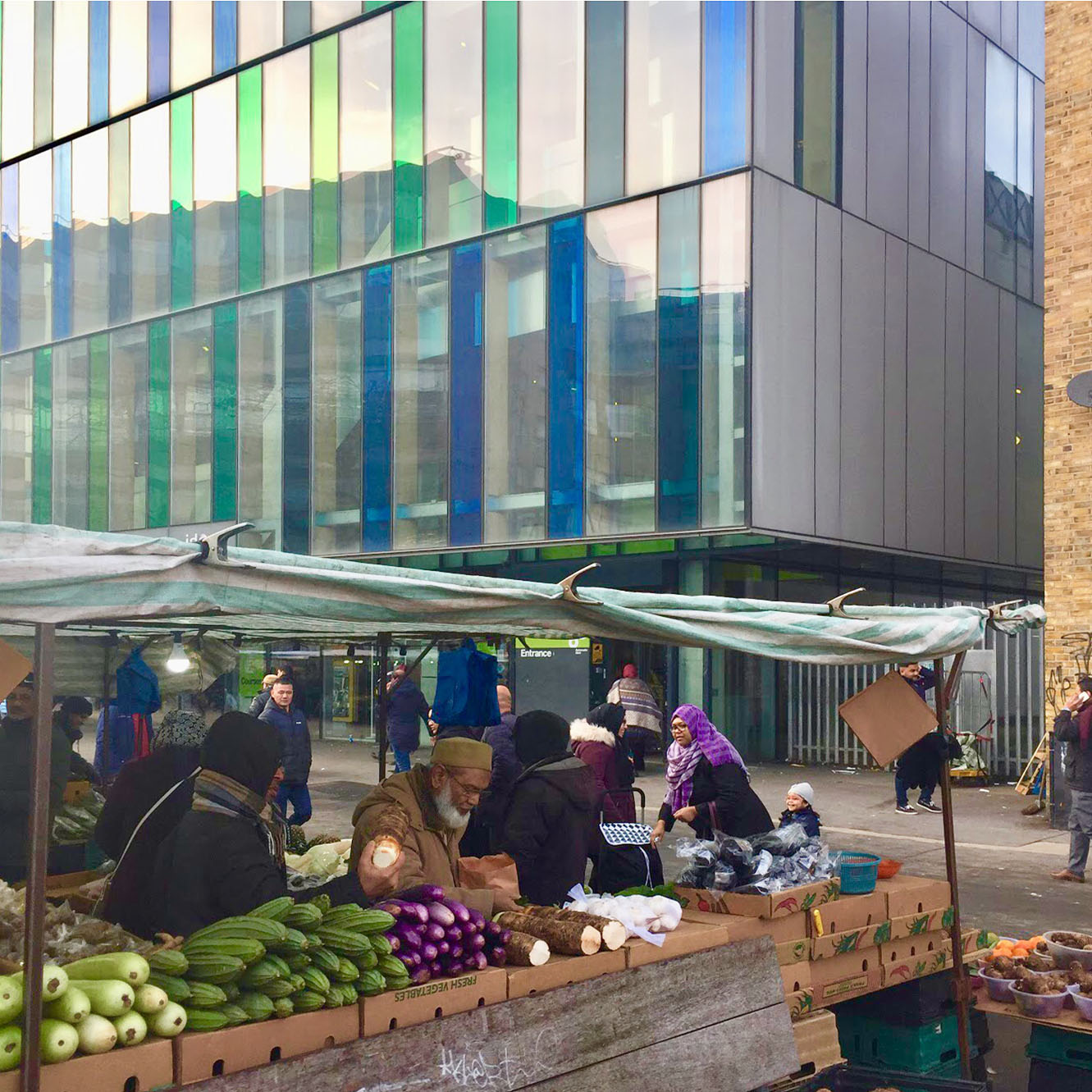
"street": "",
"address": "Former Royal London Hospital ",
"feature_type": "WHITECHAPEL_BUILDING",
"count": 53,
"search_str": "Former Royal London Hospital"
},
"tags": []
},
"file": "https://surveyoflondon.org/media/uploads/features/1230/Front%20from%20NW%20with%20market%20stall010.jpg",
"description": "",
"copyright": false,
"created": "2018-02-14"
},
{
"id": 1280,
"title": "Elevation, March 2018",
"author": {
"id": 27,
"username": "DerekKendall"
},
"feature": {
"id": 90,
"type": "Feature",
"geometry": {
"type": "MultiPolygon",
"coordinates": [
[
[
[
-0.070392617547194,
51.513051214743115
],
[
-0.070236734466932,
51.51309567357582
],
[
-0.070212927713261,
51.5130643426255
],
[
-0.070370487777156,
51.513019950696446
],
[
-0.070392617547194,
51.513051214743115
]
]
]
]
},
"properties": {
"b_number": "68",
"b_name": "",
"street": "Leman Street",
"address": "68 Leman Street",
"feature_type": "WHITECHAPEL_BUILDING",
"count": 3,
"search_str": "68 Leman Street"
},
"tags": []
},
"file": "https://surveyoflondon.org/media/uploads/features/90/SoL%20Whitechapel%20101969.jpg",
"description": "",
"copyright": true,
"created": "2018-08-07"
},
{
"id": 1446,
"title": "Nos 4-12 on the south side of Camperdown Street from the east in the early 1970s (photograph by Dan Cruickshank)",
"author": {
"id": 268,
"username": "DanCruickshank"
},
"feature": {
"id": 36,
"type": "Feature",
"geometry": {
"type": "MultiPolygon",
"coordinates": [
[
[
[
-0.071349046337364,
51.5138078614866
],
[
-0.071271119926767,
51.51383480345585
],
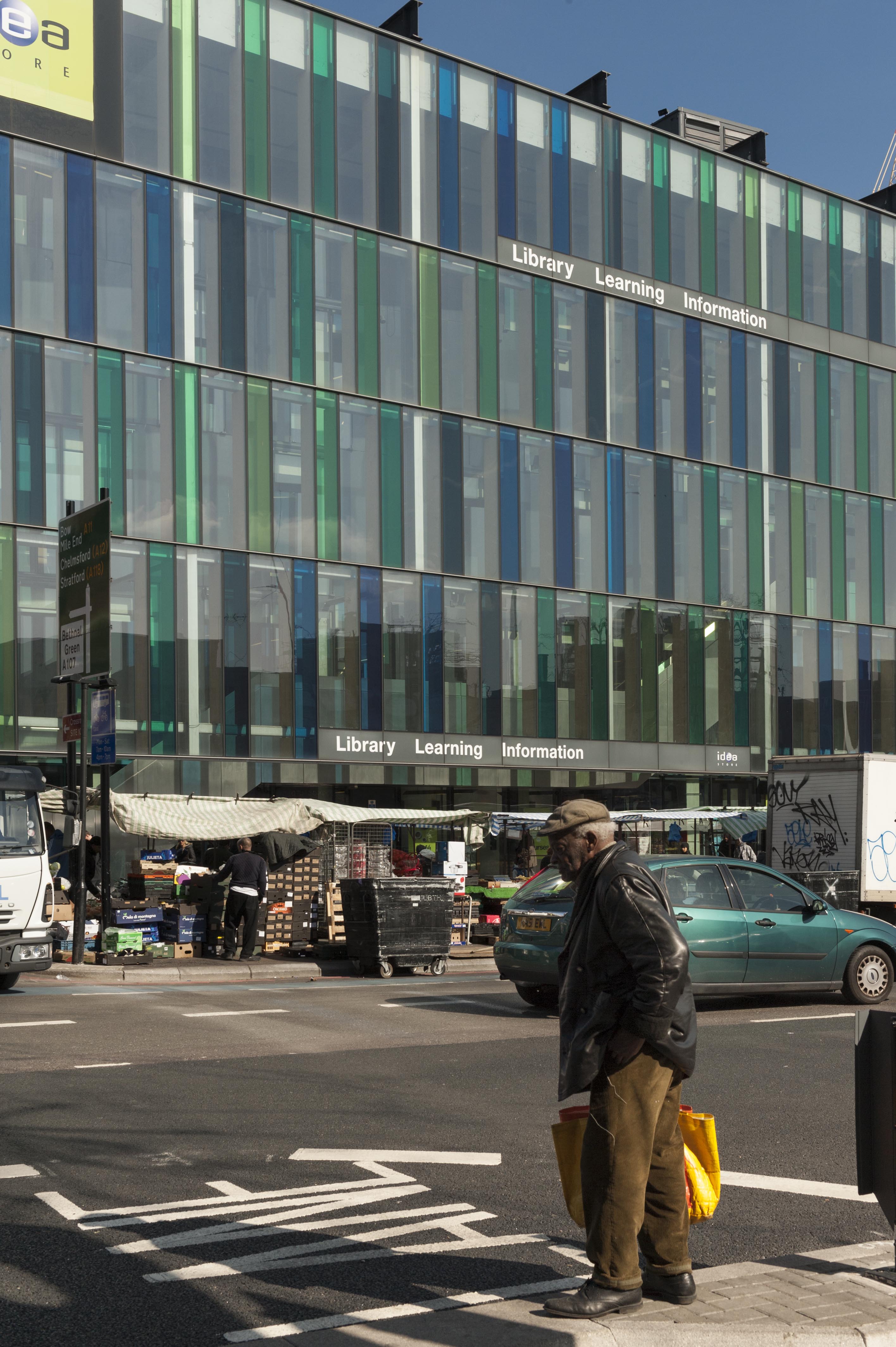
[
-0.071192934027189,
51.51374219365012
],
[
-0.071638175035756,
51.51359010289689
],
[
-0.071723422786149,
51.51368468893144
],
[
-0.071595104590834,
51.51372885698717
],
[
-0.071660988827371,
51.513800289480336
],
[
-0.071852439251352,
51.5137363635275
],
[
-0.071893659649719,
51.51377871138786
],
[
-0.071944898260579,
51.51376139378089
],
[
-0.071986149033662,
51.51381345244115
],
[
-0.071933998401112,
51.51382983458348
],
[
-0.071956084837385,
51.51385790340382
],
[
-0.071453670719252,
51.514037239610516
],
[
-0.071346445213241,
51.5139065028523
],
[
-0.07140854712421,
51.51388212034982
],
[
-0.071349046337364,
51.5138078614866
]
]
]
]
},
"properties": {
"b_number": "25",
"b_name": "Central House",
"street": "Camperdown Street",
"address": "25 Camperdown Street",
"feature_type": "WHITECHAPEL_BUILDING",
"count": 6,
"search_str": "Central House"
},
"tags": []
},
"file": "https://surveyoflondon.org/media/uploads/features/36/00170004.jpg",
"description": "",
"copyright": true,
"created": "2018-11-16"
},
{
"id": 607,
"title": "Gateway at north-west corner of Altab Ali Park from inside the park, April 2017",
"author": {
"id": 27,
"username": "DerekKendall"
},
"feature": {
"id": 296,
"type": "Feature",
"geometry": {
"type": "MultiPolygon",
"coordinates": [
[
[
[
-0.069238538289603,
51.51610506120929
],
[
-0.069007097235987,
51.5162239535272
],
[
-0.068282200256798,
51.51654369745104
],
[
-0.068157401560378,
51.51641994527148
],
[
-0.067807959279103,
51.51600137496063
],
[
-0.068541180339468,
51.515783257348254
],
[
-0.068555919008956,
51.51580580160597
],
[
-0.068713893455475,
51.515872451567986
],
[
-0.068778503699218,
51.51586114158782
],
[
-0.068817146392177,
51.515922550138725
],
[
-0.068888047037903,
51.51596428315636
],
[
-0.069016085124709,
51.515921053627785
],
[
-0.069107698271647,
51.51601562404751
],
[
-0.069243279190738,
51.515974904669626
],
[
-0.069238538289603,
51.51610506120929
]
]
]
]
},
"properties": {
"b_number": "",
"b_name": "Altab Ali Park, including the site of the parish church of St Mary Matfelon",
"street": "Whitechapel Road",
"address": "Altab Ali Park",
"feature_type": "OPEN_SPACE",
"count": 32,
"search_str": "Altab Ali Park, including the site of the parish church of St Mary Matfelon"
},
"tags": []
},
"file": "https://surveyoflondon.org/media/uploads/features/296/SoL%20Whitechapel%20100695.jpg",
"description": "",
"copyright": true,
"created": "2017-05-03"
},
{
"id": 1447,
"title": "Nos 4-12 on the south side of Camperdown Street from the west in the early 1970s (photograph by Dan Cruickshank)",
"author": {
"id": 268,
"username": "DanCruickshank"
},
"feature": {
"id": 36,
"type": "Feature",
"geometry": {
"type": "MultiPolygon",
"coordinates": [
[
[
[
-0.071349046337364,
51.5138078614866
],
[
-0.071271119926767,
51.51383480345585
],
[
-0.071192934027189,
51.51374219365012
],
[
-0.071638175035756,
51.51359010289689
],
[
-0.071723422786149,
51.51368468893144
],
[
-0.071595104590834,
51.51372885698717
],
[
-0.071660988827371,
51.513800289480336
],
[
-0.071852439251352,
51.5137363635275
],
[
-0.071893659649719,
51.51377871138786
],
[
-0.071944898260579,
51.51376139378089
],
[
-0.071986149033662,
51.51381345244115
],
[
-0.071933998401112,
51.51382983458348
],
[
-0.071956084837385,
51.51385790340382
],
[
-0.071453670719252,
51.514037239610516
],
[
-0.071346445213241,
51.5139065028523
],
[
-0.07140854712421,
51.51388212034982
],
[
-0.071349046337364,
51.5138078614866
]
]
]
]
},
"properties": {
"b_number": "25",
"b_name": "Central House",
"street": "Camperdown Street",
"address": "25 Camperdown Street",
"feature_type": "WHITECHAPEL_BUILDING",
"count": 6,
"search_str": "Central House"
},
"tags": []
},
"file": "https://surveyoflondon.org/media/uploads/features/36/00170007.jpg",
"description": "",
"copyright": true,
"created": "2018-11-16"
},
{
"id": 1167,
"title": "Royal Mint Street looking west 1980",
"author": {
"id": 153,
"username": "danny"
},
"feature": {
"id": 1341,
"type": "Feature",
"geometry": {
"type": "MultiPolygon",
"coordinates": [
[
[
[
-0.069674995219055,
51.510563447847346
],
[
-0.069470567670017,
51.51060542474273
],
[
-0.069427122021502,
51.51052602242747
],
[
-0.069442800926851,
51.51052243635141
],
[
-0.069431192855565,
51.51050552752134
],
[
-0.069544490086559,
51.510480187394315
],
[
-0.069622428211284,
51.5105273163852
],
[
-0.069656877702612,
51.51052349248554
],
[
-0.069674995219055,
51.510563447847346
]
]
]
]
},
"properties": {
"b_number": "55",
"b_name": "Tower Mint Apartments",
"street": "Royal Mint Street",
"address": "Tower Mint Apartments, 55 Royal Mint Street (with 84 John Fisher Street)",
"feature_type": "WHITECHAPEL_BUILDING",
"count": 6,
"search_str": "Tower Mint Apartments"
},
"tags": []
},
"file": "https://surveyoflondon.org/media/uploads/features/1341/Royal%20Mint%20Street%20west%20view.jpg",
"description": "A view looking west along Royal Mint Street near to its junction with John Fisher Street. The former school buildings of St Mark School are still visible on the north side of Royal Mint Street. These were demolished in advance of the construction of the new Docklands Light Railway (DLR) in the mid 1980s. The DLR begins its tunnel towards Bank Station around this point.",
"copyright": false,
"created": "2018-03-04"
},
{
"id": 234,
"title": "Whitechapel Idea Store in 2016",
"author": {
"id": 27,
"username": "DerekKendall"
},
"feature": {
"id": 518,
"type": "Feature",
"geometry": {
"type": "MultiPolygon",
"coordinates": [
[
[
[
-0.058265578249493,
51.51997368190386
],
[
-0.057870681883353,
51.520069776330836
],
[
-0.057795852846717,
51.519925640296286
],
[
-0.057754684632276,
51.51993713160212
],
[
-0.057648441439835,
51.519761149535064
],
[
-0.05807295251591,
51.51962908276924
],
[
-0.058265578249493,
51.51997368190386
]
]
]
]
},
"properties": {
"b_number": "321",
"b_name": "Whitechapel Idea Store",
"street": "Whitechapel Road",
"address": "Whitechapel Idea Store, 321 Whitechapel Road",
"feature_type": "WHITECHAPEL_BUILDING",
"count": 15,
"search_str": "Whitechapel Idea Store"
},
"tags": [
"David Adjaye",
"James Edmeston",
"John Samuel Hayward"
]
},
"file": "https://surveyoflondon.org/media/uploads/features/518/SoL%20Whitechapel100030.jpg",
"description": "",
"copyright": true,
"created": "2016-08-01"
},
{
"id": 1104,
"title": "Market and library",
"author": {
"id": 209,
"username": "f.ciufo"
},
"feature": {
"id": 518,
"type": "Feature",
"geometry": {
"type": "MultiPolygon",
"coordinates": [
[
[
[
-0.058265578249493,
51.51997368190386
],
[
-0.057870681883353,
51.520069776330836
],
[
-0.057795852846717,
51.519925640296286
],
[
-0.057754684632276,
51.51993713160212
],
[
-0.057648441439835,
51.519761149535064
],
[
-0.05807295251591,
51.51962908276924
],
[
-0.058265578249493,
51.51997368190386
]
]
]
]
},
"properties": {
"b_number": "321",
"b_name": "Whitechapel Idea Store",
"street": "Whitechapel Road",
"address": "Whitechapel Idea Store, 321 Whitechapel Road",
"feature_type": "WHITECHAPEL_BUILDING",
"count": 15,
"search_str": "Whitechapel Idea Store"
},
"tags": [
"David Adjaye",
"James Edmeston",
"John Samuel Hayward"
]
},
"file": "https://surveyoflondon.org/media/uploads/features/518/IMG_8527.jpg",
"description": "",
"copyright": true,
"created": "2018-01-27"
},
{
"id": 1195,
"title": "Whitechapel Idea Store from the south-west in early 2018",
"author": {
"id": 27,
"username": "DerekKendall"
},
"feature": {
"id": 518,
"type": "Feature",
"geometry": {
"type": "MultiPolygon",
"coordinates": [
[
[
[
-0.058265578249493,
51.51997368190386
],
[
-0.057870681883353,
51.520069776330836
],
[
-0.057795852846717,
51.519925640296286
],
[
-0.057754684632276,
51.51993713160212
],
[
-0.057648441439835,
51.519761149535064
],
[
-0.05807295251591,
51.51962908276924
],
[
-0.058265578249493,
51.51997368190386
]
]
]
]
},
"properties": {
"b_number": "321",
"b_name": "Whitechapel Idea Store",
"street": "Whitechapel Road",
"address": "Whitechapel Idea Store, 321 Whitechapel Road",
"feature_type": "WHITECHAPEL_BUILDING",
"count": 15,
"search_str": "Whitechapel Idea Store"
},
"tags": [
"David Adjaye",
"James Edmeston",
"John Samuel Hayward"
]
},
"file": "https://surveyoflondon.org/media/uploads/features/518/SoL%20Whitechapel%20101836.jpg",
"description": "",
"copyright": true,
"created": "2018-03-05"
}
]
}