HTTP 200 OK
Allow: GET, HEAD, OPTIONS
Content-Type: application/json
Vary: Accept
{
"count": 1747,
"next": "https://surveyoflondon.org/api/v1/images/?format=api&page=52",
"previous": "https://surveyoflondon.org/api/v1/images/?format=api&page=50",
"results": [
{
"id": 1011,
"title": "The ambiguous object",
"author": {
"id": 211,
"username": "paula"
},
"feature": {
"id": 1063,
"type": "Feature",
"geometry": {
"type": "MultiPolygon",
"coordinates": [
[
[
[
-0.060845062076888,
51.517232461665024
],
[
-0.060858061981046,
51.517297370705585
],
[
-0.060852072355982,
51.51729777282787
],
[
-0.060850777279358,
51.517292038613824
],
[
-0.060836585058279,
51.51723251416014
],
[
-0.060769976187858,
51.51723703364601
],
[
-0.060780310614954,
51.51729938465229
],
[
-0.060851422100426,
51.517294893689865
],
[
-0.060852072355982,
51.51729777282787
],
[
-0.060780756007888,
51.51730231203111
],
[
-0.060433008250066,
51.51733065140396
],
[
-0.060436612097579,
51.51734759826428
],
[
-0.060301835648786,
51.517358754570346
],
[
-0.060301267692063,
51.517334324990614
],
[
-0.060276367898553,
51.517334550322296
],
[
-0.060277606963858,
51.51738784759974
],
[
-0.060240911793285,
51.51738817966408
],
[
-0.060239603561777,
51.51733190531689
],
[
-0.060233709433579,
51.517328890670484
],
[
-0.060224675865392,
51.517324270305814
],
[
-0.06015408706542,
51.51728816646581
],
[
-0.060146994469308,
51.51728968696465
],
[
-0.06013876083629,
51.51729145207641
],
[
-0.060122232338685,
51.51729197252953
],
[
-0.060108489079552,
51.51729240527865
],
[
-0.060095089193358,
51.517291262708895
],
[
-0.060083703724374,
51.51729029190144
],
[
-0.060071883086905,
51.51728644484157
],
[
-0.060064540680754,
51.517282150214506
],
[
-0.060058159323826,
51.51727491549124
],
[
-0.060055164331108,
51.517266693493994
],
[
-0.060055745593556,
51.51725957394812
],
[
-0.060059185744876,
51.51725076287493
],
[
-0.060064720251821,
51.51724301807266
],
[
-0.060073694330703,
51.517237266202336
],
[
-0.060084008477322,
51.51723065542268
],
[
-0.060097749600684,
51.51722563043536
],
[
-0.060110820839004,
51.517222752616206
],
[
-0.060124043459833,
51.517219841466186
],
[
-0.060189323543314,
51.51717326471942
],
[
-0.060230524081512,
51.51717027080275
],
[
-0.060225029840865,
51.51714083975863
],
[
-0.060123966783513,
51.51714818367497
],
[
-0.060109355845798,
51.51706991604146
],
[
-0.060759990305139,
51.51701795039293
],
[
-0.060811901066283,
51.51703520053784
],
[
-0.060831243559519,
51.51714443032851
],
[
-0.060823879564995,
51.51714494230656
],
[
-0.060806280310304,
51.517037602197114
],
[
-0.060758637924026,
51.51702144683871
],
[
-0.060293715895444,
51.517058443881275
],
[
-0.060305285997092,
51.51711767437194
],
[
-0.060380056450023,
51.51711283445328
],
[
-0.060382025685871,
51.5171233828903
],
[
-0.060648003222123,
51.51710939602032
],
[
-0.060636939828746,
51.517031131377244
],
[
-0.060684659737861,
51.51702734366158
],
[
-0.060703670471419,
51.51713214159525
],
[
-0.060746477467265,
51.51712961322092
],
[
-0.060749678508541,
51.517150266791134
],
[
-0.060831225907887,
51.517144845854745
],
[
-0.060845060388772,
51.51723245093664
],
[
-0.060845062076888,
51.517232461665024
]
]
]
]
},
"properties": {
"b_number": "",
"b_name": "",
"street": "Stepney Way",
"address": "St Philip's Church Library and the Royal London Museum",
"feature_type": "WHITECHAPEL_BUILDING",
"count": 52,
"search_str": "St Philip's Church Library and the Royal London Museum"
},
"tags": []
},
"file": "https://surveyoflondon.org/media/uploads/features/1063/4297419679_1fc5dd87f8_o.jpg",
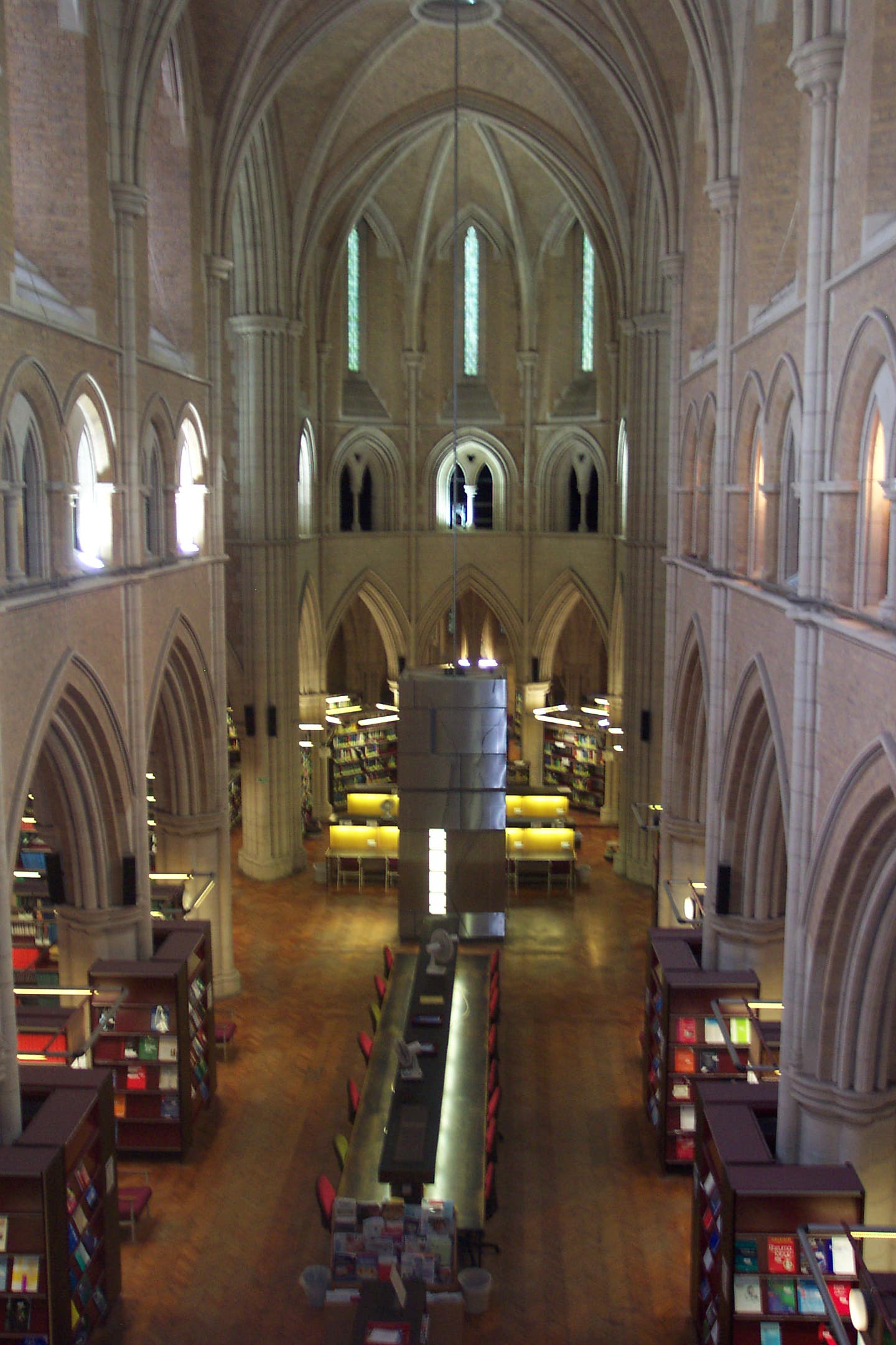
"description": "This is the Ambiguous Object (housing the lift), by Surface Architects, on completion in 2004",
"copyright": false,
"created": "2018-01-10"
},
{
"id": 1012,
"title": "Ambiguous object",
"author": {
"id": 211,
"username": "paula"
},
"feature": {
"id": 1063,
"type": "Feature",
"geometry": {
"type": "MultiPolygon",
"coordinates": [
[
[
[
-0.060845062076888,
51.517232461665024
],
[
-0.060858061981046,
51.517297370705585
],
[
-0.060852072355982,
51.51729777282787
],
[
-0.060850777279358,
51.517292038613824
],
[
-0.060836585058279,
51.51723251416014
],
[
-0.060769976187858,
51.51723703364601
],
[
-0.060780310614954,
51.51729938465229
],
[
-0.060851422100426,
51.517294893689865
],
[
-0.060852072355982,
51.51729777282787
],
[
-0.060780756007888,
51.51730231203111
],
[
-0.060433008250066,
51.51733065140396
],
[
-0.060436612097579,
51.51734759826428
],
[
-0.060301835648786,
51.517358754570346
],
[
-0.060301267692063,
51.517334324990614
],
[
-0.060276367898553,
51.517334550322296
],
[
-0.060277606963858,
51.51738784759974
],
[
-0.060240911793285,
51.51738817966408
],
[
-0.060239603561777,
51.51733190531689
],
[
-0.060233709433579,
51.517328890670484
],
[
-0.060224675865392,
51.517324270305814
],
[
-0.06015408706542,
51.51728816646581
],
[
-0.060146994469308,
51.51728968696465
],
[
-0.06013876083629,
51.51729145207641
],
[
-0.060122232338685,
51.51729197252953
],
[
-0.060108489079552,
51.51729240527865
],
[
-0.060095089193358,
51.517291262708895
],
[
-0.060083703724374,
51.51729029190144
],
[
-0.060071883086905,
51.51728644484157
],
[
-0.060064540680754,
51.517282150214506
],
[
-0.060058159323826,
51.51727491549124
],
[
-0.060055164331108,
51.517266693493994
],
[
-0.060055745593556,
51.51725957394812
],
[
-0.060059185744876,
51.51725076287493
],
[
-0.060064720251821,
51.51724301807266
],
[
-0.060073694330703,
51.517237266202336
],
[
-0.060084008477322,
51.51723065542268
],
[
-0.060097749600684,
51.51722563043536
],
[
-0.060110820839004,
51.517222752616206
],
[
-0.060124043459833,
51.517219841466186
],
[
-0.060189323543314,
51.51717326471942
],
[
-0.060230524081512,
51.51717027080275
],
[
-0.060225029840865,
51.51714083975863
],
[
-0.060123966783513,
51.51714818367497
],
[
-0.060109355845798,
51.51706991604146
],
[
-0.060759990305139,
51.51701795039293
],
[
-0.060811901066283,
51.51703520053784
],
[
-0.060831243559519,
51.51714443032851
],
[
-0.060823879564995,
51.51714494230656
],
[
-0.060806280310304,
51.517037602197114
],
[
-0.060758637924026,
51.51702144683871
],
[
-0.060293715895444,
51.517058443881275
],
[
-0.060305285997092,
51.51711767437194
],
[
-0.060380056450023,
51.51711283445328
],
[
-0.060382025685871,
51.5171233828903
],
[
-0.060648003222123,
51.51710939602032
],
[
-0.060636939828746,
51.517031131377244
],
[
-0.060684659737861,
51.51702734366158
],
[
-0.060703670471419,
51.51713214159525
],
[
-0.060746477467265,
51.51712961322092
],
[
-0.060749678508541,
51.517150266791134
],
[
-0.060831225907887,
51.517144845854745
],
[
-0.060845060388772,
51.51723245093664
],
[
-0.060845062076888,
51.517232461665024
]
]
]
]
},
"properties": {
"b_number": "",
"b_name": "",
"street": "Stepney Way",
"address": "St Philip's Church Library and the Royal London Museum",
"feature_type": "WHITECHAPEL_BUILDING",
"count": 52,
"search_str": "St Philip's Church Library and the Royal London Museum"
},
"tags": []
},
"file": "https://surveyoflondon.org/media/uploads/features/1063/4298164624_b1638dcfd6_o.jpg",
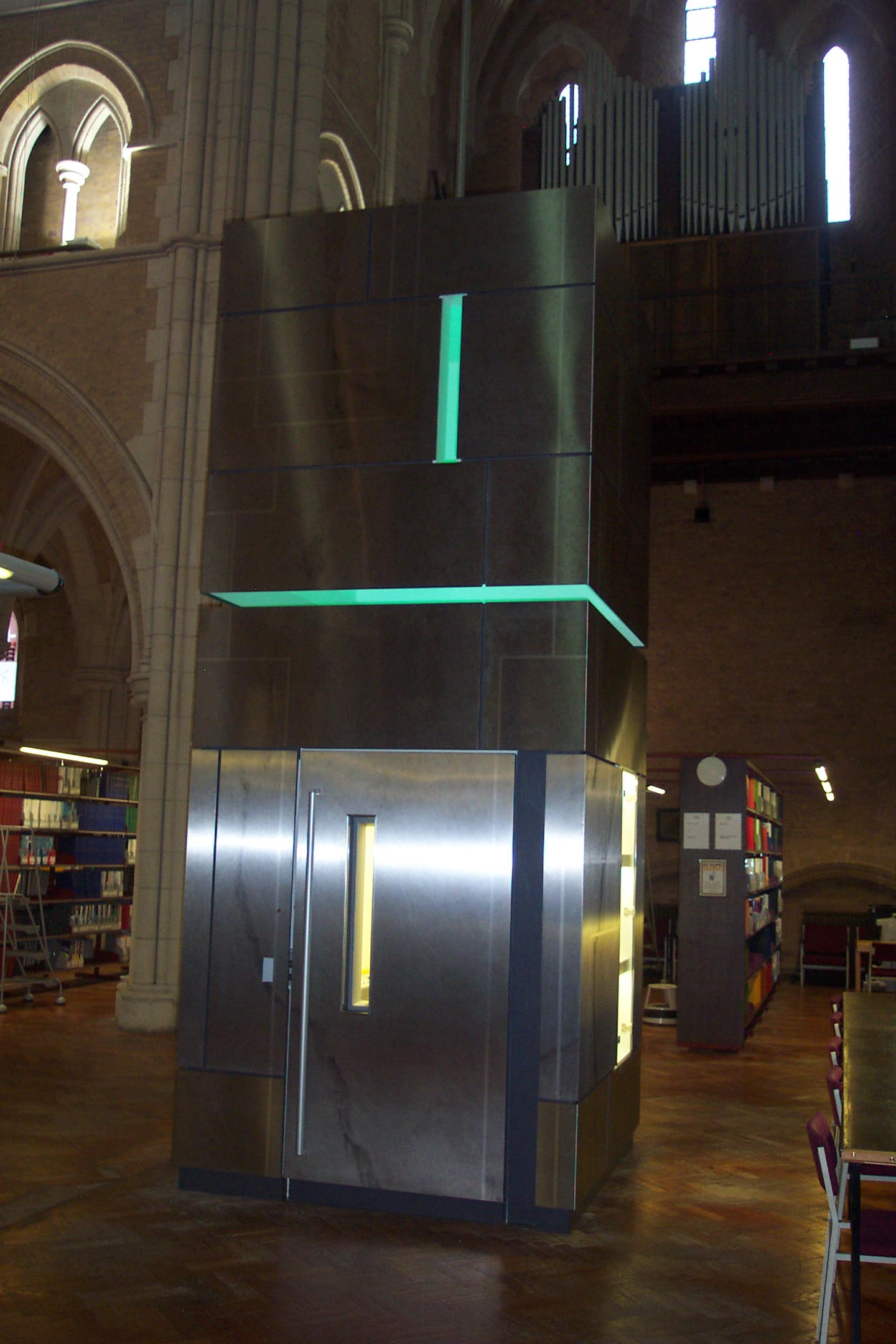
"description": "The housing of the new lift in the library is an installation by Surface Architects known as Ambiguous Object, seen here when newly installed in 2004",
"copyright": false,
"created": "2018-01-10"
},
{
"id": 927,
"title": "The Rio Cafe (on the right)",
"author": {
"id": 197,
"username": "numbi"
},
"feature": {
"id": 1395,
"type": "Feature",
"geometry": {
"type": "MultiPolygon",
"coordinates": [
[
[
[
-0.06734277723579,
51.5101408267643
],
[
-0.066910949136799,
51.510217428527255
],
[
-0.066795977317392,
51.50998414164829
],
[
-0.066852430868868,
51.50997111905564
],
[
-0.066833669508271,
51.50993011276243
],
[
-0.066709688224837,
51.50995364978504
],
[
-0.066597753455944,
51.50973669156566
],
[
-0.067039183086463,
51.50965327261519
],
[
-0.067087140764219,
51.50975289871178
],
[
-0.067115318173266,
51.50974754930748
],
[
-0.067147894414189,
51.50981436423853
],
[
-0.067117953240777,
51.50981735903555
],
[
-0.067140193085813,
51.50986423647582
],
[
-0.067209730295633,
51.509850266595954
],
[
-0.06734277723579,
51.5101408267643
]
]
]
]
},
"properties": {
"b_number": "",
"b_name": "Shapla Primary School",
"street": "Wellclose Square",
"address": "Shapla Primary School",
"feature_type": "WHITECHAPEL_BUILDING",
"count": 11,
"search_str": "Shapla Primary School"
},
"tags": []
},
"file": "https://surveyoflondon.org/media/uploads/features/1395/rio_cafe_pic.jpg",
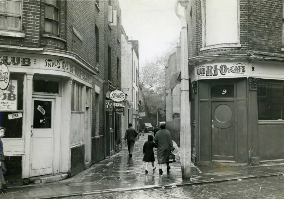
"description": "Rio means river in Castilian Spanish; in Somali Rio (spelt Riyo) means dream. \n\nThe artifacts that we are looking at include photographs by David Bailey in the 1960s of the Rio Club which were exhibited as part of the CREATE summer programme and shown at Compressor House, Royal Docks, in August 2012, court-case documents that reveal cultural conflict between the local community and the club, as well as building plans and drawings available from the Tower Hamlet Local History Library. ",
"copyright": false,
"created": "2017-10-06"
},
{
"id": 1399,
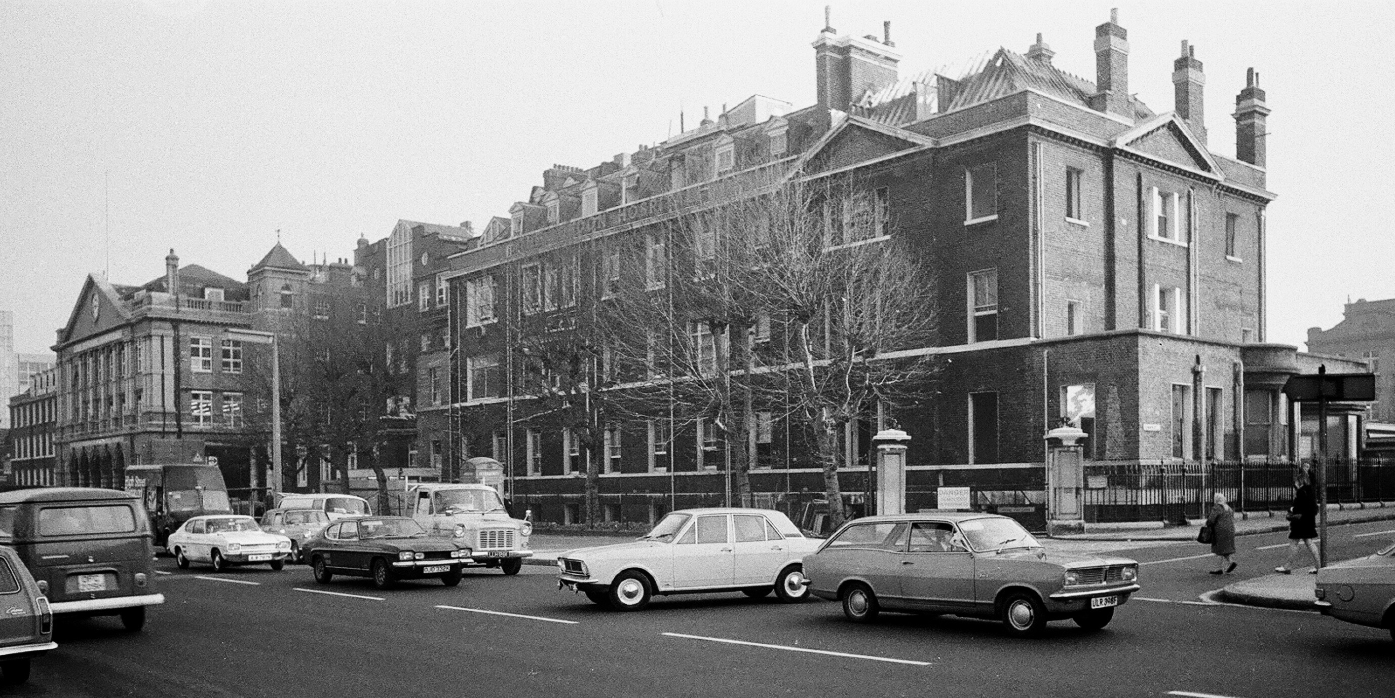
"title": "The Alexandra Wing of the London Hospital in the early 1970s (photograph by Dan Cruickshank)",
"author": {
"id": 268,
"username": "DanCruickshank"
},
"feature": {
"id": 1233,
"type": "Feature",
"geometry": {
"type": "MultiPolygon",
"coordinates": [
[
[
[
-0.06071898744648,
51.51847914149303
],
[
-0.060500593175314,
51.518078725457706
],
[
-0.060677507453823,
51.51804024673126
],
[
-0.060671223402208,
51.51802540127174
],
[
-0.06085005314625,
51.51798836558531
],
[
-0.060812945436909,
51.517920331266545
],
[
-0.060917351413957,
51.51789816547845
],
[
-0.060931197156673,
51.517923550570345
],
[
-0.061010610691191,
51.51790669069574
],
[
-0.061049931220856,
51.51797878143679
],
[
-0.061137385429043,
51.517960214409946
],
[
-0.061165435766445,
51.51801164191679
],
[
-0.061088209745711,
51.51802803744632
],
[
-0.061113189374754,
51.51807608265291
],
[
-0.061137480851473,
51.51807171260715
],
[
-0.061278658301599,
51.518317481305246
],
[
-0.061327004153713,
51.518306671582295
],
[
-0.061361885271019,
51.51836739382176
],
[
-0.061297703445739,
51.518381744329986
],
[
-0.061323145093769,
51.518424980241626
],
[
-0.060865969954968,
51.518532183713546
],
[
-0.060820667002295,
51.51845590786164
],
[
-0.06071898744648,
51.51847914149303
]
]
]
]
},
"properties": {
"b_number": "",
"b_name": "",
"street": "Turner Street",
"address": "The Royal London Dental Hospital",
"feature_type": "WHITECHAPEL_BUILDING",
"count": 9,
"search_str": "The Royal London Dental Hospital"
},
"tags": []
},
"file": "https://surveyoflondon.org/media/uploads/features/1233/00240001.jpg",
"description": "",
"copyright": true,
"created": "2018-11-13"
},
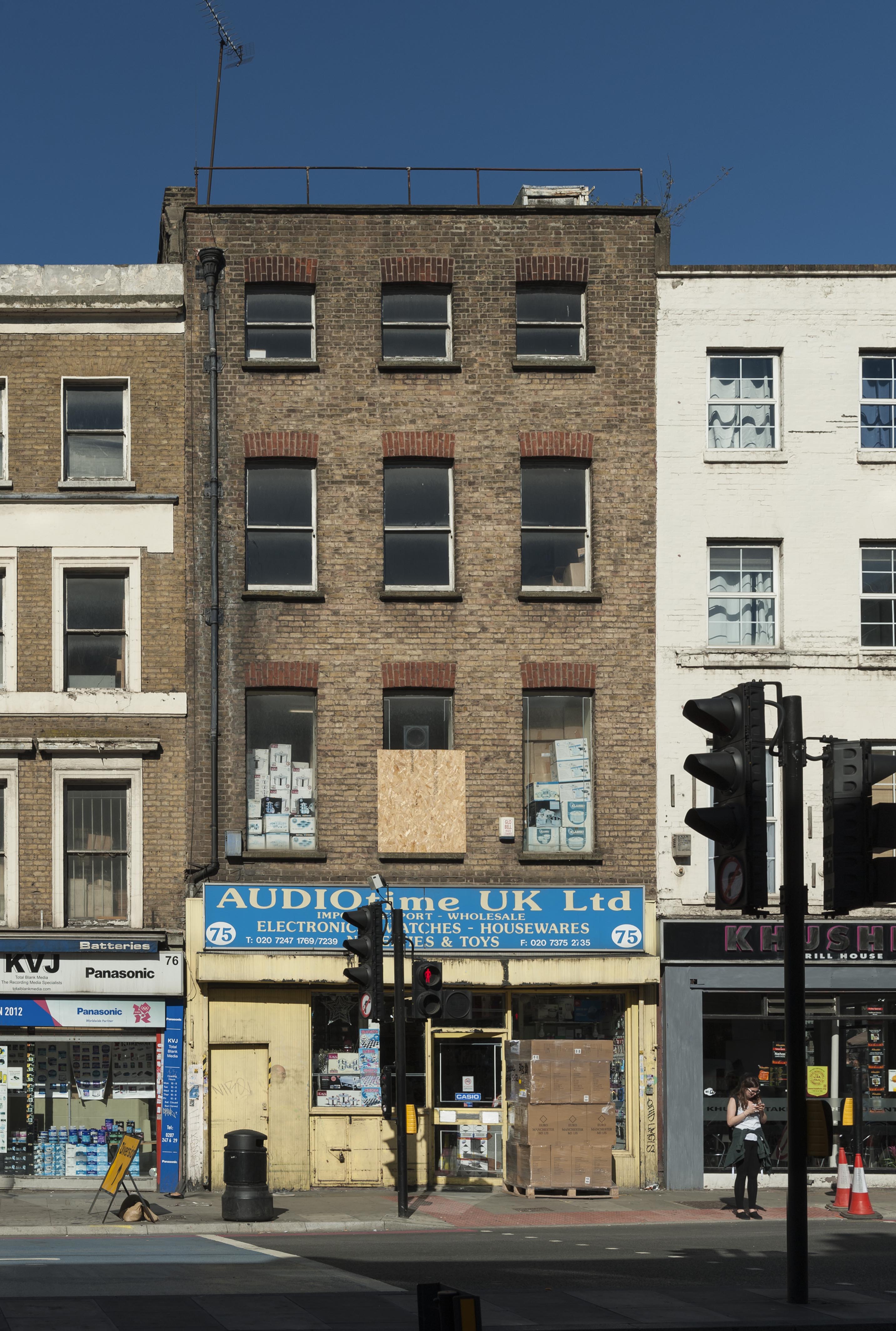
{
"id": 1370,
"title": "75 Whitechapel High Street in 2018",
"author": {
"id": 27,
"username": "DerekKendall"
},
"feature": {
"id": 314,
"type": "Feature",
"geometry": {
"type": "MultiPolygon",
"coordinates": [
[
[
[
-0.069841751221445,
51.51606452132173
],
[
-0.069925695023196,
51.516033041999854
],
[
-0.070001273739797,
51.516114205061
],
[
-0.069916647924465,
51.51614626138045
],
[
-0.069899913067933,
51.51612790461924
],
[
-0.069841751221445,
51.51606452132173
]
]
]
]
},
"properties": {
"b_number": "75",
"b_name": "75 Whitechapel High Street",
"street": "Whitechapel High Street",
"address": "75 Whitechapel High Street",
"feature_type": "WHITECHAPEL_BUILDING",
"count": 6,
"search_str": "75 Whitechapel High Street"
},
"tags": []
},
"file": "https://surveyoflondon.org/media/uploads/features/314/SoL%20Whitechapel%20102228.jpg",
"description": "",
"copyright": true,
"created": "2018-10-10"
},
{
"id": 1371,
"title": "74–76 Whitechapel High Street in 2018",
"author": {
"id": 27,
"username": "DerekKendall"
},
"feature": {
"id": 314,
"type": "Feature",
"geometry": {
"type": "MultiPolygon",
"coordinates": [
[
[
[
-0.069841751221445,
51.51606452132173
],
[
-0.069925695023196,
51.516033041999854
],
[
-0.070001273739797,
51.516114205061
],
[
-0.069916647924465,
51.51614626138045
],
[
-0.069899913067933,
51.51612790461924
],
[
-0.069841751221445,
51.51606452132173
]
]
]
]
},
"properties": {
"b_number": "75",
"b_name": "75 Whitechapel High Street",
"street": "Whitechapel High Street",
"address": "75 Whitechapel High Street",
"feature_type": "WHITECHAPEL_BUILDING",
"count": 6,
"search_str": "75 Whitechapel High Street"
},
"tags": []
},
"file": "https://surveyoflondon.org/media/uploads/features/314/SoL%20Whitechapel%20102230.jpg",
"description": "",
"copyright": true,
"created": "2018-10-10"
},
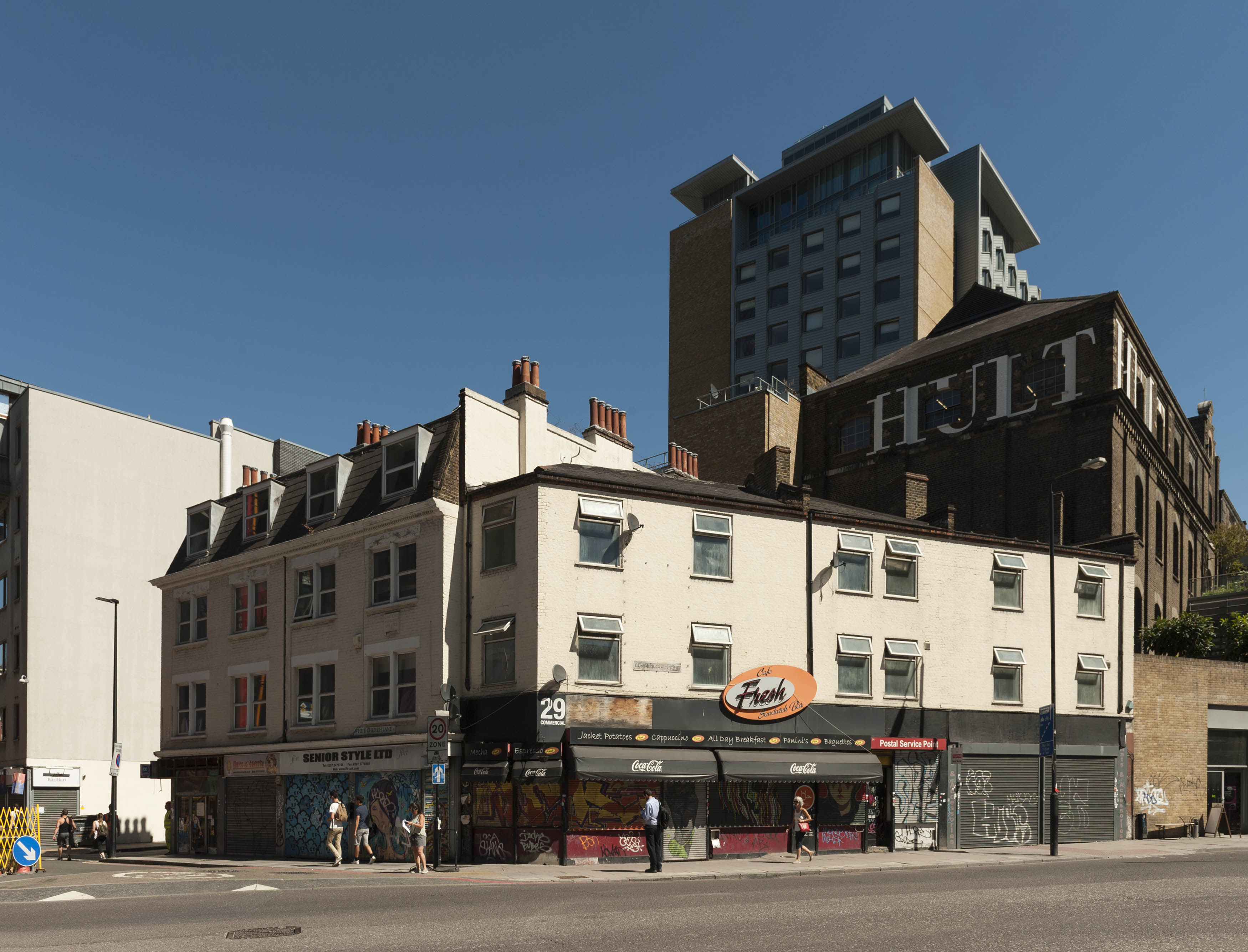
{
"id": 1323,
"title": "29 Commercial Road, long view from southwest in 2018",
"author": {
"id": 27,
"username": "DerekKendall"
},
"feature": {
"id": 293,
"type": "Feature",
"geometry": {
"type": "MultiPolygon",
"coordinates": [
[
[
[
-0.068491774631066,
51.515088861036816
],
[
-0.068491755573131,
51.51508885345113
],
[
-0.068481018200281,
51.515032955895144
],
[
-0.068557145402275,
51.51503420979888
],
[
-0.068578868958976,
51.515058349407546
],
[
-0.068491774631066,
51.515088861036816
]
]
]
]
},
"properties": {
"b_number": "29",
"b_name": "",
"street": "Commercial Road",
"address": "Fresh, 29 Commercial Road",
"feature_type": "WHITECHAPEL_BUILDING",
"count": 6,
"search_str": "Fresh, 29 Commercial Road"
},
"tags": [
"Herbert O. Ellis",
"Solomon Kirstein"
]
},
"file": "https://surveyoflondon.org/media/uploads/features/293/SoL%20Whitechapel%20102086.jpg",
"description": "",
"copyright": true,
"created": "2018-08-13"
},
{
"id": 1126,
"title": "Rear of the terrace at the Commercial St/ Whitechapel High St corner",
"author": {
"id": 18,
"username": "shahedsaleem"
},
"feature": {
"id": 401,
"type": "Feature",
"geometry": {
"type": "MultiPolygon",
"coordinates": [
[
[
[
-0.071960912758108,
51.51579721323616
],
[
-0.072122718131682,
51.51573277413889
],
[
-0.072182196785185,
51.51579475837268
],
[
-0.072182190872528,
51.51579476187234
],
[
-0.072252467610663,
51.515883929581804
],
[
-0.072190771248314,
51.51590695900495
],
[
-0.072135744377472,
51.51584957216294
],
[
-0.071993909326822,
51.51590251474903
],
[
-0.071968331310797,
51.515875839608334
],
[
-0.072018383520243,
51.51585714925005
],
[
-0.071960912758108,
51.51579721323616
]
]
]
]
},
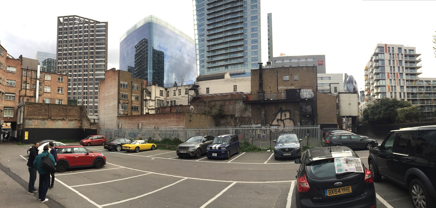
"properties": {
"b_number": "6 and 6a",
"b_name": "6 and 6a Commercial Street",
"street": "Commercial Street",
"address": "6 and 6a Commercial Street",
"feature_type": "WHITECHAPEL_BUILDING",
"count": 3,
"search_str": "6 and 6a Commercial Street"
},
"tags": []
},
"file": "https://surveyoflondon.org/media/uploads/features/401/2017-10-04%2016.31.06.jpg",
"description": "Panoramic photo taken from the rear car park, October 2017",
"copyright": false,
"created": "2018-02-09"
},
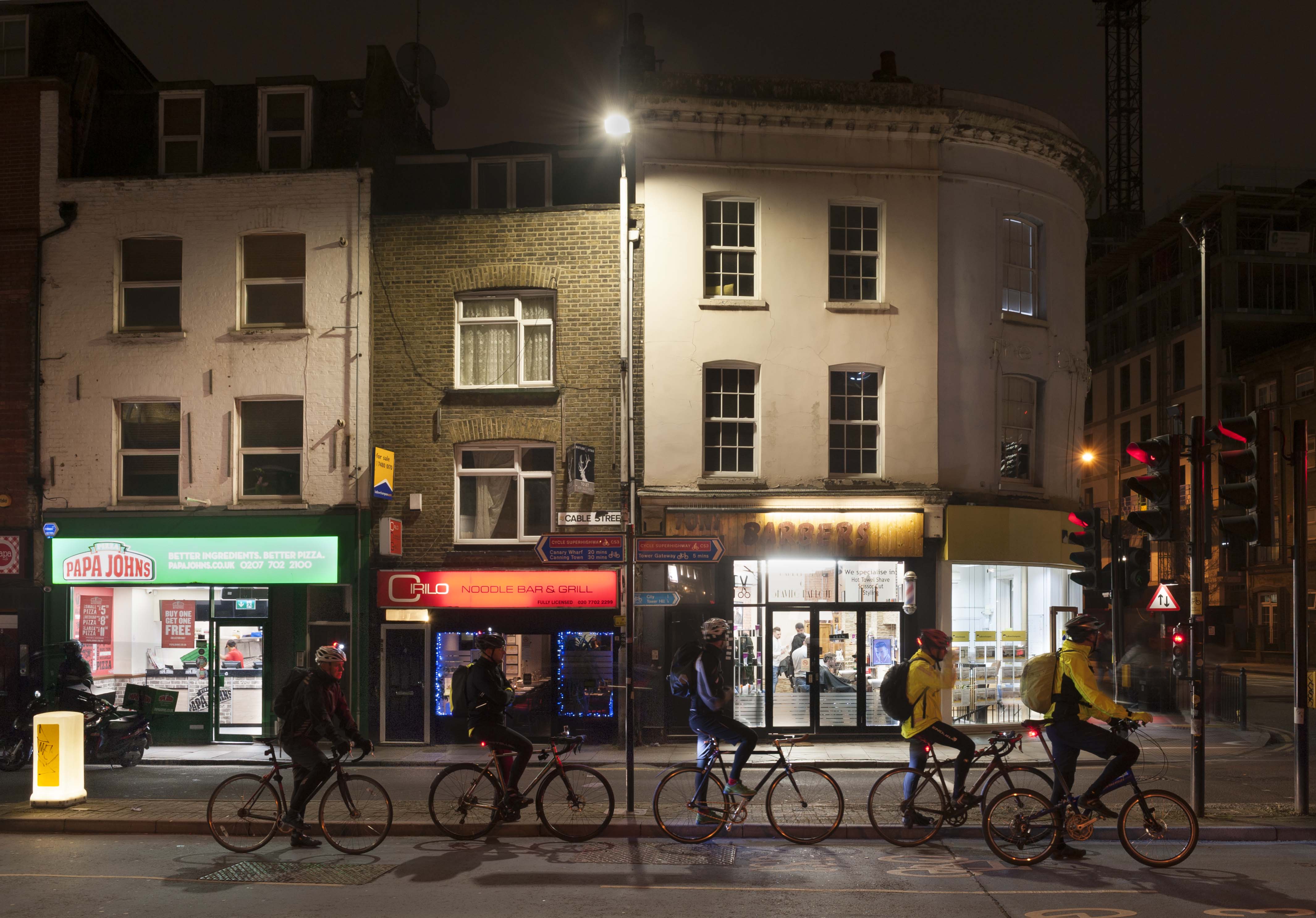
{
"id": 1186,
"title": "2-6 Cable Street in early 2018",
"author": {
"id": 27,
"username": "DerekKendall"
},
"feature": {
"id": 1377,
"type": "Feature",
"geometry": {
"type": "MultiPolygon",
"coordinates": [
[
[
[
-0.068172631919119,
51.510747029802005
],
[
-0.068154454891722,
51.510665529951076
],
[
-0.068226122571781,
51.5106672919737
],
[
-0.068245676894044,
51.510744647693585
],
[
-0.068172631919119,
51.510747029802005
]
]
]
]
},
"properties": {
"b_number": "4",
"b_name": "",
"street": "Cable Street",
"address": "4 Cable Street",
"feature_type": "WHITECHAPEL_BUILDING",
"count": 4,
"search_str": "4 Cable Street"
},
"tags": []
},
"file": "https://surveyoflondon.org/media/uploads/features/1377/SoL%20Whitechapel%20101806.jpg",
"description": "",
"copyright": true,
"created": "2018-03-05"
},
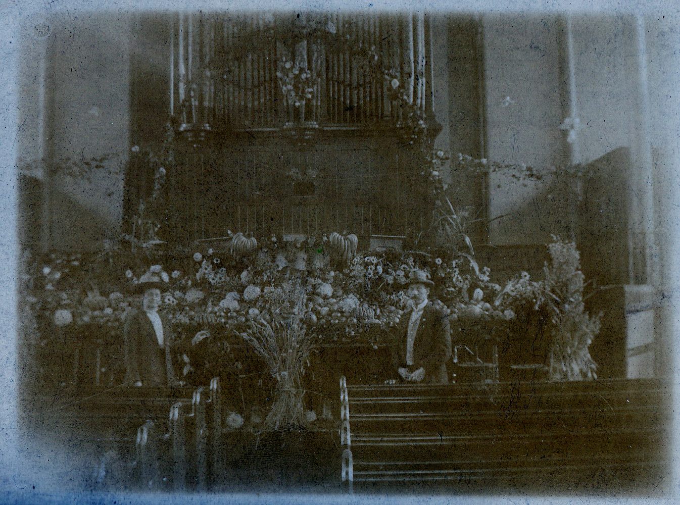
{
"id": 1637,
"title": "Brunswick Hall interior c.1910",
"author": {
"id": 19,
"username": "pmernick"
},
"feature": {
"id": 1226,
"type": "Feature",
"geometry": {
"type": "MultiPolygon",
"coordinates": [
[
[
[
-0.057781597348087,
51.51931934049726
],
[
-0.057583510279063,
51.51936335562525
],
[
-0.057331742954463,
51.51892343874043
],
[
-0.057405984242291,
51.51890625776504
],
[
-0.057417150978354,
51.51892380850925
],
[
-0.057464414646317,
51.51891346295509
],
[
-0.057455443085981,
51.51889505673813
],
[
-0.057530567994777,
51.518878391257324
],
[
-0.057781597348087,
51.51931934049726
]
]
]
]
},
"properties": {
"b_number": "208-212",
"b_name": "Whitechapel Mission",
"street": "Whitechapel Road",
"address": "Whitechapel Mission",
"feature_type": "WHITECHAPEL_BUILDING",
"count": 5,
"search_str": "Whitechapel Mission"
},
"tags": [
"Whitechapel Mission"
]
},
"file": "https://surveyoflondon.org/media/uploads/features/1226/Brunswick%20Hall%20Whitechapel-s.jpg",
"description": "Undated post card image, presumably harvest festival. ",
"copyright": false,
"created": "2019-07-25"
},
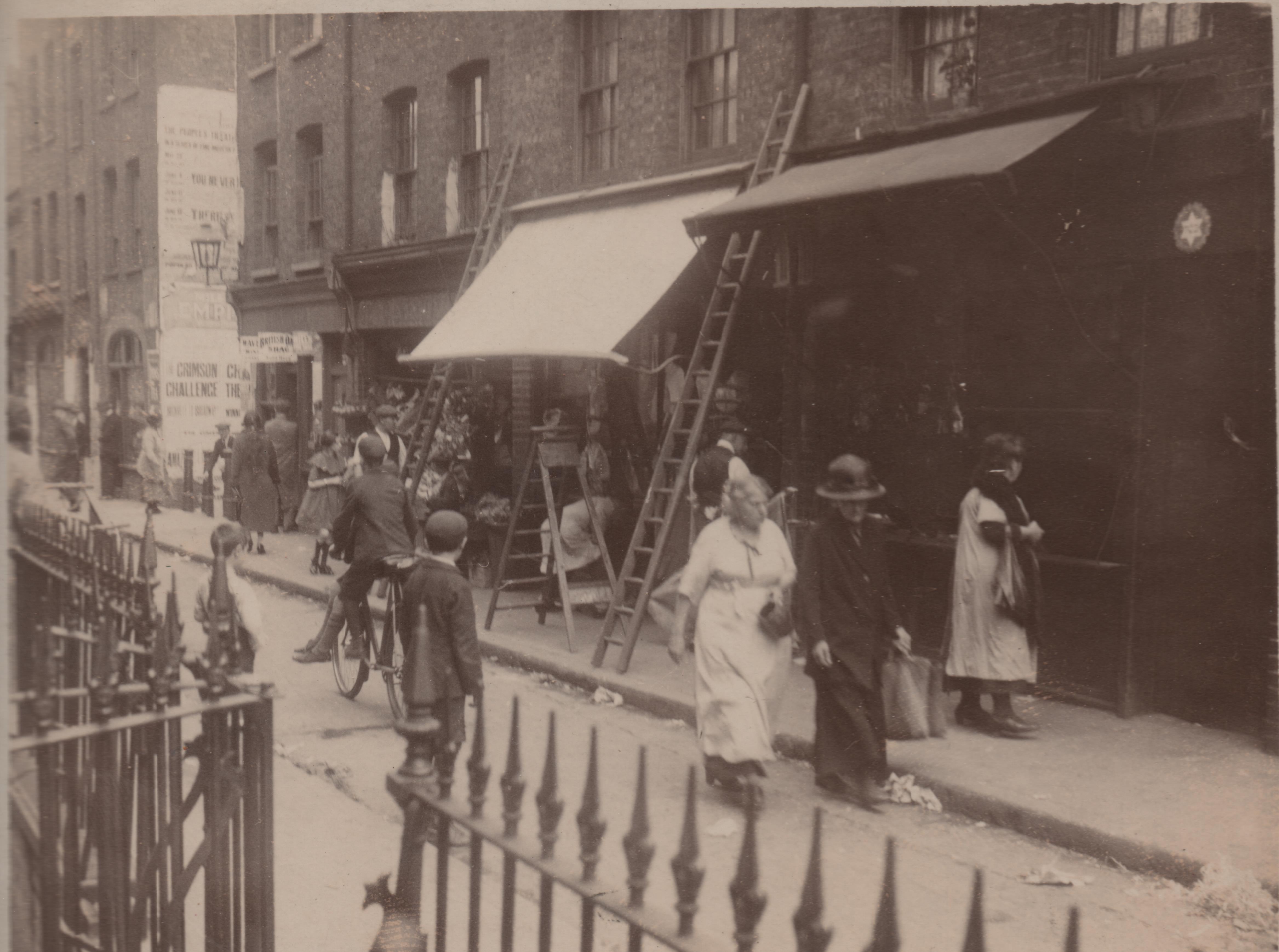
{
"id": 524,
"title": "58-70 Old Montague Street and Black Lion Yard, 1922",
"author": {
"id": 2,
"username": "surveyoflondon"
},
"feature": {
"id": 117,
"type": "Feature",
"geometry": {
"type": "MultiPolygon",
"coordinates": [
[
[
[
-0.06806827102344,
51.51747178453937
],
[
-0.068101460895763,
51.51750668263352
],
[
-0.068127081637937,
51.517498546917075
],
[
-0.068190979657861,
51.51758385745302
],
[
-0.06829264666674,
51.517552117841184
],
[
-0.068193960734805,
51.51742791101118
],
[
-0.068154357739905,
51.51743980556263
],
[
-0.068141906920262,
51.51742433319862
],
[
-0.068105152860582,
51.51743547923236
],
[
-0.068058267880135,
51.517384497187955
],
[
-0.068185267578645,
51.517342892799604
],
[
-0.068176984365513,
51.51733176372423
],
[
-0.068232283025454,
51.517312589784154
],
[
-0.068245264806965,
51.51732579782641
],
[
-0.068349859999212,
51.51729116780716
],
[
-0.068381711363567,
51.51732332091475
],
[
-0.068370261386016,
51.517328857540846
],
[
-0.068386883278381,
51.517345670853146
],
[
-0.068353452172759,
51.51735863808482
],
[
-0.068364356622077,
51.517372017514376
],
[
-0.068324950715624,
51.51738493821042
],
[
-0.068423503323907,
51.517510563231795
],
[
-0.068525811707463,
51.5174780488514
],
[
-0.068459279552895,
51.5173960957796
],
[
-0.06848999930739,
51.51738638811417
],
[
-0.068462444488936,
51.517352446533394
],
[
-0.06855236156189,
51.51732403201941
],
[
-0.068580214092029,
51.51735834023238
],
[
-0.068608963350004,
51.51734925521336
],
[
-0.068669270516383,
51.51742378261138
],
[
-0.068661546933835,
51.51742679419159
],
[
-0.068667297973198,
51.51743276025812
],
[
-0.068797448001574,
51.517394679413954
],
[
-0.068810502647693,
51.517410759726395
],
[
-0.068837814802948,
51.51740212878775
],
[
-0.068886801726823,
51.51746246921991
],
[
-0.068831490904135,
51.51747994803719
],
[
-0.068845898830914,
51.51749769522596
],
[
-0.068010308641992,
51.51776217191367
],
[
-0.068002801697141,
51.517750038795626
],
[
-0.067963954086376,
51.51776348409939
],
[
-0.067887414413438,
51.517668911097104
],
[
-0.068041157787481,
51.517620328198426
],
[
-0.068045878204274,
51.51761817542481
],
[
-0.068041681668751,
51.51761310235492
],
[
-0.068037199428783,
51.5176147798915
],
[
-0.067951551647237,
51.51750995146181
],
[
-0.06806827102344,
51.51747178453937
]
]
]
]
},
"properties": {
"b_number": "60",
"b_name": "Hopetown",
"street": "Old Montague Street",
"address": "Hopetown, 60 Old Montague Street",
"feature_type": "WHITECHAPEL_BUILDING",
"count": 6,
"search_str": "Hopetown"
},
"tags": [
"hostel",
"Salvation Army"
]
},
"file": "https://surveyoflondon.org/media/uploads/features/117/Old%20Montague%20Street%20from%20eBay%201200%20dpi.jpg",
"description": "This photograph of 1922, taken by an unknown amateur photographer, shows the south side of Old Montague Street, from No 58 (at the right, with the Star of David on the shopfront), to No 70 on the far left, with the north entrance to Black Lion Yard visible between Nos 64 and 66 on the left. The eastern half of Hopetown now occupies the site. The date of 1922 may be inferred from the poster on the side wall of No 66 in Black Lion Yard, advertising the western The Crimson Challenge at the Mile End Empire. The film was released in 1922. The Mile End Empire site is now occupied by the Genesis cinema.",
"copyright": false,
"created": "2017-03-14"
},
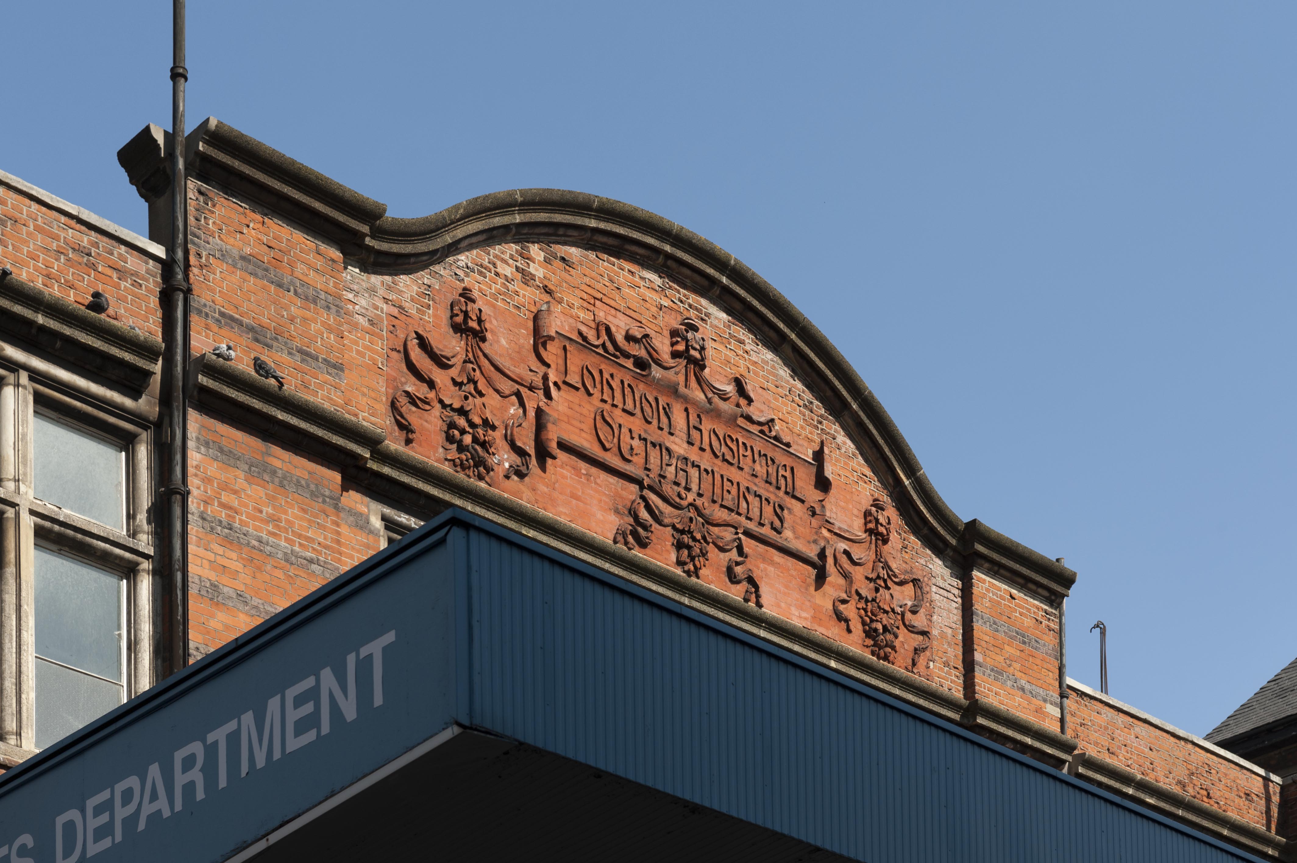
{
"id": 133,
"title": "Detail of brick relief on south elevation of the Outpatients' Department",
"author": {
"id": 27,
"username": "DerekKendall"
},
"feature": {
"id": 1188,
"type": "Feature",
"geometry": {
"type": "MultiPolygon",
"coordinates": [
[
[
[
-0.062135521845015,
51.51764176709899
],
[
-0.061842202698012,
51.517670085745486
],
[
-0.061848902036134,
51.51769938896618
],
[
-0.061550919793822,
51.51772590607731
],
[
-0.061559977080333,
51.51776552415219
],
[
-0.061447064288193,
51.51777557192973
],
[
-0.061449635978695,
51.51778682104097
],
[
-0.06118390946889,
51.51781046681395
],
[
-0.061173470769467,
51.517768252329546
],
[
-0.0611656045837,
51.517762055237526
],
[
-0.061159583649328,
51.517735562574764
],
[
-0.061165991378992,
51.51772693239806
],
[
-0.061115835114599,
51.517494904849876
],
[
-0.061108055251476,
51.51749055594055
],
[
-0.061100533853466,
51.51745850319045
],
[
-0.061102936626612,
51.5174532736114
],
[
-0.061094280097356,
51.517413095299034
],
[
-0.061827243127089,
51.517348112870636
],
[
-0.061830552360161,
51.517362587728314
],
[
-0.062066885754417,
51.51734155598123
],
[
-0.062135521845015,
51.51764176709899
]
]
]
]
},
"properties": {
"b_number": "",
"b_name": "",
"street": "Stepney Way",
"address": "Outpatients Department",
"feature_type": "WHITECHAPEL_BUILDING",
"count": 9,
"search_str": "Outpatients Department"
},
"tags": []
},
"file": "https://surveyoflondon.org/media/uploads/features/1188/SoL%20Whitechapel100113.jpg",
"description": "",
"copyright": true,
"created": "2016-07-13"
},
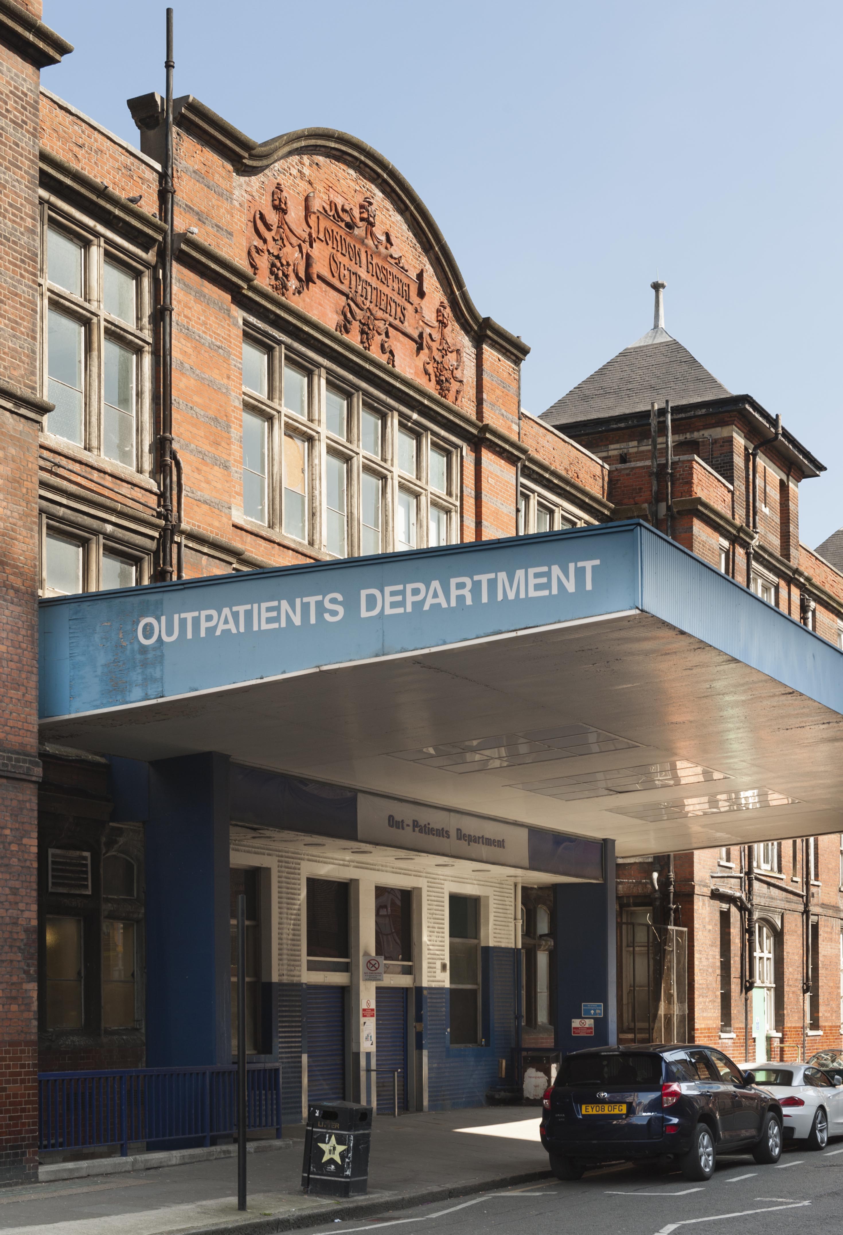
{
"id": 276,
"title": "South elevation of the Outpatients' Department in 2016",
"author": {
"id": 27,
"username": "DerekKendall"
},
"feature": {
"id": 1188,
"type": "Feature",
"geometry": {
"type": "MultiPolygon",
"coordinates": [
[
[
[
-0.062135521845015,
51.51764176709899
],
[
-0.061842202698012,
51.517670085745486
],
[
-0.061848902036134,
51.51769938896618
],
[
-0.061550919793822,
51.51772590607731
],
[
-0.061559977080333,
51.51776552415219
],
[
-0.061447064288193,
51.51777557192973
],
[
-0.061449635978695,
51.51778682104097
],
[
-0.06118390946889,
51.51781046681395
],
[
-0.061173470769467,
51.517768252329546
],
[
-0.0611656045837,
51.517762055237526
],
[
-0.061159583649328,
51.517735562574764
],
[
-0.061165991378992,
51.51772693239806
],
[
-0.061115835114599,
51.517494904849876
],
[
-0.061108055251476,
51.51749055594055
],
[
-0.061100533853466,
51.51745850319045
],
[
-0.061102936626612,
51.5174532736114
],
[
-0.061094280097356,
51.517413095299034
],
[
-0.061827243127089,
51.517348112870636
],
[
-0.061830552360161,
51.517362587728314
],
[
-0.062066885754417,
51.51734155598123
],
[
-0.062135521845015,
51.51764176709899
]
]
]
]
},
"properties": {
"b_number": "",
"b_name": "",
"street": "Stepney Way",
"address": "Outpatients Department",
"feature_type": "WHITECHAPEL_BUILDING",
"count": 9,
"search_str": "Outpatients Department"
},
"tags": []
},
"file": "https://surveyoflondon.org/media/uploads/features/1188/SoL%20Whitechapel100115.jpg",
"description": "",
"copyright": true,
"created": "2016-08-17"
},
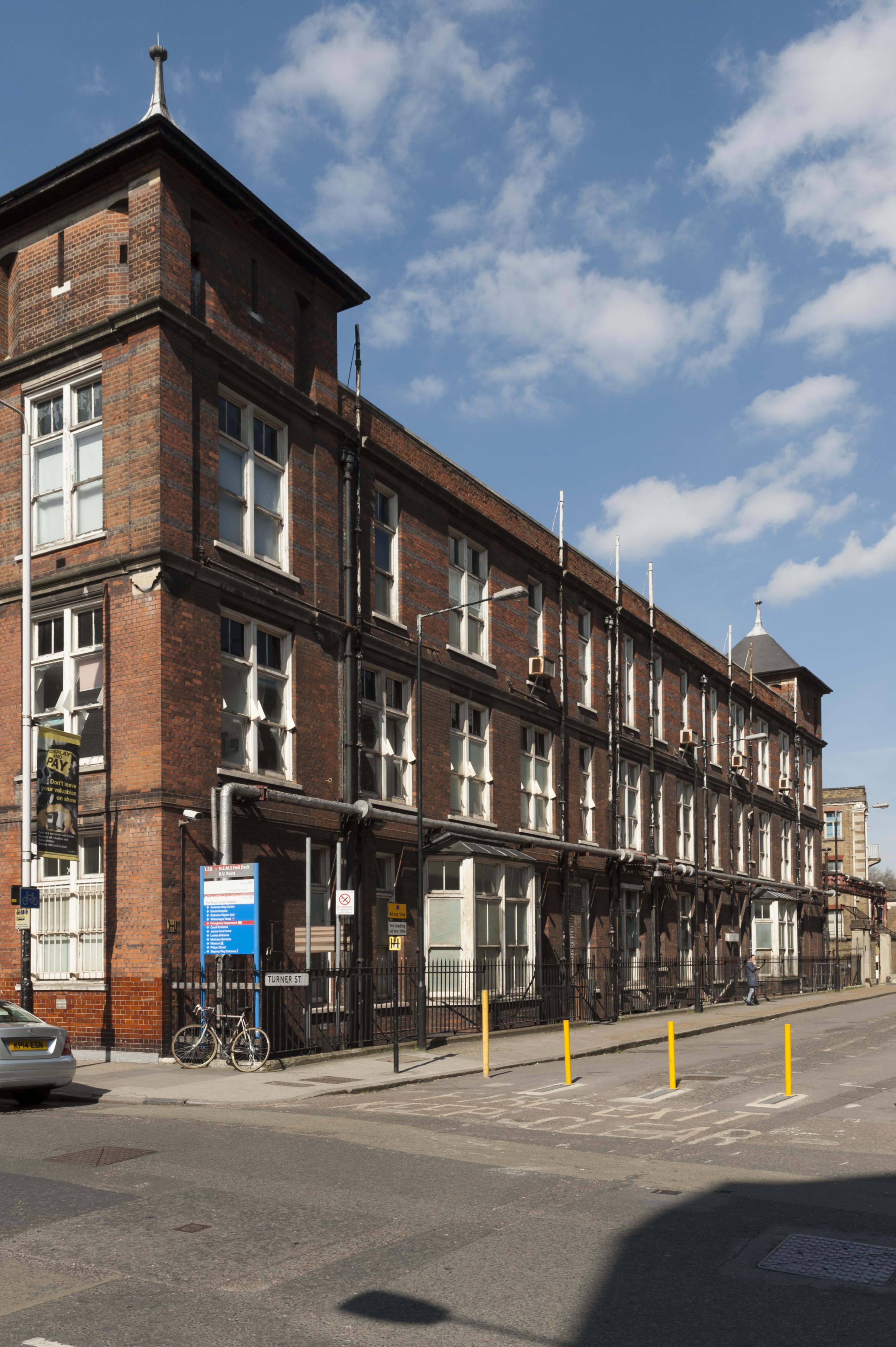
{
"id": 279,
"title": "East elevation of the Outpatients Department in 2016",
"author": {
"id": 27,
"username": "DerekKendall"
},
"feature": {
"id": 1188,
"type": "Feature",
"geometry": {
"type": "MultiPolygon",
"coordinates": [
[
[
[
-0.062135521845015,
51.51764176709899
],
[
-0.061842202698012,
51.517670085745486
],
[
-0.061848902036134,
51.51769938896618
],
[
-0.061550919793822,
51.51772590607731
],
[
-0.061559977080333,
51.51776552415219
],
[
-0.061447064288193,
51.51777557192973
],
[
-0.061449635978695,
51.51778682104097
],
[
-0.06118390946889,
51.51781046681395
],
[
-0.061173470769467,
51.517768252329546
],
[
-0.0611656045837,
51.517762055237526
],
[
-0.061159583649328,
51.517735562574764
],
[
-0.061165991378992,
51.51772693239806
],
[
-0.061115835114599,
51.517494904849876
],
[
-0.061108055251476,
51.51749055594055
],
[
-0.061100533853466,
51.51745850319045
],
[
-0.061102936626612,
51.5174532736114
],
[
-0.061094280097356,
51.517413095299034
],
[
-0.061827243127089,
51.517348112870636
],
[
-0.061830552360161,
51.517362587728314
],
[
-0.062066885754417,
51.51734155598123
],
[
-0.062135521845015,
51.51764176709899
]
]
]
]
},
"properties": {
"b_number": "",
"b_name": "",
"street": "Stepney Way",
"address": "Outpatients Department",
"feature_type": "WHITECHAPEL_BUILDING",
"count": 9,
"search_str": "Outpatients Department"
},
"tags": []
},
"file": "https://surveyoflondon.org/media/uploads/features/1188/SoL%20Whitechapel100109.jpg",
"description": "",
"copyright": true,
"created": "2016-08-17"
},
{
"id": 807,
"title": "View along Cable Street from the east (Sapphire Court to left), 2017",
"author": {
"id": 27,
"username": "DerekKendall"
},
"feature": {
"id": 1388,
"type": "Feature",
"geometry": {
"type": "MultiPolygon",
"coordinates": [
[
[
[
-0.066879502365839,
51.510844661379735
],
[
-0.066862511678253,
51.510761824516806
],
[
-0.066952814928383,
51.51075255750358
],
[
-0.066950782413508,
51.5107455473704
],
[
-0.066997569538801,
51.510740795451646
],
[
-0.066999136526024,
51.51074779791026
],
[
-0.067171264889663,
51.51073144940706
],
[
-0.067169771657697,
51.51072270400946
],
[
-0.067197802098879,
51.51072084047433
],
[
-0.067199319929543,
51.51072900489128
],
[
-0.067288775215765,
51.51072133252647
],
[
-0.067285473568536,
51.51069670449288
],
[
-0.067358367414083,
51.510691510626806
],
[
-0.067360545836973,
51.51070608117119
],
[
-0.06744649924104,
51.51070052109646
],
[
-0.06744449292239,
51.51068188369036
],
[
-0.067469680944622,
51.51068113601828
],
[
-0.067467235347347,
51.51065086365969
],
[
-0.067441116274192,
51.51065159598726
],
[
-0.067441608078574,
51.510639976378634
],
[
-0.067115839962,
51.51058809635666
],
[
-0.067138150386428,
51.51050125623889
],
[
-0.067591716505203,
51.51057152104168
],
[
-0.06767269001234,
51.510771689264104
],
[
-0.066879502365839,
51.510844661379735
]
]
]
]
},
"properties": {
"b_number": "1",
"b_name": "",
"street": "Ensign Street",
"address": "Sapphire Court, 1 Ensign Street",
"feature_type": "WHITECHAPEL_BUILDING",
"count": 7,
"search_str": "Sapphire Court, 1 Ensign Street"
},
"tags": []
},
"file": "https://surveyoflondon.org/media/uploads/features/1388/SoL%20Whitechapel%20101244.jpg",
"description": "",
"copyright": true,
"created": "2017-09-12"
},
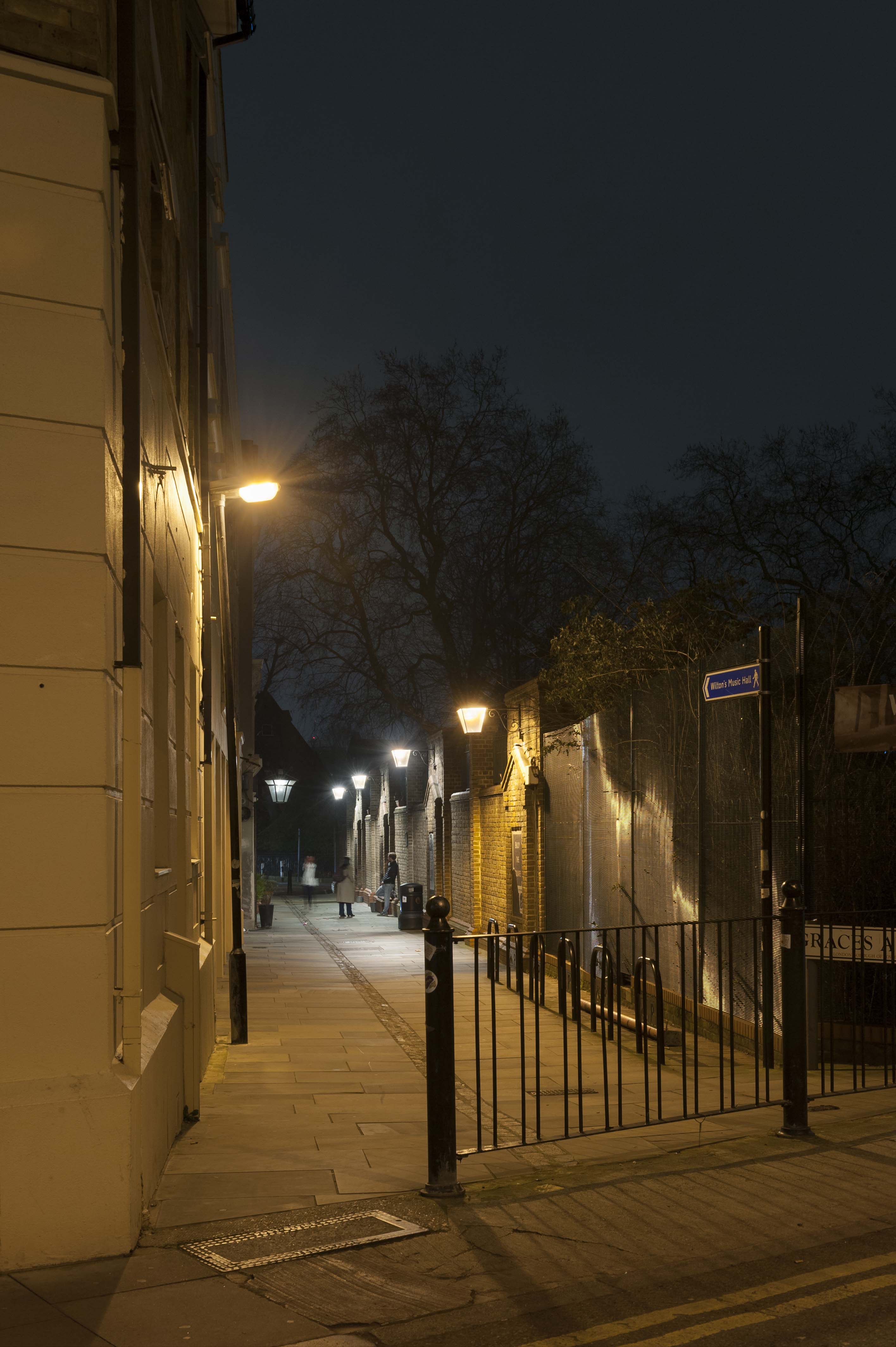
{
"id": 1178,
"title": "Grace's Alley from the west in early 2018",
"author": {
"id": 27,
"username": "DerekKendall"
},
"feature": {
"id": 1388,
"type": "Feature",
"geometry": {
"type": "MultiPolygon",
"coordinates": [
[
[
[
-0.066879502365839,
51.510844661379735
],
[
-0.066862511678253,
51.510761824516806
],
[
-0.066952814928383,
51.51075255750358
],
[
-0.066950782413508,
51.5107455473704
],
[
-0.066997569538801,
51.510740795451646
],
[
-0.066999136526024,
51.51074779791026
],
[
-0.067171264889663,
51.51073144940706
],
[
-0.067169771657697,
51.51072270400946
],
[
-0.067197802098879,
51.51072084047433
],
[
-0.067199319929543,
51.51072900489128
],
[
-0.067288775215765,
51.51072133252647
],
[
-0.067285473568536,
51.51069670449288
],
[
-0.067358367414083,
51.510691510626806
],
[
-0.067360545836973,
51.51070608117119
],
[
-0.06744649924104,
51.51070052109646
],
[
-0.06744449292239,
51.51068188369036
],
[
-0.067469680944622,
51.51068113601828
],
[
-0.067467235347347,
51.51065086365969
],
[
-0.067441116274192,
51.51065159598726
],
[
-0.067441608078574,
51.510639976378634
],
[
-0.067115839962,
51.51058809635666
],
[
-0.067138150386428,
51.51050125623889
],
[
-0.067591716505203,
51.51057152104168
],
[
-0.06767269001234,
51.510771689264104
],
[
-0.066879502365839,
51.510844661379735
]
]
]
]
},
"properties": {
"b_number": "1",
"b_name": "",
"street": "Ensign Street",
"address": "Sapphire Court, 1 Ensign Street",
"feature_type": "WHITECHAPEL_BUILDING",
"count": 7,
"search_str": "Sapphire Court, 1 Ensign Street"
},
"tags": []
},
"file": "https://surveyoflondon.org/media/uploads/features/1388/SoL%20Whitechapel%20101795.jpg",
"description": "",
"copyright": true,
"created": "2018-03-05"
},
{
"id": 1179,
"title": "Grace's Alley in early 2018",
"author": {
"id": 27,
"username": "DerekKendall"
},
"feature": {
"id": 1388,
"type": "Feature",
"geometry": {
"type": "MultiPolygon",
"coordinates": [
[
[
[
-0.066879502365839,
51.510844661379735
],
[
-0.066862511678253,
51.510761824516806
],
[
-0.066952814928383,
51.51075255750358
],
[
-0.066950782413508,
51.5107455473704
],
[
-0.066997569538801,
51.510740795451646
],
[
-0.066999136526024,
51.51074779791026
],
[
-0.067171264889663,
51.51073144940706
],
[
-0.067169771657697,
51.51072270400946
],
[
-0.067197802098879,
51.51072084047433
],
[
-0.067199319929543,
51.51072900489128
],
[
-0.067288775215765,
51.51072133252647
],
[
-0.067285473568536,
51.51069670449288
],
[
-0.067358367414083,
51.510691510626806
],
[
-0.067360545836973,
51.51070608117119
],
[
-0.06744649924104,
51.51070052109646
],
[
-0.06744449292239,
51.51068188369036
],
[
-0.067469680944622,
51.51068113601828
],
[
-0.067467235347347,
51.51065086365969
],
[
-0.067441116274192,
51.51065159598726
],
[
-0.067441608078574,
51.510639976378634
],
[
-0.067115839962,
51.51058809635666
],
[
-0.067138150386428,
51.51050125623889
],
[
-0.067591716505203,
51.51057152104168
],
[
-0.06767269001234,
51.510771689264104
],
[
-0.066879502365839,
51.510844661379735
]
]
]
]
},
"properties": {
"b_number": "1",
"b_name": "",
"street": "Ensign Street",
"address": "Sapphire Court, 1 Ensign Street",
"feature_type": "WHITECHAPEL_BUILDING",
"count": 7,
"search_str": "Sapphire Court, 1 Ensign Street"
},
"tags": []
},
"file": "https://surveyoflondon.org/media/uploads/features/1388/SoL%20Whitechapel%20101796.jpg",
"description": "",
"copyright": true,
"created": "2018-03-05"
},
{
"id": 1187,
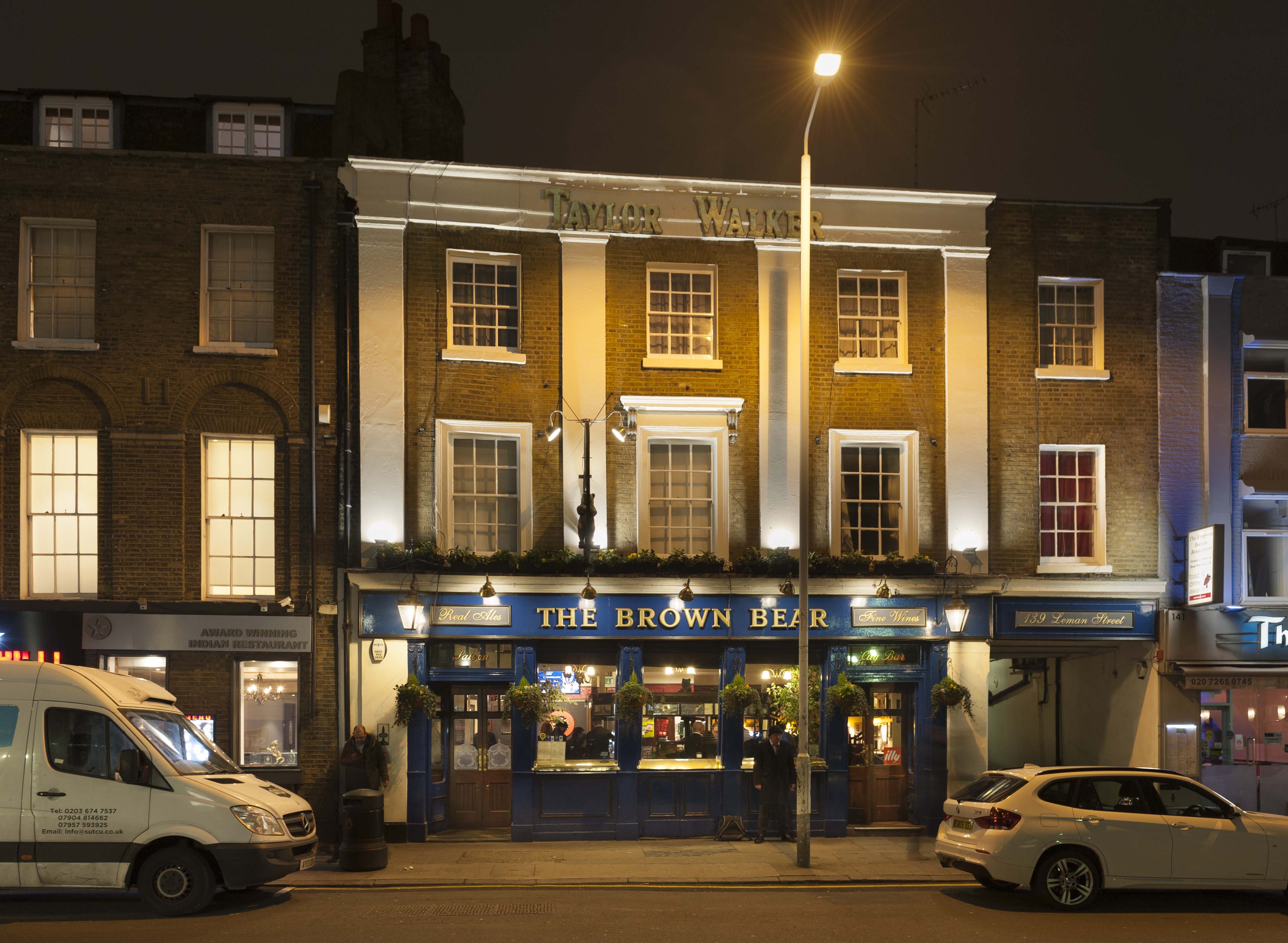
"title": "The Brown Bear, 139 Leman Street, in early 2018",
"author": {
"id": 27,
"username": "DerekKendall"
},
"feature": {
"id": 1279,
"type": "Feature",
"geometry": {
"type": "MultiPolygon",
"coordinates": [
[
[
[
-0.068607151788316,
51.511390427340054
],
[
-0.068400693495523,
51.51142780330215
],
[
-0.068389016275717,
51.511404167902676
],
[
-0.068368044928817,
51.511407578266905
],
[
-0.068328932977181,
51.51135215233573
],
[
-0.068468004764801,
51.51132778218799
],
[
-0.068463650698236,
51.511304676705464
],
[
-0.06853233892788,
51.511294270529675
],
[
-0.068607151788316,
51.511390427340054
]
]
]
]
},
"properties": {
"b_number": "139",
"b_name": "",
"street": "Leman Street",
"address": "The Brown Bear, 139 Leman Street",
"feature_type": "WHITECHAPEL_BUILDING",
"count": 6,
"search_str": "The Brown Bear, 139 Leman Street"
},
"tags": []
},
"file": "https://surveyoflondon.org/media/uploads/features/1279/SoL%20Whitechapel%20101809.jpg",
"description": "",
"copyright": true,
"created": "2018-03-05"
},
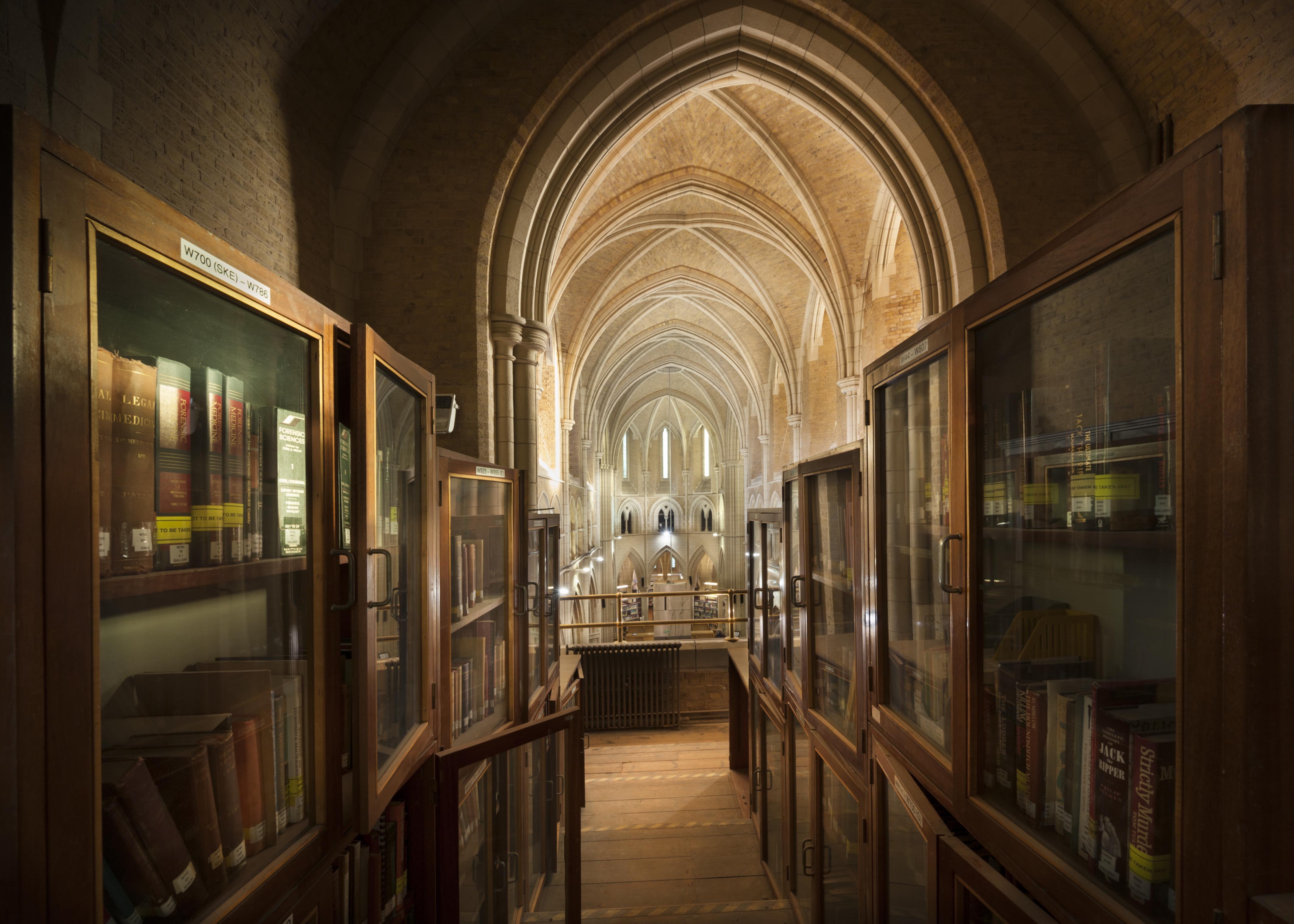
{
"id": 1093,
"title": "West gallery, looking east towards the nave, December 2017",
"author": {
"id": 27,
"username": "DerekKendall"
},
"feature": {
"id": 1063,
"type": "Feature",
"geometry": {
"type": "MultiPolygon",
"coordinates": [
[
[
[
-0.060845062076888,
51.517232461665024
],
[
-0.060858061981046,
51.517297370705585
],
[
-0.060852072355982,
51.51729777282787
],
[
-0.060850777279358,
51.517292038613824
],
[
-0.060836585058279,
51.51723251416014
],
[
-0.060769976187858,
51.51723703364601
],
[
-0.060780310614954,
51.51729938465229
],
[
-0.060851422100426,
51.517294893689865
],
[
-0.060852072355982,
51.51729777282787
],
[
-0.060780756007888,
51.51730231203111
],
[
-0.060433008250066,
51.51733065140396
],
[
-0.060436612097579,
51.51734759826428
],
[
-0.060301835648786,
51.517358754570346
],
[
-0.060301267692063,
51.517334324990614
],
[
-0.060276367898553,
51.517334550322296
],
[
-0.060277606963858,
51.51738784759974
],
[
-0.060240911793285,
51.51738817966408
],
[
-0.060239603561777,
51.51733190531689
],
[
-0.060233709433579,
51.517328890670484
],
[
-0.060224675865392,
51.517324270305814
],
[
-0.06015408706542,
51.51728816646581
],
[
-0.060146994469308,
51.51728968696465
],
[
-0.06013876083629,
51.51729145207641
],
[
-0.060122232338685,
51.51729197252953
],
[
-0.060108489079552,
51.51729240527865
],
[
-0.060095089193358,
51.517291262708895
],
[
-0.060083703724374,
51.51729029190144
],
[
-0.060071883086905,
51.51728644484157
],
[
-0.060064540680754,
51.517282150214506
],
[
-0.060058159323826,
51.51727491549124
],
[
-0.060055164331108,
51.517266693493994
],
[
-0.060055745593556,
51.51725957394812
],
[
-0.060059185744876,
51.51725076287493
],
[
-0.060064720251821,
51.51724301807266
],
[
-0.060073694330703,
51.517237266202336
],
[
-0.060084008477322,
51.51723065542268
],
[
-0.060097749600684,
51.51722563043536
],
[
-0.060110820839004,
51.517222752616206
],
[
-0.060124043459833,
51.517219841466186
],
[
-0.060189323543314,
51.51717326471942
],
[
-0.060230524081512,
51.51717027080275
],
[
-0.060225029840865,
51.51714083975863
],
[
-0.060123966783513,
51.51714818367497
],
[
-0.060109355845798,
51.51706991604146
],
[
-0.060759990305139,
51.51701795039293
],
[
-0.060811901066283,
51.51703520053784
],
[
-0.060831243559519,
51.51714443032851
],
[
-0.060823879564995,
51.51714494230656
],
[
-0.060806280310304,
51.517037602197114
],
[
-0.060758637924026,
51.51702144683871
],
[
-0.060293715895444,
51.517058443881275
],
[
-0.060305285997092,
51.51711767437194
],
[
-0.060380056450023,
51.51711283445328
],
[
-0.060382025685871,
51.5171233828903
],
[
-0.060648003222123,
51.51710939602032
],
[
-0.060636939828746,
51.517031131377244
],
[
-0.060684659737861,
51.51702734366158
],
[
-0.060703670471419,
51.51713214159525
],
[
-0.060746477467265,
51.51712961322092
],
[
-0.060749678508541,
51.517150266791134
],
[
-0.060831225907887,
51.517144845854745
],
[
-0.060845060388772,
51.51723245093664
],
[
-0.060845062076888,
51.517232461665024
]
]
]
]
},
"properties": {
"b_number": "",
"b_name": "",
"street": "Stepney Way",
"address": "St Philip's Church Library and the Royal London Museum",
"feature_type": "WHITECHAPEL_BUILDING",
"count": 52,
"search_str": "St Philip's Church Library and the Royal London Museum"
},
"tags": []
},
"file": "https://surveyoflondon.org/media/uploads/features/1063/SoL%20Whitechapel%20101678.jpg",
"description": "",
"copyright": true,
"created": "2018-01-22"
},
{
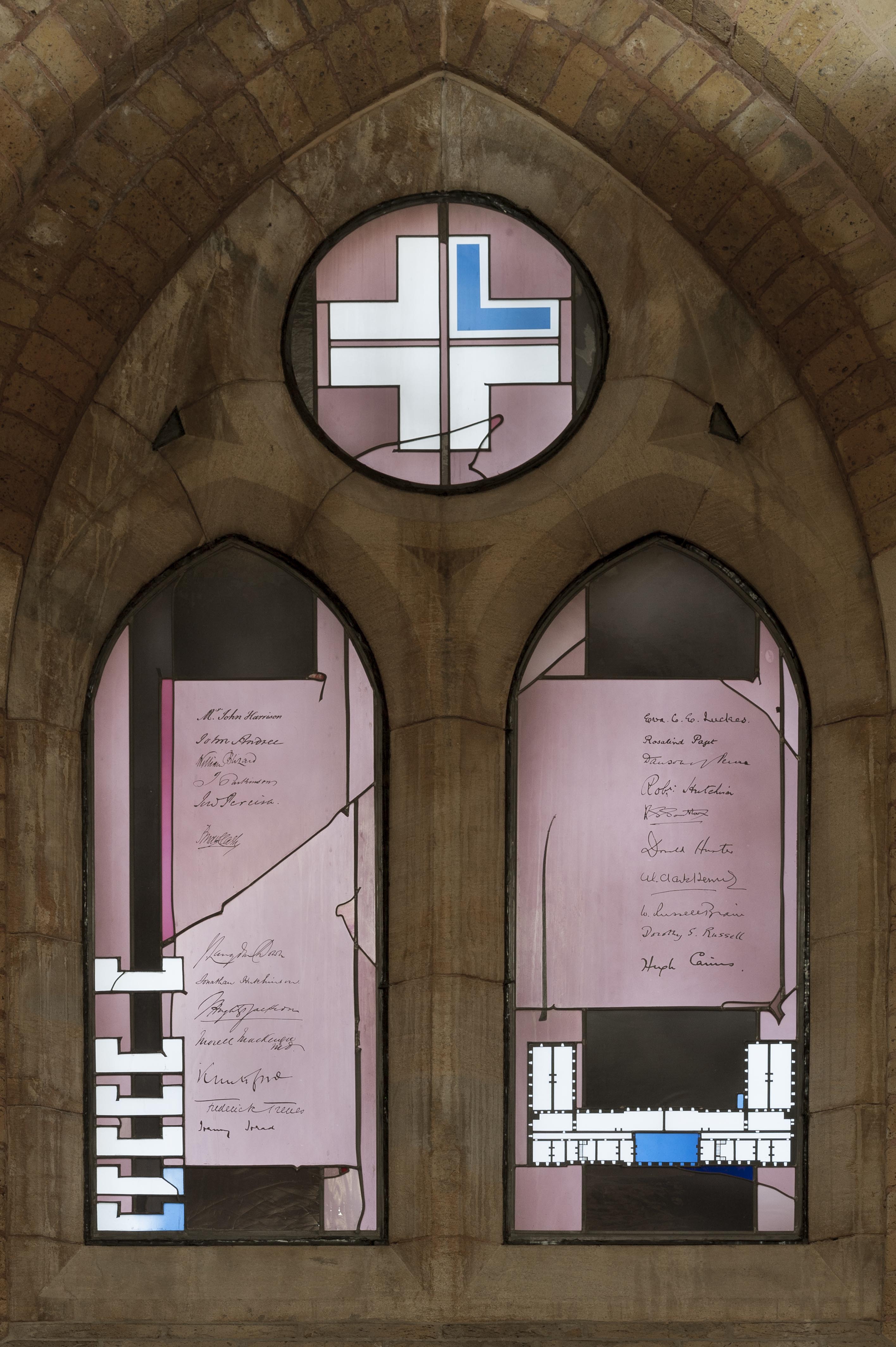
"id": 1094,
"title": "The London Hospital Window, December 2017",
"author": {
"id": 27,
"username": "DerekKendall"
},
"feature": {
"id": 1063,
"type": "Feature",
"geometry": {
"type": "MultiPolygon",
"coordinates": [
[
[
[
-0.060845062076888,
51.517232461665024
],
[
-0.060858061981046,
51.517297370705585
],
[
-0.060852072355982,
51.51729777282787
],
[
-0.060850777279358,
51.517292038613824
],
[
-0.060836585058279,
51.51723251416014
],
[
-0.060769976187858,
51.51723703364601
],
[
-0.060780310614954,
51.51729938465229
],
[
-0.060851422100426,
51.517294893689865
],
[
-0.060852072355982,
51.51729777282787
],
[
-0.060780756007888,
51.51730231203111
],
[
-0.060433008250066,
51.51733065140396
],
[
-0.060436612097579,
51.51734759826428
],
[
-0.060301835648786,
51.517358754570346
],
[
-0.060301267692063,
51.517334324990614
],
[
-0.060276367898553,
51.517334550322296
],
[
-0.060277606963858,
51.51738784759974
],
[
-0.060240911793285,
51.51738817966408
],
[
-0.060239603561777,
51.51733190531689
],
[
-0.060233709433579,
51.517328890670484
],
[
-0.060224675865392,
51.517324270305814
],
[
-0.06015408706542,
51.51728816646581
],
[
-0.060146994469308,
51.51728968696465
],
[
-0.06013876083629,
51.51729145207641
],
[
-0.060122232338685,
51.51729197252953
],
[
-0.060108489079552,
51.51729240527865
],
[
-0.060095089193358,
51.517291262708895
],
[
-0.060083703724374,
51.51729029190144
],
[
-0.060071883086905,
51.51728644484157
],
[
-0.060064540680754,
51.517282150214506
],
[
-0.060058159323826,
51.51727491549124
],
[
-0.060055164331108,
51.517266693493994
],
[
-0.060055745593556,
51.51725957394812
],
[
-0.060059185744876,
51.51725076287493
],
[
-0.060064720251821,
51.51724301807266
],
[
-0.060073694330703,
51.517237266202336
],
[
-0.060084008477322,
51.51723065542268
],
[
-0.060097749600684,
51.51722563043536
],
[
-0.060110820839004,
51.517222752616206
],
[
-0.060124043459833,
51.517219841466186
],
[
-0.060189323543314,
51.51717326471942
],
[
-0.060230524081512,
51.51717027080275
],
[
-0.060225029840865,
51.51714083975863
],
[
-0.060123966783513,
51.51714818367497
],
[
-0.060109355845798,
51.51706991604146
],
[
-0.060759990305139,
51.51701795039293
],
[
-0.060811901066283,
51.51703520053784
],
[
-0.060831243559519,
51.51714443032851
],
[
-0.060823879564995,
51.51714494230656
],
[
-0.060806280310304,
51.517037602197114
],
[
-0.060758637924026,
51.51702144683871
],
[
-0.060293715895444,
51.517058443881275
],
[
-0.060305285997092,
51.51711767437194
],
[
-0.060380056450023,
51.51711283445328
],
[
-0.060382025685871,
51.5171233828903
],
[
-0.060648003222123,
51.51710939602032
],
[
-0.060636939828746,
51.517031131377244
],
[
-0.060684659737861,
51.51702734366158
],
[
-0.060703670471419,
51.51713214159525
],
[
-0.060746477467265,
51.51712961322092
],
[
-0.060749678508541,
51.517150266791134
],
[
-0.060831225907887,
51.517144845854745
],
[
-0.060845060388772,
51.51723245093664
],
[
-0.060845062076888,
51.517232461665024
]
]
]
]
},
"properties": {
"b_number": "",
"b_name": "",
"street": "Stepney Way",
"address": "St Philip's Church Library and the Royal London Museum",
"feature_type": "WHITECHAPEL_BUILDING",
"count": 52,
"search_str": "St Philip's Church Library and the Royal London Museum"
},
"tags": []
},
"file": "https://surveyoflondon.org/media/uploads/features/1063/SoL%20Whitechapel%20101687.jpg",
"description": "",
"copyright": true,
"created": "2018-01-22"
}
]
}