HTTP 200 OK
Allow: GET, HEAD, OPTIONS
Content-Type: application/json
Vary: Accept
{
"count": 1747,
"next": "https://surveyoflondon.org/api/v1/images/?format=api&page=51",
"previous": "https://surveyoflondon.org/api/v1/images/?format=api&page=49",
"results": [
{
"id": 941,
"title": "St Philip’s Church, Architectural model, north elevation",
"author": {
"id": 203,
"username": "matthew"
},
"feature": {
"id": 1063,
"type": "Feature",
"geometry": {
"type": "MultiPolygon",
"coordinates": [
[
[
[
-0.060845062076888,
51.517232461665024
],
[
-0.060858061981046,
51.517297370705585
],
[
-0.060852072355982,
51.51729777282787
],
[
-0.060850777279358,
51.517292038613824
],
[
-0.060836585058279,
51.51723251416014
],
[
-0.060769976187858,
51.51723703364601
],
[
-0.060780310614954,
51.51729938465229
],
[
-0.060851422100426,
51.517294893689865
],
[
-0.060852072355982,
51.51729777282787
],
[
-0.060780756007888,
51.51730231203111
],
[
-0.060433008250066,
51.51733065140396
],
[
-0.060436612097579,
51.51734759826428
],
[
-0.060301835648786,
51.517358754570346
],
[
-0.060301267692063,
51.517334324990614
],
[
-0.060276367898553,
51.517334550322296
],
[
-0.060277606963858,
51.51738784759974
],
[
-0.060240911793285,
51.51738817966408
],
[
-0.060239603561777,
51.51733190531689
],
[
-0.060233709433579,
51.517328890670484
],
[
-0.060224675865392,
51.517324270305814
],
[
-0.06015408706542,
51.51728816646581
],
[
-0.060146994469308,
51.51728968696465
],
[
-0.06013876083629,
51.51729145207641
],
[
-0.060122232338685,
51.51729197252953
],
[
-0.060108489079552,
51.51729240527865
],
[
-0.060095089193358,
51.517291262708895
],
[
-0.060083703724374,
51.51729029190144
],
[
-0.060071883086905,
51.51728644484157
],
[
-0.060064540680754,
51.517282150214506
],
[
-0.060058159323826,
51.51727491549124
],
[
-0.060055164331108,
51.517266693493994
],
[
-0.060055745593556,
51.51725957394812
],
[
-0.060059185744876,
51.51725076287493
],
[
-0.060064720251821,
51.51724301807266
],
[
-0.060073694330703,
51.517237266202336
],
[
-0.060084008477322,
51.51723065542268
],
[
-0.060097749600684,
51.51722563043536
],
[
-0.060110820839004,
51.517222752616206
],
[
-0.060124043459833,
51.517219841466186
],
[
-0.060189323543314,
51.51717326471942
],
[
-0.060230524081512,
51.51717027080275
],
[
-0.060225029840865,
51.51714083975863
],
[
-0.060123966783513,
51.51714818367497
],
[
-0.060109355845798,
51.51706991604146
],
[
-0.060759990305139,
51.51701795039293
],
[
-0.060811901066283,
51.51703520053784
],
[
-0.060831243559519,
51.51714443032851
],
[
-0.060823879564995,
51.51714494230656
],
[
-0.060806280310304,
51.517037602197114
],
[
-0.060758637924026,
51.51702144683871
],
[
-0.060293715895444,
51.517058443881275
],
[
-0.060305285997092,
51.51711767437194
],
[
-0.060380056450023,
51.51711283445328
],
[
-0.060382025685871,
51.5171233828903
],
[
-0.060648003222123,
51.51710939602032
],
[
-0.060636939828746,
51.517031131377244
],
[
-0.060684659737861,
51.51702734366158
],
[
-0.060703670471419,
51.51713214159525
],
[
-0.060746477467265,
51.51712961322092
],
[
-0.060749678508541,
51.517150266791134
],
[
-0.060831225907887,
51.517144845854745
],
[
-0.060845060388772,
51.51723245093664
],
[
-0.060845062076888,
51.517232461665024
]
]
]
]
},
"properties": {
"b_number": "",
"b_name": "",
"street": "Stepney Way",
"address": "St Philip's Church Library and the Royal London Museum",
"feature_type": "WHITECHAPEL_BUILDING",
"count": 52,
"search_str": "St Philip's Church Library and the Royal London Museum"
},
"tags": []
},
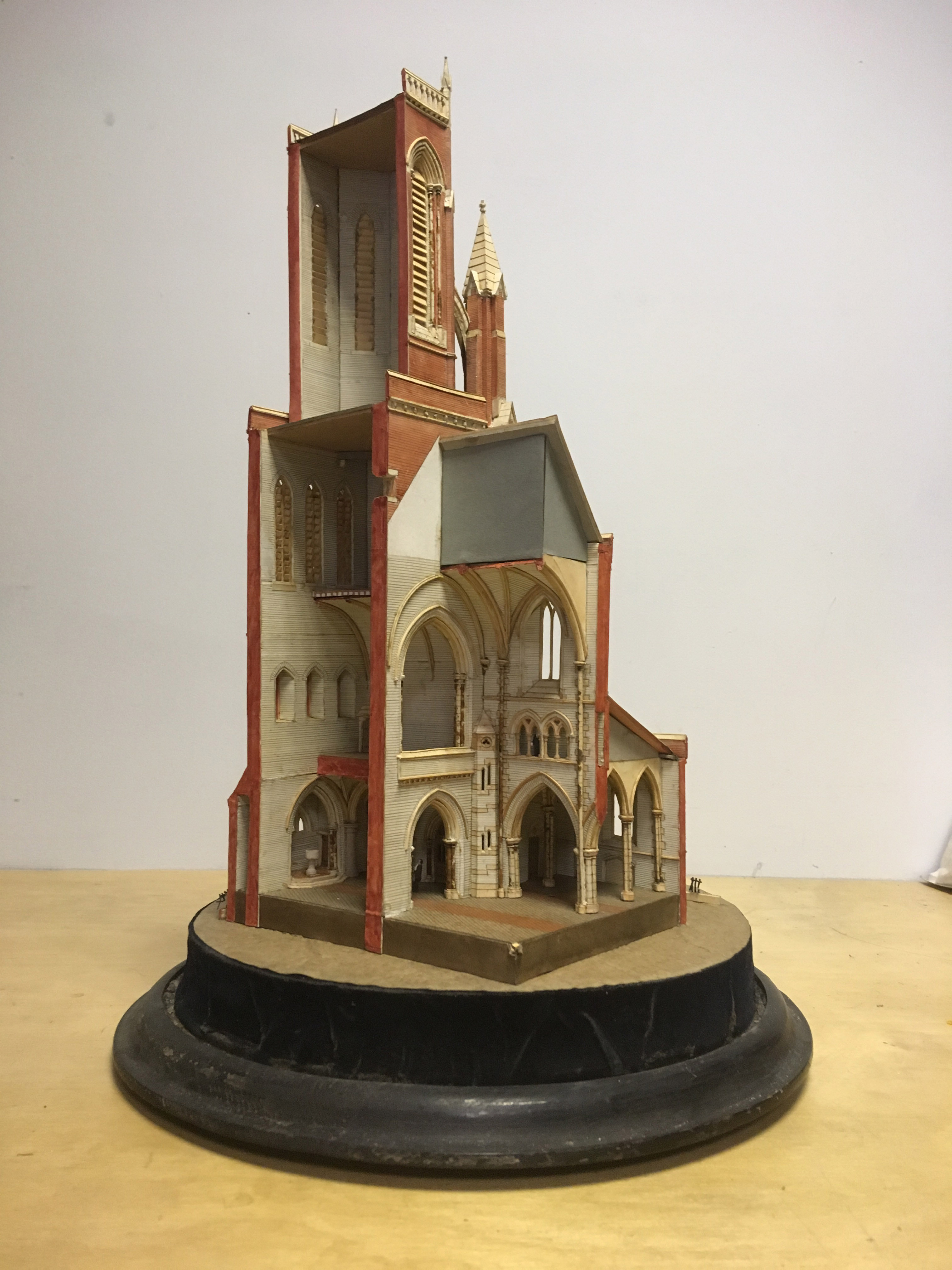
"file": "https://surveyoflondon.org/media/uploads/features/1063/St%20Philip's%20Model%202.JPG",
"description": "Architectural model for St Philip’s Church, made by the prominent model-maker C. N. Thwaite, c. 1888. ",
"copyright": false,
"created": "2017-10-20"
},
{
"id": 942,
"title": "St Philip’s Church, Architectural model, view of interior",
"author": {
"id": 203,
"username": "matthew"
},
"feature": {
"id": 1063,
"type": "Feature",
"geometry": {
"type": "MultiPolygon",
"coordinates": [
[
[
[
-0.060845062076888,
51.517232461665024
],
[
-0.060858061981046,
51.517297370705585
],
[
-0.060852072355982,
51.51729777282787
],
[
-0.060850777279358,
51.517292038613824
],
[
-0.060836585058279,
51.51723251416014
],
[
-0.060769976187858,
51.51723703364601
],
[
-0.060780310614954,
51.51729938465229
],
[
-0.060851422100426,
51.517294893689865
],
[
-0.060852072355982,
51.51729777282787
],
[
-0.060780756007888,
51.51730231203111
],
[
-0.060433008250066,
51.51733065140396
],
[
-0.060436612097579,
51.51734759826428
],
[
-0.060301835648786,
51.517358754570346
],
[
-0.060301267692063,
51.517334324990614
],
[
-0.060276367898553,
51.517334550322296
],
[
-0.060277606963858,
51.51738784759974
],
[
-0.060240911793285,
51.51738817966408
],
[
-0.060239603561777,
51.51733190531689
],
[
-0.060233709433579,
51.517328890670484
],
[
-0.060224675865392,
51.517324270305814
],
[
-0.06015408706542,
51.51728816646581
],
[
-0.060146994469308,
51.51728968696465
],
[
-0.06013876083629,
51.51729145207641
],
[
-0.060122232338685,
51.51729197252953
],
[
-0.060108489079552,
51.51729240527865
],
[
-0.060095089193358,
51.517291262708895
],
[
-0.060083703724374,
51.51729029190144
],
[
-0.060071883086905,
51.51728644484157
],
[
-0.060064540680754,
51.517282150214506
],
[
-0.060058159323826,
51.51727491549124
],
[
-0.060055164331108,
51.517266693493994
],
[
-0.060055745593556,
51.51725957394812
],
[
-0.060059185744876,
51.51725076287493
],
[
-0.060064720251821,
51.51724301807266
],
[
-0.060073694330703,
51.517237266202336
],
[
-0.060084008477322,
51.51723065542268
],
[
-0.060097749600684,
51.51722563043536
],
[
-0.060110820839004,
51.517222752616206
],
[
-0.060124043459833,
51.517219841466186
],
[
-0.060189323543314,
51.51717326471942
],
[
-0.060230524081512,
51.51717027080275
],
[
-0.060225029840865,
51.51714083975863
],
[
-0.060123966783513,
51.51714818367497
],
[
-0.060109355845798,
51.51706991604146
],
[
-0.060759990305139,
51.51701795039293
],
[
-0.060811901066283,
51.51703520053784
],
[
-0.060831243559519,
51.51714443032851
],
[
-0.060823879564995,
51.51714494230656
],
[
-0.060806280310304,
51.517037602197114
],
[
-0.060758637924026,
51.51702144683871
],
[
-0.060293715895444,
51.517058443881275
],
[
-0.060305285997092,
51.51711767437194
],
[
-0.060380056450023,
51.51711283445328
],
[
-0.060382025685871,
51.5171233828903
],
[
-0.060648003222123,
51.51710939602032
],
[
-0.060636939828746,
51.517031131377244
],
[
-0.060684659737861,
51.51702734366158
],
[
-0.060703670471419,
51.51713214159525
],
[
-0.060746477467265,
51.51712961322092
],
[
-0.060749678508541,
51.517150266791134
],
[
-0.060831225907887,
51.517144845854745
],
[
-0.060845060388772,
51.51723245093664
],
[
-0.060845062076888,
51.517232461665024
]
]
]
]
},
"properties": {
"b_number": "",
"b_name": "",
"street": "Stepney Way",
"address": "St Philip's Church Library and the Royal London Museum",
"feature_type": "WHITECHAPEL_BUILDING",
"count": 52,
"search_str": "St Philip's Church Library and the Royal London Museum"
},
"tags": []
},
"file": "https://surveyoflondon.org/media/uploads/features/1063/St%20Philips%20Model.JPG",
"description": "Architectural model for St Philip’s Church, made by the prominent model-maker C. N. Thwaite, c. 1888.",
"copyright": false,
"created": "2017-10-20"
},
{
"id": 125,
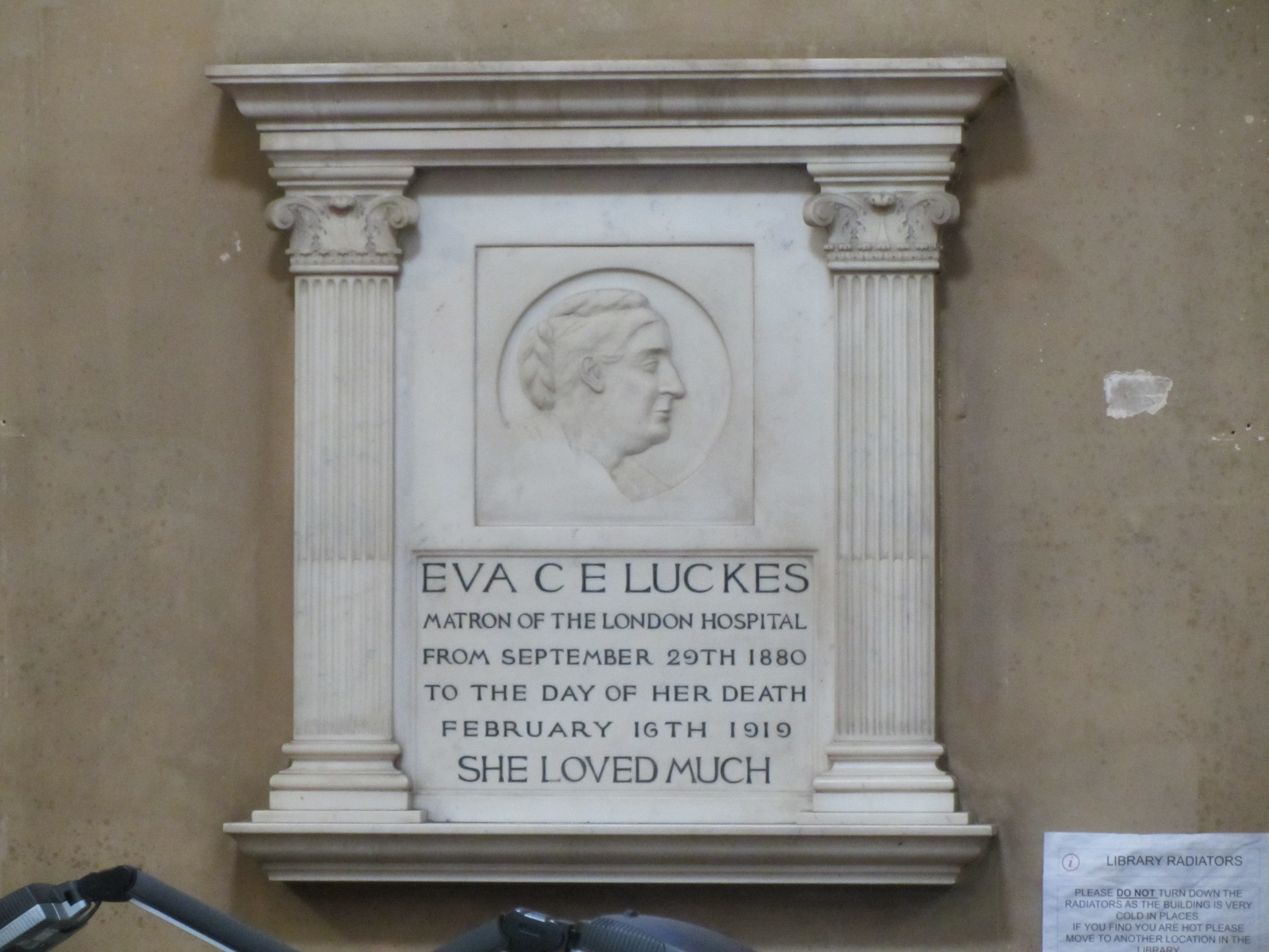
"title": "Monument to Eva Luckes, hospital matron, on the north wall",
"author": {
"id": 11,
"username": "amyspencer"
},
"feature": {
"id": 1063,
"type": "Feature",
"geometry": {
"type": "MultiPolygon",
"coordinates": [
[
[
[
-0.060845062076888,
51.517232461665024
],
[
-0.060858061981046,
51.517297370705585
],
[
-0.060852072355982,
51.51729777282787
],
[
-0.060850777279358,
51.517292038613824
],
[
-0.060836585058279,
51.51723251416014
],
[
-0.060769976187858,
51.51723703364601
],
[
-0.060780310614954,
51.51729938465229
],
[
-0.060851422100426,
51.517294893689865
],
[
-0.060852072355982,
51.51729777282787
],
[
-0.060780756007888,
51.51730231203111
],
[
-0.060433008250066,
51.51733065140396
],
[
-0.060436612097579,
51.51734759826428
],
[
-0.060301835648786,
51.517358754570346
],
[
-0.060301267692063,
51.517334324990614
],
[
-0.060276367898553,
51.517334550322296
],
[
-0.060277606963858,
51.51738784759974
],
[
-0.060240911793285,
51.51738817966408
],
[
-0.060239603561777,
51.51733190531689
],
[
-0.060233709433579,
51.517328890670484
],
[
-0.060224675865392,
51.517324270305814
],
[
-0.06015408706542,
51.51728816646581
],
[
-0.060146994469308,
51.51728968696465
],
[
-0.06013876083629,
51.51729145207641
],
[
-0.060122232338685,
51.51729197252953
],
[
-0.060108489079552,
51.51729240527865
],
[
-0.060095089193358,
51.517291262708895
],
[
-0.060083703724374,
51.51729029190144
],
[
-0.060071883086905,
51.51728644484157
],
[
-0.060064540680754,
51.517282150214506
],
[
-0.060058159323826,
51.51727491549124
],
[
-0.060055164331108,
51.517266693493994
],
[
-0.060055745593556,
51.51725957394812
],
[
-0.060059185744876,
51.51725076287493
],
[
-0.060064720251821,
51.51724301807266
],
[
-0.060073694330703,
51.517237266202336
],
[
-0.060084008477322,
51.51723065542268
],
[
-0.060097749600684,
51.51722563043536
],
[
-0.060110820839004,
51.517222752616206
],
[
-0.060124043459833,
51.517219841466186
],
[
-0.060189323543314,
51.51717326471942
],
[
-0.060230524081512,
51.51717027080275
],
[
-0.060225029840865,
51.51714083975863
],
[
-0.060123966783513,
51.51714818367497
],
[
-0.060109355845798,
51.51706991604146
],
[
-0.060759990305139,
51.51701795039293
],
[
-0.060811901066283,
51.51703520053784
],
[
-0.060831243559519,
51.51714443032851
],
[
-0.060823879564995,
51.51714494230656
],
[
-0.060806280310304,
51.517037602197114
],
[
-0.060758637924026,
51.51702144683871
],
[
-0.060293715895444,
51.517058443881275
],
[
-0.060305285997092,
51.51711767437194
],
[
-0.060380056450023,
51.51711283445328
],
[
-0.060382025685871,
51.5171233828903
],
[
-0.060648003222123,
51.51710939602032
],
[
-0.060636939828746,
51.517031131377244
],
[
-0.060684659737861,
51.51702734366158
],
[
-0.060703670471419,
51.51713214159525
],
[
-0.060746477467265,
51.51712961322092
],
[
-0.060749678508541,
51.517150266791134
],
[
-0.060831225907887,
51.517144845854745
],
[
-0.060845060388772,
51.51723245093664
],
[
-0.060845062076888,
51.517232461665024
]
]
]
]
},
"properties": {
"b_number": "",
"b_name": "",
"street": "Stepney Way",
"address": "St Philip's Church Library and the Royal London Museum",
"feature_type": "WHITECHAPEL_BUILDING",
"count": 52,
"search_str": "St Philip's Church Library and the Royal London Museum"
},
"tags": []
},
"file": "https://surveyoflondon.org/media/uploads/features/1063/IMG_8379.JPG",
"description": "",
"copyright": false,
"created": "2016-07-13"
},
{
"id": 1505,
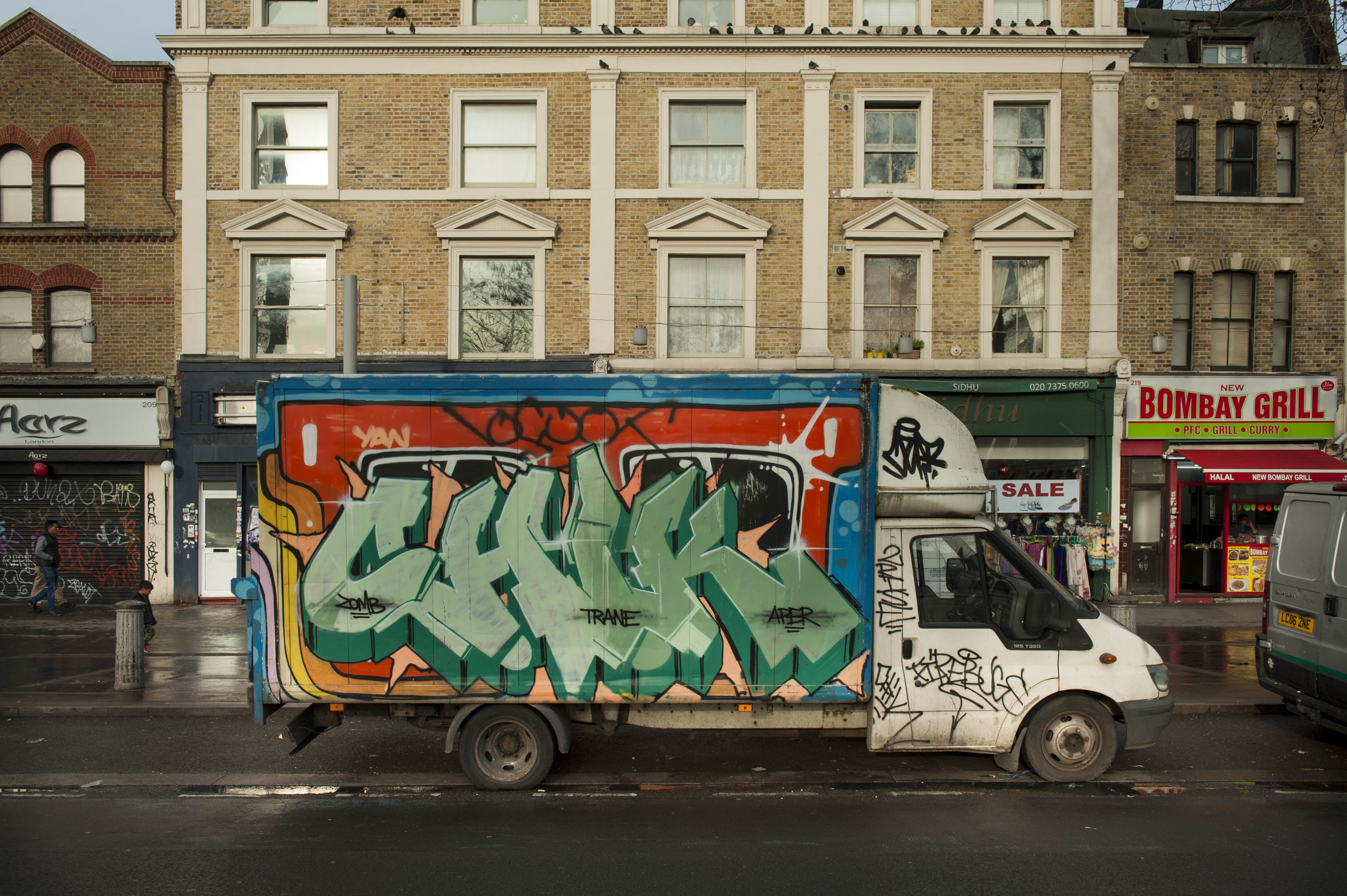
"title": "213-217 Whitechapel Road with van, December 2018",
"author": {
"id": 27,
"username": "DerekKendall"
},
"feature": {
"id": 478,
"type": "Feature",
"geometry": {
"type": "MultiPolygon",
"coordinates": [
[
[
[
-0.062132379354576,
51.51896430028482
],
[
-0.062012923245552,
51.518773774940634
],
[
-0.062074527748064,
51.51876109111685
],
[
-0.062186092786667,
51.5189503233719
],
[
-0.062132379354576,
51.51896430028482
]
]
]
]
},
"properties": {
"b_number": "215",
"b_name": "",
"street": "Whitechapel Road",
"address": "215 Whitechapel Road",
"feature_type": "WHITECHAPEL_BUILDING",
"count": 3,
"search_str": "215 Whitechapel Road"
},
"tags": []
},
"file": "https://surveyoflondon.org/media/uploads/features/478/SoL%20Whitechapel%20102554.jpg",
"description": "",
"copyright": true,
"created": "2019-01-09"
},
{
"id": 1509,
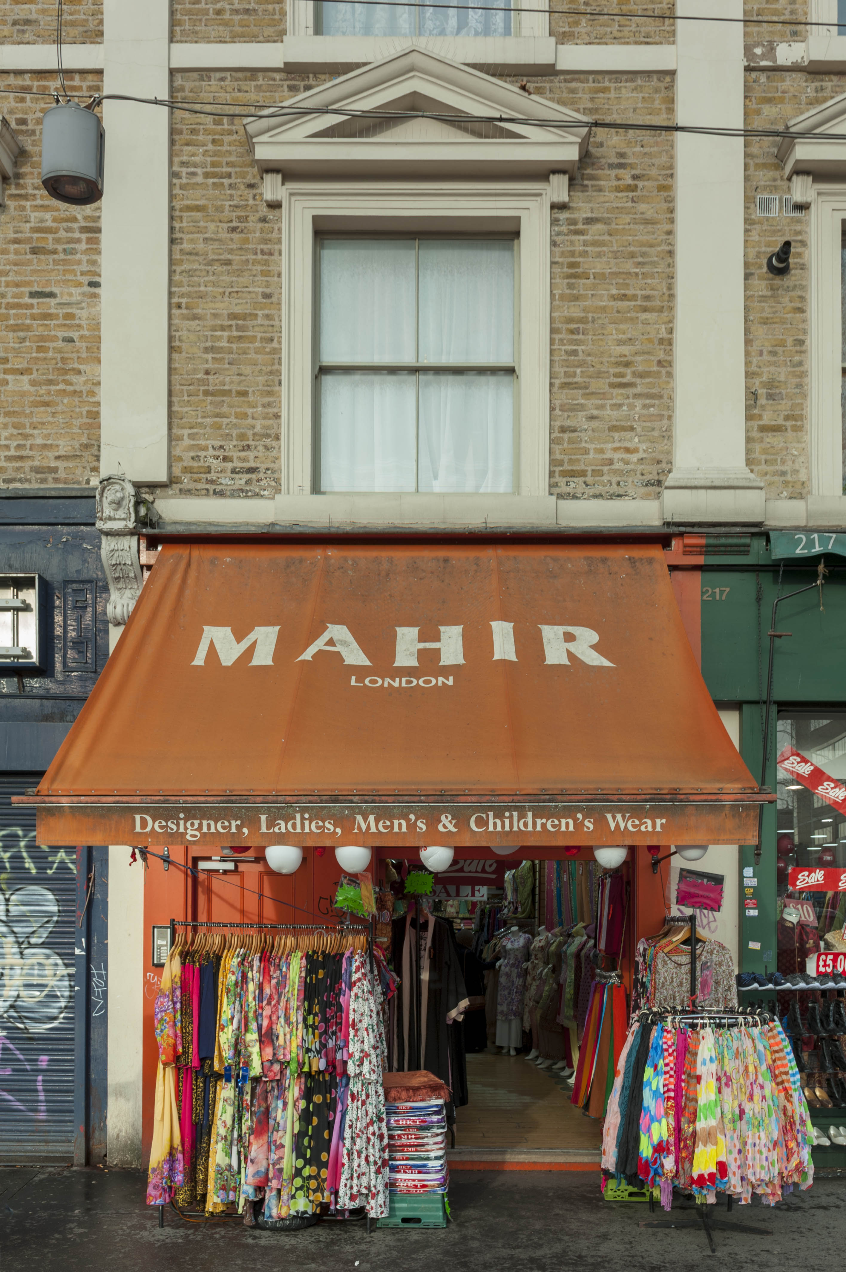
"title": "215 Whitechapel Road, December 2018",
"author": {
"id": 27,
"username": "DerekKendall"
},
"feature": {
"id": 478,
"type": "Feature",
"geometry": {
"type": "MultiPolygon",
"coordinates": [
[
[
[
-0.062132379354576,
51.51896430028482
],
[
-0.062012923245552,
51.518773774940634
],
[
-0.062074527748064,
51.51876109111685
],
[
-0.062186092786667,
51.5189503233719
],
[
-0.062132379354576,
51.51896430028482
]
]
]
]
},
"properties": {
"b_number": "215",
"b_name": "",
"street": "Whitechapel Road",
"address": "215 Whitechapel Road",
"feature_type": "WHITECHAPEL_BUILDING",
"count": 3,
"search_str": "215 Whitechapel Road"
},
"tags": []
},
"file": "https://surveyoflondon.org/media/uploads/features/478/SoL%20Whitechapel%20102566.jpg",
"description": "",
"copyright": true,
"created": "2019-01-09"
},
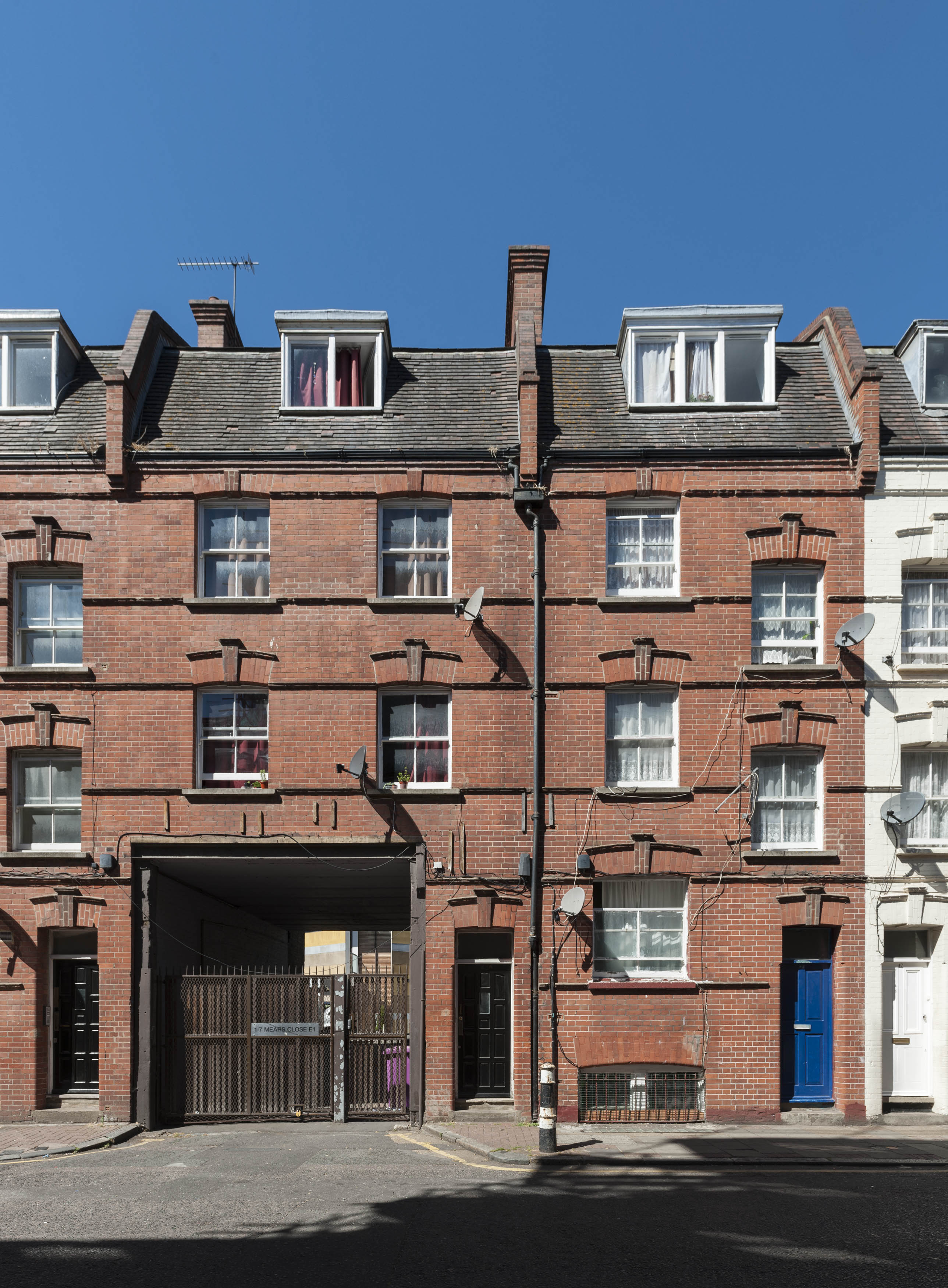
{
"id": 1322,
"title": "Settles Street, with entrance to Mears Close in 2018",
"author": {
"id": 27,
"username": "DerekKendall"
},
"feature": {
"id": 747,
"type": "Feature",
"geometry": {
"type": "MultiPolygon",
"coordinates": [
[
[
[
-0.064677853271033,
51.516743160690204
],
[
-0.06455605120814,
51.5167511338842
],
[
-0.064551505578996,
51.51671107682754
],
[
-0.064673430956566,
51.51670428724732
],
[
-0.064673445521557,
51.516704290333976
],
[
-0.064673442192478,
51.51670429048104
],
[
-0.064677853271033,
51.516743160690204
]
]
]
]
},
"properties": {
"b_number": "68",
"b_name": "",
"street": "Settles Street",
"address": "47-55 Settles Street",
"feature_type": "WHITECHAPEL_BUILDING",
"count": 1,
"search_str": "47-55 Settles Street"
},
"tags": []
},
"file": "https://surveyoflondon.org/media/uploads/features/747/SoL%20Whitechapel%20102081.jpg",
"description": "",
"copyright": true,
"created": "2018-08-13"
},
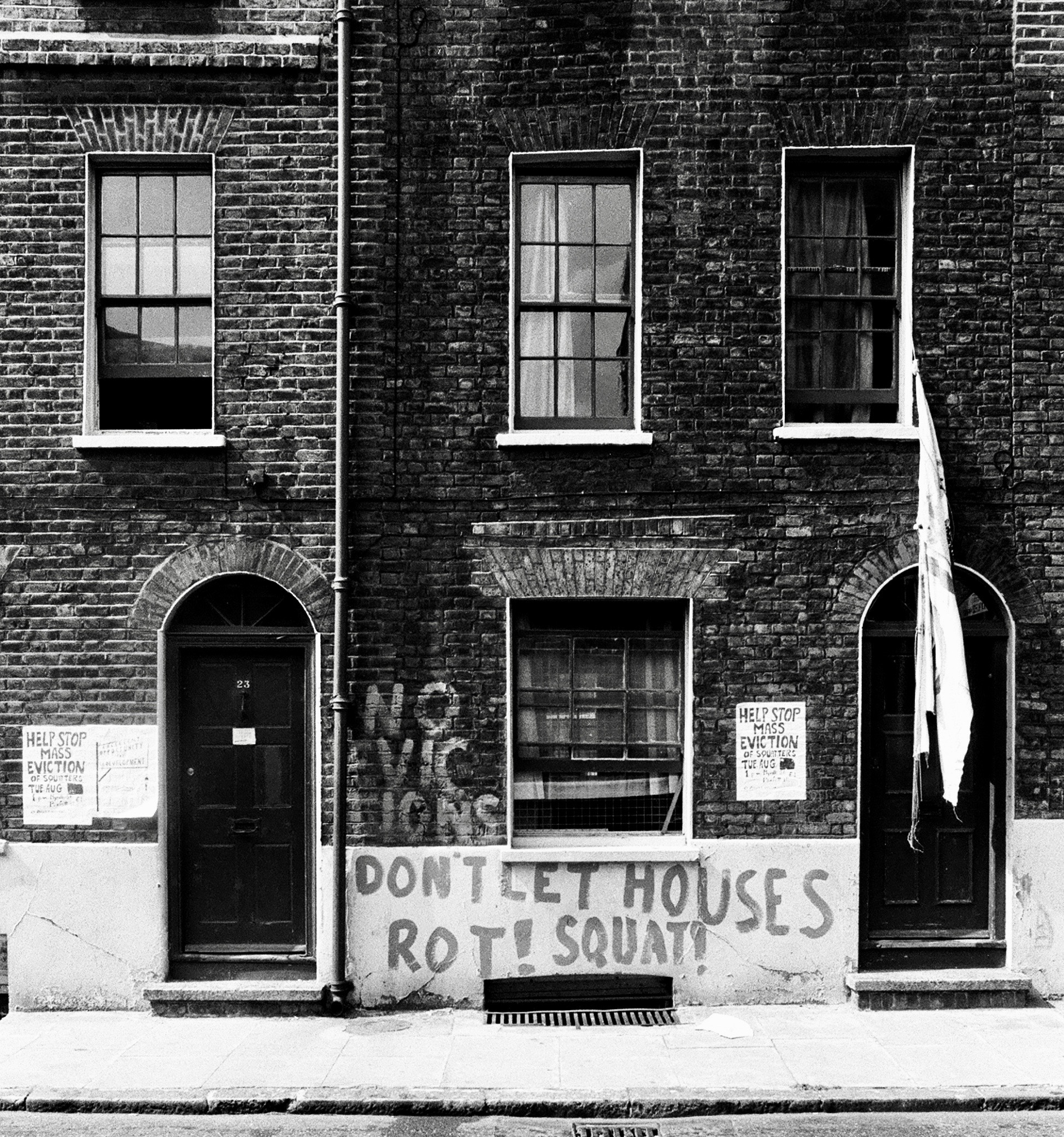
{
"id": 1411,
"title": "23-25 Parfett Street in the early 1970s (photograph by Dan Cruickshank)",
"author": {
"id": 268,
"username": "DanCruickshank"
},
"feature": {
"id": 722,
"type": "Feature",
"geometry": {
"type": "MultiPolygon",
"coordinates": [
[
[
[
-0.064093264697669,
51.51647140916488
],
[
-0.063971196795808,
51.51648182506738
],
[
-0.063912667218243,
51.51622120770483
],
[
-0.064035065630637,
51.51621070018117
],
[
-0.064093264697669,
51.51647140916488
]
]
]
]
},
"properties": {
"b_number": "23-35",
"b_name": "",
"street": "Parfett Street",
"address": "23-35 Parfett Street",
"feature_type": "WHITECHAPEL_BUILDING",
"count": 1,
"search_str": "23-35 Parfett Street"
},
"tags": []
},
"file": "https://surveyoflondon.org/media/uploads/features/722/00250002.jpg",
"description": "",
"copyright": true,
"created": "2018-11-13"
},
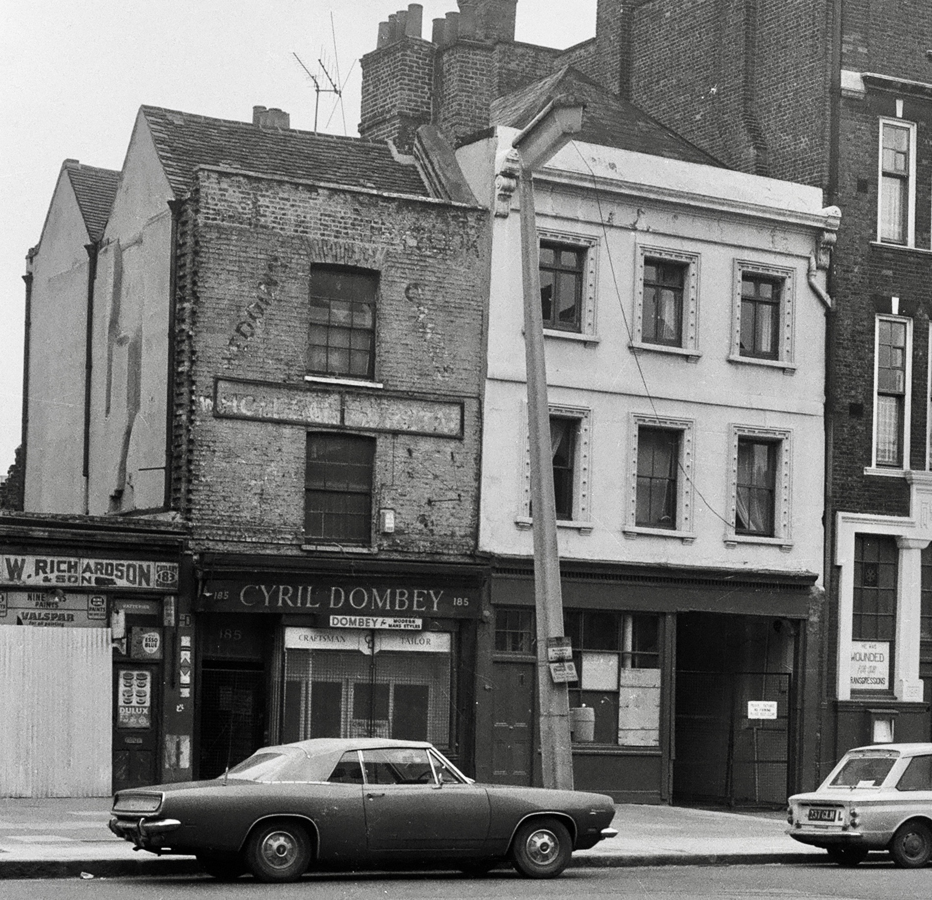
{
"id": 1445,
"title": "185 and 187 Whitechapel Road in the early 1970s (photograph by Dan Cruickshank)",
"author": {
"id": 268,
"username": "DanCruickshank"
},
"feature": {
"id": 454,
"type": "Feature",
"geometry": {
"type": "MultiPolygon",
"coordinates": [
[
[
[
-0.063667260850097,
51.51848862393991
],
[
-0.06360763059881,
51.51850554866203
],
[
-0.063589964404232,
51.51848132170112
],
[
-0.063552789553256,
51.518491872933986
],
[
-0.063496378982988,
51.5184145126676
],
[
-0.063594819394982,
51.5183863647881
],
[
-0.063667260850097,
51.51848862393991
]
]
]
]
},
"properties": {
"b_number": "187",
"b_name": "",
"street": "Whitechapel Road",
"address": "187 Whitechapel Road",
"feature_type": "WHITECHAPEL_BUILDING",
"count": 4,
"search_str": "187 Whitechapel Road"
},
"tags": [
"William Rowland"
]
},
"file": "https://surveyoflondon.org/media/uploads/features/454/00490033.jpg",
"description": "",
"copyright": true,
"created": "2018-11-16"
},
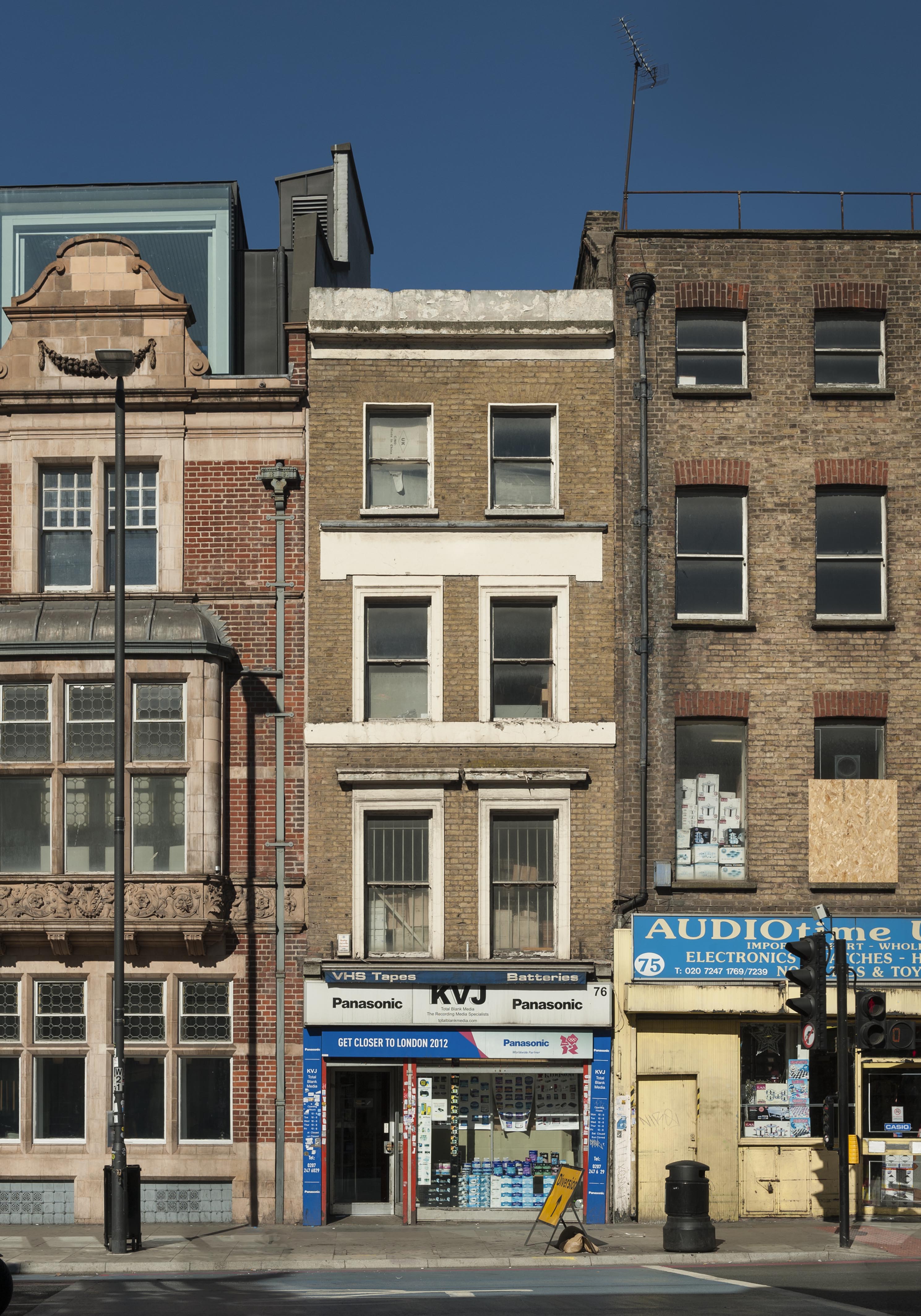
{
"id": 1369,
"title": "76 Whitechapel High Street in 2018",
"author": {
"id": 27,
"username": "DerekKendall"
},
"feature": {
"id": 315,
"type": "Feature",
"geometry": {
"type": "MultiPolygon",
"coordinates": [
[
[
[
-0.070001262506134,
51.51611420182703
],
[
-0.069925683789541,
51.516033038765876
],
[
-0.069976822772036,
51.516012970027454
],
[
-0.070049788081591,
51.51609931840464
],
[
-0.070001262506134,
51.51611420182703
]
]
]
]
},
"properties": {
"b_number": "76",
"b_name": "76 Whitechapel High Street",
"street": "Whitechapel High Street",
"address": "76 Whitechapel High Street",
"feature_type": "WHITECHAPEL_BUILDING",
"count": 9,
"search_str": "76 Whitechapel High Street"
},
"tags": []
},
"file": "https://surveyoflondon.org/media/uploads/features/315/SoL%20Whitechapel%20102227.jpg",
"description": "",
"copyright": true,
"created": "2018-10-10"
},
{
"id": 1346,
"title": "6 and 6A Commercial Street in 2018",
"author": {
"id": 27,
"username": "DerekKendall"
},
"feature": {
"id": 401,
"type": "Feature",
"geometry": {
"type": "MultiPolygon",
"coordinates": [
[
[
[
-0.071960912758108,
51.51579721323616
],
[
-0.072122718131682,
51.51573277413889
],
[
-0.072182196785185,
51.51579475837268
],
[
-0.072182190872528,
51.51579476187234
],
[
-0.072252467610663,
51.515883929581804
],
[
-0.072190771248314,
51.51590695900495
],
[
-0.072135744377472,
51.51584957216294
],
[
-0.071993909326822,
51.51590251474903
],
[
-0.071968331310797,
51.515875839608334
],
[
-0.072018383520243,
51.51585714925005
],
[
-0.071960912758108,
51.51579721323616
]
]
]
]
},
"properties": {
"b_number": "6 and 6a",
"b_name": "6 and 6a Commercial Street",
"street": "Commercial Street",
"address": "6 and 6a Commercial Street",
"feature_type": "WHITECHAPEL_BUILDING",
"count": 3,
"search_str": "6 and 6a Commercial Street"
},
"tags": []
},
"file": "https://surveyoflondon.org/media/uploads/features/401/SoL%20Whitechapel%20102196.jpg",
"description": "",
"copyright": true,
"created": "2018-10-10"
},
{
"id": 1400,
"title": "The Alexandra Wing of the London Hospital (its west end) in the early 1970s (photograph by Dan Cruickshank)",
"author": {
"id": 268,
"username": "DanCruickshank"
},
"feature": {
"id": 1233,
"type": "Feature",
"geometry": {
"type": "MultiPolygon",
"coordinates": [
[
[
[
-0.06071898744648,
51.51847914149303
],
[
-0.060500593175314,
51.518078725457706
],
[
-0.060677507453823,
51.51804024673126
],
[
-0.060671223402208,
51.51802540127174
],
[
-0.06085005314625,
51.51798836558531
],
[
-0.060812945436909,
51.517920331266545
],
[
-0.060917351413957,
51.51789816547845
],
[
-0.060931197156673,
51.517923550570345
],
[
-0.061010610691191,
51.51790669069574
],
[
-0.061049931220856,
51.51797878143679
],
[
-0.061137385429043,
51.517960214409946
],
[
-0.061165435766445,
51.51801164191679
],
[
-0.061088209745711,
51.51802803744632
],
[
-0.061113189374754,
51.51807608265291
],
[
-0.061137480851473,
51.51807171260715
],
[
-0.061278658301599,
51.518317481305246
],
[
-0.061327004153713,
51.518306671582295
],
[
-0.061361885271019,
51.51836739382176
],
[
-0.061297703445739,
51.518381744329986
],
[
-0.061323145093769,
51.518424980241626
],
[
-0.060865969954968,
51.518532183713546
],
[
-0.060820667002295,
51.51845590786164
],
[
-0.06071898744648,
51.51847914149303
]
]
]
]
},
"properties": {
"b_number": "",
"b_name": "",
"street": "Turner Street",
"address": "The Royal London Dental Hospital",
"feature_type": "WHITECHAPEL_BUILDING",
"count": 9,
"search_str": "The Royal London Dental Hospital"
},
"tags": []
},
"file": "https://surveyoflondon.org/media/uploads/features/1233/00240002.jpg",
"description": "",
"copyright": true,
"created": "2018-11-13"
},
{
"id": 426,
"title": "Aldgate Bars Underpass, 2011",
"author": {
"id": 66,
"username": "ddavid212"
},
"feature": {
"id": 412,
"type": "Feature",
"geometry": {
"type": "MultiPolygon",
"coordinates": [
[
[
[
-0.074012377775073,
51.51467748481298
],
[
-0.073983102664757,
51.51468897957842
],
[
-0.073892347597563,
51.51462748821428
],
[
-0.073737883579577,
51.514681742397556
],
[
-0.07371880686675,
51.51466591527795
],
[
-0.073900376177773,
51.51460205045548
],
[
-0.074012377775073,
51.51467748481298
]
]
]
]
},
"properties": {
"b_number": "141 to 143",
"b_name": "hoarding on site of 141-143 Whitechapel High Street",
"street": "Whitechapel High Street",
"address": "141-143 Whitechapel High Street",
"feature_type": "WHITECHAPEL_BUILDING",
"count": 8,
"search_str": "hoarding on site of 141-143 Whitechapel High Street"
},
"tags": []
},
"file": "https://surveyoflondon.org/media/uploads/features/412/subway5.JPG",
"description": "Situated below the site of the former Aldgate Bars and present-day Whitechapel-Aldgate junction, this underpass was closed in 2015.",
"copyright": false,
"created": "2016-10-23"
},
{
"id": 18,
"title": "65A-71 Whitechapel High Street",
"author": {
"id": 27,
"username": "DerekKendall"
},
"feature": {
"id": 165,
"type": "Feature",
"geometry": {
"type": "MultiPolygon",
"coordinates": [
[
[
[
-0.069889119521129,
51.51579713749756
],
[
-0.069830541484445,
51.51582381203128
],
[
-0.069748230427938,
51.51575345083506
],
[
-0.069809844959613,
51.51573576424656
],
[
-0.069889119521129,
51.51579713749756
]
]
]
]
},
"properties": {
"b_number": "65",
"b_name": "",
"street": "Whitechapel High Street",
"address": "65 Whitechapel High Street",
"feature_type": "WHITECHAPEL_BUILDING",
"count": 4,
"search_str": "65 Whitechapel High Street"
},
"tags": []
},
"file": "https://surveyoflondon.org/media/uploads/features/165/SoL%20Whitechapel100361.jpg",
"description": "",
"copyright": true,
"created": null
},
{
"id": 1385,
"title": "Marks of the Lane, 59 Wentworth Street, 1978",
"author": {
"id": 252,
"username": "mark3"
},
"feature": {
"id": 1742,
"type": "Feature",
"geometry": {
"type": "MultiPolygon",
"coordinates": [
[
[
[
-0.076387722492951,
51.516257872286374
],
[
-0.07580974439088,
51.51649846859169
],
[
-0.075744693982384,
51.51651411423466
],
[
-0.075332716624042,
51.51665341173461
],
[
-0.075277819023276,
51.516667372076085
],
[
-0.074429584483841,
51.51681699796736
],
[
-0.074402209988697,
51.516763242480046
],
[
-0.075229889371391,
51.51661092868018
],
[
-0.074836715281391,
51.516135055700595
],
[
-0.074917049606191,
51.51611135328064
],
[
-0.075312012611936,
51.51658616747119
],
[
-0.075695505281233,
51.51646463519818
],
[
-0.075779072585588,
51.51644696856364
],
[
-0.076328753388395,
51.516209038390684
],
[
-0.076387722492951,
51.516257872286374
]
]
]
]
},
"properties": {
"b_number": "",
"b_name": "",
"street": "",
"address": "Petticoat Lane Market",
"feature_type": "PLACE",
"count": 39,
"search_str": "Petticoat Lane Market"
},
"tags": []
},
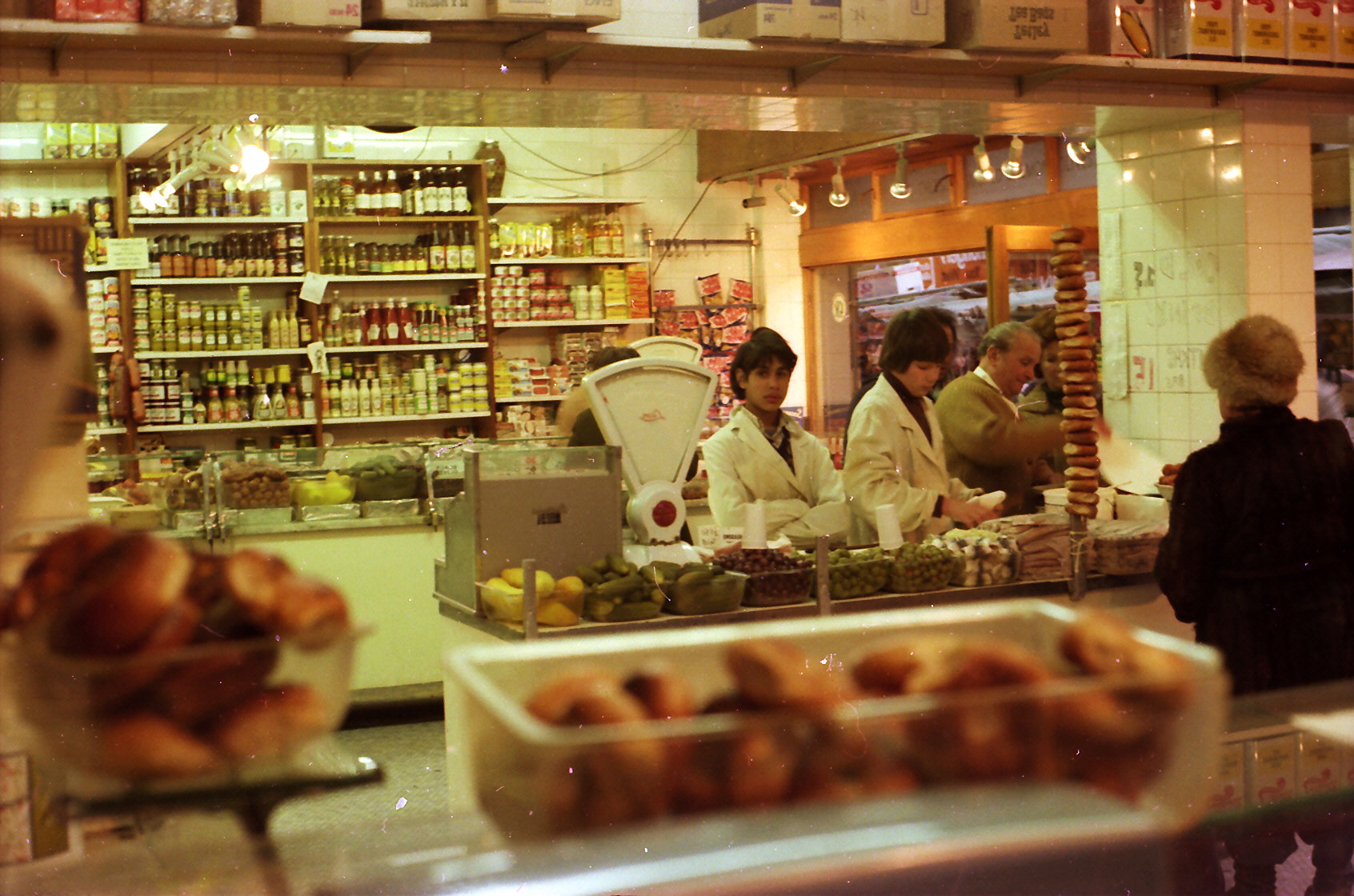
"file": "https://surveyoflondon.org/media/uploads/features/1742/Marks%20deli%201978_0012.jpg",
"description": "Selling bagels and lutkas on a Sunday morning. ",
"copyright": false,
"created": "2018-10-28"
},
{
"id": 1507,
"title": "Shopfront at 223-225 Whitechapel Road, December 2018",
"author": {
"id": 27,
"username": "DerekKendall"
},
"feature": {
"id": 482,
"type": "Feature",
"geometry": {
"type": "MultiPolygon",
"coordinates": [
[
[
[
-0.061827120520907,
51.51907516384937
],
[
-0.061711209214386,
51.51910346447861
],
[
-0.061717737685342,
51.51911541982897
],
[
-0.061673248411225,
51.519127455753186
],
[
-0.061654676881271,
51.51909351284264
],
[
-0.061732040582857,
51.51907341986276
],
[
-0.061701309729407,
51.51902291286971
],
[
-0.061627152177638,
51.51904010908138
],
[
-0.061621779416406,
51.51904125458228
],
[
-0.061530437466549,
51.518879896569096
],
[
-0.061535850449336,
51.51887799011652
],
[
-0.061668902792321,
51.51884677475007
],
[
-0.061694748739827,
51.51885171742009
],
[
-0.061827120520907,
51.51907516384937
]
]
]
]
},
"properties": {
"b_number": "223-225",
"b_name": "",
"street": "Whitechapel Road",
"address": "223-225 Whitechapel Road with 2-6 Fulbourne Street",
"feature_type": "WHITECHAPEL_BUILDING",
"count": 4,
"search_str": "223-225 Whitechapel Road with 2-6 Fulbourne Street"
},
"tags": []
},
"file": "https://surveyoflondon.org/media/uploads/features/482/SoL%20Whitechapel%20102562.jpg",
"description": "",
"copyright": true,
"created": "2019-01-09"
},
{
"id": 991,
"title": "Auction Catalogue dated 22.6.1885,",
"author": {
"id": 131,
"username": "Tomreed"
},
"feature": {
"id": 169,
"type": "Feature",
"geometry": {
"type": "MultiPolygon",
"coordinates": [
[
[
[
-0.069651046927799,
51.515906748996194
],
[
-0.069592567052389,
51.51593286484659
],
[
-0.069462353413791,
51.51582917877918
],
[
-0.069513217260896,
51.51581285271919
],
[
-0.069471535482955,
51.51577379234225
],
[
-0.069534270508602,
51.515757354492386
],
[
-0.069599774486383,
51.515845312065174
],
[
-0.069589679654299,
51.51585075075555
],
[
-0.069651046927799,
51.515906748996194
]
]
]
]
},
"properties": {
"b_number": "69",
"b_name": "",
"street": "Whitechapel High Street",
"address": "69 Whitechapel High Street",
"feature_type": "WHITECHAPEL_BUILDING",
"count": 11,
"search_str": "69 Whitechapel High Street"
},
"tags": []
},
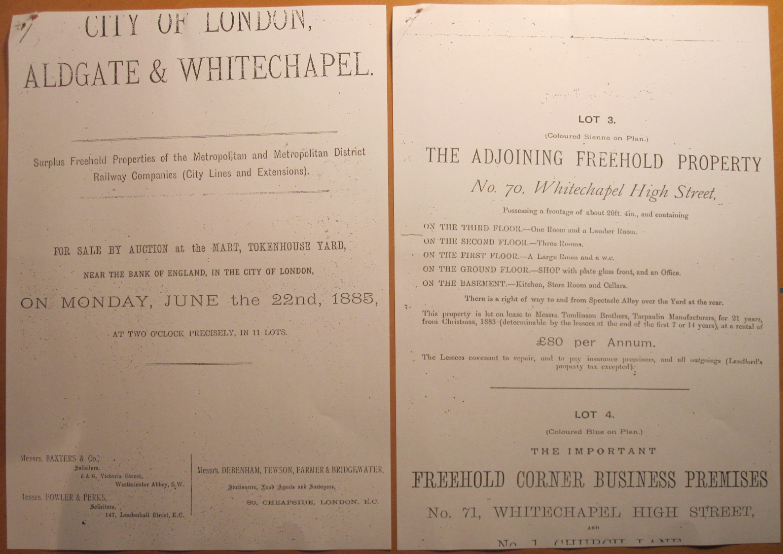
"file": "https://surveyoflondon.org/media/uploads/features/169/Screen%20Shot%202017-12-20%20at%2015.40.05.png",
"description": "Sale by the London Metropolitan Railway Company of the whole block including no.70, but excluding only no. 69, Whitechapel High St. No. 70 is recorded as leased to Tomlinson Bros, Tarpaulin makers, until Xmas 1904. This records a third floor with one room “and a lumber room”. \n",
"copyright": false,
"created": "2017-12-20"
},
{
"id": 1503,
"title": "27 Commercial Road in December 2018",
"author": {
"id": 27,
"username": "DerekKendall"
},
"feature": {
"id": 102,
"type": "Feature",
"geometry": {
"type": "MultiPolygon",
"coordinates": [
[
[
[
-0.068884991325227,
51.51509176890641
],
[
-0.068884964761477,
51.515091771690116
],
[
-0.068794658458709,
51.51512331365302
],
[
-0.068755208747082,
51.51507437068053
],
[
-0.068763951154488,
51.515060519662065
],
[
-0.06878690364361,
51.51504817492868
],
[
-0.068894901526045,
51.51504995339762
],
[
-0.068909858606256,
51.515082006494964
],
[
-0.068884991325227,
51.51509176890641
]
]
]
]
},
"properties": {
"b_number": "27",
"b_name": "",
"street": "Commercial Road",
"address": "27 Commercial Road",
"feature_type": "WHITECHAPEL_BUILDING",
"count": 10,
"search_str": "27 Commercial Road"
},
"tags": []
},
"file": "https://surveyoflondon.org/media/uploads/features/102/SoL%20Whitechapel%20102547.jpg",
"description": "",
"copyright": true,
"created": "2019-01-09"
},
{
"id": 324,
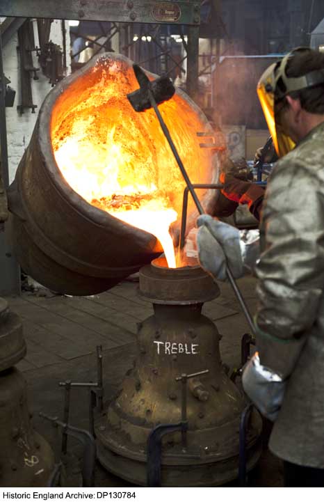
"title": "Whitechapel Bell Foundry, pouring molten metal in 2010",
"author": {
"id": 37,
"username": "HistoricEngland"
},
"feature": {
"id": 155,
"type": "Feature",
"geometry": {
"type": "MultiPolygon",
"coordinates": [
[
[
[
-0.067279828395434,
51.51695705948158
],
[
-0.067093469618443,
51.517032789909806
],
[
-0.067051200483431,
51.516996757810816
],
[
-0.067090391118988,
51.51698039038376
],
[
-0.06706090910812,
51.51695688633854
],
[
-0.067015052606677,
51.51697914860705
],
[
-0.067015052606682,
51.516979148607064
],
[
-0.067015052606675,
51.51697914860705
],
[
-0.066983358160437,
51.516951324364136
],
[
-0.066904378563551,
51.516904192470385
],
[
-0.066814855785544,
51.516858952938556
],
[
-0.066749004017844,
51.51678511344983
],
[
-0.066726651062502,
51.51660623379854
],
[
-0.066916087304028,
51.516542881724156
],
[
-0.067063145906456,
51.51668871217051
],
[
-0.067018758534236,
51.51670613616749
],
[
-0.067108196018859,
51.516794826264736
],
[
-0.067132918133769,
51.516785121743794
],
[
-0.067195489248199,
51.51684716970448
],
[
-0.06716822056742,
51.5168577515391
],
[
-0.067184699138495,
51.51687146748573
],
[
-0.067279828395434,
51.51695705948158
]
],
[
[
-0.067093263845335,
51.516893872671716
],
[
-0.067031009970172,
51.516845232635745
],
[
-0.066988676105,
51.51686586339187
],
[
-0.067034303634964,
51.51688439111608
],
[
-0.067057406216514,
51.51690729267392
],
[
-0.067093263845335,
51.516893872671716
]
]
]
]
},
"properties": {
"b_number": "32-34",
"b_name": "Whitechapel Bell Foundry, 32–34 Whitechapel Road",
"street": "Whitechapel Road",
"address": "32-34 Whitechapel Road",
"feature_type": "WHITECHAPEL_BUILDING",
"count": 26,
"search_str": "Whitechapel Bell Foundry, 32–34 Whitechapel Road"
},
"tags": [
"bells",
"foundry"
]
},
"file": "https://surveyoflondon.org/media/uploads/features/155/DP130784.jpg",
"description": "Photograph by Derek Kendall. Copyright Historic England Archive (see archive.HistoricEngland.org.uk)",
"copyright": true,
"created": "2016-09-02"
},
{
"id": 1577,
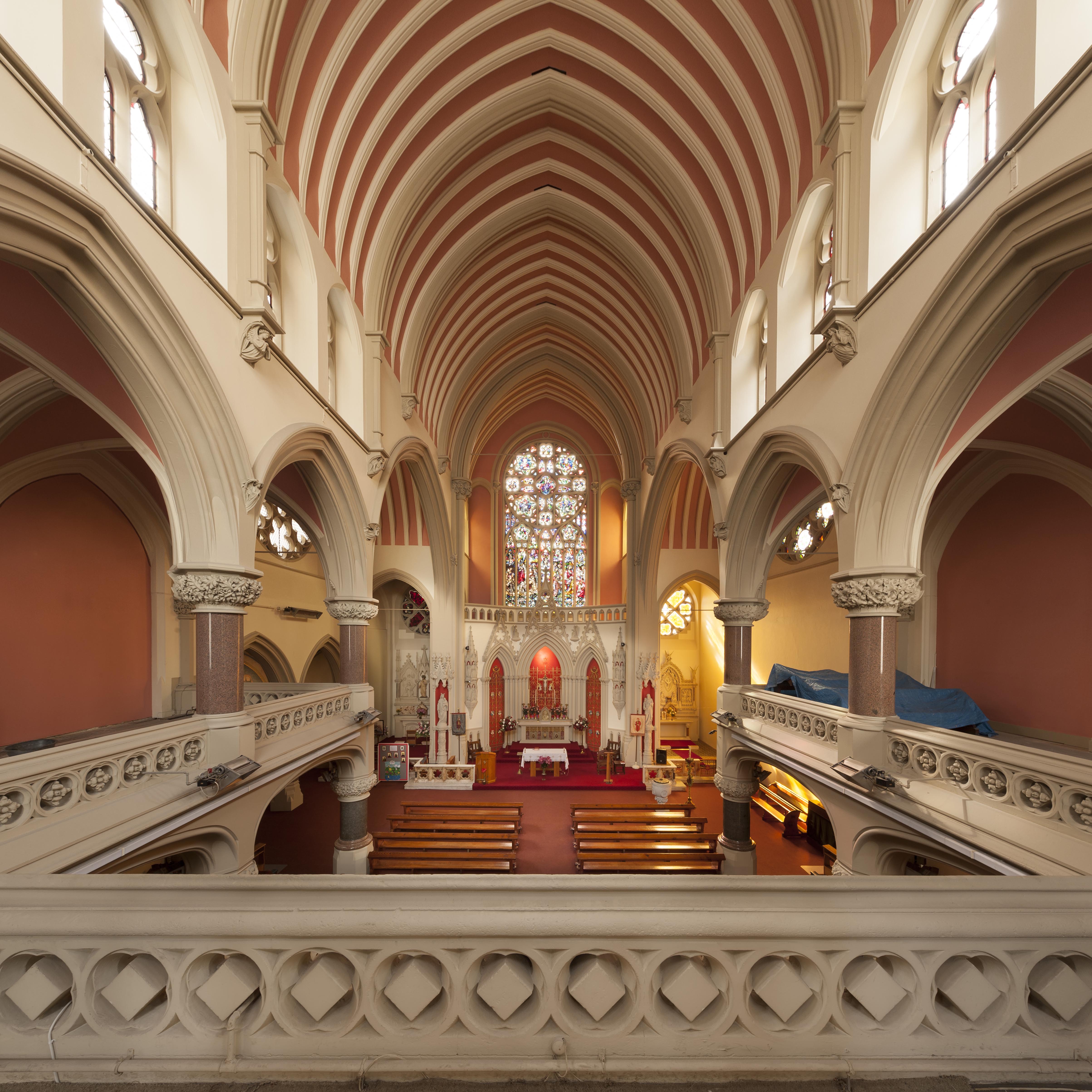
"title": "Gallery looking south",
"author": {
"id": 27,
"username": "DerekKendall"
},
"feature": {
"id": 1297,
"type": "Feature",
"geometry": {
"type": "MultiPolygon",
"coordinates": [
[
[
[
-0.071935648282288,
51.51134524228436
],
[
-0.071874729442993,
51.51121363108998
],
[
-0.071816144948546,
51.51122339231668
],
[
-0.071776588646252,
51.51120578254433
],
[
-0.071762024560661,
51.51117337877791
],
[
-0.07177649375904,
51.511141452410264
],
[
-0.071834141993347,
51.51113011940239
],
[
-0.071816329795347,
51.51108571239466
],
[
-0.072075019832766,
51.51104549229583
],
[
-0.072193056743033,
51.51130853787665
],
[
-0.072151551976597,
51.51131487321276
],
[
-0.072147312228886,
51.51132649961524
],
[
-0.072142333320455,
51.51133343542439
],
[
-0.072015847069243,
51.5113547481352
],
[
-0.071996105248008,
51.51135617797319
],
[
-0.071982278923131,
51.511350687404345
],
[
-0.071975230627282,
51.51134004502751
],
[
-0.071935648282288,
51.51134524228436
]
]
]
]
},
"properties": {
"b_number": "",
"b_name": "Roman Catholic Church of the English Martyrs",
"street": "Prescot Street",
"address": "Roman Catholic Church of the English Martyrs",
"feature_type": "WHITECHAPEL_BUILDING",
"count": 20,
"search_str": "Roman Catholic Church of the English Martyrs"
},
"tags": []
},
"file": "https://surveyoflondon.org/media/uploads/features/1297/SoL%20Whitechapel%20101926.jpg",
"description": "",
"copyright": false,
"created": "2019-04-03"
},
{
"id": 1580,
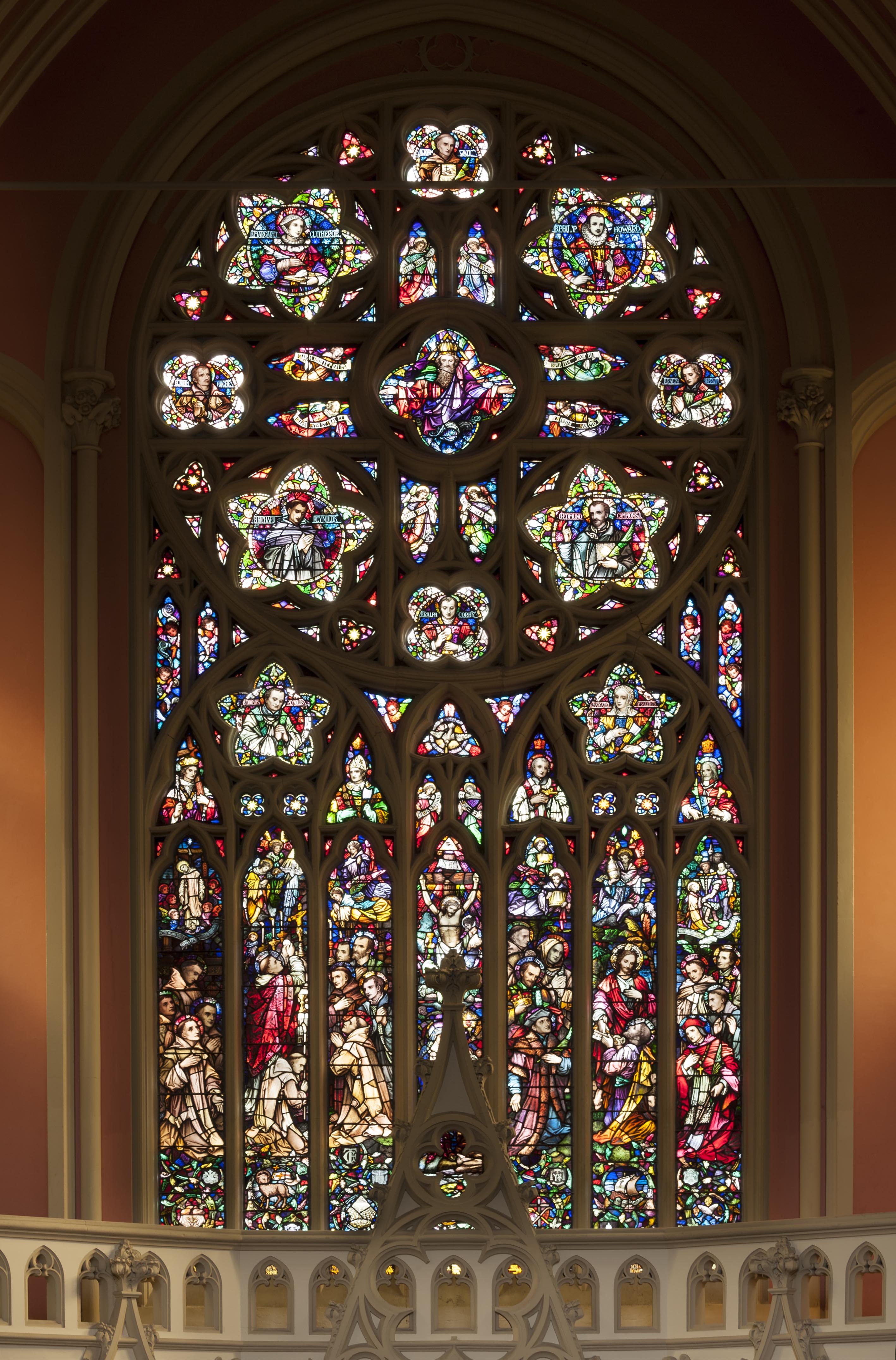
"title": "Stained glass window depicting the crucified Christ and thirty-two English martyrs",
"author": {
"id": 27,
"username": "DerekKendall"
},
"feature": {
"id": 1297,
"type": "Feature",
"geometry": {
"type": "MultiPolygon",
"coordinates": [
[
[
[
-0.071935648282288,
51.51134524228436
],
[
-0.071874729442993,
51.51121363108998
],
[
-0.071816144948546,
51.51122339231668
],
[
-0.071776588646252,
51.51120578254433
],
[
-0.071762024560661,
51.51117337877791
],
[
-0.07177649375904,
51.511141452410264
],
[
-0.071834141993347,
51.51113011940239
],
[
-0.071816329795347,
51.51108571239466
],
[
-0.072075019832766,
51.51104549229583
],
[
-0.072193056743033,
51.51130853787665
],
[
-0.072151551976597,
51.51131487321276
],
[
-0.072147312228886,
51.51132649961524
],
[
-0.072142333320455,
51.51133343542439
],
[
-0.072015847069243,
51.5113547481352
],
[
-0.071996105248008,
51.51135617797319
],
[
-0.071982278923131,
51.511350687404345
],
[
-0.071975230627282,
51.51134004502751
],
[
-0.071935648282288,
51.51134524228436
]
]
]
]
},
"properties": {
"b_number": "",
"b_name": "Roman Catholic Church of the English Martyrs",
"street": "Prescot Street",
"address": "Roman Catholic Church of the English Martyrs",
"feature_type": "WHITECHAPEL_BUILDING",
"count": 20,
"search_str": "Roman Catholic Church of the English Martyrs"
},
"tags": []
},
"file": "https://surveyoflondon.org/media/uploads/features/1297/SoL%20Whitechapel%20101935.jpg",
"description": "",
"copyright": false,
"created": "2019-04-03"
}
]
}