HTTP 200 OK
Allow: GET, HEAD, OPTIONS
Content-Type: application/json
Vary: Accept
{
"count": 1747,
"next": "https://surveyoflondon.org/api/v1/images/?format=api&page=6",
"previous": "https://surveyoflondon.org/api/v1/images/?format=api&page=4",
"results": [
{
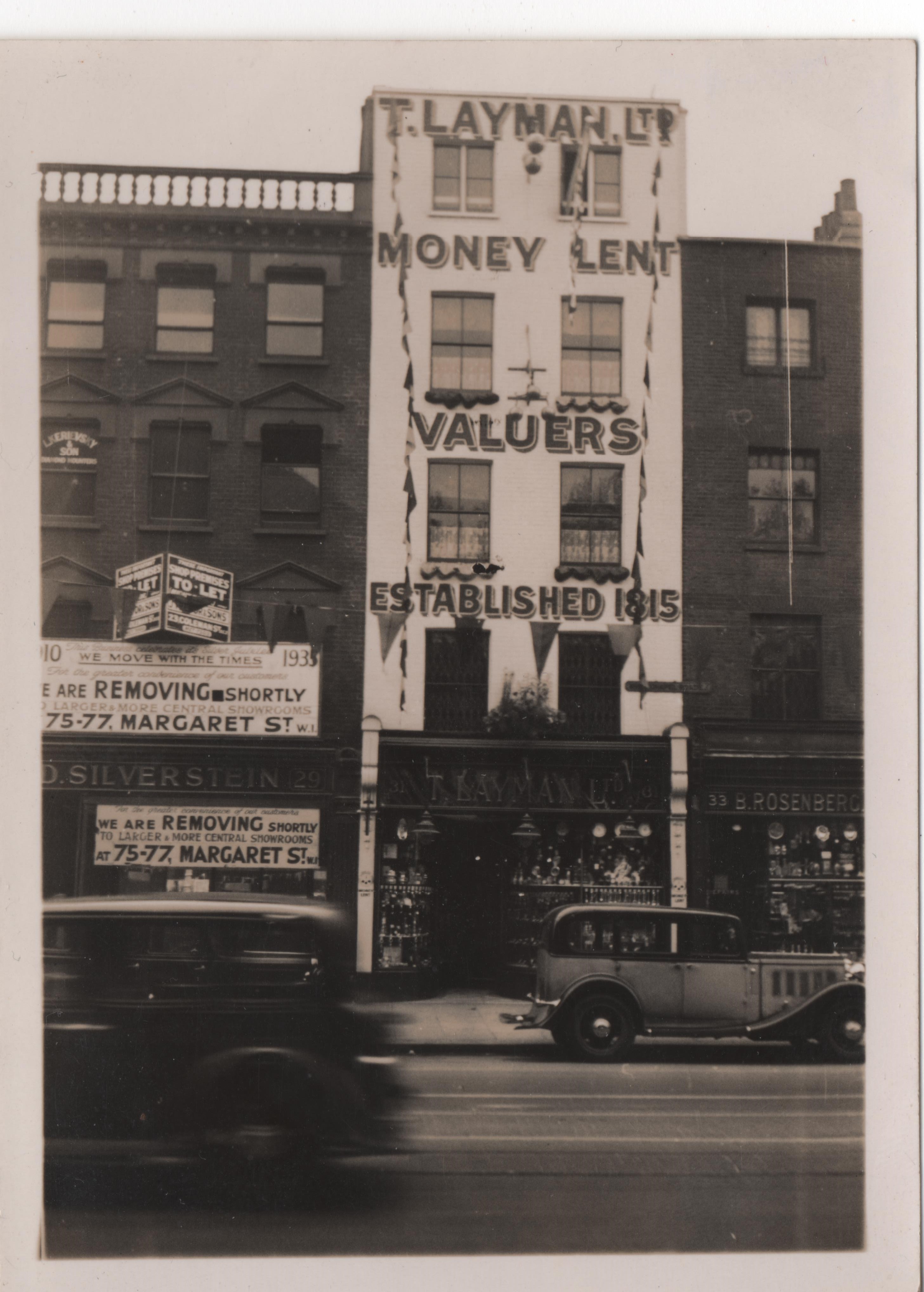
"id": 525,
"title": "29-33 Whitechapel Road, 1935",
"author": {
"id": 2,
"username": "surveyoflondon"
},
"feature": {
"id": 123,
"type": "Feature",
"geometry": {
"type": "MultiPolygon",
"coordinates": [
[
[
[
-0.068793603793373,
51.516578747857835
],
[
-0.069023766104963,
51.51678764124127
],
[
-0.068947455138612,
51.51681733407167
],
[
-0.068726807173385,
51.51661335180725
],
[
-0.068793603793373,
51.516578747857835
]
]
]
]
},
"properties": {
"b_number": "29",
"b_name": "",
"street": "Whitechapel Road",
"address": "29 Whitechapel Road",
"feature_type": "WHITECHAPEL_BUILDING",
"count": 2,
"search_str": "29 Whitechapel Road"
},
"tags": []
},
"file": "https://surveyoflondon.org/media/uploads/features/123/29%20to%2033%20Whitechapel%20Road%201935.jpg",
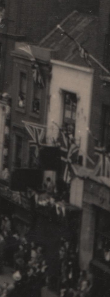
"description": "This photograph by an unknown, probably amateur, photographer shows 29, 31 and 33 Whitechapel Road in 1935, the bunting presumably up for the Silver Jubilee of King George V and Queen Mary which took place on 6 May 1935. The sites of the two buildings to the right (Nos 31 and 33) are now covered by Black Lion House.",
"copyright": false,
"created": "2017-03-14"
},
{
"id": 1234,
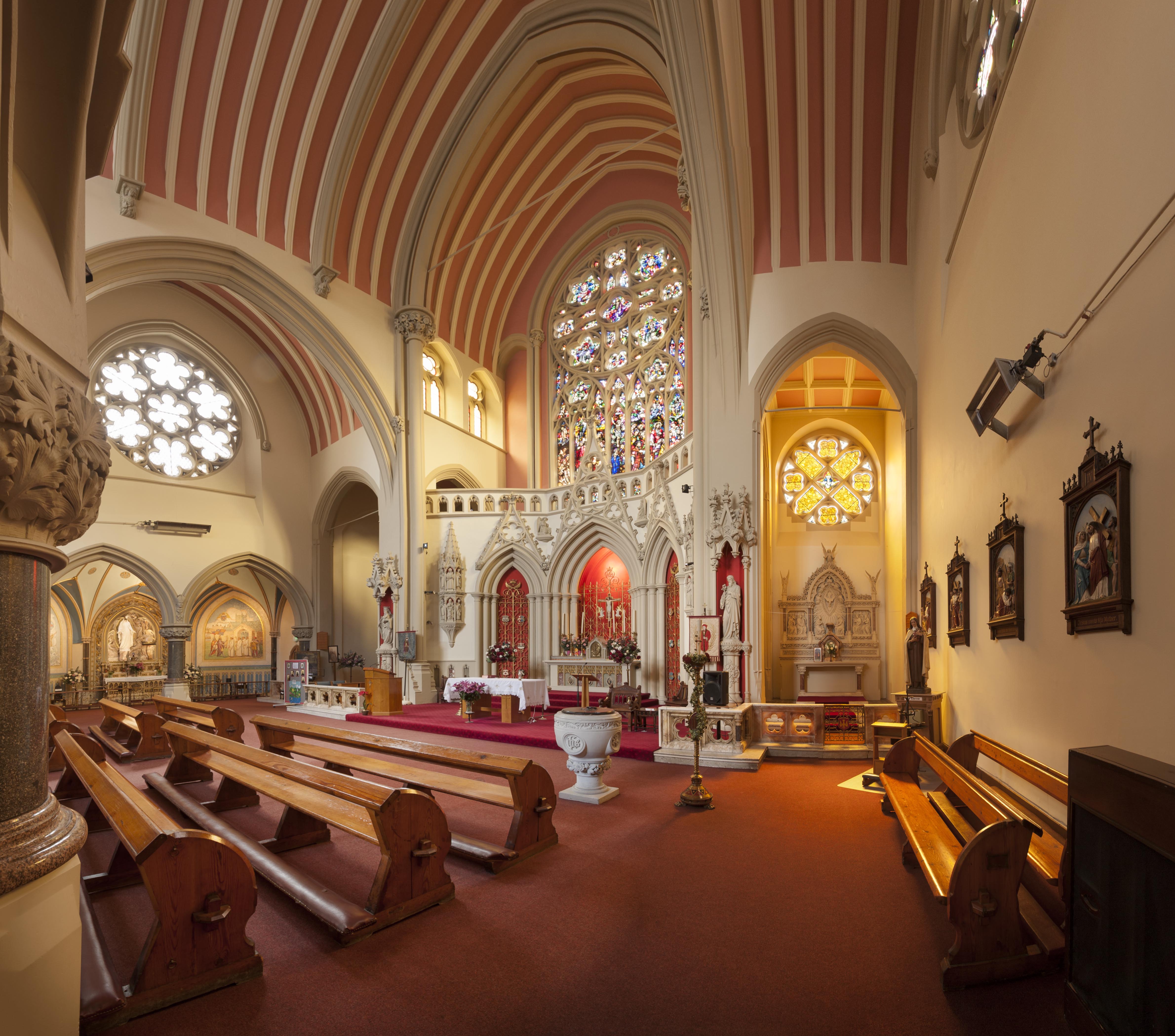
"title": "Interior, March 2018",
"author": {
"id": 27,
"username": "DerekKendall"
},
"feature": {
"id": 1297,
"type": "Feature",
"geometry": {
"type": "MultiPolygon",
"coordinates": [
[
[
[
-0.071935648282288,
51.51134524228436
],
[
-0.071874729442993,
51.51121363108998
],
[
-0.071816144948546,
51.51122339231668
],
[
-0.071776588646252,
51.51120578254433
],
[
-0.071762024560661,
51.51117337877791
],
[
-0.07177649375904,
51.511141452410264
],
[
-0.071834141993347,
51.51113011940239
],
[
-0.071816329795347,
51.51108571239466
],
[
-0.072075019832766,
51.51104549229583
],
[
-0.072193056743033,
51.51130853787665
],
[
-0.072151551976597,
51.51131487321276
],
[
-0.072147312228886,
51.51132649961524
],
[
-0.072142333320455,
51.51133343542439
],
[
-0.072015847069243,
51.5113547481352
],
[
-0.071996105248008,
51.51135617797319
],
[
-0.071982278923131,
51.511350687404345
],
[
-0.071975230627282,
51.51134004502751
],
[
-0.071935648282288,
51.51134524228436
]
]
]
]
},
"properties": {
"b_number": "",
"b_name": "Roman Catholic Church of the English Martyrs",
"street": "Prescot Street",
"address": "Roman Catholic Church of the English Martyrs",
"feature_type": "WHITECHAPEL_BUILDING",
"count": 20,
"search_str": "Roman Catholic Church of the English Martyrs"
},
"tags": []
},
"file": "https://surveyoflondon.org/media/uploads/features/1297/SoL%20Whitechapel%20101902.jpg",
"description": "",
"copyright": true,
"created": "2018-03-27"
},
{
"id": 1408,
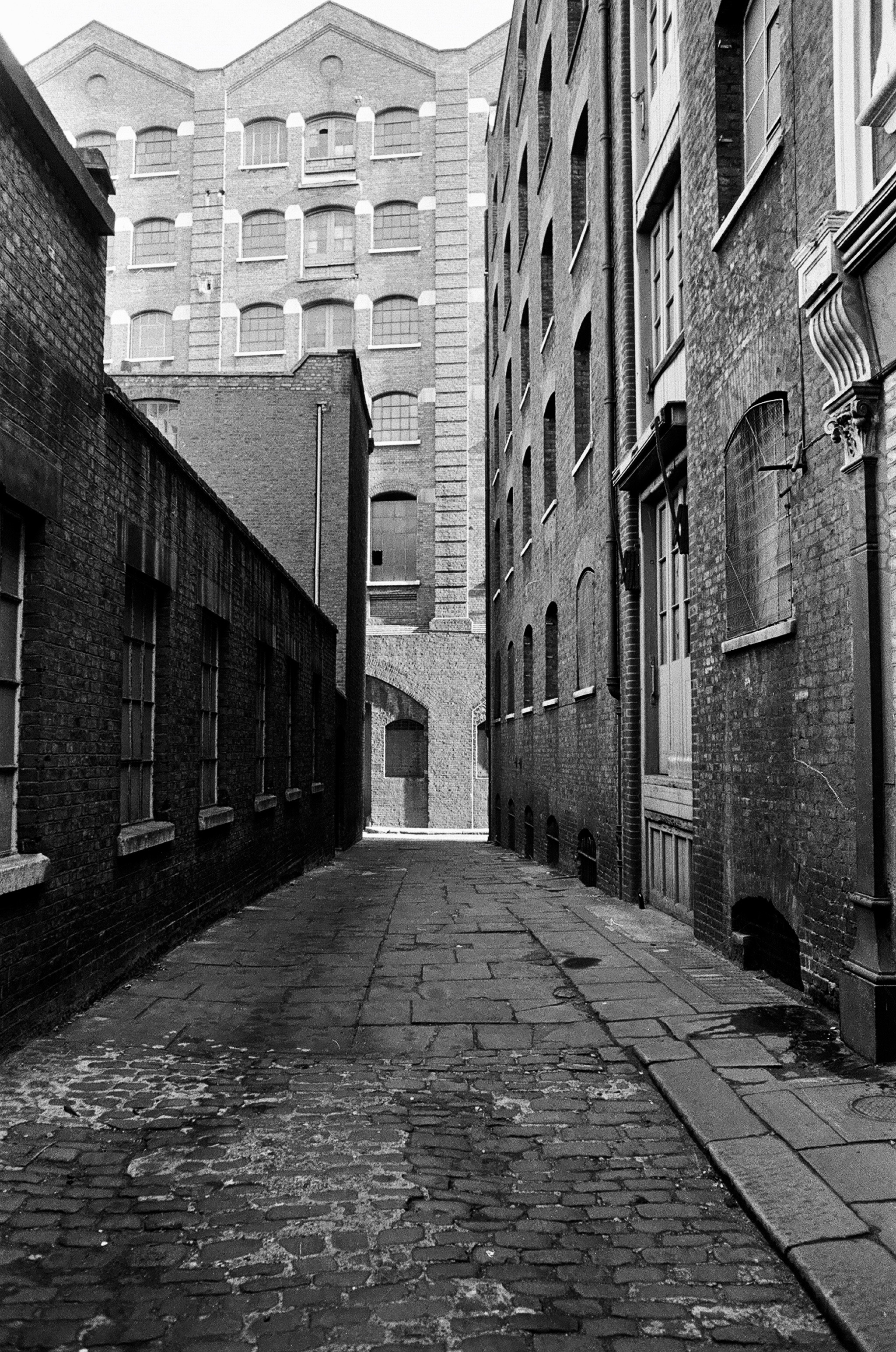
"title": "View along the eastern section of Leman Passage in the early 1970s looking east (photograph by Dan Cruickshank)",
"author": {
"id": 268,
"username": "DanCruickshank"
},
"feature": {
"id": 1046,
"type": "Feature",
"geometry": {
"type": "MultiPolygon",
"coordinates": [
[
[
[
-0.069714718327607,
51.512779796737654
],
[
-0.070041265672745,
51.5131969319805
],
[
-0.069377993137045,
51.51342051283188
],
[
-0.0690271561552,
51.51300045828788
],
[
-0.069714718327607,
51.512779796737654
]
]
]
]
},
"properties": {
"b_number": "65",
"b_name": "",
"street": "Leman Street",
"address": "Drapery Plaza (formerly Student Castle), 65 Leman Street",
"feature_type": "WHITECHAPEL_BUILDING",
"count": 7,
"search_str": "Drapery Plaza (formerly Student Castle), 65 Leman Street"
},
"tags": []
},
"file": "https://surveyoflondon.org/media/uploads/features/1046/00410003.jpg",
"description": "",
"copyright": true,
"created": "2018-11-13"
},
{
"id": 101,
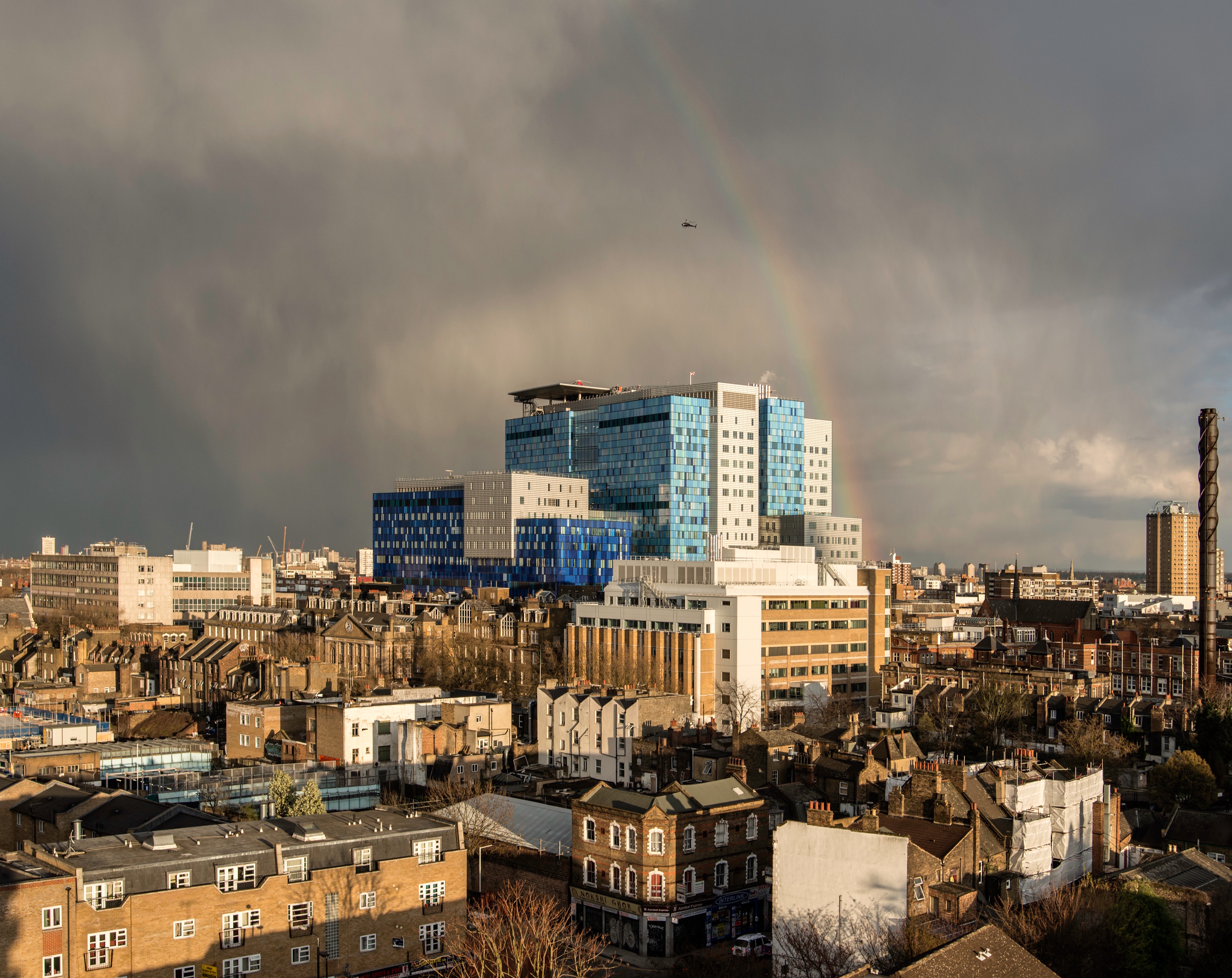
"title": "The Royal London Hospital, view from the north-west",
"author": {
"id": 29,
"username": "CRedgrave"
},
"feature": {
"id": 1230,
"type": "Feature",
"geometry": {
"type": "MultiPolygon",
"coordinates": [
[
[
[
-0.06071898744648,
51.51847914149303
],
[
-0.060743358937849,
51.518529899918775
],
[
-0.060362148562617,
51.518618013153
],
[
-0.060404024127419,
51.51868851949335
],
[
-0.060356952993906,
51.51869974522794
],
[
-0.060399234817198,
51.51877056309998
],
[
-0.060042469531136,
51.5188530372297
],
[
-0.060006551123239,
51.51879256032364
],
[
-0.05997171006068,
51.51880061452483
],
[
-0.059923949522789,
51.51872019830377
],
[
-0.059602716389847,
51.51879445706454
],
[
-0.059631951693606,
51.51884368227145
],
[
-0.059135089420495,
51.51895853862307
],
[
-0.059031394281591,
51.51878393727422
],
[
-0.059075483581288,
51.51877374555587
],
[
-0.05923306113512,
51.518737319626666
],
[
-0.059261815633844,
51.518785736083466
],
[
-0.059453095208379,
51.51874286661955
],
[
-0.059437777096903,
51.51871791341666
],
[
-0.059509844762857,
51.518701022201654
],
[
-0.059472510825189,
51.51863713193043
],
[
-0.059893693119402,
51.51853565124978
],
[
-0.059897251108141,
51.51854177905041
],
[
-0.060406197614306,
51.5184267554985
],
[
-0.060388475186227,
51.51839623334771
],
[
-0.060226549751936,
51.51811735804654
],
[
-0.060490662909997,
51.51805857683586
],
[
-0.060500593175314,
51.518078725457706
],
[
-0.06071898744648,
51.51847914149303
]
]
]
]
},
"properties": {
"b_number": "",
"b_name": "Former Royal London Hospital",
"street": "",
"address": "Former Royal London Hospital ",
"feature_type": "WHITECHAPEL_BUILDING",
"count": 53,
"search_str": "Former Royal London Hospital"
},
"tags": []
},
"file": "https://surveyoflondon.org/media/uploads/features/1230/London%20Hospital%2C%20CR%202013.jpg",
"description": "",
"copyright": true,
"created": "2016-06-29"
},
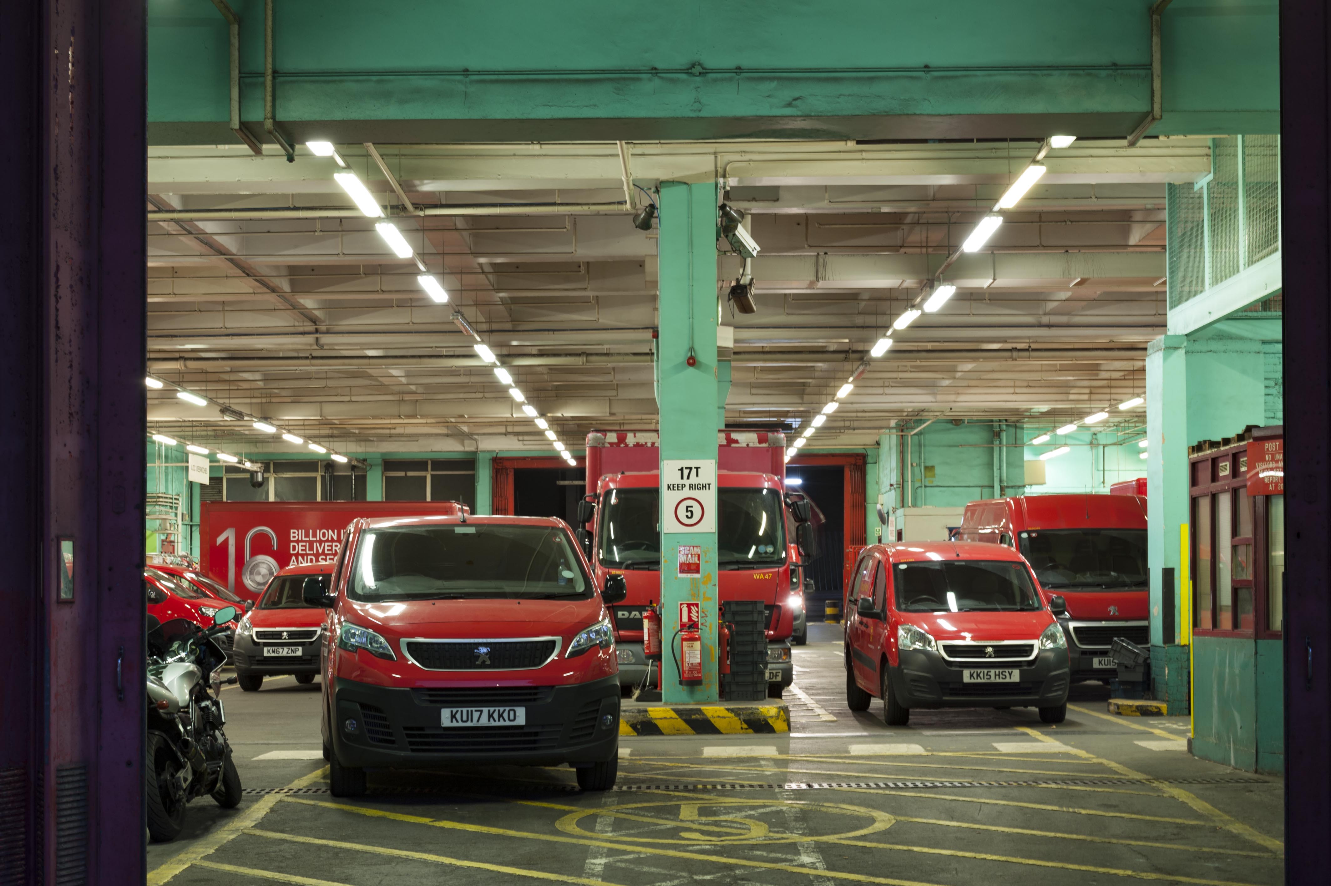
{
"id": 1417,
"title": "East London Mail Centre, view into garage from the east in late 2018",
"author": {
"id": 27,
"username": "DerekKendall"
},
"feature": {
"id": 1227,
"type": "Feature",
"geometry": {
"type": "MultiPolygon",
"coordinates": [
[
[
[
-0.058796596412285,
51.51912310433929
],
[
-0.057896913703648,
51.51929776742821
],
[
-0.057646155790783,
51.51878891291734
],
[
-0.057726960269829,
51.518773414154225
],
[
-0.057663251646104,
51.51864413103036
],
[
-0.058003630287349,
51.51857884372657
],
[
-0.058058858263524,
51.51869091551577
],
[
-0.058183402152667,
51.518667026720365
],
[
-0.058192757854339,
51.51868601168758
],
[
-0.058228318266828,
51.5186791908066
],
[
-0.058378536493976,
51.518984017000164
],
[
-0.058419330251411,
51.51897619228836
],
[
-0.058450444692009,
51.51903932977383
],
[
-0.05871794555232,
51.51898801961153
],
[
-0.058796596412285,
51.51912310433929
]
]
]
]
},
"properties": {
"b_number": "180–206",
"b_name": "East London Mail Centre and E1 Delivery Office",
"street": "Whitechapel Road",
"address": "East London Mail Centre and E1 Delivery Office",
"feature_type": "WHITECHAPEL_BUILDING",
"count": 14,
"search_str": "East London Mail Centre and E1 Delivery Office"
},
"tags": []
},
"file": "https://surveyoflondon.org/media/uploads/features/1227/SoL%20Whitechapel%20102277.jpg",
"description": "",
"copyright": true,
"created": "2018-11-13"
},
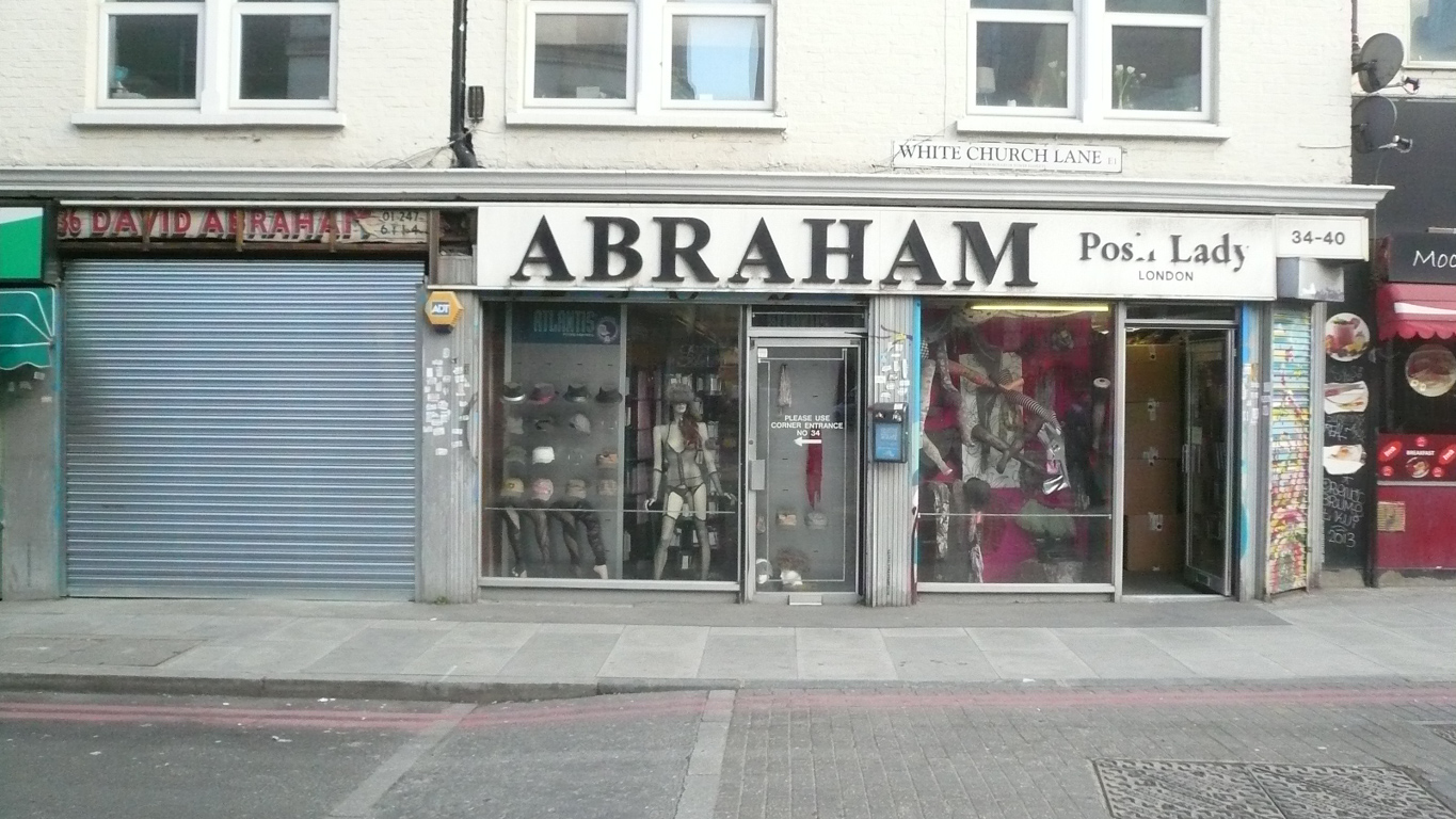
{
"id": 72,
"title": "Kirstein's Mansions, 34-40 White Church Lane, in 2015",
"author": {
"id": 2,
"username": "surveyoflondon"
},
"feature": {
"id": 184,
"type": "Feature",
"geometry": {
"type": "MultiPolygon",
"coordinates": [
[
[
[
-0.068578857725277,
51.515058346172935
],
[
-0.068684010525248,
51.51517341266261
],
[
-0.068486063121396,
51.51522368270303
],
[
-0.068452900682943,
51.5151753964142
],
[
-0.068534791469645,
51.515150123741485
],
[
-0.06850924458504,
51.515123238092826
],
[
-0.068432210792558,
51.51514928400303
],
[
-0.068403530730357,
51.51511976827265
],
[
-0.068578857725277,
51.515058346172935
]
]
]
]
},
"properties": {
"b_number": "34-40",
"b_name": "Kirstein's Mansions",
"street": "White Church Lane",
"address": "Kirstein's Mansions, 34-40 White Church Lane",
"feature_type": "WHITECHAPEL_BUILDING",
"count": 5,
"search_str": "Kirstein's Mansions"
},
"tags": [
"David Abraham",
"Solomon Kirstein",
"street art"
]
},
"file": "https://surveyoflondon.org/media/uploads/features/184/P1150388.jpg",
"description": "",
"copyright": false,
"created": "2016-06-22"
},
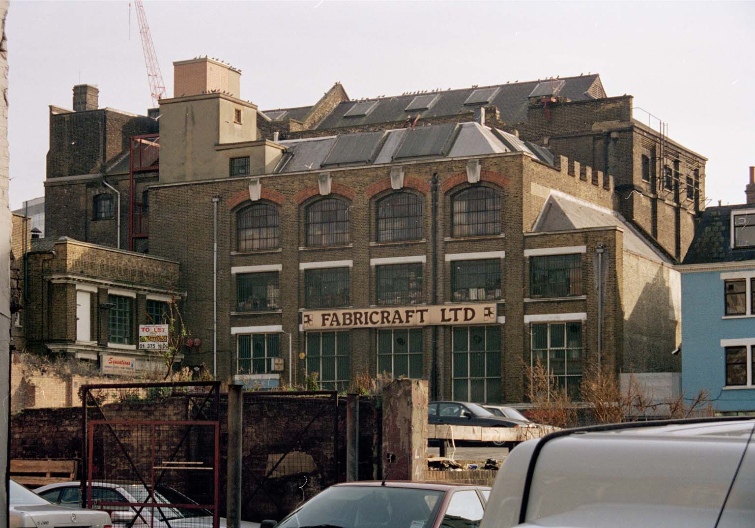
{
"id": 80,
"title": "St George's Brewery from Assam Street, c2010",
"author": {
"id": 29,
"username": "CRedgrave"
},
"feature": {
"id": 103,
"type": "Feature",
"geometry": {
"type": "MultiPolygon",
"coordinates": [
[
[
[
-0.068374712930605,
51.5151408298259
],
[
-0.06804295614913,
51.51523312333845
],
[
-0.067818209826392,
51.51529176188959
],
[
-0.067732324854293,
51.51515294140592
],
[
-0.068296249445127,
51.51502991558809
],
[
-0.068374712930605,
51.5151408298259
]
]
]
]
},
"properties": {
"b_number": "33",
"b_name": "",
"street": "Commercial Road",
"address": "Former St George's Brewery, 33 Commercial Road",
"feature_type": "WHITECHAPEL_BUILDING",
"count": 8,
"search_str": "Former St George's Brewery, 33 Commercial Road"
},
"tags": [
"brewery"
]
},
"file": "https://surveyoflondon.org/media/uploads/features/103/Scan.jpg",
"description": "",
"copyright": true,
"created": "2016-06-24"
},
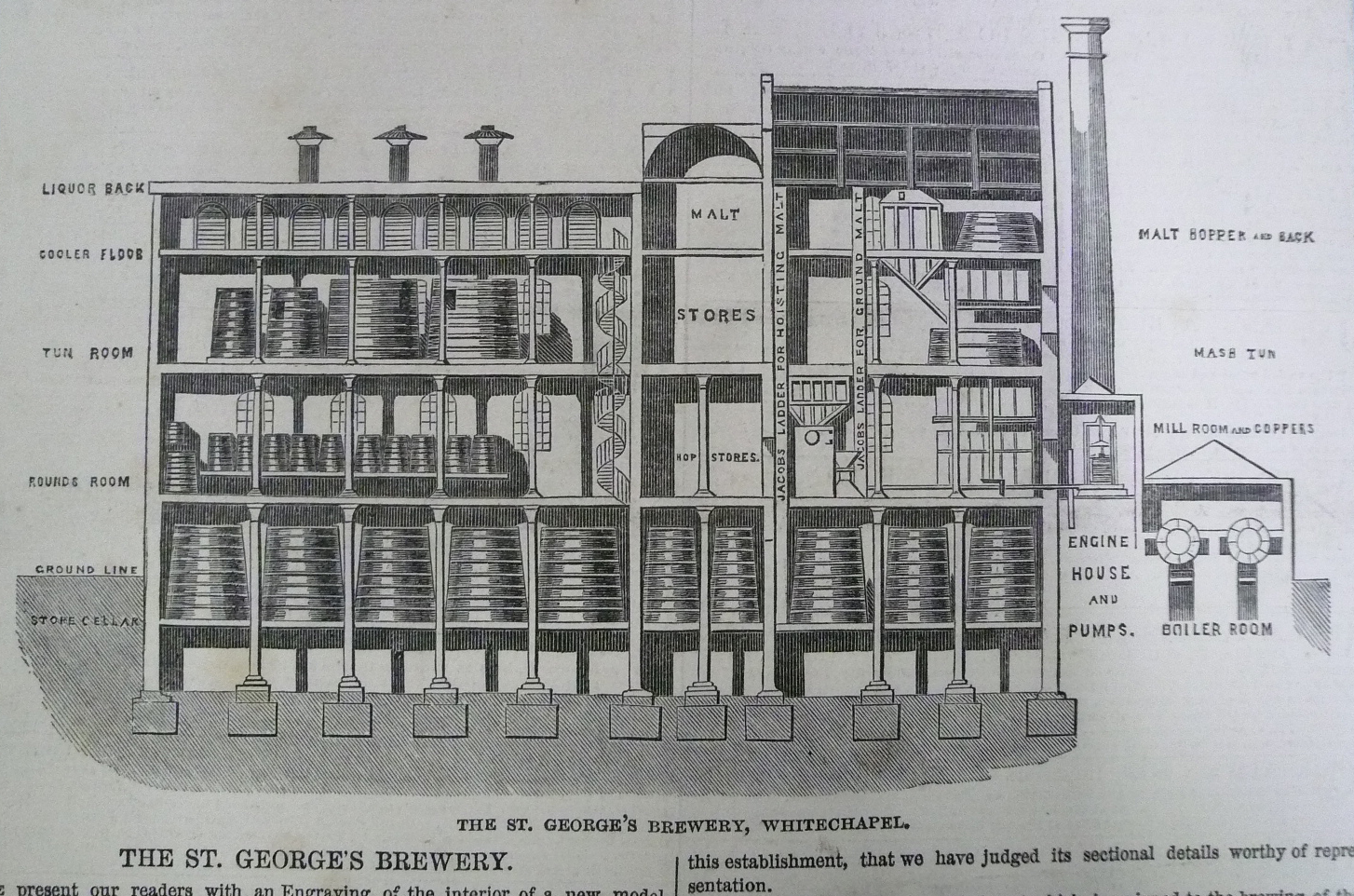
{
"id": 81,
"title": "St George's Brewery, section from the 'Illustrated London News', 18 December 1847",
"author": {
"id": 30,
"username": "ILN"
},
"feature": {
"id": 103,
"type": "Feature",
"geometry": {
"type": "MultiPolygon",
"coordinates": [
[
[
[
-0.068374712930605,
51.5151408298259
],
[
-0.06804295614913,
51.51523312333845
],
[
-0.067818209826392,
51.51529176188959
],
[
-0.067732324854293,
51.51515294140592
],
[
-0.068296249445127,
51.51502991558809
],
[
-0.068374712930605,
51.5151408298259
]
]
]
]
},
"properties": {
"b_number": "33",
"b_name": "",
"street": "Commercial Road",
"address": "Former St George's Brewery, 33 Commercial Road",
"feature_type": "WHITECHAPEL_BUILDING",
"count": 8,
"search_str": "Former St George's Brewery, 33 Commercial Road"
},
"tags": [
"brewery"
]
},
"file": "https://surveyoflondon.org/media/uploads/features/103/P1180287%20cropped.jpg",
"description": "",
"copyright": false,
"created": "2016-06-24"
},
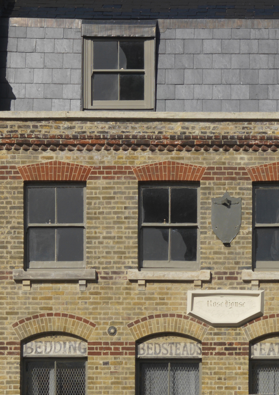
{
"id": 172,
"title": "Rose House detail, 201 Whitechapel Road",
"author": {
"id": 29,
"username": "CRedgrave"
},
"feature": {
"id": 472,
"type": "Feature",
"geometry": {
"type": "MultiPolygon",
"coordinates": [
[
[
[
-0.062568880179938,
51.51870074654416
],
[
-0.06256888017995,
51.51870074654419
],
[
-0.062537425055803,
51.5187096276745
],
[
-0.062570294282167,
51.518780165312286
],
[
-0.062505727637473,
51.51880077292788
],
[
-0.062441978236087,
51.51868276869965
],
[
-0.062547913361328,
51.51865958014376
],
[
-0.062568880179938,
51.51870074654416
]
]
]
]
},
"properties": {
"b_number": "201",
"b_name": "",
"street": "Whitechapel Road",
"address": "201 Whitechapel Road",
"feature_type": "WHITECHAPEL_BUILDING",
"count": 3,
"search_str": "201 Whitechapel Road"
},
"tags": []
},
"file": "https://surveyoflondon.org/media/uploads/features/472/Crop%20detail%20of%20Rose%20House%20from%20the%20same%20photo-%20Whitechapel%20high%20str_7SLIXif.jpg",
"description": "",
"copyright": true,
"created": "2016-07-27"
},
{
"id": 162,
"title": "29 White Church Lane, July 2014",
"author": {
"id": 29,
"username": "CRedgrave"
},
"feature": {
"id": 162,
"type": "Feature",
"geometry": {
"type": "MultiPolygon",
"coordinates": [
[
[
[
-0.069006759704738,
51.5150568844191
],
[
-0.069014695757064,
51.51523956315401
],
[
-0.068912141496422,
51.515269068053904
],
[
-0.068847667114587,
51.5151890784224
],
[
-0.06894818219913,
51.51515300087076
],
[
-0.069009646187998,
51.51513326826132
],
[
-0.069006759704738,
51.5150568844191
]
]
]
]
},
"properties": {
"b_number": "29-33",
"b_name": "",
"street": "White Church Lane",
"address": "29-33 White Church Lane",
"feature_type": "WHITECHAPEL_BUILDING",
"count": 3,
"search_str": "29-33 White Church Lane"
},
"tags": [
"George Coles",
"synagogue"
]
},
"file": "https://surveyoflondon.org/media/uploads/features/162/29%20Whitechurch%20Lane%20-%20Chris%20R%20July%202014.jpg",
"description": "",
"copyright": true,
"created": "2016-07-22"
},
{
"id": 167,
"title": "3-7 Vallance Road in 2014",
"author": {
"id": 29,
"username": "CRedgrave"
},
"feature": {
"id": 574,
"type": "Feature",
"geometry": {
"type": "MultiPolygon",
"coordinates": [
[
[
[
-0.0630649796894,
51.518767682046445
],
[
-0.063156515277658,
51.51874568134991
],
[
-0.063180093846779,
51.51877886473826
],
[
-0.063081979933892,
51.51880419887161
],
[
-0.0630649796894,
51.518767682046445
]
]
]
]
},
"properties": {
"b_number": "5",
"b_name": "",
"street": "Vallance Road",
"address": "5 Vallance Road",
"feature_type": "WHITECHAPEL_BUILDING",
"count": 2,
"search_str": "5 Vallance Road"
},
"tags": []
},
"file": "https://surveyoflondon.org/media/uploads/features/574/Valance%20Road.jpg",
"description": "",
"copyright": true,
"created": "2016-07-25"
},
{
"id": 168,
"title": "3-7 Vallance Road in 2014",
"author": {
"id": 29,
"username": "CRedgrave"
},
"feature": {
"id": 572,
"type": "Feature",
"geometry": {
"type": "MultiPolygon",
"coordinates": [
[
[
[
-0.063206394876046,
51.51881587952975
],
[
-0.063100616490422,
51.518844230455755
],
[
-0.063081979933892,
51.51880419887161
],
[
-0.063180093846779,
51.51877886473826
],
[
-0.063206394876046,
51.51881587952975
]
]
]
]
},
"properties": {
"b_number": "7",
"b_name": "",
"street": "Vallance Road",
"address": "7 Vallance Road",
"feature_type": "WHITECHAPEL_BUILDING",
"count": 2,
"search_str": "7 Vallance Road"
},
"tags": []
},
"file": "https://surveyoflondon.org/media/uploads/features/572/Valance%20Road.jpg",
"description": "",
"copyright": true,
"created": "2016-07-25"
},
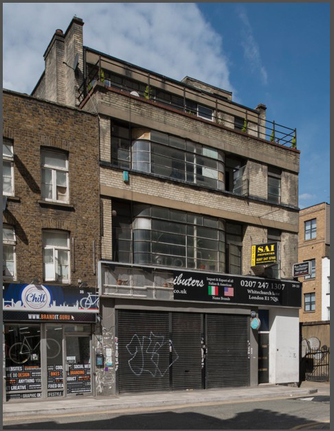
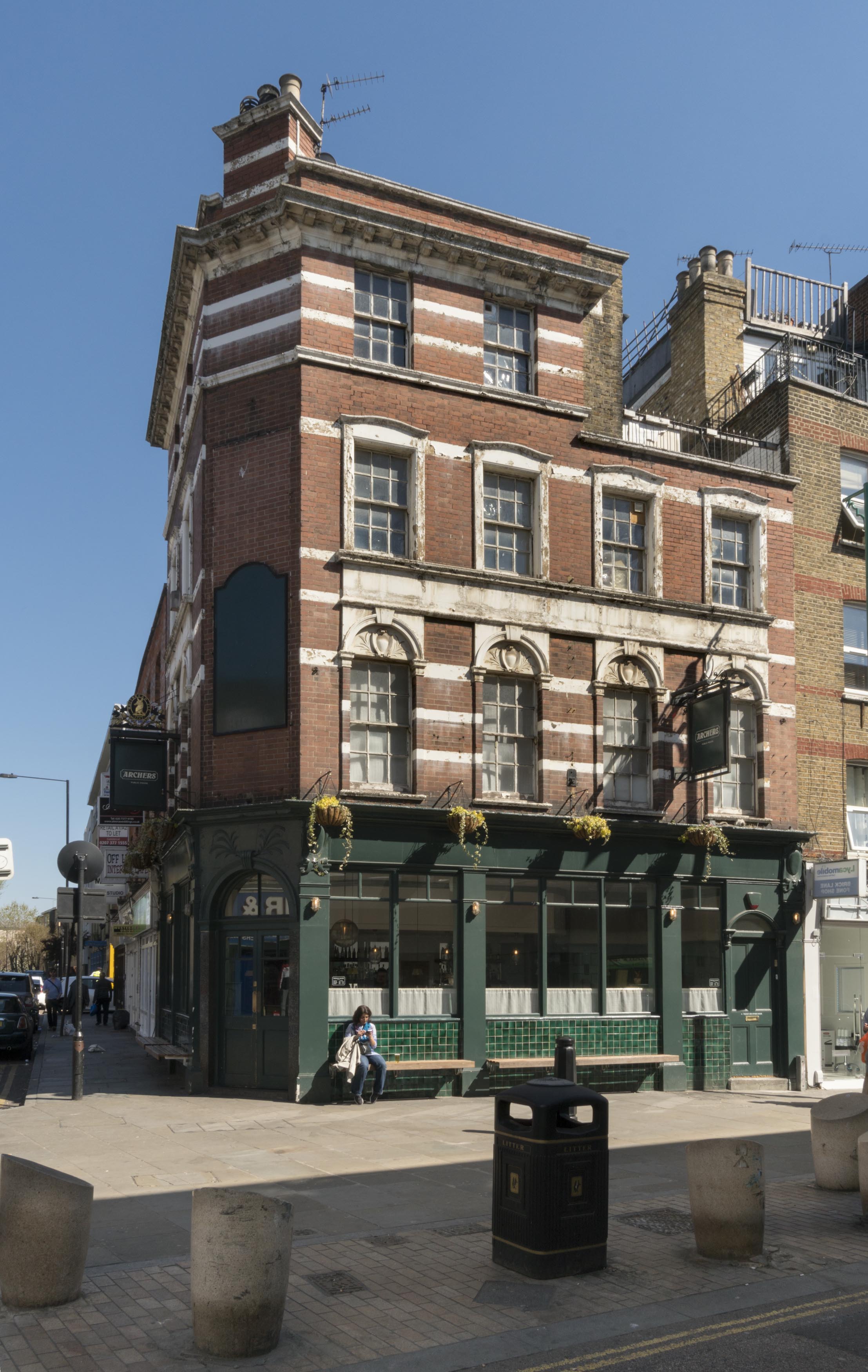
{
"id": 598,
"title": "The Archers, 42 Osborn Street, April 2017",
"author": {
"id": 27,
"username": "DerekKendall"
},
"feature": {
"id": 134,
"type": "Feature",
"geometry": {
"type": "MultiPolygon",
"coordinates": [
[
[
[
-0.070243500569242,
51.517154861646205
],
[
-0.0702968300595,
51.51714038134803
],
[
-0.070335680411927,
51.517193274330154
],
[
-0.070342810454315,
51.51721756480552
],
[
-0.070323664139563,
51.517236333829224
],
[
-0.070251837070749,
51.517247294829744
],
[
-0.070217386307061,
51.51718744011919
],
[
-0.070254671152518,
51.51717791764134
],
[
-0.070254692290288,
51.51717741759675
],
[
-0.070243500569242,
51.517154861646205
]
]
]
]
},
"properties": {
"b_number": "42",
"b_name": "",
"street": "Osborn Street",
"address": "The Buxton (formerly the Archers) public house, 42 Osborn Street",
"feature_type": "WHITECHAPEL_BUILDING",
"count": 3,
"search_str": "The Buxton (formerly the Archers) public house, 42 Osborn Street"
},
"tags": []
},
"file": "https://surveyoflondon.org/media/uploads/features/134/SoL%20Whitechapel%20100682.jpg",
"description": "",
"copyright": true,
"created": "2017-05-03"
},
{
"id": 526,
"title": "10-12 Whitechapel Road, 1935",
"author": {
"id": 2,
"username": "surveyoflondon"
},
"feature": {
"id": 146,
"type": "Feature",
"geometry": {
"type": "MultiPolygon",
"coordinates": [
[
[
[
-0.067867860495883,
51.51670407080909
],
[
-0.067828863322737,
51.5167206102403
],
[
-0.067711449192187,
51.51661339667722
],
[
-0.067749868829088,
51.51660024858239
],
[
-0.067867860495883,
51.51670407080909
]
]
]
]
},
"properties": {
"b_number": "10",
"b_name": "",
"street": "Whitechapel Road",
"address": "10 Whitechapel Road",
"feature_type": "WHITECHAPEL_BUILDING",
"count": 4,
"search_str": "10 Whitechapel Road"
},
"tags": [
"Buck & Hickman"
]
},
"file": "https://surveyoflondon.org/media/uploads/features/146/Whitechapel%20Road%2010%20t%2012%20in%201935.jpg",
"description": "Detail from a photograph taken of the procession of King George V and Queen Mary along Whitechapel Road for the Silver Jubilee celebrations in May 1935",
"copyright": false,
"created": "2017-03-14"
},
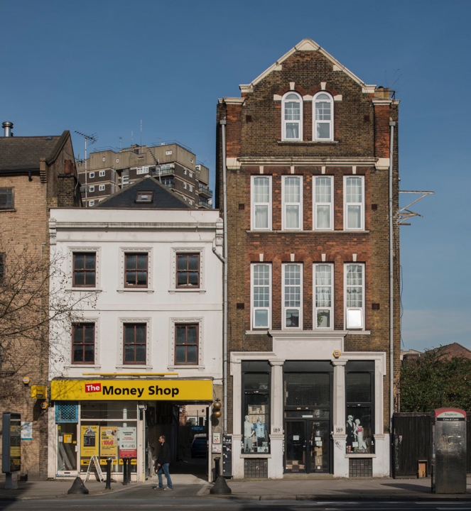
{
"id": 165,
"title": "187-189 Whitechapel Road in 2014",
"author": {
"id": 29,
"username": "CRedgrave"
},
"feature": {
"id": 455,
"type": "Feature",
"geometry": {
"type": "MultiPolygon",
"coordinates": [
[
[
[
-0.063552789553256,
51.518491872933986
],
[
-0.063587905248789,
51.51854399965979
],
[
-0.063597319520449,
51.51856145154207
],
[
-0.063568315779777,
51.51859308627029
],
[
-0.063524872751908,
51.51861009747596
],
[
-0.063407612111254,
51.51843748479917
],
[
-0.063496378982988,
51.5184145126676
],
[
-0.063552789553256,
51.518491872933986
]
]
]
]
},
"properties": {
"b_number": "189",
"b_name": "",
"street": "Whitechapel Road",
"address": "189 Whitechapel Road",
"feature_type": "WHITECHAPEL_BUILDING",
"count": 3,
"search_str": "189 Whitechapel Road"
},
"tags": [
"David Baron",
"Hebrew Christian Testimony to Israel",
"William Alfred Pite"
]
},
"file": "https://surveyoflondon.org/media/uploads/features/455/187-189%20Whitechapel%20Road.jpg",
"description": "",
"copyright": true,
"created": "2016-07-22"
},
{
"id": 484,
"title": "Walden Street north side (east end)",
"author": {
"id": 21,
"username": "IsobelWatson"
},
"feature": {
"id": 1082,
"type": "Feature",
"geometry": {
"type": "MultiPolygon",
"coordinates": [
[
[
[
-0.059877296860589,
51.51624413755992
],
[
-0.059893505212075,
51.51630560198411
],
[
-0.059824094491814,
51.51631236842941
],
[
-0.059808053571849,
51.516251144438705
],
[
-0.059877296860589,
51.51624413755992
]
]
]
]
},
"properties": {
"b_number": "41",
"b_name": "",
"street": "",
"address": "41 Walden Street",
"feature_type": "WHITECHAPEL_BUILDING",
"count": 6,
"search_str": "41 Walden Street"
},
"tags": []
},
"file": "https://surveyoflondon.org/media/uploads/features/1082/Walden%20St%2033-51%20(odd)%20c%201990.jpg",
"description": "Dated c.1990",
"copyright": false,
"created": "2017-01-23"
},
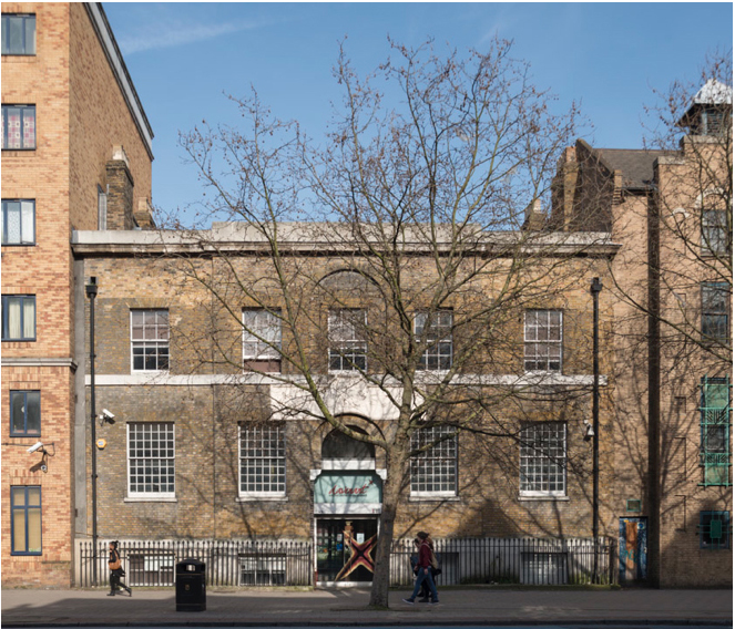
{
"id": 161,
"title": "Former Davenant School, 179 Whitechapel Road",
"author": {
"id": 29,
"username": "CRedgrave"
},
"feature": {
"id": 452,
"type": "Feature",
"geometry": {
"type": "MultiPolygon",
"coordinates": [
[
[
[
-0.06408176276412,
51.518388594133064
],
[
-0.064079076989357,
51.518451921601226
],
[
-0.064014118536147,
51.518467104995885
],
[
-0.063936244085074,
51.51842608315136
],
[
-0.06387175509906,
51.51844488660313
],
[
-0.063789009522268,
51.51833442643744
],
[
-0.063997611137361,
51.51827758805008
],
[
-0.06408176276412,
51.518388594133064
]
]
]
]
},
"properties": {
"b_number": "179",
"b_name": "Davenant Youth Centre (former Davenant School)",
"street": "Whitechapel Road",
"address": "Davenant Youth Centre, 179 Whitechapel Road",
"feature_type": "WHITECHAPEL_BUILDING",
"count": 18,
"search_str": "Davenant Youth Centre (former Davenant School)"
},
"tags": [
"Davenant",
"school"
]
},
"file": "https://surveyoflondon.org/media/uploads/features/452/179%20Whitechapel%20Road%20.jpg",
"description": "",
"copyright": true,
"created": "2016-07-22"
},
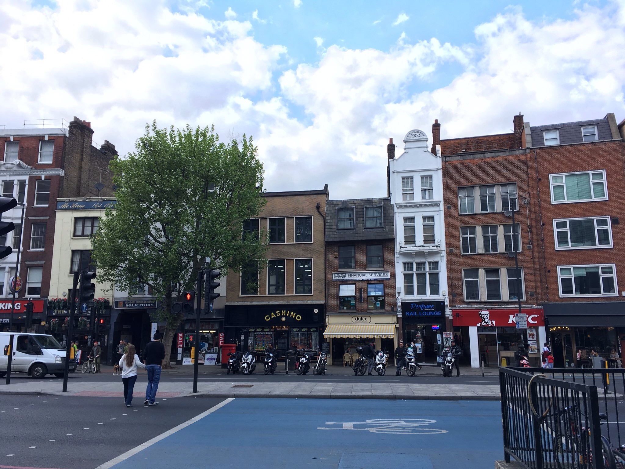
{
"id": 560,
"title": "Shop fronts",
"author": {
"id": 125,
"username": "Rrudall1"
},
"feature": {
"id": 319,
"type": "Feature",
"geometry": {
"type": "MultiPolygon",
"coordinates": [
[
[
[
-0.070587508487069,
51.51582522832629
],
[
-0.070675611333876,
51.51579418730421
],
[
-0.070852952784208,
51.5159819428065
],
[
-0.070751387378099,
51.51601330811343
],
[
-0.070697858527576,
51.51594882337312
],
[
-0.070639428539506,
51.51597016664268
],
[
-0.070598561790314,
51.51592506125996
],
[
-0.070661386641758,
51.51590208444297
],
[
-0.070587508487069,
51.51582522832629
]
]
]
]
},
"properties": {
"b_number": "87",
"b_name": "87 Whitechapel High Street",
"street": "Whitechapel High Street",
"address": "87 Whitechapel High Street",
"feature_type": "WHITECHAPEL_BUILDING",
"count": 3,
"search_str": "87 Whitechapel High Street"
},
"tags": []
},
"file": "https://surveyoflondon.org/media/uploads/features/322/image.jpg",
"description": "A view of the mixture of buildings on Whitechapel High Street (from No 83 at the right to No 90 at the left), spring 2017",
"copyright": false,
"created": "2017-05-02"
},
{
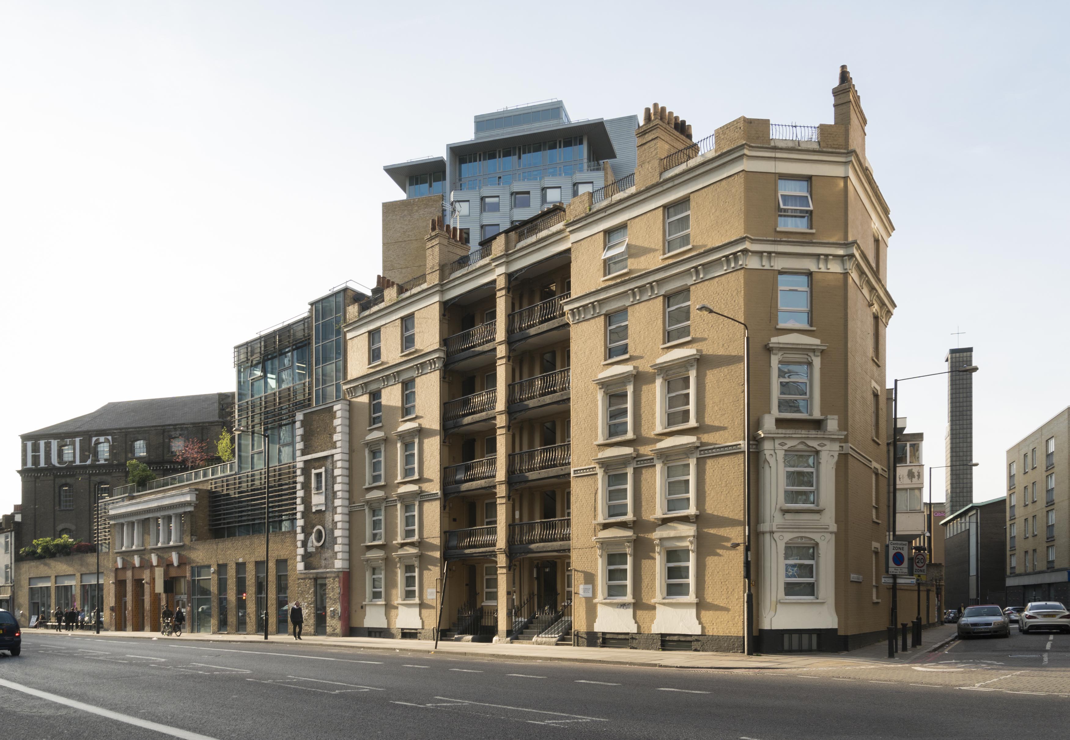
"id": 457,
"title": "Morrison Buildings, 35A Commercial Road, night view c.2008",
"author": {
"id": 29,
"username": "CRedgrave"
},
"feature": {
"id": 104,
"type": "Feature",
"geometry": {
"type": "MultiPolygon",
"coordinates": [
[
[
[
-0.067575873484362,
51.51517071197499
],
[
-0.067301848069004,
51.51519583699676
],
[
-0.067290915712187,
51.51515928337511
],
[
-0.067487025493436,
51.51513886953629
],
[
-0.067486243833999,
51.51507915216355
],
[
-0.067459551430111,
51.5150784716129
],
[
-0.067459190104118,
51.51512082958824
],
[
-0.067370744732515,
51.51512026535021
],
[
-0.067371602468317,
51.51509139494637
],
[
-0.067337341817176,
51.51509045260022
],
[
-0.067336157702324,
51.51511842307299
],
[
-0.067260978211402,
51.51511209496762
],
[
-0.06726103970934,
51.515062477366264
],
[
-0.067197978833116,
51.515058893491776
],
[
-0.06719423414954,
51.51500285179641
],
[
-0.067219601501926,
51.514981641263006
],
[
-0.067538550311893,
51.51500979847367
],
[
-0.067575873484362,
51.51517071197499
]
]
]
]
},
"properties": {
"b_number": "35A",
"b_name": "",
"street": "Commercial Road",
"address": "Morrison Buildings North, 35a Commercial Road",
"feature_type": "WHITECHAPEL_BUILDING",
"count": 4,
"search_str": "Morrison Buildings North, 35a Commercial Road"
},
"tags": [
"philanthropic dwellings"
]
},
"file": "https://surveyoflondon.org/media/uploads/features/104/Morrison%20Dwellings.jpg",
"description": "",
"copyright": true,
"created": "2016-11-17"
},
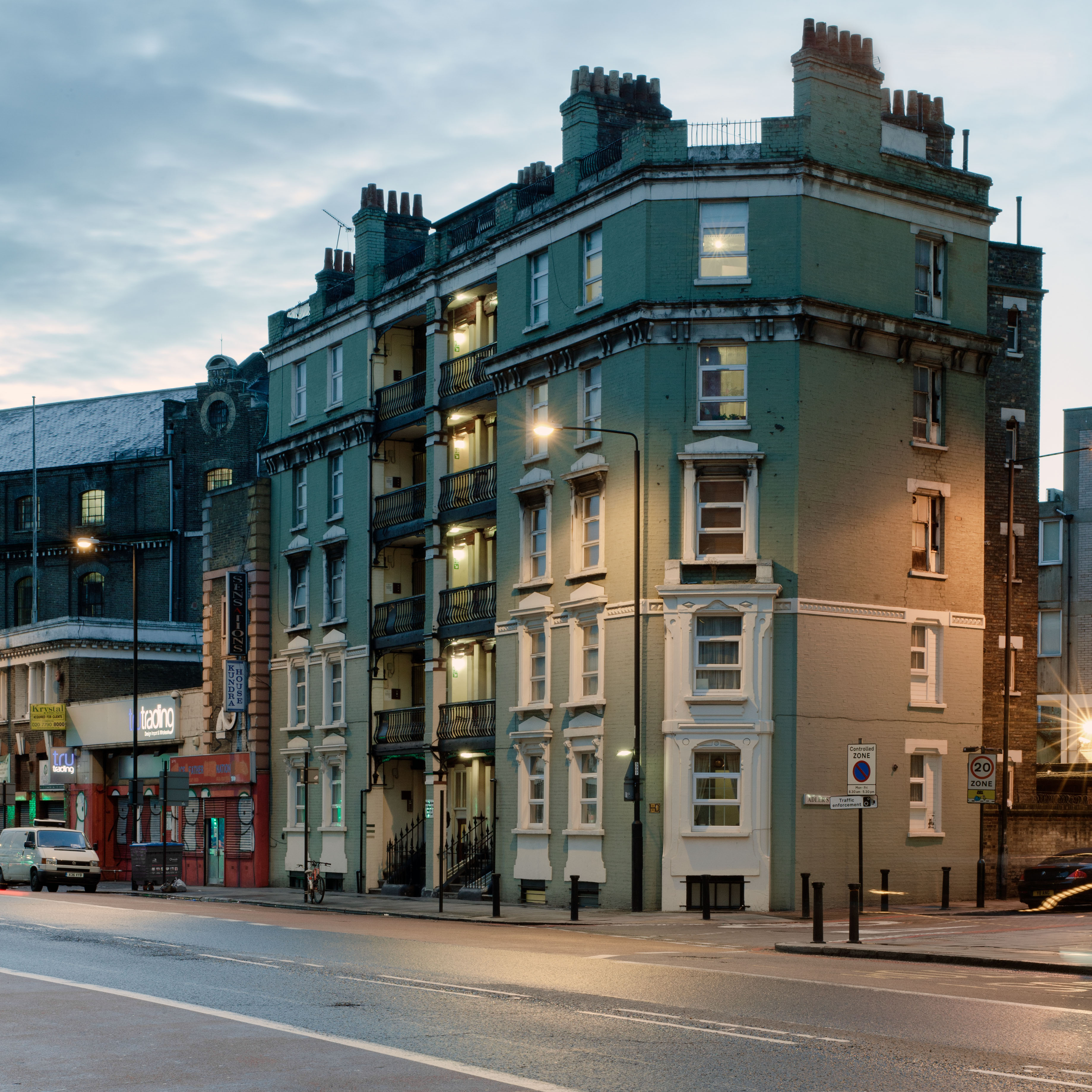
{
"id": 591,
"title": "Morrison Buildings North, 35A Commercial Road, from the south-east in April 2017",
"author": {
"id": 27,
"username": "DerekKendall"
},
"feature": {
"id": 104,
"type": "Feature",
"geometry": {
"type": "MultiPolygon",
"coordinates": [
[
[
[
-0.067575873484362,
51.51517071197499
],
[
-0.067301848069004,
51.51519583699676
],
[
-0.067290915712187,
51.51515928337511
],
[
-0.067487025493436,
51.51513886953629
],
[
-0.067486243833999,
51.51507915216355
],
[
-0.067459551430111,
51.5150784716129
],
[
-0.067459190104118,
51.51512082958824
],
[
-0.067370744732515,
51.51512026535021
],
[
-0.067371602468317,
51.51509139494637
],
[
-0.067337341817176,
51.51509045260022
],
[
-0.067336157702324,
51.51511842307299
],
[
-0.067260978211402,
51.51511209496762
],
[
-0.06726103970934,
51.515062477366264
],
[
-0.067197978833116,
51.515058893491776
],
[
-0.06719423414954,
51.51500285179641
],
[
-0.067219601501926,
51.514981641263006
],
[
-0.067538550311893,
51.51500979847367
],
[
-0.067575873484362,
51.51517071197499
]
]
]
]
},
"properties": {
"b_number": "35A",
"b_name": "",
"street": "Commercial Road",
"address": "Morrison Buildings North, 35a Commercial Road",
"feature_type": "WHITECHAPEL_BUILDING",
"count": 4,
"search_str": "Morrison Buildings North, 35a Commercial Road"
},
"tags": [
"philanthropic dwellings"
]
},
"file": "https://surveyoflondon.org/media/uploads/features/104/SoL%20Whitechapel%20100632.jpg",
"description": "",
"copyright": true,
"created": "2017-05-03"
}
]
}
%20c%201990.jpg)