HTTP 200 OK
Allow: GET, HEAD, OPTIONS
Content-Type: application/json
Vary: Accept
{
"count": 1747,
"next": "https://surveyoflondon.org/api/v1/images/?format=api&page=46",
"previous": "https://surveyoflondon.org/api/v1/images/?format=api&page=44",
"results": [
{
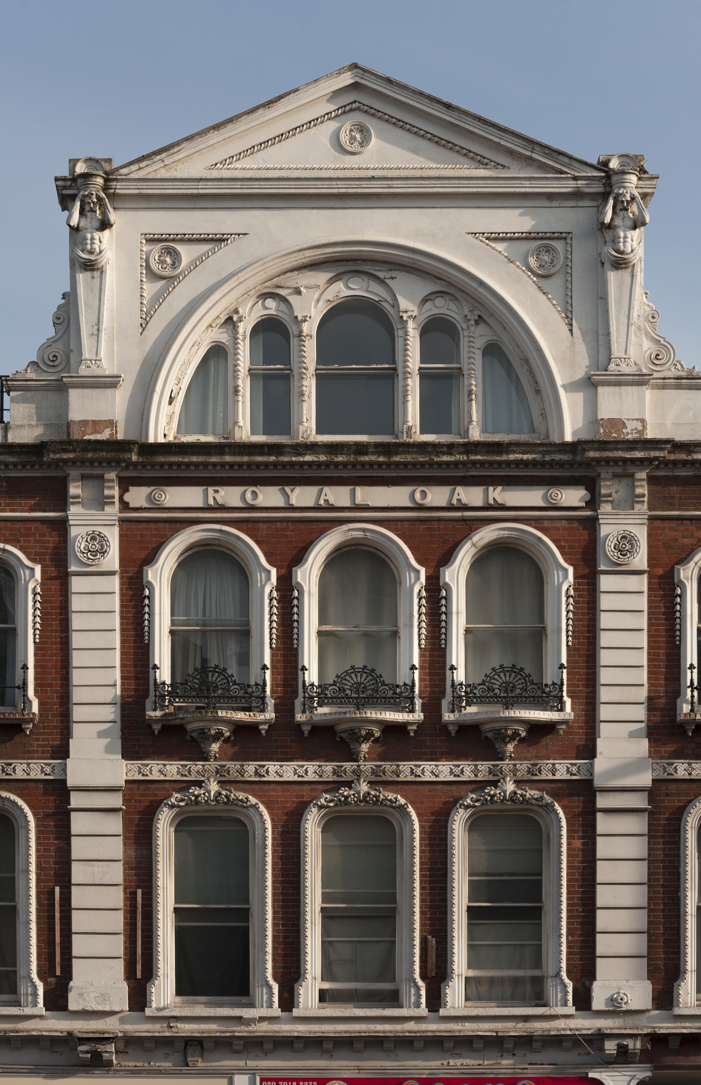
"id": 956,
"title": "Former Royal Oak public house, facade detail, March 2017",
"author": {
"id": 27,
"username": "DerekKendall"
},
"feature": {
"id": 873,
"type": "Feature",
"geometry": {
"type": "MultiPolygon",
"coordinates": [
[
[
[
-0.063739503777729,
51.51804861845898
],
[
-0.063683451117025,
51.51797300209851
],
[
-0.0637089382797,
51.51796483346984
],
[
-0.063836182144524,
51.51792452272944
],
[
-0.063835842009052,
51.51792462190747
],
[
-0.063877274830691,
51.51791330545044
],
[
-0.063934479931202,
51.51800468952643
],
[
-0.063739503777729,
51.51804861845898
]
]
]
]
},
"properties": {
"b_number": "118-120",
"b_name": "Former Royal Oak public house",
"street": "Whitechapel Road",
"address": "Former Royal Oak public house, 118-120 Whitechapel Road",
"feature_type": "WHITECHAPEL_BUILDING",
"count": 9,
"search_str": "Former Royal Oak public house"
},
"tags": [
"Royal Oak"
]
},
"file": "https://surveyoflondon.org/media/uploads/features/873/SoL%20Whitechapel%20100754.jpg",
"description": "",
"copyright": true,
"created": "2017-11-30"
},
{
"id": 980,
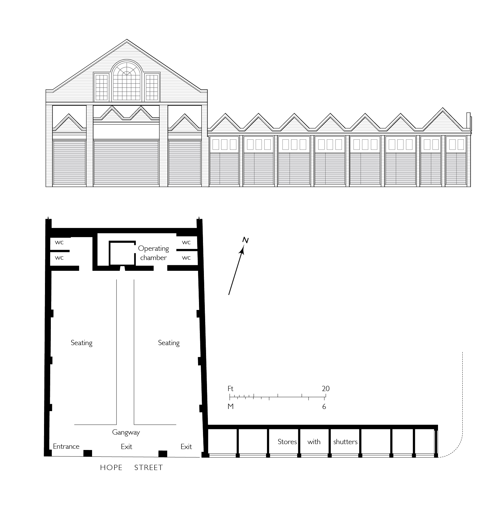
"title": "Hope Street's fish-market hall of 1901-2, adapted for evening cinema use in 1909-10, later a poultry slaughterhouse (shechita)",
"author": {
"id": 82,
"username": "HelenJones"
},
"feature": {
"id": 118,
"type": "Feature",
"geometry": {
"type": "MultiPolygon",
"coordinates": [
[
[
[
-0.068854900961053,
51.51773005717977
],
[
-0.068993303305841,
51.51769835942027
],
[
-0.068993311546556,
51.51769835753326
],
[
-0.069011717927375,
51.51772969068575
],
[
-0.068876708117188,
51.517763727296845
],
[
-0.068854900961053,
51.51773005717977
]
]
]
]
},
"properties": {
"b_number": "25",
"b_name": "",
"street": "Old Montague Street",
"address": "25 Old Montague Street",
"feature_type": "WHITECHAPEL_BUILDING",
"count": 13,
"search_str": "25 Old Montague Street"
},
"tags": []
},
"file": "https://surveyoflondon.org/media/uploads/features/118/Fish%20market%20cinema%20plan%20final%202.jpg",
"description": "",
"copyright": false,
"created": "2017-12-05"
},
{
"id": 733,
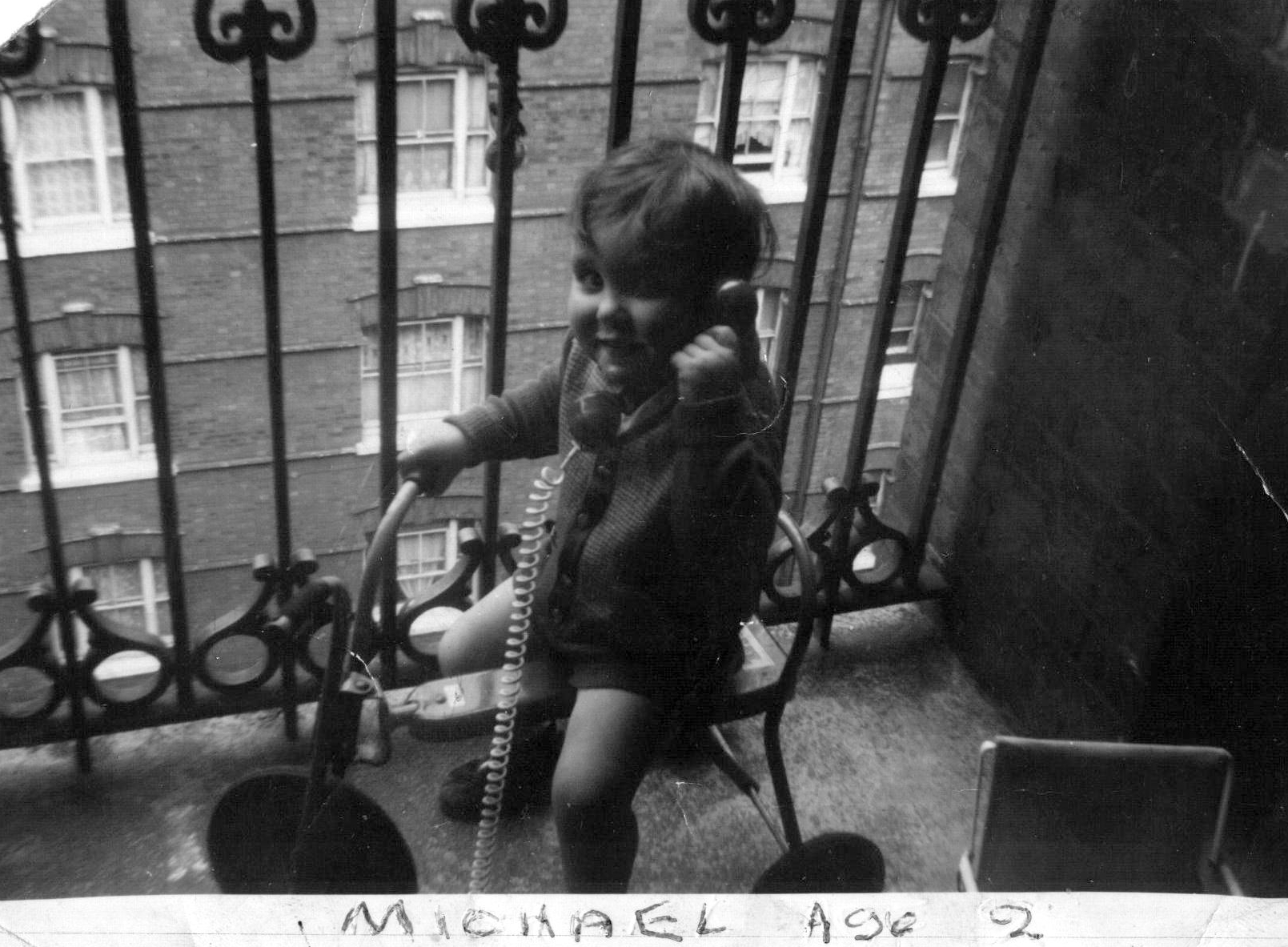
"title": "On the landing at Brady Street Dwellings",
"author": {
"id": 181,
"username": "mick"
},
"feature": {
"id": 611,
"type": "Feature",
"geometry": {
"type": "MultiPolygon",
"coordinates": [
[
[
[
-0.061071171968994,
51.52081854756523
],
[
-0.060751914384132,
51.520910345673705
],
[
-0.060670800177771,
51.520804404847986
],
[
-0.060468455213489,
51.52086122248221
],
[
-0.060450699740395,
51.52083834953325
],
[
-0.060348963469709,
51.52086716970229
],
[
-0.060327054268411,
51.52084002855742
],
[
-0.060218088338048,
51.52087362145146
],
[
-0.060181870551264,
51.52082767044763
],
[
-0.059888941340425,
51.5209177401419
],
[
-0.059906837511582,
51.520944348074295
],
[
-0.059794155620414,
51.52097953029167
],
[
-0.059832243956796,
51.521028790808174
],
[
-0.059621239031678,
51.52108457365709
],
[
-0.059750656156039,
51.521261628315195
],
[
-0.060092261050819,
51.521162518995624
],
[
-0.060201267294625,
51.5213109827491
],
[
-0.059711284021543,
51.521455446025634
],
[
-0.059608494153443,
51.52131130869682
],
[
-0.059508393196664,
51.521340050168135
],
[
-0.059253117703057,
51.52099166668332
],
[
-0.059256033768267,
51.5209595242491
],
[
-0.059159886666936,
51.520817675044256
],
[
-0.059263515528805,
51.520783743654874
],
[
-0.059005942108209,
51.52046133162211
],
[
-0.059340108320742,
51.520363660572684
],
[
-0.059350977165626,
51.520379010450526
],
[
-0.059653760593448,
51.52029256187745
],
[
-0.059732700862836,
51.52040478191169
],
[
-0.059399004206541,
51.520507265410146
],
[
-0.059386008017351,
51.52050099774739
],
[
-0.059330111279166,
51.52051942249526
],
[
-0.059427473319942,
51.520650551502136
],
[
-0.059335113114943,
51.52067740335036
],
[
-0.059393880270447,
51.52075719296283
],
[
-0.059578966698866,
51.52070547069434
],
[
-0.059521505013312,
51.5206204479455
],
[
-0.059633019030968,
51.52058917356787
],
[
-0.05965569761926,
51.52061535612946
],
[
-0.059758050698807,
51.52058539506149
],
[
-0.059784825395434,
51.520617287071275
],
[
-0.059896250945807,
51.520586175310825
],
[
-0.059905010512797,
51.5206001008183
],
[
-0.060207891820099,
51.520512562603464
],
[
-0.060152819128302,
51.52043377382353
],
[
-0.060255799218263,
51.520404384952066
],
[
-0.060243948876997,
51.520387831372716
],
[
-0.060374285949892,
51.52035112116383
],
[
-0.06040163767932,
51.52038826992398
],
[
-0.060493821347423,
51.520361732013576
],
[
-0.060585729284775,
51.52048450453705
],
[
-0.060667847773396,
51.520461046936504
],
[
-0.060740712007704,
51.520573214734334
],
[
-0.060789668351451,
51.52055928381185
],
[
-0.060862533037535,
51.52067145153698
],
[
-0.060908498405939,
51.52065859991671
],
[
-0.06094600415928,
51.52070981388415
],
[
-0.060904572245245,
51.52072152762277
],
[
-0.060915563003104,
51.5207389782457
],
[
-0.06100155865022,
51.52071591478786
],
[
-0.061071171968994,
51.52081854756523
]
]
]
]
},
"properties": {
"b_number": "",
"b_name": "Swanlea Secondary School",
"street": "Brady Street",
"address": "Swanlea Secondary School, Brady Street and Durward Street",
"feature_type": "WHITECHAPEL_BUILDING",
"count": 20,
"search_str": "Swanlea Secondary School"
},
"tags": []
},
"file": "https://surveyoflondon.org/media/uploads/features/611/1963%20On%20trike%20on%20landing.JPG",
"description": "My first mobile phone.",
"copyright": false,
"created": "2017-08-09"
},
{
"id": 734,
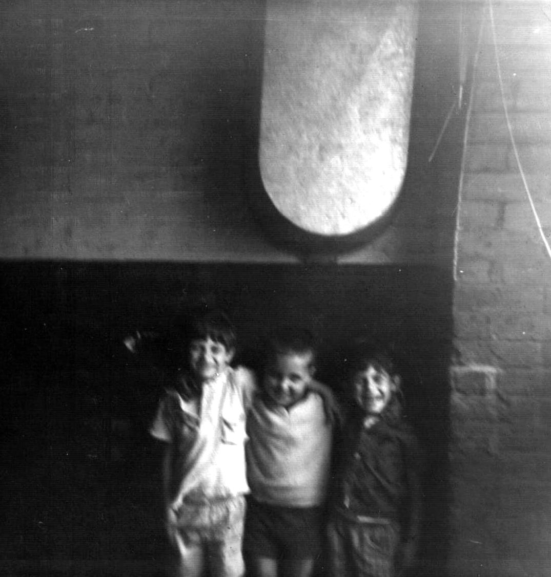
"title": "Friends on the landing in Brady Street Dwellings",
"author": {
"id": 181,
"username": "mick"
},
"feature": {
"id": 611,
"type": "Feature",
"geometry": {
"type": "MultiPolygon",
"coordinates": [
[
[
[
-0.061071171968994,
51.52081854756523
],
[
-0.060751914384132,
51.520910345673705
],
[
-0.060670800177771,
51.520804404847986
],
[
-0.060468455213489,
51.52086122248221
],
[
-0.060450699740395,
51.52083834953325
],
[
-0.060348963469709,
51.52086716970229
],
[
-0.060327054268411,
51.52084002855742
],
[
-0.060218088338048,
51.52087362145146
],
[
-0.060181870551264,
51.52082767044763
],
[
-0.059888941340425,
51.5209177401419
],
[
-0.059906837511582,
51.520944348074295
],
[
-0.059794155620414,
51.52097953029167
],
[
-0.059832243956796,
51.521028790808174
],
[
-0.059621239031678,
51.52108457365709
],
[
-0.059750656156039,
51.521261628315195
],
[
-0.060092261050819,
51.521162518995624
],
[
-0.060201267294625,
51.5213109827491
],
[
-0.059711284021543,
51.521455446025634
],
[
-0.059608494153443,
51.52131130869682
],
[
-0.059508393196664,
51.521340050168135
],
[
-0.059253117703057,
51.52099166668332
],
[
-0.059256033768267,
51.5209595242491
],
[
-0.059159886666936,
51.520817675044256
],
[
-0.059263515528805,
51.520783743654874
],
[
-0.059005942108209,
51.52046133162211
],
[
-0.059340108320742,
51.520363660572684
],
[
-0.059350977165626,
51.520379010450526
],
[
-0.059653760593448,
51.52029256187745
],
[
-0.059732700862836,
51.52040478191169
],
[
-0.059399004206541,
51.520507265410146
],
[
-0.059386008017351,
51.52050099774739
],
[
-0.059330111279166,
51.52051942249526
],
[
-0.059427473319942,
51.520650551502136
],
[
-0.059335113114943,
51.52067740335036
],
[
-0.059393880270447,
51.52075719296283
],
[
-0.059578966698866,
51.52070547069434
],
[
-0.059521505013312,
51.5206204479455
],
[
-0.059633019030968,
51.52058917356787
],
[
-0.05965569761926,
51.52061535612946
],
[
-0.059758050698807,
51.52058539506149
],
[
-0.059784825395434,
51.520617287071275
],
[
-0.059896250945807,
51.520586175310825
],
[
-0.059905010512797,
51.5206001008183
],
[
-0.060207891820099,
51.520512562603464
],
[
-0.060152819128302,
51.52043377382353
],
[
-0.060255799218263,
51.520404384952066
],
[
-0.060243948876997,
51.520387831372716
],
[
-0.060374285949892,
51.52035112116383
],
[
-0.06040163767932,
51.52038826992398
],
[
-0.060493821347423,
51.520361732013576
],
[
-0.060585729284775,
51.52048450453705
],
[
-0.060667847773396,
51.520461046936504
],
[
-0.060740712007704,
51.520573214734334
],
[
-0.060789668351451,
51.52055928381185
],
[
-0.060862533037535,
51.52067145153698
],
[
-0.060908498405939,
51.52065859991671
],
[
-0.06094600415928,
51.52070981388415
],
[
-0.060904572245245,
51.52072152762277
],
[
-0.060915563003104,
51.5207389782457
],
[
-0.06100155865022,
51.52071591478786
],
[
-0.061071171968994,
51.52081854756523
]
]
]
]
},
"properties": {
"b_number": "",
"b_name": "Swanlea Secondary School",
"street": "Brady Street",
"address": "Swanlea Secondary School, Brady Street and Durward Street",
"feature_type": "WHITECHAPEL_BUILDING",
"count": 20,
"search_str": "Swanlea Secondary School"
},
"tags": []
},
"file": "https://surveyoflondon.org/media/uploads/features/611/1965%20Paul%2C%20Michael%2C%20David%2C%20Bath.jpg",
"description": "Paul, myself and David on the landing. I don't have good memories of that tin bath, nor of the bath house at the end of the block, or even being washed in the sink when I was still small enough.",
"copyright": false,
"created": "2017-08-09"
},
{
"id": 735,
"title": "Aunty Pat between Brady Street Dwellings and the Mansions",
"author": {
"id": 181,
"username": "mick"
},
"feature": {
"id": 611,
"type": "Feature",
"geometry": {
"type": "MultiPolygon",
"coordinates": [
[
[
[
-0.061071171968994,
51.52081854756523
],
[
-0.060751914384132,
51.520910345673705
],
[
-0.060670800177771,
51.520804404847986
],
[
-0.060468455213489,
51.52086122248221
],
[
-0.060450699740395,
51.52083834953325
],
[
-0.060348963469709,
51.52086716970229
],
[
-0.060327054268411,
51.52084002855742
],
[
-0.060218088338048,
51.52087362145146
],
[
-0.060181870551264,
51.52082767044763
],
[
-0.059888941340425,
51.5209177401419
],
[
-0.059906837511582,
51.520944348074295
],
[
-0.059794155620414,
51.52097953029167
],
[
-0.059832243956796,
51.521028790808174
],
[
-0.059621239031678,
51.52108457365709
],
[
-0.059750656156039,
51.521261628315195
],
[
-0.060092261050819,
51.521162518995624
],
[
-0.060201267294625,
51.5213109827491
],
[
-0.059711284021543,
51.521455446025634
],
[
-0.059608494153443,
51.52131130869682
],
[
-0.059508393196664,
51.521340050168135
],
[
-0.059253117703057,
51.52099166668332
],
[
-0.059256033768267,
51.5209595242491
],
[
-0.059159886666936,
51.520817675044256
],
[
-0.059263515528805,
51.520783743654874
],
[
-0.059005942108209,
51.52046133162211
],
[
-0.059340108320742,
51.520363660572684
],
[
-0.059350977165626,
51.520379010450526
],
[
-0.059653760593448,
51.52029256187745
],
[
-0.059732700862836,
51.52040478191169
],
[
-0.059399004206541,
51.520507265410146
],
[
-0.059386008017351,
51.52050099774739
],
[
-0.059330111279166,
51.52051942249526
],
[
-0.059427473319942,
51.520650551502136
],
[
-0.059335113114943,
51.52067740335036
],
[
-0.059393880270447,
51.52075719296283
],
[
-0.059578966698866,
51.52070547069434
],
[
-0.059521505013312,
51.5206204479455
],
[
-0.059633019030968,
51.52058917356787
],
[
-0.05965569761926,
51.52061535612946
],
[
-0.059758050698807,
51.52058539506149
],
[
-0.059784825395434,
51.520617287071275
],
[
-0.059896250945807,
51.520586175310825
],
[
-0.059905010512797,
51.5206001008183
],
[
-0.060207891820099,
51.520512562603464
],
[
-0.060152819128302,
51.52043377382353
],
[
-0.060255799218263,
51.520404384952066
],
[
-0.060243948876997,
51.520387831372716
],
[
-0.060374285949892,
51.52035112116383
],
[
-0.06040163767932,
51.52038826992398
],
[
-0.060493821347423,
51.520361732013576
],
[
-0.060585729284775,
51.52048450453705
],
[
-0.060667847773396,
51.520461046936504
],
[
-0.060740712007704,
51.520573214734334
],
[
-0.060789668351451,
51.52055928381185
],
[
-0.060862533037535,
51.52067145153698
],
[
-0.060908498405939,
51.52065859991671
],
[
-0.06094600415928,
51.52070981388415
],
[
-0.060904572245245,
51.52072152762277
],
[
-0.060915563003104,
51.5207389782457
],
[
-0.06100155865022,
51.52071591478786
],
[
-0.061071171968994,
51.52081854756523
]
]
]
]
},
"properties": {
"b_number": "",
"b_name": "Swanlea Secondary School",
"street": "Brady Street",
"address": "Swanlea Secondary School, Brady Street and Durward Street",
"feature_type": "WHITECHAPEL_BUILDING",
"count": 20,
"search_str": "Swanlea Secondary School"
},
"tags": []
},
"file": "https://surveyoflondon.org/media/uploads/features/611/pat%20brady%20st%20dwellings.jpg",
"description": "At the time, most of the family on my mum's side lived in Brady Street Dwellings, in four or five flats all told.",
"copyright": false,
"created": "2017-08-09"
},
{
"id": 738,
"title": "Nana and mum outside Brady Street Dwellings",
"author": {
"id": 181,
"username": "mick"
},
"feature": {
"id": 611,
"type": "Feature",
"geometry": {
"type": "MultiPolygon",
"coordinates": [
[
[
[
-0.061071171968994,
51.52081854756523
],
[
-0.060751914384132,
51.520910345673705
],
[
-0.060670800177771,
51.520804404847986
],
[
-0.060468455213489,
51.52086122248221
],
[
-0.060450699740395,
51.52083834953325
],
[
-0.060348963469709,
51.52086716970229
],
[
-0.060327054268411,
51.52084002855742
],
[
-0.060218088338048,
51.52087362145146
],
[
-0.060181870551264,
51.52082767044763
],
[
-0.059888941340425,
51.5209177401419
],
[
-0.059906837511582,
51.520944348074295
],
[
-0.059794155620414,
51.52097953029167
],
[
-0.059832243956796,
51.521028790808174
],
[
-0.059621239031678,
51.52108457365709
],
[
-0.059750656156039,
51.521261628315195
],
[
-0.060092261050819,
51.521162518995624
],
[
-0.060201267294625,
51.5213109827491
],
[
-0.059711284021543,
51.521455446025634
],
[
-0.059608494153443,
51.52131130869682
],
[
-0.059508393196664,
51.521340050168135
],
[
-0.059253117703057,
51.52099166668332
],
[
-0.059256033768267,
51.5209595242491
],
[
-0.059159886666936,
51.520817675044256
],
[
-0.059263515528805,
51.520783743654874
],
[
-0.059005942108209,
51.52046133162211
],
[
-0.059340108320742,
51.520363660572684
],
[
-0.059350977165626,
51.520379010450526
],
[
-0.059653760593448,
51.52029256187745
],
[
-0.059732700862836,
51.52040478191169
],
[
-0.059399004206541,
51.520507265410146
],
[
-0.059386008017351,
51.52050099774739
],
[
-0.059330111279166,
51.52051942249526
],
[
-0.059427473319942,
51.520650551502136
],
[
-0.059335113114943,
51.52067740335036
],
[
-0.059393880270447,
51.52075719296283
],
[
-0.059578966698866,
51.52070547069434
],
[
-0.059521505013312,
51.5206204479455
],
[
-0.059633019030968,
51.52058917356787
],
[
-0.05965569761926,
51.52061535612946
],
[
-0.059758050698807,
51.52058539506149
],
[
-0.059784825395434,
51.520617287071275
],
[
-0.059896250945807,
51.520586175310825
],
[
-0.059905010512797,
51.5206001008183
],
[
-0.060207891820099,
51.520512562603464
],
[
-0.060152819128302,
51.52043377382353
],
[
-0.060255799218263,
51.520404384952066
],
[
-0.060243948876997,
51.520387831372716
],
[
-0.060374285949892,
51.52035112116383
],
[
-0.06040163767932,
51.52038826992398
],
[
-0.060493821347423,
51.520361732013576
],
[
-0.060585729284775,
51.52048450453705
],
[
-0.060667847773396,
51.520461046936504
],
[
-0.060740712007704,
51.520573214734334
],
[
-0.060789668351451,
51.52055928381185
],
[
-0.060862533037535,
51.52067145153698
],
[
-0.060908498405939,
51.52065859991671
],
[
-0.06094600415928,
51.52070981388415
],
[
-0.060904572245245,
51.52072152762277
],
[
-0.060915563003104,
51.5207389782457
],
[
-0.06100155865022,
51.52071591478786
],
[
-0.061071171968994,
51.52081854756523
]
]
]
]
},
"properties": {
"b_number": "",
"b_name": "Swanlea Secondary School",
"street": "Brady Street",
"address": "Swanlea Secondary School, Brady Street and Durward Street",
"feature_type": "WHITECHAPEL_BUILDING",
"count": 20,
"search_str": "Swanlea Secondary School"
},
"tags": []
},
"file": "https://surveyoflondon.org/media/uploads/features/611/scan%205%20-%20Copy%20(2)_b8iCYCX.jpg",
"description": "",
"copyright": false,
"created": "2017-08-09"
},
{
"id": 739,
"title": "Dad on the landing in Brady Street Dwellings",
"author": {
"id": 181,
"username": "mick"
},
"feature": {
"id": 611,
"type": "Feature",
"geometry": {
"type": "MultiPolygon",
"coordinates": [
[
[
[
-0.061071171968994,
51.52081854756523
],
[
-0.060751914384132,
51.520910345673705
],
[
-0.060670800177771,
51.520804404847986
],
[
-0.060468455213489,
51.52086122248221
],
[
-0.060450699740395,
51.52083834953325
],
[
-0.060348963469709,
51.52086716970229
],
[
-0.060327054268411,
51.52084002855742
],
[
-0.060218088338048,
51.52087362145146
],
[
-0.060181870551264,
51.52082767044763
],
[
-0.059888941340425,
51.5209177401419
],
[
-0.059906837511582,
51.520944348074295
],
[
-0.059794155620414,
51.52097953029167
],
[
-0.059832243956796,
51.521028790808174
],
[
-0.059621239031678,
51.52108457365709
],
[
-0.059750656156039,
51.521261628315195
],
[
-0.060092261050819,
51.521162518995624
],
[
-0.060201267294625,
51.5213109827491
],
[
-0.059711284021543,
51.521455446025634
],
[
-0.059608494153443,
51.52131130869682
],
[
-0.059508393196664,
51.521340050168135
],
[
-0.059253117703057,
51.52099166668332
],
[
-0.059256033768267,
51.5209595242491
],
[
-0.059159886666936,
51.520817675044256
],
[
-0.059263515528805,
51.520783743654874
],
[
-0.059005942108209,
51.52046133162211
],
[
-0.059340108320742,
51.520363660572684
],
[
-0.059350977165626,
51.520379010450526
],
[
-0.059653760593448,
51.52029256187745
],
[
-0.059732700862836,
51.52040478191169
],
[
-0.059399004206541,
51.520507265410146
],
[
-0.059386008017351,
51.52050099774739
],
[
-0.059330111279166,
51.52051942249526
],
[
-0.059427473319942,
51.520650551502136
],
[
-0.059335113114943,
51.52067740335036
],
[
-0.059393880270447,
51.52075719296283
],
[
-0.059578966698866,
51.52070547069434
],
[
-0.059521505013312,
51.5206204479455
],
[
-0.059633019030968,
51.52058917356787
],
[
-0.05965569761926,
51.52061535612946
],
[
-0.059758050698807,
51.52058539506149
],
[
-0.059784825395434,
51.520617287071275
],
[
-0.059896250945807,
51.520586175310825
],
[
-0.059905010512797,
51.5206001008183
],
[
-0.060207891820099,
51.520512562603464
],
[
-0.060152819128302,
51.52043377382353
],
[
-0.060255799218263,
51.520404384952066
],
[
-0.060243948876997,
51.520387831372716
],
[
-0.060374285949892,
51.52035112116383
],
[
-0.06040163767932,
51.52038826992398
],
[
-0.060493821347423,
51.520361732013576
],
[
-0.060585729284775,
51.52048450453705
],
[
-0.060667847773396,
51.520461046936504
],
[
-0.060740712007704,
51.520573214734334
],
[
-0.060789668351451,
51.52055928381185
],
[
-0.060862533037535,
51.52067145153698
],
[
-0.060908498405939,
51.52065859991671
],
[
-0.06094600415928,
51.52070981388415
],
[
-0.060904572245245,
51.52072152762277
],
[
-0.060915563003104,
51.5207389782457
],
[
-0.06100155865022,
51.52071591478786
],
[
-0.061071171968994,
51.52081854756523
]
]
]
]
},
"properties": {
"b_number": "",
"b_name": "Swanlea Secondary School",
"street": "Brady Street",
"address": "Swanlea Secondary School, Brady Street and Durward Street",
"feature_type": "WHITECHAPEL_BUILDING",
"count": 20,
"search_str": "Swanlea Secondary School"
},
"tags": []
},
"file": "https://surveyoflondon.org/media/uploads/features/611/1968%20Dad%20on%20landing.JPG",
"description": "",
"copyright": false,
"created": "2017-08-09"
},
{
"id": 740,
"title": "In the yard at Brady Street Dwellings",
"author": {
"id": 181,
"username": "mick"
},
"feature": {
"id": 611,
"type": "Feature",
"geometry": {
"type": "MultiPolygon",
"coordinates": [
[
[
[
-0.061071171968994,
51.52081854756523
],
[
-0.060751914384132,
51.520910345673705
],
[
-0.060670800177771,
51.520804404847986
],
[
-0.060468455213489,
51.52086122248221
],
[
-0.060450699740395,
51.52083834953325
],
[
-0.060348963469709,
51.52086716970229
],
[
-0.060327054268411,
51.52084002855742
],
[
-0.060218088338048,
51.52087362145146
],
[
-0.060181870551264,
51.52082767044763
],
[
-0.059888941340425,
51.5209177401419
],
[
-0.059906837511582,
51.520944348074295
],
[
-0.059794155620414,
51.52097953029167
],
[
-0.059832243956796,
51.521028790808174
],
[
-0.059621239031678,
51.52108457365709
],
[
-0.059750656156039,
51.521261628315195
],
[
-0.060092261050819,
51.521162518995624
],
[
-0.060201267294625,
51.5213109827491
],
[
-0.059711284021543,
51.521455446025634
],
[
-0.059608494153443,
51.52131130869682
],
[
-0.059508393196664,
51.521340050168135
],
[
-0.059253117703057,
51.52099166668332
],
[
-0.059256033768267,
51.5209595242491
],
[
-0.059159886666936,
51.520817675044256
],
[
-0.059263515528805,
51.520783743654874
],
[
-0.059005942108209,
51.52046133162211
],
[
-0.059340108320742,
51.520363660572684
],
[
-0.059350977165626,
51.520379010450526
],
[
-0.059653760593448,
51.52029256187745
],
[
-0.059732700862836,
51.52040478191169
],
[
-0.059399004206541,
51.520507265410146
],
[
-0.059386008017351,
51.52050099774739
],
[
-0.059330111279166,
51.52051942249526
],
[
-0.059427473319942,
51.520650551502136
],
[
-0.059335113114943,
51.52067740335036
],
[
-0.059393880270447,
51.52075719296283
],
[
-0.059578966698866,
51.52070547069434
],
[
-0.059521505013312,
51.5206204479455
],
[
-0.059633019030968,
51.52058917356787
],
[
-0.05965569761926,
51.52061535612946
],
[
-0.059758050698807,
51.52058539506149
],
[
-0.059784825395434,
51.520617287071275
],
[
-0.059896250945807,
51.520586175310825
],
[
-0.059905010512797,
51.5206001008183
],
[
-0.060207891820099,
51.520512562603464
],
[
-0.060152819128302,
51.52043377382353
],
[
-0.060255799218263,
51.520404384952066
],
[
-0.060243948876997,
51.520387831372716
],
[
-0.060374285949892,
51.52035112116383
],
[
-0.06040163767932,
51.52038826992398
],
[
-0.060493821347423,
51.520361732013576
],
[
-0.060585729284775,
51.52048450453705
],
[
-0.060667847773396,
51.520461046936504
],
[
-0.060740712007704,
51.520573214734334
],
[
-0.060789668351451,
51.52055928381185
],
[
-0.060862533037535,
51.52067145153698
],
[
-0.060908498405939,
51.52065859991671
],
[
-0.06094600415928,
51.52070981388415
],
[
-0.060904572245245,
51.52072152762277
],
[
-0.060915563003104,
51.5207389782457
],
[
-0.06100155865022,
51.52071591478786
],
[
-0.061071171968994,
51.52081854756523
]
]
]
]
},
"properties": {
"b_number": "",
"b_name": "Swanlea Secondary School",
"street": "Brady Street",
"address": "Swanlea Secondary School, Brady Street and Durward Street",
"feature_type": "WHITECHAPEL_BUILDING",
"count": 20,
"search_str": "Swanlea Secondary School"
},
"tags": []
},
"file": "https://surveyoflondon.org/media/uploads/features/611/scan%20916.jpg",
"description": "I'm in that pram :)",
"copyright": false,
"created": "2017-08-09"
},
{
"id": 1049,
"title": "Foundation School",
"author": {
"id": 18,
"username": "shahedsaleem"
},
"feature": {
"id": 457,
"type": "Feature",
"geometry": {
"type": "MultiPolygon",
"coordinates": [
[
[
[
-0.064306653921509,
51.51869756687207
],
[
-0.064105375412222,
51.51875924135426
],
[
-0.063952198181477,
51.518573484546806
],
[
-0.063984079642557,
51.518563251740986
],
[
-0.064068953323597,
51.518666177498226
],
[
-0.064236440229581,
51.51861241996125
],
[
-0.064306653921509,
51.51869756687207
]
]
]
]
},
"properties": {
"b_number": "179",
"b_name": "",
"street": "Whitechapel Road",
"address": "Davenant Centre to rear of 179 Whitechapel Road",
"feature_type": "WHITECHAPEL_BUILDING",
"count": 9,
"search_str": "Davenant Centre to rear of 179 Whitechapel Road"
},
"tags": [
"Davenant School",
"Foundation School",
"'Frank Ponler Telfer"
]
},
"file": "https://surveyoflondon.org/media/uploads/features/457/IMG_4755.jpg",
"description": "The Foundation School building to the rear of the Davenant Centre, vacant when photographed in October 2017",
"copyright": false,
"created": "2018-01-19"
},
{
"id": 1420,
"title": "Sunnamusk, 75 Whitechapel Road, view to east in late 2018",
"author": {
"id": 27,
"username": "DerekKendall"
},
"feature": {
"id": 112,
"type": "Feature",
"geometry": {
"type": "MultiPolygon",
"coordinates": [
[
[
[
-0.066957716149887,
51.51736190286489
],
[
-0.067080084424384,
51.51747807555298
],
[
-0.067080079175569,
51.51747808475281
],
[
-0.066975623228904,
51.51751707479948
],
[
-0.066860292367928,
51.51739939698715
],
[
-0.066957716149887,
51.51736190286489
]
]
]
]
},
"properties": {
"b_number": "75",
"b_name": "",
"street": "Whitechapel Road",
"address": "75 Whitechapel Road",
"feature_type": "WHITECHAPEL_BUILDING",
"count": 7,
"search_str": "75 Whitechapel Road"
},
"tags": []
},
"file": "https://surveyoflondon.org/media/uploads/features/112/SoL%20Whitechapel%20102281.jpg",
"description": "",
"copyright": true,
"created": "2018-11-13"
},
{
"id": 298,
"title": "62 Fieldgate Street, detail of shopfront with figures by Stik on shutter",
"author": {
"id": 27,
"username": "DerekKendall"
},
"feature": {
"id": 772,
"type": "Feature",
"geometry": {
"type": "MultiPolygon",
"coordinates": [
[
[
[
-0.063967783353312,
51.516999443880245
],
[
-0.063903334345823,
51.51700882842304
],
[
-0.063890957027578,
51.516927618452264
],
[
-0.063838321235722,
51.51693399544056
],
[
-0.063824313187807,
51.51688177295215
],
[
-0.063925986512683,
51.51686990389643
],
[
-0.063967783353312,
51.516999443880245
]
]
]
]
},
"properties": {
"b_number": "62",
"b_name": "",
"street": "Fieldgate Street",
"address": "London Action Resource Centre, 62 Fieldgate Street",
"feature_type": "WHITECHAPEL_BUILDING",
"count": 5,
"search_str": "London Action Resource Centre, 62 Fieldgate Street"
},
"tags": [
"chapel",
"school",
"synagogue"
]
},
"file": "https://surveyoflondon.org/media/uploads/features/772/SoL%20Whitechapel100438.jpg",
"description": "",
"copyright": true,
"created": "2016-08-19"
},
{
"id": 1061,
"title": "Foundation School staircase ",
"author": {
"id": 18,
"username": "shahedsaleem"
},
"feature": {
"id": 457,
"type": "Feature",
"geometry": {
"type": "MultiPolygon",
"coordinates": [
[
[
[
-0.064306653921509,
51.51869756687207
],
[
-0.064105375412222,
51.51875924135426
],
[
-0.063952198181477,
51.518573484546806
],
[
-0.063984079642557,
51.518563251740986
],
[
-0.064068953323597,
51.518666177498226
],
[
-0.064236440229581,
51.51861241996125
],
[
-0.064306653921509,
51.51869756687207
]
]
]
]
},
"properties": {
"b_number": "179",
"b_name": "",
"street": "Whitechapel Road",
"address": "Davenant Centre to rear of 179 Whitechapel Road",
"feature_type": "WHITECHAPEL_BUILDING",
"count": 9,
"search_str": "Davenant Centre to rear of 179 Whitechapel Road"
},
"tags": [
"Davenant School",
"Foundation School",
"'Frank Ponler Telfer"
]
},
"file": "https://surveyoflondon.org/media/uploads/features/457/IMG_4768.jpg",
"description": "",
"copyright": false,
"created": "2018-01-19"
},
{
"id": 1062,
"title": "Foundation School staircase",
"author": {
"id": 18,
"username": "shahedsaleem"
},
"feature": {
"id": 457,
"type": "Feature",
"geometry": {
"type": "MultiPolygon",
"coordinates": [
[
[
[
-0.064306653921509,
51.51869756687207
],
[
-0.064105375412222,
51.51875924135426
],
[
-0.063952198181477,
51.518573484546806
],
[
-0.063984079642557,
51.518563251740986
],
[
-0.064068953323597,
51.518666177498226
],
[
-0.064236440229581,
51.51861241996125
],
[
-0.064306653921509,
51.51869756687207
]
]
]
]
},
"properties": {
"b_number": "179",
"b_name": "",
"street": "Whitechapel Road",
"address": "Davenant Centre to rear of 179 Whitechapel Road",
"feature_type": "WHITECHAPEL_BUILDING",
"count": 9,
"search_str": "Davenant Centre to rear of 179 Whitechapel Road"
},
"tags": [
"Davenant School",
"Foundation School",
"'Frank Ponler Telfer"
]
},
"file": "https://surveyoflondon.org/media/uploads/features/457/IMG_4790.jpg",
"description": "",
"copyright": false,
"created": "2018-01-19"
},
{
"id": 1064,
"title": "Foundation School",
"author": {
"id": 18,
"username": "shahedsaleem"
},
"feature": {
"id": 457,
"type": "Feature",
"geometry": {
"type": "MultiPolygon",
"coordinates": [
[
[
[
-0.064306653921509,
51.51869756687207
],
[
-0.064105375412222,
51.51875924135426
],
[
-0.063952198181477,
51.518573484546806
],
[
-0.063984079642557,
51.518563251740986
],
[
-0.064068953323597,
51.518666177498226
],
[
-0.064236440229581,
51.51861241996125
],
[
-0.064306653921509,
51.51869756687207
]
]
]
]
},
"properties": {
"b_number": "179",
"b_name": "",
"street": "Whitechapel Road",
"address": "Davenant Centre to rear of 179 Whitechapel Road",
"feature_type": "WHITECHAPEL_BUILDING",
"count": 9,
"search_str": "Davenant Centre to rear of 179 Whitechapel Road"
},
"tags": [
"Davenant School",
"Foundation School",
"'Frank Ponler Telfer"
]
},
"file": "https://surveyoflondon.org/media/uploads/features/457/IMG_4777.jpg",
"description": "",
"copyright": false,
"created": "2018-01-19"
},
{
"id": 1122,
"title": "Spelman House view to the Davis estate",
"author": {
"id": 209,
"username": "f.ciufo"
},
"feature": {
"id": 223,
"type": "Feature",
"geometry": {
"type": "MultiPolygon",
"coordinates": [
[
[
[
-0.069651275011124,
51.51835449089215
],
[
-0.069592024694681,
51.51836717419471
],
[
-0.069587125932472,
51.518360246262
],
[
-0.069422150097701,
51.51838609725476
],
[
-0.069428895460589,
51.51840120950797
],
[
-0.069398491903018,
51.518404780174386
],
[
-0.069392714379199,
51.51838967325895
],
[
-0.069237263189485,
51.51841785638787
],
[
-0.069221236825655,
51.518417615963294
],
[
-0.069198758310569,
51.518413055117485
],
[
-0.069189106230736,
51.518402805327085
],
[
-0.069120097916717,
51.51825457693517
],
[
-0.069105176600071,
51.518256968483236
],
[
-0.069099054846448,
51.518236845706575
],
[
-0.06911264195119,
51.518235161624375
],
[
-0.069068670608898,
51.51812739697248
],
[
-0.069053930480549,
51.518128134519145
],
[
-0.06903992435002,
51.518096251376235
],
[
-0.069181990019506,
51.518069271172465
],
[
-0.069281479672148,
51.518305780531115
],
[
-0.069312100496919,
51.518315438787596
],
[
-0.069603812103688,
51.51826672197482
],
[
-0.069651275011124,
51.51835449089215
]
]
]
]
},
"properties": {
"b_number": "",
"b_name": "Spelman House",
"street": "Spelman Street and Chicksand Street",
"address": "Spelman House, Spelman Street and Chicksand Street",
"feature_type": "WHITECHAPEL_BUILDING",
"count": 11,
"search_str": "Spelman House"
},
"tags": []
},
"file": "https://surveyoflondon.org/media/uploads/features/223/David%20estate%20Spelman%20view.jpg",
"description": "",
"copyright": false,
"created": "2018-02-05"
},
{
"id": 1081,
"title": "187-189 Whitechapel Road from the rear (north) in 2017",
"author": {
"id": 18,
"username": "shahedsaleem"
},
"feature": {
"id": 455,
"type": "Feature",
"geometry": {
"type": "MultiPolygon",
"coordinates": [
[
[
[
-0.063552789553256,
51.518491872933986
],
[
-0.063587905248789,
51.51854399965979
],
[
-0.063597319520449,
51.51856145154207
],
[
-0.063568315779777,
51.51859308627029
],
[
-0.063524872751908,
51.51861009747596
],
[
-0.063407612111254,
51.51843748479917
],
[
-0.063496378982988,
51.5184145126676
],
[
-0.063552789553256,
51.518491872933986
]
]
]
]
},
"properties": {
"b_number": "189",
"b_name": "",
"street": "Whitechapel Road",
"address": "189 Whitechapel Road",
"feature_type": "WHITECHAPEL_BUILDING",
"count": 3,
"search_str": "189 Whitechapel Road"
},
"tags": [
"David Baron",
"Hebrew Christian Testimony to Israel",
"William Alfred Pite"
]
},
"file": "https://surveyoflondon.org/media/uploads/features/455/IMG_4804.jpg",
"description": "",
"copyright": true,
"created": "2018-01-22"
},
{
"id": 647,
"title": "shopfront detail, 62 Fieldgate Street, April 2017",
"author": {
"id": 27,
"username": "DerekKendall"
},
"feature": {
"id": 772,
"type": "Feature",
"geometry": {
"type": "MultiPolygon",
"coordinates": [
[
[
[
-0.063967783353312,
51.516999443880245
],
[
-0.063903334345823,
51.51700882842304
],
[
-0.063890957027578,
51.516927618452264
],
[
-0.063838321235722,
51.51693399544056
],
[
-0.063824313187807,
51.51688177295215
],
[
-0.063925986512683,
51.51686990389643
],
[
-0.063967783353312,
51.516999443880245
]
]
]
]
},
"properties": {
"b_number": "62",
"b_name": "",
"street": "Fieldgate Street",
"address": "London Action Resource Centre, 62 Fieldgate Street",
"feature_type": "WHITECHAPEL_BUILDING",
"count": 5,
"search_str": "London Action Resource Centre, 62 Fieldgate Street"
},
"tags": [
"chapel",
"school",
"synagogue"
]
},
"file": "https://surveyoflondon.org/media/uploads/features/772/SoL%20Whitechapel%20100787.jpg",
"description": "",
"copyright": true,
"created": "2017-05-03"
},
{
"id": 1080,
"title": "Victoria Court in 2017, view from the north from the site once used as a burial ground",
"author": {
"id": 18,
"username": "shahedsaleem"
},
"feature": {
"id": 451,
"type": "Feature",
"geometry": {
"type": "MultiPolygon",
"coordinates": [
[
[
[
-0.064139252358071,
51.51823673198003
],
[
-0.06422467000739,
51.518346425966705
],
[
-0.064177257407922,
51.518360409628556
],
[
-0.064197400298868,
51.51838157998063
],
[
-0.064314311397713,
51.51834722394549
],
[
-0.064393901318059,
51.51845016772106
],
[
-0.064701041337057,
51.518357738488795
],
[
-0.064747012722818,
51.518417198380064
],
[
-0.06467083369988,
51.518440997737464
],
[
-0.064683009271265,
51.51845785526754
],
[
-0.064638177699466,
51.518471885170186
],
[
-0.064626931402256,
51.518454713375164
],
[
-0.064436789685546,
51.5185141157853
],
[
-0.064468180071722,
51.51855471671167
],
[
-0.064378693342528,
51.518581646196814
],
[
-0.064357574451078,
51.518554330557166
],
[
-0.064253209573688,
51.518585737233266
],
[
-0.064115144626773,
51.518407159570806
],
[
-0.064146908797247,
51.51839817155196
],
[
-0.06412723147593,
51.518375115377665
],
[
-0.06408176276412,
51.518388594133064
],
[
-0.063997611137361,
51.51827758805008
],
[
-0.064139252358071,
51.51823673198003
]
]
]
]
},
"properties": {
"b_number": "177",
"b_name": "",
"street": "Whitechapel Road",
"address": "Victoria Court (Salvation Army Lifehouse), 177 Whitechapel Road",
"feature_type": "WHITECHAPEL_BUILDING",
"count": 5,
"search_str": "Victoria Court (Salvation Army Lifehouse), 177 Whitechapel Road"
},
"tags": [
"Bryant and May",
"'Salvation Army"
]
},
"file": "https://surveyoflondon.org/media/uploads/features/451/IMG_4778.jpg",
"description": "",
"copyright": true,
"created": "2018-01-22"
},
{
"id": 1124,
"title": "Spelman House at night",
"author": {
"id": 209,
"username": "f.ciufo"
},
"feature": {
"id": 223,
"type": "Feature",
"geometry": {
"type": "MultiPolygon",
"coordinates": [
[
[
[
-0.069651275011124,
51.51835449089215
],
[
-0.069592024694681,
51.51836717419471
],
[
-0.069587125932472,
51.518360246262
],
[
-0.069422150097701,
51.51838609725476
],
[
-0.069428895460589,
51.51840120950797
],
[
-0.069398491903018,
51.518404780174386
],
[
-0.069392714379199,
51.51838967325895
],
[
-0.069237263189485,
51.51841785638787
],
[
-0.069221236825655,
51.518417615963294
],
[
-0.069198758310569,
51.518413055117485
],
[
-0.069189106230736,
51.518402805327085
],
[
-0.069120097916717,
51.51825457693517
],
[
-0.069105176600071,
51.518256968483236
],
[
-0.069099054846448,
51.518236845706575
],
[
-0.06911264195119,
51.518235161624375
],
[
-0.069068670608898,
51.51812739697248
],
[
-0.069053930480549,
51.518128134519145
],
[
-0.06903992435002,
51.518096251376235
],
[
-0.069181990019506,
51.518069271172465
],
[
-0.069281479672148,
51.518305780531115
],
[
-0.069312100496919,
51.518315438787596
],
[
-0.069603812103688,
51.51826672197482
],
[
-0.069651275011124,
51.51835449089215
]
]
]
]
},
"properties": {
"b_number": "",
"b_name": "Spelman House",
"street": "Spelman Street and Chicksand Street",
"address": "Spelman House, Spelman Street and Chicksand Street",
"feature_type": "WHITECHAPEL_BUILDING",
"count": 11,
"search_str": "Spelman House"
},
"tags": []
},
"file": "https://surveyoflondon.org/media/uploads/features/223/Fanny%20Spelman%20House%20edited_wVIdFTC.jpg",
"description": "",
"copyright": false,
"created": "2018-02-05"
},
{
"id": 613,
"title": "East London Works, April 2017",
"author": {
"id": 27,
"username": "DerekKendall"
},
"feature": {
"id": 284,
"type": "Feature",
"geometry": {
"type": "MultiPolygon",
"coordinates": [
[
[
[
-0.067850717807257,
51.5170182258628
],
[
-0.067970244992025,
51.517142177390376
],
[
-0.067970250740239,
51.51714218201996
],
[
-0.067080079175569,
51.51747808475281
],
[
-0.067080084424384,
51.51747807555298
],
[
-0.066957716149887,
51.51736190286489
],
[
-0.067850717807257,
51.5170182258628
]
]
]
]
},
"properties": {
"b_number": "65-75",
"b_name": "Whitechapel Technology Centre (East London Works)",
"street": "Whitechapel Road",
"address": "65-75 Whitechapel Road",
"feature_type": "WHITECHAPEL_BUILDING",
"count": 13,
"search_str": "Whitechapel Technology Centre (East London Works)"
},
"tags": []
},
"file": "https://surveyoflondon.org/media/uploads/features/284/SoL%20Whitechapel%20100723.jpg",
"description": "",
"copyright": true,
"created": "2017-05-03"
}
]
}
_b8iCYCX.jpg)