HTTP 200 OK
Allow: GET, HEAD, OPTIONS
Content-Type: application/json
Vary: Accept
{
"count": 1747,
"next": "https://surveyoflondon.org/api/v1/images/?format=api&page=43",
"previous": "https://surveyoflondon.org/api/v1/images/?format=api&page=41",
"results": [
{
"id": 950,
"title": "128-130 Whitechapel Road in March 2017",
"author": {
"id": 27,
"username": "DerekKendall"
},
"feature": {
"id": 874,
"type": "Feature",
"geometry": {
"type": "MultiPolygon",
"coordinates": [
[
[
[
-0.063444664131397,
51.518114623730156
],
[
-0.063380440598615,
51.51802298751179
],
[
-0.063434060928744,
51.51800797843079
],
[
-0.063447528246425,
51.51802670573921
],
[
-0.063504460719125,
51.51801076950424
],
[
-0.063492227125086,
51.51799375781086
],
[
-0.063543750714911,
51.51797933556872
],
[
-0.063615003194189,
51.51807643609671
],
[
-0.063444664131397,
51.518114623730156
]
]
]
]
},
"properties": {
"b_number": "128-130",
"b_name": "",
"street": "Whitechapel Road",
"address": "128-130 Whitechapel Road",
"feature_type": "WHITECHAPEL_BUILDING",
"count": 4,
"search_str": "128-130 Whitechapel Road"
},
"tags": []
},
"file": "https://surveyoflondon.org/media/uploads/features/874/SoL%20Whitechapel%20100765.jpg",
"description": "",
"copyright": true,
"created": "2017-11-30"
},
{
"id": 948,
"title": "132 Whitechapel Road in March 2017",
"author": {
"id": 27,
"username": "DerekKendall"
},
"feature": {
"id": 869,
"type": "Feature",
"geometry": {
"type": "MultiPolygon",
"coordinates": [
[
[
[
-0.063380440598615,
51.51802298751179
],
[
-0.063444664131397,
51.518114623730156
],
[
-0.063327954731949,
51.518140788162945
],
[
-0.063249951606898,
51.518032318562604
],
[
-0.063294244099136,
51.5180199205383
],
[
-0.063307613678762,
51.51803851202517
],
[
-0.063334825888804,
51.518030894974025
],
[
-0.063320965574468,
51.51801162109644
],
[
-0.063363670522046,
51.51799966740948
],
[
-0.063380440598615,
51.51802298751179
]
]
]
]
},
"properties": {
"b_number": "132",
"b_name": "",
"street": "Whitechapel Road",
"address": "132 Whitechapel Road",
"feature_type": "WHITECHAPEL_BUILDING",
"count": 3,
"search_str": "132 Whitechapel Road"
},
"tags": []
},
"file": "https://surveyoflondon.org/media/uploads/features/869/SoL%20Whitechapel%20100766.jpg",
"description": "",
"copyright": true,
"created": "2017-11-30"
},
{
"id": 1419,
"title": "33 Commercial Road in late 2018",
"author": {
"id": 27,
"username": "DerekKendall"
},
"feature": {
"id": 295,
"type": "Feature",
"geometry": {
"type": "MultiPolygon",
"coordinates": [
[
[
[
-0.067818209826392,
51.51529176188959
],
[
-0.06764487976478,
51.515339414001744
],
[
-0.067607750809999,
51.515285910919964
],
[
-0.067575873484414,
51.51517071197488
],
[
-0.06753593722878,
51.51499574438642
],
[
-0.068296238211366,
51.515029912353455
],
[
-0.067732324854293,
51.51515294140592
],
[
-0.067818209826392,
51.51529176188959
]
]
]
]
},
"properties": {
"b_number": "33",
"b_name": "",
"street": "Commercial Road",
"address": "Hult International Business School (with Hult Tower), 33 Commercial Road",
"feature_type": "WHITECHAPEL_BUILDING",
"count": 11,
"search_str": "Hult International Business School (with Hult Tower), 33 Commercial Road"
},
"tags": []
},
"file": "https://surveyoflondon.org/media/uploads/features/295/SoL%20Whitechapel%20102279.jpg",
"description": "",
"copyright": true,
"created": "2018-11-13"
},
{
"id": 208,
"title": "269-273 Whitechapel Road in 2016",
"author": {
"id": 27,
"username": "DerekKendall"
},
"feature": {
"id": 496,
"type": "Feature",
"geometry": {
"type": "MultiPolygon",
"coordinates": [
[
[
[
-0.060071633969903,
51.51936604849084
],
[
-0.059977916919255,
51.519232761124464
],
[
-0.06009954482173,
51.5192052830406
],
[
-0.060195494903185,
51.519337366967875
],
[
-0.060071633969903,
51.51936604849084
]
]
]
]
},
"properties": {
"b_number": "269",
"b_name": "",
"street": "Whitechapel Road",
"address": "Former Grave Maurice public house, 269 Whitechapel Road",
"feature_type": "WHITECHAPEL_BUILDING",
"count": 9,
"search_str": "Former Grave Maurice public house, 269 Whitechapel Road"
},
"tags": []
},
"file": "https://surveyoflondon.org/media/uploads/features/496/SoL%20Whitechapel100021.jpg",
"description": "",
"copyright": true,
"created": "2016-07-28"
},
{
"id": 712,
"title": "6-14 Cable Street from the north-west in 2017",
"author": {
"id": 27,
"username": "DerekKendall"
},
"feature": {
"id": 1378,
"type": "Feature",
"geometry": {
"type": "MultiPolygon",
"coordinates": [
[
[
[
-0.068094866490909,
51.51074956580129
],
[
-0.068077053316227,
51.510667161734126
],
[
-0.068154454891722,
51.510665529951076
],
[
-0.068172631919119,
51.510747029802005
],
[
-0.068094866490909,
51.51074956580129
]
]
]
]
},
"properties": {
"b_number": "6",
"b_name": "",
"street": "Cable Street",
"address": "6 Cable Street",
"feature_type": "WHITECHAPEL_BUILDING",
"count": 3,
"search_str": "6 Cable Street"
},
"tags": []
},
"file": "https://surveyoflondon.org/media/uploads/features/1378/SoL%20Whitechapel%20101133.jpg",
"description": "",
"copyright": true,
"created": "2017-08-02"
},
{
"id": 1315,
"title": "6–14 Cable Street from the north-west in 2018",
"author": {
"id": 27,
"username": "DerekKendall"
},
"feature": {
"id": 1378,
"type": "Feature",
"geometry": {
"type": "MultiPolygon",
"coordinates": [
[
[
[
-0.068094866490909,
51.51074956580129
],
[
-0.068077053316227,
51.510667161734126
],
[
-0.068154454891722,
51.510665529951076
],
[
-0.068172631919119,
51.510747029802005
],
[
-0.068094866490909,
51.51074956580129
]
]
]
]
},
"properties": {
"b_number": "6",
"b_name": "",
"street": "Cable Street",
"address": "6 Cable Street",
"feature_type": "WHITECHAPEL_BUILDING",
"count": 3,
"search_str": "6 Cable Street"
},
"tags": []
},
"file": "https://surveyoflondon.org/media/uploads/features/1378/SoL%20Whitechapel%20102067.jpg",
"description": "",
"copyright": true,
"created": "2018-08-13"
},
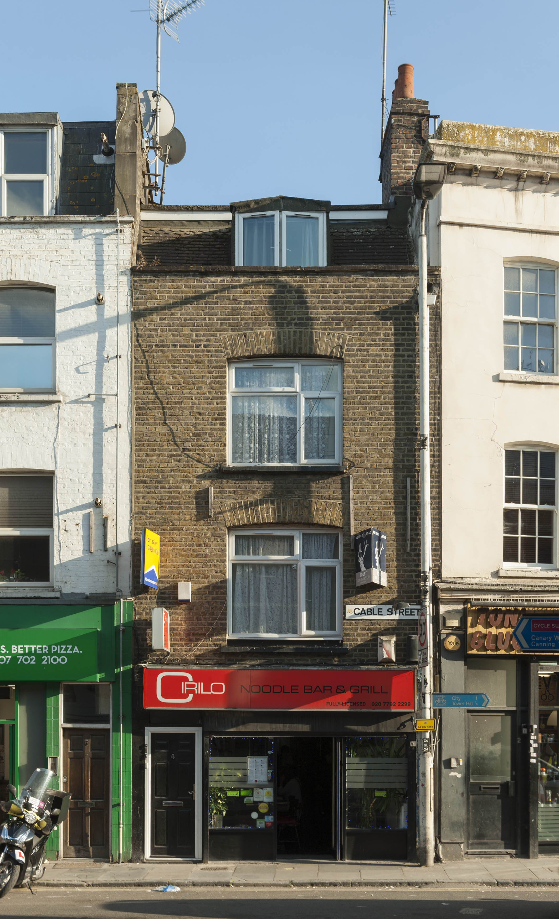
{
"id": 1316,
"title": "4 Cable Street in 2018",
"author": {
"id": 27,
"username": "DerekKendall"
},
"feature": {
"id": 1377,
"type": "Feature",
"geometry": {
"type": "MultiPolygon",
"coordinates": [
[
[
[
-0.068172631919119,
51.510747029802005
],
[
-0.068154454891722,
51.510665529951076
],
[
-0.068226122571781,
51.5106672919737
],
[
-0.068245676894044,
51.510744647693585
],
[
-0.068172631919119,
51.510747029802005
]
]
]
]
},
"properties": {
"b_number": "4",
"b_name": "",
"street": "Cable Street",
"address": "4 Cable Street",
"feature_type": "WHITECHAPEL_BUILDING",
"count": 4,
"search_str": "4 Cable Street"
},
"tags": []
},
"file": "https://surveyoflondon.org/media/uploads/features/1377/SoL%20Whitechapel%20102069.jpg",
"description": "",
"copyright": true,
"created": "2018-08-13"
},
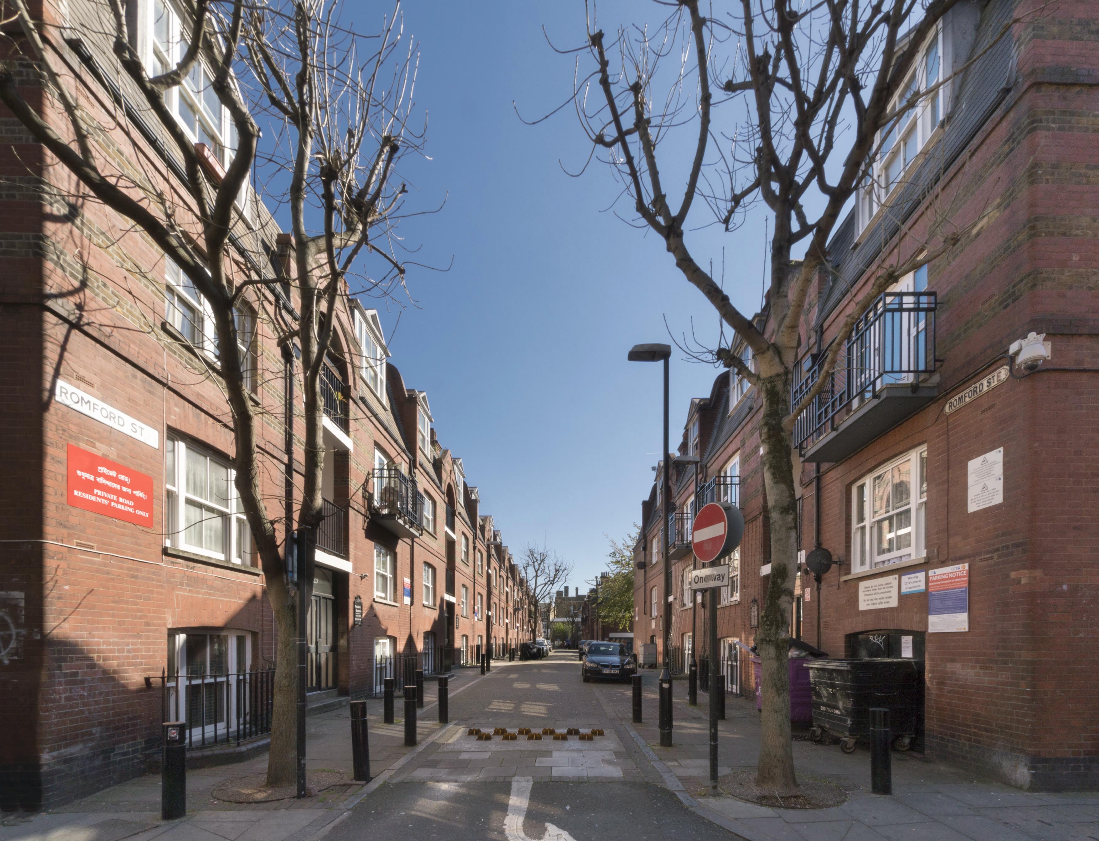
{
"id": 967,
"title": "Romford Street from the north in March 2017",
"author": {
"id": 27,
"username": "DerekKendall"
},
"feature": {
"id": 799,
"type": "Feature",
"geometry": {
"type": "MultiPolygon",
"coordinates": [
[
[
[
-0.062843236574583,
51.51703151131618
],
[
-0.062960990812389,
51.51701701253781
],
[
-0.062985086743996,
51.51711895898897
],
[
-0.06286721454711,
51.51713195017545
],
[
-0.062843236574583,
51.51703151131618
]
]
]
]
},
"properties": {
"b_number": "23",
"b_name": "Fieldgate Mansions",
"street": "Romford Street",
"address": "23 Fieldgate Mansions, Romford Street",
"feature_type": "WHITECHAPEL_BUILDING",
"count": 5,
"search_str": "Fieldgate Mansions"
},
"tags": [
"Davis Brothers",
"Rowland Plumbe"
]
},
"file": "https://surveyoflondon.org/media/uploads/features/799/SoL%20Whitechapel%20100797.jpg",
"description": "",
"copyright": true,
"created": "2017-11-30"
},
{
"id": 972,
"title": "Parfett Street from the north in March 2017",
"author": {
"id": 27,
"username": "DerekKendall"
},
"feature": {
"id": 773,
"type": "Feature",
"geometry": {
"type": "MultiPolygon",
"coordinates": [
[
[
[
-0.063916334138354,
51.516827664082804
],
[
-0.063794688272452,
51.51684278519736
],
[
-0.06378501838863,
51.51679865593286
],
[
-0.063906272994409,
51.516783587511334
],
[
-0.063916334138354,
51.516827664082804
]
]
]
]
},
"properties": {
"b_number": "56",
"b_name": "",
"street": "Parfett Street",
"address": "34-60 Parfett Street",
"feature_type": "WHITECHAPEL_BUILDING",
"count": 1,
"search_str": "34-60 Parfett Street"
},
"tags": []
},
"file": "https://surveyoflondon.org/media/uploads/features/773/SoL%20Whitechapel%20100785.jpg",
"description": "",
"copyright": true,
"created": "2017-11-30"
},
{
"id": 973,
"title": "93-105 Commercial Road in March 2017",
"author": {
"id": 27,
"username": "DerekKendall"
},
"feature": {
"id": 834,
"type": "Feature",
"geometry": {
"type": "MultiPolygon",
"coordinates": [
[
[
[
-0.064214571468647,
51.515297894007325
],
[
-0.06409373011175,
51.515303324086275
],
[
-0.064029305858308,
51.515300857211386
],
[
-0.064024794258674,
51.51526508047461
],
[
-0.063813728130468,
51.515279507375304
],
[
-0.063782813650682,
51.5150212569089
],
[
-0.063901138389998,
51.51501743647746
],
[
-0.063900400903331,
51.514852023894335
],
[
-0.063951275389277,
51.5148514000492
],
[
-0.063955568187405,
51.51501833508917
],
[
-0.064179406536186,
51.515019045708
],
[
-0.064214571468647,
51.515297894007325
]
]
]
]
},
"properties": {
"b_number": "101",
"b_name": "Duru House",
"street": "Commercial Road",
"address": "Duru House, 101 Commercial Road",
"feature_type": "WHITECHAPEL_BUILDING",
"count": 1,
"search_str": "Duru House"
},
"tags": []
},
"file": "https://surveyoflondon.org/media/uploads/features/834/SoL%20Whitechapel%20100652.jpg",
"description": "",
"copyright": true,
"created": "2017-11-30"
},
{
"id": 974,
"title": "103-105 Commercial Road in March 2017",
"author": {
"id": 27,
"username": "DerekKendall"
},
"feature": {
"id": 679,
"type": "Feature",
"geometry": {
"type": "MultiPolygon",
"coordinates": [
[
[
[
-0.063774907180962,
51.51500875923633
],
[
-0.063763848919449,
51.514850502339904
],
[
-0.063829232894095,
51.51485092962506
],
[
-0.063835200212188,
51.51501900561046
],
[
-0.063812193317095,
51.515020308307605
],
[
-0.06381136466506,
51.51500797713519
],
[
-0.063774907180962,
51.51500875923633
]
]
]
]
},
"properties": {
"b_number": "105",
"b_name": "",
"street": "Commercial Road",
"address": "105 Commercial Road",
"feature_type": "WHITECHAPEL_BUILDING",
"count": 1,
"search_str": "105 Commercial Road"
},
"tags": []
},
"file": "https://surveyoflondon.org/media/uploads/features/679/SoL%20Whitechapel%20100655.jpg",
"description": "",
"copyright": true,
"created": "2017-11-30"
},
{
"id": 975,
"title": "111-119 Commercial Road in March 2017",
"author": {
"id": 27,
"username": "DerekKendall"
},
"feature": {
"id": 939,
"type": "Feature",
"geometry": {
"type": "MultiPolygon",
"coordinates": [
[
[
[
-0.063504394604818,
51.514998492307654
],
[
-0.063497409165149,
51.51496774777935
],
[
-0.063494639192536,
51.51493137674633
],
[
-0.063482487433887,
51.51484592661137
],
[
-0.063644388537125,
51.514848600265665
],
[
-0.06364547981438,
51.51499221156054
],
[
-0.063504394604818,
51.514998492307654
]
]
]
]
},
"properties": {
"b_number": "111-113",
"b_name": "",
"street": "Commercial Road",
"address": "Mirch Masala, 111-113 Commercial Road",
"feature_type": "WHITECHAPEL_BUILDING",
"count": 1,
"search_str": "Mirch Masala, 111-113 Commercial Road"
},
"tags": []
},
"file": "https://surveyoflondon.org/media/uploads/features/939/SoL%20Whitechapel%20100657.jpg",
"description": "",
"copyright": true,
"created": "2017-11-30"
},
{
"id": 976,
"title": "111-125 Commercial Road in March 2017",
"author": {
"id": 27,
"username": "DerekKendall"
},
"feature": {
"id": 941,
"type": "Feature",
"geometry": {
"type": "MultiPolygon",
"coordinates": [
[
[
[
-0.063482487433887,
51.51484592661137
],
[
-0.063494639192536,
51.51493137674633
],
[
-0.063494650488559,
51.51493138077874
],
[
-0.063497409165148,
51.51496774777936
],
[
-0.063411243079039,
51.514972752844066
],
[
-0.063409397765872,
51.514944027566266
],
[
-0.063328272385019,
51.51494467498107
],
[
-0.063308201590578,
51.514843048433995
],
[
-0.063482487433887,
51.51484592661137
]
]
]
]
},
"properties": {
"b_number": "115-119",
"b_name": "",
"street": "Commercial Road",
"address": "115-119 Commercial Road",
"feature_type": "WHITECHAPEL_BUILDING",
"count": 2,
"search_str": "115-119 Commercial Road"
},
"tags": []
},
"file": "https://surveyoflondon.org/media/uploads/features/941/SoL%20Whitechapel%20100658.jpg",
"description": "",
"copyright": true,
"created": "2017-11-30"
},
{
"id": 977,
"title": "115-119 Commercial Road in March 2017",
"author": {
"id": 27,
"username": "DerekKendall"
},
"feature": {
"id": 941,
"type": "Feature",
"geometry": {
"type": "MultiPolygon",
"coordinates": [
[
[
[
-0.063482487433887,
51.51484592661137
],
[
-0.063494639192536,
51.51493137674633
],
[
-0.063494650488559,
51.51493138077874
],
[
-0.063497409165148,
51.51496774777936
],
[
-0.063411243079039,
51.514972752844066
],
[
-0.063409397765872,
51.514944027566266
],
[
-0.063328272385019,
51.51494467498107
],
[
-0.063308201590578,
51.514843048433995
],
[
-0.063482487433887,
51.51484592661137
]
]
]
]
},
"properties": {
"b_number": "115-119",
"b_name": "",
"street": "Commercial Road",
"address": "115-119 Commercial Road",
"feature_type": "WHITECHAPEL_BUILDING",
"count": 2,
"search_str": "115-119 Commercial Road"
},
"tags": []
},
"file": "https://surveyoflondon.org/media/uploads/features/941/SoL%20Whitechapel%20100659.jpg",
"description": "",
"copyright": true,
"created": "2017-11-30"
},
{
"id": 978,
"title": "123-125 Commercial Road in March 2017",
"author": {
"id": 27,
"username": "DerekKendall"
},
"feature": {
"id": 943,
"type": "Feature",
"geometry": {
"type": "MultiPolygon",
"coordinates": [
[
[
[
-0.06320828418865,
51.514940037196396
],
[
-0.063206586192368,
51.51494104199723
],
[
-0.063143871020159,
51.51494628756004
],
[
-0.063123998524454,
51.51485457115799
],
[
-0.063147942975275,
51.51484040190397
],
[
-0.063178240268371,
51.5148409022371
],
[
-0.063199181991605,
51.51490891459924
],
[
-0.063199193614314,
51.51490891951369
],
[
-0.063206382380096,
51.51494011208925
],
[
-0.06320828418865,
51.514940037196396
]
]
]
]
},
"properties": {
"b_number": "125",
"b_name": "",
"street": "Commercial Road",
"address": "125 Commercial Road",
"feature_type": "WHITECHAPEL_BUILDING",
"count": 1,
"search_str": "125 Commercial Road"
},
"tags": []
},
"file": "https://surveyoflondon.org/media/uploads/features/943/SoL%20Whitechapel%20100664.jpg",
"description": "",
"copyright": true,
"created": "2017-11-30"
},
{
"id": 968,
"title": "View along Fieldgate Street looking east in March 2017",
"author": {
"id": 27,
"username": "DerekKendall"
},
"feature": {
"id": 952,
"type": "Feature",
"geometry": {
"type": "MultiPolygon",
"coordinates": [
[
[
[
-0.063224838574926,
51.51742703674588
],
[
-0.063322040829257,
51.51741667230535
],
[
-0.063298653433,
51.517330887563304
],
[
-0.063354491307214,
51.51732433241702
],
[
-0.063387346046494,
51.51744390621123
],
[
-0.063136511461646,
51.51747453253069
],
[
-0.063051216005064,
51.51721239716419
],
[
-0.063317432155636,
51.51717857581876
],
[
-0.063335052798611,
51.51724787921287
],
[
-0.063297767815742,
51.51725206585034
],
[
-0.063309366109842,
51.51730503436188
],
[
-0.063250182506436,
51.51731152124056
],
[
-0.063233216369447,
51.51724035484846
],
[
-0.063166066284679,
51.517248516423805
],
[
-0.063224838574926,
51.51742703674588
]
]
]
]
},
"properties": {
"b_number": "91-99",
"b_name": "",
"street": "Fieldgate Street",
"address": "91-99 Fieldgate Street, including Feather Mews",
"feature_type": "WHITECHAPEL_BUILDING",
"count": 5,
"search_str": "91-99 Fieldgate Street, including Feather Mews"
},
"tags": [
"Eva Pepper",
"Rowland Plumbe"
]
},
"file": "https://surveyoflondon.org/media/uploads/features/952/SoL%20Whitechapel%20100794.jpg",
"description": "",
"copyright": true,
"created": "2017-11-30"
},
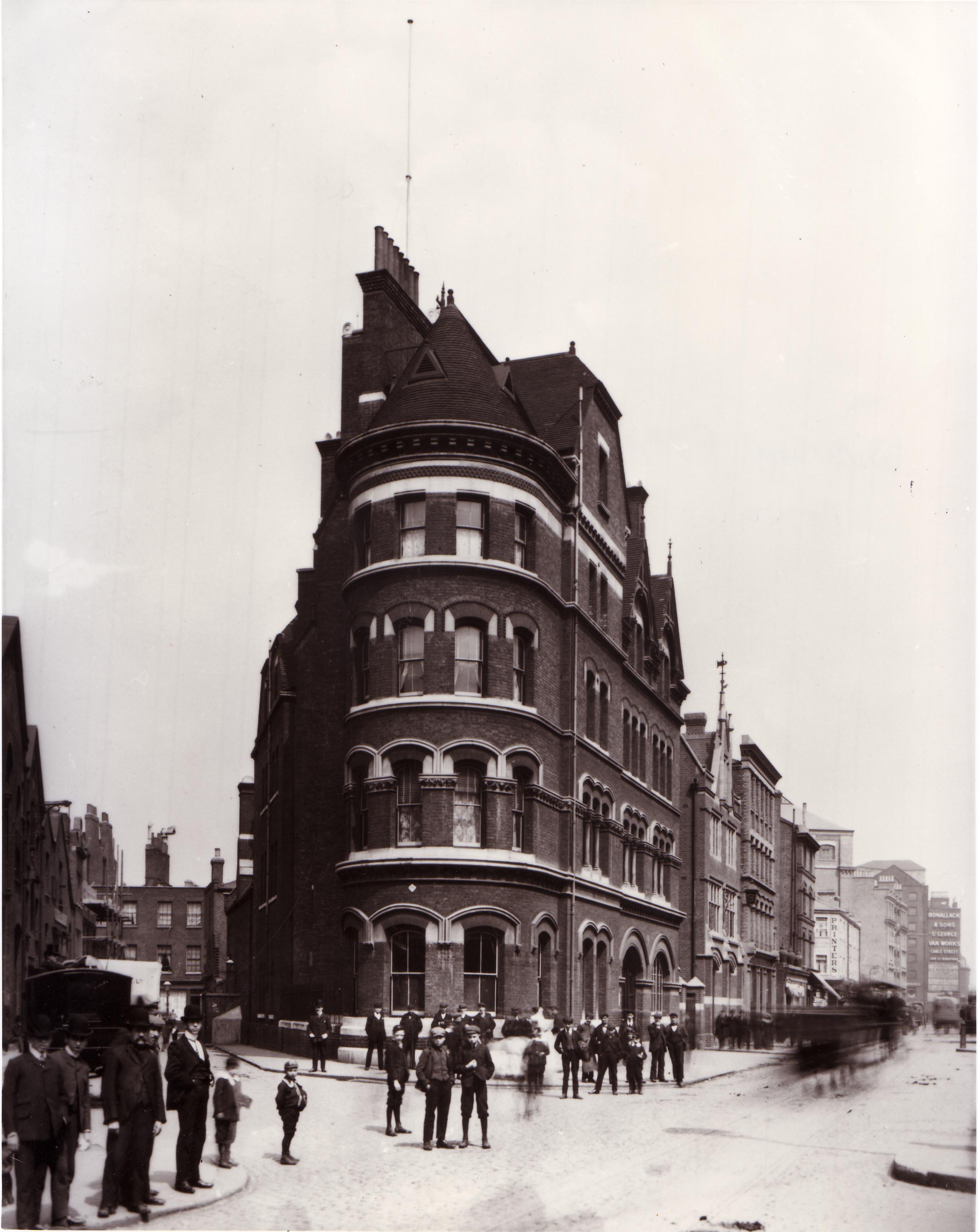
{
"id": 445,
"title": "Whitechapel Fire Station in 1902",
"author": {
"id": 37,
"username": "HistoricEngland"
},
"feature": {
"id": 101,
"type": "Feature",
"geometry": {
"type": "MultiPolygon",
"coordinates": [
[
[
[
-0.069645462493737,
51.515142463727784
],
[
-0.069222888876109,
51.51529835788027
],
[
-0.069232652835499,
51.51526035048273
],
[
-0.069278826604558,
51.51522930389526
],
[
-0.06930377951036,
51.515073225280084
],
[
-0.069647827894883,
51.515086522706206
],
[
-0.069645462493737,
51.515142463727784
]
]
]
]
},
"properties": {
"b_number": "",
"b_name": "Whitechapel Fire Station",
"street": "Manningtree Street",
"address": "Whitechapel Fire Station, Manningtree Street",
"feature_type": "WHITECHAPEL_BUILDING",
"count": 9,
"search_str": "Whitechapel Fire Station"
},
"tags": [
"fire station"
]
},
"file": "https://surveyoflondon.org/media/uploads/features/101/Whitechapel%20Fire%20Station%2C%201902%2C%20HELR%201259%20or%2081-10333%20copy.jpg",
"description": "",
"copyright": true,
"created": "2016-11-15"
},
{
"id": 1630,
"title": "126-137 Whitechapel High Street in 2017",
"author": {
"id": 27,
"username": "DerekKendall"
},
"feature": {
"id": 410,
"type": "Feature",
"geometry": {
"type": "MultiPolygon",
"coordinates": [
[
[
[
-0.073123499137501,
51.515098498967234
],
[
-0.073054522002975,
51.51512618968762
],
[
-0.073088569874063,
51.515158539429386
],
[
-0.07307022306129,
51.51516605486894
],
[
-0.072877010967006,
51.514978700396895
],
[
-0.072884591984978,
51.51495690090528
],
[
-0.072950284423876,
51.514930528832366
],
[
-0.073123499137501,
51.515098498967234
]
]
]
]
},
"properties": {
"b_number": "126",
"b_name": "126 Whitechapel High Street",
"street": "Whitechapel High Street",
"address": "126 Whitechapel High Street, London E1 7PT",
"feature_type": "WHITECHAPEL_BUILDING",
"count": 4,
"search_str": "126 Whitechapel High Street"
},
"tags": []
},
"file": "https://surveyoflondon.org/media/uploads/features/410/SoL%20Whitechapel%20100973.jpg",
"description": "",
"copyright": true,
"created": "2019-07-05"
},
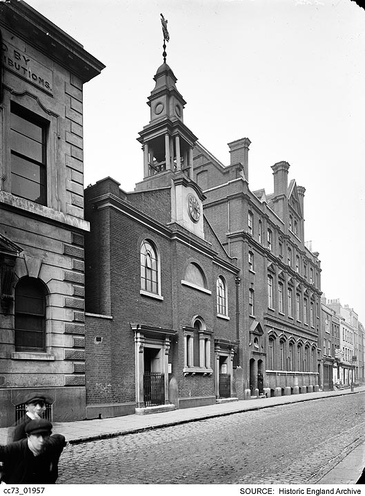
{
"id": 403,
"title": "St George's German Lutheran Church and school beyond in the 1920s",
"author": {
"id": 37,
"username": "HistoricEngland"
},
"feature": {
"id": 17,
"type": "Feature",
"geometry": {
"type": "MultiPolygon",
"coordinates": [
[
[
[
-0.07063554499044,
51.514165253062664
],
[
-0.070405394989044,
51.5142577505096
],
[
-0.070368459316428,
51.51421883204737
],
[
-0.070427800505043,
51.51419483274977
],
[
-0.070359330002431,
51.51412101663757
],
[
-0.070376872840001,
51.514112887757804
],
[
-0.070313812852201,
51.514054169773665
],
[
-0.070469168765051,
51.51398880154131
],
[
-0.07063554499044,
51.514165253062664
]
]
]
]
},
"properties": {
"b_number": "55",
"b_name": "St George’s German Lutheran Church",
"street": "Alie Street",
"address": "St George’s German Lutheran Church, 55 Alie Street",
"feature_type": "WHITECHAPEL_BUILDING",
"count": 8,
"search_str": "St George’s German Lutheran Church"
},
"tags": [
"church",
"lutheran"
]
},
"file": "https://surveyoflondon.org/media/uploads/features/17/cc73_01957.jpg",
"description": "reproduced by permission of the Historic England Archive (see archive.HistoricEngland.org.uk)",
"copyright": true,
"created": "2016-09-20"
},
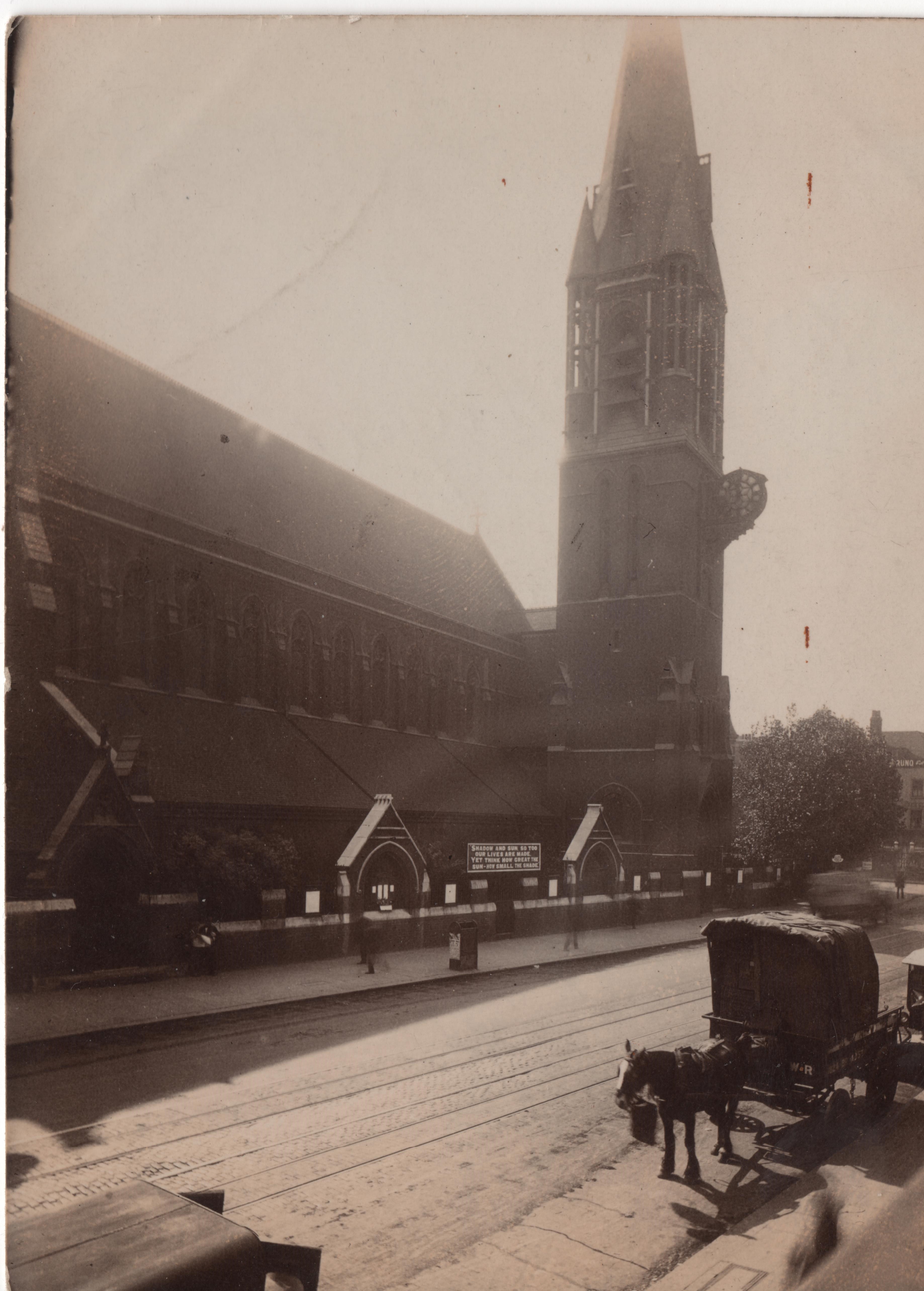
{
"id": 527,
"title": "St Mary Matfelon, c. 1920",
"author": {
"id": 2,
"username": "surveyoflondon"
},
"feature": {
"id": 296,
"type": "Feature",
"geometry": {
"type": "MultiPolygon",
"coordinates": [
[
[
[
-0.069238538289603,
51.51610506120929
],
[
-0.069007097235987,
51.5162239535272
],
[
-0.068282200256798,
51.51654369745104
],
[
-0.068157401560378,
51.51641994527148
],
[
-0.067807959279103,
51.51600137496063
],
[
-0.068541180339468,
51.515783257348254
],
[
-0.068555919008956,
51.51580580160597
],
[
-0.068713893455475,
51.515872451567986
],
[
-0.068778503699218,
51.51586114158782
],
[
-0.068817146392177,
51.515922550138725
],
[
-0.068888047037903,
51.51596428315636
],
[
-0.069016085124709,
51.515921053627785
],
[
-0.069107698271647,
51.51601562404751
],
[
-0.069243279190738,
51.515974904669626
],
[
-0.069238538289603,
51.51610506120929
]
]
]
]
},
"properties": {
"b_number": "",
"b_name": "Altab Ali Park, including the site of the parish church of St Mary Matfelon",
"street": "Whitechapel Road",
"address": "Altab Ali Park",
"feature_type": "OPEN_SPACE",
"count": 32,
"search_str": "Altab Ali Park, including the site of the parish church of St Mary Matfelon"
},
"tags": []
},
"file": "https://surveyoflondon.org/media/uploads/features/296/St%20Mary%20Whitechapel%20nd%20eBay.jpg",
"description": "This photograph, by an unknown amateur photographer, of the north side of the church was taken from, perhaps, 31 Whitechapel Road. The date of the photograph is hard to establish but the quotation on the church noticeboard \"Shadow and sun, so too our lives are made Yet think how great the sun - how small the shade\" is a slight misquotation (it is 'Here learn how great the sun' in the original) from the poet Richard Le Gallienne's New Poems, first published in 1910.",
"copyright": false,
"created": "2017-03-14"
}
]
}