HTTP 200 OK
Allow: GET, HEAD, OPTIONS
Content-Type: application/json
Vary: Accept
{
"count": 1747,
"next": "https://surveyoflondon.org/api/v1/images/?format=api&page=42",
"previous": "https://surveyoflondon.org/api/v1/images/?format=api&page=40",
"results": [
{
"id": 1437,
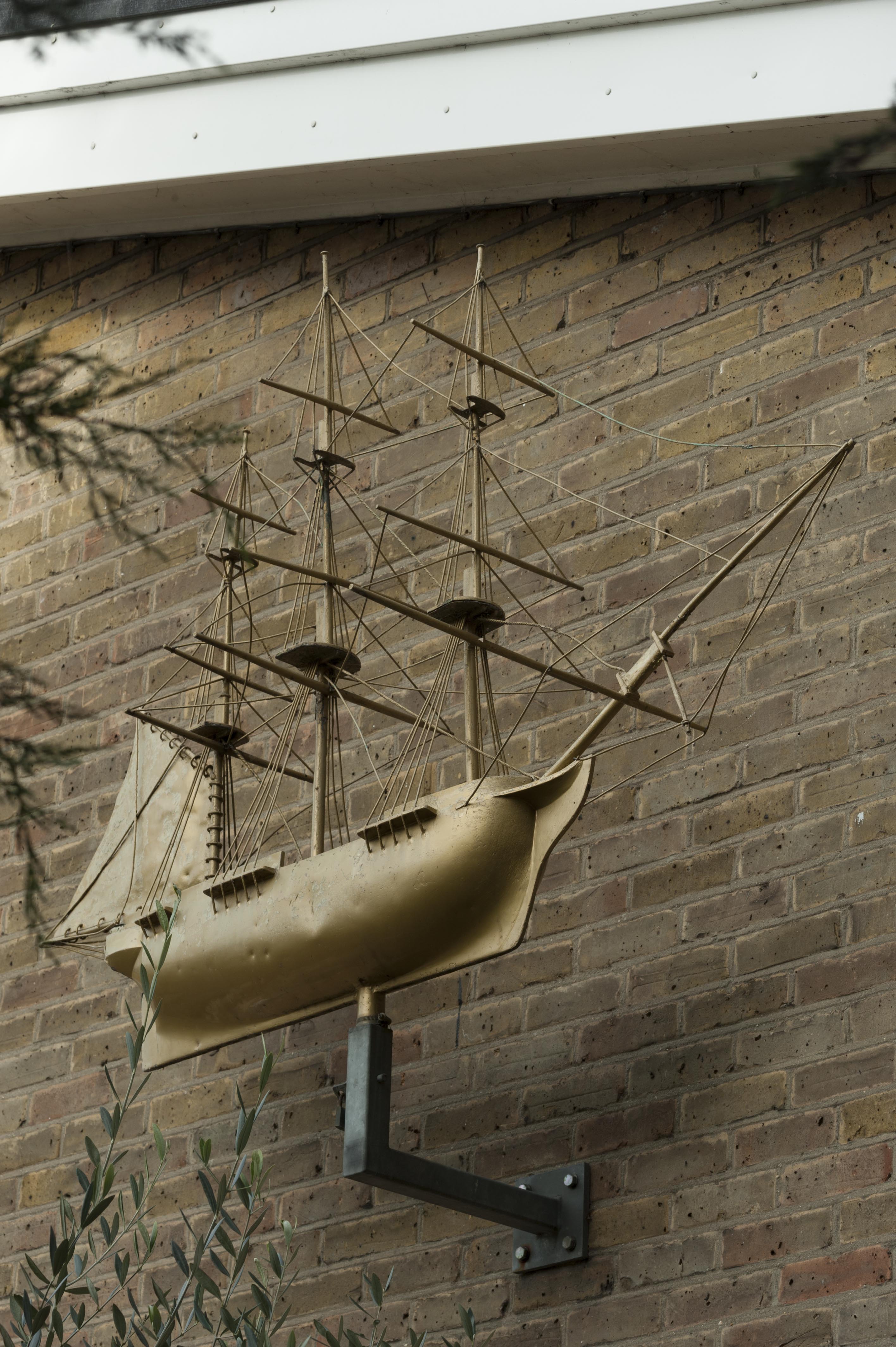
"title": "St Paul's School, ship from St Paul's Church on south elevation of assembly hall, October 2018",
"author": {
"id": 27,
"username": "DerekKendall"
},
"feature": {
"id": 1399,
"type": "Feature",
"geometry": {
"type": "MultiPolygon",
"coordinates": [
[
[
[
-0.06624311370635,
51.51019072010641
],
[
-0.066077627531148,
51.510204269850675
],
[
-0.066069527116146,
51.510170337345684
],
[
-0.06611551384684,
51.51016638639934
],
[
-0.066109726117682,
51.51014703372793
],
[
-0.065814585354416,
51.5101673738921
],
[
-0.065821533323482,
51.51022330153386
],
[
-0.065683910471039,
51.51023360737856
],
[
-0.065657889334494,
51.51008339520407
],
[
-0.065349361164399,
51.51010853754948
],
[
-0.06532938777826,
51.510008209650636
],
[
-0.065633994165545,
51.509987653756085
],
[
-0.065620188745178,
51.50991765971934
],
[
-0.065722948991599,
51.50991121538507
],
[
-0.065716780377172,
51.509880881568165
],
[
-0.065901817537395,
51.50986765480321
],
[
-0.06593178354119,
51.50999605393065
],
[
-0.066038317356042,
51.509988508785376
],
[
-0.066023042932445,
51.50990918839897
],
[
-0.065998737156917,
51.50991111308007
],
[
-0.065980280001972,
51.50981894970597
],
[
-0.066320560006103,
51.50979200375635
],
[
-0.06632996113982,
51.50983401855985
],
[
-0.066268265775343,
51.50983881506029
],
[
-0.066265082872055,
51.50982597208467
],
[
-0.066214609325215,
51.509829790835916
],
[
-0.066234584593038,
51.50993011860635
],
[
-0.066179431061551,
51.509934441553284
],
[
-0.066189455574639,
51.5099837339709
],
[
-0.066197871962622,
51.509983000685985
],
[
-0.066205558541818,
51.510021498909204
],
[
-0.066199016557763,
51.510021972412325
],
[
-0.066209250254486,
51.51006632649741
],
[
-0.066216245469672,
51.51006615116071
],
[
-0.066221862792188,
51.51009851070753
],
[
-0.066214365136205,
51.51009954983773
],
[
-0.066220460291682,
51.51013162657133
],
[
-0.06623170678327,
51.51013006787535
],
[
-0.06624311370635,
51.51019072010641
]
]
]
]
},
"properties": {
"b_number": "",
"b_name": "St Paul's School",
"street": "Wellclose Square",
"address": "St Paul's School, Wellclose Square",
"feature_type": "WHITECHAPEL_BUILDING",
"count": 22,
"search_str": "St Paul's School"
},
"tags": [
"Rev. Dan Greatorex",
"Thomas F. Ford and Partners",
"Wilby & Burnett"
]
},
"file": "https://surveyoflondon.org/media/uploads/features/1399/SoL%20Whitechapel%20102326.jpg",
"description": "",
"copyright": true,
"created": "2018-11-13"
},
{
"id": 937,
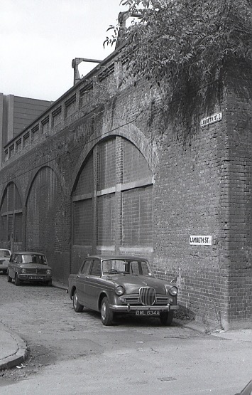
"title": "Lambeth Street c.1980",
"author": {
"id": 201,
"username": "stephen"
},
"feature": {
"id": 1007,
"type": "Feature",
"geometry": {
"type": "MultiPolygon",
"coordinates": [
[
[
[
-0.068604481747272,
51.51259519216751
],
[
-0.068394295073252,
51.512662674029954
],
[
-0.068193731130485,
51.51223927149179
],
[
-0.068417624655329,
51.51219797913798
],
[
-0.068604481747272,
51.51259519216751
]
]
]
]
},
"properties": {
"b_number": "1 to 54 ",
"b_name": "1–54 Times Square, Hooper Street",
"street": "Hooper Street",
"address": "1–54 Times Square",
"feature_type": "WHITECHAPEL_BUILDING",
"count": 10,
"search_str": "1–54 Times Square, Hooper Street"
},
"tags": []
},
"file": "https://surveyoflondon.org/media/uploads/features/1006/Lambeth%20Street.jpg",
"description": "Lambeth Street was totally demolished with the elevated railway goods yard and has now disappeared entirely.",
"copyright": false,
"created": "2017-10-17"
},
{
"id": 1387,
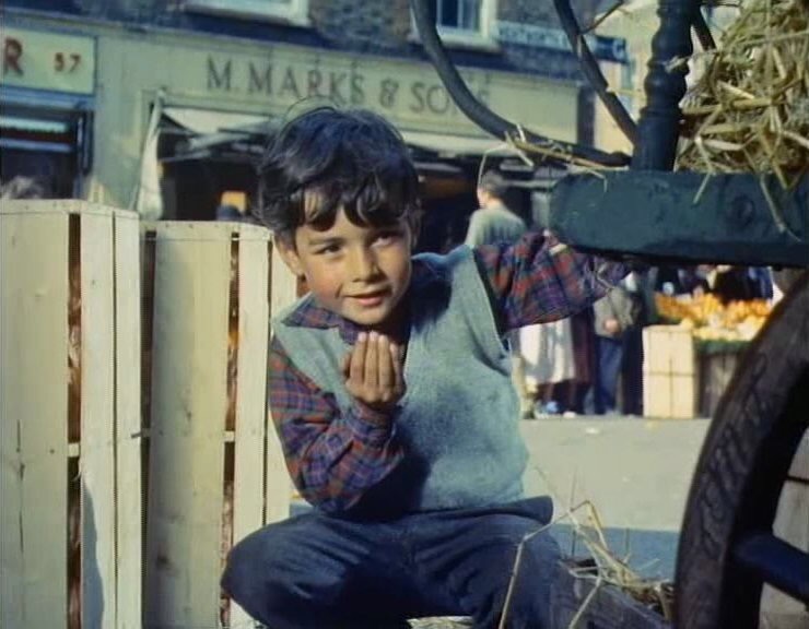
"title": "Marks of the Lane on film",
"author": {
"id": 252,
"username": "mark3"
},
"feature": {
"id": 1742,
"type": "Feature",
"geometry": {
"type": "MultiPolygon",
"coordinates": [
[
[
[
-0.076387722492951,
51.516257872286374
],
[
-0.07580974439088,
51.51649846859169
],
[
-0.075744693982384,
51.51651411423466
],
[
-0.075332716624042,
51.51665341173461
],
[
-0.075277819023276,
51.516667372076085
],
[
-0.074429584483841,
51.51681699796736
],
[
-0.074402209988697,
51.516763242480046
],
[
-0.075229889371391,
51.51661092868018
],
[
-0.074836715281391,
51.516135055700595
],
[
-0.074917049606191,
51.51611135328064
],
[
-0.075312012611936,
51.51658616747119
],
[
-0.075695505281233,
51.51646463519818
],
[
-0.075779072585588,
51.51644696856364
],
[
-0.076328753388395,
51.516209038390684
],
[
-0.076387722492951,
51.516257872286374
]
]
]
]
},
"properties": {
"b_number": "",
"b_name": "",
"street": "",
"address": "Petticoat Lane Market",
"feature_type": "PLACE",
"count": 39,
"search_str": "Petticoat Lane Market"
},
"tags": []
},
"file": "https://surveyoflondon.org/media/uploads/features/1742/184DCACF-615E-41AF-9948-CA65F85B28DE.jpeg",
"description": "From the 1955 film A Kid for Two Farthings, Mossy Marks Deli seen in the background.",
"copyright": false,
"created": "2018-10-29"
},
{
"id": 910,
"title": "27 Osborn Street electricity building, August 2017",
"author": {
"id": 27,
"username": "DerekKendall"
},
"feature": {
"id": 366,
"type": "Feature",
"geometry": {
"type": "MultiPolygon",
"coordinates": [
[
[
[
-0.070392769032621,
51.5168396082387
],
[
-0.070416821811696,
51.51687119092505
],
[
-0.070392777430673,
51.516877759472365
],
[
-0.070330986157356,
51.516897070723935
],
[
-0.070263606849935,
51.51681540799081
],
[
-0.070208799541442,
51.5167130461999
],
[
-0.070306436020532,
51.51668853473626
],
[
-0.070326981644783,
51.51672096617906
],
[
-0.070479199289594,
51.51668836609234
],
[
-0.070554181094918,
51.516778701532566
],
[
-0.070521880281139,
51.516783178768726
],
[
-0.070527230878303,
51.51679820496649
],
[
-0.070392769032621,
51.5168396082387
]
]
]
]
},
"properties": {
"b_number": "27",
"b_name": "27 Osborn Street",
"street": "Osborn Street",
"address": "27 Osborn Street",
"feature_type": "WHITECHAPEL_BUILDING",
"count": 3,
"search_str": "27 Osborn Street"
},
"tags": [
"Stepney Borough Council",
"Whitechapel District Board of Works"
]
},
"file": "https://surveyoflondon.org/media/uploads/features/366/SoL%20Whitechapel%20101443.jpg",
"description": "",
"copyright": true,
"created": "2017-09-26"
},
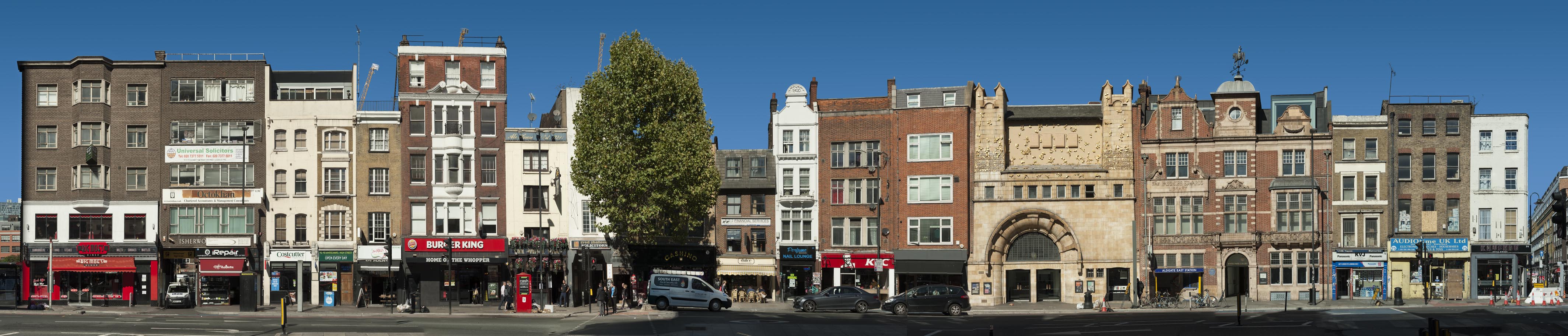
{
"id": 1367,
"title": "Whitechapel High Street, panorama of north side in 2018",
"author": {
"id": 27,
"username": "DerekKendall"
},
"feature": {
"id": 388,
"type": "Feature",
"geometry": {
"type": "MultiPolygon",
"coordinates": [
[
[
[
-0.070444999065034,
51.516268747815374
],
[
-0.070444987924411,
51.51626873485329
],
[
-0.070191183413983,
51.515943931980686
],
[
-0.07030660834808,
51.51590379026539
],
[
-0.070366244631028,
51.515976197771835
],
[
-0.070382361693267,
51.515991401135054
],
[
-0.070520839263358,
51.51595250664741
],
[
-0.070554830739485,
51.51599269532529
],
[
-0.070536539383068,
51.51600061037052
],
[
-0.070670856421127,
51.51616489931219
],
[
-0.070742289448097,
51.51614590797361
],
[
-0.070776212105595,
51.51618683122123
],
[
-0.070667546631979,
51.51621488771394
],
[
-0.070691375516433,
51.5162459029802
],
[
-0.070587290171224,
51.51627187207374
],
[
-0.070551087840537,
51.51627061113889
],
[
-0.07048764157752,
51.51628876524349
],
[
-0.070470164368826,
51.516262702692195
],
[
-0.070444999076386,
51.51626873811411
],
[
-0.070444999065034,
51.516268747815374
]
]
]
]
},
"properties": {
"b_number": "77–82",
"b_name": "Whitechapel Gallery, 77–82 Whitechapel High Street",
"street": "Whitechapel High Street",
"address": " 77–82 Whitechapel High Street",
"feature_type": "WHITECHAPEL_BUILDING",
"count": 13,
"search_str": "Whitechapel Gallery, 77–82 Whitechapel High Street"
},
"tags": []
},
"file": "https://surveyoflondon.org/media/uploads/features/388/SoL%20Whitechapel%20102233.jpg",
"description": "",
"copyright": true,
"created": "2018-10-10"
},
{
"id": 924,
"title": "Former Jagonari Women's Centre",
"author": {
"id": 18,
"username": "shahedsaleem"
},
"feature": {
"id": 453,
"type": "Feature",
"geometry": {
"type": "MultiPolygon",
"coordinates": [
[
[
[
-0.06387175509906,
51.51844488660313
],
[
-0.063674757657848,
51.51849920648765
],
[
-0.063594819394982,
51.5183863647881
],
[
-0.063789009522268,
51.51833442643744
],
[
-0.06387175509906,
51.51844488660313
]
]
]
]
},
"properties": {
"b_number": "183-185",
"b_name": "Former Jagonari Women's Centre, 183-185 Whitechapel Road",
"street": "Whitechapel Road",
"address": "183-185 Whitechapel Road",
"feature_type": "WHITECHAPEL_BUILDING",
"count": 15,
"search_str": "Former Jagonari Women's Centre, 183-185 Whitechapel Road"
},
"tags": [
"GLC",
"Jagonari",
"Matrix",
"nursery"
]
},
"file": "https://surveyoflondon.org/media/uploads/features/453/IMG_4820-jagonari-resized.jpg",
"description": "The former Jagonari Women's Centre seen from Whitechapel Road, photographed in October 2017",
"copyright": false,
"created": "2017-10-06"
},
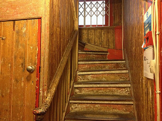
{
"id": 674,
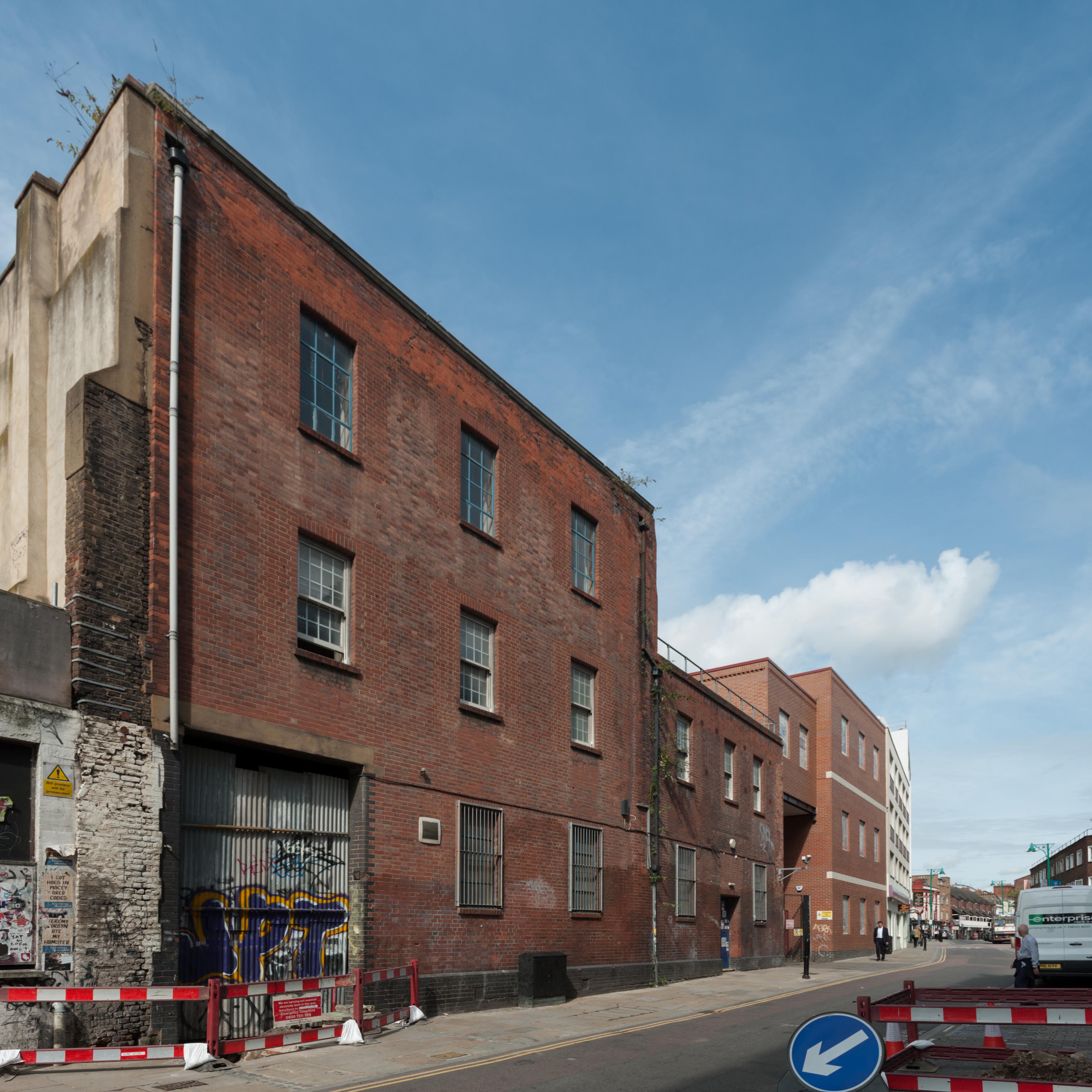
"title": "Stairs of 84b Whitechapel High Street",
"author": {
"id": 138,
"username": "michaelshade"
},
"feature": {
"id": 397,
"type": "Feature",
"geometry": {
"type": "MultiPolygon",
"coordinates": [
[
[
[
-0.070631734980517,
51.516055421900404
],
[
-0.070694810837976,
51.5160316148736
],
[
-0.070694812656241,
51.51603160856848
],
[
-0.070694822071344,
51.51603161810757
],
[
-0.070705382817133,
51.51602803925736
],
[
-0.070776774733246,
51.516123324187696
],
[
-0.070694983149094,
51.516128965932744
],
[
-0.070631734980517,
51.516055421900404
]
]
]
]
},
"properties": {
"b_number": "84B",
"b_name": "84B Whitechapel High Street",
"street": "Angel Alley, Whitechapel High Street",
"address": " 84B Whitechapel High Street",
"feature_type": "WHITECHAPEL_BUILDING",
"count": 10,
"search_str": "84B Whitechapel High Street"
},
"tags": []
},
"file": "https://surveyoflondon.org/media/uploads/features/397/stairs.jpg",
"description": "",
"copyright": true,
"created": "2017-05-24"
},
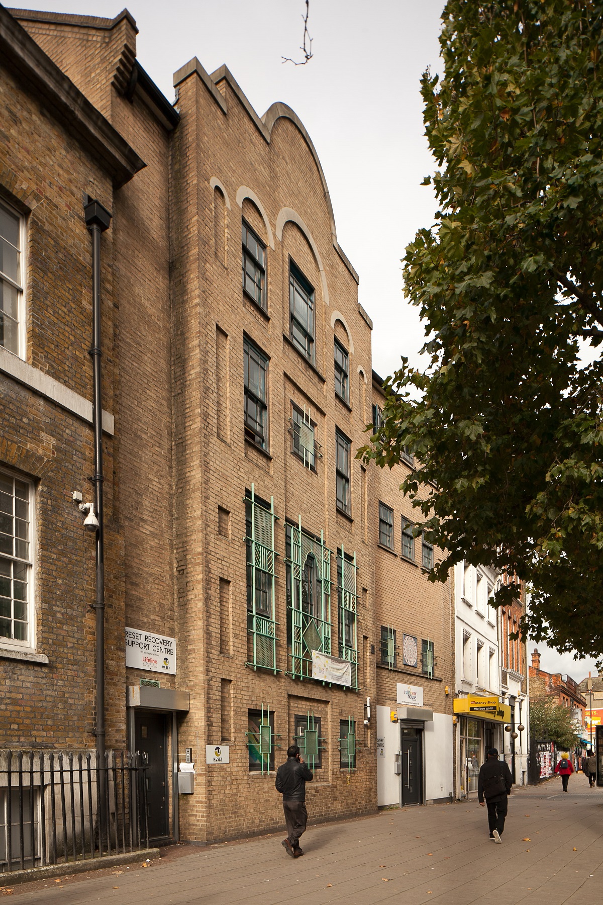
{
"id": 938,
"title": "Old German Mission Day School",
"author": {
"id": 201,
"username": "stephen"
},
"feature": {
"id": 1448,
"type": "Feature",
"geometry": {
"type": "MultiPolygon",
"coordinates": [
[
[
[
-0.070578995059682,
51.51446641575787
],
[
-0.070916294099672,
51.514341722525785
],
[
-0.071028314716768,
51.51446581892952
],
[
-0.070692872229902,
51.51458286029582
],
[
-0.070578995059682,
51.51446641575787
]
]
]
]
},
"properties": {
"b_number": "",
"b_name": "Leman Locke",
"street": "Leman Street",
"address": "Leman Locke, 15–17 Leman Street",
"feature_type": "WHITECHAPEL_BUILDING",
"count": 12,
"search_str": "Leman Locke"
},
"tags": []
},
"file": "https://surveyoflondon.org/media/uploads/features/1448/P4153615.jpg",
"description": "Taken in 2007 prior to demolition. By then it was a restaurant.",
"copyright": false,
"created": "2017-10-17"
},
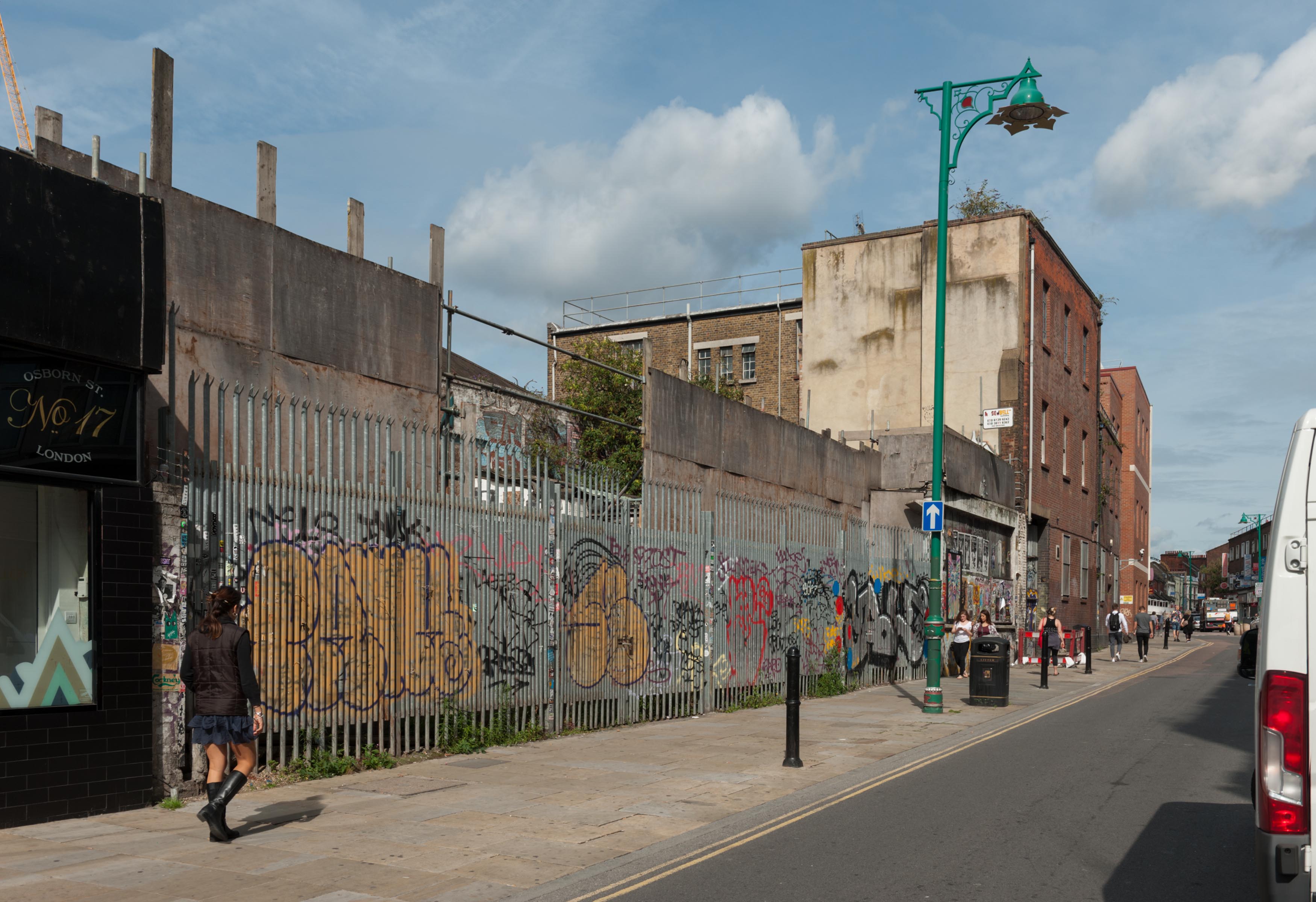
{
"id": 908,
"title": "perimeter fence and street art at 19 to 23 Osborn Street, August 2017",
"author": {
"id": 27,
"username": "DerekKendall"
},
"feature": {
"id": 367,
"type": "Feature",
"geometry": {
"type": "MultiPolygon",
"coordinates": [
[
[
[
-0.070208788307576,
51.51671304296634
],
[
-0.070168698474152,
51.516642176924165
],
[
-0.070328598606914,
51.51659775292492
],
[
-0.070233638934197,
51.51643169469593
],
[
-0.07040277854452,
51.516389321672
],
[
-0.070427796874914,
51.516431704260015
],
[
-0.070531482057751,
51.51640852908396
],
[
-0.070495583452263,
51.516357381859585
],
[
-0.070624394552914,
51.51632218024373
],
[
-0.070775232954332,
51.51657790057318
],
[
-0.070374697197082,
51.51666834737638
],
[
-0.070349845537708,
51.516633207223116
],
[
-0.070314268571881,
51.51664150653588
],
[
-0.070338037036976,
51.51668116844782
],
[
-0.070208788307576,
51.51671304296634
]
]
]
]
},
"properties": {
"b_number": "19 to 23",
"b_name": "19 to 23 Osborn Street",
"street": "Osborn Street",
"address": "19-23 Osborn Street",
"feature_type": "WHITECHAPEL_BUILDING",
"count": 7,
"search_str": "19 to 23 Osborn Street"
},
"tags": []
},
"file": "https://surveyoflondon.org/media/uploads/features/367/SoL%20Whitechapel%20101440.jpg",
"description": "",
"copyright": true,
"created": "2017-09-26"
},
{
"id": 404,
"title": "Works to shopfront",
"author": {
"id": 18,
"username": "shahedsaleem"
},
"feature": {
"id": 127,
"type": "Feature",
"geometry": {
"type": "MultiPolygon",
"coordinates": [
[
[
[
-0.07009538632603,
51.51682863215052
],
[
-0.069899297441953,
51.51688000406167
],
[
-0.069926861736421,
51.51692096003251
],
[
-0.069755313388332,
51.516965902310844
],
[
-0.069688230882331,
51.51687981843807
],
[
-0.069791302503827,
51.51685352499619
],
[
-0.069791299084404,
51.51685351965192
],
[
-0.069872596565606,
51.51683278080442
],
[
-0.069872598030862,
51.51683278043064
],
[
-0.069908557891993,
51.516822755068496
],
[
-0.069929332859543,
51.5168517618956
],
[
-0.069986073792892,
51.51683594289044
],
[
-0.069967253218652,
51.51680966491183
],
[
-0.070065621617059,
51.51678224032084
],
[
-0.07009538632603,
51.51682863215052
]
]
]
]
},
"properties": {
"b_number": "22",
"b_name": "",
"street": "Osborn Street",
"address": "22 Osborn Street",
"feature_type": "WHITECHAPEL_BUILDING",
"count": 2,
"search_str": "22 Osborn Street"
},
"tags": []
},
"file": "https://surveyoflondon.org/media/uploads/features/127/IMG_4168.JPG",
"description": "Work in progress has revealed old painted lettering beneath the former shop signage (photo taken on 23.09.16)",
"copyright": false,
"created": "2016-09-23"
},
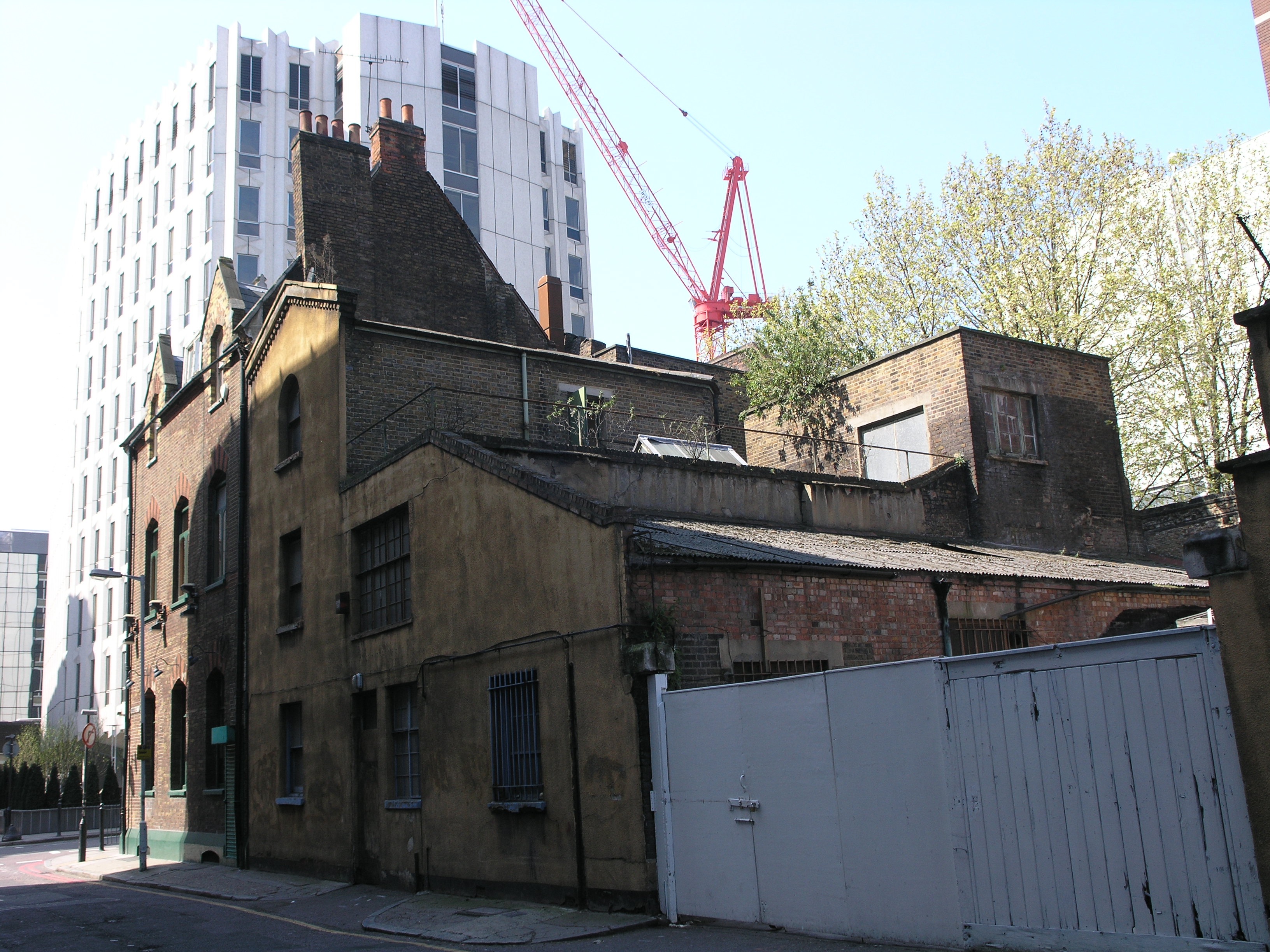
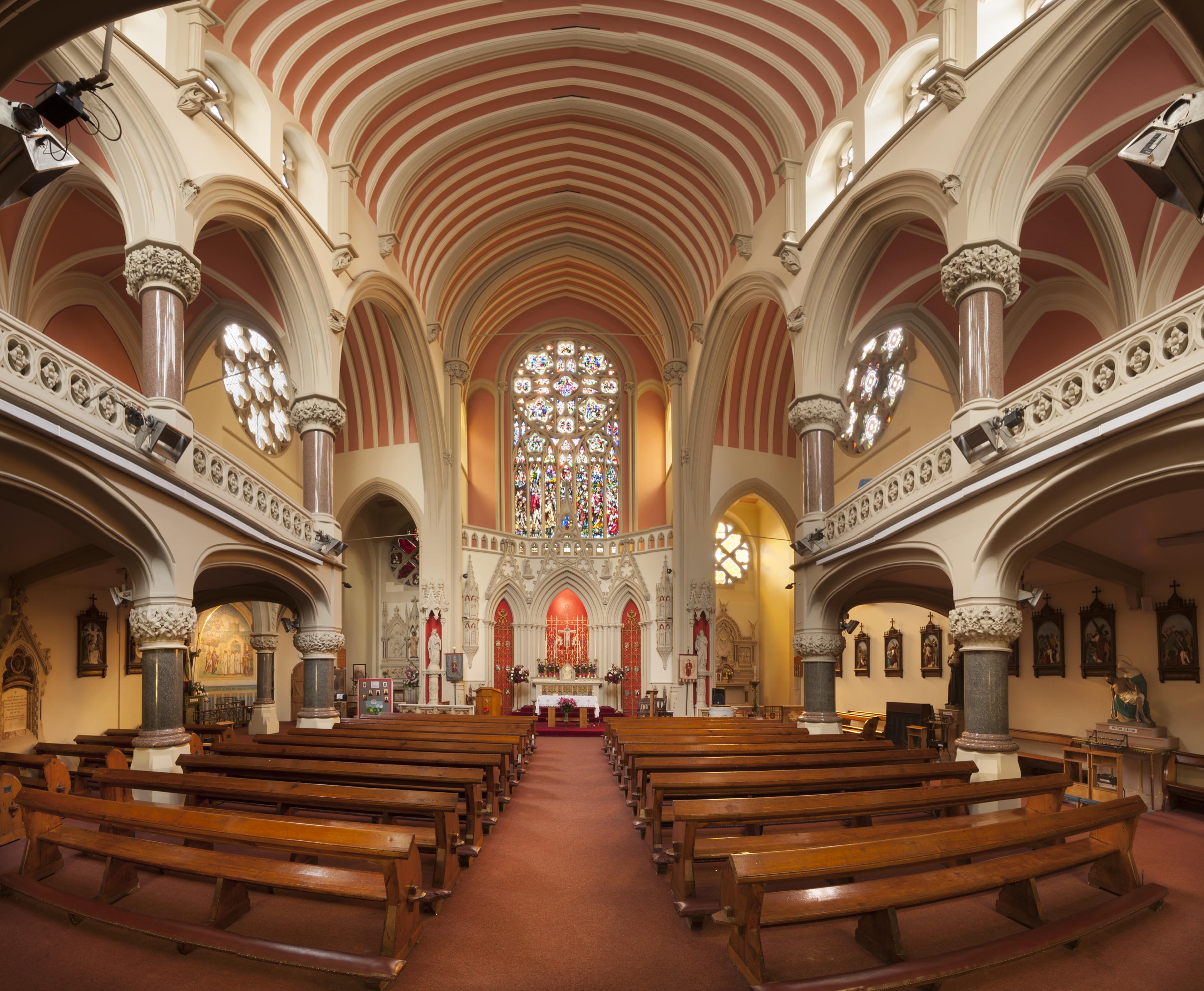
{
"id": 1232,
"title": "Interior, March 2018",
"author": {
"id": 27,
"username": "DerekKendall"
},
"feature": {
"id": 1297,
"type": "Feature",
"geometry": {
"type": "MultiPolygon",
"coordinates": [
[
[
[
-0.071935648282288,
51.51134524228436
],
[
-0.071874729442993,
51.51121363108998
],
[
-0.071816144948546,
51.51122339231668
],
[
-0.071776588646252,
51.51120578254433
],
[
-0.071762024560661,
51.51117337877791
],
[
-0.07177649375904,
51.511141452410264
],
[
-0.071834141993347,
51.51113011940239
],
[
-0.071816329795347,
51.51108571239466
],
[
-0.072075019832766,
51.51104549229583
],
[
-0.072193056743033,
51.51130853787665
],
[
-0.072151551976597,
51.51131487321276
],
[
-0.072147312228886,
51.51132649961524
],
[
-0.072142333320455,
51.51133343542439
],
[
-0.072015847069243,
51.5113547481352
],
[
-0.071996105248008,
51.51135617797319
],
[
-0.071982278923131,
51.511350687404345
],
[
-0.071975230627282,
51.51134004502751
],
[
-0.071935648282288,
51.51134524228436
]
]
]
]
},
"properties": {
"b_number": "",
"b_name": "Roman Catholic Church of the English Martyrs",
"street": "Prescot Street",
"address": "Roman Catholic Church of the English Martyrs",
"feature_type": "WHITECHAPEL_BUILDING",
"count": 20,
"search_str": "Roman Catholic Church of the English Martyrs"
},
"tags": []
},
"file": "https://surveyoflondon.org/media/uploads/features/1297/SoL%20Whitechapel%20101900.jpg",
"description": "",
"copyright": true,
"created": "2018-03-27"
},
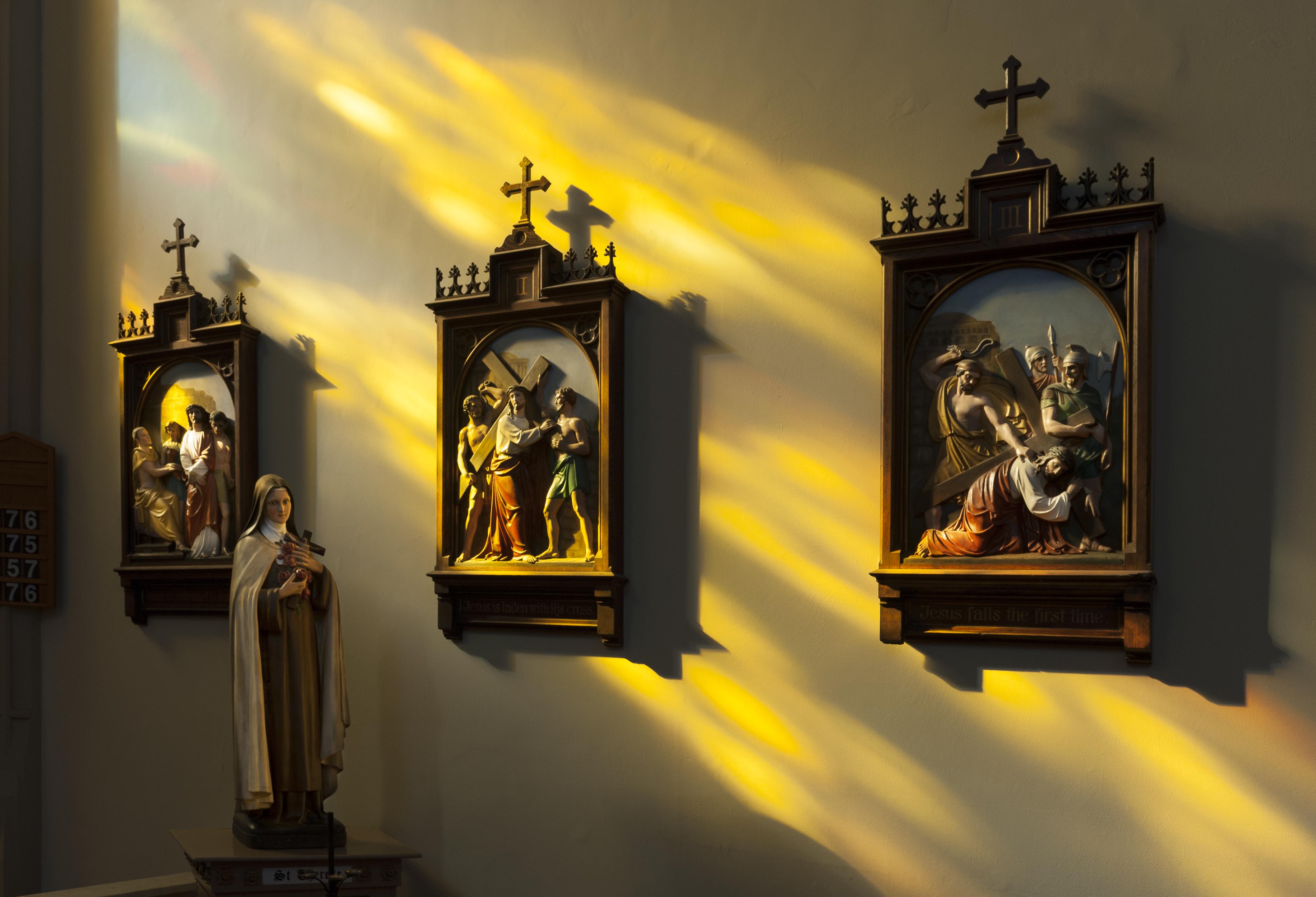
{
"id": 1233,
"title": "Stations of the Cross, March 2018",
"author": {
"id": 27,
"username": "DerekKendall"
},
"feature": {
"id": 1297,
"type": "Feature",
"geometry": {
"type": "MultiPolygon",
"coordinates": [
[
[
[
-0.071935648282288,
51.51134524228436
],
[
-0.071874729442993,
51.51121363108998
],
[
-0.071816144948546,
51.51122339231668
],
[
-0.071776588646252,
51.51120578254433
],
[
-0.071762024560661,
51.51117337877791
],
[
-0.07177649375904,
51.511141452410264
],
[
-0.071834141993347,
51.51113011940239
],
[
-0.071816329795347,
51.51108571239466
],
[
-0.072075019832766,
51.51104549229583
],
[
-0.072193056743033,
51.51130853787665
],
[
-0.072151551976597,
51.51131487321276
],
[
-0.072147312228886,
51.51132649961524
],
[
-0.072142333320455,
51.51133343542439
],
[
-0.072015847069243,
51.5113547481352
],
[
-0.071996105248008,
51.51135617797319
],
[
-0.071982278923131,
51.511350687404345
],
[
-0.071975230627282,
51.51134004502751
],
[
-0.071935648282288,
51.51134524228436
]
]
]
]
},
"properties": {
"b_number": "",
"b_name": "Roman Catholic Church of the English Martyrs",
"street": "Prescot Street",
"address": "Roman Catholic Church of the English Martyrs",
"feature_type": "WHITECHAPEL_BUILDING",
"count": 20,
"search_str": "Roman Catholic Church of the English Martyrs"
},
"tags": []
},
"file": "https://surveyoflondon.org/media/uploads/features/1297/SoL%20Whitechapel%20101905.jpg",
"description": "",
"copyright": true,
"created": "2018-03-27"
},
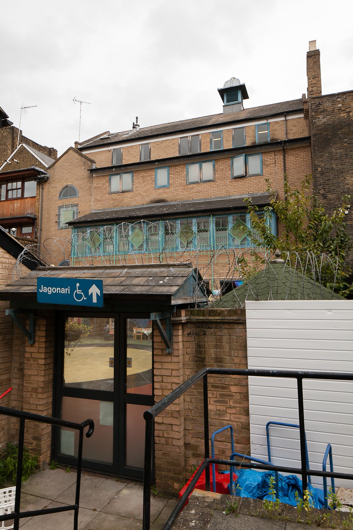
{
"id": 925,
"title": "Former Jagonari Women's Centre",
"author": {
"id": 18,
"username": "shahedsaleem"
},
"feature": {
"id": 453,
"type": "Feature",
"geometry": {
"type": "MultiPolygon",
"coordinates": [
[
[
[
-0.06387175509906,
51.51844488660313
],
[
-0.063674757657848,
51.51849920648765
],
[
-0.063594819394982,
51.5183863647881
],
[
-0.063789009522268,
51.51833442643744
],
[
-0.06387175509906,
51.51844488660313
]
]
]
]
},
"properties": {
"b_number": "183-185",
"b_name": "Former Jagonari Women's Centre, 183-185 Whitechapel Road",
"street": "Whitechapel Road",
"address": "183-185 Whitechapel Road",
"feature_type": "WHITECHAPEL_BUILDING",
"count": 15,
"search_str": "Former Jagonari Women's Centre, 183-185 Whitechapel Road"
},
"tags": [
"GLC",
"Jagonari",
"Matrix",
"nursery"
]
},
"file": "https://surveyoflondon.org/media/uploads/features/453/IMG_4798.jpg",
"description": "A rear view of the former Jagonari Women's Centre, photographed in October 2017",
"copyright": false,
"created": "2017-10-06"
},
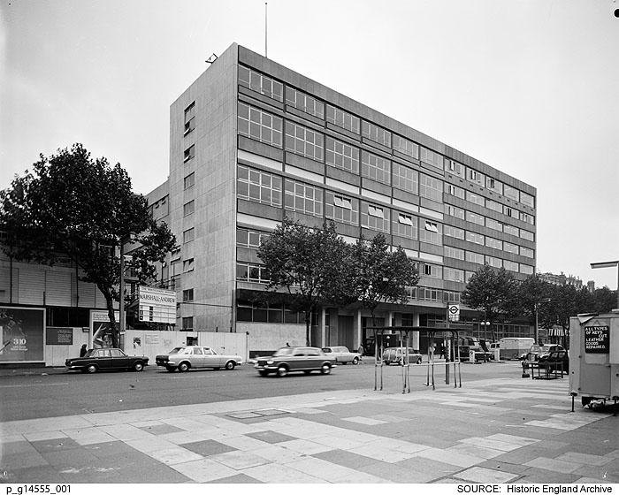
{
"id": 509,
"title": "Eastern District Post Office, Whitechapel Road, in 1970",
"author": {
"id": 37,
"username": "HistoricEngland"
},
"feature": {
"id": 1227,
"type": "Feature",
"geometry": {
"type": "MultiPolygon",
"coordinates": [
[
[
[
-0.058796596412285,
51.51912310433929
],
[
-0.057896913703648,
51.51929776742821
],
[
-0.057646155790783,
51.51878891291734
],
[
-0.057726960269829,
51.518773414154225
],
[
-0.057663251646104,
51.51864413103036
],
[
-0.058003630287349,
51.51857884372657
],
[
-0.058058858263524,
51.51869091551577
],
[
-0.058183402152667,
51.518667026720365
],
[
-0.058192757854339,
51.51868601168758
],
[
-0.058228318266828,
51.5186791908066
],
[
-0.058378536493976,
51.518984017000164
],
[
-0.058419330251411,
51.51897619228836
],
[
-0.058450444692009,
51.51903932977383
],
[
-0.05871794555232,
51.51898801961153
],
[
-0.058796596412285,
51.51912310433929
]
]
]
]
},
"properties": {
"b_number": "180–206",
"b_name": "East London Mail Centre and E1 Delivery Office",
"street": "Whitechapel Road",
"address": "East London Mail Centre and E1 Delivery Office",
"feature_type": "WHITECHAPEL_BUILDING",
"count": 14,
"search_str": "East London Mail Centre and E1 Delivery Office"
},
"tags": []
},
"file": "https://surveyoflondon.org/media/uploads/features/1227/p_g14555_001.jpg",
"description": "View of the Eastern District Post Office in Whitechapel Road shortly after the completion of the ambitious redevelopment of the site by the Ministry of Public Buildings and Works.\nReproduced by permission of the Historic England Archive (see archive.HistoricEngland.org.uk)",
"copyright": false,
"created": "2017-03-08"
},
{
"id": 1416,
"title": "East London Mail Centre, view along Whitechapel Road from the east in late 2018",
"author": {
"id": 27,
"username": "DerekKendall"
},
"feature": {
"id": 1227,
"type": "Feature",
"geometry": {
"type": "MultiPolygon",
"coordinates": [
[
[
[
-0.058796596412285,
51.51912310433929
],
[
-0.057896913703648,
51.51929776742821
],
[
-0.057646155790783,
51.51878891291734
],
[
-0.057726960269829,
51.518773414154225
],
[
-0.057663251646104,
51.51864413103036
],
[
-0.058003630287349,
51.51857884372657
],
[
-0.058058858263524,
51.51869091551577
],
[
-0.058183402152667,
51.518667026720365
],
[
-0.058192757854339,
51.51868601168758
],
[
-0.058228318266828,
51.5186791908066
],
[
-0.058378536493976,
51.518984017000164
],
[
-0.058419330251411,
51.51897619228836
],
[
-0.058450444692009,
51.51903932977383
],
[
-0.05871794555232,
51.51898801961153
],
[
-0.058796596412285,
51.51912310433929
]
]
]
]
},
"properties": {
"b_number": "180–206",
"b_name": "East London Mail Centre and E1 Delivery Office",
"street": "Whitechapel Road",
"address": "East London Mail Centre and E1 Delivery Office",
"feature_type": "WHITECHAPEL_BUILDING",
"count": 14,
"search_str": "East London Mail Centre and E1 Delivery Office"
},
"tags": []
},
"file": "https://surveyoflondon.org/media/uploads/features/1227/SoL%20Whitechapel%20102272.jpg",
"description": "",
"copyright": true,
"created": "2018-11-13"
},
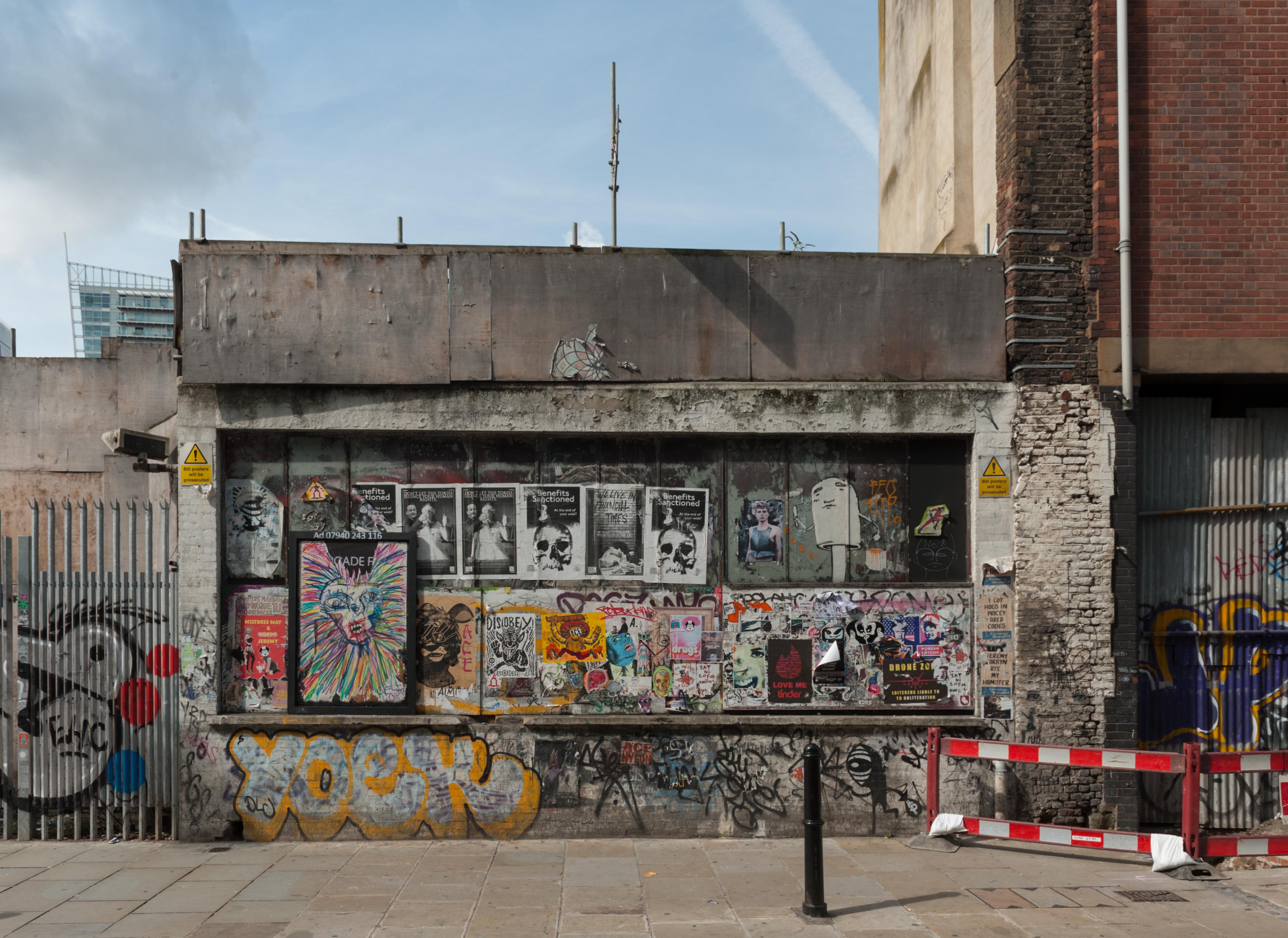
{
"id": 909,
"title": "Street art and bill posting at former 23 Osborn Street, August 2017",
"author": {
"id": 27,
"username": "DerekKendall"
},
"feature": {
"id": 367,
"type": "Feature",
"geometry": {
"type": "MultiPolygon",
"coordinates": [
[
[
[
-0.070208788307576,
51.51671304296634
],
[
-0.070168698474152,
51.516642176924165
],
[
-0.070328598606914,
51.51659775292492
],
[
-0.070233638934197,
51.51643169469593
],
[
-0.07040277854452,
51.516389321672
],
[
-0.070427796874914,
51.516431704260015
],
[
-0.070531482057751,
51.51640852908396
],
[
-0.070495583452263,
51.516357381859585
],
[
-0.070624394552914,
51.51632218024373
],
[
-0.070775232954332,
51.51657790057318
],
[
-0.070374697197082,
51.51666834737638
],
[
-0.070349845537708,
51.516633207223116
],
[
-0.070314268571881,
51.51664150653588
],
[
-0.070338037036976,
51.51668116844782
],
[
-0.070208788307576,
51.51671304296634
]
]
]
]
},
"properties": {
"b_number": "19 to 23",
"b_name": "19 to 23 Osborn Street",
"street": "Osborn Street",
"address": "19-23 Osborn Street",
"feature_type": "WHITECHAPEL_BUILDING",
"count": 7,
"search_str": "19 to 23 Osborn Street"
},
"tags": []
},
"file": "https://surveyoflondon.org/media/uploads/features/367/SoL%20Whitechapel%20101442.jpg",
"description": "",
"copyright": true,
"created": "2017-09-26"
},
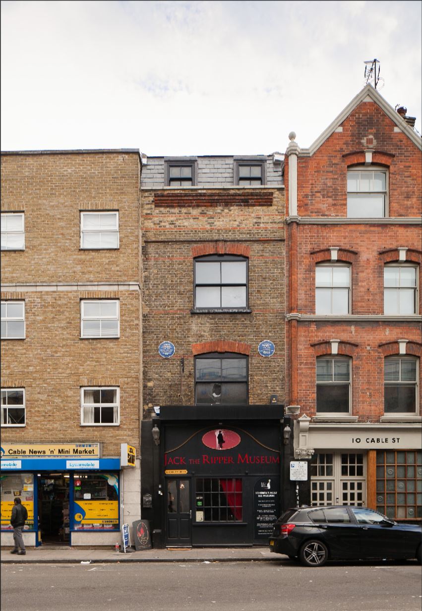
{
"id": 930,
"title": "Elevation, October 2017",
"author": {
"id": 18,
"username": "shahedsaleem"
},
"feature": {
"id": 1376,
"type": "Feature",
"geometry": {
"type": "MultiPolygon",
"coordinates": [
[
[
[
-0.067940770062805,
51.510695148477346
],
[
-0.067956121490136,
51.51075409026937
],
[
-0.067956121490136,
51.51075409026937
],
[
-0.067887886383568,
51.51075590403737
],
[
-0.067875349403458,
51.51069988445148
],
[
-0.067940770062805,
51.510695148477346
]
]
]
]
},
"properties": {
"b_number": "12",
"b_name": "Jack the Ripper Museum, 12 Cable Street",
"street": "Cable Street",
"address": "Jack the Ripper Museum, 12 Cable Street",
"feature_type": "WHITECHAPEL_BUILDING",
"count": 8,
"search_str": "Jack the Ripper Museum, 12 Cable Street"
},
"tags": [
"Charles Henry Harrod"
]
},
"file": "https://surveyoflondon.org/media/uploads/features/1376/CABLE_2.JPG",
"description": "",
"copyright": false,
"created": "2017-10-06"
},
{
"id": 1629,
"title": "122 Whitechapel High Street in 2017",
"author": {
"id": 27,
"username": "DerekKendall"
},
"feature": {
"id": 357,
"type": "Feature",
"geometry": {
"type": "MultiPolygon",
"coordinates": [
[
[
[
-0.072906470279445,
51.5151978632323
],
[
-0.072840800408846,
51.51522217894417
],
[
-0.072667686791624,
51.51504017284175
],
[
-0.072728647366159,
51.51501760087987
],
[
-0.072906470279445,
51.5151978632323
]
]
]
]
},
"properties": {
"b_number": "122",
"b_name": "122 Whitechapel High Street",
"street": "Whitechapel High Street",
"address": "122 Whitechapel High Street",
"feature_type": "WHITECHAPEL_BUILDING",
"count": 2,
"search_str": "122 Whitechapel High Street"
},
"tags": []
},
"file": "https://surveyoflondon.org/media/uploads/features/357/SoL%20Whitechapel%20100974.jpg",
"description": "",
"copyright": true,
"created": "2019-07-05"
},
{
"id": 949,
"title": "132 Whitechapel Road and buildings to its west in March 2017",
"author": {
"id": 27,
"username": "DerekKendall"
},
"feature": {
"id": 869,
"type": "Feature",
"geometry": {
"type": "MultiPolygon",
"coordinates": [
[
[
[
-0.063380440598615,
51.51802298751179
],
[
-0.063444664131397,
51.518114623730156
],
[
-0.063327954731949,
51.518140788162945
],
[
-0.063249951606898,
51.518032318562604
],
[
-0.063294244099136,
51.5180199205383
],
[
-0.063307613678762,
51.51803851202517
],
[
-0.063334825888804,
51.518030894974025
],
[
-0.063320965574468,
51.51801162109644
],
[
-0.063363670522046,
51.51799966740948
],
[
-0.063380440598615,
51.51802298751179
]
]
]
]
},
"properties": {
"b_number": "132",
"b_name": "",
"street": "Whitechapel Road",
"address": "132 Whitechapel Road",
"feature_type": "WHITECHAPEL_BUILDING",
"count": 3,
"search_str": "132 Whitechapel Road"
},
"tags": []
},
"file": "https://surveyoflondon.org/media/uploads/features/869/SoL%20Whitechapel%20100769.jpg",
"description": "",
"copyright": true,
"created": "2017-11-30"
},
{
"id": 963,
"title": "102-106 Whitechapel Road in March 2017",
"author": {
"id": 27,
"username": "DerekKendall"
},
"feature": {
"id": 862,
"type": "Feature",
"geometry": {
"type": "MultiPolygon",
"coordinates": [
[
[
[
-0.064507263116604,
51.51782788022154
],
[
-0.064384735635999,
51.51786619405259
],
[
-0.064269624814203,
51.517705484506365
],
[
-0.064284781932583,
51.517700755422936
],
[
-0.064240056588541,
51.517636782452485
],
[
-0.064352304125039,
51.51760623597855
],
[
-0.064423378234511,
51.517707896499076
],
[
-0.064507263116604,
51.51782788022154
]
]
]
]
},
"properties": {
"b_number": "104-106",
"b_name": "",
"street": "Whitechapel Road",
"address": "104-106 Whitechapel Road",
"feature_type": "WHITECHAPEL_BUILDING",
"count": 3,
"search_str": "104-106 Whitechapel Road"
},
"tags": []
},
"file": "https://surveyoflondon.org/media/uploads/features/862/SoL%20Whitechapel%20100746.jpg",
"description": "",
"copyright": true,
"created": "2017-11-30"
}
]
}