HTTP 200 OK
Allow: GET, HEAD, OPTIONS
Content-Type: application/json
Vary: Accept
{
"count": 1747,
"next": "https://surveyoflondon.org/api/v1/images/?format=api&page=41",
"previous": "https://surveyoflondon.org/api/v1/images/?format=api&page=39",
"results": [
{
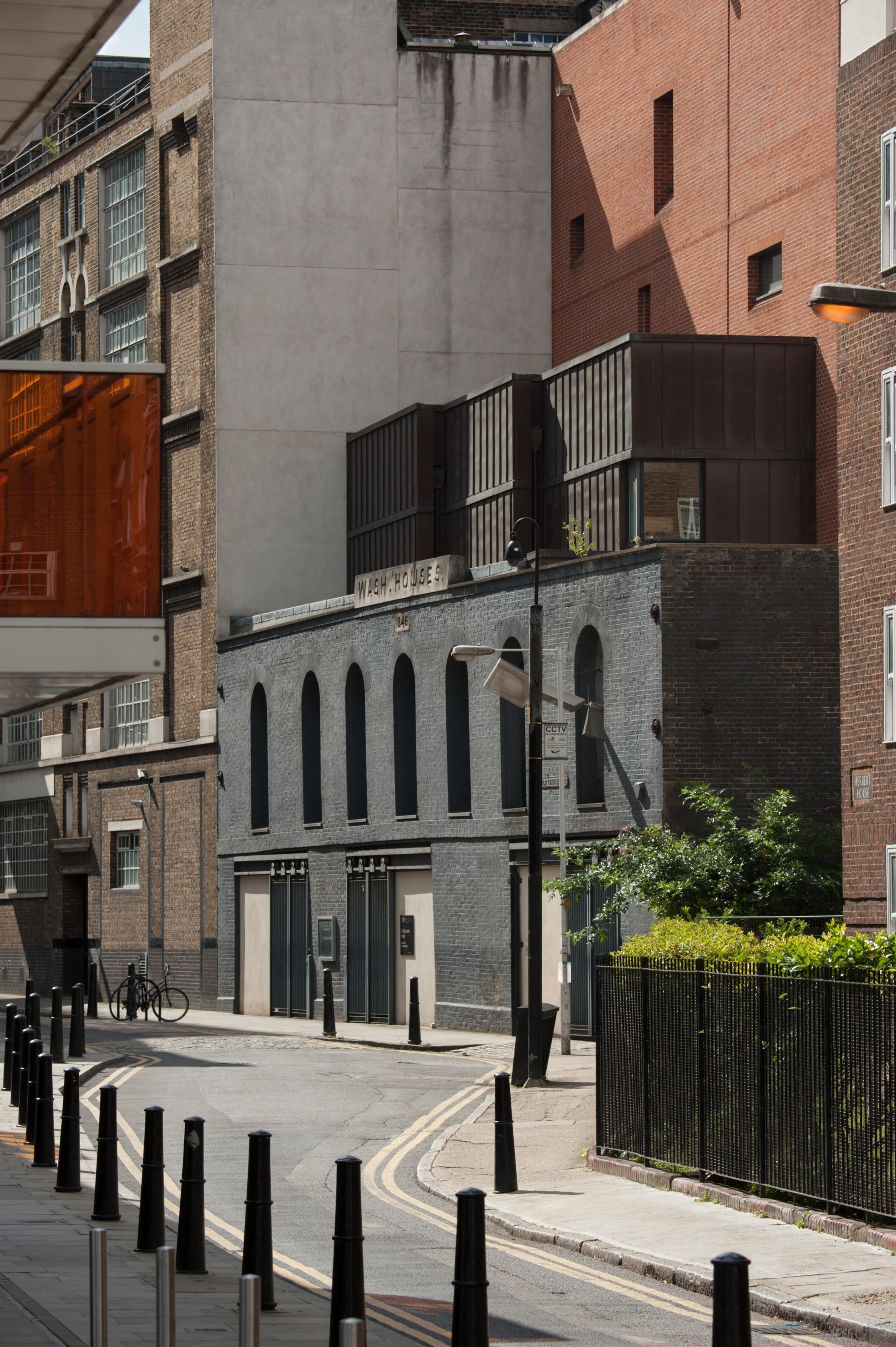
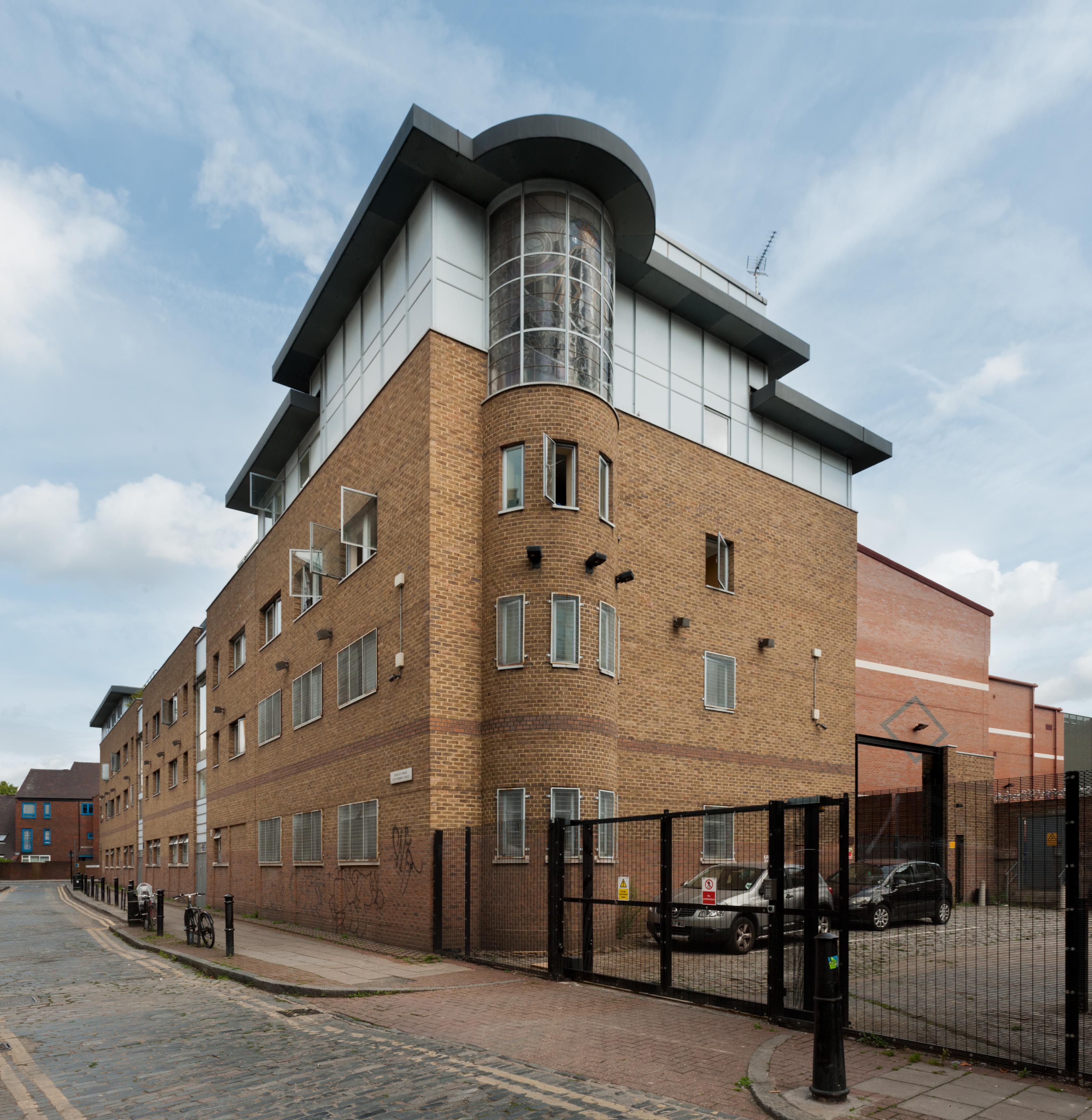
"id": 874,
"title": "The Wash Houses from the north east",
"author": {
"id": 27,
"username": "DerekKendall"
},
"feature": {
"id": 1447,
"type": "Feature",
"geometry": {
"type": "MultiPolygon",
"coordinates": [
[
[
[
-0.073620345272929,
51.51568885255038
],
[
-0.073978291920849,
51.515581075868006
],
[
-0.074105154053684,
51.51572542989613
],
[
-0.073829058934223,
51.51581988475423
],
[
-0.073816416255057,
51.51580549883457
],
[
-0.073765536685163,
51.515822645959325
],
[
-0.073818338832879,
51.51587274604106
],
[
-0.073896057393162,
51.515850404112115
],
[
-0.073900642179228,
51.51585546922409
],
[
-0.073811510459007,
51.51588294615875
],
[
-0.073751379811388,
51.51582774828753
],
[
-0.073609777363084,
51.515693181519985
],
[
-0.073620345272929,
51.51568885255038
]
]
]
]
},
"properties": {
"b_number": "25",
"b_name": "The Wash Houses, London Metropolitan University, former Whitechapel Baths",
"street": "Old Castle Street",
"address": "The Wash Houses, London Metropolitan Univeristy, 25 Old Castle Street, London E1 7NT",
"feature_type": "WHITECHAPEL_BUILDING",
"count": 19,
"search_str": "The Wash Houses, London Metropolitan University, former Whitechapel Baths"
},
"tags": [
"cholera",
"library",
"swimming",
"washing",
"women"
]
},
"file": "https://surveyoflondon.org/media/uploads/features/1447/SoL%20Whitechapel%20101279.jpg",
"description": "",
"copyright": true,
"created": "2017-09-26"
},
{
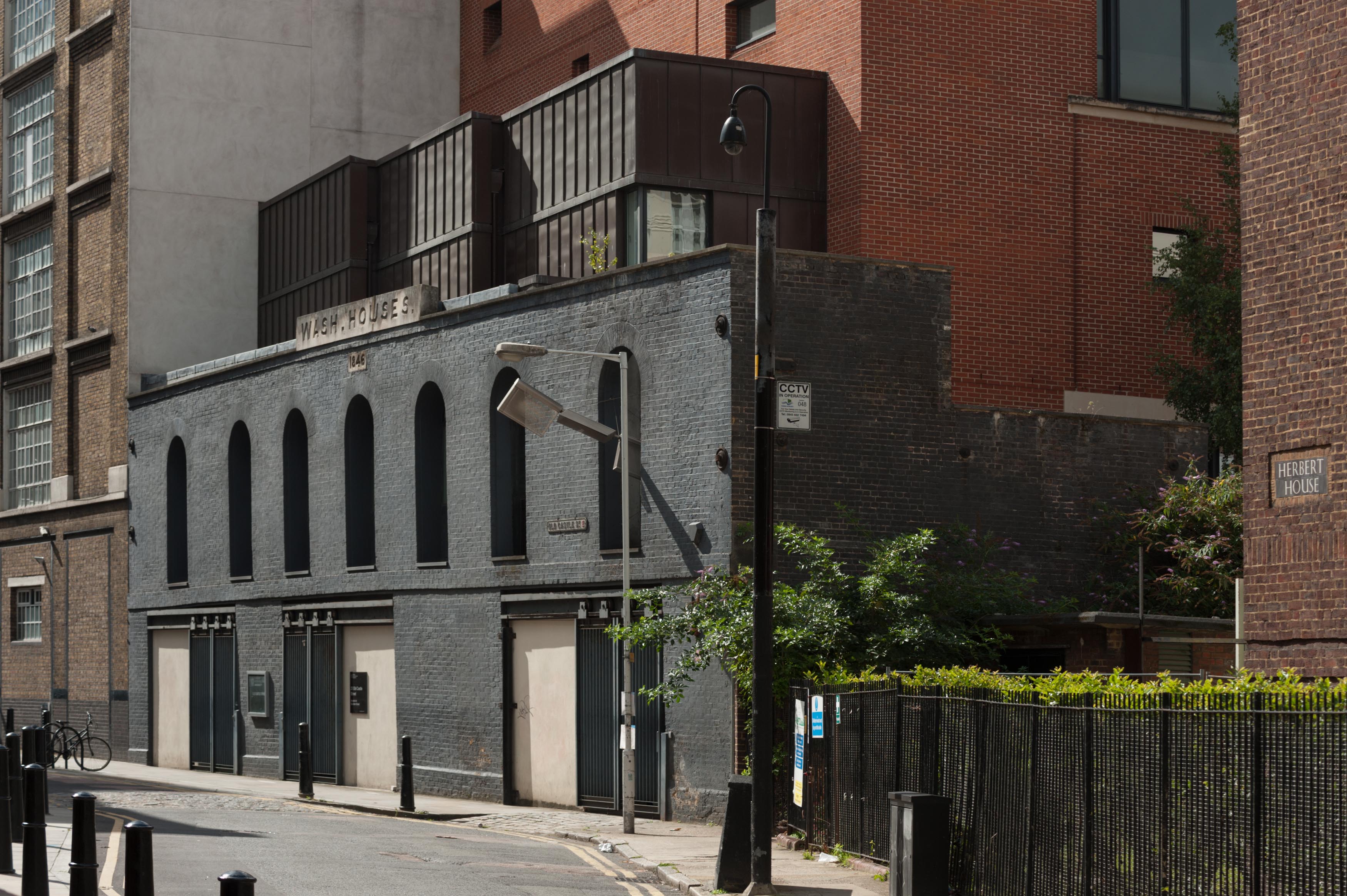
"id": 875,
"title": "The Wash Houses from the north east, August 2017",
"author": {
"id": 27,
"username": "DerekKendall"
},
"feature": {
"id": 1447,
"type": "Feature",
"geometry": {
"type": "MultiPolygon",
"coordinates": [
[
[
[
-0.073620345272929,
51.51568885255038
],
[
-0.073978291920849,
51.515581075868006
],
[
-0.074105154053684,
51.51572542989613
],
[
-0.073829058934223,
51.51581988475423
],
[
-0.073816416255057,
51.51580549883457
],
[
-0.073765536685163,
51.515822645959325
],
[
-0.073818338832879,
51.51587274604106
],
[
-0.073896057393162,
51.515850404112115
],
[
-0.073900642179228,
51.51585546922409
],
[
-0.073811510459007,
51.51588294615875
],
[
-0.073751379811388,
51.51582774828753
],
[
-0.073609777363084,
51.515693181519985
],
[
-0.073620345272929,
51.51568885255038
]
]
]
]
},
"properties": {
"b_number": "25",
"b_name": "The Wash Houses, London Metropolitan University, former Whitechapel Baths",
"street": "Old Castle Street",
"address": "The Wash Houses, London Metropolitan Univeristy, 25 Old Castle Street, London E1 7NT",
"feature_type": "WHITECHAPEL_BUILDING",
"count": 19,
"search_str": "The Wash Houses, London Metropolitan University, former Whitechapel Baths"
},
"tags": [
"cholera",
"library",
"swimming",
"washing",
"women"
]
},
"file": "https://surveyoflondon.org/media/uploads/features/1447/SoL%20Whitechapel%20101284.jpg",
"description": "",
"copyright": true,
"created": "2017-09-26"
},
{
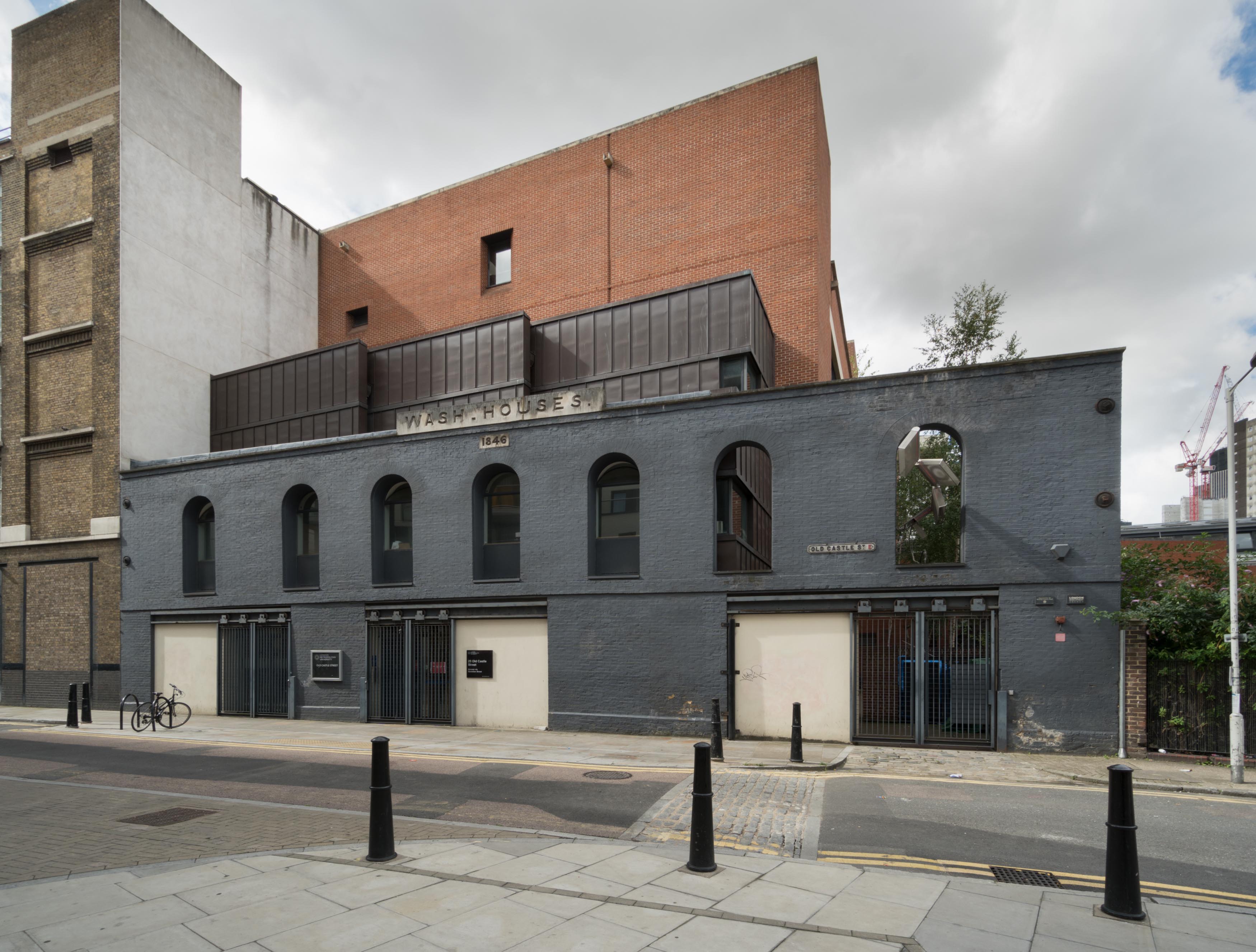
"id": 876,
"title": "The Wash Houses from the east, August 2017",
"author": {
"id": 27,
"username": "DerekKendall"
},
"feature": {
"id": 1447,
"type": "Feature",
"geometry": {
"type": "MultiPolygon",
"coordinates": [
[
[
[
-0.073620345272929,
51.51568885255038
],
[
-0.073978291920849,
51.515581075868006
],
[
-0.074105154053684,
51.51572542989613
],
[
-0.073829058934223,
51.51581988475423
],
[
-0.073816416255057,
51.51580549883457
],
[
-0.073765536685163,
51.515822645959325
],
[
-0.073818338832879,
51.51587274604106
],
[
-0.073896057393162,
51.515850404112115
],
[
-0.073900642179228,
51.51585546922409
],
[
-0.073811510459007,
51.51588294615875
],
[
-0.073751379811388,
51.51582774828753
],
[
-0.073609777363084,
51.515693181519985
],
[
-0.073620345272929,
51.51568885255038
]
]
]
]
},
"properties": {
"b_number": "25",
"b_name": "The Wash Houses, London Metropolitan University, former Whitechapel Baths",
"street": "Old Castle Street",
"address": "The Wash Houses, London Metropolitan Univeristy, 25 Old Castle Street, London E1 7NT",
"feature_type": "WHITECHAPEL_BUILDING",
"count": 19,
"search_str": "The Wash Houses, London Metropolitan University, former Whitechapel Baths"
},
"tags": [
"cholera",
"library",
"swimming",
"washing",
"women"
]
},
"file": "https://surveyoflondon.org/media/uploads/features/1447/SoL%20Whitechapel%20101286.jpg",
"description": "",
"copyright": true,
"created": "2017-09-26"
},
{
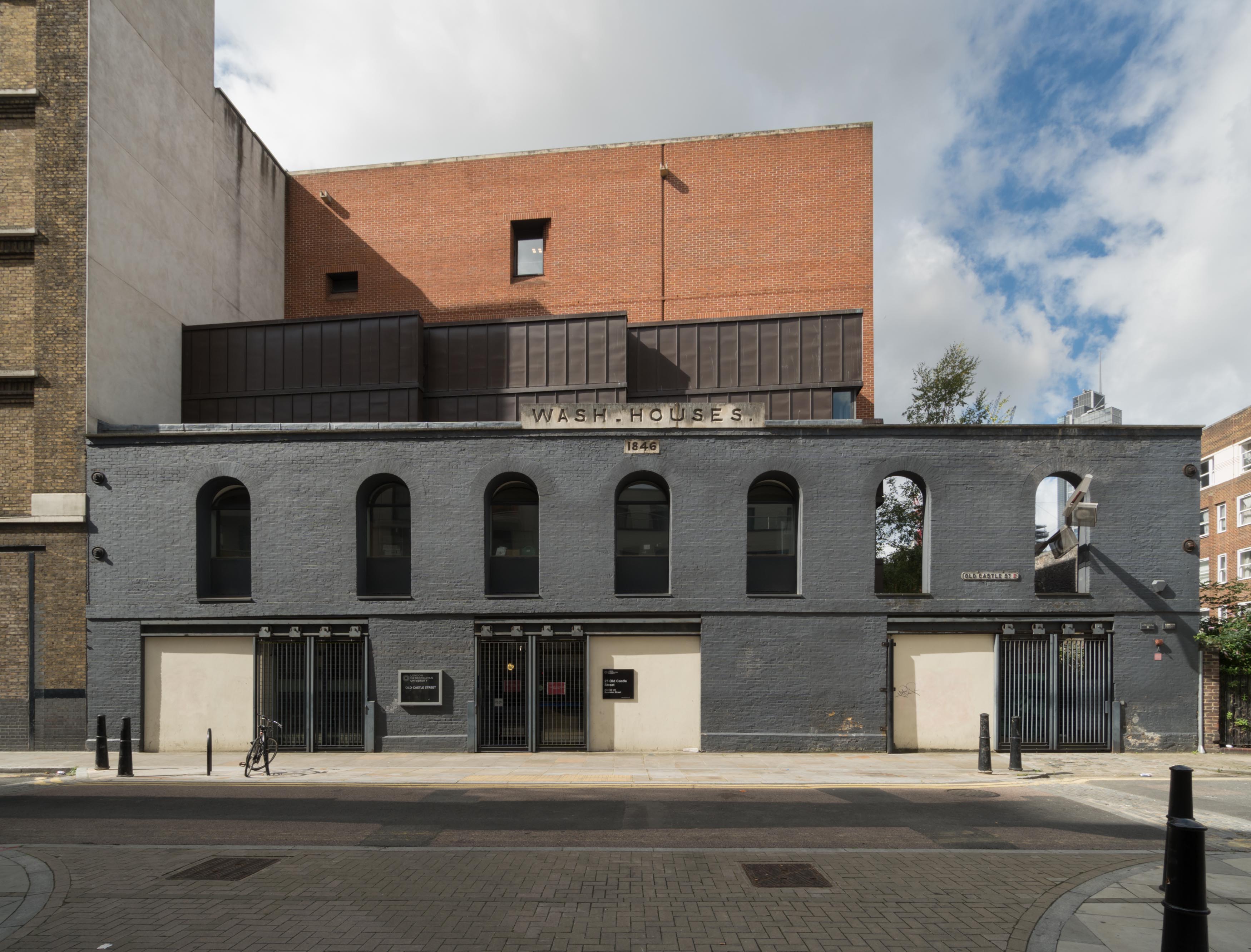
"id": 877,
"title": "The Wash Houses, August 2017",
"author": {
"id": 27,
"username": "DerekKendall"
},
"feature": {
"id": 1447,
"type": "Feature",
"geometry": {
"type": "MultiPolygon",
"coordinates": [
[
[
[
-0.073620345272929,
51.51568885255038
],
[
-0.073978291920849,
51.515581075868006
],
[
-0.074105154053684,
51.51572542989613
],
[
-0.073829058934223,
51.51581988475423
],
[
-0.073816416255057,
51.51580549883457
],
[
-0.073765536685163,
51.515822645959325
],
[
-0.073818338832879,
51.51587274604106
],
[
-0.073896057393162,
51.515850404112115
],
[
-0.073900642179228,
51.51585546922409
],
[
-0.073811510459007,
51.51588294615875
],
[
-0.073751379811388,
51.51582774828753
],
[
-0.073609777363084,
51.515693181519985
],
[
-0.073620345272929,
51.51568885255038
]
]
]
]
},
"properties": {
"b_number": "25",
"b_name": "The Wash Houses, London Metropolitan University, former Whitechapel Baths",
"street": "Old Castle Street",
"address": "The Wash Houses, London Metropolitan Univeristy, 25 Old Castle Street, London E1 7NT",
"feature_type": "WHITECHAPEL_BUILDING",
"count": 19,
"search_str": "The Wash Houses, London Metropolitan University, former Whitechapel Baths"
},
"tags": [
"cholera",
"library",
"swimming",
"washing",
"women"
]
},
"file": "https://surveyoflondon.org/media/uploads/features/1447/SoL%20Whitechapel%20101287.jpg",
"description": "",
"copyright": true,
"created": "2017-09-26"
},
{
"id": 916,
"title": "Dellow Centre from Gunthorpe Street, August 2017",
"author": {
"id": 27,
"username": "DerekKendall"
},
"feature": {
"id": 364,
"type": "Feature",
"geometry": {
"type": "MultiPolygon",
"coordinates": [
[
[
[
-0.071489806542886,
51.517023172539695
],
[
-0.071243898612021,
51.51660982272529
],
[
-0.071190306454479,
51.516576885746375
],
[
-0.071306299769721,
51.51654960254589
],
[
-0.071326638948875,
51.51652155453997
],
[
-0.071374403242583,
51.5165233420156
],
[
-0.07170710495994,
51.516972518185476
],
[
-0.071689530249958,
51.51699956808665
],
[
-0.071662895989952,
51.51700659921577
],
[
-0.071622347338577,
51.51700294482352
],
[
-0.071489806542886,
51.517023172539695
]
]
]
]
},
"properties": {
"b_number": "82",
"b_name": "The Dellow Centre",
"street": "Wentworth Street",
"address": "Providence Row, The Dellow Centre, 82 Wentworth Street",
"feature_type": "WHITECHAPEL_BUILDING",
"count": 13,
"search_str": "The Dellow Centre"
},
"tags": []
},
"file": "https://surveyoflondon.org/media/uploads/features/364/SoL%20Whitechapel%20101454.jpg",
"description": "",
"copyright": true,
"created": "2017-09-26"
},
{
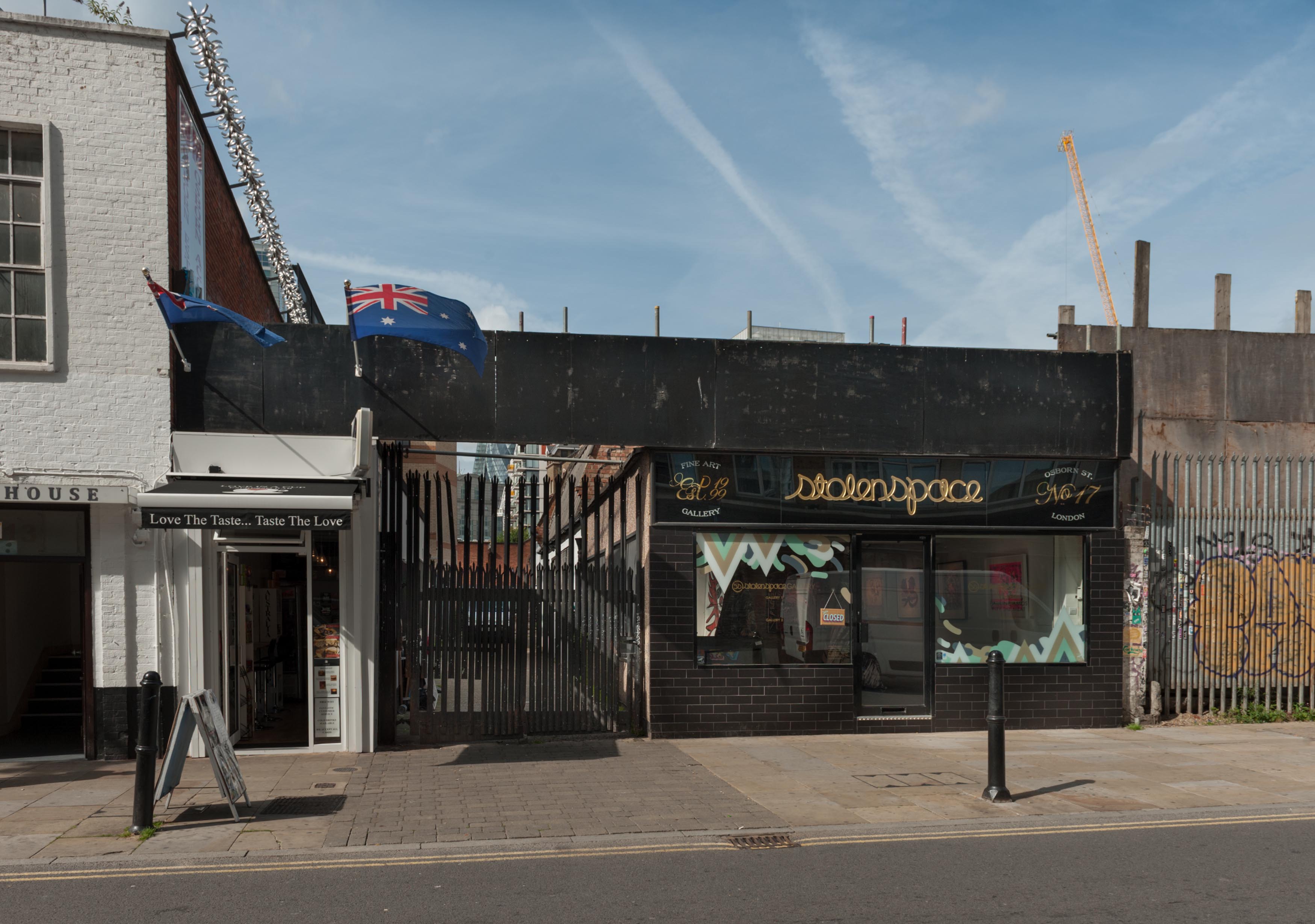
"id": 907,
"title": "Cafe at 15 Osborn Street, Stolen Space Gallery at 17, and rear entrance to Whitechapel Gallery, August 2017",
"author": {
"id": 27,
"username": "DerekKendall"
},
"feature": {
"id": 372,
"type": "Feature",
"geometry": {
"type": "MultiPolygon",
"coordinates": [
[
[
[
-0.070402778544495,
51.516389321671994
],
[
-0.070233638934218,
51.51643169469596
],
[
-0.070069276198967,
51.51646909706458
],
[
-0.070041407881536,
51.516421424748614
],
[
-0.070326070855666,
51.51635664668792
],
[
-0.070386341977288,
51.516360999507576
],
[
-0.070402778544495,
51.516389321671994
]
]
]
]
},
"properties": {
"b_number": "17",
"b_name": "17 Osborn Street",
"street": "Osborn Street",
"address": "Stolen Space, 17 Osborn Street",
"feature_type": "WHITECHAPEL_BUILDING",
"count": 2,
"search_str": "17 Osborn Street"
},
"tags": []
},
"file": "https://surveyoflondon.org/media/uploads/features/372/SoL%20Whitechapel%20101439.jpg",
"description": "",
"copyright": true,
"created": "2017-09-26"
},
{
"id": 627,
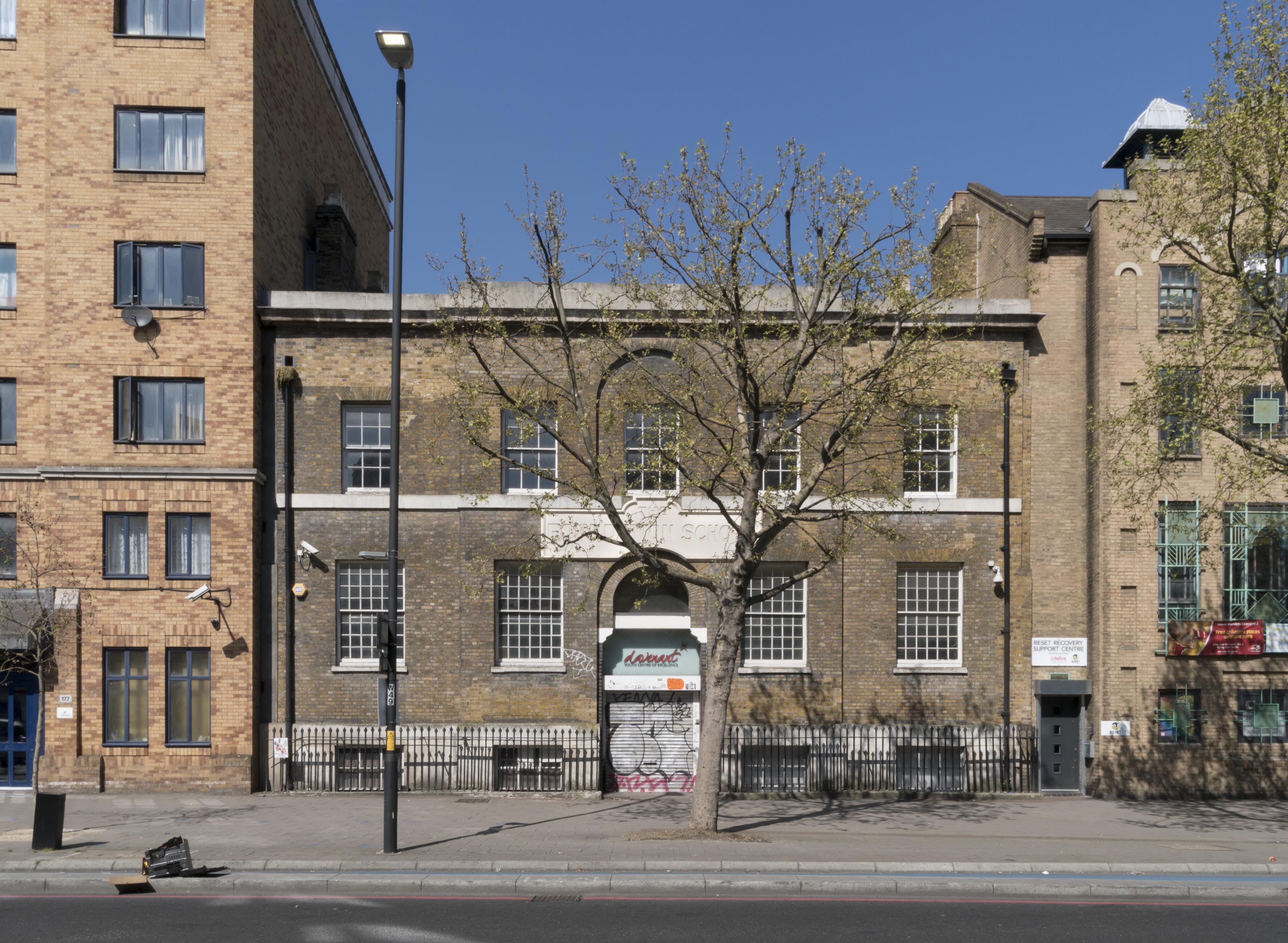
"title": "179 Whitechapel Road, April 2017",
"author": {
"id": 27,
"username": "DerekKendall"
},
"feature": {
"id": 452,
"type": "Feature",
"geometry": {
"type": "MultiPolygon",
"coordinates": [
[
[
[
-0.06408176276412,
51.518388594133064
],
[
-0.064079076989357,
51.518451921601226
],
[
-0.064014118536147,
51.518467104995885
],
[
-0.063936244085074,
51.51842608315136
],
[
-0.06387175509906,
51.51844488660313
],
[
-0.063789009522268,
51.51833442643744
],
[
-0.063997611137361,
51.51827758805008
],
[
-0.06408176276412,
51.518388594133064
]
]
]
]
},
"properties": {
"b_number": "179",
"b_name": "Davenant Youth Centre (former Davenant School)",
"street": "Whitechapel Road",
"address": "Davenant Youth Centre, 179 Whitechapel Road",
"feature_type": "WHITECHAPEL_BUILDING",
"count": 18,
"search_str": "Davenant Youth Centre (former Davenant School)"
},
"tags": [
"Davenant",
"school"
]
},
"file": "https://surveyoflondon.org/media/uploads/features/452/SoL%20Whitechapel%20100776.jpg",
"description": "",
"copyright": true,
"created": "2017-05-03"
},
{
"id": 904,
"title": "5 and 7 Osborn Street, August 2017",
"author": {
"id": 27,
"username": "DerekKendall"
},
"feature": {
"id": 391,
"type": "Feature",
"geometry": {
"type": "MultiPolygon",
"coordinates": [
[
[
[
-0.0699256385862,
51.51626805239805
],
[
-0.069994430833407,
51.516244821693576
],
[
-0.070016730348399,
51.5162647583072
],
[
-0.06994466528717,
51.5162895671175
],
[
-0.0699256385862,
51.51626805239805
]
]
]
]
},
"properties": {
"b_number": "7",
"b_name": "7 Osborn Street",
"street": "Osborn Street",
"address": "7 Osborn Street",
"feature_type": "WHITECHAPEL_BUILDING",
"count": 2,
"search_str": "7 Osborn Street"
},
"tags": []
},
"file": "https://surveyoflondon.org/media/uploads/features/391/SoL%20Whitechapel%20101437.jpg",
"description": "",
"copyright": true,
"created": "2017-09-26"
},
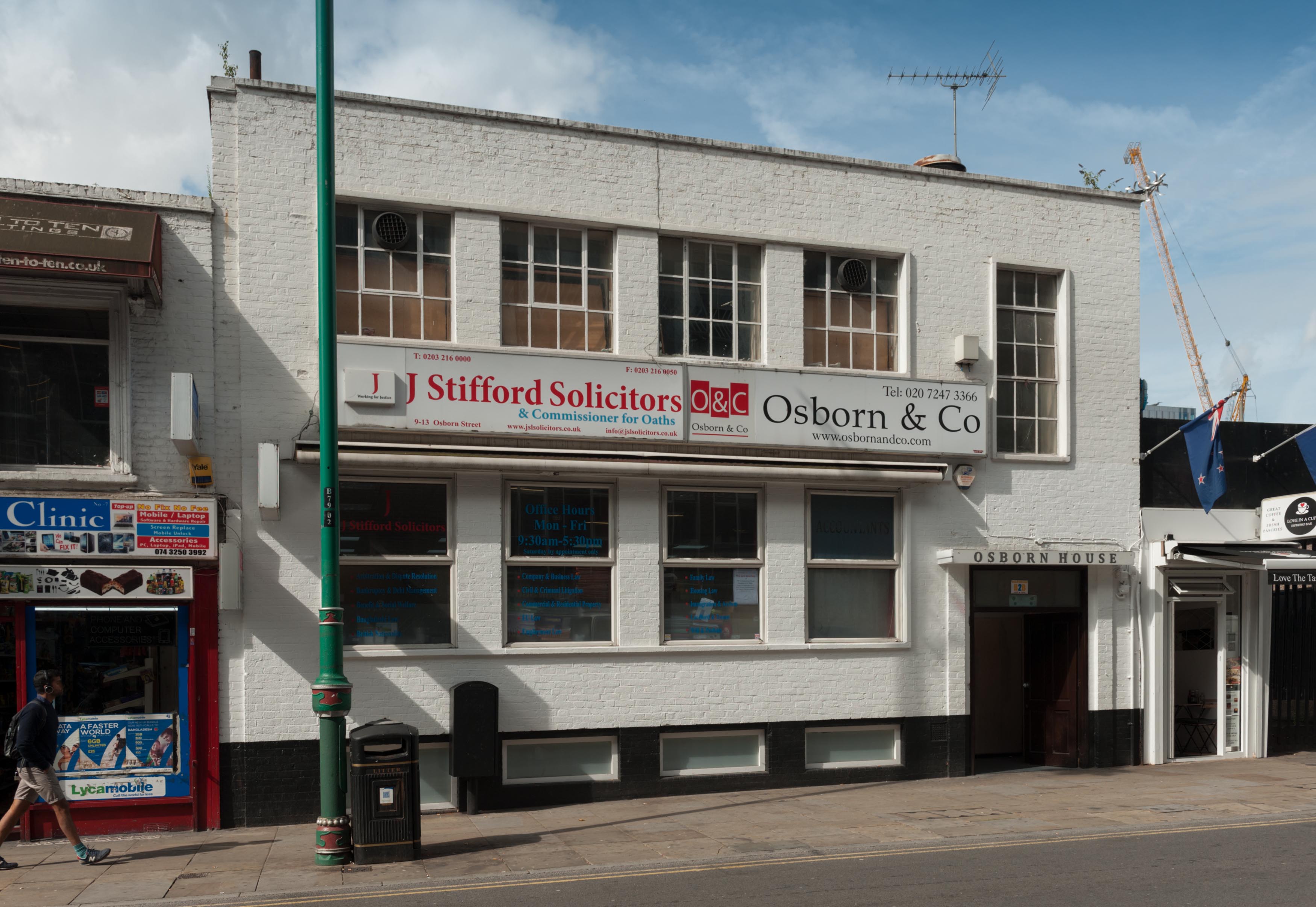
{
"id": 905,
"title": "9-13 Osborn Street, August 2017",
"author": {
"id": 27,
"username": "DerekKendall"
},
"feature": {
"id": 392,
"type": "Feature",
"geometry": {
"type": "MultiPolygon",
"coordinates": [
[
[
[
-0.07014797927071,
51.51634220941502
],
[
-0.070147967634972,
51.516342205661495
],
[
-0.070007799873136,
51.51637973313135
],
[
-0.069939167558236,
51.51629218417821
],
[
-0.069944654053405,
51.516289563883646
],
[
-0.070016719114671,
51.51626475507335
],
[
-0.07006091883039,
51.51624953903239
],
[
-0.070093539236031,
51.51628642487065
],
[
-0.07015540314417,
51.516265127868394
],
[
-0.070199520796705,
51.51632668915274
],
[
-0.070181109339512,
51.51633223301351
],
[
-0.070147978868688,
51.51634220889529
],
[
-0.07014797927071,
51.51634220941502
]
]
]
]
},
"properties": {
"b_number": "9-13",
"b_name": "9-13 Osborn Street",
"street": "Osborn Street",
"address": "Osborn House, 9-13 Osborn Street",
"feature_type": "WHITECHAPEL_BUILDING",
"count": 2,
"search_str": "9-13 Osborn Street"
},
"tags": []
},
"file": "https://surveyoflondon.org/media/uploads/features/392/SoL%20Whitechapel%20101438.jpg",
"description": "",
"copyright": true,
"created": "2017-09-26"
},
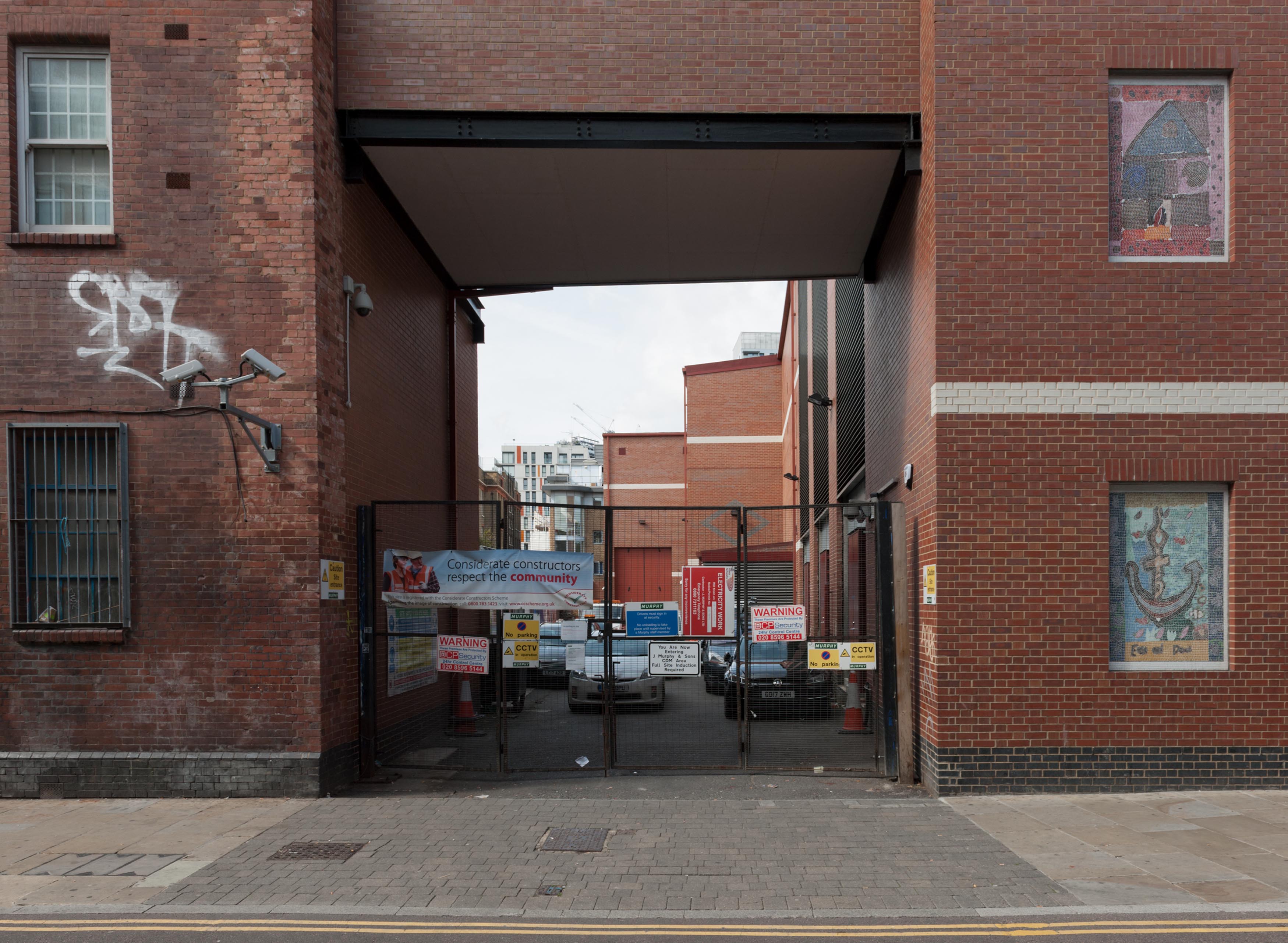
{
"id": 911,
"title": "Entrance to electricity substation, August 2017",
"author": {
"id": 27,
"username": "DerekKendall"
},
"feature": {
"id": 403,
"type": "Feature",
"geometry": {
"type": "MultiPolygon",
"coordinates": [
[
[
[
-0.070428470671249,
51.51703857523385
],
[
-0.07036422734981,
51.516945322405284
],
[
-0.070330986157414,
51.51689707072388
],
[
-0.070392777430672,
51.51687775947235
],
[
-0.070437144006129,
51.51693301970784
],
[
-0.070774827255344,
51.516855774492015
],
[
-0.07074640812008,
51.516816124626274
],
[
-0.07090145346137,
51.51678001240825
],
[
-0.070876954080184,
51.51674152267537
],
[
-0.071130885676613,
51.51668019678022
],
[
-0.071197349238024,
51.51678200054396
],
[
-0.071230099646628,
51.51677577693351
],
[
-0.07127634891399,
51.51685645983061
],
[
-0.071087189951145,
51.516895346035234
],
[
-0.070616873946699,
51.516999851225
],
[
-0.070428470671249,
51.51703857523385
]
]
]
]
},
"properties": {
"b_number": "27",
"b_name": "",
"street": "Osborn Street",
"address": "27 Osborn Street",
"feature_type": "WHITECHAPEL_BUILDING",
"count": 3,
"search_str": "27 Osborn Street"
},
"tags": []
},
"file": "https://surveyoflondon.org/media/uploads/features/403/SoL%20Whitechapel%20101444.jpg",
"description": "",
"copyright": true,
"created": "2017-09-26"
},
{
"id": 628,
"title": "179 Whitechapel Road from the south-east in April 2017",
"author": {
"id": 27,
"username": "DerekKendall"
},
"feature": {
"id": 452,
"type": "Feature",
"geometry": {
"type": "MultiPolygon",
"coordinates": [
[
[
[
-0.06408176276412,
51.518388594133064
],
[
-0.064079076989357,
51.518451921601226
],
[
-0.064014118536147,
51.518467104995885
],
[
-0.063936244085074,
51.51842608315136
],
[
-0.06387175509906,
51.51844488660313
],
[
-0.063789009522268,
51.51833442643744
],
[
-0.063997611137361,
51.51827758805008
],
[
-0.06408176276412,
51.518388594133064
]
]
]
]
},
"properties": {
"b_number": "179",
"b_name": "Davenant Youth Centre (former Davenant School)",
"street": "Whitechapel Road",
"address": "Davenant Youth Centre, 179 Whitechapel Road",
"feature_type": "WHITECHAPEL_BUILDING",
"count": 18,
"search_str": "Davenant Youth Centre (former Davenant School)"
},
"tags": [
"Davenant",
"school"
]
},
"file": "https://surveyoflondon.org/media/uploads/features/452/SoL%20Whitechapel%20100777.jpg",
"description": "",
"copyright": true,
"created": "2017-05-03"
},
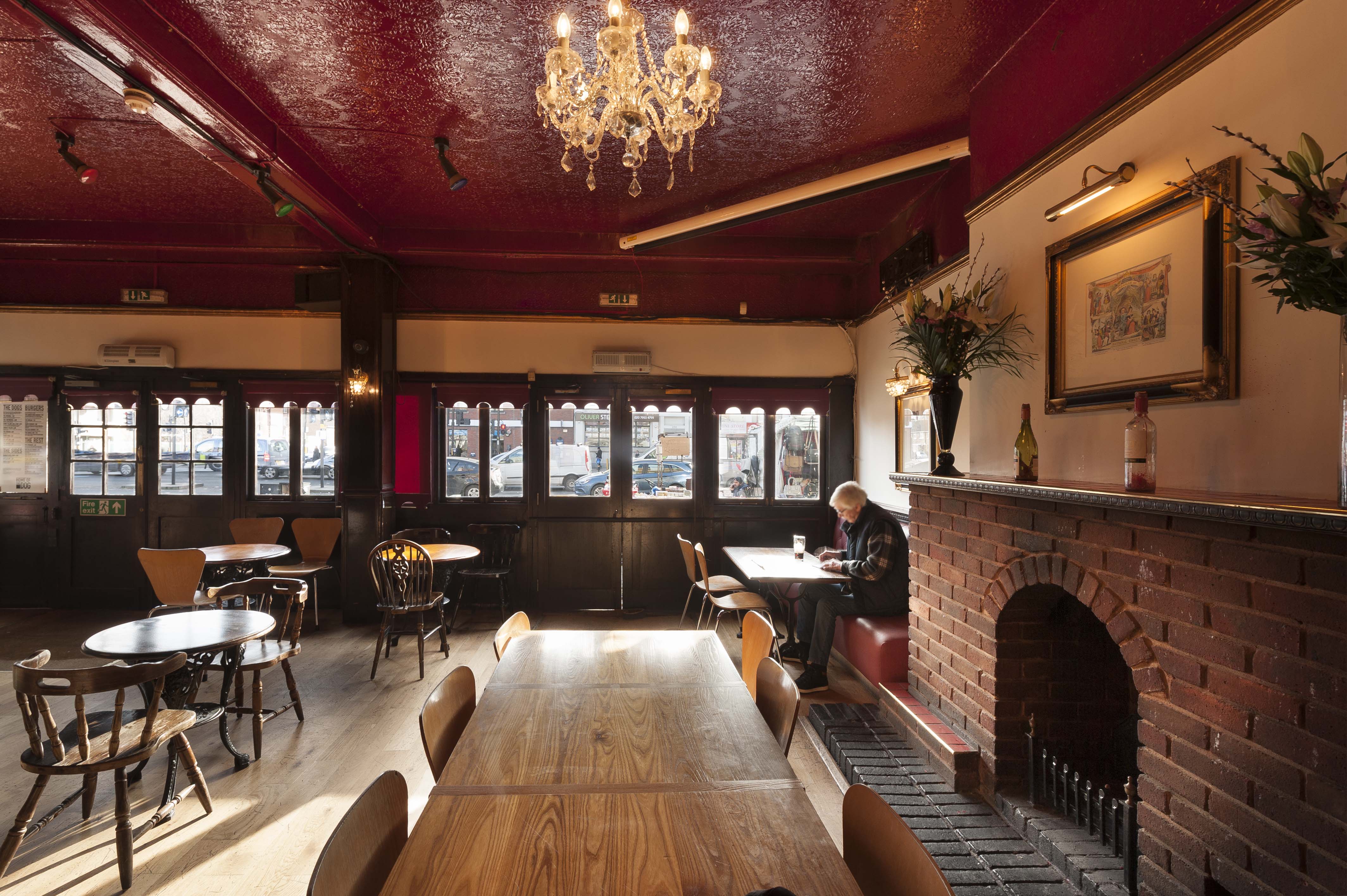
{
"id": 1118,
"title": "The Blind Beggar, interior looking south in 2018",
"author": {
"id": 27,
"username": "DerekKendall"
},
"feature": {
"id": 521,
"type": "Feature",
"geometry": {
"type": "MultiPolygon",
"coordinates": [
[
[
[
-0.057044351749301,
51.52005556326038
],
[
-0.057062845054071,
51.52008733971823
],
[
-0.057006580922032,
51.52009916710701
],
[
-0.056992538373997,
51.520075225540054
],
[
-0.056933469956532,
51.520088559604176
],
[
-0.05684130439071,
51.51992730823853
],
[
-0.056960904550882,
51.519899865751334
],
[
-0.057044351749301,
51.52005556326038
]
]
]
]
},
"properties": {
"b_number": "337",
"b_name": "The Blind Beggar public house",
"street": "Whitechapel Road",
"address": "The Blind Beggar, 337 Whitechapel Road",
"feature_type": "WHITECHAPEL_BUILDING",
"count": 9,
"search_str": "The Blind Beggar public house"
},
"tags": []
},
"file": "https://surveyoflondon.org/media/uploads/features/521/SoL%20Whitechapel%20101742.jpg",
"description": "",
"copyright": true,
"created": "2018-01-29"
},
{
"id": 750,
"title": "Chemist on the Vallance Rd corner in May 2014",
"author": {
"id": 18,
"username": "shahedsaleem"
},
"feature": {
"id": 422,
"type": "Feature",
"geometry": {
"type": "MultiPolygon",
"coordinates": [
[
[
[
-0.06270212037316,
51.51862633234804
],
[
-0.062776541829826,
51.518610158780305
],
[
-0.06281702921814,
51.51868151322284
],
[
-0.062751025821007,
51.518713377913635
],
[
-0.06270212037316,
51.51862633234804
]
]
]
]
},
"properties": {
"b_number": "197",
"b_name": "",
"street": "Whitechapel Road",
"address": "197 Whitechapel Road",
"feature_type": "WHITECHAPEL_BUILDING",
"count": 2,
"search_str": "197 Whitechapel Road"
},
"tags": []
},
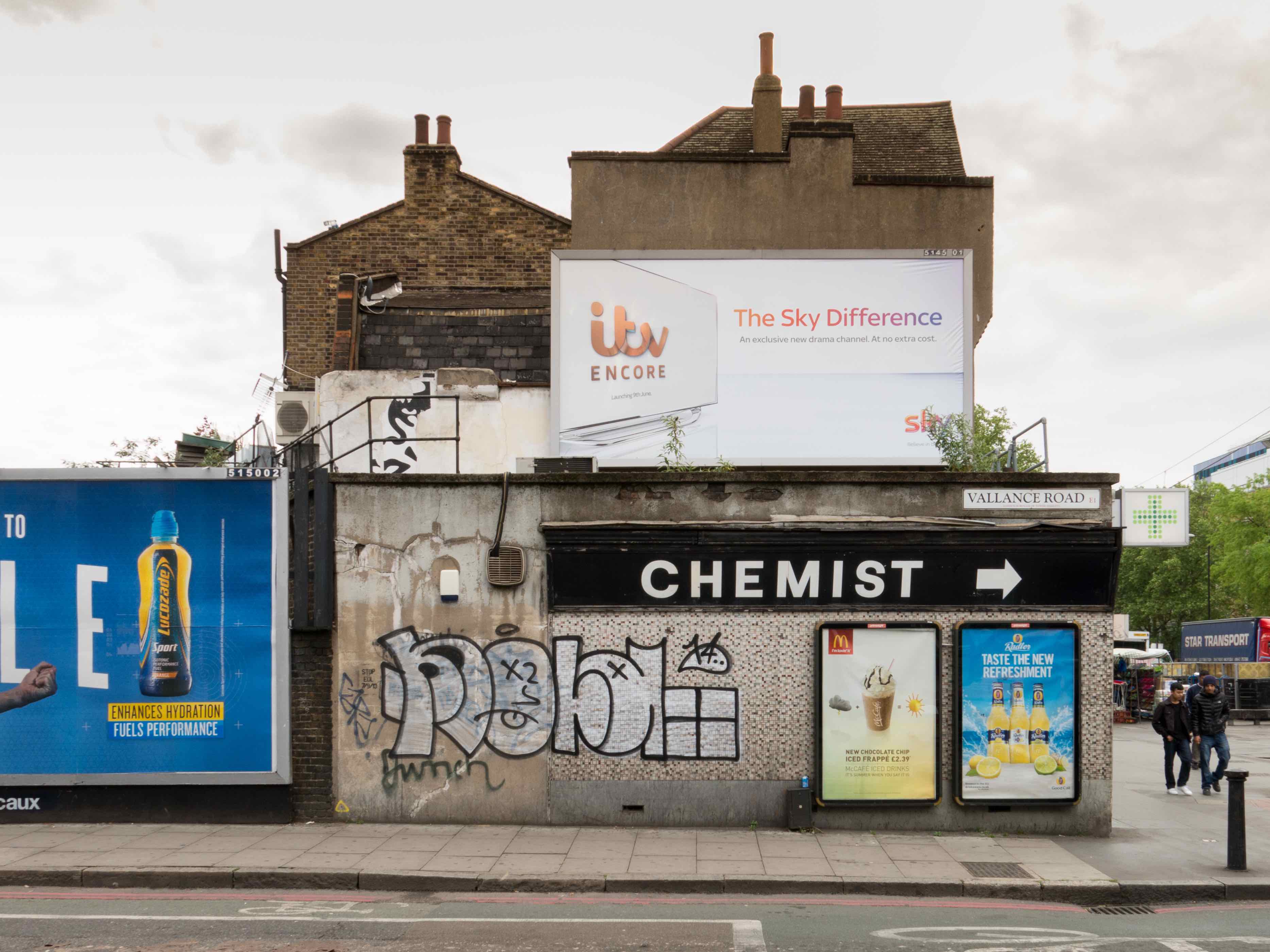
"file": "https://surveyoflondon.org/media/uploads/features/422/20140522-IMG_0059%20copy.jpg",
"description": "I used to have an office for some years until 2015 on Derbyshire Street further up Vallance Road, and I used to pass this corner often. I always liked the combination of the 1950's style signage (not sure when it actually dates from), with the graffiti and posters which would intermittently change.\nI often thought that I should take a picture of it as it seemed ripe for a clean up, and I'm glad I managed to get this one when I did, as it has recently been refurbished and spruced up, and is now a perfume shop (I think).",
"copyright": false,
"created": "2017-09-06"
},
{
"id": 1109,
"title": "A room with a view",
"author": {
"id": 209,
"username": "f.ciufo"
},
"feature": {
"id": 223,
"type": "Feature",
"geometry": {
"type": "MultiPolygon",
"coordinates": [
[
[
[
-0.069651275011124,
51.51835449089215
],
[
-0.069592024694681,
51.51836717419471
],
[
-0.069587125932472,
51.518360246262
],
[
-0.069422150097701,
51.51838609725476
],
[
-0.069428895460589,
51.51840120950797
],
[
-0.069398491903018,
51.518404780174386
],
[
-0.069392714379199,
51.51838967325895
],
[
-0.069237263189485,
51.51841785638787
],
[
-0.069221236825655,
51.518417615963294
],
[
-0.069198758310569,
51.518413055117485
],
[
-0.069189106230736,
51.518402805327085
],
[
-0.069120097916717,
51.51825457693517
],
[
-0.069105176600071,
51.518256968483236
],
[
-0.069099054846448,
51.518236845706575
],
[
-0.06911264195119,
51.518235161624375
],
[
-0.069068670608898,
51.51812739697248
],
[
-0.069053930480549,
51.518128134519145
],
[
-0.06903992435002,
51.518096251376235
],
[
-0.069181990019506,
51.518069271172465
],
[
-0.069281479672148,
51.518305780531115
],
[
-0.069312100496919,
51.518315438787596
],
[
-0.069603812103688,
51.51826672197482
],
[
-0.069651275011124,
51.51835449089215
]
]
]
]
},
"properties": {
"b_number": "",
"b_name": "Spelman House",
"street": "Spelman Street and Chicksand Street",
"address": "Spelman House, Spelman Street and Chicksand Street",
"feature_type": "WHITECHAPEL_BUILDING",
"count": 11,
"search_str": "Spelman House"
},
"tags": []
},
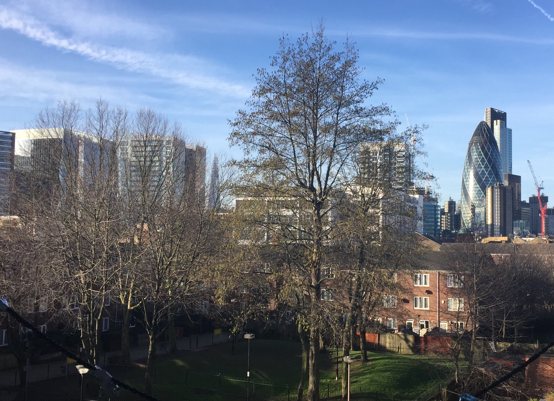
"file": "https://surveyoflondon.org/media/uploads/features/223/Foto%2024-02-17%2C%2008%2046%2030.jpg",
"description": "",
"copyright": true,
"created": "2018-01-27"
},
{
"id": 933,
"title": "Back Church Lane looking south c1990",
"author": {
"id": 200,
"username": "rob"
},
"feature": {
"id": 1041,
"type": "Feature",
"geometry": {
"type": "MultiPolygon",
"coordinates": [
[
[
[
-0.066992032219366,
51.5134960535117
],
[
-0.067125184168537,
51.5135419901409
],
[
-0.067092069884069,
51.5135773971637
],
[
-0.066960222450063,
51.51353210116446
],
[
-0.066992032219366,
51.5134960535117
]
]
]
]
},
"properties": {
"b_number": "117",
"b_name": "117 Back Church Lane",
"street": "Back Church Lane",
"address": "117 Back Church Lane",
"feature_type": "WHITECHAPEL_BUILDING",
"count": 3,
"search_str": "117 Back Church Lane"
},
"tags": []
},
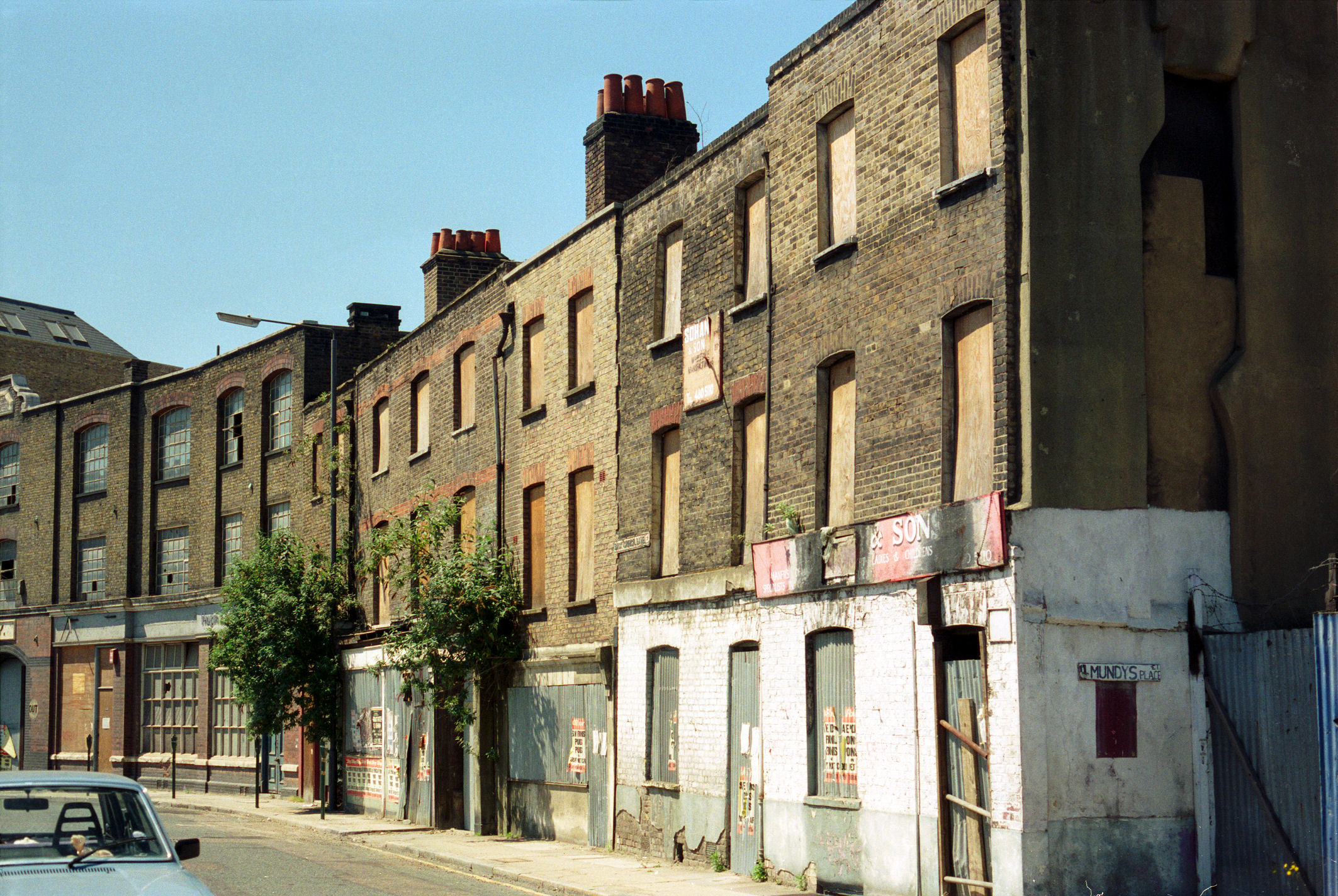
"file": "https://surveyoflondon.org/media/uploads/features/1041/Back%20Church%20Lane%20c1990%2001.jpg",
"description": "The western side of Back Church Lane taken close to the junction with Fairclough Street. The building with the bushes growing out either side was the site of the 'Cherry Tree' public house.",
"copyright": false,
"created": "2017-10-13"
},
{
"id": 935,
"title": "Back Church Lane c.1980",
"author": {
"id": 201,
"username": "stephen"
},
"feature": {
"id": 1041,
"type": "Feature",
"geometry": {
"type": "MultiPolygon",
"coordinates": [
[
[
[
-0.066992032219366,
51.5134960535117
],
[
-0.067125184168537,
51.5135419901409
],
[
-0.067092069884069,
51.5135773971637
],
[
-0.066960222450063,
51.51353210116446
],
[
-0.066992032219366,
51.5134960535117
]
]
]
]
},
"properties": {
"b_number": "117",
"b_name": "117 Back Church Lane",
"street": "Back Church Lane",
"address": "117 Back Church Lane",
"feature_type": "WHITECHAPEL_BUILDING",
"count": 3,
"search_str": "117 Back Church Lane"
},
"tags": []
},
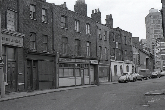
"file": "https://surveyoflondon.org/media/uploads/features/1041/Back%20Church%20Lane%20copy.jpg",
"description": " Great-great Grandparents lived at 120 [on the corner with Sander Street, opposite]. Demolished in the 1960s.",
"copyright": false,
"created": "2017-10-17"
},
{
"id": 668,
"title": "A wedding at New Road Synagogue, 1973",
"author": {
"id": 109,
"username": "stanley"
},
"feature": {
"id": 1463,
"type": "Feature",
"geometry": {
"type": "MultiPolygon",
"coordinates": [
[
[
[
-0.063134492360364,
51.51782738505861
],
[
-0.063025709537606,
51.51764418006528
],
[
-0.062931156135412,
51.51766686232899
],
[
-0.062954889604093,
51.51770900962472
],
[
-0.062726482458675,
51.517765079903484
],
[
-0.062748999276863,
51.51780173726752
],
[
-0.062973174374441,
51.51774578529897
],
[
-0.063032903202825,
51.51784972503275
],
[
-0.063134492360364,
51.51782738505861
]
]
]
]
},
"properties": {
"b_number": "115",
"b_name": "",
"street": "New Road",
"address": "115 New Road and the former New Road Synagogue",
"feature_type": "WHITECHAPEL_BUILDING",
"count": 9,
"search_str": "115 New Road and the former New Road Synagogue"
},
"tags": [
"Lewis Solomon",
"Samuel Montagu"
]
},
"file": "https://surveyoflondon.org/media/uploads/features/1463/Stanley%20Meinchick's%20wedding%20photo%20in%20New%20Road%20synagogue.jpg",
"description": "Stanley Meinchick has sent us this photograph of his wedding at New Road Synagogue, 16 December 1973 (that's him on the right), which he believes was the last wedding conducted there before the synagogue closed. ",
"copyright": false,
"created": "2017-05-12"
},
{
"id": 936,
"title": "Gower's Walk, looking north, c.1980",
"author": {
"id": 201,
"username": "stephen"
},
"feature": {
"id": 1005,
"type": "Feature",
"geometry": {
"type": "MultiPolygon",
"coordinates": [
[
[
[
-0.067180798939432,
51.512911920220176
],
[
-0.067624988998484,
51.51289617869746
],
[
-0.067674782792481,
51.51313629851437
],
[
-0.067721744056023,
51.51313289915908
],
[
-0.067755852211198,
51.51322248870878
],
[
-0.067682509657788,
51.51321710704479
],
[
-0.067654590885861,
51.513297328210555
],
[
-0.067516875836223,
51.51328532147534
],
[
-0.067468956763533,
51.51341668205499
],
[
-0.067277526303318,
51.51337909942833
],
[
-0.067137642973819,
51.51333104278721
],
[
-0.067188431523132,
51.51317071067776
],
[
-0.067203219362638,
51.51308470897374
],
[
-0.067183076322121,
51.51292857876673
],
[
-0.067180798939432,
51.512911920220176
]
],
[
[
-0.067402751092455,
51.513321694761274
],
[
-0.067420144835674,
51.51325312417157
],
[
-0.067384587480254,
51.51325045159809
],
[
-0.067384326780274,
51.51323027699892
],
[
-0.067335343500746,
51.513228774201664
],
[
-0.067319383083405,
51.513316147649554
],
[
-0.067402751092455,
51.513321694761274
]
],
[
[
-0.067492150220602,
51.51318475803046
],
[
-0.067522036285235,
51.513084399017174
],
[
-0.067453414453496,
51.51307283525235
],
[
-0.067418954868062,
51.51317590098832
],
[
-0.067492150220602,
51.51318475803046
]
],
[
[
-0.06747986041909,
51.51304058127036
],
[
-0.067475683647445,
51.51294174750583
],
[
-0.067394851036263,
51.51294215421109
],
[
-0.067401211342125,
51.51304206725618
],
[
-0.06747986041909,
51.51304058127036
]
]
]
]
},
"properties": {
"b_number": "40",
"b_name": "Chandlery House, 40 Gower's Walk",
"street": "Gower's Walk",
"address": "Chandlery House, 40 Gower's Walk",
"feature_type": "WHITECHAPEL_BUILDING",
"count": 11,
"search_str": "Chandlery House, 40 Gower's Walk"
},
"tags": []
},
"file": "https://surveyoflondon.org/media/uploads/features/1005/img185%20copy.png",
"description": "Great-great grandparents lived in Wagner's Buildings [on the west side of Gower's Walk]\n in 1861 - census sheet is missing for part of this road.",
"copyright": false,
"created": "2017-10-17"
},
{
"id": 1669,
"title": "Rear of hospital during conversion ",
"author": {
"id": 118,
"username": "david2"
},
"feature": {
"id": 1230,
"type": "Feature",
"geometry": {
"type": "MultiPolygon",
"coordinates": [
[
[
[
-0.06071898744648,
51.51847914149303
],
[
-0.060743358937849,
51.518529899918775
],
[
-0.060362148562617,
51.518618013153
],
[
-0.060404024127419,
51.51868851949335
],
[
-0.060356952993906,
51.51869974522794
],
[
-0.060399234817198,
51.51877056309998
],
[
-0.060042469531136,
51.5188530372297
],
[
-0.060006551123239,
51.51879256032364
],
[
-0.05997171006068,
51.51880061452483
],
[
-0.059923949522789,
51.51872019830377
],
[
-0.059602716389847,
51.51879445706454
],
[
-0.059631951693606,
51.51884368227145
],
[
-0.059135089420495,
51.51895853862307
],
[
-0.059031394281591,
51.51878393727422
],
[
-0.059075483581288,
51.51877374555587
],
[
-0.05923306113512,
51.518737319626666
],
[
-0.059261815633844,
51.518785736083466
],
[
-0.059453095208379,
51.51874286661955
],
[
-0.059437777096903,
51.51871791341666
],
[
-0.059509844762857,
51.518701022201654
],
[
-0.059472510825189,
51.51863713193043
],
[
-0.059893693119402,
51.51853565124978
],
[
-0.059897251108141,
51.51854177905041
],
[
-0.060406197614306,
51.5184267554985
],
[
-0.060388475186227,
51.51839623334771
],
[
-0.060226549751936,
51.51811735804654
],
[
-0.060490662909997,
51.51805857683586
],
[
-0.060500593175314,
51.518078725457706
],
[
-0.06071898744648,
51.51847914149303
]
]
]
]
},
"properties": {
"b_number": "",
"b_name": "Former Royal London Hospital",
"street": "",
"address": "Former Royal London Hospital ",
"feature_type": "WHITECHAPEL_BUILDING",
"count": 53,
"search_str": "Former Royal London Hospital"
},
"tags": []
},
"file": "https://surveyoflondon.org/media/uploads/features/1230/AAAAAAAATemp_Delete.JPG",
"description": "This is the rear of the hospital stripped right back, to 18th-century work where possible, during its conversion to a 'Civic Centre'. Soon new buildings will obscure this view",
"copyright": false,
"created": "2019-11-29"
},
{
"id": 939,
"title": "Buckle Street",
"author": {
"id": 201,
"username": "stephen"
},
"feature": {
"id": 987,
"type": "Feature",
"geometry": {
"type": "MultiPolygon",
"coordinates": [
[
[
[
-0.070145370299403,
51.51450072634437
],
[
-0.07014611994867,
51.51450455659268
],
[
-0.070144309574274,
51.514509535874474
],
[
-0.070140121750315,
51.51451620267396
],
[
-0.070136623713428,
51.51452004299396
],
[
-0.070132782230155,
51.51452343811338
],
[
-0.07012919823248,
51.51452605003296
],
[
-0.070032329210259,
51.51456074054102
],
[
-0.069888287217447,
51.51461232427546
],
[
-0.069840045190473,
51.514629600448345
],
[
-0.069774452824825,
51.51465322031716
],
[
-0.06976437015771,
51.514657348821736
],
[
-0.069752142738503,
51.51465949508699
],
[
-0.069738751592763,
51.514659184706524
],
[
-0.069727055003321,
51.514656294262764
],
[
-0.069718712135325,
51.51465200744966
],
[
-0.069710007581218,
51.51464360333125
],
[
-0.069703346477841,
51.51462231454975
],
[
-0.069687670795924,
51.5145762148712
],
[
-0.069654908902713,
51.514479867076176
],
[
-0.069639134856717,
51.51444518750716
],
[
-0.069621768125469,
51.51441285371942
],
[
-0.069616967605489,
51.5143964229486
],
[
-0.069618177681695,
51.51438973157497
],
[
-0.069621435653496,
51.51437947349934
],
[
-0.069630708154631,
51.51436447257293
],
[
-0.069646015054674,
51.51435269798059
],
[
-0.069669258695001,
51.51434149605311
],
[
-0.06990815956914,
51.514236930554475
],
[
-0.070061827306772,
51.51416967057941
],
[
-0.070205488914527,
51.51432361317142
],
[
-0.070080560753047,
51.51437793580642
],
[
-0.070064472214771,
51.51438470803152
],
[
-0.070066767405088,
51.51439004684161
],
[
-0.070083931212681,
51.514419269950324
],
[
-0.070132489860627,
51.51448663206476
],
[
-0.070141902651642,
51.514496931909626
],
[
-0.070145370299403,
51.51450072634437
]
]
]
]
},
"properties": {
"b_number": "71",
"b_name": "Altitude Point",
"street": "Alie Street",
"address": "71 (Altitude Point) and 81 Alie Street with 9 Buckle Street (Goldpence Apartments)",
"feature_type": "WHITECHAPEL_BUILDING",
"count": 11,
"search_str": "Altitude Point"
},
"tags": []
},
"file": "https://surveyoflondon.org/media/uploads/features/1448/P4153617.jpg",
"description": "Old warehouse/factory on the south side of Buckle Street (at the end of the then-surviving stump of Plough Street), taken in 2007 before demolition for Altitude Point. ",
"copyright": false,
"created": "2017-10-19"
}
]
}