HTTP 200 OK
Allow: GET, HEAD, OPTIONS
Content-Type: application/json
Vary: Accept
{
"count": 1747,
"next": "https://surveyoflondon.org/api/v1/images/?format=api&page=39",
"previous": "https://surveyoflondon.org/api/v1/images/?format=api&page=37",
"results": [
{
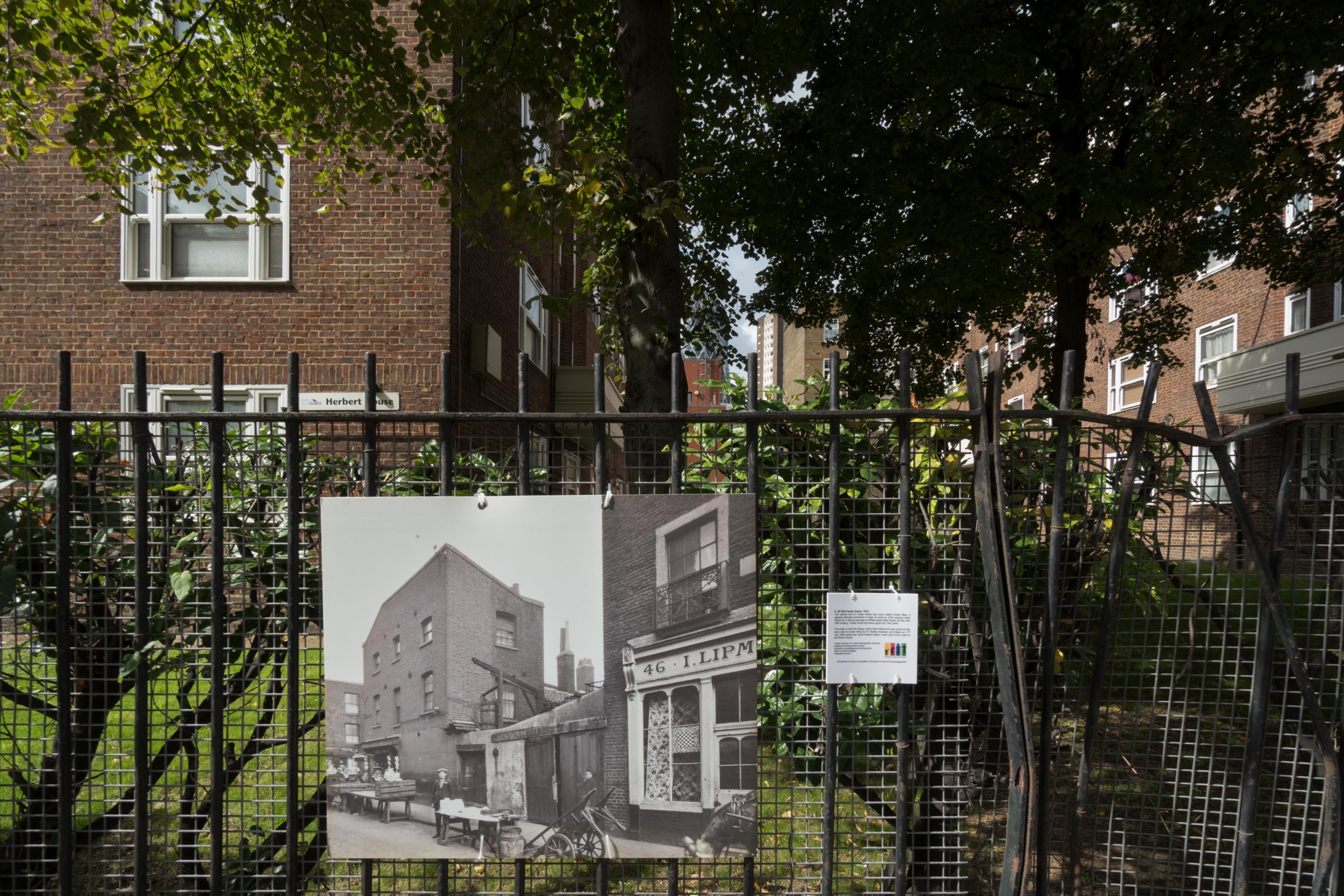
"id": 866,
"title": "Old Castle Street past and present",
"author": {
"id": 27,
"username": "DerekKendall"
},
"feature": {
"id": 355,
"type": "Feature",
"geometry": {
"type": "MultiPolygon",
"coordinates": [
[
[
[
-0.074471609124608,
51.516157394230596
],
[
-0.074094924476241,
51.51627050128873
],
[
-0.07389322310185,
51.51601309694218
],
[
-0.074264013012644,
51.515898564190884
],
[
-0.074337530456423,
51.51598441114345
],
[
-0.074271504609232,
51.516006422063526
],
[
-0.074251298845097,
51.51598282761466
],
[
-0.074049011165702,
51.51605026352619
],
[
-0.074144047562767,
51.516169151315886
],
[
-0.074359544442729,
51.51610517582989
],
[
-0.074351750936823,
51.51609801971847
],
[
-0.07440543525088,
51.51608012306834
],
[
-0.074471609124608,
51.516157394230596
]
]
]
]
},
"properties": {
"b_number": "",
"b_name": "Herbert House",
"street": "Old Castle Street",
"address": "Herbert House, Old Castle Street, London E1 7TW",
"feature_type": "WHITECHAPEL_BUILDING",
"count": 8,
"search_str": "Herbert House"
},
"tags": []
},
"file": "https://surveyoflondon.org/media/uploads/features/355/SoL%20Whitechapel%20101296.jpg",
"description": "",
"copyright": true,
"created": "2017-09-26"
},
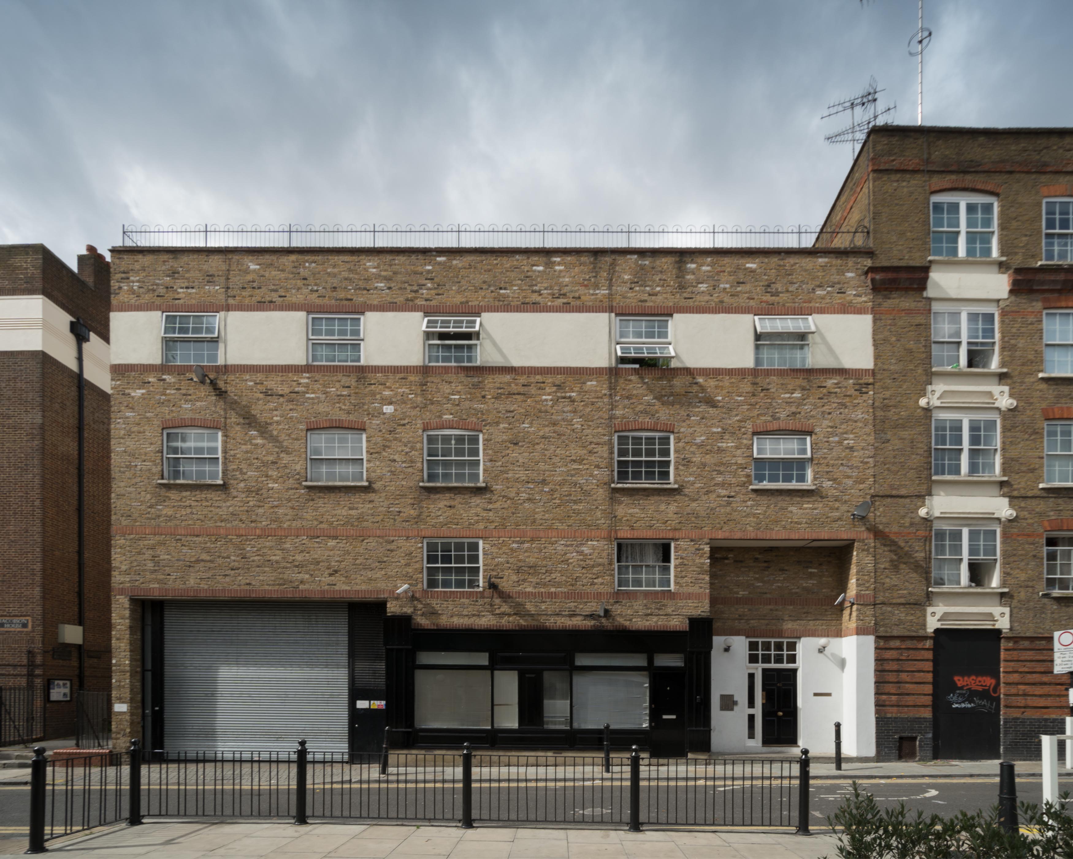
{
"id": 869,
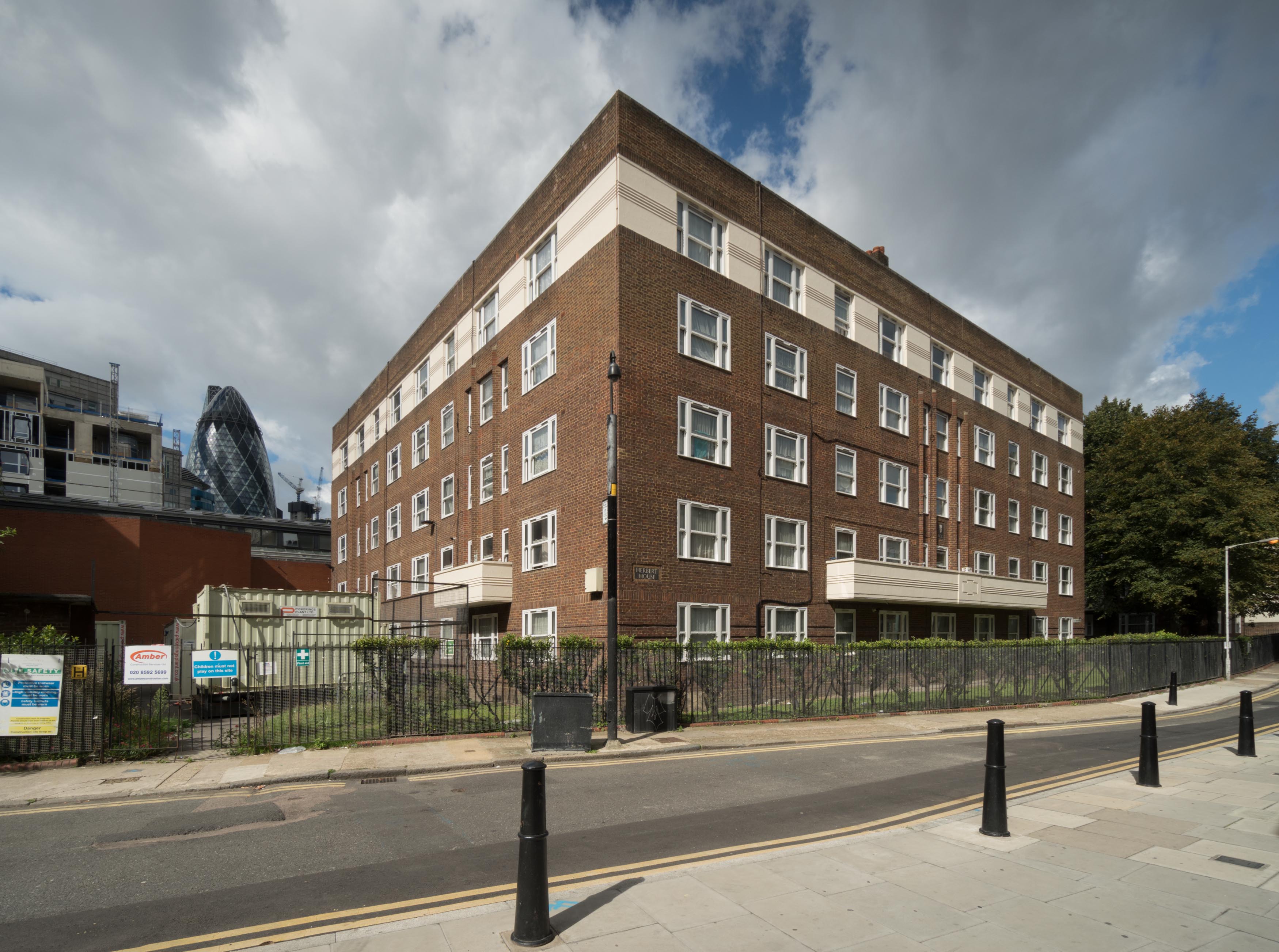
"title": "Herbert House from the south east, August 2017",
"author": {
"id": 27,
"username": "DerekKendall"
},
"feature": {
"id": 355,
"type": "Feature",
"geometry": {
"type": "MultiPolygon",
"coordinates": [
[
[
[
-0.074471609124608,
51.516157394230596
],
[
-0.074094924476241,
51.51627050128873
],
[
-0.07389322310185,
51.51601309694218
],
[
-0.074264013012644,
51.515898564190884
],
[
-0.074337530456423,
51.51598441114345
],
[
-0.074271504609232,
51.516006422063526
],
[
-0.074251298845097,
51.51598282761466
],
[
-0.074049011165702,
51.51605026352619
],
[
-0.074144047562767,
51.516169151315886
],
[
-0.074359544442729,
51.51610517582989
],
[
-0.074351750936823,
51.51609801971847
],
[
-0.07440543525088,
51.51608012306834
],
[
-0.074471609124608,
51.516157394230596
]
]
]
]
},
"properties": {
"b_number": "",
"b_name": "Herbert House",
"street": "Old Castle Street",
"address": "Herbert House, Old Castle Street, London E1 7TW",
"feature_type": "WHITECHAPEL_BUILDING",
"count": 8,
"search_str": "Herbert House"
},
"tags": []
},
"file": "https://surveyoflondon.org/media/uploads/features/355/SoL%20Whitechapel%20101293.jpg",
"description": "",
"copyright": true,
"created": "2017-09-26"
},
{
"id": 700,
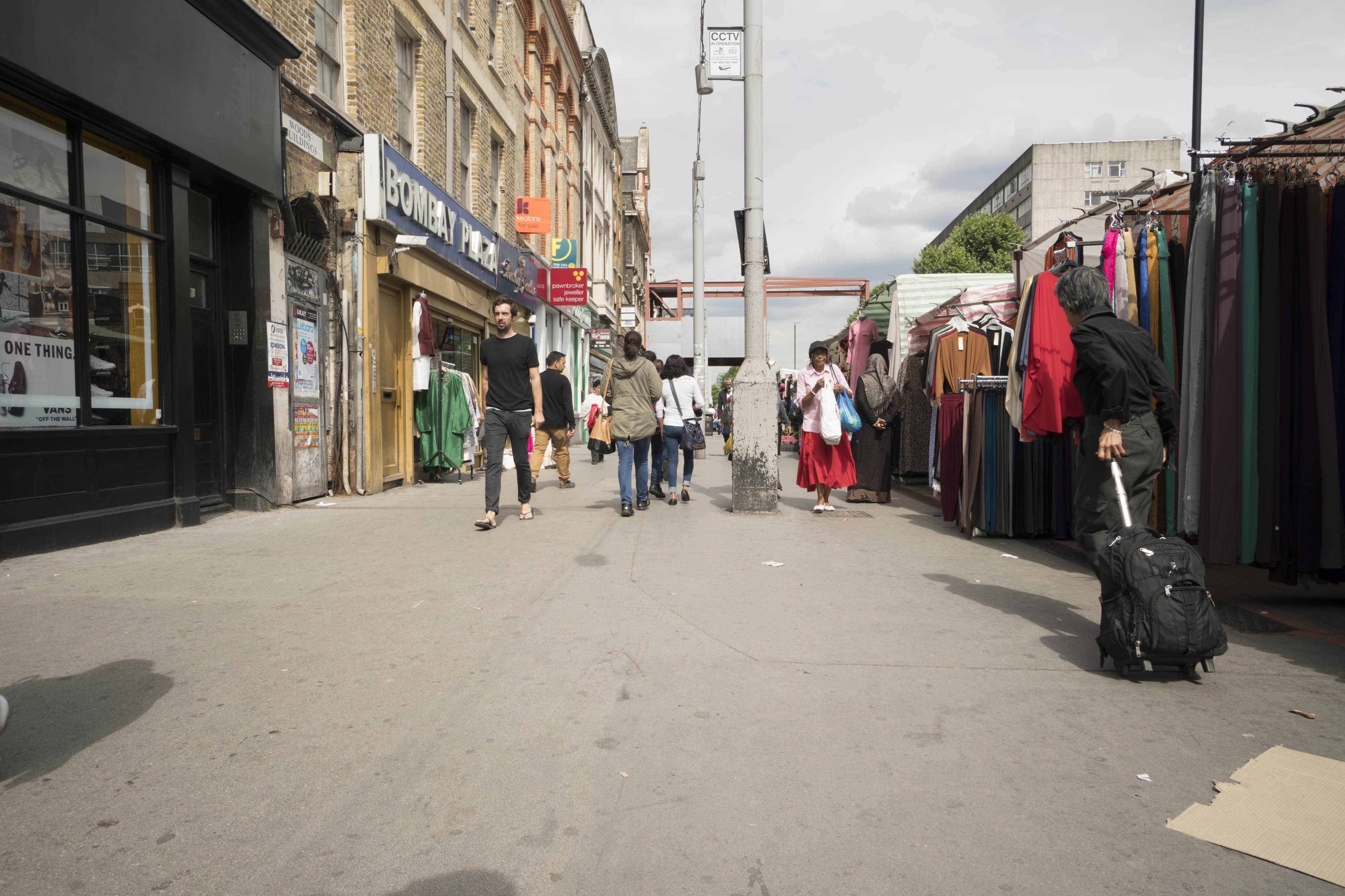
"title": "Whitechapel Market, pavement from the west in 2017",
"author": {
"id": 27,
"username": "DerekKendall"
},
"feature": {
"id": 1698,
"type": "Feature",
"geometry": {
"type": "MultiPolygon",
"coordinates": [
[
[
[
-0.062755898137067,
51.51857235799611
],
[
-0.058216859270041,
51.51960039921044
],
[
-0.058148482851386,
51.51948612756745
],
[
-0.061091729886378,
51.51883423152082
],
[
-0.061616259170046,
51.51871888429734
],
[
-0.06270768344222,
51.51847582817058
],
[
-0.062755898137067,
51.51857235799611
]
]
]
]
},
"properties": {
"b_number": "",
"b_name": "",
"street": "Whitechapel Road",
"address": "Whitechapel Market, Whitechapel Road",
"feature_type": "PLACE",
"count": 48,
"search_str": "Whitechapel Market, Whitechapel Road"
},
"tags": []
},
"file": "https://surveyoflondon.org/media/uploads/features/1698/SoL%20Whitechapel%20101207.jpg",
"description": "",
"copyright": true,
"created": "2017-07-28"
},
{
"id": 690,
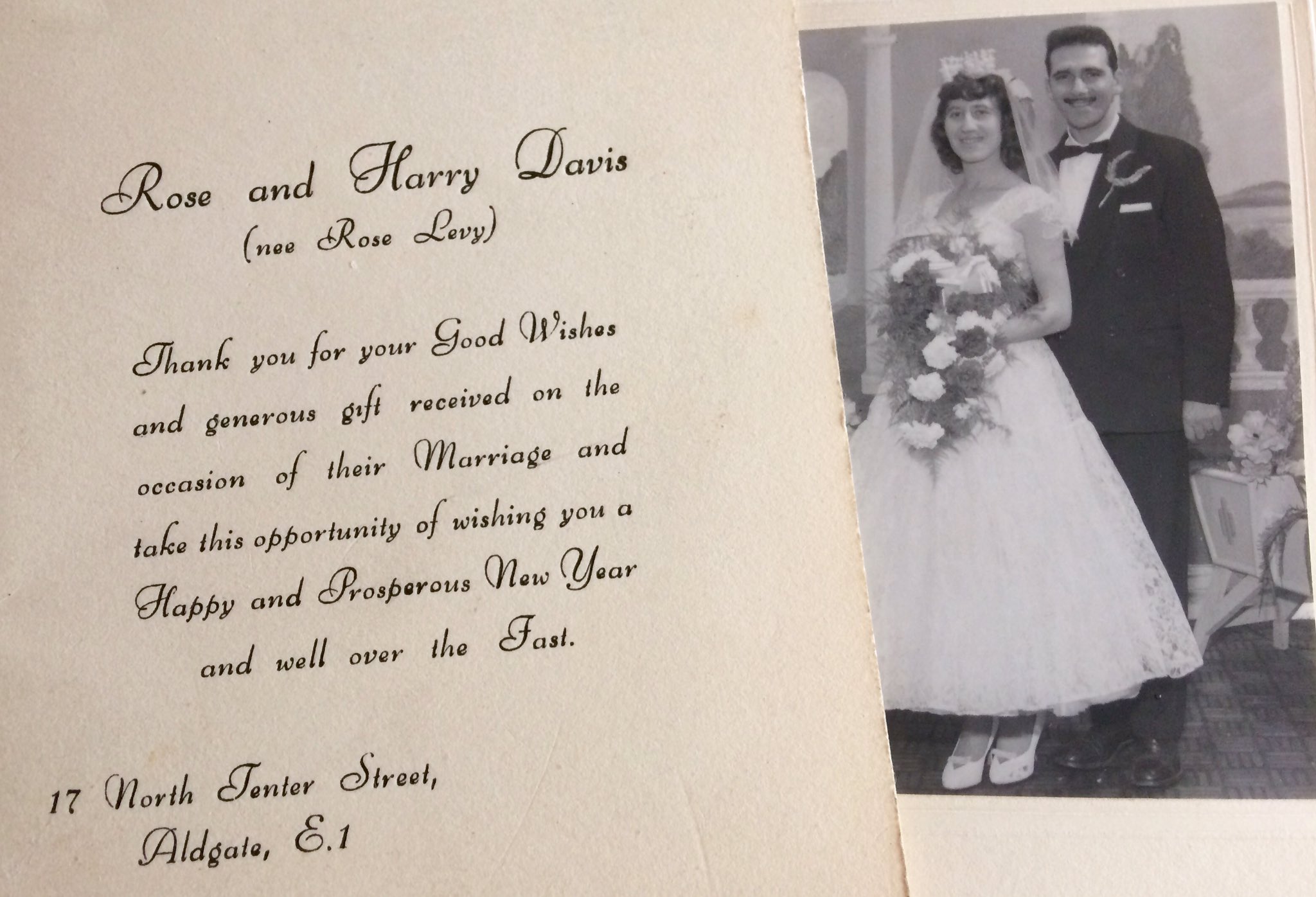
"title": "Auntie Rosie & Uncle Harry's wedding thank you card, 1957. Submitted by Cat.",
"author": {
"id": 22,
"username": "sarahannmilne"
},
"feature": {
"id": 95,
"type": "Feature",
"geometry": {
"type": "MultiPolygon",
"coordinates": [
[
[
[
-0.072288312836018,
51.512824307605015
],
[
-0.072121612943253,
51.512858159153865
],
[
-0.072025478409202,
51.512890409815434
],
[
-0.072011859946938,
51.51286535896135
],
[
-0.071966433437302,
51.51287497358547
],
[
-0.071934030456307,
51.51281536880901
],
[
-0.071897041880432,
51.51282319750863
],
[
-0.071941565002123,
51.51290509717561
],
[
-0.071831416366548,
51.512942678785066
],
[
-0.071781735212569,
51.5128432447703
],
[
-0.071725521861399,
51.51285417962799
],
[
-0.07176487086724,
51.51293293466522
],
[
-0.071675647300703,
51.51295029074344
],
[
-0.071664919501195,
51.51292881954059
],
[
-0.071609406497337,
51.512939618081724
],
[
-0.071587377736956,
51.512895528347
],
[
-0.071612025842334,
51.512890733734274
],
[
-0.071602267132423,
51.512871202037054
],
[
-0.071638516898164,
51.51286415062836
],
[
-0.071631665323334,
51.51285043746628
],
[
-0.071520551906845,
51.51287205152489
],
[
-0.071479483670422,
51.51278985445861
],
[
-0.071510654926827,
51.51278379096125
],
[
-0.071493990169301,
51.51275043681792
],
[
-0.071398637684366,
51.51276898494904
],
[
-0.071377550943573,
51.51272678005531
],
[
-0.071560243982688,
51.512691242207104
],
[
-0.071533397485951,
51.51263750953841
],
[
-0.071453105482364,
51.51265312815549
],
[
-0.071420349396566,
51.51258756716799
],
[
-0.07167247628417,
51.51253852254618
],
[
-0.071707184439989,
51.512607989805105
],
[
-0.071606228537011,
51.51262762818665
],
[
-0.071633225247965,
51.51268166132723
],
[
-0.07169132093397,
51.512670360313905
],
[
-0.071712967532689,
51.512713685153294
],
[
-0.071811121682106,
51.5126945917228
],
[
-0.071768019434541,
51.512608324512954
],
[
-0.071970981647633,
51.512568842989026
],
[
-0.072017837645733,
51.51266262230734
],
[
-0.071954707384708,
51.51267490286048
],
[
-0.072013765441807,
51.5127931035959
],
[
-0.072057545202814,
51.51278458724506
],
[
-0.072087040272971,
51.512843619299026
],
[
-0.072110299177035,
51.51283569768739
],
[
-0.072067753844785,
51.51274483657161
],
[
-0.072241827775471,
51.51271310224785
],
[
-0.072288312836018,
51.512824307605015
]
]
]
]
},
"properties": {
"b_number": "",
"b_name": "",
"street": "St Mark Street",
"address": "English Martyrs RC Primary School, St Mark Street",
"feature_type": "WHITECHAPEL_BUILDING",
"count": 9,
"search_str": "English Martyrs RC Primary School, St Mark Street"
},
"tags": []
},
"file": "https://surveyoflondon.org/media/uploads/features/95/Cat_North_Tenter.jpg-large",
"description": "Sent out during Yom Kippur, hence wishes 'over the Fast'. Their address was the now demolished terraced house, 17 North Tenter Street. ",
"copyright": false,
"created": "2017-07-04"
},
{
"id": 846,
"title": "Entrance to school, looking towards the west",
"author": {
"id": 27,
"username": "DerekKendall"
},
"feature": {
"id": 95,
"type": "Feature",
"geometry": {
"type": "MultiPolygon",
"coordinates": [
[
[
[
-0.072288312836018,
51.512824307605015
],
[
-0.072121612943253,
51.512858159153865
],
[
-0.072025478409202,
51.512890409815434
],
[
-0.072011859946938,
51.51286535896135
],
[
-0.071966433437302,
51.51287497358547
],
[
-0.071934030456307,
51.51281536880901
],
[
-0.071897041880432,
51.51282319750863
],
[
-0.071941565002123,
51.51290509717561
],
[
-0.071831416366548,
51.512942678785066
],
[
-0.071781735212569,
51.5128432447703
],
[
-0.071725521861399,
51.51285417962799
],
[
-0.07176487086724,
51.51293293466522
],
[
-0.071675647300703,
51.51295029074344
],
[
-0.071664919501195,
51.51292881954059
],
[
-0.071609406497337,
51.512939618081724
],
[
-0.071587377736956,
51.512895528347
],
[
-0.071612025842334,
51.512890733734274
],
[
-0.071602267132423,
51.512871202037054
],
[
-0.071638516898164,
51.51286415062836
],
[
-0.071631665323334,
51.51285043746628
],
[
-0.071520551906845,
51.51287205152489
],
[
-0.071479483670422,
51.51278985445861
],
[
-0.071510654926827,
51.51278379096125
],
[
-0.071493990169301,
51.51275043681792
],
[
-0.071398637684366,
51.51276898494904
],
[
-0.071377550943573,
51.51272678005531
],
[
-0.071560243982688,
51.512691242207104
],
[
-0.071533397485951,
51.51263750953841
],
[
-0.071453105482364,
51.51265312815549
],
[
-0.071420349396566,
51.51258756716799
],
[
-0.07167247628417,
51.51253852254618
],
[
-0.071707184439989,
51.512607989805105
],
[
-0.071606228537011,
51.51262762818665
],
[
-0.071633225247965,
51.51268166132723
],
[
-0.07169132093397,
51.512670360313905
],
[
-0.071712967532689,
51.512713685153294
],
[
-0.071811121682106,
51.5126945917228
],
[
-0.071768019434541,
51.512608324512954
],
[
-0.071970981647633,
51.512568842989026
],
[
-0.072017837645733,
51.51266262230734
],
[
-0.071954707384708,
51.51267490286048
],
[
-0.072013765441807,
51.5127931035959
],
[
-0.072057545202814,
51.51278458724506
],
[
-0.072087040272971,
51.512843619299026
],
[
-0.072110299177035,
51.51283569768739
],
[
-0.072067753844785,
51.51274483657161
],
[
-0.072241827775471,
51.51271310224785
],
[
-0.072288312836018,
51.512824307605015
]
]
]
]
},
"properties": {
"b_number": "",
"b_name": "",
"street": "St Mark Street",
"address": "English Martyrs RC Primary School, St Mark Street",
"feature_type": "WHITECHAPEL_BUILDING",
"count": 9,
"search_str": "English Martyrs RC Primary School, St Mark Street"
},
"tags": []
},
"file": "https://surveyoflondon.org/media/uploads/features/95/SoL%20Whitechapel%20101581.jpg",
"description": "",
"copyright": true,
"created": "2017-09-12"
},
{
"id": 887,
"title": "The new public space Resolution Plaza between Denning Point and Ladbroke Court/Sloane Apartments, August 2017",
"author": {
"id": 27,
"username": "DerekKendall"
},
"feature": {
"id": 418,
"type": "Feature",
"geometry": {
"type": "MultiPolygon",
"coordinates": [
[
[
[
-0.072746598508902,
51.51606954342789
],
[
-0.072960598509013,
51.51600294342786
],
[
-0.073204179460588,
51.516286636711484
],
[
-0.07309813858896,
51.51632069440908
],
[
-0.073209924770563,
51.51645628282147
],
[
-0.073448547413177,
51.516379700226935
],
[
-0.073388848290212,
51.51630691952966
],
[
-0.073540198509107,
51.51626194342803
],
[
-0.073676298509083,
51.516416243428104
],
[
-0.073207798508838,
51.51657004342822
],
[
-0.072746598508902,
51.51606954342789
]
]
]
]
},
"properties": {
"b_number": "3",
"b_name": "3 Resolution Plaza ",
"street": "3 Resolution Plaza",
"address": "3 Resolution Plaza",
"feature_type": "WHITECHAPEL_BUILDING",
"count": 4,
"search_str": "3 Resolution Plaza "
},
"tags": []
},
"file": "https://surveyoflondon.org/media/uploads/features/418/SoL%20Whitechapel%20101309.jpg",
"description": "",
"copyright": true,
"created": "2017-09-26"
},
{
"id": 881,
"title": "Ladbroke Court and Sloane Apartments with reclad Denning Point, August 2017",
"author": {
"id": 27,
"username": "DerekKendall"
},
"feature": {
"id": 421,
"type": "Feature",
"geometry": {
"type": "MultiPolygon",
"coordinates": [
[
[
[
-0.073270498508809,
51.51668484342829
],
[
-0.073691098508962,
51.516691743428304
],
[
-0.073783398508939,
51.51681264342838
],
[
-0.073403298508775,
51.51686164342839
],
[
-0.073270498508809,
51.51668484342829
]
]
]
]
},
"properties": {
"b_number": "4",
"b_name": "Ladbroke Court, 4 Resolution Plaza",
"street": "Commercial Street",
"address": "Ladbroke Court, 4 Resolution Plaza",
"feature_type": "WHITECHAPEL_BUILDING",
"count": 7,
"search_str": "Ladbroke Court, 4 Resolution Plaza"
},
"tags": []
},
"file": "https://surveyoflondon.org/media/uploads/features/421/SoL%20Whitechapel%20101302.jpg",
"description": "",
"copyright": true,
"created": "2017-09-26"
},
{
"id": 882,
"title": "Ladbroke Court and view down Wentworth Street",
"author": {
"id": 27,
"username": "DerekKendall"
},
"feature": {
"id": 421,
"type": "Feature",
"geometry": {
"type": "MultiPolygon",
"coordinates": [
[
[
[
-0.073270498508809,
51.51668484342829
],
[
-0.073691098508962,
51.516691743428304
],
[
-0.073783398508939,
51.51681264342838
],
[
-0.073403298508775,
51.51686164342839
],
[
-0.073270498508809,
51.51668484342829
]
]
]
]
},
"properties": {
"b_number": "4",
"b_name": "Ladbroke Court, 4 Resolution Plaza",
"street": "Commercial Street",
"address": "Ladbroke Court, 4 Resolution Plaza",
"feature_type": "WHITECHAPEL_BUILDING",
"count": 7,
"search_str": "Ladbroke Court, 4 Resolution Plaza"
},
"tags": []
},
"file": "https://surveyoflondon.org/media/uploads/features/421/SoL%20Whitechapel%20101304.jpg",
"description": "",
"copyright": true,
"created": "2017-09-26"
},
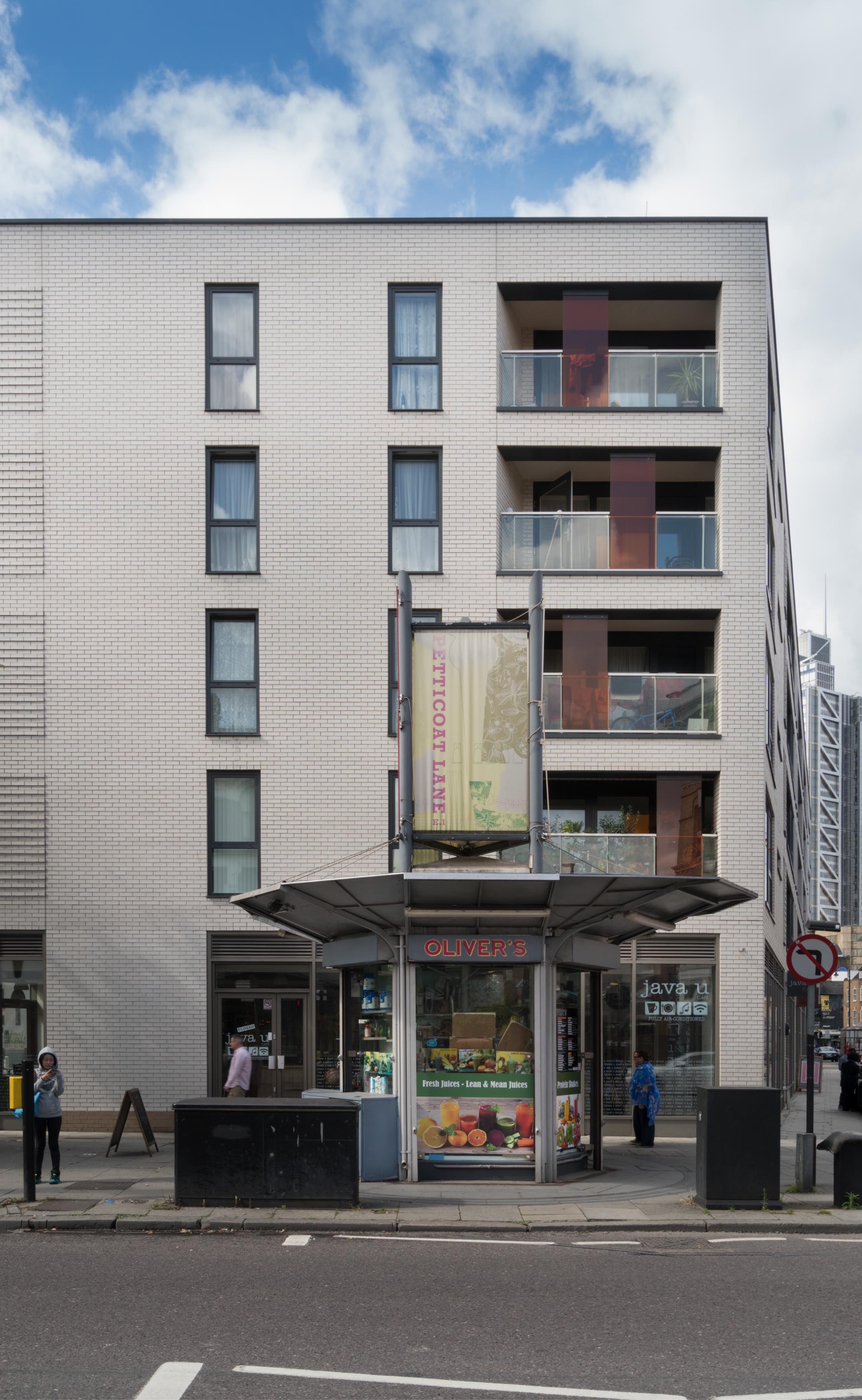
{
"id": 883,
"title": "Ladbroke Court and Petticoat Lane kiosk on Commercial Street",
"author": {
"id": 27,
"username": "DerekKendall"
},
"feature": {
"id": 421,
"type": "Feature",
"geometry": {
"type": "MultiPolygon",
"coordinates": [
[
[
[
-0.073270498508809,
51.51668484342829
],
[
-0.073691098508962,
51.516691743428304
],
[
-0.073783398508939,
51.51681264342838
],
[
-0.073403298508775,
51.51686164342839
],
[
-0.073270498508809,
51.51668484342829
]
]
]
]
},
"properties": {
"b_number": "4",
"b_name": "Ladbroke Court, 4 Resolution Plaza",
"street": "Commercial Street",
"address": "Ladbroke Court, 4 Resolution Plaza",
"feature_type": "WHITECHAPEL_BUILDING",
"count": 7,
"search_str": "Ladbroke Court, 4 Resolution Plaza"
},
"tags": []
},
"file": "https://surveyoflondon.org/media/uploads/features/421/SoL%20Whitechapel%20101305.jpg",
"description": "",
"copyright": true,
"created": "2017-09-26"
},
{
"id": 880,
"title": "Arcadia Court entrance in Old Castle Street, August 2017",
"author": {
"id": 27,
"username": "DerekKendall"
},
"feature": {
"id": 415,
"type": "Feature",
"geometry": {
"type": "MultiPolygon",
"coordinates": [
[
[
[
-0.074344918245398,
51.51668771806424
],
[
-0.074231753948737,
51.51655050176662
],
[
-0.074402628185746,
51.51650488175361
],
[
-0.074484845351035,
51.516618730970144
],
[
-0.074451564816013,
51.516627570285884
],
[
-0.074464842346093,
51.51664692918771
],
[
-0.074407427803073,
51.516657836736705
],
[
-0.07441539181586,
51.51667127366154
],
[
-0.074344918245398,
51.51668771806424
]
]
]
]
},
"properties": {
"b_number": "45",
"b_name": "Arcadia Court, 45 Old Castle Street, and 4 (formerly 1a) Old Castle Street",
"street": "Old Castle Street",
"address": "Arcadia Court, 45 Old Castle Street and 4 Old Castle Street",
"feature_type": "WHITECHAPEL_BUILDING",
"count": 6,
"search_str": "Arcadia Court, 45 Old Castle Street, and 4 (formerly 1a) Old Castle Street"
},
"tags": []
},
"file": "https://surveyoflondon.org/media/uploads/features/415/SoL%20Whitechapel%20101300.jpg",
"description": "",
"copyright": true,
"created": "2017-09-26"
},
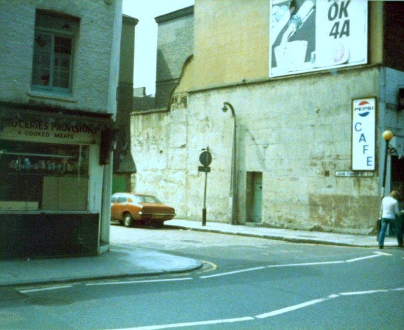
{
"id": 754,
"title": "Harts and the Model Inn, 1978",
"author": {
"id": 153,
"username": "danny"
},
"feature": {
"id": 1353,
"type": "Feature",
"geometry": {
"type": "MultiPolygon",
"coordinates": [
[
[
[
-0.06933779479114,
51.51062557173645
],
[
-0.069125899290664,
51.510656966033906
],
[
-0.069081875421886,
51.510576206860954
],
[
-0.069208826063677,
51.5105467054335
],
[
-0.069214093083725,
51.51055435016756
],
[
-0.069289339979864,
51.51053756613521
],
[
-0.06933779479114,
51.51062557173645
]
]
]
]
},
"properties": {
"b_number": "57-60",
"b_name": "",
"street": "Royal Mint Street",
"address": "57-60 Royal Mint Street",
"feature_type": "WHITECHAPEL_BUILDING",
"count": 3,
"search_str": "57-60 Royal Mint Street"
},
"tags": []
},
"file": "https://surveyoflondon.org/media/uploads/features/1353/JFS%20and%20RMS%201978.jpg",
"description": "This is a photograph taken in Royal Mint Street looking south-east towards the junction with John Fisher Street. On the left can be seen Hart's grocery shop. A small one-man business run by a man called Johnny and his assistant Dolly - famous for a statuesque blond beehive hairstyle throughout the 1960s.\n\nThe cafe opposite was know as the Model Inn according to a non-working neon sign that hung outside for many years. In the background can be seen two of the blocks on the Peabody Trust Whitechapel Estate.",
"copyright": false,
"created": "2017-09-08"
},
{
"id": 903,
"title": "5 and 7 Osborn Street, August 2017",
"author": {
"id": 27,
"username": "DerekKendall"
},
"feature": {
"id": 390,
"type": "Feature",
"geometry": {
"type": "MultiPolygon",
"coordinates": [
[
[
[
-0.069973623824868,
51.51622082697441
],
[
-0.069994442067134,
51.51624482492744
],
[
-0.069925649819964,
51.5162680556319
],
[
-0.069901490866583,
51.5162402067735
],
[
-0.069973623824868,
51.51622082697441
]
]
]
]
},
"properties": {
"b_number": "5",
"b_name": "5 Osborn Street",
"street": "Osborn Street",
"address": "5 Osborn Street",
"feature_type": "WHITECHAPEL_BUILDING",
"count": 2,
"search_str": "5 Osborn Street"
},
"tags": []
},
"file": "https://surveyoflondon.org/media/uploads/features/390/SoL%20Whitechapel%20101437.jpg",
"description": "",
"copyright": true,
"created": "2017-09-26"
},
{
"id": 897,
"title": "74 (right), 75 and 76 Whitechapel High Street",
"author": {
"id": 27,
"username": "DerekKendall"
},
"feature": {
"id": 314,
"type": "Feature",
"geometry": {
"type": "MultiPolygon",
"coordinates": [
[
[
[
-0.069841751221445,
51.51606452132173
],
[
-0.069925695023196,
51.516033041999854
],
[
-0.070001273739797,
51.516114205061
],
[
-0.069916647924465,
51.51614626138045
],
[
-0.069899913067933,
51.51612790461924
],
[
-0.069841751221445,
51.51606452132173
]
]
]
]
},
"properties": {
"b_number": "75",
"b_name": "75 Whitechapel High Street",
"street": "Whitechapel High Street",
"address": "75 Whitechapel High Street",
"feature_type": "WHITECHAPEL_BUILDING",
"count": 6,
"search_str": "75 Whitechapel High Street"
},
"tags": []
},
"file": "https://surveyoflondon.org/media/uploads/features/314/SoL%20Whitechapel%20101356.jpg",
"description": "The yellow door of No 75 marks the former access to Bull Court, in existence by the 17th century, and which survived vestigially until c. 1900. ",
"copyright": true,
"created": "2017-09-26"
},
{
"id": 891,
"title": "Mosaic on Commercial Street boundary wall of Canon Barnett Primary School",
"author": {
"id": 27,
"username": "DerekKendall"
},
"feature": {
"id": 399,
"type": "Feature",
"geometry": {
"type": "MultiPolygon",
"coordinates": [
[
[
[
-0.0718106394676,
51.51610397748269
],
[
-0.071910650694868,
51.51607255627536
],
[
-0.072009433966083,
51.51618984809891
],
[
-0.071907256843951,
51.51622171585677
],
[
-0.071907271171249,
51.51622171812537
],
[
-0.071907268076959,
51.51622171909061
],
[
-0.071931795963511,
51.5162521618839
],
[
-0.071610195810633,
51.516352649906445
],
[
-0.071600272401668,
51.516341236744296
],
[
-0.071463340884386,
51.51638740891522
],
[
-0.071422376478407,
51.516309559498886
],
[
-0.07144244173494,
51.51630248744659
],
[
-0.071392341446793,
51.516238646773026
],
[
-0.071558823959752,
51.51618439684411
],
[
-0.071567446232768,
51.516194850907375
],
[
-0.071743764744855,
51.516135543880424
],
[
-0.071736254917458,
51.516127340619526
],
[
-0.0718106394676,
51.51610397748269
]
]
]
]
},
"properties": {
"b_number": "",
"b_name": "Canon Barnett Primary School",
"street": "Gunthorpe Street",
"address": "Canon Barnett School",
"feature_type": "WHITECHAPEL_BUILDING",
"count": 6,
"search_str": "Canon Barnett Primary School"
},
"tags": []
},
"file": "https://surveyoflondon.org/media/uploads/features/399/SoL%20Whitechapel%20101317.jpg",
"description": "",
"copyright": true,
"created": "2017-09-26"
},
{
"id": 1117,
"title": "The Blind Beggar, interior looking east in 2018",
"author": {
"id": 27,
"username": "DerekKendall"
},
"feature": {
"id": 521,
"type": "Feature",
"geometry": {
"type": "MultiPolygon",
"coordinates": [
[
[
[
-0.057044351749301,
51.52005556326038
],
[
-0.057062845054071,
51.52008733971823
],
[
-0.057006580922032,
51.52009916710701
],
[
-0.056992538373997,
51.520075225540054
],
[
-0.056933469956532,
51.520088559604176
],
[
-0.05684130439071,
51.51992730823853
],
[
-0.056960904550882,
51.519899865751334
],
[
-0.057044351749301,
51.52005556326038
]
]
]
]
},
"properties": {
"b_number": "337",
"b_name": "The Blind Beggar public house",
"street": "Whitechapel Road",
"address": "The Blind Beggar, 337 Whitechapel Road",
"feature_type": "WHITECHAPEL_BUILDING",
"count": 9,
"search_str": "The Blind Beggar public house"
},
"tags": []
},
"file": "https://surveyoflondon.org/media/uploads/features/521/SoL%20Whitechapel%20101741.jpg",
"description": "",
"copyright": true,
"created": "2018-01-29"
},
{
"id": 889,
"title": "Entrance to Kensington Apartments, August 2017",
"author": {
"id": 27,
"username": "DerekKendall"
},
"feature": {
"id": 417,
"type": "Feature",
"geometry": {
"type": "MultiPolygon",
"coordinates": [
[
[
[
-0.072579098508925,
51.51588574342777
],
[
-0.072804098509042,
51.515812043427744
],
[
-0.07310819850918,
51.5157573434277
],
[
-0.073255698509161,
51.51591574342781
],
[
-0.072960598509013,
51.51600294342786
],
[
-0.072746598508902,
51.51606954342789
],
[
-0.072579098508925,
51.51588574342777
]
]
]
]
},
"properties": {
"b_number": "",
"b_name": "Kensington Apartments, 11 Commercial Street",
"street": "11 Commercial Street",
"address": "Kensington Apartments, 11 Commercial Street, London 6LW and 6NE",
"feature_type": "WHITECHAPEL_BUILDING",
"count": 9,
"search_str": "Kensington Apartments, 11 Commercial Street"
},
"tags": []
},
"file": "https://surveyoflondon.org/media/uploads/features/417/SoL%20Whitechapel%20101314.jpg",
"description": "",
"copyright": true,
"created": "2017-09-26"
},
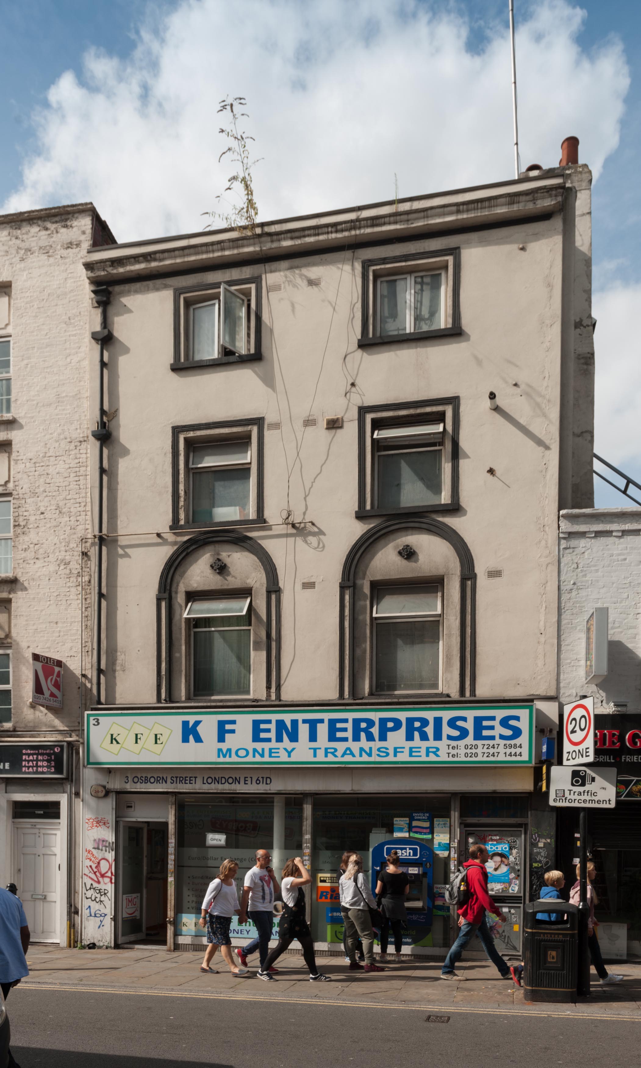
{
"id": 902,
"title": "3 Osborn Street, August 2017",
"author": {
"id": 27,
"username": "DerekKendall"
},
"feature": {
"id": 389,
"type": "Feature",
"geometry": {
"type": "MultiPolygon",
"coordinates": [
[
[
[
-0.069863083495921,
51.51618288394659
],
[
-0.069930691991153,
51.51615861001944
],
[
-0.069973635058592,
51.5162208302083
],
[
-0.069902469309888,
51.51623995015087
],
[
-0.069863083495921,
51.51618288394659
]
]
]
]
},
"properties": {
"b_number": "3",
"b_name": "3 Osborn Street",
"street": "Osborn Street",
"address": "3 Osborn Street",
"feature_type": "WHITECHAPEL_BUILDING",
"count": 2,
"search_str": "3 Osborn Street"
},
"tags": []
},
"file": "https://surveyoflondon.org/media/uploads/features/389/SoL%20Whitechapel%20101435.jpg",
"description": "",
"copyright": true,
"created": "2017-09-26"
},
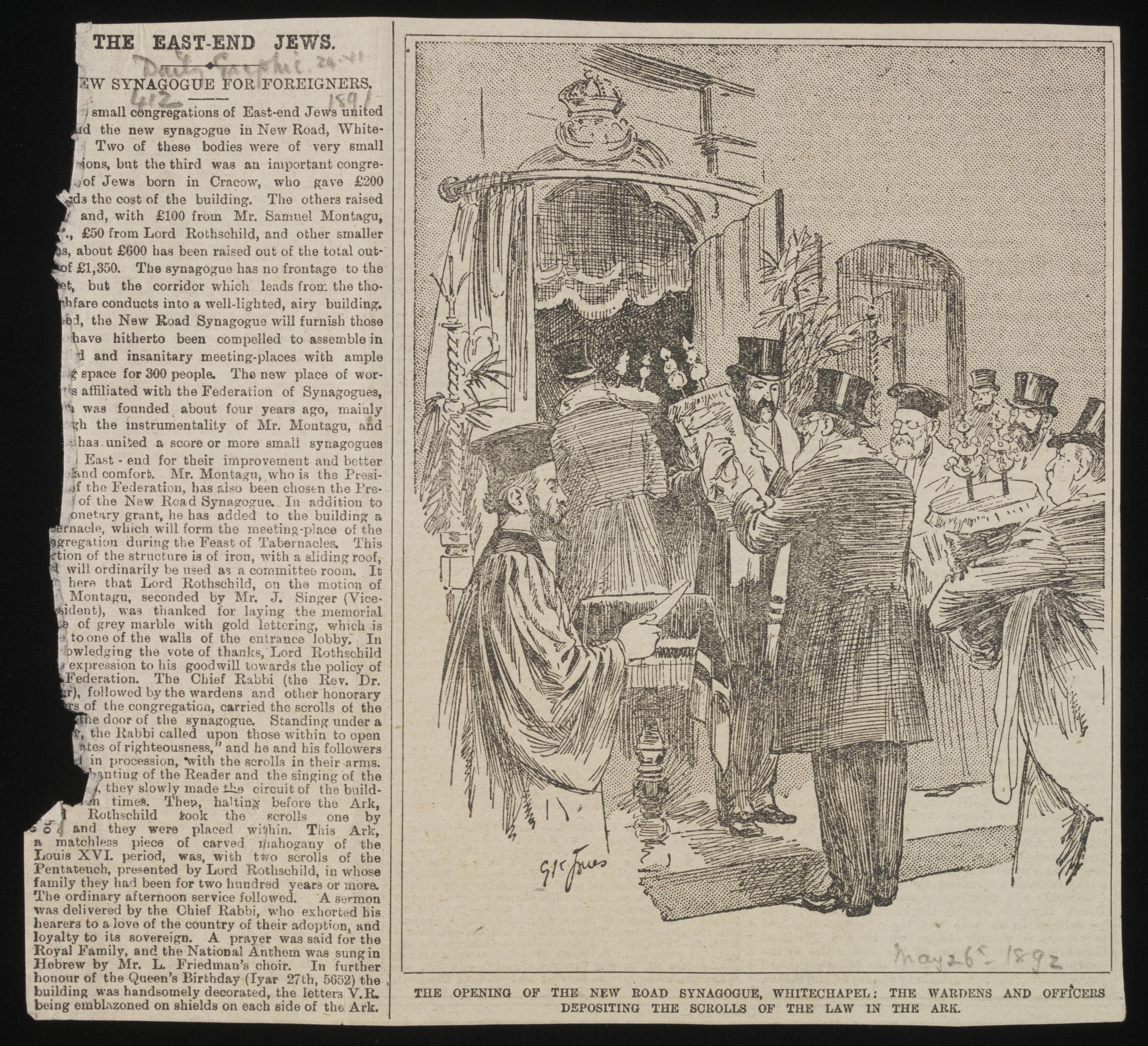
{
"id": 558,
"title": "Report of opening of New Road Synagogue, 26 May 1892 © Victoria and Albert Museum, London",
"author": {
"id": 22,
"username": "sarahannmilne"
},
"feature": {
"id": 1463,
"type": "Feature",
"geometry": {
"type": "MultiPolygon",
"coordinates": [
[
[
[
-0.063134492360364,
51.51782738505861
],
[
-0.063025709537606,
51.51764418006528
],
[
-0.062931156135412,
51.51766686232899
],
[
-0.062954889604093,
51.51770900962472
],
[
-0.062726482458675,
51.517765079903484
],
[
-0.062748999276863,
51.51780173726752
],
[
-0.062973174374441,
51.51774578529897
],
[
-0.063032903202825,
51.51784972503275
],
[
-0.063134492360364,
51.51782738505861
]
]
]
]
},
"properties": {
"b_number": "115",
"b_name": "",
"street": "New Road",
"address": "115 New Road and the former New Road Synagogue",
"feature_type": "WHITECHAPEL_BUILDING",
"count": 9,
"search_str": "115 New Road and the former New Road Synagogue"
},
"tags": [
"Lewis Solomon",
"Samuel Montagu"
]
},
"file": "https://surveyoflondon.org/media/uploads/features/1463/New%20Road%20Synagogue.jpg",
"description": "Cutting from The Daily Graphic, with an article titled 'The East-End Jews' and accompanying illustration of the Torah scrolls being deposited into the ark in the New Road Synagogue, Whitechapel. © Victoria and Albert Museum, London",
"copyright": true,
"created": "2017-05-02"
},
{
"id": 348,
"title": "Tower House in 2016, porch detail",
"author": {
"id": 27,
"username": "DerekKendall"
},
"feature": {
"id": 839,
"type": "Feature",
"geometry": {
"type": "MultiPolygon",
"coordinates": [
[
[
[
-0.064497563558549,
51.517361628803805
],
[
-0.064496408109862,
51.51736309395909
],
[
-0.064348901589247,
51.517381493231476
],
[
-0.064343975983599,
51.51736612215419
],
[
-0.064054660314112,
51.517402209452214
],
[
-0.064059058880887,
51.517415936099994
],
[
-0.063880964779871,
51.51743814997979
],
[
-0.063877096358366,
51.517426077614196
],
[
-0.063528073193922,
51.517469610821024
],
[
-0.063478650874795,
51.517449375087956
],
[
-0.063465163734058,
51.51737222076246
],
[
-0.063672133997618,
51.51734725578329
],
[
-0.063667407479579,
51.51723290068993
],
[
-0.063724830703042,
51.51723384881843
],
[
-0.063725147296712,
51.517226384957326
],
[
-0.063667724082622,
51.517225436829115
],
[
-0.063646330595039,
51.51716533088115
],
[
-0.06369299365168,
51.51713771882066
],
[
-0.063728249907456,
51.517153239118066
],
[
-0.063773509194633,
51.517148149709364
],
[
-0.063793395289669,
51.517131845319966
],
[
-0.063867317624302,
51.51712375146289
],
[
-0.063900994386595,
51.517134287085675
],
[
-0.064225680705438,
51.51709706728731
],
[
-0.064219264541115,
51.517072344955054
],
[
-0.064310349325468,
51.51706187287984
],
[
-0.064316793729717,
51.51708593036503
],
[
-0.064372224762903,
51.517078933034306
],
[
-0.064422011504583,
51.51705414924394
],
[
-0.064459090927727,
51.517083143770165
],
[
-0.064448950765029,
51.51709642076694
],
[
-0.064497563558549,
51.517361628803805
]
]
]
]
},
"properties": {
"b_number": "81",
"b_name": "",
"street": "Fieldgate Street",
"address": "Tower House, 81 Fieldgate Street",
"feature_type": "WHITECHAPEL_BUILDING",
"count": 8,
"search_str": "Tower House, 81 Fieldgate Street"
},
"tags": []
},
"file": "https://surveyoflondon.org/media/uploads/features/839/SoL%20Whitechapel100178.jpg",
"description": "",
"copyright": true,
"created": "2016-09-02"
},
{
"id": 929,
"title": "Site of former Rio Cafe, October 2017",
"author": {
"id": 18,
"username": "shahedsaleem"
},
"feature": {
"id": 1395,
"type": "Feature",
"geometry": {
"type": "MultiPolygon",
"coordinates": [
[
[
[
-0.06734277723579,
51.5101408267643
],
[
-0.066910949136799,
51.510217428527255
],
[
-0.066795977317392,
51.50998414164829
],
[
-0.066852430868868,
51.50997111905564
],
[
-0.066833669508271,
51.50993011276243
],
[
-0.066709688224837,
51.50995364978504
],
[
-0.066597753455944,
51.50973669156566
],
[
-0.067039183086463,
51.50965327261519
],
[
-0.067087140764219,
51.50975289871178
],
[
-0.067115318173266,
51.50974754930748
],
[
-0.067147894414189,
51.50981436423853
],
[
-0.067117953240777,
51.50981735903555
],
[
-0.067140193085813,
51.50986423647582
],
[
-0.067209730295633,
51.509850266595954
],
[
-0.06734277723579,
51.5101408267643
]
]
]
]
},
"properties": {
"b_number": "",
"b_name": "Shapla Primary School",
"street": "Wellclose Square",
"address": "Shapla Primary School",
"feature_type": "WHITECHAPEL_BUILDING",
"count": 11,
"search_str": "Shapla Primary School"
},
"tags": []
},
"file": "https://surveyoflondon.org/media/uploads/features/1395/RIO_2.JPG",
"description": "",
"copyright": false,
"created": "2017-10-06"
}
]
}