HTTP 200 OK
Allow: GET, HEAD, OPTIONS
Content-Type: application/json
Vary: Accept
{
"count": 1747,
"next": "https://surveyoflondon.org/api/v1/images/?format=api&page=35",
"previous": "https://surveyoflondon.org/api/v1/images/?format=api&page=33",
"results": [
{
"id": 533,
"title": "Tuning the bells",
"author": {
"id": 118,
"username": "david2"
},
"feature": {
"id": 155,
"type": "Feature",
"geometry": {
"type": "MultiPolygon",
"coordinates": [
[
[
[
-0.067279828395434,
51.51695705948158
],
[
-0.067093469618443,
51.517032789909806
],
[
-0.067051200483431,
51.516996757810816
],
[
-0.067090391118988,
51.51698039038376
],
[
-0.06706090910812,
51.51695688633854
],
[
-0.067015052606677,
51.51697914860705
],
[
-0.067015052606682,
51.516979148607064
],
[
-0.067015052606675,
51.51697914860705
],
[
-0.066983358160437,
51.516951324364136
],
[
-0.066904378563551,
51.516904192470385
],
[
-0.066814855785544,
51.516858952938556
],
[
-0.066749004017844,
51.51678511344983
],
[
-0.066726651062502,
51.51660623379854
],
[
-0.066916087304028,
51.516542881724156
],
[
-0.067063145906456,
51.51668871217051
],
[
-0.067018758534236,
51.51670613616749
],
[
-0.067108196018859,
51.516794826264736
],
[
-0.067132918133769,
51.516785121743794
],
[
-0.067195489248199,
51.51684716970448
],
[
-0.06716822056742,
51.5168577515391
],
[
-0.067184699138495,
51.51687146748573
],
[
-0.067279828395434,
51.51695705948158
]
],
[
[
-0.067093263845335,
51.516893872671716
],
[
-0.067031009970172,
51.516845232635745
],
[
-0.066988676105,
51.51686586339187
],
[
-0.067034303634964,
51.51688439111608
],
[
-0.067057406216514,
51.51690729267392
],
[
-0.067093263845335,
51.516893872671716
]
]
]
]
},
"properties": {
"b_number": "32-34",
"b_name": "Whitechapel Bell Foundry, 32–34 Whitechapel Road",
"street": "Whitechapel Road",
"address": "32-34 Whitechapel Road",
"feature_type": "WHITECHAPEL_BUILDING",
"count": 26,
"search_str": "Whitechapel Bell Foundry, 32–34 Whitechapel Road"
},
"tags": [
"bells",
"foundry"
]
},
"file": "https://surveyoflondon.org/media/uploads/features/155/AAAAA.JPG",
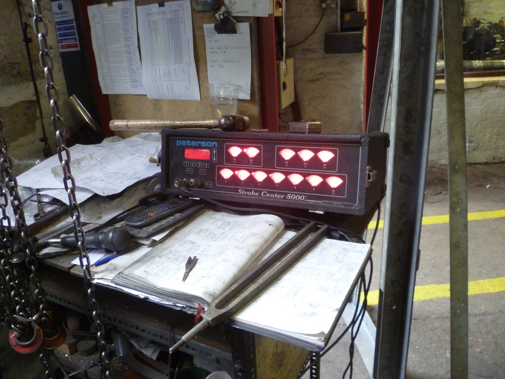
"description": "Tools for tuning bells - the old way, a tuning fork and ears; the new way, electronics.\n\nIt's the skills that are lost when industry closes, an irreplaceable tradition that goes back into the Middle Ages. For a few flats...",
"copyright": false,
"created": "2017-04-01"
},
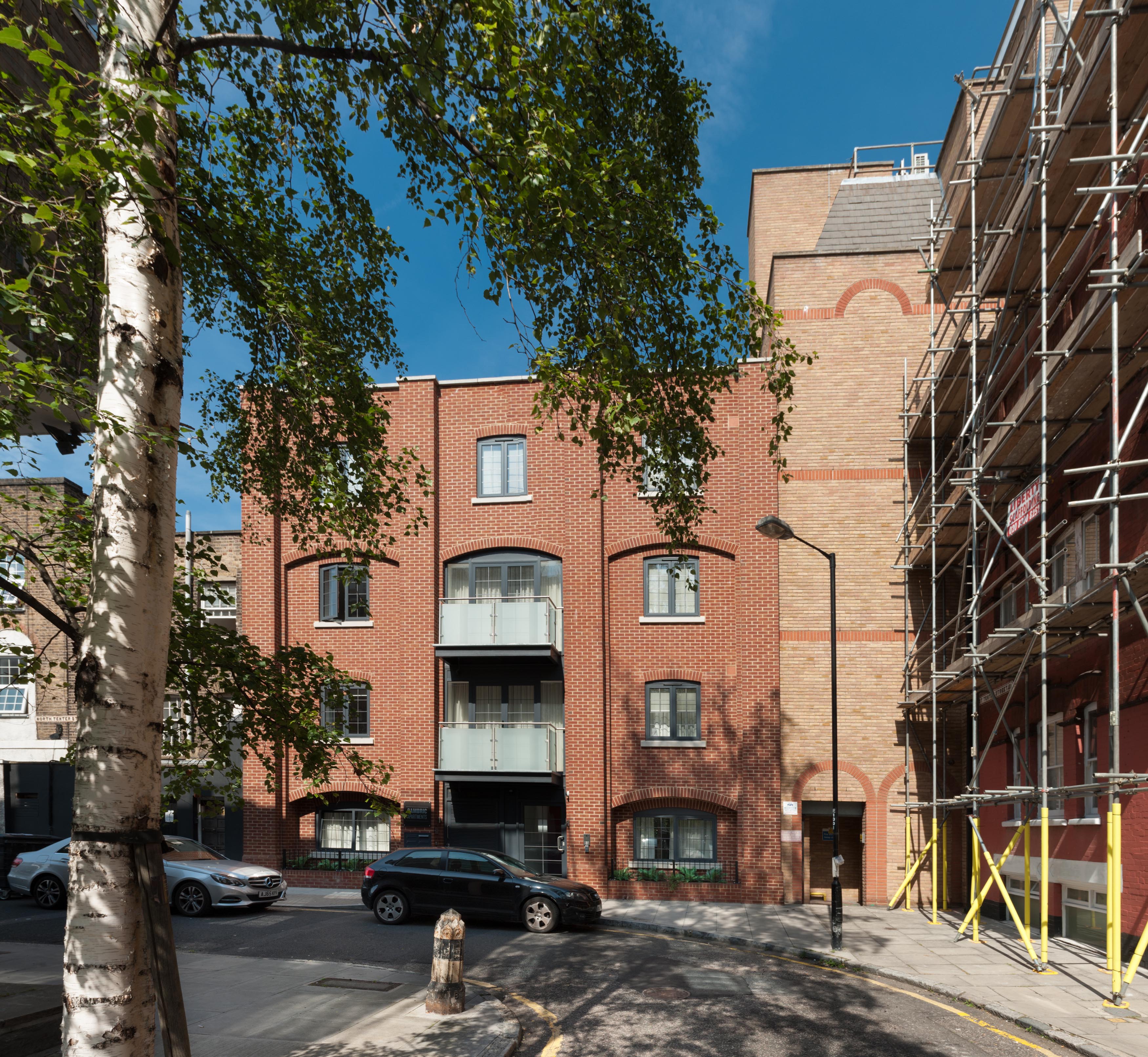
{
"id": 855,
"title": "Facade from West Tenter Street, August 2017",
"author": {
"id": 27,
"username": "DerekKendall"
},
"feature": {
"id": 75,
"type": "Feature",
"geometry": {
"type": "MultiPolygon",
"coordinates": [
[
[
[
-0.071139857936981,
51.51350808858458
],
[
-0.070996386486313,
51.51333179876335
],
[
-0.071151831464676,
51.51328688620648
],
[
-0.071290173208852,
51.51345812213034
],
[
-0.071139857936981,
51.51350808858458
]
]
]
]
},
"properties": {
"b_number": "2",
"b_name": "Cambric Apartments, 2 North Tenter Street",
"street": "North Tenter Street",
"address": "Cambric Apartments, 2 North Tenter Street",
"feature_type": "WHITECHAPEL_BUILDING",
"count": 2,
"search_str": "Cambric Apartments, 2 North Tenter Street"
},
"tags": []
},
"file": "https://surveyoflondon.org/media/uploads/features/75/SoL%20Whitechapel%20101598.jpg",
"description": "",
"copyright": true,
"created": "2017-09-12"
},
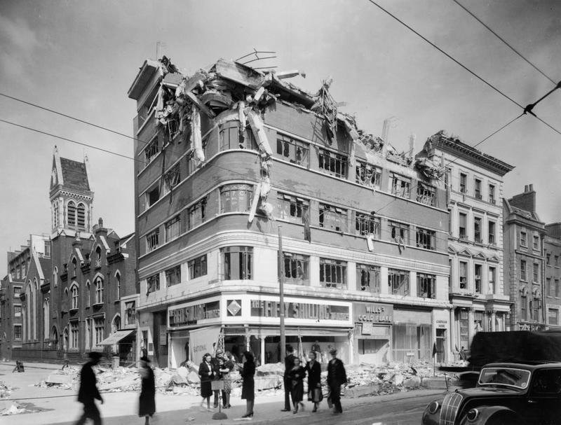
{
"id": 685,
"title": "Bomb damage in the High Street, 1945",
"author": {
"id": 128,
"username": "dominic2"
},
"feature": {
"id": 409,
"type": "Feature",
"geometry": {
"type": "MultiPolygon",
"coordinates": [
[
[
[
-0.073096594828976,
51.5148823430546
],
[
-0.073219833056639,
51.51484164572821
],
[
-0.073279281585646,
51.5149363594433
],
[
-0.073403460495228,
51.515064928338404
],
[
-0.073336320356684,
51.51508947306282
],
[
-0.073388741994547,
51.515145139987375
],
[
-0.073324615495707,
51.51516864852203
],
[
-0.073096594828976,
51.5148823430546
]
]
]
]
},
"properties": {
"b_number": "130",
"b_name": "",
"street": "Whitechapel High Street",
"address": "130 Whitechapel High Street, London E1 7PS",
"feature_type": "WHITECHAPEL_BUILDING",
"count": 5,
"search_str": "130 Whitechapel High Street, London E1 7PS"
},
"tags": []
},
"file": "https://surveyoflondon.org/media/uploads/features/409/1945%20corner%20Goulston%20and%20High%20Street.JPG",
"description": "",
"copyright": false,
"created": "2017-06-21"
},
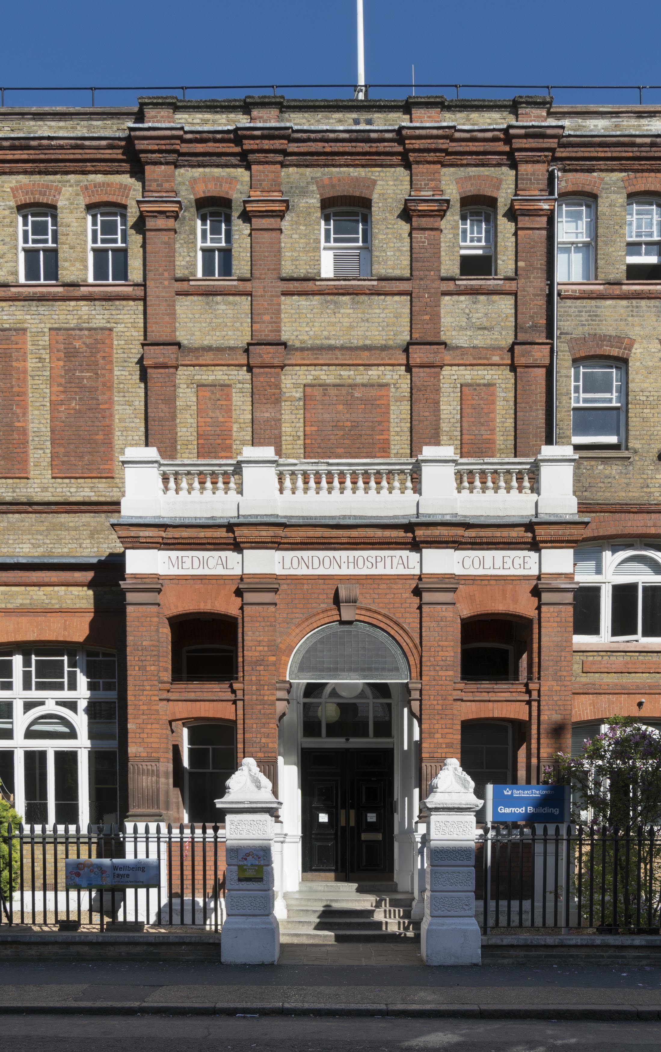
{
"id": 657,
"title": "The south elevation of the Garrod Building in 2017",
"author": {
"id": 27,
"username": "DerekKendall"
},
"feature": {
"id": 1189,
"type": "Feature",
"geometry": {
"type": "MultiPolygon",
"coordinates": [
[
[
[
-0.060957318414032,
51.51782190843071
],
[
-0.060536358742238,
51.517916494366496
],
[
-0.06042382559955,
51.5177169757099
],
[
-0.060423392052643,
51.517716267459285
],
[
-0.06037583590265,
51.51772558880798
],
[
-0.060352091559155,
51.517682266082666
],
[
-0.060399184829325,
51.5176714337657
],
[
-0.060382136461735,
51.517636775872596
],
[
-0.060366794729858,
51.51763667842599
],
[
-0.060353568375337,
51.517633521256826
],
[
-0.060340249107007,
51.51762886391949
],
[
-0.060331431296148,
51.51762072004323
],
[
-0.060328691457909,
51.51761554771857
],
[
-0.060326999079391,
51.517611443342886
],
[
-0.060327382221525,
51.517606284181284
],
[
-0.060329047985828,
51.51760203725169
],
[
-0.060331232366157,
51.517597910289986
],
[
-0.060333234968373,
51.517593887621835
],
[
-0.0603394749266,
51.51758477508556
],
[
-0.060343650894546,
51.51757832358151
],
[
-0.060315667444656,
51.51752195768432
],
[
-0.060339055445574,
51.51749626222509
],
[
-0.06039972958586,
51.51748509401273
],
[
-0.060844270778094,
51.51743888994093
],
[
-0.060875340433462,
51.517555246058656
],
[
-0.060894657489377,
51.517564918111205
],
[
-0.060905236784801,
51.51757830806902
],
[
-0.060907454524091,
51.51759005281749
],
[
-0.060906490522428,
51.51760128121761
],
[
-0.060896928755295,
51.51761642472545
],
[
-0.060890333226028,
51.51762687042926
],
[
-0.060957318414032,
51.51782190843071
]
]
]
]
},
"properties": {
"b_number": "",
"b_name": "Garrod Building",
"street": "Stepney Way",
"address": "Garrod Building",
"feature_type": "WHITECHAPEL_BUILDING",
"count": 31,
"search_str": "Garrod Building"
},
"tags": []
},
"file": "https://surveyoflondon.org/media/uploads/features/1189/SoL%20Whitechapel%20100544.jpg",
"description": "",
"copyright": true,
"created": "2017-05-09"
},
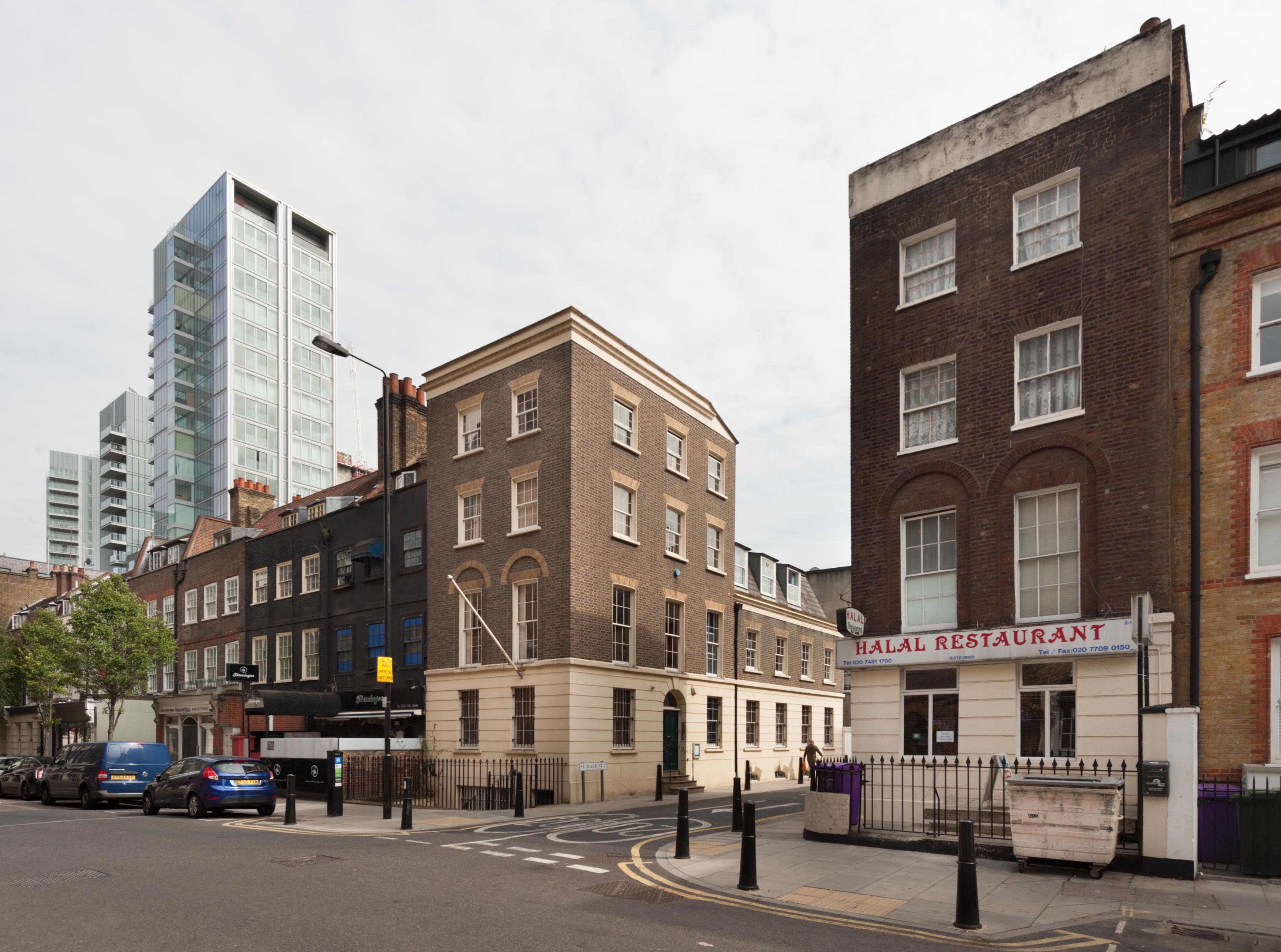
{
"id": 825,
"title": "Entrance to St Mark Street from Alie Street, August 2017",
"author": {
"id": 27,
"username": "DerekKendall"
},
"feature": {
"id": 39,
"type": "Feature",
"geometry": {
"type": "MultiPolygon",
"coordinates": [
[
[
[
-0.071664079468146,
51.51343051902844
],
[
-0.071600413466814,
51.513454875943125
],
[
-0.071534942236408,
51.51337367949251
],
[
-0.071598443192382,
51.51335322818265
],
[
-0.071664079468146,
51.51343051902844
]
]
]
]
},
"properties": {
"b_number": "2–6",
"b_name": "",
"street": "St Mark Street",
"address": "2–6 St Mark Street",
"feature_type": "WHITECHAPEL_BUILDING",
"count": 6,
"search_str": "2–6 St Mark Street"
},
"tags": []
},
"file": "https://surveyoflondon.org/media/uploads/features/39/SoL%20Whitechapel%20101561.jpg",
"description": "",
"copyright": true,
"created": "2017-09-12"
},
{
"id": 659,
"title": "The Doric entrance porch on the west elevation of the Garrod Building in 2017",
"author": {
"id": 27,
"username": "DerekKendall"
},
"feature": {
"id": 1189,
"type": "Feature",
"geometry": {
"type": "MultiPolygon",
"coordinates": [
[
[
[
-0.060957318414032,
51.51782190843071
],
[
-0.060536358742238,
51.517916494366496
],
[
-0.06042382559955,
51.5177169757099
],
[
-0.060423392052643,
51.517716267459285
],
[
-0.06037583590265,
51.51772558880798
],
[
-0.060352091559155,
51.517682266082666
],
[
-0.060399184829325,
51.5176714337657
],
[
-0.060382136461735,
51.517636775872596
],
[
-0.060366794729858,
51.51763667842599
],
[
-0.060353568375337,
51.517633521256826
],
[
-0.060340249107007,
51.51762886391949
],
[
-0.060331431296148,
51.51762072004323
],
[
-0.060328691457909,
51.51761554771857
],
[
-0.060326999079391,
51.517611443342886
],
[
-0.060327382221525,
51.517606284181284
],
[
-0.060329047985828,
51.51760203725169
],
[
-0.060331232366157,
51.517597910289986
],
[
-0.060333234968373,
51.517593887621835
],
[
-0.0603394749266,
51.51758477508556
],
[
-0.060343650894546,
51.51757832358151
],
[
-0.060315667444656,
51.51752195768432
],
[
-0.060339055445574,
51.51749626222509
],
[
-0.06039972958586,
51.51748509401273
],
[
-0.060844270778094,
51.51743888994093
],
[
-0.060875340433462,
51.517555246058656
],
[
-0.060894657489377,
51.517564918111205
],
[
-0.060905236784801,
51.51757830806902
],
[
-0.060907454524091,
51.51759005281749
],
[
-0.060906490522428,
51.51760128121761
],
[
-0.060896928755295,
51.51761642472545
],
[
-0.060890333226028,
51.51762687042926
],
[
-0.060957318414032,
51.51782190843071
]
]
]
]
},
"properties": {
"b_number": "",
"b_name": "Garrod Building",
"street": "Stepney Way",
"address": "Garrod Building",
"feature_type": "WHITECHAPEL_BUILDING",
"count": 31,
"search_str": "Garrod Building"
},
"tags": []
},
"file": "https://surveyoflondon.org/media/uploads/features/1189/SoL%20Whitechapel%20100546.jpg",
"description": "",
"copyright": true,
"created": "2017-05-09"
},
{
"id": 660,
"title": "The west elevation of the Garrod Building in 2017",
"author": {
"id": 27,
"username": "DerekKendall"
},
"feature": {
"id": 1189,
"type": "Feature",
"geometry": {
"type": "MultiPolygon",
"coordinates": [
[
[
[
-0.060957318414032,
51.51782190843071
],
[
-0.060536358742238,
51.517916494366496
],
[
-0.06042382559955,
51.5177169757099
],
[
-0.060423392052643,
51.517716267459285
],
[
-0.06037583590265,
51.51772558880798
],
[
-0.060352091559155,
51.517682266082666
],
[
-0.060399184829325,
51.5176714337657
],
[
-0.060382136461735,
51.517636775872596
],
[
-0.060366794729858,
51.51763667842599
],
[
-0.060353568375337,
51.517633521256826
],
[
-0.060340249107007,
51.51762886391949
],
[
-0.060331431296148,
51.51762072004323
],
[
-0.060328691457909,
51.51761554771857
],
[
-0.060326999079391,
51.517611443342886
],
[
-0.060327382221525,
51.517606284181284
],
[
-0.060329047985828,
51.51760203725169
],
[
-0.060331232366157,
51.517597910289986
],
[
-0.060333234968373,
51.517593887621835
],
[
-0.0603394749266,
51.51758477508556
],
[
-0.060343650894546,
51.51757832358151
],
[
-0.060315667444656,
51.51752195768432
],
[
-0.060339055445574,
51.51749626222509
],
[
-0.06039972958586,
51.51748509401273
],
[
-0.060844270778094,
51.51743888994093
],
[
-0.060875340433462,
51.517555246058656
],
[
-0.060894657489377,
51.517564918111205
],
[
-0.060905236784801,
51.51757830806902
],
[
-0.060907454524091,
51.51759005281749
],
[
-0.060906490522428,
51.51760128121761
],
[
-0.060896928755295,
51.51761642472545
],
[
-0.060890333226028,
51.51762687042926
],
[
-0.060957318414032,
51.51782190843071
]
]
]
]
},
"properties": {
"b_number": "",
"b_name": "Garrod Building",
"street": "Stepney Way",
"address": "Garrod Building",
"feature_type": "WHITECHAPEL_BUILDING",
"count": 31,
"search_str": "Garrod Building"
},
"tags": []
},
"file": "https://surveyoflondon.org/media/uploads/features/1189/SoL%20Whitechapel%20100547.jpg",
"description": "",
"copyright": true,
"created": "2017-05-09"
},
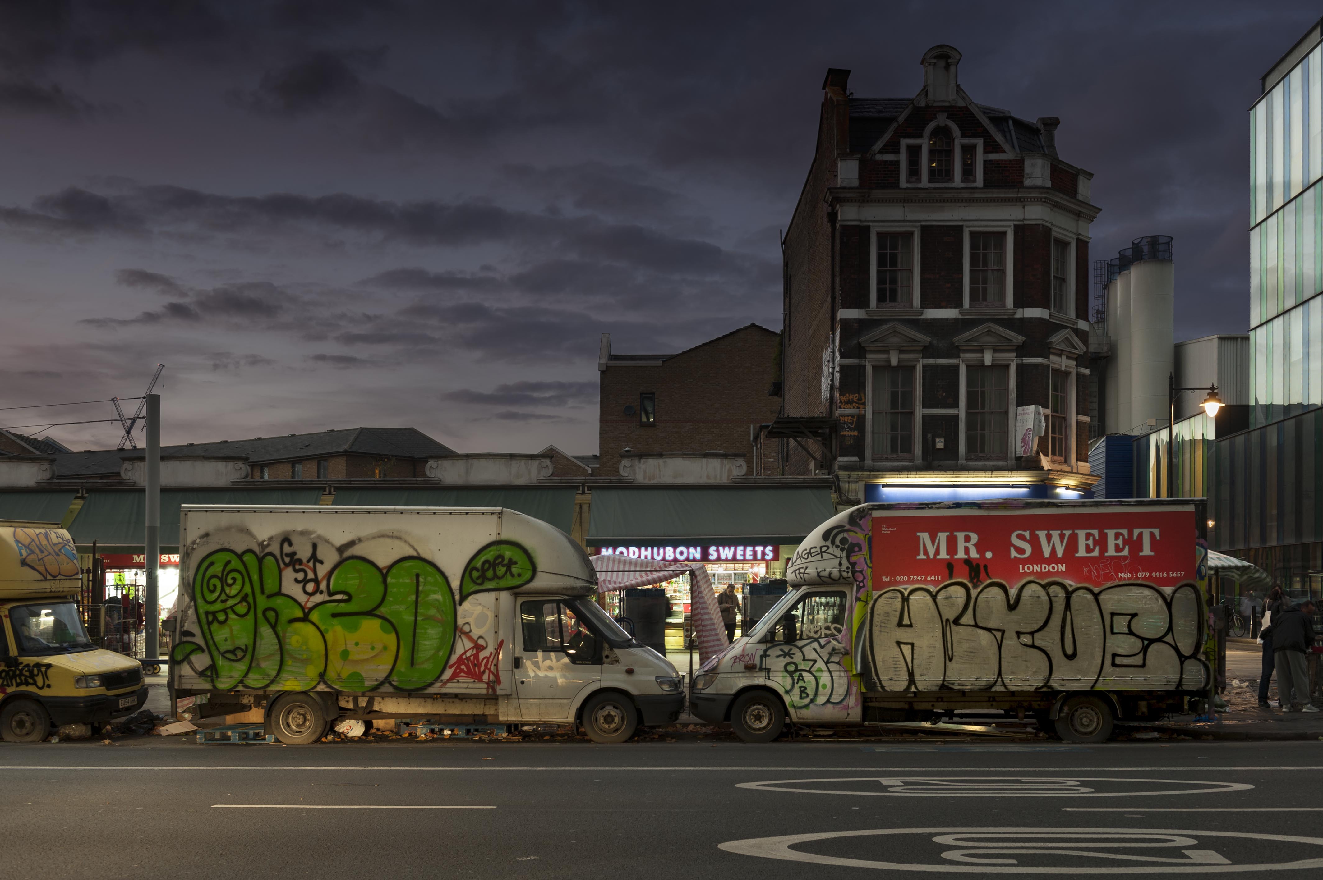
{
"id": 1413,
"title": "Market vans in late 2018",
"author": {
"id": 27,
"username": "DerekKendall"
},
"feature": {
"id": 1698,
"type": "Feature",
"geometry": {
"type": "MultiPolygon",
"coordinates": [
[
[
[
-0.062755898137067,
51.51857235799611
],
[
-0.058216859270041,
51.51960039921044
],
[
-0.058148482851386,
51.51948612756745
],
[
-0.061091729886378,
51.51883423152082
],
[
-0.061616259170046,
51.51871888429734
],
[
-0.06270768344222,
51.51847582817058
],
[
-0.062755898137067,
51.51857235799611
]
]
]
]
},
"properties": {
"b_number": "",
"b_name": "",
"street": "Whitechapel Road",
"address": "Whitechapel Market, Whitechapel Road",
"feature_type": "PLACE",
"count": 48,
"search_str": "Whitechapel Market, Whitechapel Road"
},
"tags": []
},
"file": "https://surveyoflondon.org/media/uploads/features/1698/SoL%20Whitechapel%20102267.jpg",
"description": "",
"copyright": true,
"created": "2018-11-13"
},
{
"id": 661,
"title": "The west elevation of the Garrod Building in 2017",
"author": {
"id": 27,
"username": "DerekKendall"
},
"feature": {
"id": 1189,
"type": "Feature",
"geometry": {
"type": "MultiPolygon",
"coordinates": [
[
[
[
-0.060957318414032,
51.51782190843071
],
[
-0.060536358742238,
51.517916494366496
],
[
-0.06042382559955,
51.5177169757099
],
[
-0.060423392052643,
51.517716267459285
],
[
-0.06037583590265,
51.51772558880798
],
[
-0.060352091559155,
51.517682266082666
],
[
-0.060399184829325,
51.5176714337657
],
[
-0.060382136461735,
51.517636775872596
],
[
-0.060366794729858,
51.51763667842599
],
[
-0.060353568375337,
51.517633521256826
],
[
-0.060340249107007,
51.51762886391949
],
[
-0.060331431296148,
51.51762072004323
],
[
-0.060328691457909,
51.51761554771857
],
[
-0.060326999079391,
51.517611443342886
],
[
-0.060327382221525,
51.517606284181284
],
[
-0.060329047985828,
51.51760203725169
],
[
-0.060331232366157,
51.517597910289986
],
[
-0.060333234968373,
51.517593887621835
],
[
-0.0603394749266,
51.51758477508556
],
[
-0.060343650894546,
51.51757832358151
],
[
-0.060315667444656,
51.51752195768432
],
[
-0.060339055445574,
51.51749626222509
],
[
-0.06039972958586,
51.51748509401273
],
[
-0.060844270778094,
51.51743888994093
],
[
-0.060875340433462,
51.517555246058656
],
[
-0.060894657489377,
51.517564918111205
],
[
-0.060905236784801,
51.51757830806902
],
[
-0.060907454524091,
51.51759005281749
],
[
-0.060906490522428,
51.51760128121761
],
[
-0.060896928755295,
51.51761642472545
],
[
-0.060890333226028,
51.51762687042926
],
[
-0.060957318414032,
51.51782190843071
]
]
]
]
},
"properties": {
"b_number": "",
"b_name": "Garrod Building",
"street": "Stepney Way",
"address": "Garrod Building",
"feature_type": "WHITECHAPEL_BUILDING",
"count": 31,
"search_str": "Garrod Building"
},
"tags": []
},
"file": "https://surveyoflondon.org/media/uploads/features/1189/SoL%20Whitechapel%20100549.jpg",
"description": "",
"copyright": true,
"created": "2017-05-09"
},
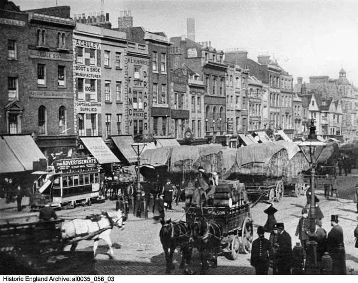
{
"id": 350,
"title": "Whitechapel High Street and the hay market, c. 1895",
"author": {
"id": 25,
"username": "Aileen"
},
"feature": {
"id": 1743,
"type": "Feature",
"geometry": {
"type": "MultiPolygon",
"coordinates": [
[
[
[
-0.073411821699579,
51.51467674446512
],
[
-0.072731355303774,
51.514916811528764
],
[
-0.07188498637862,
51.51521927010499
],
[
-0.071325614752325,
51.51544095498937
],
[
-0.070774639967226,
51.515605952693505
],
[
-0.069847461990603,
51.51600844129137
],
[
-0.069612775522787,
51.51611554197248
],
[
-0.069514933844418,
51.51603777987923
],
[
-0.07062003013613,
51.51555119093597
],
[
-0.071250881804969,
51.51535269561576
],
[
-0.071777920220375,
51.515135083966406
],
[
-0.073328190602561,
51.5145926917498
],
[
-0.073411821699579,
51.51467674446512
]
]
]
]
},
"properties": {
"b_number": "",
"b_name": "",
"street": "",
"address": "Whitechapel High Street",
"feature_type": "PLACE",
"count": 14,
"search_str": "Whitechapel High Street"
},
"tags": []
},
"file": "https://surveyoflondon.org/media/uploads/features/1743/al0035_056_03.jpg",
"description": "The Whitechapel hay market was a longstanding feature of the High Street, and a source of traffic congestion that exasperated the local authorities for many years. This photograph from the Historic England Archives shows the north side from No 77 on the extreme right, the then-newly built Free Library (later Passmore Edwards Library, now part of Whitechapel Gallery), to No 102 (part of T. Venables & Son, furnishers and drapers) on the left. Of the buildings seen, only the library and Nos 89 (the White Hart), 91, 92 and 93 survive in recognisable form (see archive.HistoricEngland.org.uk).",
"copyright": false,
"created": "2016-09-02"
},
{
"id": 770,
"title": "Interior looking south east, August 2017",
"author": {
"id": 27,
"username": "DerekKendall"
},
"feature": {
"id": 13,
"type": "Feature",
"geometry": {
"type": "MultiPolygon",
"coordinates": [
[
[
[
-0.070300598211778,
51.51553175369474
],
[
-0.069909685041584,
51.51566601870094
],
[
-0.069762598214758,
51.51551508304666
],
[
-0.06980073408505,
51.51550203175569
],
[
-0.069734850402611,
51.515430598241764
],
[
-0.0696935021834,
51.515445550776434
],
[
-0.069553336995274,
51.515279095645894
],
[
-0.069960309630875,
51.51513532543541
],
[
-0.070300598211778,
51.51553175369474
]
]
]
]
},
"properties": {
"b_number": "59-63",
"b_name": "Central House, London Metropolitan University",
"street": "Whitechapel High Street",
"address": "Central House, 59-63 Whitechapel High Street",
"feature_type": "WHITECHAPEL_BUILDING",
"count": 18,
"search_str": "Central House, London Metropolitan University"
},
"tags": []
},
"file": "https://surveyoflondon.org/media/uploads/features/13/SoL%20Whitechapel%20101382.jpg",
"description": "",
"copyright": true,
"created": "2017-09-12"
},
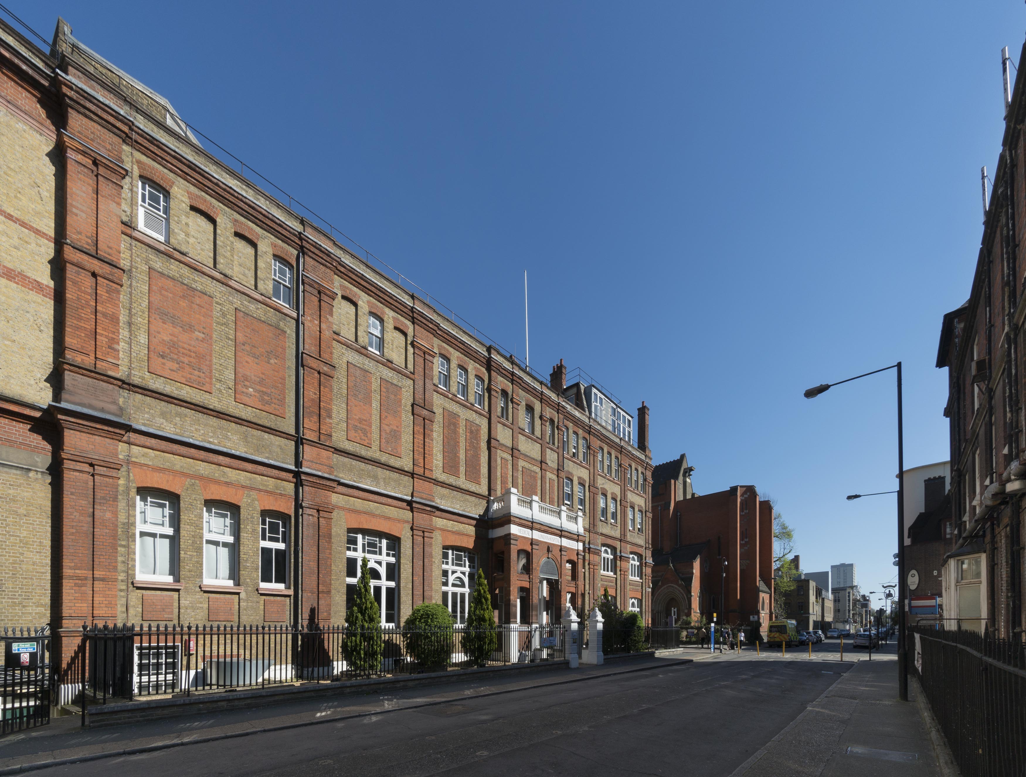
{
"id": 103,
"title": "21-29 Whitechapel Road",
"author": {
"id": 27,
"username": "DerekKendall"
},
"feature": {
"id": 121,
"type": "Feature",
"geometry": {
"type": "MultiPolygon",
"coordinates": [
[
[
[
-0.069054122731655,
51.51672762843165
],
[
-0.068854756856642,
51.516547067549645
],
[
-0.068919228675855,
51.51651366796187
],
[
-0.069004017855321,
51.5165906183173
],
[
-0.069168802522377,
51.51674671885503
],
[
-0.069067179586633,
51.516794208110376
],
[
-0.069054122731655,
51.51672762843165
]
]
]
]
},
"properties": {
"b_number": "25",
"b_name": "",
"street": "Whitechapel Road",
"address": "25 Whitechapel Road",
"feature_type": "WHITECHAPEL_BUILDING",
"count": 3,
"search_str": "25 Whitechapel Road"
},
"tags": []
},
"file": "https://surveyoflondon.org/media/uploads/features/121/SoL%20Whitechapel100252.jpg",
"description": "No. 25 is located directly in the middle of the photograph above 'MTB Exchange'",
"copyright": true,
"created": "2016-06-29"
},
{
"id": 672,
"title": "Kirstein's Mansions in 1965",
"author": {
"id": 2,
"username": "surveyoflondon"
},
"feature": {
"id": 184,
"type": "Feature",
"geometry": {
"type": "MultiPolygon",
"coordinates": [
[
[
[
-0.068578857725277,
51.515058346172935
],
[
-0.068684010525248,
51.51517341266261
],
[
-0.068486063121396,
51.51522368270303
],
[
-0.068452900682943,
51.5151753964142
],
[
-0.068534791469645,
51.515150123741485
],
[
-0.06850924458504,
51.515123238092826
],
[
-0.068432210792558,
51.51514928400303
],
[
-0.068403530730357,
51.51511976827265
],
[
-0.068578857725277,
51.515058346172935
]
]
]
]
},
"properties": {
"b_number": "34-40",
"b_name": "Kirstein's Mansions",
"street": "White Church Lane",
"address": "Kirstein's Mansions, 34-40 White Church Lane",
"feature_type": "WHITECHAPEL_BUILDING",
"count": 5,
"search_str": "Kirstein's Mansions"
},
"tags": [
"David Abraham",
"Solomon Kirstein",
"street art"
]
},
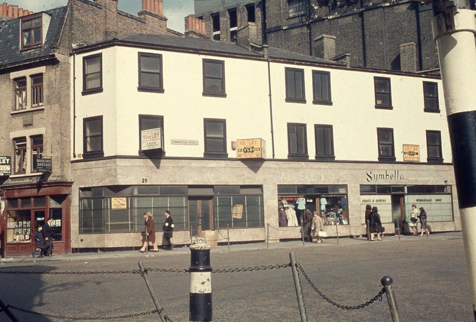
"file": "https://surveyoflondon.org/media/uploads/features/184/whitechapel%20road%20from%20Gary%20Hutton%20FB.jpg",
"description": "Kirstein's Mansions can be seen on the left, beside 29-31a Commercial Road, a photograph in Tower Hamlets Archives from Tower Hamlets Photo Archive 1960s and 1970s album on Facebook",
"copyright": false,
"created": "2017-05-22"
},
{
"id": 663,
"title": "The former Resident Doctors' Hostel of the London Hospital, view from Turner Street in 2017",
"author": {
"id": 27,
"username": "DerekKendall"
},
"feature": {
"id": 1187,
"type": "Feature",
"geometry": {
"type": "MultiPolygon",
"coordinates": [
[
[
[
-0.061853613587725,
51.51795357347482
],
[
-0.061311298322689,
51.518075049965745
],
[
-0.061297685346835,
51.51805160774173
],
[
-0.061269622596728,
51.518057950858406
],
[
-0.061233454788416,
51.51799566789858
],
[
-0.061263609210615,
51.517988851994616
],
[
-0.061253110770819,
51.517970773090006
],
[
-0.061797911851981,
51.51784762820333
],
[
-0.061853613587725,
51.51795357347482
]
]
]
]
},
"properties": {
"b_number": "",
"b_name": "",
"street": "Turner Street",
"address": "Ambrose King Centre and Grahame Hayton Unit",
"feature_type": "WHITECHAPEL_BUILDING",
"count": 5,
"search_str": "Ambrose King Centre and Grahame Hayton Unit"
},
"tags": []
},
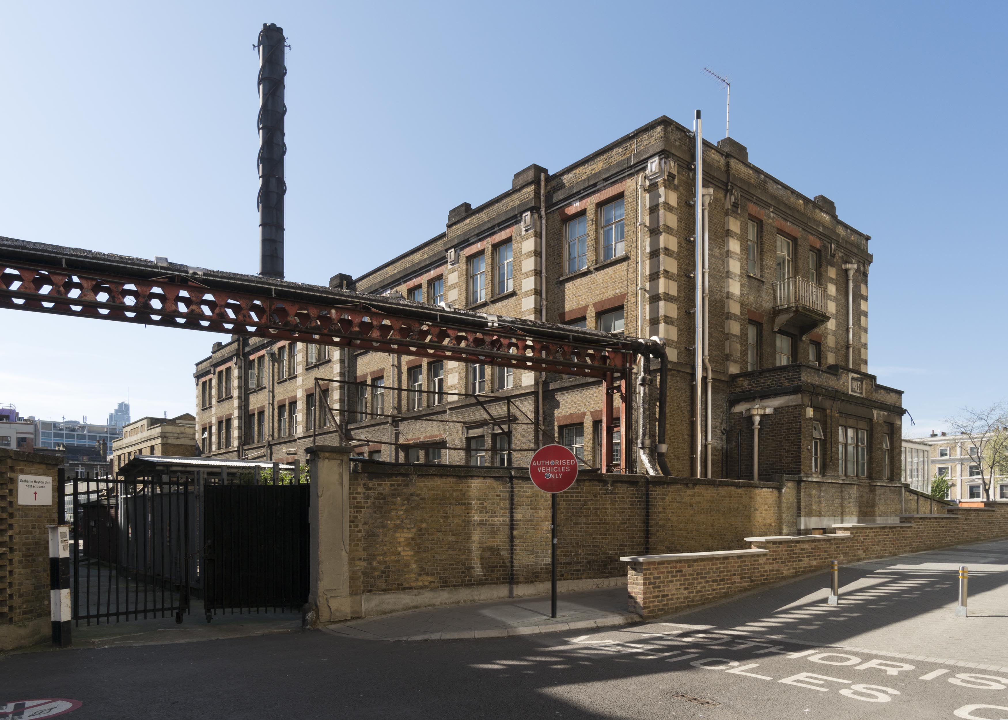
"file": "https://surveyoflondon.org/media/uploads/features/1187/SoL%20Whitechapel%20100551.jpg",
"description": "",
"copyright": true,
"created": "2017-05-09"
},
{
"id": 417,
"title": "Gherkin/ the city from Osborn Street",
"author": {
"id": 56,
"username": "tamara"
},
"feature": {
"id": 367,
"type": "Feature",
"geometry": {
"type": "MultiPolygon",
"coordinates": [
[
[
[
-0.070208788307576,
51.51671304296634
],
[
-0.070168698474152,
51.516642176924165
],
[
-0.070328598606914,
51.51659775292492
],
[
-0.070233638934197,
51.51643169469593
],
[
-0.07040277854452,
51.516389321672
],
[
-0.070427796874914,
51.516431704260015
],
[
-0.070531482057751,
51.51640852908396
],
[
-0.070495583452263,
51.516357381859585
],
[
-0.070624394552914,
51.51632218024373
],
[
-0.070775232954332,
51.51657790057318
],
[
-0.070374697197082,
51.51666834737638
],
[
-0.070349845537708,
51.516633207223116
],
[
-0.070314268571881,
51.51664150653588
],
[
-0.070338037036976,
51.51668116844782
],
[
-0.070208788307576,
51.51671304296634
]
]
]
]
},
"properties": {
"b_number": "19 to 23",
"b_name": "19 to 23 Osborn Street",
"street": "Osborn Street",
"address": "19-23 Osborn Street",
"feature_type": "WHITECHAPEL_BUILDING",
"count": 7,
"search_str": "19 to 23 Osborn Street"
},
"tags": []
},
"file": "https://surveyoflondon.org/media/uploads/features/367/tstoll15.jpg",
"description": "The Gherkin and the city of London spotted from 23 Osborn Street as part of a larger project documenting streets of some of East London's markets, image taken in 2016 by Tamara Stoll.",
"copyright": false,
"created": "2016-09-25"
},
{
"id": 720,
"title": "St Paul's Vicarage, 11 Dock Street, from the west in 2017",
"author": {
"id": 27,
"username": "DerekKendall"
},
"feature": {
"id": 1369,
"type": "Feature",
"geometry": {
"type": "MultiPolygon",
"coordinates": [
[
[
[
-0.06814938718865,
51.510141181955404
],
[
-0.06818852879571,
51.51022903462514
],
[
-0.068067568754798,
51.51025118835928
],
[
-0.068025430552516,
51.5101641393888
],
[
-0.06814938718865,
51.510141181955404
]
]
]
]
},
"properties": {
"b_number": "11",
"b_name": "11 Dock Street",
"street": "Dock Street",
"address": "11 Dock Street",
"feature_type": "WHITECHAPEL_BUILDING",
"count": 3,
"search_str": "11 Dock Street"
},
"tags": [
"Henry Roberts",
"William Cubitt"
]
},
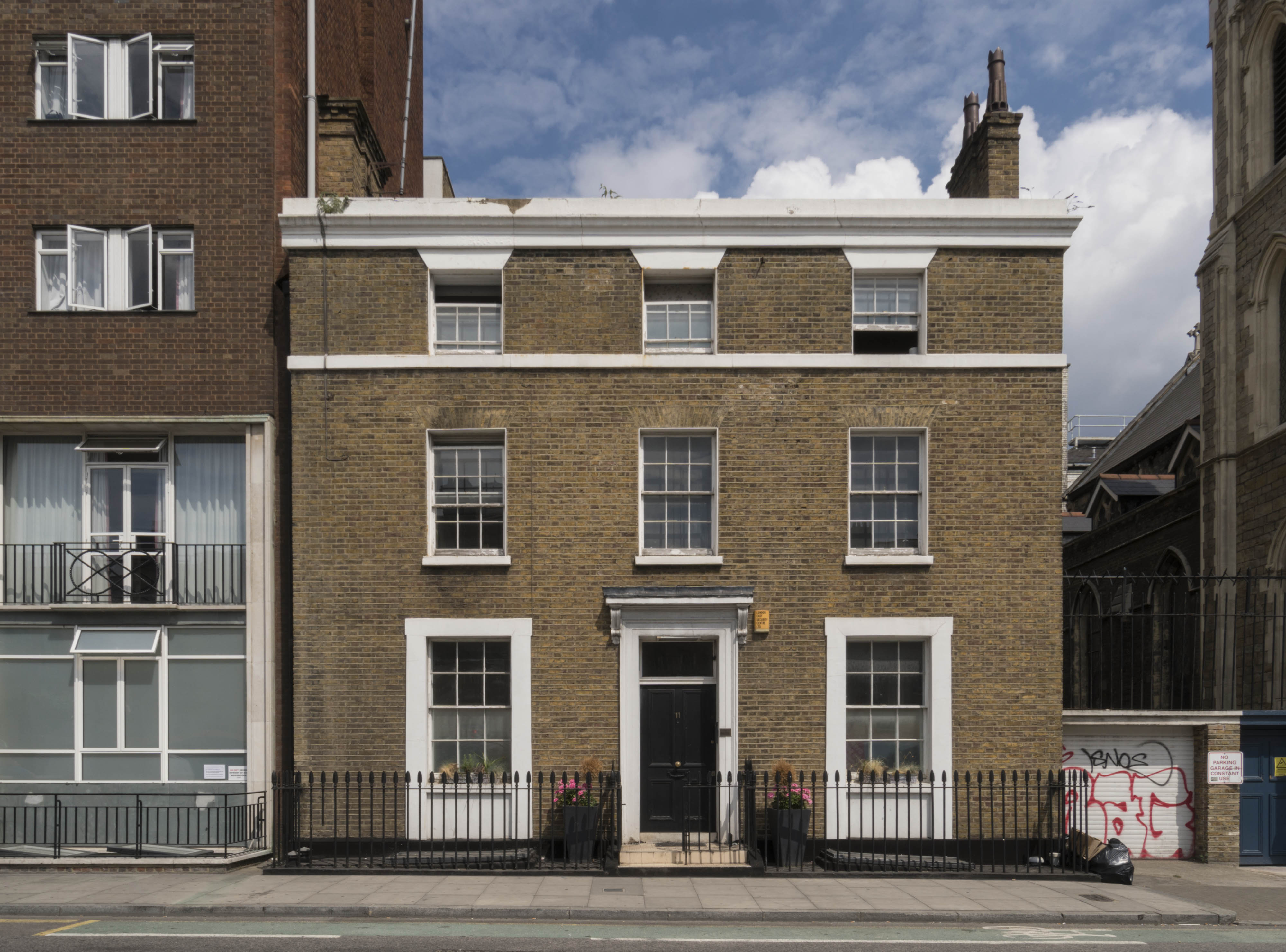
"file": "https://surveyoflondon.org/media/uploads/features/1369/SoL%20Whitechapel%20101147.jpg",
"description": "",
"copyright": true,
"created": "2017-08-02"
},
{
"id": 671,
"title": "29-31a Commercial Road in 1965",
"author": {
"id": 2,
"username": "surveyoflondon"
},
"feature": {
"id": 293,
"type": "Feature",
"geometry": {
"type": "MultiPolygon",
"coordinates": [
[
[
[
-0.068491774631066,
51.515088861036816
],
[
-0.068491755573131,
51.51508885345113
],
[
-0.068481018200281,
51.515032955895144
],
[
-0.068557145402275,
51.51503420979888
],
[
-0.068578868958976,
51.515058349407546
],
[
-0.068491774631066,
51.515088861036816
]
]
]
]
},
"properties": {
"b_number": "29",
"b_name": "",
"street": "Commercial Road",
"address": "Fresh, 29 Commercial Road",
"feature_type": "WHITECHAPEL_BUILDING",
"count": 6,
"search_str": "Fresh, 29 Commercial Road"
},
"tags": [
"Herbert O. Ellis",
"Solomon Kirstein"
]
},
"file": "https://surveyoflondon.org/media/uploads/features/293/whitechapel%20road%20from%20Gary%20Hutton%20FB.jpg",
"description": "from Tower Hamlets Archives from Tower Hamlets Photo Archive 1960s and 1970s album on Facebook",
"copyright": false,
"created": "2017-05-22"
},
{
"id": 681,
"title": "Snowy the dog outside Blooms, photographed by Ian Berry for 'This is Whitechapel 1972', copyright Ian Berry",
"author": {
"id": 157,
"username": "Rosemarie_Wayland_Zetolofsky"
},
"feature": {
"id": 322,
"type": "Feature",
"geometry": {
"type": "MultiPolygon",
"coordinates": [
[
[
[
-0.070826085356955,
51.515731678715305
],
[
-0.070926036876346,
51.51568963184868
],
[
-0.070975568878107,
51.51573563457872
],
[
-0.070938498759621,
51.51574884259805
],
[
-0.071053600330032,
51.515872108514294
],
[
-0.070987330377168,
51.51589641332655
],
[
-0.070910007660269,
51.515813725352466
],
[
-0.070826085356955,
51.515731678715305
]
]
]
]
},
"properties": {
"b_number": "90",
"b_name": "90 Whitechapel High Street",
"street": "Whitechapel High Street",
"address": "90 Whitechapel High Street",
"feature_type": "WHITECHAPEL_BUILDING",
"count": 5,
"search_str": "90 Whitechapel High Street"
},
"tags": []
},
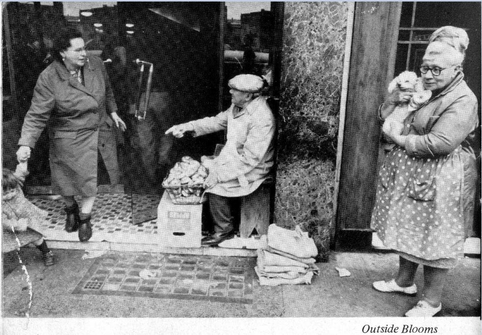
"file": "https://surveyoflondon.org/media/uploads/features/322/Capture.JPG",
"description": "The lady holding the dog is Betty. She worked for the bakers 'Doris Cohen'. When Doris found out the photographer was taking pictures at Blooms she sent Betty with her (Doris') dog to get into them. ",
"copyright": true,
"created": "2017-06-06"
},
{
"id": 1623,
"title": "KVJ shop interior in 2018",
"author": {
"id": 27,
"username": "DerekKendall"
},
"feature": {
"id": 315,
"type": "Feature",
"geometry": {
"type": "MultiPolygon",
"coordinates": [
[
[
[
-0.070001262506134,
51.51611420182703
],
[
-0.069925683789541,
51.516033038765876
],
[
-0.069976822772036,
51.516012970027454
],
[
-0.070049788081591,
51.51609931840464
],
[
-0.070001262506134,
51.51611420182703
]
]
]
]
},
"properties": {
"b_number": "76",
"b_name": "76 Whitechapel High Street",
"street": "Whitechapel High Street",
"address": "76 Whitechapel High Street",
"feature_type": "WHITECHAPEL_BUILDING",
"count": 9,
"search_str": "76 Whitechapel High Street"
},
"tags": []
},
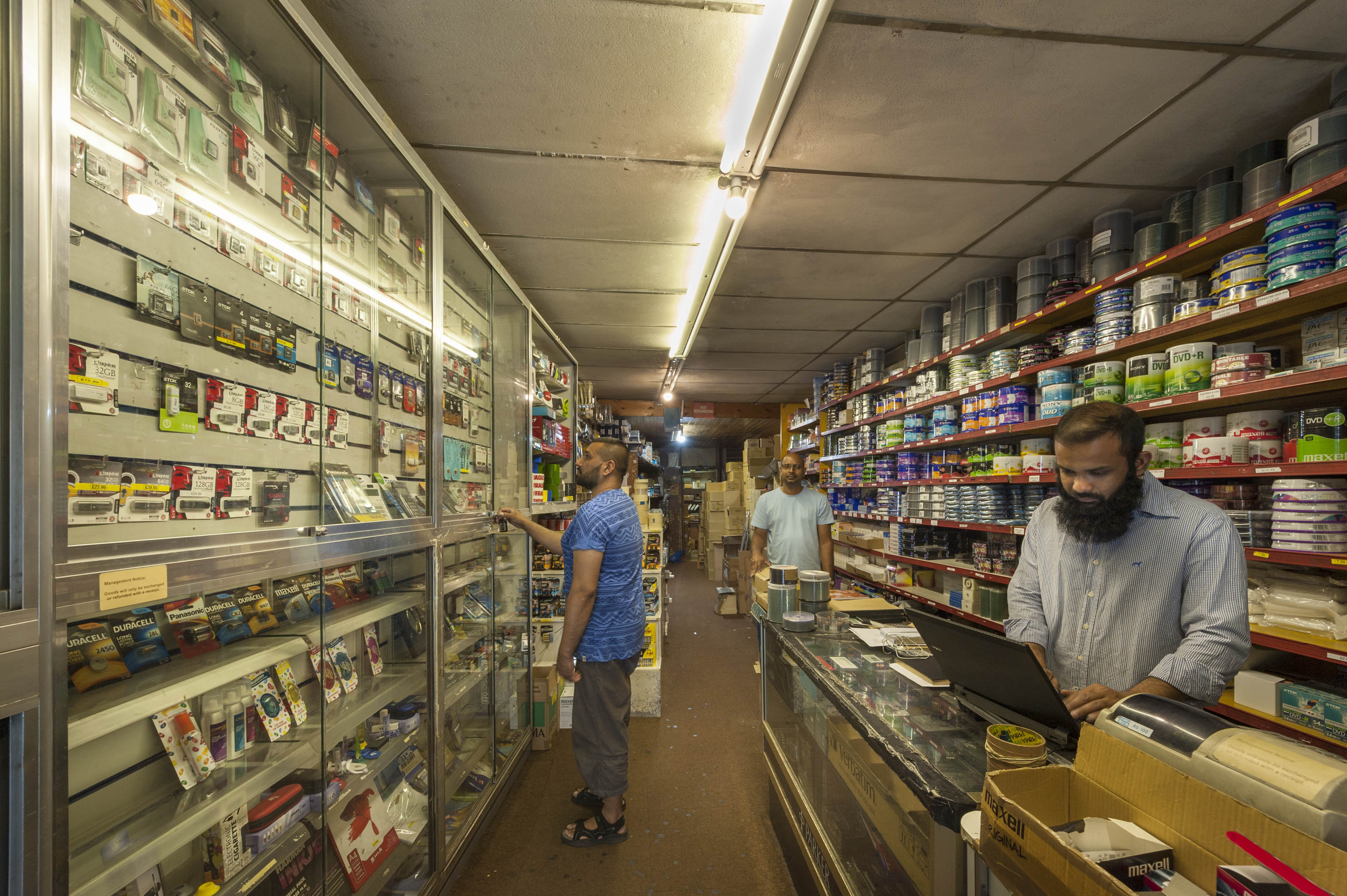
"file": "https://surveyoflondon.org/media/uploads/features/315/SoL%20Whitechapel%20102130.jpg",
"description": "",
"copyright": true,
"created": "2019-06-13"
},
{
"id": 693,
"title": "The Culpeper, formerly the City Darts, previously the Princess Alice, June 2017",
"author": {
"id": 27,
"username": "DerekKendall"
},
"feature": {
"id": 361,
"type": "Feature",
"geometry": {
"type": "MultiPolygon",
"coordinates": [
[
[
[
-0.072767575103936,
51.516845305306816
],
[
-0.072982437061767,
51.51677817553716
],
[
-0.073050882093095,
51.51685314376525
],
[
-0.073030606825987,
51.51687969929775
],
[
-0.072802739910383,
51.51688939919542
],
[
-0.072767575103936,
51.516845305306816
]
]
]
]
},
"properties": {
"b_number": "40-42",
"b_name": "The Culpeper, 40-42 Commercial Street",
"street": "Commercial Street",
"address": "The Culpeper, 40 Commercial Street",
"feature_type": "WHITECHAPEL_BUILDING",
"count": 5,
"search_str": "The Culpeper, 40-42 Commercial Street"
},
"tags": []
},
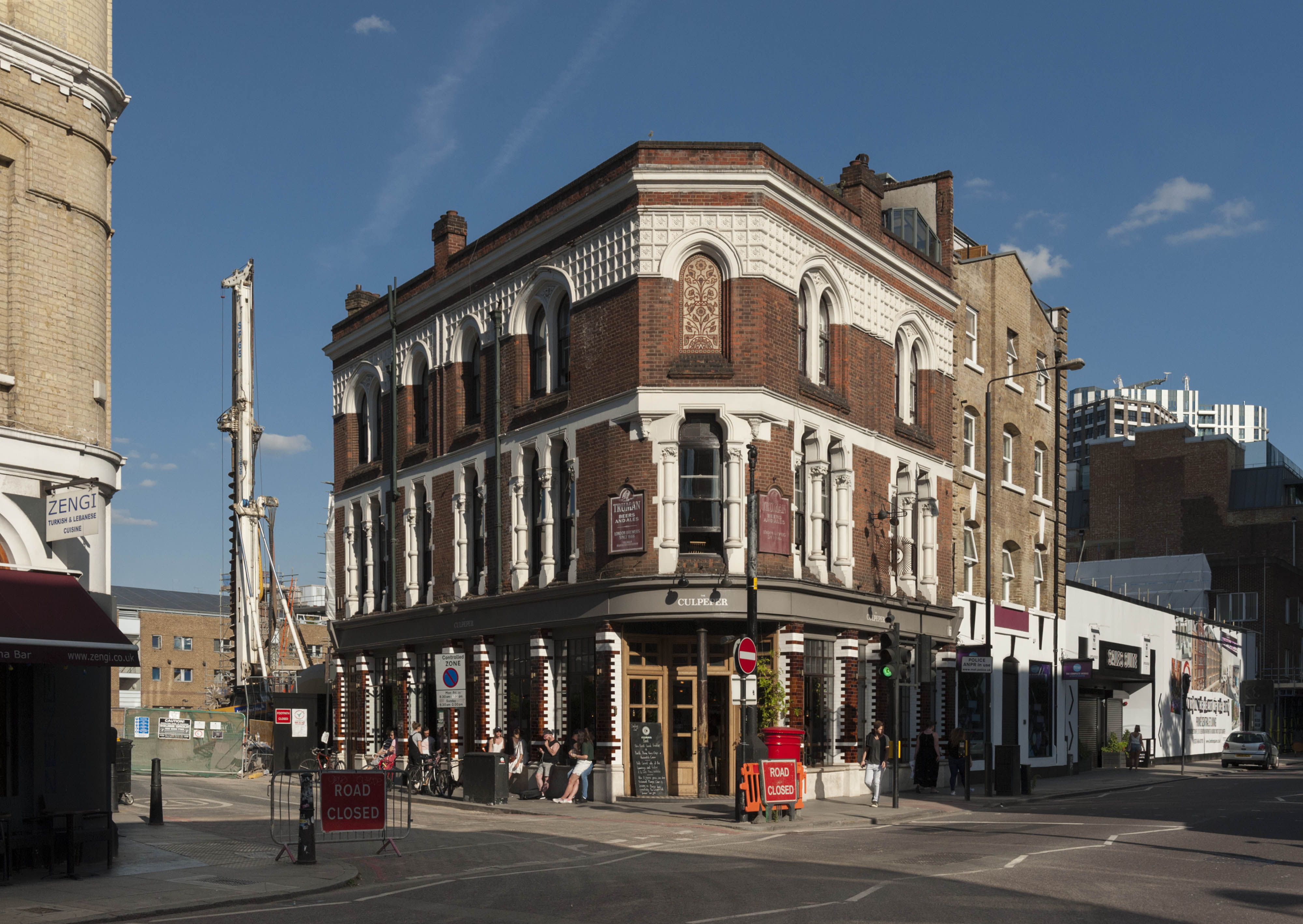
"file": "https://surveyoflondon.org/media/uploads/features/361/SoL%20Whitechapel%20100816.jpg",
"description": "",
"copyright": true,
"created": "2017-07-20"
}
]
}