HTTP 200 OK
Allow: GET, HEAD, OPTIONS
Content-Type: application/json
Vary: Accept
{
"count": 1747,
"next": "https://surveyoflondon.org/api/v1/images/?format=api&page=34",
"previous": "https://surveyoflondon.org/api/v1/images/?format=api&page=32",
"results": [
{
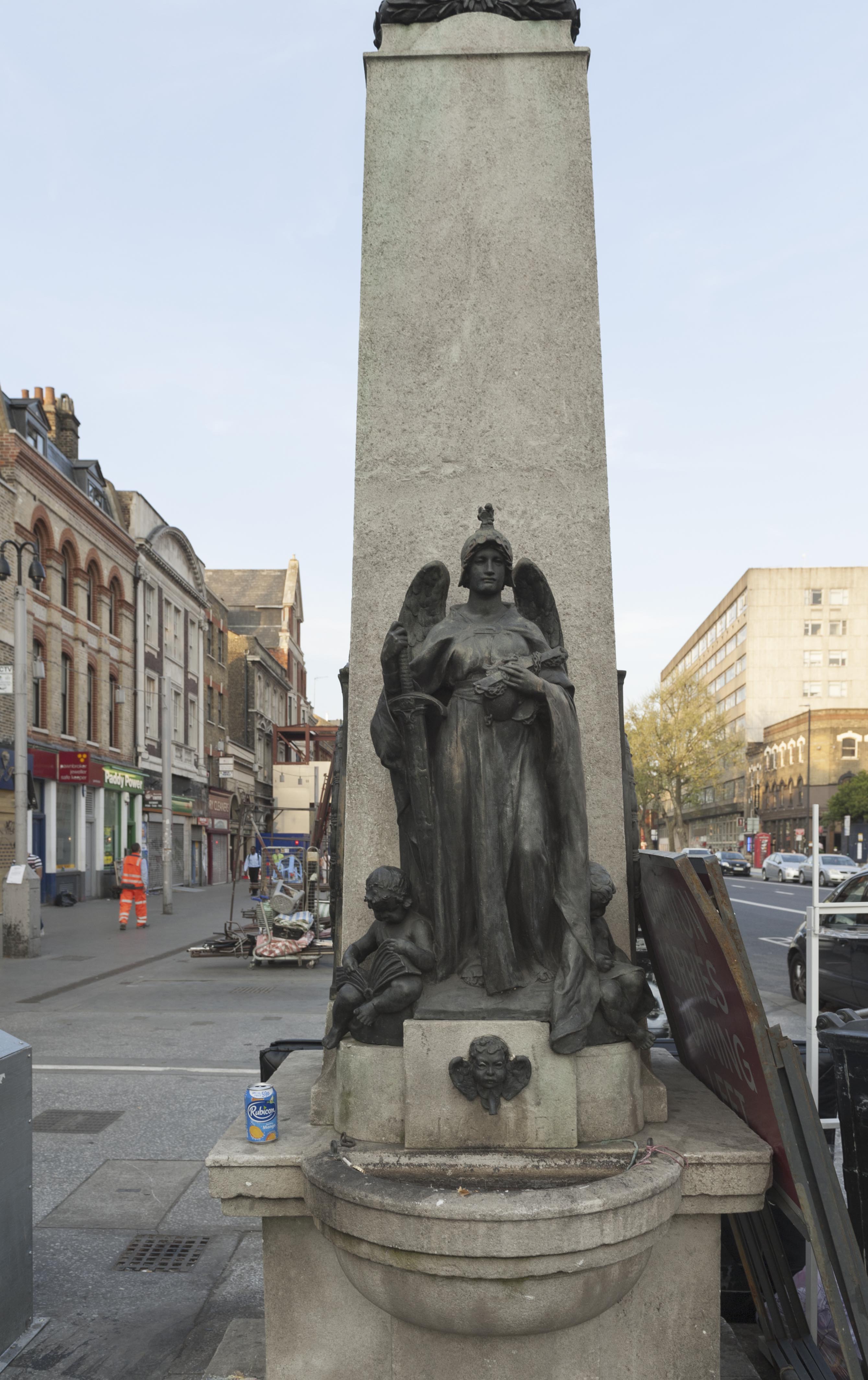
"id": 302,
"title": "Drinking Fountain, 1911, W. S. Frith, from west",
"author": {
"id": 27,
"username": "DerekKendall"
},
"feature": {
"id": 1698,
"type": "Feature",
"geometry": {
"type": "MultiPolygon",
"coordinates": [
[
[
[
-0.062755898137067,
51.51857235799611
],
[
-0.058216859270041,
51.51960039921044
],
[
-0.058148482851386,
51.51948612756745
],
[
-0.061091729886378,
51.51883423152082
],
[
-0.061616259170046,
51.51871888429734
],
[
-0.06270768344222,
51.51847582817058
],
[
-0.062755898137067,
51.51857235799611
]
]
]
]
},
"properties": {
"b_number": "",
"b_name": "",
"street": "Whitechapel Road",
"address": "Whitechapel Market, Whitechapel Road",
"feature_type": "PLACE",
"count": 48,
"search_str": "Whitechapel Market, Whitechapel Road"
},
"tags": []
},
"file": "https://surveyoflondon.org/media/uploads/features/491/SoL%20Whitechapel100408.jpg",
"description": "",
"copyright": true,
"created": "2016-08-23"
},
{
"id": 268,
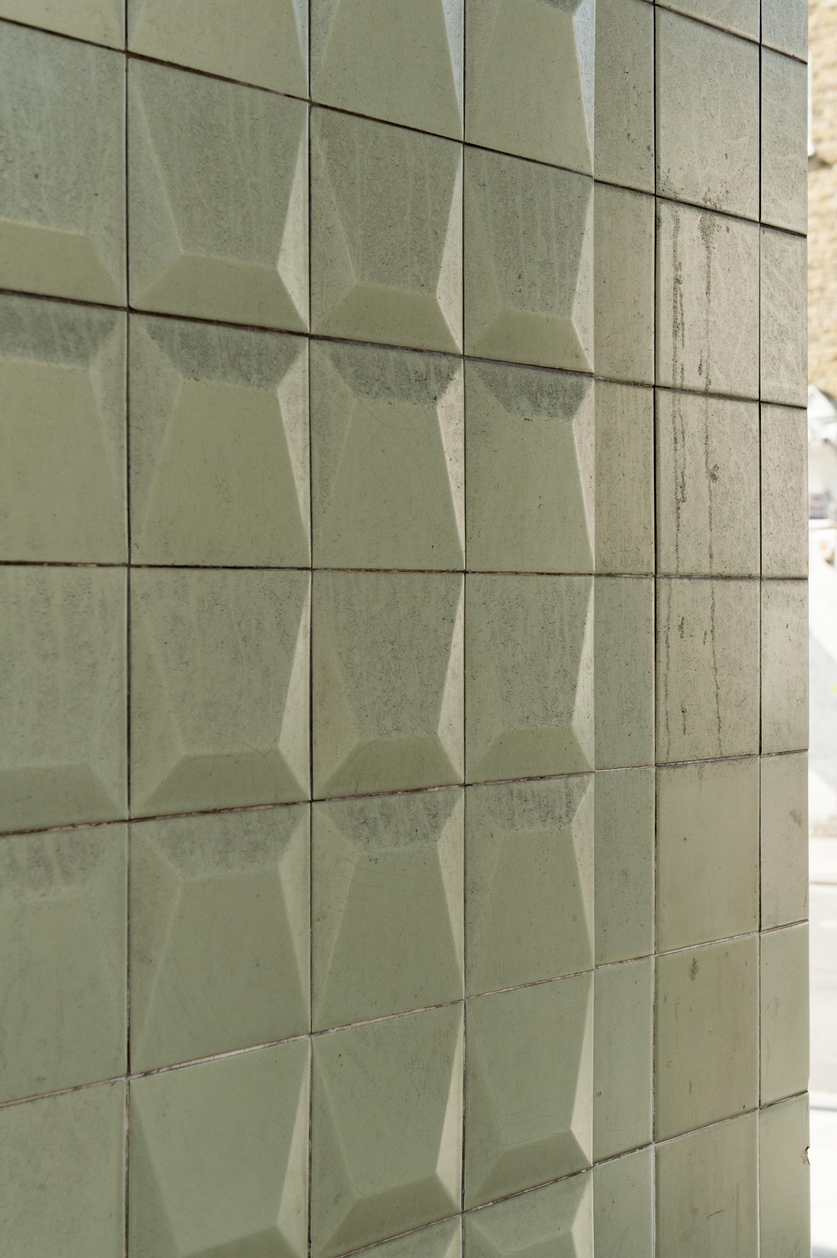
"title": "Detail of tiles on the Dental Hospital and Institute of Dentistry in 2016",
"author": {
"id": 27,
"username": "DerekKendall"
},
"feature": {
"id": 1166,
"type": "Feature",
"geometry": {
"type": "MultiPolygon",
"coordinates": [
[
[
[
-0.062351470894244,
51.51718815629615
],
[
-0.061292929801261,
51.51728379235413
],
[
-0.061222794483401,
51.51696856036261
],
[
-0.062282192019856,
51.516876806223415
],
[
-0.062351470894244,
51.51718815629615
]
]
]
]
},
"properties": {
"b_number": "",
"b_name": "",
"street": "Stepney Way",
"address": "Dental Hospital and Institute of Dentistry",
"feature_type": "WHITECHAPEL_BUILDING",
"count": 13,
"search_str": "Dental Hospital and Institute of Dentistry"
},
"tags": [
"Dental Institute",
"London Hospital",
"Royal London Hospital",
"Stephen Statham & Associates",
"Students' Union"
]
},
"file": "https://surveyoflondon.org/media/uploads/features/1166/SoL%20Whitechapel100147.jpg",
"description": "",
"copyright": true,
"created": "2016-08-17"
},
{
"id": 653,
"title": "View from Fieldgate Street of the Dental Block and Students' Union, the Outpatients Annexe and the Royal London Hospital, 2017",
"author": {
"id": 27,
"username": "DerekKendall"
},
"feature": {
"id": 1166,
"type": "Feature",
"geometry": {
"type": "MultiPolygon",
"coordinates": [
[
[
[
-0.062351470894244,
51.51718815629615
],
[
-0.061292929801261,
51.51728379235413
],
[
-0.061222794483401,
51.51696856036261
],
[
-0.062282192019856,
51.516876806223415
],
[
-0.062351470894244,
51.51718815629615
]
]
]
]
},
"properties": {
"b_number": "",
"b_name": "",
"street": "Stepney Way",
"address": "Dental Hospital and Institute of Dentistry",
"feature_type": "WHITECHAPEL_BUILDING",
"count": 13,
"search_str": "Dental Hospital and Institute of Dentistry"
},
"tags": [
"Dental Institute",
"London Hospital",
"Royal London Hospital",
"Stephen Statham & Associates",
"Students' Union"
]
},
"file": "https://surveyoflondon.org/media/uploads/features/1166/SoL%20Whitechapel%20100537.jpg",
"description": "",
"copyright": true,
"created": "2017-05-09"
},
{
"id": 665,
"title": "26–28 Mount Terrace in 2017",
"author": {
"id": 27,
"username": "DerekKendall"
},
"feature": {
"id": 1175,
"type": "Feature",
"geometry": {
"type": "MultiPolygon",
"coordinates": [
[
[
[
-0.062080947471919,
51.518019853005946
],
[
-0.062117387834708,
51.51808284263647
],
[
-0.062061959179686,
51.518095324099704
],
[
-0.062025317454428,
51.51803198626631
],
[
-0.062080947471919,
51.518019853005946
]
]
]
]
},
"properties": {
"b_number": "29",
"b_name": "",
"street": "Mount Terrace",
"address": "29 Mount Terrace",
"feature_type": "WHITECHAPEL_BUILDING",
"count": 4,
"search_str": "29 Mount Terrace"
},
"tags": []
},
"file": "https://surveyoflondon.org/media/uploads/features/1175/SoL%20Whitechapel%20100554.jpg",
"description": "",
"copyright": true,
"created": "2017-05-09"
},
{
"id": 666,
"title": "Mount Terrace from the west in 2017, looking towards the Alexandra Wing of the Royal London Hospital",
"author": {
"id": 27,
"username": "DerekKendall"
},
"feature": {
"id": 1175,
"type": "Feature",
"geometry": {
"type": "MultiPolygon",
"coordinates": [
[
[
[
-0.062080947471919,
51.518019853005946
],
[
-0.062117387834708,
51.51808284263647
],
[
-0.062061959179686,
51.518095324099704
],
[
-0.062025317454428,
51.51803198626631
],
[
-0.062080947471919,
51.518019853005946
]
]
]
]
},
"properties": {
"b_number": "29",
"b_name": "",
"street": "Mount Terrace",
"address": "29 Mount Terrace",
"feature_type": "WHITECHAPEL_BUILDING",
"count": 4,
"search_str": "29 Mount Terrace"
},
"tags": []
},
"file": "https://surveyoflondon.org/media/uploads/features/1175/SoL%20Whitechapel%20100555.jpg",
"description": "",
"copyright": true,
"created": "2017-05-09"
},
{
"id": 768,
"title": "Aldgate Place under construction, August 2017",
"author": {
"id": 27,
"username": "DerekKendall"
},
"feature": {
"id": 1440,
"type": "Feature",
"geometry": {
"type": "MultiPolygon",
"coordinates": [
[
[
[
-0.071358974125237,
51.51518482253958
],
[
-0.071350073326624,
51.515220031634875
],
[
-0.070983113437351,
51.515314714709994
],
[
-0.071030492335444,
51.51515189362231
],
[
-0.071358974125237,
51.51518482253958
]
]
]
]
},
"properties": {
"b_number": "",
"b_name": "Aldgate Place",
"street": "Whitechapel High Street",
"address": "Aldgate Place, Whitechapel High Street",
"feature_type": "WHITECHAPEL_BUILDING",
"count": 8,
"search_str": "Aldgate Place"
},
"tags": []
},
"file": "https://surveyoflondon.org/media/uploads/features/1440/SoL%20Whitechapel%20101338.jpg",
"description": "",
"copyright": true,
"created": "2017-09-12"
},
{
"id": 791,
"title": "17 Whitechurch Lane in 2017",
"author": {
"id": 27,
"username": "DerekKendall"
},
"feature": {
"id": 142,
"type": "Feature",
"geometry": {
"type": "MultiPolygon",
"coordinates": [
[
[
[
-0.069126224544899,
51.515558849026164
],
[
-0.069240640768582,
51.5155289531881
],
[
-0.069240647310599,
51.51552894973457
],
[
-0.069240652002255,
51.51552895642242
],
[
-0.069337650654143,
51.515502135962606
],
[
-0.06936636946444,
51.51553864705814
],
[
-0.06926099560633,
51.51556742365802
],
[
-0.069260946514621,
51.51556743076239
],
[
-0.069133866951602,
51.51560102001405
],
[
-0.069111479703893,
51.51557006198587
],
[
-0.069126227710551,
51.51555885436859
],
[
-0.069126224544899,
51.515558849026164
]
]
]
]
},
"properties": {
"b_number": "17",
"b_name": "",
"street": "White Church Lane",
"address": "17 White Church Lane",
"feature_type": "WHITECHAPEL_BUILDING",
"count": 3,
"search_str": "17 White Church Lane"
},
"tags": []
},
"file": "https://surveyoflondon.org/media/uploads/features/142/SoL%20Whitechapel%20101430.jpg",
"description": "",
"copyright": true,
"created": "2017-09-12"
},
{
"id": 687,
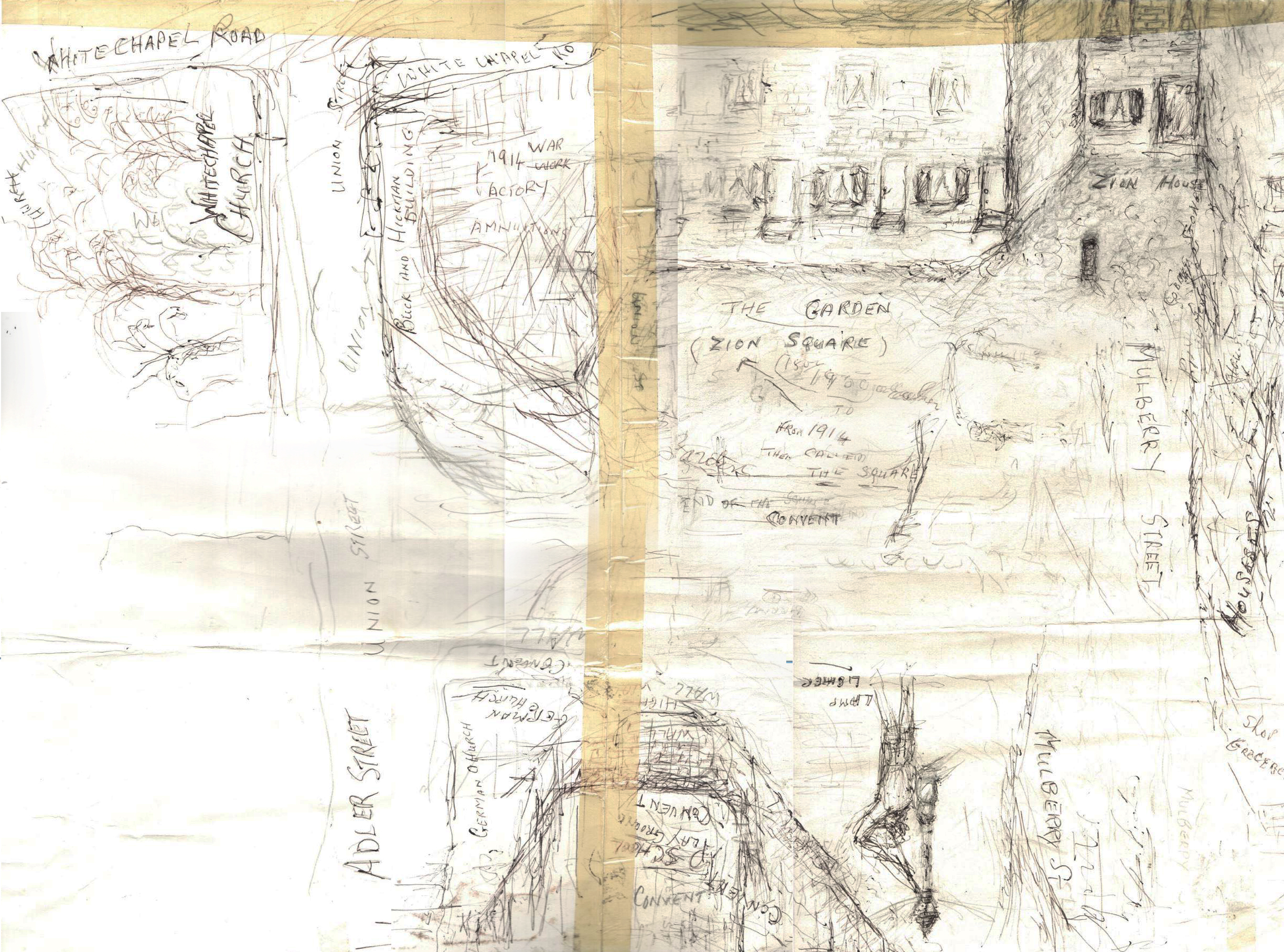
"title": "Drawing by Betty Heller, detail showing Mulberry Street (formerly Sion Square) looking south to the present-day German Church",
"author": {
"id": 154,
"username": "CharlesHeller"
},
"feature": {
"id": 301,
"type": "Feature",
"geometry": {
"type": "MultiPolygon",
"coordinates": [
[
[
[
-0.067736975376783,
51.51614633297866
],
[
-0.067736964788515,
51.51614633139776
],
[
-0.067438878078407,
51.51626048776608
],
[
-0.067384045533061,
51.51620177426893
],
[
-0.06686585726795,
51.516354207114226
],
[
-0.066894961295245,
51.516392721034535
],
[
-0.066827400254887,
51.516412594884436
],
[
-0.066798572993988,
51.51637444713945
],
[
-0.066765252861003,
51.516384248613996
],
[
-0.066686306327938,
51.51627977648115
],
[
-0.06755668359082,
51.51602374125061
],
[
-0.067648667130944,
51.516056627121685
],
[
-0.067736975376783,
51.51614633297866
]
]
]
]
},
"properties": {
"b_number": "42",
"b_name": "",
"street": "Adler Street",
"address": "Qbic London City, 42 Adler Street",
"feature_type": "WHITECHAPEL_BUILDING",
"count": 6,
"search_str": "Qbic London City, 42 Adler Street"
},
"tags": [
"Buck & Hickman",
"George public house",
"hotel"
]
},
"file": "https://surveyoflondon.org/media/uploads/features/301/Detail_2.JPG",
"description": "",
"copyright": false,
"created": "2017-06-22"
},
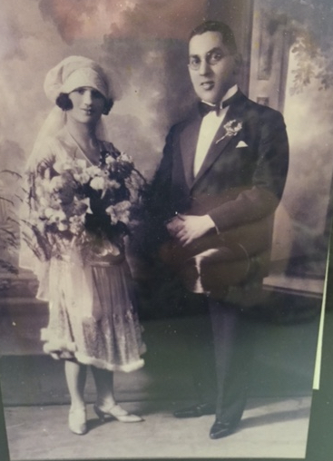
{
"id": 670,
"title": "Wedding photo of Israel Diamondstein and my grandmother Sarah.",
"author": {
"id": 133,
"username": "JK"
},
"feature": {
"id": 1693,
"type": "Feature",
"geometry": {
"type": "MultiPolygon",
"coordinates": [
[
[
[
-0.056924820063391,
51.51421560219889
],
[
-0.056971528015528,
51.51384623288136
],
[
-0.056871283938334,
51.51384124455362
],
[
-0.056934090778343,
51.51334759183443
],
[
-0.056961378785735,
51.51334984253725
],
[
-0.056915064232779,
51.51369304937437
],
[
-0.056945399913239,
51.51369481101075
],
[
-0.05707036637998,
51.51270569613911
],
[
-0.057094859080964,
51.512692342970155
],
[
-0.057601165327806,
51.51270585634352
],
[
-0.057589985814951,
51.51287716368871
],
[
-0.057298716796144,
51.5128702704231
],
[
-0.05712032901136,
51.514207150881575
],
[
-0.057176259676711,
51.514210325711645
],
[
-0.057326396682964,
51.51306991929563
],
[
-0.057438581555427,
51.513075374830706
],
[
-0.057291998274849,
51.514217009307295
],
[
-0.057370355032114,
51.51422154476658
],
[
-0.0574378067005,
51.513720234981136
],
[
-0.057592244751566,
51.51372854854964
],
[
-0.057506512466477,
51.51436822441069
],
[
-0.056914094806786,
51.514301665339865
],
[
-0.056920900395039,
51.514246742232395
],
[
-0.056844116463965,
51.51424250231826
],
[
-0.056848464438455,
51.51421145931197
],
[
-0.056924820063391,
51.51421560219889
]
]
]
]
},
"properties": {
"b_number": "",
"b_name": "",
"street": "",
"address": "Greater Whitechapel",
"feature_type": "GREATER_WHITECHAPEL",
"count": 2,
"search_str": "Greater Whitechapel"
},
"tags": []
},
"file": "https://surveyoflondon.org/media/uploads/features/1693/Untitled.jpg",
"description": "Israel's father was Nathan Diamondstein. The tobacco business, despite being started by my great grandma, was in her husband's name!!",
"copyright": false,
"created": "2017-05-22"
},
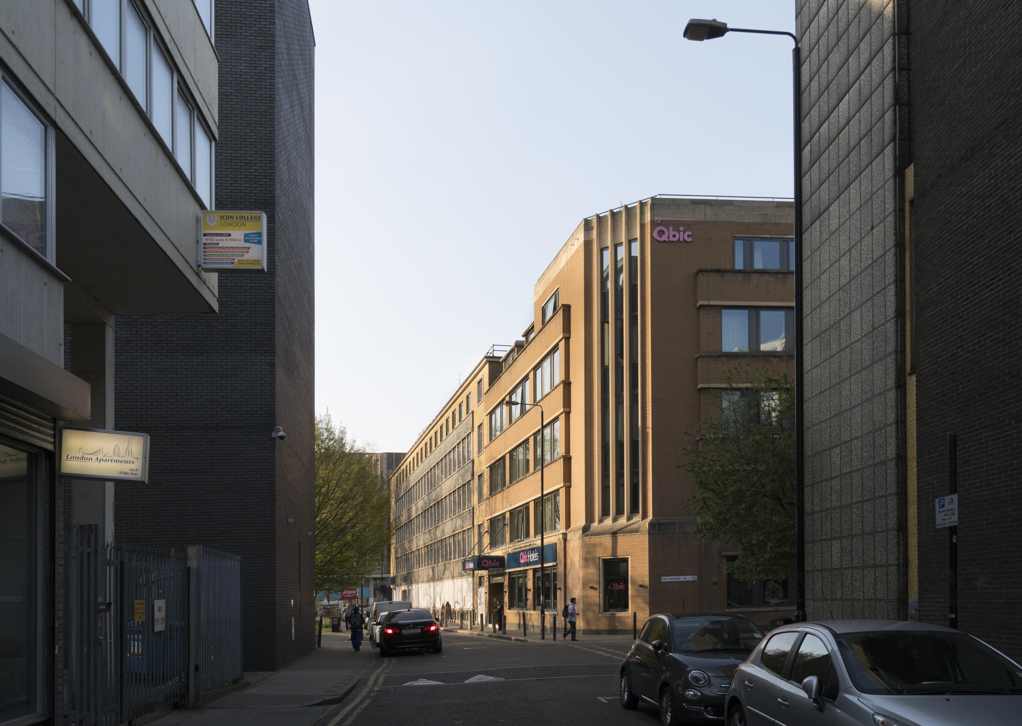
{
"id": 667,
"title": "The west elevation of the Royal London Dental Hospital from Mount Terrace in 2017",
"author": {
"id": 27,
"username": "DerekKendall"
},
"feature": {
"id": 1233,
"type": "Feature",
"geometry": {
"type": "MultiPolygon",
"coordinates": [
[
[
[
-0.06071898744648,
51.51847914149303
],
[
-0.060500593175314,
51.518078725457706
],
[
-0.060677507453823,
51.51804024673126
],
[
-0.060671223402208,
51.51802540127174
],
[
-0.06085005314625,
51.51798836558531
],
[
-0.060812945436909,
51.517920331266545
],
[
-0.060917351413957,
51.51789816547845
],
[
-0.060931197156673,
51.517923550570345
],
[
-0.061010610691191,
51.51790669069574
],
[
-0.061049931220856,
51.51797878143679
],
[
-0.061137385429043,
51.517960214409946
],
[
-0.061165435766445,
51.51801164191679
],
[
-0.061088209745711,
51.51802803744632
],
[
-0.061113189374754,
51.51807608265291
],
[
-0.061137480851473,
51.51807171260715
],
[
-0.061278658301599,
51.518317481305246
],
[
-0.061327004153713,
51.518306671582295
],
[
-0.061361885271019,
51.51836739382176
],
[
-0.061297703445739,
51.518381744329986
],
[
-0.061323145093769,
51.518424980241626
],
[
-0.060865969954968,
51.518532183713546
],
[
-0.060820667002295,
51.51845590786164
],
[
-0.06071898744648,
51.51847914149303
]
]
]
]
},
"properties": {
"b_number": "",
"b_name": "",
"street": "Turner Street",
"address": "The Royal London Dental Hospital",
"feature_type": "WHITECHAPEL_BUILDING",
"count": 9,
"search_str": "The Royal London Dental Hospital"
},
"tags": []
},
"file": "https://surveyoflondon.org/media/uploads/features/1233/SoL%20Whitechapel%20100555.jpg",
"description": "",
"copyright": true,
"created": "2017-05-09"
},
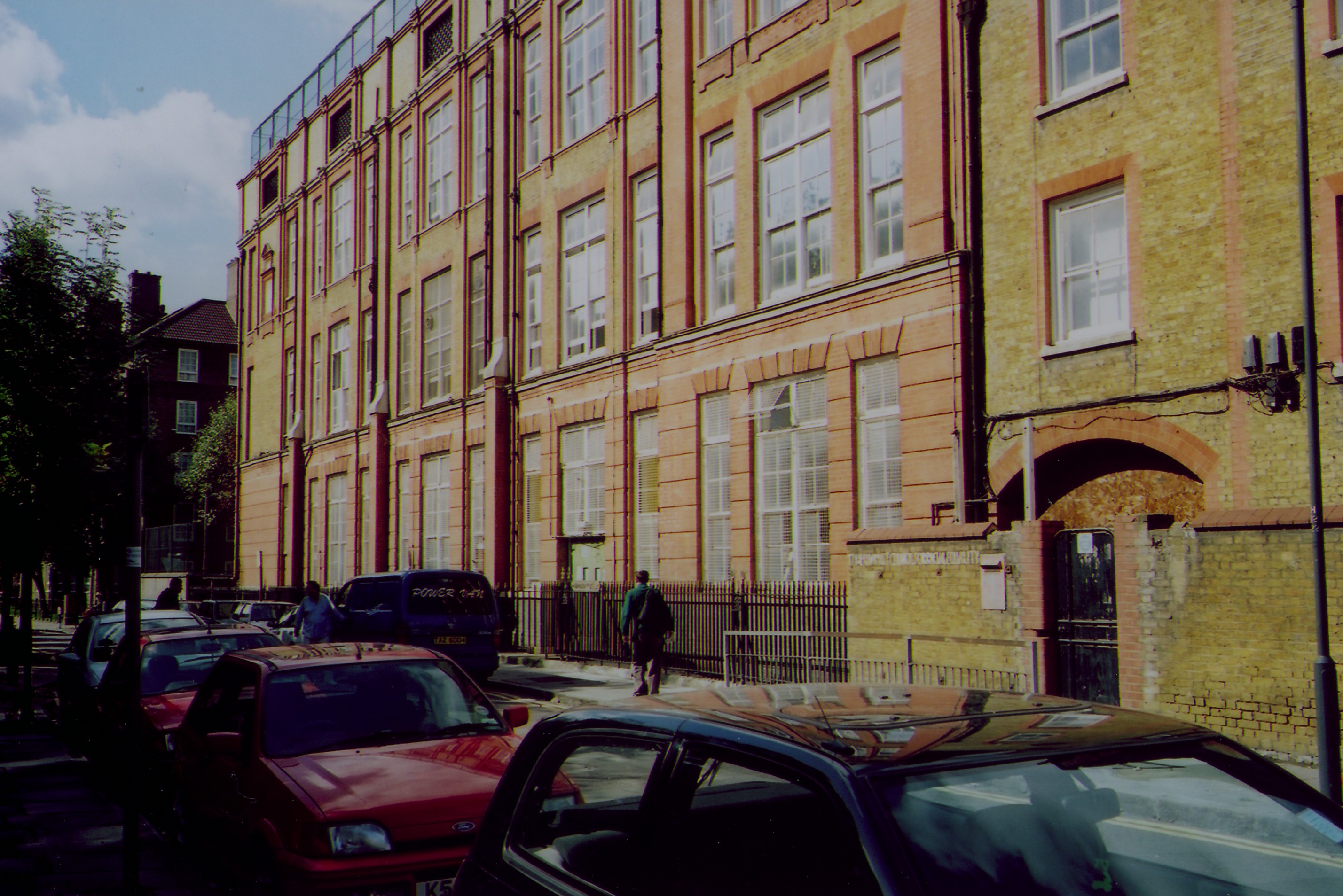
{
"id": 437,
"title": "Montefiore Centre 2 (2001)",
"author": {
"id": 69,
"username": "bryan_mawer"
},
"feature": {
"id": 1617,
"type": "Feature",
"geometry": {
"type": "MultiPolygon",
"coordinates": [
[
[
[
-0.066484897477261,
51.51973007331081
],
[
-0.067081453933615,
51.519721292244824
],
[
-0.067090659783377,
51.51989194689293
],
[
-0.066503297146198,
51.519901419163396
],
[
-0.066484897477261,
51.51973007331081
]
]
]
]
},
"properties": {
"b_number": "",
"b_name": "",
"street": "",
"address": "Greater Whitechapel: former Deal Street School",
"feature_type": "GREATER_WHITECHAPEL",
"count": 7,
"search_str": "Greater Whitechapel: former Deal Street School"
},
"tags": []
},
"file": "https://surveyoflondon.org/media/uploads/features/1617/dealstsch2.jpg",
"description": "Horwood's early map c.1799 shows only four small buildings, likely houses, at the east corner of Church St (later Hanbury St) and Deal St (correlating to the left of the photo). The later edition of Horwood c.1812 shows a small sugarhouse to the east of this site (correlating to the right of the photo). The arch visible here marks the location of the sugarhouse.",
"copyright": false,
"created": "2016-10-27"
},
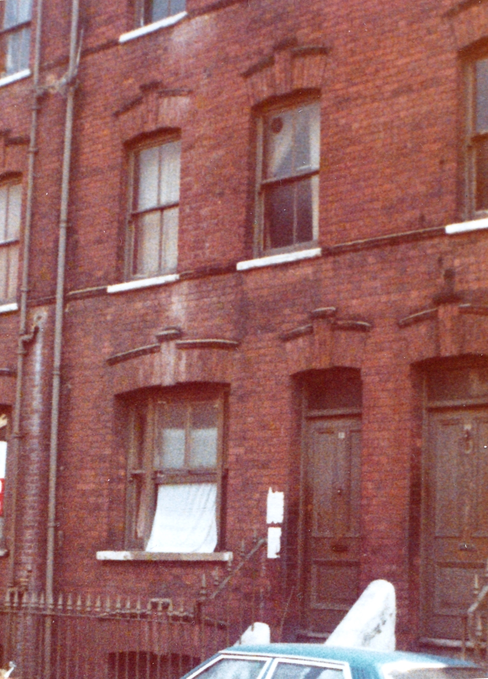
{
"id": 675,
"title": "12 Settles Street, 1980",
"author": {
"id": 142,
"username": "rv"
},
"feature": {
"id": 832,
"type": "Feature",
"geometry": {
"type": "MultiPolygon",
"coordinates": [
[
[
[
-0.06423596804638,
51.51539125973037
],
[
-0.064104513627684,
51.515396809055495
],
[
-0.06409954839363,
51.5153537642123
],
[
-0.064231686596889,
51.515348186031474
],
[
-0.06423596804638,
51.51539125973037
]
]
]
]
},
"properties": {
"b_number": "12",
"b_name": "",
"street": "Settles Street",
"address": "12 Settles Street",
"feature_type": "WHITECHAPEL_BUILDING",
"count": 3,
"search_str": "12 Settles Street"
},
"tags": [
"Davis Brothers"
]
},
"file": "https://surveyoflondon.org/media/uploads/features/832/Settles%20Street%20no%2012%20-1980.jpg",
"description": "I took this photograph in 1980, when the buildings were presumably empty and condemned for demolition.",
"copyright": false,
"created": "2017-05-24"
},
{
"id": 609,
"title": "Adler Street's north end from the south, showing 40 and 42 on the east side, April 2017",
"author": {
"id": 27,
"username": "DerekKendall"
},
"feature": {
"id": 301,
"type": "Feature",
"geometry": {
"type": "MultiPolygon",
"coordinates": [
[
[
[
-0.067736975376783,
51.51614633297866
],
[
-0.067736964788515,
51.51614633139776
],
[
-0.067438878078407,
51.51626048776608
],
[
-0.067384045533061,
51.51620177426893
],
[
-0.06686585726795,
51.516354207114226
],
[
-0.066894961295245,
51.516392721034535
],
[
-0.066827400254887,
51.516412594884436
],
[
-0.066798572993988,
51.51637444713945
],
[
-0.066765252861003,
51.516384248613996
],
[
-0.066686306327938,
51.51627977648115
],
[
-0.06755668359082,
51.51602374125061
],
[
-0.067648667130944,
51.516056627121685
],
[
-0.067736975376783,
51.51614633297866
]
]
]
]
},
"properties": {
"b_number": "42",
"b_name": "",
"street": "Adler Street",
"address": "Qbic London City, 42 Adler Street",
"feature_type": "WHITECHAPEL_BUILDING",
"count": 6,
"search_str": "Qbic London City, 42 Adler Street"
},
"tags": [
"Buck & Hickman",
"George public house",
"hotel"
]
},
"file": "https://surveyoflondon.org/media/uploads/features/301/SoL%20Whitechapel%20100693.jpg",
"description": "",
"copyright": true,
"created": "2017-05-03"
},
{
"id": 713,
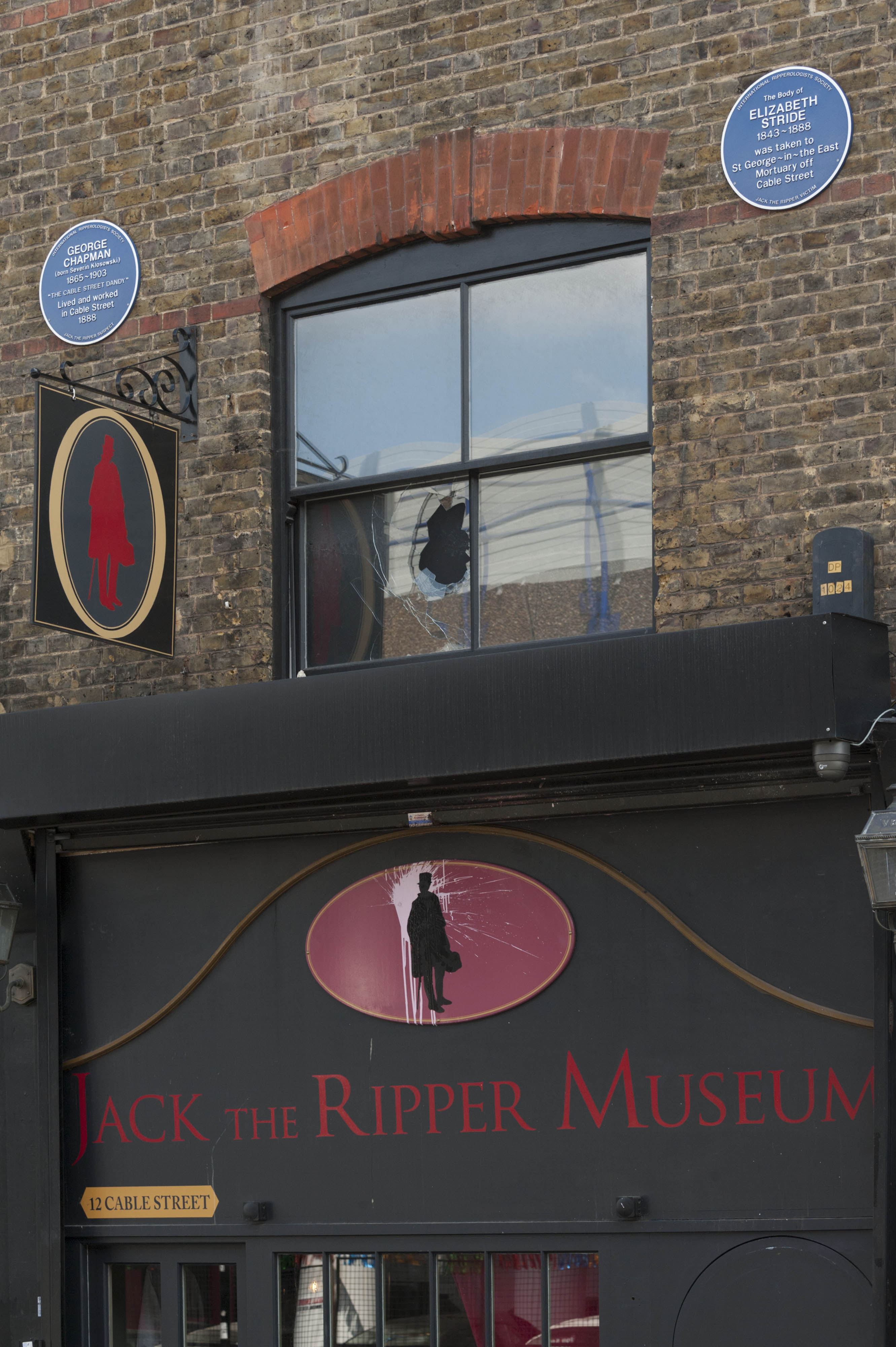
"title": "12 Cable Street, facade in 2017",
"author": {
"id": 27,
"username": "DerekKendall"
},
"feature": {
"id": 1376,
"type": "Feature",
"geometry": {
"type": "MultiPolygon",
"coordinates": [
[
[
[
-0.067940770062805,
51.510695148477346
],
[
-0.067956121490136,
51.51075409026937
],
[
-0.067956121490136,
51.51075409026937
],
[
-0.067887886383568,
51.51075590403737
],
[
-0.067875349403458,
51.51069988445148
],
[
-0.067940770062805,
51.510695148477346
]
]
]
]
},
"properties": {
"b_number": "12",
"b_name": "Jack the Ripper Museum, 12 Cable Street",
"street": "Cable Street",
"address": "Jack the Ripper Museum, 12 Cable Street",
"feature_type": "WHITECHAPEL_BUILDING",
"count": 8,
"search_str": "Jack the Ripper Museum, 12 Cable Street"
},
"tags": [
"Charles Henry Harrod"
]
},
"file": "https://surveyoflondon.org/media/uploads/features/1376/SoL%20Whitechapel%20101134.jpg",
"description": "",
"copyright": true,
"created": "2017-08-02"
},
{
"id": 792,
"title": "11-19 Whitechurch Lane in 2017",
"author": {
"id": 27,
"username": "DerekKendall"
},
"feature": {
"id": 142,
"type": "Feature",
"geometry": {
"type": "MultiPolygon",
"coordinates": [
[
[
[
-0.069126224544899,
51.515558849026164
],
[
-0.069240640768582,
51.5155289531881
],
[
-0.069240647310599,
51.51552894973457
],
[
-0.069240652002255,
51.51552895642242
],
[
-0.069337650654143,
51.515502135962606
],
[
-0.06936636946444,
51.51553864705814
],
[
-0.06926099560633,
51.51556742365802
],
[
-0.069260946514621,
51.51556743076239
],
[
-0.069133866951602,
51.51560102001405
],
[
-0.069111479703893,
51.51557006198587
],
[
-0.069126227710551,
51.51555885436859
],
[
-0.069126224544899,
51.515558849026164
]
]
]
]
},
"properties": {
"b_number": "17",
"b_name": "",
"street": "White Church Lane",
"address": "17 White Church Lane",
"feature_type": "WHITECHAPEL_BUILDING",
"count": 3,
"search_str": "17 White Church Lane"
},
"tags": []
},
"file": "https://surveyoflondon.org/media/uploads/features/142/SoL%20Whitechapel%20101431.jpg",
"description": "",
"copyright": true,
"created": "2017-09-12"
},
{
"id": 677,
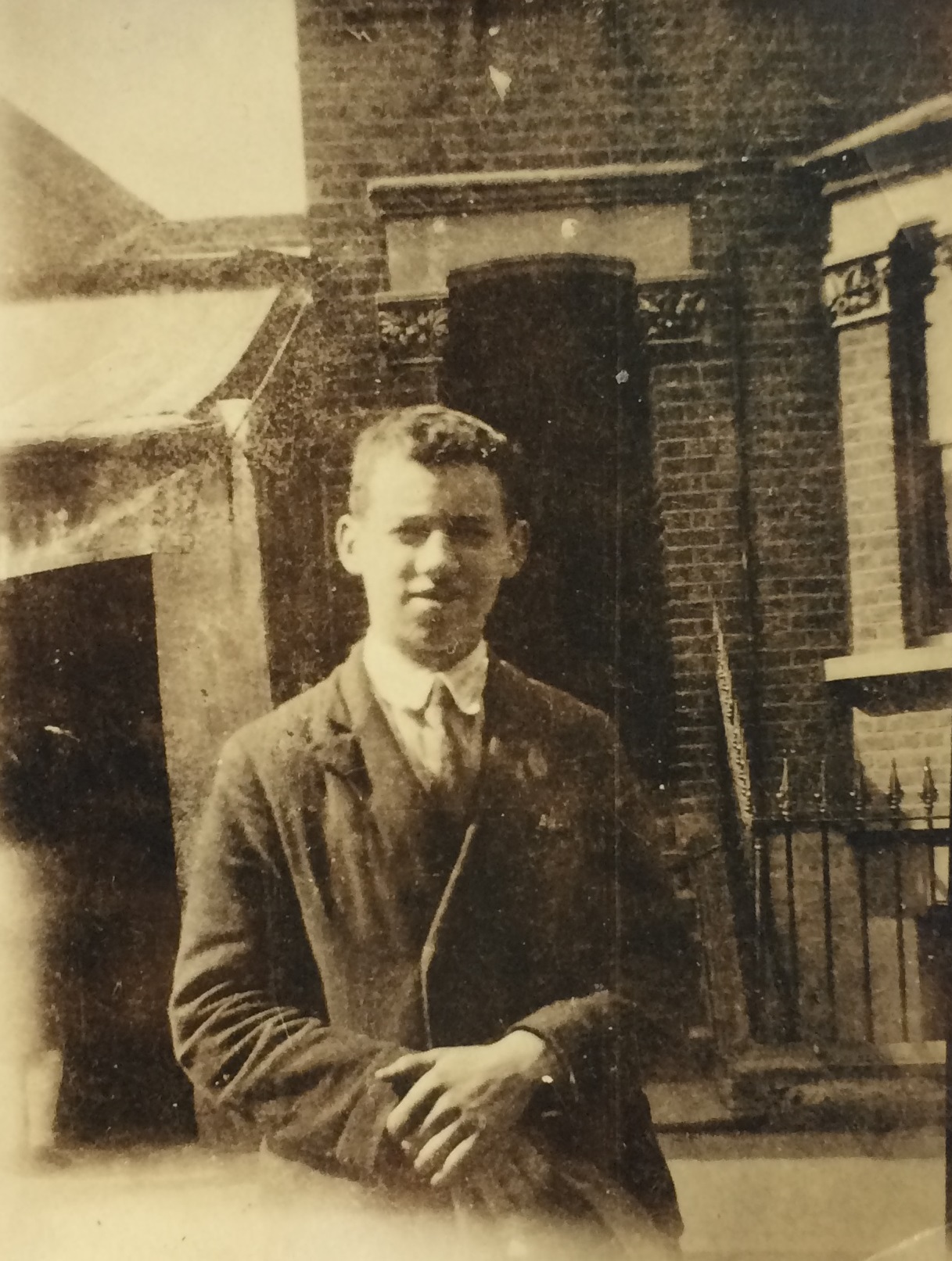
"title": "Lewis Nyman outside 47 Old Montague Street, c. 1930",
"author": {
"id": 155,
"username": "Denis"
},
"feature": {
"id": 273,
"type": "Feature",
"geometry": {
"type": "MultiPolygon",
"coordinates": [
[
[
[
-0.068974291434595,
51.51766597962726
],
[
-0.068974283222104,
51.51766598158452
],
[
-0.068834913599773,
51.517699196814895
],
[
-0.068812439942397,
51.517664497623926
],
[
-0.068952655404238,
51.51762914864754
],
[
-0.068974291434595,
51.51766597962726
]
]
]
]
},
"properties": {
"b_number": "21",
"b_name": "",
"street": "Old Montague Street",
"address": "21 Old Montague Street",
"feature_type": "WHITECHAPEL_BUILDING",
"count": 14,
"search_str": "21 Old Montague Street"
},
"tags": []
},
"file": "https://surveyoflondon.org/media/uploads/features/273/OldMontague%20Street%20Lewis%20Nyman%20at%2047%20c%201930.jpg",
"description": "This photograph shows my father, Lewis Nyman, b. 1913, outside 47 Old Montague Street, c. 1930. He was later an officer with the London Fire Brigade based at Whitechapel fire station on Commercial Road. ",
"copyright": false,
"created": "2017-06-05"
},
{
"id": 721,
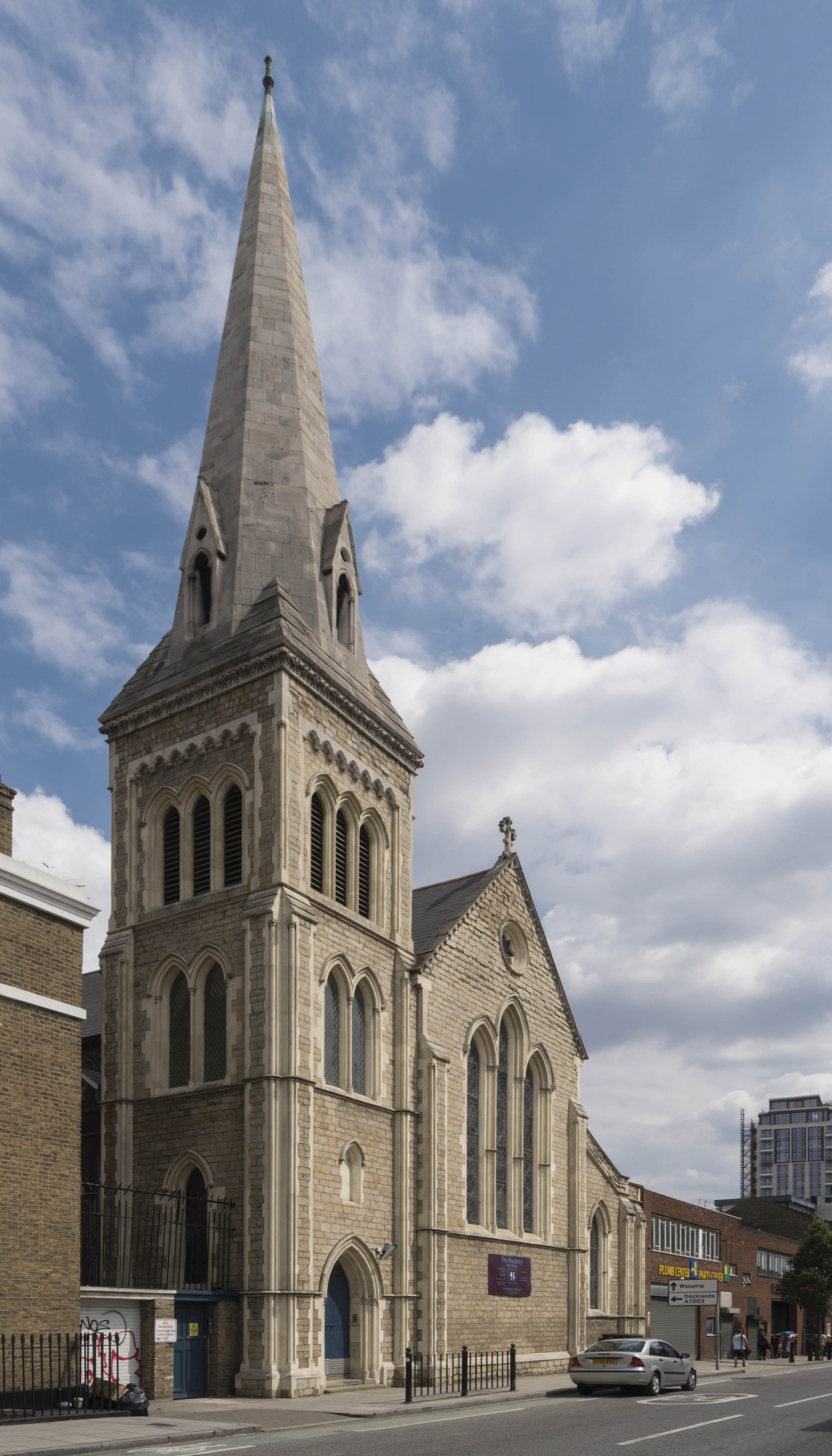
"title": "Church of St Paul from the north-west in 2017",
"author": {
"id": 27,
"username": "DerekKendall"
},
"feature": {
"id": 1371,
"type": "Feature",
"geometry": {
"type": "MultiPolygon",
"coordinates": [
[
[
[
-0.068057208494737,
51.50994707934026
],
[
-0.068128144074089,
51.510098245489516
],
[
-0.067833383002716,
51.510150364911766
],
[
-0.0678086195768,
51.51009705078618
],
[
-0.067791713048129,
51.51010026052854
],
[
-0.067768418439094,
51.51005627276704
],
[
-0.06778532495294,
51.510053063027875
],
[
-0.06776230081429,
51.510002684478415
],
[
-0.068057208494737,
51.50994707934026
]
]
]
]
},
"properties": {
"b_number": "",
"b_name": "St Paul's Church",
"street": "Dock Street",
"address": "Former Church of St Paul, Dock Street",
"feature_type": "WHITECHAPEL_BUILDING",
"count": 16,
"search_str": "St Paul's Church"
},
"tags": [
"Capt. Robert J. Elliot",
"Henry Roberts",
"James Pennethorne",
"Rev. Dan Greatorex",
"Rev. Joseph Williamson",
"William Cubitt"
]
},
"file": "https://surveyoflondon.org/media/uploads/features/1371/SoL%20Whitechapel%20101148.jpg",
"description": "",
"copyright": true,
"created": "2017-08-02"
},
{
"id": 686,
"title": "Drawing by Betty Heller showing Mulberry Street (formerly Sion Square), looking north from the present-day German Church ",
"author": {
"id": 154,
"username": "CharlesHeller"
},
"feature": {
"id": 301,
"type": "Feature",
"geometry": {
"type": "MultiPolygon",
"coordinates": [
[
[
[
-0.067736975376783,
51.51614633297866
],
[
-0.067736964788515,
51.51614633139776
],
[
-0.067438878078407,
51.51626048776608
],
[
-0.067384045533061,
51.51620177426893
],
[
-0.06686585726795,
51.516354207114226
],
[
-0.066894961295245,
51.516392721034535
],
[
-0.066827400254887,
51.516412594884436
],
[
-0.066798572993988,
51.51637444713945
],
[
-0.066765252861003,
51.516384248613996
],
[
-0.066686306327938,
51.51627977648115
],
[
-0.06755668359082,
51.51602374125061
],
[
-0.067648667130944,
51.516056627121685
],
[
-0.067736975376783,
51.51614633297866
]
]
]
]
},
"properties": {
"b_number": "42",
"b_name": "",
"street": "Adler Street",
"address": "Qbic London City, 42 Adler Street",
"feature_type": "WHITECHAPEL_BUILDING",
"count": 6,
"search_str": "Qbic London City, 42 Adler Street"
},
"tags": [
"Buck & Hickman",
"George public house",
"hotel"
]
},
"file": "https://surveyoflondon.org/media/uploads/features/301/Combined.jpg",
"description": "",
"copyright": false,
"created": "2017-06-22"
},
{
"id": 676,
"title": "Lewis Nyman outside Easington Buildings, c. 1930",
"author": {
"id": 155,
"username": "Denis"
},
"feature": {
"id": 117,
"type": "Feature",
"geometry": {
"type": "MultiPolygon",
"coordinates": [
[
[
[
-0.06806827102344,
51.51747178453937
],
[
-0.068101460895763,
51.51750668263352
],
[
-0.068127081637937,
51.517498546917075
],
[
-0.068190979657861,
51.51758385745302
],
[
-0.06829264666674,
51.517552117841184
],
[
-0.068193960734805,
51.51742791101118
],
[
-0.068154357739905,
51.51743980556263
],
[
-0.068141906920262,
51.51742433319862
],
[
-0.068105152860582,
51.51743547923236
],
[
-0.068058267880135,
51.517384497187955
],
[
-0.068185267578645,
51.517342892799604
],
[
-0.068176984365513,
51.51733176372423
],
[
-0.068232283025454,
51.517312589784154
],
[
-0.068245264806965,
51.51732579782641
],
[
-0.068349859999212,
51.51729116780716
],
[
-0.068381711363567,
51.51732332091475
],
[
-0.068370261386016,
51.517328857540846
],
[
-0.068386883278381,
51.517345670853146
],
[
-0.068353452172759,
51.51735863808482
],
[
-0.068364356622077,
51.517372017514376
],
[
-0.068324950715624,
51.51738493821042
],
[
-0.068423503323907,
51.517510563231795
],
[
-0.068525811707463,
51.5174780488514
],
[
-0.068459279552895,
51.5173960957796
],
[
-0.06848999930739,
51.51738638811417
],
[
-0.068462444488936,
51.517352446533394
],
[
-0.06855236156189,
51.51732403201941
],
[
-0.068580214092029,
51.51735834023238
],
[
-0.068608963350004,
51.51734925521336
],
[
-0.068669270516383,
51.51742378261138
],
[
-0.068661546933835,
51.51742679419159
],
[
-0.068667297973198,
51.51743276025812
],
[
-0.068797448001574,
51.517394679413954
],
[
-0.068810502647693,
51.517410759726395
],
[
-0.068837814802948,
51.51740212878775
],
[
-0.068886801726823,
51.51746246921991
],
[
-0.068831490904135,
51.51747994803719
],
[
-0.068845898830914,
51.51749769522596
],
[
-0.068010308641992,
51.51776217191367
],
[
-0.068002801697141,
51.517750038795626
],
[
-0.067963954086376,
51.51776348409939
],
[
-0.067887414413438,
51.517668911097104
],
[
-0.068041157787481,
51.517620328198426
],
[
-0.068045878204274,
51.51761817542481
],
[
-0.068041681668751,
51.51761310235492
],
[
-0.068037199428783,
51.5176147798915
],
[
-0.067951551647237,
51.51750995146181
],
[
-0.06806827102344,
51.51747178453937
]
]
]
]
},
"properties": {
"b_number": "60",
"b_name": "Hopetown",
"street": "Old Montague Street",
"address": "Hopetown, 60 Old Montague Street",
"feature_type": "WHITECHAPEL_BUILDING",
"count": 6,
"search_str": "Hopetown"
},
"tags": [
"hostel",
"Salvation Army"
]
},
"file": "https://surveyoflondon.org/media/uploads/features/117/Old%20Montague%20Street%20Lewis%20Nyman%20c%201930%20crop.jpg",
"description": "This photograph looking east along Old Montague Street, near the entry to King's Arms Court, is of Lewis Nyman, b. 1913, later an officer with the London Fire Brigade, based at Whitechapel Fire Station in Commercial Road",
"copyright": false,
"created": "2017-06-05"
},
{
"id": 1457,
"title": "8-16 New Road in November 2018",
"author": {
"id": 27,
"username": "DerekKendall"
},
"feature": {
"id": 1135,
"type": "Feature",
"geometry": {
"type": "MultiPolygon",
"coordinates": [
[
[
[
-0.061938871316412,
51.51538025540808
],
[
-0.061827847722865,
51.51538932820588
],
[
-0.061824316933417,
51.51537248761009
],
[
-0.061769739293505,
51.515376712236055
],
[
-0.0617652840551,
51.51535363242298
],
[
-0.061819909564877,
51.515349190087086
],
[
-0.06193045363785,
51.51534015647431
],
[
-0.061938871316412,
51.51538025540808
]
]
]
]
},
"properties": {
"b_number": "14",
"b_name": "",
"street": "New Road",
"address": "14 New Road",
"feature_type": "WHITECHAPEL_BUILDING",
"count": 6,
"search_str": "14 New Road"
},
"tags": []
},
"file": "https://surveyoflondon.org/media/uploads/features/1135/SoL%20Whitechapel%20102449.jpg",
"description": "",
"copyright": true,
"created": "2018-11-28"
}
]
}