HTTP 200 OK
Allow: GET, HEAD, OPTIONS
Content-Type: application/json
Vary: Accept
{
"count": 1747,
"next": "https://surveyoflondon.org/api/v1/images/?format=api&page=33",
"previous": "https://surveyoflondon.org/api/v1/images/?format=api&page=31",
"results": [
{
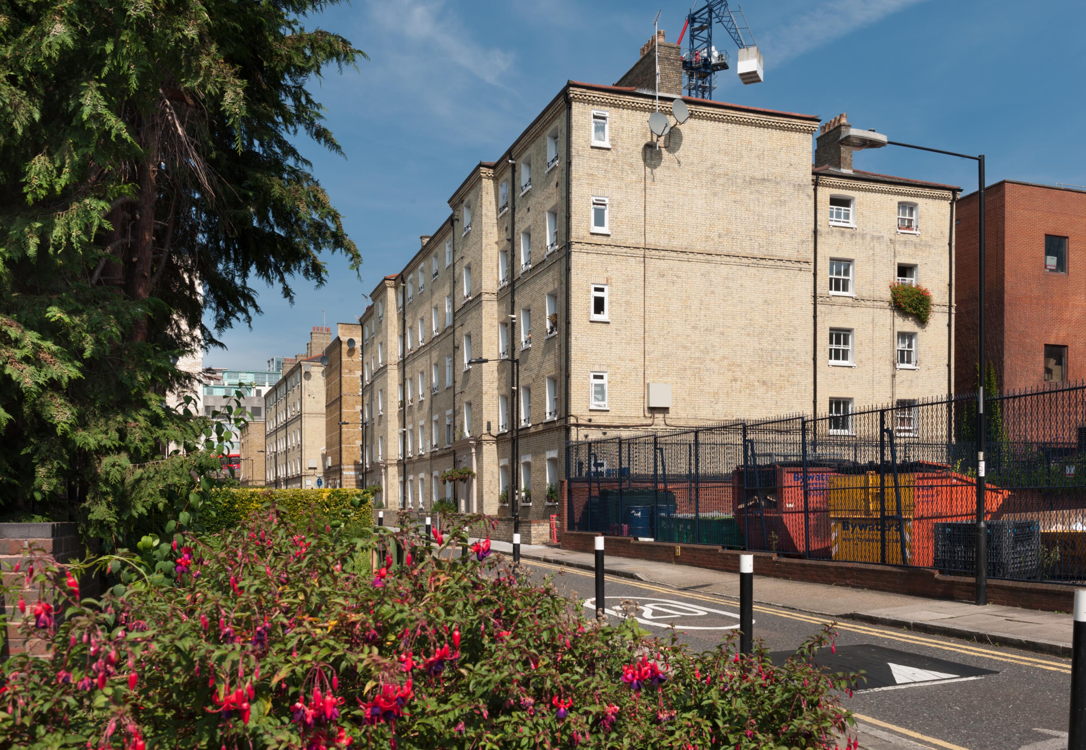
"id": 822,
"title": "Blocks B and C, Peabody Estate Whitechapel, from the south-west in 2017",
"author": {
"id": 27,
"username": "DerekKendall"
},
"feature": {
"id": 1352,
"type": "Feature",
"geometry": {
"type": "MultiPolygon",
"coordinates": [
[
[
[
-0.068980253673337,
51.509997638390146
],
[
-0.068823086473226,
51.5100236320231
],
[
-0.068789903646787,
51.50995139715312
],
[
-0.068759854759232,
51.50995556245091
],
[
-0.068775169227535,
51.509990765933516
],
[
-0.068664263939354,
51.51000874511573
],
[
-0.068614676937933,
51.509900744520685
],
[
-0.068723801013164,
51.5098809884877
],
[
-0.068738030639538,
51.509911656976705
],
[
-0.068770392613036,
51.50990505665727
],
[
-0.068710237477159,
51.50978231902587
],
[
-0.06867829833462,
51.50978703569193
],
[
-0.06869025053137,
51.50981344599384
],
[
-0.068578303371593,
51.50983373801831
],
[
-0.068524992652128,
51.50972567377717
],
[
-0.068637066219804,
51.50970247355177
],
[
-0.068653534979427,
51.50973245337327
],
[
-0.06868738906496,
51.50972660321021
],
[
-0.068647407167212,
51.509656624693264
],
[
-0.068790578161074,
51.509626356904455
],
[
-0.068827420420714,
51.5097044435053
],
[
-0.068837780441953,
51.50970228403377
],
[
-0.068858347428686,
51.50974572930374
],
[
-0.068852676360026,
51.509747383474846
],
[
-0.068919152674699,
51.509875176556776
],
[
-0.068930433292494,
51.509873323497544
],
[
-0.068949282406989,
51.509913245333344
],
[
-0.068942690757891,
51.509914593088745
],
[
-0.068980253673337,
51.509997638390146
]
]
]
]
},
"properties": {
"b_number": "",
"b_name": "Blocks B and C",
"street": "John Fisher Street",
"address": "Blocks B and C, John Fisher Street, Peabody Estate Whitechapel",
"feature_type": "WHITECHAPEL_BUILDING",
"count": 14,
"search_str": "Blocks B and C"
},
"tags": []
},
"file": "https://surveyoflondon.org/media/uploads/features/1352/SoL%20Whitechapel%20101603.jpg",
"description": "",
"copyright": true,
"created": "2017-09-12"
},
{
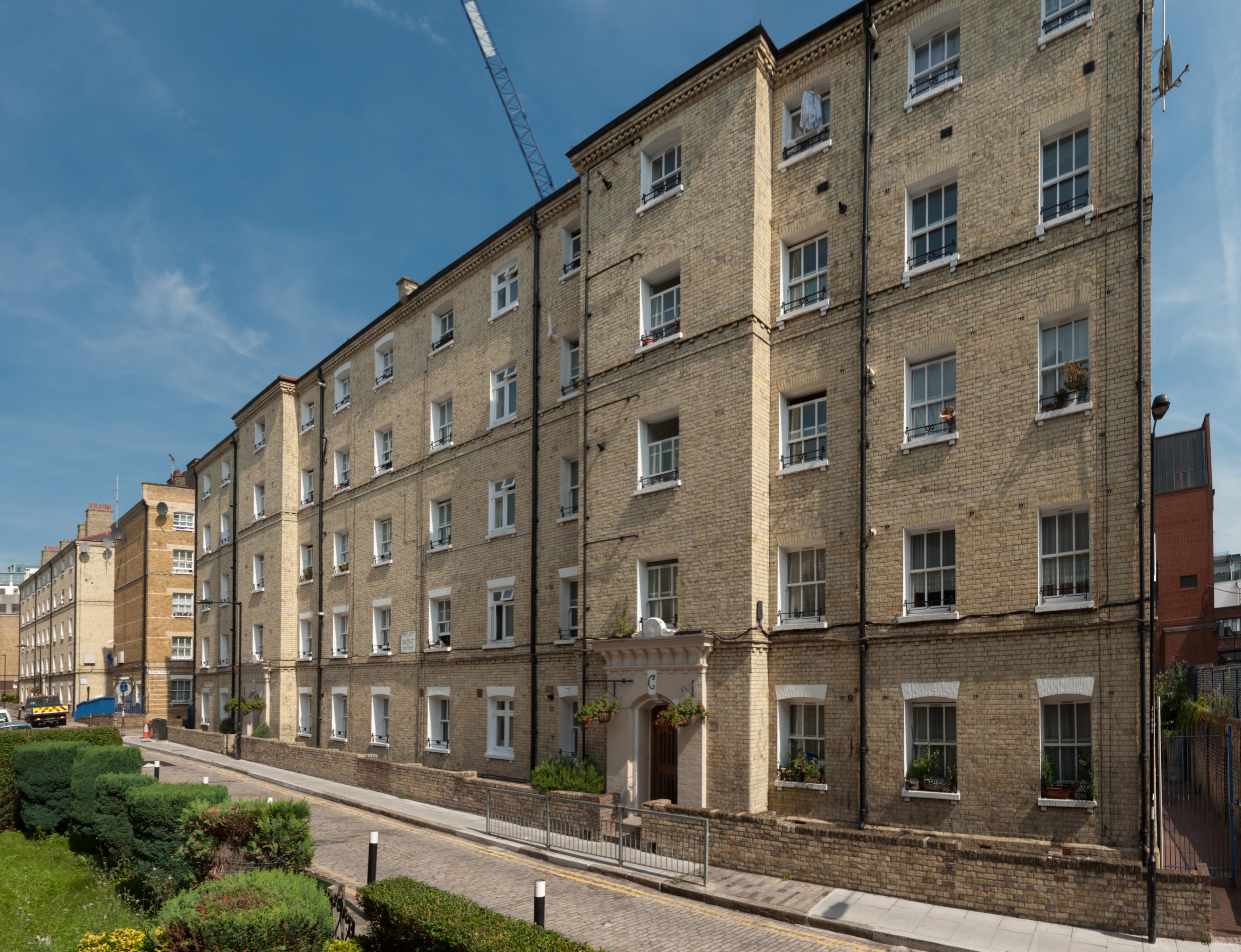
"id": 823,
"title": "Blocks B and C, Peabody Estate Whitechapel, from the south-west in 2017",
"author": {
"id": 27,
"username": "DerekKendall"
},
"feature": {
"id": 1352,
"type": "Feature",
"geometry": {
"type": "MultiPolygon",
"coordinates": [
[
[
[
-0.068980253673337,
51.509997638390146
],
[
-0.068823086473226,
51.5100236320231
],
[
-0.068789903646787,
51.50995139715312
],
[
-0.068759854759232,
51.50995556245091
],
[
-0.068775169227535,
51.509990765933516
],
[
-0.068664263939354,
51.51000874511573
],
[
-0.068614676937933,
51.509900744520685
],
[
-0.068723801013164,
51.5098809884877
],
[
-0.068738030639538,
51.509911656976705
],
[
-0.068770392613036,
51.50990505665727
],
[
-0.068710237477159,
51.50978231902587
],
[
-0.06867829833462,
51.50978703569193
],
[
-0.06869025053137,
51.50981344599384
],
[
-0.068578303371593,
51.50983373801831
],
[
-0.068524992652128,
51.50972567377717
],
[
-0.068637066219804,
51.50970247355177
],
[
-0.068653534979427,
51.50973245337327
],
[
-0.06868738906496,
51.50972660321021
],
[
-0.068647407167212,
51.509656624693264
],
[
-0.068790578161074,
51.509626356904455
],
[
-0.068827420420714,
51.5097044435053
],
[
-0.068837780441953,
51.50970228403377
],
[
-0.068858347428686,
51.50974572930374
],
[
-0.068852676360026,
51.509747383474846
],
[
-0.068919152674699,
51.509875176556776
],
[
-0.068930433292494,
51.509873323497544
],
[
-0.068949282406989,
51.509913245333344
],
[
-0.068942690757891,
51.509914593088745
],
[
-0.068980253673337,
51.509997638390146
]
]
]
]
},
"properties": {
"b_number": "",
"b_name": "Blocks B and C",
"street": "John Fisher Street",
"address": "Blocks B and C, John Fisher Street, Peabody Estate Whitechapel",
"feature_type": "WHITECHAPEL_BUILDING",
"count": 14,
"search_str": "Blocks B and C"
},
"tags": []
},
"file": "https://surveyoflondon.org/media/uploads/features/1352/SoL%20Whitechapel%20101606.jpg",
"description": "",
"copyright": true,
"created": "2017-09-12"
},
{
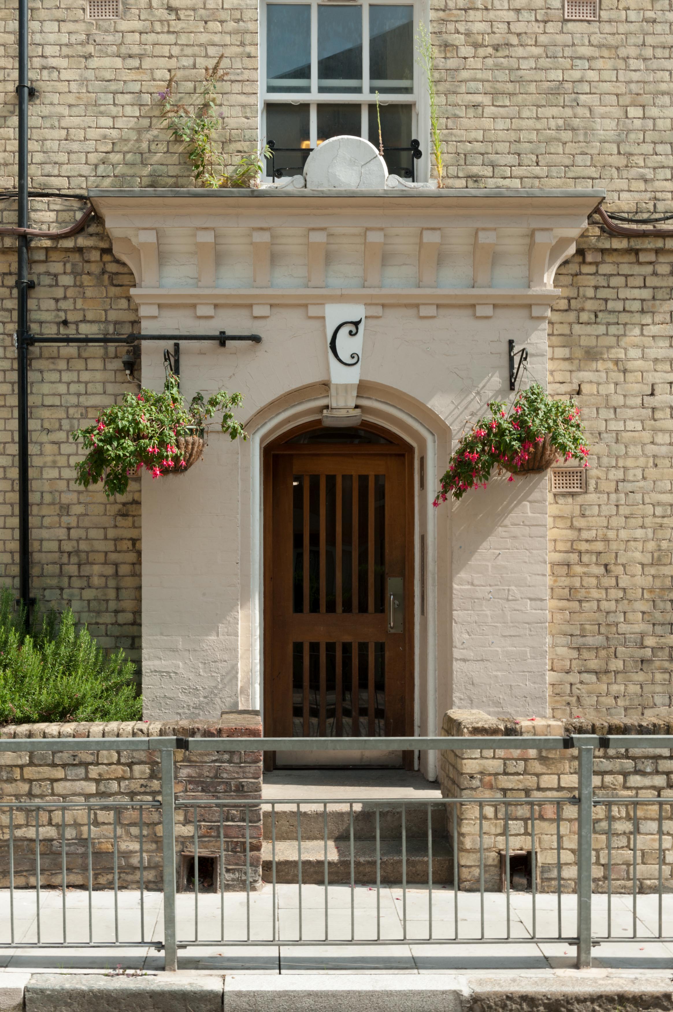
"id": 824,
"title": "Block C, Peabody Estate Whitechapel, entrance detail in 2017",
"author": {
"id": 27,
"username": "DerekKendall"
},
"feature": {
"id": 1352,
"type": "Feature",
"geometry": {
"type": "MultiPolygon",
"coordinates": [
[
[
[
-0.068980253673337,
51.509997638390146
],
[
-0.068823086473226,
51.5100236320231
],
[
-0.068789903646787,
51.50995139715312
],
[
-0.068759854759232,
51.50995556245091
],
[
-0.068775169227535,
51.509990765933516
],
[
-0.068664263939354,
51.51000874511573
],
[
-0.068614676937933,
51.509900744520685
],
[
-0.068723801013164,
51.5098809884877
],
[
-0.068738030639538,
51.509911656976705
],
[
-0.068770392613036,
51.50990505665727
],
[
-0.068710237477159,
51.50978231902587
],
[
-0.06867829833462,
51.50978703569193
],
[
-0.06869025053137,
51.50981344599384
],
[
-0.068578303371593,
51.50983373801831
],
[
-0.068524992652128,
51.50972567377717
],
[
-0.068637066219804,
51.50970247355177
],
[
-0.068653534979427,
51.50973245337327
],
[
-0.06868738906496,
51.50972660321021
],
[
-0.068647407167212,
51.509656624693264
],
[
-0.068790578161074,
51.509626356904455
],
[
-0.068827420420714,
51.5097044435053
],
[
-0.068837780441953,
51.50970228403377
],
[
-0.068858347428686,
51.50974572930374
],
[
-0.068852676360026,
51.509747383474846
],
[
-0.068919152674699,
51.509875176556776
],
[
-0.068930433292494,
51.509873323497544
],
[
-0.068949282406989,
51.509913245333344
],
[
-0.068942690757891,
51.509914593088745
],
[
-0.068980253673337,
51.509997638390146
]
]
]
]
},
"properties": {
"b_number": "",
"b_name": "Blocks B and C",
"street": "John Fisher Street",
"address": "Blocks B and C, John Fisher Street, Peabody Estate Whitechapel",
"feature_type": "WHITECHAPEL_BUILDING",
"count": 14,
"search_str": "Blocks B and C"
},
"tags": []
},
"file": "https://surveyoflondon.org/media/uploads/features/1352/SoL%20Whitechapel%20101607.jpg",
"description": "",
"copyright": true,
"created": "2017-09-12"
},
{
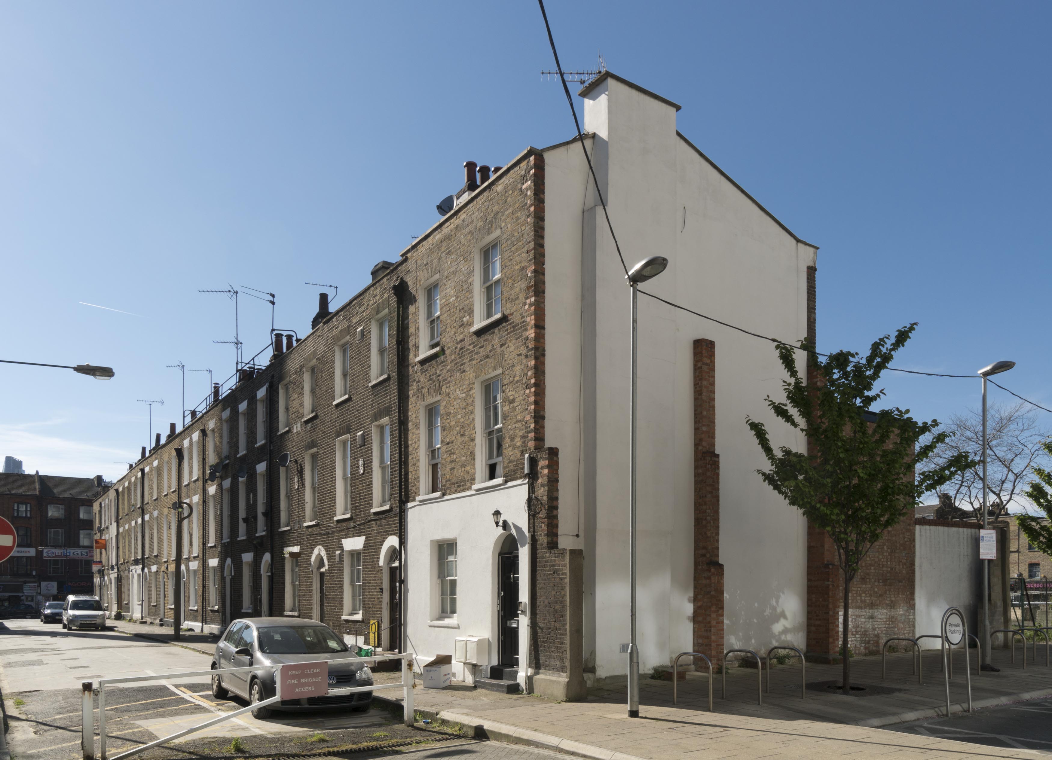
"id": 664,
"title": "Mount Terrace from the east in 2017",
"author": {
"id": 27,
"username": "DerekKendall"
},
"feature": {
"id": 1175,
"type": "Feature",
"geometry": {
"type": "MultiPolygon",
"coordinates": [
[
[
[
-0.062080947471919,
51.518019853005946
],
[
-0.062117387834708,
51.51808284263647
],
[
-0.062061959179686,
51.518095324099704
],
[
-0.062025317454428,
51.51803198626631
],
[
-0.062080947471919,
51.518019853005946
]
]
]
]
},
"properties": {
"b_number": "29",
"b_name": "",
"street": "Mount Terrace",
"address": "29 Mount Terrace",
"feature_type": "WHITECHAPEL_BUILDING",
"count": 4,
"search_str": "29 Mount Terrace"
},
"tags": []
},
"file": "https://surveyoflondon.org/media/uploads/features/1175/SoL%20Whitechapel%20100553.jpg",
"description": "",
"copyright": true,
"created": "2017-05-09"
},
{
"id": 834,
"title": "Elevation, August 2017",
"author": {
"id": 27,
"username": "DerekKendall"
},
"feature": {
"id": 44,
"type": "Feature",
"geometry": {
"type": "MultiPolygon",
"coordinates": [
[
[
[
-0.072784603564218,
51.5126980555633
],
[
-0.072798831781275,
51.51279415378411
],
[
-0.072652036138757,
51.51280335953512
],
[
-0.072635717286442,
51.51270592523098
],
[
-0.072784603564218,
51.5126980555633
]
]
]
]
},
"properties": {
"b_number": "31",
"b_name": "",
"street": "West Tenter Street",
"address": "31 West Tenter Street",
"feature_type": "WHITECHAPEL_BUILDING",
"count": 4,
"search_str": "31 West Tenter Street"
},
"tags": []
},
"file": "https://surveyoflondon.org/media/uploads/features/44/SoL%20Whitechapel%20101568.jpg",
"description": "",
"copyright": true,
"created": "2017-09-12"
},
{
"id": 895,
"title": "Whitechapel High Street and Aldgate Place, August 2017",
"author": {
"id": 27,
"username": "DerekKendall"
},
"feature": {
"id": 1743,
"type": "Feature",
"geometry": {
"type": "MultiPolygon",
"coordinates": [
[
[
[
-0.073411821699579,
51.51467674446512
],
[
-0.072731355303774,
51.514916811528764
],
[
-0.07188498637862,
51.51521927010499
],
[
-0.071325614752325,
51.51544095498937
],
[
-0.070774639967226,
51.515605952693505
],
[
-0.069847461990603,
51.51600844129137
],
[
-0.069612775522787,
51.51611554197248
],
[
-0.069514933844418,
51.51603777987923
],
[
-0.07062003013613,
51.51555119093597
],
[
-0.071250881804969,
51.51535269561576
],
[
-0.071777920220375,
51.515135083966406
],
[
-0.073328190602561,
51.5145926917498
],
[
-0.073411821699579,
51.51467674446512
]
]
]
]
},
"properties": {
"b_number": "",
"b_name": "",
"street": "",
"address": "Whitechapel High Street",
"feature_type": "PLACE",
"count": 14,
"search_str": "Whitechapel High Street"
},
"tags": []
},
"file": "https://surveyoflondon.org/media/uploads/features/1743/SoL%20Whitechapel%20101329.jpg",
"description": "The far point of the triangular site in the foreground is the site of Gardiner's Corner, a local landmark department store till it closed in 1971. It burned down in May 1972.",
"copyright": true,
"created": "2017-09-26"
},
{
"id": 1327,
"title": "Former churchyard wall, Whitechapel Road, summer 2018",
"author": {
"id": 27,
"username": "DerekKendall"
},
"feature": {
"id": 296,
"type": "Feature",
"geometry": {
"type": "MultiPolygon",
"coordinates": [
[
[
[
-0.069238538289603,
51.51610506120929
],
[
-0.069007097235987,
51.5162239535272
],
[
-0.068282200256798,
51.51654369745104
],
[
-0.068157401560378,
51.51641994527148
],
[
-0.067807959279103,
51.51600137496063
],
[
-0.068541180339468,
51.515783257348254
],
[
-0.068555919008956,
51.51580580160597
],
[
-0.068713893455475,
51.515872451567986
],
[
-0.068778503699218,
51.51586114158782
],
[
-0.068817146392177,
51.515922550138725
],
[
-0.068888047037903,
51.51596428315636
],
[
-0.069016085124709,
51.515921053627785
],
[
-0.069107698271647,
51.51601562404751
],
[
-0.069243279190738,
51.515974904669626
],
[
-0.069238538289603,
51.51610506120929
]
]
]
]
},
"properties": {
"b_number": "",
"b_name": "Altab Ali Park, including the site of the parish church of St Mary Matfelon",
"street": "Whitechapel Road",
"address": "Altab Ali Park",
"feature_type": "OPEN_SPACE",
"count": 32,
"search_str": "Altab Ali Park, including the site of the parish church of St Mary Matfelon"
},
"tags": []
},
"file": "https://surveyoflondon.org/media/uploads/features/296/SoL%20Whitechapel%20102093.jpg",
"description": "",
"copyright": true,
"created": "2018-08-13"
},
{
"id": 854,
"title": "Facade detail, August 2017",
"author": {
"id": 27,
"username": "DerekKendall"
},
"feature": {
"id": 79,
"type": "Feature",
"geometry": {
"type": "MultiPolygon",
"coordinates": [
[
[
[
-0.070548194239689,
51.51314308206007
],
[
-0.070484646321357,
51.51306089823059
],
[
-0.070566483903249,
51.513038423432384
],
[
-0.07055574158657,
51.51302526610146
],
[
-0.07052551682963,
51.51303256769445
],
[
-0.070489489998683,
51.51298392076877
],
[
-0.070609649264874,
51.51294753535601
],
[
-0.070726020130319,
51.51309155496748
],
[
-0.070548194239689,
51.51314308206007
]
]
]
]
},
"properties": {
"b_number": "18",
"b_name": "Albion Mills",
"street": "East Tenter Street",
"address": "Albion Mills, 18 East Tenter Street",
"feature_type": "WHITECHAPEL_BUILDING",
"count": 3,
"search_str": "Albion Mills"
},
"tags": []
},
"file": "https://surveyoflondon.org/media/uploads/features/79/SoL%20Whitechapel%20101597.jpg",
"description": "",
"copyright": true,
"created": "2017-09-12"
},
{
"id": 304,
"title": "Drinking Fountain, 1911, W. S. Frith, figure of Justice",
"author": {
"id": 27,
"username": "DerekKendall"
},
"feature": {
"id": 1698,
"type": "Feature",
"geometry": {
"type": "MultiPolygon",
"coordinates": [
[
[
[
-0.062755898137067,
51.51857235799611
],
[
-0.058216859270041,
51.51960039921044
],
[
-0.058148482851386,
51.51948612756745
],
[
-0.061091729886378,
51.51883423152082
],
[
-0.061616259170046,
51.51871888429734
],
[
-0.06270768344222,
51.51847582817058
],
[
-0.062755898137067,
51.51857235799611
]
]
]
]
},
"properties": {
"b_number": "",
"b_name": "",
"street": "Whitechapel Road",
"address": "Whitechapel Market, Whitechapel Road",
"feature_type": "PLACE",
"count": 48,
"search_str": "Whitechapel Market, Whitechapel Road"
},
"tags": []
},
"file": "https://surveyoflondon.org/media/uploads/features/491/SoL%20Whitechapel100411.jpg",
"description": "",
"copyright": true,
"created": "2016-08-23"
},
{
"id": 351,
"title": "The London Hospital Medical College in 1887, looking north-east",
"author": {
"id": 37,
"username": "HistoricEngland"
},
"feature": {
"id": 1189,
"type": "Feature",
"geometry": {
"type": "MultiPolygon",
"coordinates": [
[
[
[
-0.060957318414032,
51.51782190843071
],
[
-0.060536358742238,
51.517916494366496
],
[
-0.06042382559955,
51.5177169757099
],
[
-0.060423392052643,
51.517716267459285
],
[
-0.06037583590265,
51.51772558880798
],
[
-0.060352091559155,
51.517682266082666
],
[
-0.060399184829325,
51.5176714337657
],
[
-0.060382136461735,
51.517636775872596
],
[
-0.060366794729858,
51.51763667842599
],
[
-0.060353568375337,
51.517633521256826
],
[
-0.060340249107007,
51.51762886391949
],
[
-0.060331431296148,
51.51762072004323
],
[
-0.060328691457909,
51.51761554771857
],
[
-0.060326999079391,
51.517611443342886
],
[
-0.060327382221525,
51.517606284181284
],
[
-0.060329047985828,
51.51760203725169
],
[
-0.060331232366157,
51.517597910289986
],
[
-0.060333234968373,
51.517593887621835
],
[
-0.0603394749266,
51.51758477508556
],
[
-0.060343650894546,
51.51757832358151
],
[
-0.060315667444656,
51.51752195768432
],
[
-0.060339055445574,
51.51749626222509
],
[
-0.06039972958586,
51.51748509401273
],
[
-0.060844270778094,
51.51743888994093
],
[
-0.060875340433462,
51.517555246058656
],
[
-0.060894657489377,
51.517564918111205
],
[
-0.060905236784801,
51.51757830806902
],
[
-0.060907454524091,
51.51759005281749
],
[
-0.060906490522428,
51.51760128121761
],
[
-0.060896928755295,
51.51761642472545
],
[
-0.060890333226028,
51.51762687042926
],
[
-0.060957318414032,
51.51782190843071
]
]
]
]
},
"properties": {
"b_number": "",
"b_name": "Garrod Building",
"street": "Stepney Way",
"address": "Garrod Building",
"feature_type": "WHITECHAPEL_BUILDING",
"count": 31,
"search_str": "Garrod Building"
},
"tags": []
},
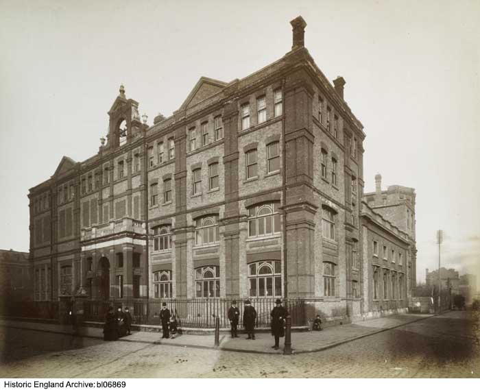
"file": "https://surveyoflondon.org/media/uploads/features/1189/bl06869.jpg",
"description": "Photograph by Bedford Lemere, reproduced by permission of the Historic England Archive (see archive.HistoricEngland.org.uk). ",
"copyright": true,
"created": "2016-09-05"
},
{
"id": 357,
"title": "The London Hospital Medical College, as depicted in The Illustrated London News on 3 May 1887",
"author": {
"id": 37,
"username": "HistoricEngland"
},
"feature": {
"id": 1189,
"type": "Feature",
"geometry": {
"type": "MultiPolygon",
"coordinates": [
[
[
[
-0.060957318414032,
51.51782190843071
],
[
-0.060536358742238,
51.517916494366496
],
[
-0.06042382559955,
51.5177169757099
],
[
-0.060423392052643,
51.517716267459285
],
[
-0.06037583590265,
51.51772558880798
],
[
-0.060352091559155,
51.517682266082666
],
[
-0.060399184829325,
51.5176714337657
],
[
-0.060382136461735,
51.517636775872596
],
[
-0.060366794729858,
51.51763667842599
],
[
-0.060353568375337,
51.517633521256826
],
[
-0.060340249107007,
51.51762886391949
],
[
-0.060331431296148,
51.51762072004323
],
[
-0.060328691457909,
51.51761554771857
],
[
-0.060326999079391,
51.517611443342886
],
[
-0.060327382221525,
51.517606284181284
],
[
-0.060329047985828,
51.51760203725169
],
[
-0.060331232366157,
51.517597910289986
],
[
-0.060333234968373,
51.517593887621835
],
[
-0.0603394749266,
51.51758477508556
],
[
-0.060343650894546,
51.51757832358151
],
[
-0.060315667444656,
51.51752195768432
],
[
-0.060339055445574,
51.51749626222509
],
[
-0.06039972958586,
51.51748509401273
],
[
-0.060844270778094,
51.51743888994093
],
[
-0.060875340433462,
51.517555246058656
],
[
-0.060894657489377,
51.517564918111205
],
[
-0.060905236784801,
51.51757830806902
],
[
-0.060907454524091,
51.51759005281749
],
[
-0.060906490522428,
51.51760128121761
],
[
-0.060896928755295,
51.51761642472545
],
[
-0.060890333226028,
51.51762687042926
],
[
-0.060957318414032,
51.51782190843071
]
]
]
]
},
"properties": {
"b_number": "",
"b_name": "Garrod Building",
"street": "Stepney Way",
"address": "Garrod Building",
"feature_type": "WHITECHAPEL_BUILDING",
"count": 31,
"search_str": "Garrod Building"
},
"tags": []
},
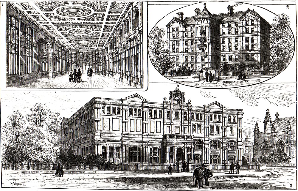
"file": "https://surveyoflondon.org/media/uploads/features/1189/Medical%20College%2C%20Royal%20London%20Hospital%2C%20ILN%2C%203-5-1887%2C%20p%20194.jpg",
"description": "Historic England London Region",
"copyright": true,
"created": "2016-09-05"
},
{
"id": 673,
"title": "25 Whitechapel Road, reconstructed first-floor plan (drawing by Helen Jones)",
"author": {
"id": 2,
"username": "surveyoflondon"
},
"feature": {
"id": 121,
"type": "Feature",
"geometry": {
"type": "MultiPolygon",
"coordinates": [
[
[
[
-0.069054122731655,
51.51672762843165
],
[
-0.068854756856642,
51.516547067549645
],
[
-0.068919228675855,
51.51651366796187
],
[
-0.069004017855321,
51.5165906183173
],
[
-0.069168802522377,
51.51674671885503
],
[
-0.069067179586633,
51.516794208110376
],
[
-0.069054122731655,
51.51672762843165
]
]
]
]
},
"properties": {
"b_number": "25",
"b_name": "",
"street": "Whitechapel Road",
"address": "25 Whitechapel Road",
"feature_type": "WHITECHAPEL_BUILDING",
"count": 3,
"search_str": "25 Whitechapel Road"
},
"tags": []
},
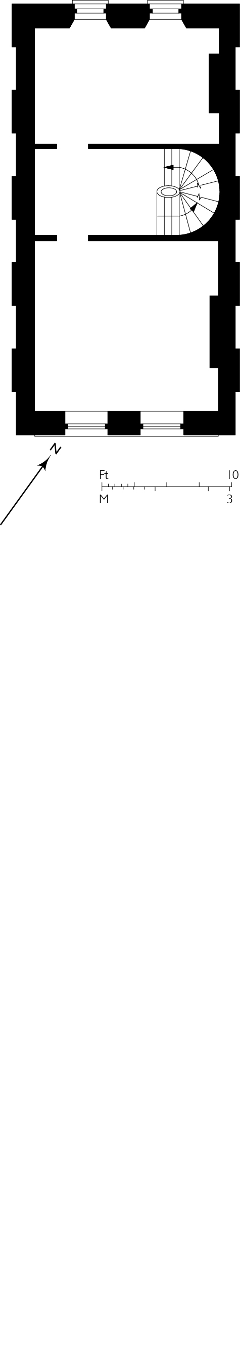
"file": "https://surveyoflondon.org/media/uploads/features/121/25%20Whitechapel%20Road.jpg",
"description": "",
"copyright": true,
"created": "2017-05-23"
},
{
"id": 862,
"title": "Former Infants' School in rear courtyard, August 2017",
"author": {
"id": 86,
"username": "sarah"
},
"feature": {
"id": 14,
"type": "Feature",
"geometry": {
"type": "MultiPolygon",
"coordinates": [
[
[
[
-0.070322287876143,
51.51429132072393
],
[
-0.070220137049335,
51.51432934981866
],
[
-0.070156634879805,
51.514263257830265
],
[
-0.070255687954261,
51.514223852106205
],
[
-0.070322287876143,
51.51429132072393
]
]
]
]
},
"properties": {
"b_number": "21",
"b_name": "Former Infant School, now flats",
"street": "Buckle Street",
"address": "Former Infant School, 21 Buckle House",
"feature_type": "WHITECHAPEL_BUILDING",
"count": 3,
"search_str": "Former Infant School, now flats"
},
"tags": []
},
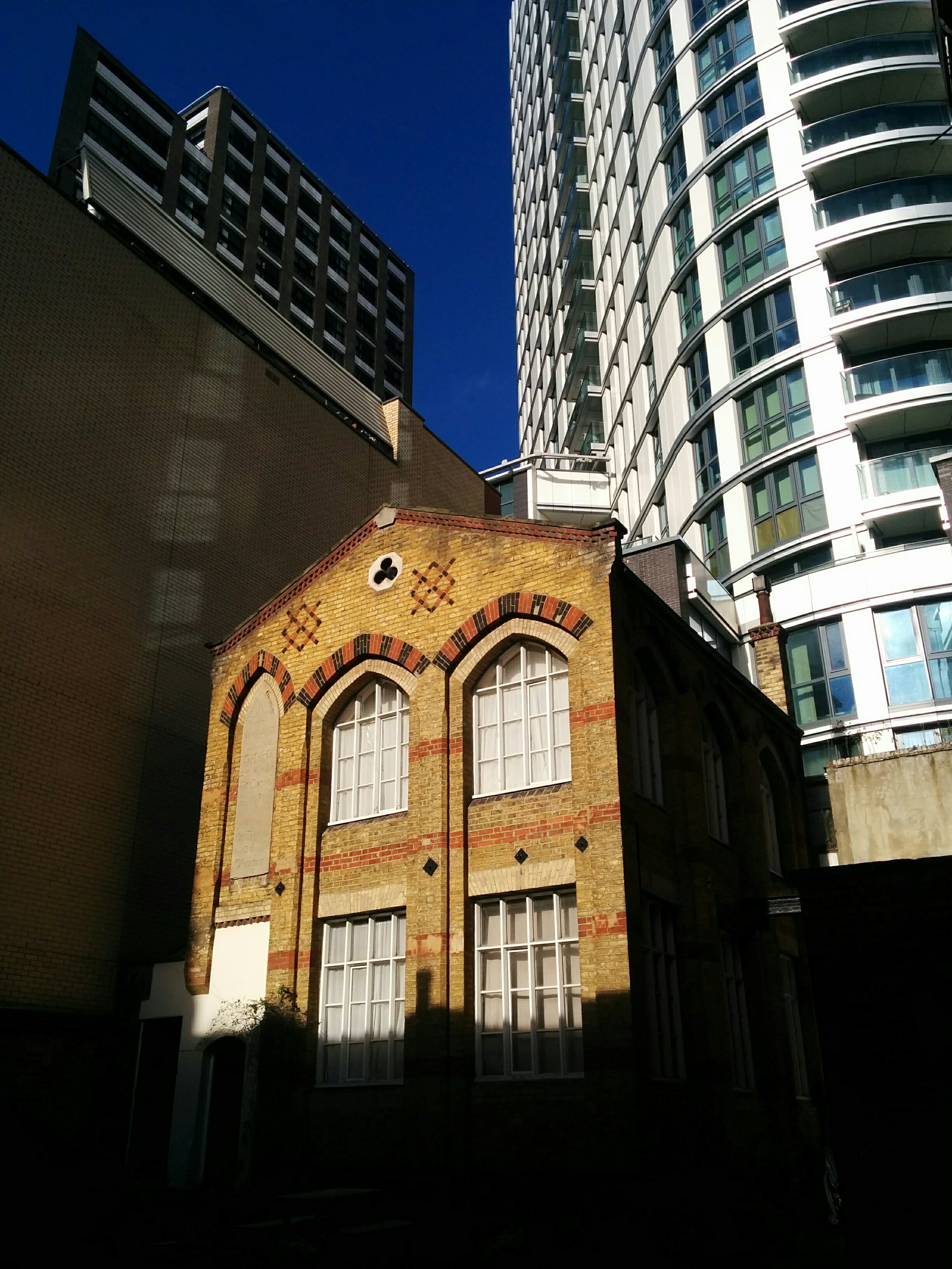
"file": "https://surveyoflondon.org/media/uploads/features/18/IMG_20170913_162949.jpg",
"description": "",
"copyright": false,
"created": "2017-09-21"
},
{
"id": 789,
"title": "Elevation to Mansell Street, August 2017",
"author": {
"id": 27,
"username": "DerekKendall"
},
"feature": {
"id": 51,
"type": "Feature",
"geometry": {
"type": "MultiPolygon",
"coordinates": [
[
[
[
-0.072928919261596,
51.5118841365536
],
[
-0.072485061184731,
51.51190593466166
],
[
-0.072449938765841,
51.51175604290379
],
[
-0.072901564349165,
51.51171434189942
],
[
-0.072928919261596,
51.5118841365536
]
]
]
]
},
"properties": {
"b_number": "83-85",
"b_name": "Tugu Building (formerly Insignia House), 83–85 Mansell Street",
"street": "Mansell Street",
"address": "Tugu Building, 83–85 Mansell Street",
"feature_type": "WHITECHAPEL_BUILDING",
"count": 4,
"search_str": "Tugu Building (formerly Insignia House), 83–85 Mansell Street"
},
"tags": []
},
"file": "https://surveyoflondon.org/media/uploads/features/51/SoL%20Whitechapel%20101515.jpg",
"description": "",
"copyright": true,
"created": "2017-09-12"
},
{
"id": 790,
"title": "Looking north east up Mansell Street",
"author": {
"id": 27,
"username": "DerekKendall"
},
"feature": {
"id": 51,
"type": "Feature",
"geometry": {
"type": "MultiPolygon",
"coordinates": [
[
[
[
-0.072928919261596,
51.5118841365536
],
[
-0.072485061184731,
51.51190593466166
],
[
-0.072449938765841,
51.51175604290379
],
[
-0.072901564349165,
51.51171434189942
],
[
-0.072928919261596,
51.5118841365536
]
]
]
]
},
"properties": {
"b_number": "83-85",
"b_name": "Tugu Building (formerly Insignia House), 83–85 Mansell Street",
"street": "Mansell Street",
"address": "Tugu Building, 83–85 Mansell Street",
"feature_type": "WHITECHAPEL_BUILDING",
"count": 4,
"search_str": "Tugu Building (formerly Insignia House), 83–85 Mansell Street"
},
"tags": []
},
"file": "https://surveyoflondon.org/media/uploads/features/51/SoL%20Whitechapel%20101516.jpg",
"description": "",
"copyright": true,
"created": "2017-09-12"
},
{
"id": 845,
"title": "Rear facade to West Tenter Street, August 2017",
"author": {
"id": 27,
"username": "DerekKendall"
},
"feature": {
"id": 51,
"type": "Feature",
"geometry": {
"type": "MultiPolygon",
"coordinates": [
[
[
[
-0.072928919261596,
51.5118841365536
],
[
-0.072485061184731,
51.51190593466166
],
[
-0.072449938765841,
51.51175604290379
],
[
-0.072901564349165,
51.51171434189942
],
[
-0.072928919261596,
51.5118841365536
]
]
]
]
},
"properties": {
"b_number": "83-85",
"b_name": "Tugu Building (formerly Insignia House), 83–85 Mansell Street",
"street": "Mansell Street",
"address": "Tugu Building, 83–85 Mansell Street",
"feature_type": "WHITECHAPEL_BUILDING",
"count": 4,
"search_str": "Tugu Building (formerly Insignia House), 83–85 Mansell Street"
},
"tags": []
},
"file": "https://surveyoflondon.org/media/uploads/features/51/SoL%20Whitechapel%20101580.jpg",
"description": "",
"copyright": true,
"created": "2017-09-12"
},
{
"id": 620,
"title": "the site of 18-24 Whitechapel Road in April 2017",
"author": {
"id": 27,
"username": "DerekKendall"
},
"feature": {
"id": 150,
"type": "Feature",
"geometry": {
"type": "MultiPolygon",
"coordinates": [
[
[
[
-0.067616460995772,
51.516817193189674
],
[
-0.067489528858448,
51.51687130946722
],
[
-0.067202726681577,
51.51660507423893
],
[
-0.067319002357261,
51.516558991934765
],
[
-0.067537613033775,
51.51675134121886
],
[
-0.067616460995772,
51.516817193189674
]
]
]
]
},
"properties": {
"b_number": "20-22",
"b_name": "",
"street": "Whitechapel Road",
"address": "20-22 Whitechapel Road",
"feature_type": "WHITECHAPEL_BUILDING",
"count": 5,
"search_str": "20-22 Whitechapel Road"
},
"tags": [
"Buck & Hickman",
"Salvation Army",
"William Booth"
]
},
"file": "https://surveyoflondon.org/media/uploads/features/150/SoL%20Whitechapel%20100732.jpg",
"description": "",
"copyright": true,
"created": "2017-05-03"
},
{
"id": 868,
"title": "Herbert House from the south east, August 2017",
"author": {
"id": 27,
"username": "DerekKendall"
},
"feature": {
"id": 355,
"type": "Feature",
"geometry": {
"type": "MultiPolygon",
"coordinates": [
[
[
[
-0.074471609124608,
51.516157394230596
],
[
-0.074094924476241,
51.51627050128873
],
[
-0.07389322310185,
51.51601309694218
],
[
-0.074264013012644,
51.515898564190884
],
[
-0.074337530456423,
51.51598441114345
],
[
-0.074271504609232,
51.516006422063526
],
[
-0.074251298845097,
51.51598282761466
],
[
-0.074049011165702,
51.51605026352619
],
[
-0.074144047562767,
51.516169151315886
],
[
-0.074359544442729,
51.51610517582989
],
[
-0.074351750936823,
51.51609801971847
],
[
-0.07440543525088,
51.51608012306834
],
[
-0.074471609124608,
51.516157394230596
]
]
]
]
},
"properties": {
"b_number": "",
"b_name": "Herbert House",
"street": "Old Castle Street",
"address": "Herbert House, Old Castle Street, London E1 7TW",
"feature_type": "WHITECHAPEL_BUILDING",
"count": 8,
"search_str": "Herbert House"
},
"tags": []
},
"file": "https://surveyoflondon.org/media/uploads/features/355/SoL%20Whitechapel%20101294.jpg",
"description": "",
"copyright": true,
"created": "2017-09-26"
},
{
"id": 267,
"title": "South elevation of the Dental Hospital and Institute of Dentistry (overlooking Newark Street) in 2016",
"author": {
"id": 27,
"username": "DerekKendall"
},
"feature": {
"id": 1166,
"type": "Feature",
"geometry": {
"type": "MultiPolygon",
"coordinates": [
[
[
[
-0.062351470894244,
51.51718815629615
],
[
-0.061292929801261,
51.51728379235413
],
[
-0.061222794483401,
51.51696856036261
],
[
-0.062282192019856,
51.516876806223415
],
[
-0.062351470894244,
51.51718815629615
]
]
]
]
},
"properties": {
"b_number": "",
"b_name": "",
"street": "Stepney Way",
"address": "Dental Hospital and Institute of Dentistry",
"feature_type": "WHITECHAPEL_BUILDING",
"count": 13,
"search_str": "Dental Hospital and Institute of Dentistry"
},
"tags": [
"Dental Institute",
"London Hospital",
"Royal London Hospital",
"Stephen Statham & Associates",
"Students' Union"
]
},
"file": "https://surveyoflondon.org/media/uploads/features/1166/SoL%20Whitechapel100138.jpg",
"description": "",
"copyright": true,
"created": "2016-08-17"
},
{
"id": 861,
"title": "Alie Street looking north, August 2017",
"author": {
"id": 27,
"username": "DerekKendall"
},
"feature": {
"id": 987,
"type": "Feature",
"geometry": {
"type": "MultiPolygon",
"coordinates": [
[
[
[
-0.070145370299403,
51.51450072634437
],
[
-0.07014611994867,
51.51450455659268
],
[
-0.070144309574274,
51.514509535874474
],
[
-0.070140121750315,
51.51451620267396
],
[
-0.070136623713428,
51.51452004299396
],
[
-0.070132782230155,
51.51452343811338
],
[
-0.07012919823248,
51.51452605003296
],
[
-0.070032329210259,
51.51456074054102
],
[
-0.069888287217447,
51.51461232427546
],
[
-0.069840045190473,
51.514629600448345
],
[
-0.069774452824825,
51.51465322031716
],
[
-0.06976437015771,
51.514657348821736
],
[
-0.069752142738503,
51.51465949508699
],
[
-0.069738751592763,
51.514659184706524
],
[
-0.069727055003321,
51.514656294262764
],
[
-0.069718712135325,
51.51465200744966
],
[
-0.069710007581218,
51.51464360333125
],
[
-0.069703346477841,
51.51462231454975
],
[
-0.069687670795924,
51.5145762148712
],
[
-0.069654908902713,
51.514479867076176
],
[
-0.069639134856717,
51.51444518750716
],
[
-0.069621768125469,
51.51441285371942
],
[
-0.069616967605489,
51.5143964229486
],
[
-0.069618177681695,
51.51438973157497
],
[
-0.069621435653496,
51.51437947349934
],
[
-0.069630708154631,
51.51436447257293
],
[
-0.069646015054674,
51.51435269798059
],
[
-0.069669258695001,
51.51434149605311
],
[
-0.06990815956914,
51.514236930554475
],
[
-0.070061827306772,
51.51416967057941
],
[
-0.070205488914527,
51.51432361317142
],
[
-0.070080560753047,
51.51437793580642
],
[
-0.070064472214771,
51.51438470803152
],
[
-0.070066767405088,
51.51439004684161
],
[
-0.070083931212681,
51.514419269950324
],
[
-0.070132489860627,
51.51448663206476
],
[
-0.070141902651642,
51.514496931909626
],
[
-0.070145370299403,
51.51450072634437
]
]
]
]
},
"properties": {
"b_number": "71",
"b_name": "Altitude Point",
"street": "Alie Street",
"address": "71 (Altitude Point) and 81 Alie Street with 9 Buckle Street (Goldpence Apartments)",
"feature_type": "WHITECHAPEL_BUILDING",
"count": 11,
"search_str": "Altitude Point"
},
"tags": []
},
"file": "https://surveyoflondon.org/media/uploads/features/987/SoL%20Whitechapel%20101630.jpg",
"description": "",
"copyright": true,
"created": "2017-09-12"
}
]
}