HTTP 200 OK
Allow: GET, HEAD, OPTIONS
Content-Type: application/json
Vary: Accept
{
"count": 1747,
"next": "https://surveyoflondon.org/api/v1/images/?format=api&page=32",
"previous": "https://surveyoflondon.org/api/v1/images/?format=api&page=30",
"results": [
{
"id": 1432,
"title": "St Paul's School from the north, October 2018",
"author": {
"id": 27,
"username": "DerekKendall"
},
"feature": {
"id": 1399,
"type": "Feature",
"geometry": {
"type": "MultiPolygon",
"coordinates": [
[
[
[
-0.06624311370635,
51.51019072010641
],
[
-0.066077627531148,
51.510204269850675
],
[
-0.066069527116146,
51.510170337345684
],
[
-0.06611551384684,
51.51016638639934
],
[
-0.066109726117682,
51.51014703372793
],
[
-0.065814585354416,
51.5101673738921
],
[
-0.065821533323482,
51.51022330153386
],
[
-0.065683910471039,
51.51023360737856
],
[
-0.065657889334494,
51.51008339520407
],
[
-0.065349361164399,
51.51010853754948
],
[
-0.06532938777826,
51.510008209650636
],
[
-0.065633994165545,
51.509987653756085
],
[
-0.065620188745178,
51.50991765971934
],
[
-0.065722948991599,
51.50991121538507
],
[
-0.065716780377172,
51.509880881568165
],
[
-0.065901817537395,
51.50986765480321
],
[
-0.06593178354119,
51.50999605393065
],
[
-0.066038317356042,
51.509988508785376
],
[
-0.066023042932445,
51.50990918839897
],
[
-0.065998737156917,
51.50991111308007
],
[
-0.065980280001972,
51.50981894970597
],
[
-0.066320560006103,
51.50979200375635
],
[
-0.06632996113982,
51.50983401855985
],
[
-0.066268265775343,
51.50983881506029
],
[
-0.066265082872055,
51.50982597208467
],
[
-0.066214609325215,
51.509829790835916
],
[
-0.066234584593038,
51.50993011860635
],
[
-0.066179431061551,
51.509934441553284
],
[
-0.066189455574639,
51.5099837339709
],
[
-0.066197871962622,
51.509983000685985
],
[
-0.066205558541818,
51.510021498909204
],
[
-0.066199016557763,
51.510021972412325
],
[
-0.066209250254486,
51.51006632649741
],
[
-0.066216245469672,
51.51006615116071
],
[
-0.066221862792188,
51.51009851070753
],
[
-0.066214365136205,
51.51009954983773
],
[
-0.066220460291682,
51.51013162657133
],
[
-0.06623170678327,
51.51013006787535
],
[
-0.06624311370635,
51.51019072010641
]
]
]
]
},
"properties": {
"b_number": "",
"b_name": "St Paul's School",
"street": "Wellclose Square",
"address": "St Paul's School, Wellclose Square",
"feature_type": "WHITECHAPEL_BUILDING",
"count": 22,
"search_str": "St Paul's School"
},
"tags": [
"Rev. Dan Greatorex",
"Thomas F. Ford and Partners",
"Wilby & Burnett"
]
},
"file": "https://surveyoflondon.org/media/uploads/features/1399/SoL%20Whitechapel%20102313.jpg",
"description": "",
"copyright": true,
"created": "2018-11-13"
},
{
"id": 714,
"title": "3-5 Dock Street in 2017",
"author": {
"id": 27,
"username": "DerekKendall"
},
"feature": {
"id": 1365,
"type": "Feature",
"geometry": {
"type": "MultiPolygon",
"coordinates": [
[
[
[
-0.068241530990364,
51.510600395763326
],
[
-0.068329930862273,
51.510586923752456
],
[
-0.068344140610016,
51.51063057393707
],
[
-0.068256813924684,
51.51064657698752
],
[
-0.068241530990364,
51.510600395763326
]
]
]
]
},
"properties": {
"b_number": "3",
"b_name": "",
"street": "Dock Street",
"address": "3 Dock Street",
"feature_type": "WHITECHAPEL_BUILDING",
"count": 2,
"search_str": "3 Dock Street"
},
"tags": []
},
"file": "https://surveyoflondon.org/media/uploads/features/1365/SoL%20Whitechapel%20101141.jpg",
"description": "",
"copyright": true,
"created": "2017-08-02"
},
{
"id": 1578,
"title": "Sacred Heart Chapel",
"author": {
"id": 27,
"username": "DerekKendall"
},
"feature": {
"id": 1297,
"type": "Feature",
"geometry": {
"type": "MultiPolygon",
"coordinates": [
[
[
[
-0.071935648282288,
51.51134524228436
],
[
-0.071874729442993,
51.51121363108998
],
[
-0.071816144948546,
51.51122339231668
],
[
-0.071776588646252,
51.51120578254433
],
[
-0.071762024560661,
51.51117337877791
],
[
-0.07177649375904,
51.511141452410264
],
[
-0.071834141993347,
51.51113011940239
],
[
-0.071816329795347,
51.51108571239466
],
[
-0.072075019832766,
51.51104549229583
],
[
-0.072193056743033,
51.51130853787665
],
[
-0.072151551976597,
51.51131487321276
],
[
-0.072147312228886,
51.51132649961524
],
[
-0.072142333320455,
51.51133343542439
],
[
-0.072015847069243,
51.5113547481352
],
[
-0.071996105248008,
51.51135617797319
],
[
-0.071982278923131,
51.511350687404345
],
[
-0.071975230627282,
51.51134004502751
],
[
-0.071935648282288,
51.51134524228436
]
]
]
]
},
"properties": {
"b_number": "",
"b_name": "Roman Catholic Church of the English Martyrs",
"street": "Prescot Street",
"address": "Roman Catholic Church of the English Martyrs",
"feature_type": "WHITECHAPEL_BUILDING",
"count": 20,
"search_str": "Roman Catholic Church of the English Martyrs"
},
"tags": []
},
"file": "https://surveyoflondon.org/media/uploads/features/1297/SoL%20Whitechapel%20101938.jpg",
"description": "",
"copyright": false,
"created": "2019-04-03"
},
{
"id": 858,
"title": "Foundation stone, August 2017",
"author": {
"id": 27,
"username": "DerekKendall"
},
"feature": {
"id": 18,
"type": "Feature",
"geometry": {
"type": "MultiPolygon",
"coordinates": [
[
[
[
-0.070376872840044,
51.51411288775777
],
[
-0.070160905948437,
51.51421296101531
],
[
-0.070191890237181,
51.51424342945293
],
[
-0.070147651440662,
51.51426163662261
],
[
-0.070061827306772,
51.5141696705794
],
[
-0.070313812852204,
51.514054169773665
],
[
-0.070376872840044,
51.51411288775777
]
]
]
]
},
"properties": {
"b_number": "55-57",
"b_name": "St George's German and English School",
"street": "Alie Street",
"address": "St George's Schools, 55-57 Alie Street",
"feature_type": "WHITECHAPEL_BUILDING",
"count": 9,
"search_str": "St George's German and English School"
},
"tags": []
},
"file": "https://surveyoflondon.org/media/uploads/features/18/SoL%20Whitechapel%20101628.jpg",
"description": "",
"copyright": true,
"created": "2017-09-12"
},
{
"id": 632,
"title": "41-71 Commercial Road, from the south-east in April 2017",
"author": {
"id": 27,
"username": "DerekKendall"
},
"feature": {
"id": 743,
"type": "Feature",
"geometry": {
"type": "MultiPolygon",
"coordinates": [
[
[
[
-0.065940840894641,
51.51534267136614
],
[
-0.065758710265093,
51.51534031627579
],
[
-0.065759896690425,
51.51536713153882
],
[
-0.065661902929906,
51.51536550258144
],
[
-0.065665158849203,
51.51533910647148
],
[
-0.065607377628692,
51.5153383642442
],
[
-0.065618554346483,
51.515153482881864
],
[
-0.065685795868202,
51.51515617261407
],
[
-0.065689515013838,
51.51511997754315
],
[
-0.06524034808665,
51.51510200965637
],
[
-0.065260060375008,
51.514910185093484
],
[
-0.066340402746709,
51.51495339872259
],
[
-0.066332435964355,
51.515141488382255
],
[
-0.06639323053103,
51.515288884934414
],
[
-0.06633108781968,
51.51528636646112
],
[
-0.066327516384165,
51.51532067199593
],
[
-0.066018983113402,
51.515306614646654
],
[
-0.066023726052727,
51.515194656540515
],
[
-0.066205558408212,
51.51519765511499
],
[
-0.066211396065766,
51.5151394923549
],
[
-0.065949631484121,
51.51513517568518
],
[
-0.065940840894641,
51.51534267136614
]
]
]
]
},
"properties": {
"b_number": "41-71",
"b_name": "London Metropolitan University",
"street": "Commercial Road",
"address": "London Metropolitan University (formerly Norwich House), 41-71 Commercial Road",
"feature_type": "WHITECHAPEL_BUILDING",
"count": 3,
"search_str": "London Metropolitan University"
},
"tags": []
},
"file": "https://surveyoflondon.org/media/uploads/features/743/SoL%20Whitechapel%20100635.jpg",
"description": "",
"copyright": true,
"created": "2017-05-03"
},
{
"id": 633,
"title": "41-71 Commercial Road, detail of east section, April 2017",
"author": {
"id": 27,
"username": "DerekKendall"
},
"feature": {
"id": 743,
"type": "Feature",
"geometry": {
"type": "MultiPolygon",
"coordinates": [
[
[
[
-0.065940840894641,
51.51534267136614
],
[
-0.065758710265093,
51.51534031627579
],
[
-0.065759896690425,
51.51536713153882
],
[
-0.065661902929906,
51.51536550258144
],
[
-0.065665158849203,
51.51533910647148
],
[
-0.065607377628692,
51.5153383642442
],
[
-0.065618554346483,
51.515153482881864
],
[
-0.065685795868202,
51.51515617261407
],
[
-0.065689515013838,
51.51511997754315
],
[
-0.06524034808665,
51.51510200965637
],
[
-0.065260060375008,
51.514910185093484
],
[
-0.066340402746709,
51.51495339872259
],
[
-0.066332435964355,
51.515141488382255
],
[
-0.06639323053103,
51.515288884934414
],
[
-0.06633108781968,
51.51528636646112
],
[
-0.066327516384165,
51.51532067199593
],
[
-0.066018983113402,
51.515306614646654
],
[
-0.066023726052727,
51.515194656540515
],
[
-0.066205558408212,
51.51519765511499
],
[
-0.066211396065766,
51.5151394923549
],
[
-0.065949631484121,
51.51513517568518
],
[
-0.065940840894641,
51.51534267136614
]
]
]
]
},
"properties": {
"b_number": "41-71",
"b_name": "London Metropolitan University",
"street": "Commercial Road",
"address": "London Metropolitan University (formerly Norwich House), 41-71 Commercial Road",
"feature_type": "WHITECHAPEL_BUILDING",
"count": 3,
"search_str": "London Metropolitan University"
},
"tags": []
},
"file": "https://surveyoflondon.org/media/uploads/features/743/SoL%20Whitechapel%20100636.jpg",
"description": "",
"copyright": true,
"created": "2017-05-03"
},
{
"id": 639,
"title": "Myrdle Court from the south-east in April 2017",
"author": {
"id": 27,
"username": "DerekKendall"
},
"feature": {
"id": 945,
"type": "Feature",
"geometry": {
"type": "MultiPolygon",
"coordinates": [
[
[
[
-0.063395576110824,
51.51532570633008
],
[
-0.063424636963954,
51.51532465672824
],
[
-0.063430736667186,
51.515355111809406
],
[
-0.063374199233621,
51.51535619980341
],
[
-0.063376818796412,
51.515384788840755
],
[
-0.063253433569967,
51.51539109318966
],
[
-0.063239339981731,
51.51531804899278
],
[
-0.063262660613309,
51.5153166930199
],
[
-0.063221677951623,
51.51511335336705
],
[
-0.063198404929005,
51.51511576412523
],
[
-0.063184291114637,
51.51502041909799
],
[
-0.063244209561294,
51.515014653738525
],
[
-0.063256059364837,
51.515062086382244
],
[
-0.06331325381516,
51.51505846550964
],
[
-0.063314792739034,
51.515070371697426
],
[
-0.063387096045083,
51.515064915726306
],
[
-0.063394520666152,
51.515090985388426
],
[
-0.06335859307676,
51.51509368610927
],
[
-0.063373027588811,
51.51516736312828
],
[
-0.063406308090149,
51.51516502934457
],
[
-0.063413100897032,
51.515189092644235
],
[
-0.063376341899324,
51.515192474407826
],
[
-0.063395576110824,
51.51532570633008
]
]
]
]
},
"properties": {
"b_number": "64-82",
"b_name": "Myrdle Court",
"street": "Myrdle Street",
"address": "Myrdle Court, 64-82 Myrdle Street",
"feature_type": "WHITECHAPEL_BUILDING",
"count": 4,
"search_str": "Myrdle Court"
},
"tags": []
},
"file": "https://surveyoflondon.org/media/uploads/features/945/SoL%20Whitechapel%20100667.jpg",
"description": "",
"copyright": true,
"created": "2017-05-03"
},
{
"id": 630,
"title": "detail, 4-6 Davenant Street, April 2017",
"author": {
"id": 27,
"username": "DerekKendall"
},
"feature": {
"id": 447,
"type": "Feature",
"geometry": {
"type": "MultiPolygon",
"coordinates": [
[
[
[
-0.066000379683971,
51.51801717318487
],
[
-0.065902523536936,
51.518054844035966
],
[
-0.065915849030403,
51.518066008897065
],
[
-0.065635142967849,
51.51817830254989
],
[
-0.065622772493828,
51.5181662778255
],
[
-0.06547331244918,
51.51822612607392
],
[
-0.06535243564743,
51.518133058255366
],
[
-0.06552364156612,
51.518065857820545
],
[
-0.065537532985728,
51.51807963340919
],
[
-0.065914252256016,
51.51793176484099
],
[
-0.066000379683971,
51.51801717318487
]
]
]
]
},
"properties": {
"b_number": "4-6",
"b_name": "",
"street": "Davenant Street",
"address": "The Denim Factory, 4-6 Davenant Street",
"feature_type": "WHITECHAPEL_BUILDING",
"count": 4,
"search_str": "The Denim Factory, 4-6 Davenant Street"
},
"tags": []
},
"file": "https://surveyoflondon.org/media/uploads/features/447/SoL%20Whitechapel%20100780.jpg",
"description": "",
"copyright": true,
"created": "2017-05-03"
},
{
"id": 648,
"title": "Parfett Street, north end viewed from the south in April 2017",
"author": {
"id": 27,
"username": "DerekKendall"
},
"feature": {
"id": 790,
"type": "Feature",
"geometry": {
"type": "MultiPolygon",
"coordinates": [
[
[
[
-0.063759935053559,
51.516142499902905
],
[
-0.063643226436877,
51.51615352721272
],
[
-0.063634419350566,
51.516111587160516
],
[
-0.063750243294686,
51.51610004155972
],
[
-0.063759935053559,
51.516142499902905
]
]
]
]
},
"properties": {
"b_number": "22",
"b_name": "",
"street": "Parfett Street",
"address": "22-26 Parfett Street",
"feature_type": "WHITECHAPEL_BUILDING",
"count": 2,
"search_str": "22-26 Parfett Street"
},
"tags": []
},
"file": "https://surveyoflondon.org/media/uploads/features/790/SoL%20Whitechapel%20100785.jpg",
"description": "",
"copyright": true,
"created": "2017-05-03"
},
{
"id": 649,
"title": "Parfett Street, north end viewed from the south in April 2017",
"author": {
"id": 27,
"username": "DerekKendall"
},
"feature": {
"id": 790,
"type": "Feature",
"geometry": {
"type": "MultiPolygon",
"coordinates": [
[
[
[
-0.063759935053559,
51.516142499902905
],
[
-0.063643226436877,
51.51615352721272
],
[
-0.063634419350566,
51.516111587160516
],
[
-0.063750243294686,
51.51610004155972
],
[
-0.063759935053559,
51.516142499902905
]
]
]
]
},
"properties": {
"b_number": "22",
"b_name": "",
"street": "Parfett Street",
"address": "22-26 Parfett Street",
"feature_type": "WHITECHAPEL_BUILDING",
"count": 2,
"search_str": "22-26 Parfett Street"
},
"tags": []
},
"file": "https://surveyoflondon.org/media/uploads/features/790/SoL%20Whitechapel%20100786.jpg",
"description": "",
"copyright": true,
"created": "2017-05-03"
},
{
"id": 650,
"title": "Myrdle Court from the south in April 2017",
"author": {
"id": 27,
"username": "DerekKendall"
},
"feature": {
"id": 945,
"type": "Feature",
"geometry": {
"type": "MultiPolygon",
"coordinates": [
[
[
[
-0.063395576110824,
51.51532570633008
],
[
-0.063424636963954,
51.51532465672824
],
[
-0.063430736667186,
51.515355111809406
],
[
-0.063374199233621,
51.51535619980341
],
[
-0.063376818796412,
51.515384788840755
],
[
-0.063253433569967,
51.51539109318966
],
[
-0.063239339981731,
51.51531804899278
],
[
-0.063262660613309,
51.5153166930199
],
[
-0.063221677951623,
51.51511335336705
],
[
-0.063198404929005,
51.51511576412523
],
[
-0.063184291114637,
51.51502041909799
],
[
-0.063244209561294,
51.515014653738525
],
[
-0.063256059364837,
51.515062086382244
],
[
-0.06331325381516,
51.51505846550964
],
[
-0.063314792739034,
51.515070371697426
],
[
-0.063387096045083,
51.515064915726306
],
[
-0.063394520666152,
51.515090985388426
],
[
-0.06335859307676,
51.51509368610927
],
[
-0.063373027588811,
51.51516736312828
],
[
-0.063406308090149,
51.51516502934457
],
[
-0.063413100897032,
51.515189092644235
],
[
-0.063376341899324,
51.515192474407826
],
[
-0.063395576110824,
51.51532570633008
]
]
]
]
},
"properties": {
"b_number": "64-82",
"b_name": "Myrdle Court",
"street": "Myrdle Street",
"address": "Myrdle Court, 64-82 Myrdle Street",
"feature_type": "WHITECHAPEL_BUILDING",
"count": 4,
"search_str": "Myrdle Court"
},
"tags": []
},
"file": "https://surveyoflondon.org/media/uploads/features/945/SoL%20Whitechapel%20100666.jpg",
"description": "",
"copyright": true,
"created": "2017-05-03"
},
{
"id": 631,
"title": "detail, 4-6 Davenant Street, April 2017",
"author": {
"id": 27,
"username": "DerekKendall"
},
"feature": {
"id": 447,
"type": "Feature",
"geometry": {
"type": "MultiPolygon",
"coordinates": [
[
[
[
-0.066000379683971,
51.51801717318487
],
[
-0.065902523536936,
51.518054844035966
],
[
-0.065915849030403,
51.518066008897065
],
[
-0.065635142967849,
51.51817830254989
],
[
-0.065622772493828,
51.5181662778255
],
[
-0.06547331244918,
51.51822612607392
],
[
-0.06535243564743,
51.518133058255366
],
[
-0.06552364156612,
51.518065857820545
],
[
-0.065537532985728,
51.51807963340919
],
[
-0.065914252256016,
51.51793176484099
],
[
-0.066000379683971,
51.51801717318487
]
]
]
]
},
"properties": {
"b_number": "4-6",
"b_name": "",
"street": "Davenant Street",
"address": "The Denim Factory, 4-6 Davenant Street",
"feature_type": "WHITECHAPEL_BUILDING",
"count": 4,
"search_str": "The Denim Factory, 4-6 Davenant Street"
},
"tags": []
},
"file": "https://surveyoflondon.org/media/uploads/features/447/SoL%20Whitechapel%20100781.jpg",
"description": "",
"copyright": true,
"created": "2017-05-03"
},
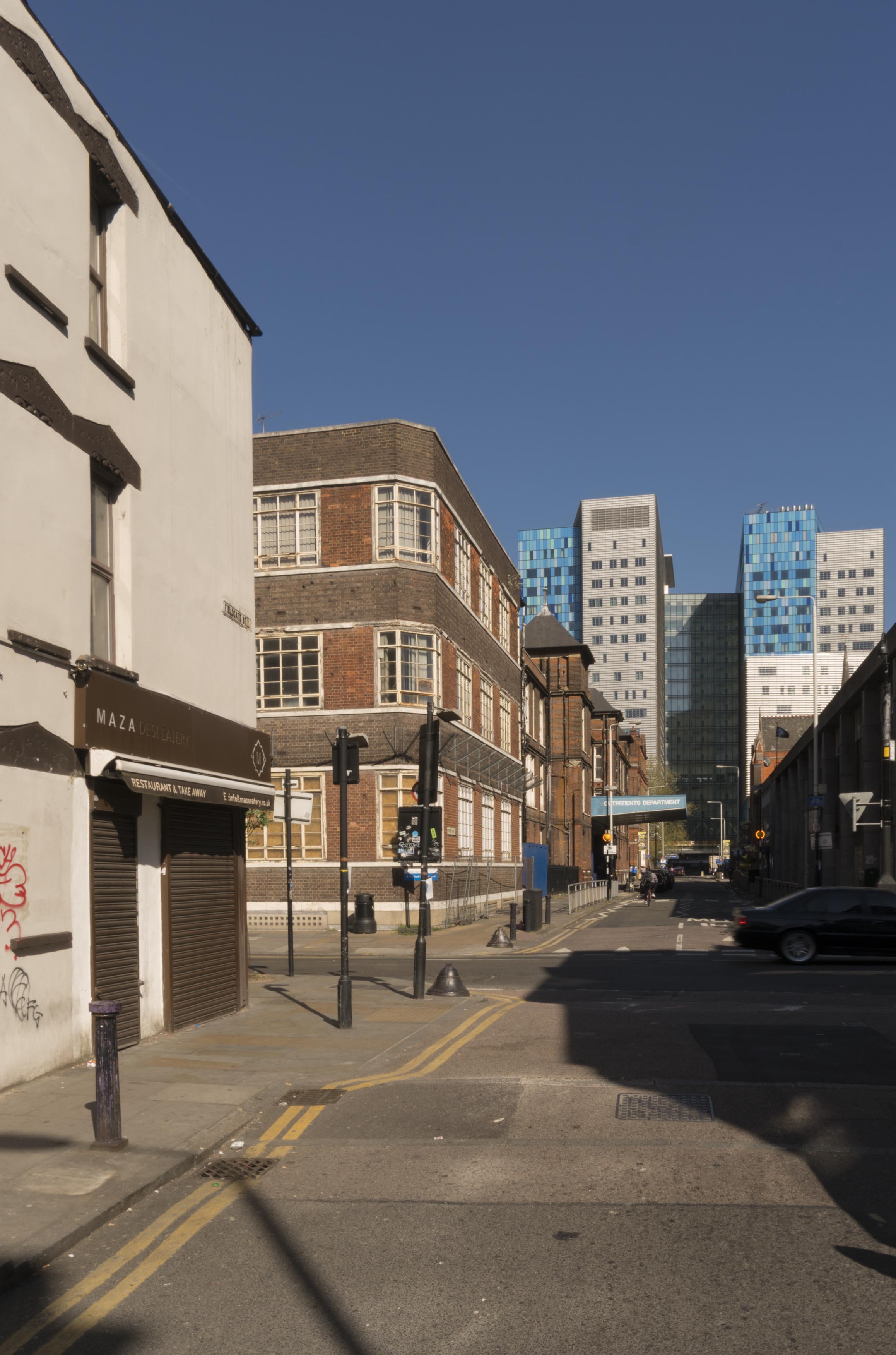
{
"id": 652,
"title": "View from Fieldgate Street of the Outpatients Annexe and the Royal London Hospital in 2017",
"author": {
"id": 27,
"username": "DerekKendall"
},
"feature": {
"id": 1169,
"type": "Feature",
"geometry": {
"type": "MultiPolygon",
"coordinates": [
[
[
[
-0.062456463541029,
51.51763155109922
],
[
-0.062233002466947,
51.51765074567982
],
[
-0.062215365478867,
51.517640218152785
],
[
-0.062185351637145,
51.51750050340947
],
[
-0.062104804724637,
51.51750741228653
],
[
-0.062099269211858,
51.51748320021078
],
[
-0.062178566598708,
51.51747597203999
],
[
-0.062145354927392,
51.517326007800555
],
[
-0.062155816070435,
51.51731674635259
],
[
-0.062378476416372,
51.51729783557244
],
[
-0.062395826510099,
51.51730486117923
],
[
-0.062467696087621,
51.51761902734175
],
[
-0.062456463541029,
51.51763155109922
]
]
]
]
},
"properties": {
"b_number": "",
"b_name": "",
"street": "New Road",
"address": "Outpatients Annexe",
"feature_type": "WHITECHAPEL_BUILDING",
"count": 8,
"search_str": "Outpatients Annexe"
},
"tags": []
},
"file": "https://surveyoflondon.org/media/uploads/features/1169/SoL%20Whitechapel%20100536.jpg",
"description": "",
"copyright": true,
"created": "2017-05-09"
},
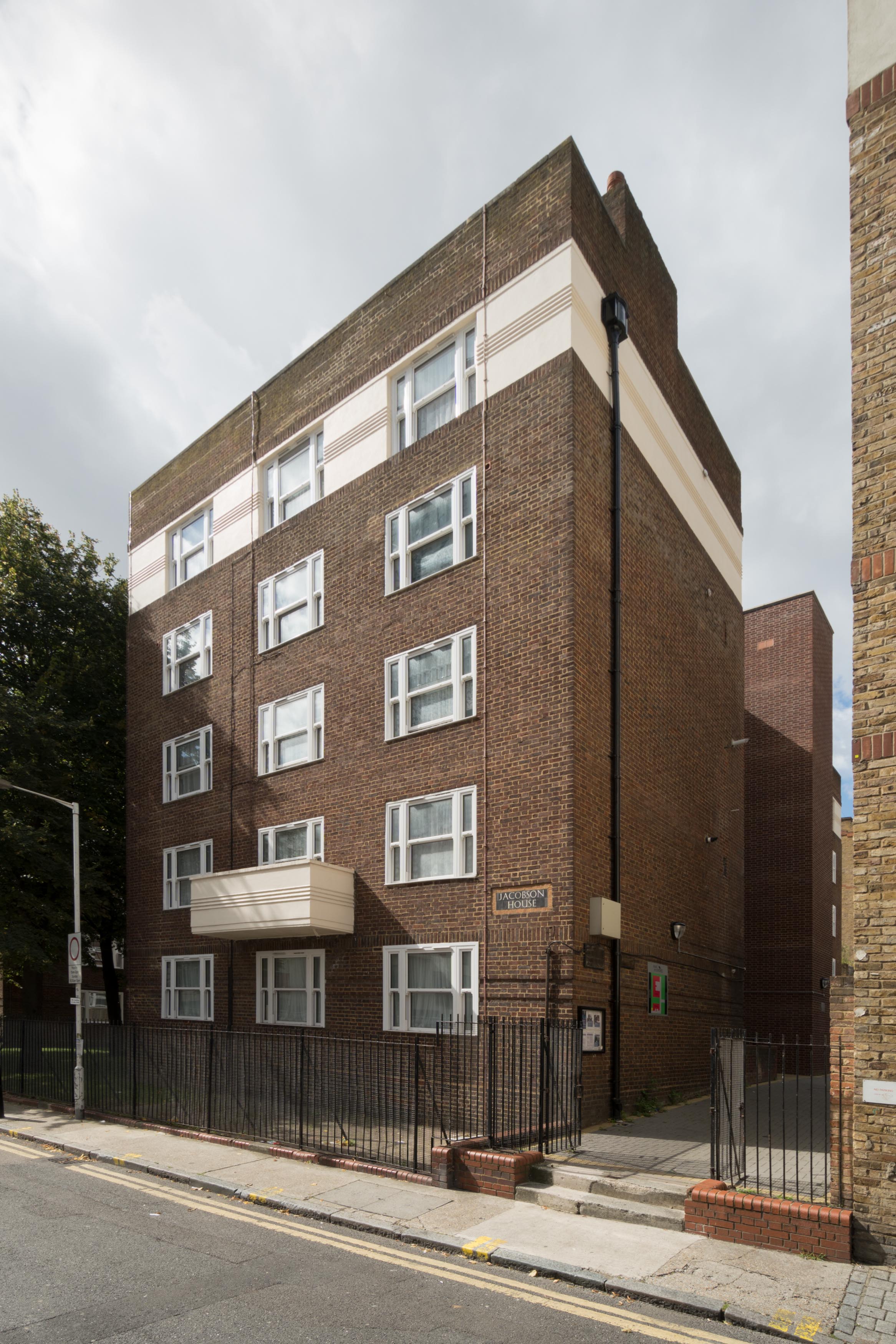
{
"id": 871,
"title": "Jacobson House from the north east, August 2017",
"author": {
"id": 27,
"username": "DerekKendall"
},
"feature": {
"id": 360,
"type": "Feature",
"geometry": {
"type": "MultiPolygon",
"coordinates": [
[
[
[
-0.07423403963285,
51.516503606312355
],
[
-0.074156532403938,
51.516411210746014
],
[
-0.074532413230944,
51.516293337714195
],
[
-0.074597977879442,
51.51637753118774
],
[
-0.074541826123861,
51.51639446844773
],
[
-0.074527982311285,
51.51637839093804
],
[
-0.074410176673803,
51.51641570980419
],
[
-0.074425375542949,
51.516434587988286
],
[
-0.074401935237512,
51.516441609061424
],
[
-0.074387462399548,
51.516423320530194
],
[
-0.07432590949398,
51.51644160373759
],
[
-0.074337439062236,
51.51645409236486
],
[
-0.07431611346368,
51.51646257342577
],
[
-0.074328421961193,
51.516479761297504
],
[
-0.07423403963285,
51.516503606312355
]
]
]
]
},
"properties": {
"b_number": "",
"b_name": "Jacobson House",
"street": "Old Castle Street",
"address": "Jacobson House",
"feature_type": "WHITECHAPEL_BUILDING",
"count": 5,
"search_str": "Jacobson House"
},
"tags": []
},
"file": "https://surveyoflondon.org/media/uploads/features/360/SoL%20Whitechapel%20101298.jpg",
"description": "",
"copyright": true,
"created": "2017-09-26"
},
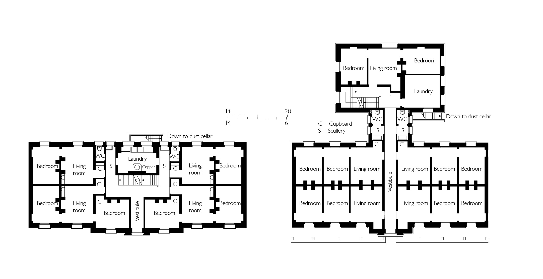
{
"id": 1668,
"title": "Whitechapel Peabody Estate, typical ground-floor plans as built",
"author": {
"id": 82,
"username": "HelenJones"
},
"feature": {
"id": 1347,
"type": "Feature",
"geometry": {
"type": "MultiPolygon",
"coordinates": [
[
[
[
-0.069819559407313,
51.50997990573074
],
[
-0.069698917146582,
51.51000714041904
],
[
-0.069667902850764,
51.50995327540266
],
[
-0.069655885450865,
51.5099555480626
],
[
-0.069607612590961,
51.509875152694654
],
[
-0.069619902299889,
51.50987203363261
],
[
-0.069585387143879,
51.509810178022995
],
[
-0.069712932375651,
51.50978154064002
],
[
-0.069819559407313,
51.50997990573074
]
]
]
]
},
"properties": {
"b_number": "",
"b_name": "Block H",
"street": "John Fisher Street",
"address": "Block H, John Fisher Street, Peabody Estate Whitechapel",
"feature_type": "WHITECHAPEL_BUILDING",
"count": 9,
"search_str": "Block H"
},
"tags": []
},
"file": "https://surveyoflondon.org/media/uploads/features/1347/Peabody%20Estate%20block%20plans%20combined.jpg",
"description": "",
"copyright": true,
"created": "2019-10-04"
},
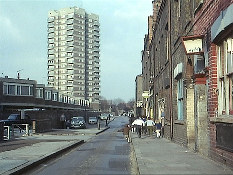
{
"id": 651,
"title": "View of Old Montague Street in 1967",
"author": {
"id": 2,
"username": "surveyoflondon"
},
"feature": {
"id": 443,
"type": "Feature",
"geometry": {
"type": "MultiPolygon",
"coordinates": [
[
[
[
-0.066594018903949,
51.517975482292115
],
[
-0.066709386502622,
51.51807843796118
],
[
-0.067042865968193,
51.51794048775021
],
[
-0.066931741930401,
51.517831449114254
],
[
-0.067075868810343,
51.517774022771334
],
[
-0.067223329780351,
51.51793223724433
],
[
-0.06721195349107,
51.517948748869564
],
[
-0.067220032287073,
51.51795901153467
],
[
-0.067239428468246,
51.51796557353967
],
[
-0.067227428972104,
51.518006358676985
],
[
-0.067200045912731,
51.518009350467004
],
[
-0.067194557153817,
51.518024254931
],
[
-0.066268488171356,
51.51841953468079
],
[
-0.066251828915295,
51.51840479112701
],
[
-0.066199743993834,
51.51842769857914
],
[
-0.066110310212097,
51.51834854879821
],
[
-0.066182289885013,
51.51831689145463
],
[
-0.066197973902778,
51.51833077197025
],
[
-0.066215079254811,
51.518323248859886
],
[
-0.066076636626758,
51.5182007254038
],
[
-0.066594018903949,
51.517975482292115
]
]
]
]
},
"properties": {
"b_number": "82-86",
"b_name": "Don Gratton House, Alma Home, Greatorex Street Young People's Centre and Institute of Psychotrauma",
"street": "Old Montague Street",
"address": "82-86 Old Montague Street with 12-18 Greatorex Street",
"feature_type": "WHITECHAPEL_BUILDING",
"count": 2,
"search_str": "Don Gratton House, Alma Home, Greatorex Street Young People's Centre and Institute of Psychotrauma"
},
"tags": []
},
"file": "https://surveyoflondon.org/media/uploads/features/443/London%20Nobody%20Knows%20Old%20Montague%20Street.jpg",
"description": "A still from the 1967 documentary, The London Nobody Knows, showing Spring Walk on the left, with pauline House beyond, and on the right the late 19th/early 20th-century houses and shops at approximately 134-148 Old Montague Street, on which Don Gratton House was later built.",
"copyright": false,
"created": "2017-05-08"
},
{
"id": 634,
"title": "75-91 Commercial Road from the south-west in April 2017",
"author": {
"id": 27,
"username": "DerekKendall"
},
"feature": {
"id": 766,
"type": "Feature",
"geometry": {
"type": "MultiPolygon",
"coordinates": [
[
[
[
-0.06479636918847,
51.514849127060785
],
[
-0.064796380423472,
51.51484913029562
],
[
-0.064801696545098,
51.51501893523036
],
[
-0.064802160253748,
51.515044626500355
],
[
-0.064750929669421,
51.515043969450474
],
[
-0.064737668986278,
51.51485040214179
],
[
-0.06479636918847,
51.514849127060785
]
]
]
]
},
"properties": {
"b_number": "79",
"b_name": "",
"street": "Commercial Road",
"address": "79 Commercial Road",
"feature_type": "WHITECHAPEL_BUILDING",
"count": 11,
"search_str": "79 Commercial Road"
},
"tags": []
},
"file": "https://surveyoflondon.org/media/uploads/features/766/SoL%20Whitechapel%20100637.jpg",
"description": "",
"copyright": true,
"created": "2017-05-03"
},
{
"id": 806,
"title": "St Paul's School, former mission room from south-east in 2017",
"author": {
"id": 27,
"username": "DerekKendall"
},
"feature": {
"id": 1398,
"type": "Feature",
"geometry": {
"type": "MultiPolygon",
"coordinates": [
[
[
[
-0.06617795318375,
51.51038731673777
],
[
-0.065912350489888,
51.51041084290673
],
[
-0.06588610031897,
51.51032669039412
],
[
-0.066162776826975,
51.51030567245064
],
[
-0.06617795318375,
51.51038731673777
]
]
]
]
},
"properties": {
"b_number": "",
"b_name": "St Paul's School Mission Room and Infant Nursery (later used as Church House)",
"street": "Wellclose Square",
"address": "St Paul's School Mission Room and Infant Nursery",
"feature_type": "WHITECHAPEL_BUILDING",
"count": 11,
"search_str": "St Paul's School Mission Room and Infant Nursery (later used as Church House)"
},
"tags": []
},
"file": "https://surveyoflondon.org/media/uploads/features/1398/SoL%20Whitechapel%20101237.jpg",
"description": "",
"copyright": true,
"created": "2017-09-12"
},
{
"id": 635,
"title": "75-91 Commercial Road from the south-west in April 2017",
"author": {
"id": 27,
"username": "DerekKendall"
},
"feature": {
"id": 766,
"type": "Feature",
"geometry": {
"type": "MultiPolygon",
"coordinates": [
[
[
[
-0.06479636918847,
51.514849127060785
],
[
-0.064796380423472,
51.51484913029562
],
[
-0.064801696545098,
51.51501893523036
],
[
-0.064802160253748,
51.515044626500355
],
[
-0.064750929669421,
51.515043969450474
],
[
-0.064737668986278,
51.51485040214179
],
[
-0.06479636918847,
51.514849127060785
]
]
]
]
},
"properties": {
"b_number": "79",
"b_name": "",
"street": "Commercial Road",
"address": "79 Commercial Road",
"feature_type": "WHITECHAPEL_BUILDING",
"count": 11,
"search_str": "79 Commercial Road"
},
"tags": []
},
"file": "https://surveyoflondon.org/media/uploads/features/766/SoL%20Whitechapel%20100643.jpg",
"description": "",
"copyright": true,
"created": "2017-05-03"
},
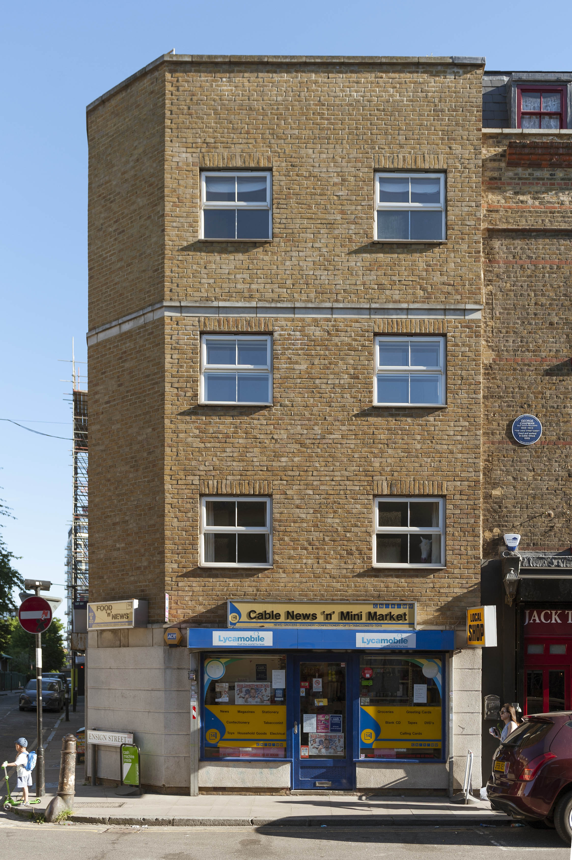
{
"id": 1310,
"title": "14 Cable Street in 2018",
"author": {
"id": 27,
"username": "DerekKendall"
},
"feature": {
"id": 1382,
"type": "Feature",
"geometry": {
"type": "MultiPolygon",
"coordinates": [
[
[
[
-0.067887886383568,
51.51075590403737
],
[
-0.067820260884705,
51.510757696725335
],
[
-0.067799092133055,
51.5107515340712
],
[
-0.06778241302769,
51.51070532978045
],
[
-0.067790866405221,
51.51070372491158
],
[
-0.067758854100828,
51.51062354759984
],
[
-0.067881979388402,
51.5105982512014
],
[
-0.067897629153322,
51.51064676406128
],
[
-0.067859086602214,
51.510654849802144
],
[
-0.067875349403458,
51.51069988445148
],
[
-0.067887886383568,
51.51075590403737
]
]
]
]
},
"properties": {
"b_number": "2",
"b_name": "",
"street": "Ensign Street",
"address": "2 Ensign Street (with 14 Cable Street)",
"feature_type": "WHITECHAPEL_BUILDING",
"count": 2,
"search_str": "2 Ensign Street (with 14 Cable Street)"
},
"tags": []
},
"file": "https://surveyoflondon.org/media/uploads/features/1382/SoL%20Whitechapel%20102060.jpg",
"description": "",
"copyright": true,
"created": "2018-08-13"
}
]
}