HTTP 200 OK
Allow: GET, HEAD, OPTIONS
Content-Type: application/json
Vary: Accept
{
"count": 1747,
"next": "https://surveyoflondon.org/api/v1/images/?format=api&page=25",
"previous": "https://surveyoflondon.org/api/v1/images/?format=api&page=23",
"results": [
{
"id": 292,
"title": "35-34 Turner Street from the north-east in 2016",
"author": {
"id": 27,
"username": "DerekKendall"
},
"feature": {
"id": 1141,
"type": "Feature",
"geometry": {
"type": "MultiPolygon",
"coordinates": [
[
[
[
-0.060734054799167,
51.51596309895724
],
[
-0.060734054804616,
51.51596309895732
],
[
-0.060834691436662,
51.51595184622962
],
[
-0.060834691440533,
51.5159518462292
],
[
-0.060874768043526,
51.51594870544232
],
[
-0.060884014696546,
51.51598806915839
],
[
-0.060842853044806,
51.51599116860811
],
[
-0.060743235699522,
51.51600064976582
],
[
-0.060734054799167,
51.51596309895724
]
]
]
]
},
"properties": {
"b_number": "43",
"b_name": "",
"street": "Turner Street",
"address": "43 Turner Street",
"feature_type": "WHITECHAPEL_BUILDING",
"count": 4,
"search_str": "43 Turner Street"
},
"tags": []
},
"file": "https://surveyoflondon.org/media/uploads/features/1141/SoL%20Whitechapel100085.jpg",
"description": "",
"copyright": true,
"created": "2016-08-17"
},
{
"id": 293,
"title": "39-43 Turner Street",
"author": {
"id": 27,
"username": "DerekKendall"
},
"feature": {
"id": 1141,
"type": "Feature",
"geometry": {
"type": "MultiPolygon",
"coordinates": [
[
[
[
-0.060734054799167,
51.51596309895724
],
[
-0.060734054804616,
51.51596309895732
],
[
-0.060834691436662,
51.51595184622962
],
[
-0.060834691440533,
51.5159518462292
],
[
-0.060874768043526,
51.51594870544232
],
[
-0.060884014696546,
51.51598806915839
],
[
-0.060842853044806,
51.51599116860811
],
[
-0.060743235699522,
51.51600064976582
],
[
-0.060734054799167,
51.51596309895724
]
]
]
]
},
"properties": {
"b_number": "43",
"b_name": "",
"street": "Turner Street",
"address": "43 Turner Street",
"feature_type": "WHITECHAPEL_BUILDING",
"count": 4,
"search_str": "43 Turner Street"
},
"tags": []
},
"file": "https://surveyoflondon.org/media/uploads/features/1141/SoL%20Whitechapel100086.jpg",
"description": "",
"copyright": true,
"created": "2016-08-17"
},
{
"id": 290,
"title": "45 Turner Street from the north-east in 2016",
"author": {
"id": 27,
"username": "DerekKendall"
},
"feature": {
"id": 1146,
"type": "Feature",
"geometry": {
"type": "MultiPolygon",
"coordinates": [
[
[
[
-0.060743235699522,
51.51600064976582
],
[
-0.060884014696546,
51.51598806915839
],
[
-0.060900637466801,
51.51598665550543
],
[
-0.06091346038848,
51.51603806709756
],
[
-0.060764451413858,
51.51605191728123
],
[
-0.060753958640414,
51.51604673193427
],
[
-0.060743235699522,
51.51600064976582
]
]
]
]
},
"properties": {
"b_number": "45",
"b_name": "",
"street": "Turner Street",
"address": "45 Turner Street",
"feature_type": "WHITECHAPEL_BUILDING",
"count": 1,
"search_str": "45 Turner Street"
},
"tags": []
},
"file": "https://surveyoflondon.org/media/uploads/features/1146/SoL%20Whitechapel100083_c7olF5A.jpg",
"description": "",
"copyright": true,
"created": "2016-08-17"
},
{
"id": 282,
"title": "33-51 Walden Street in 2016",
"author": {
"id": 27,
"username": "DerekKendall"
},
"feature": {
"id": 1078,
"type": "Feature",
"geometry": {
"type": "MultiPolygon",
"coordinates": [
[
[
[
-0.060103671685088,
51.5162851138199
],
[
-0.060087286398528,
51.51622288799857
],
[
-0.06016097444144,
51.51621543115877
],
[
-0.060177225083742,
51.516277943343304
],
[
-0.060103671685088,
51.5162851138199
]
]
]
]
},
"properties": {
"b_number": "33",
"b_name": "",
"street": "",
"address": "33 Walden Street",
"feature_type": "WHITECHAPEL_BUILDING",
"count": 5,
"search_str": "33 Walden Street"
},
"tags": []
},
"file": "https://surveyoflondon.org/media/uploads/features/1078/SoL%20Whitechapel100064_E7jAEga.jpg",
"description": "",
"copyright": true,
"created": "2016-08-17"
},
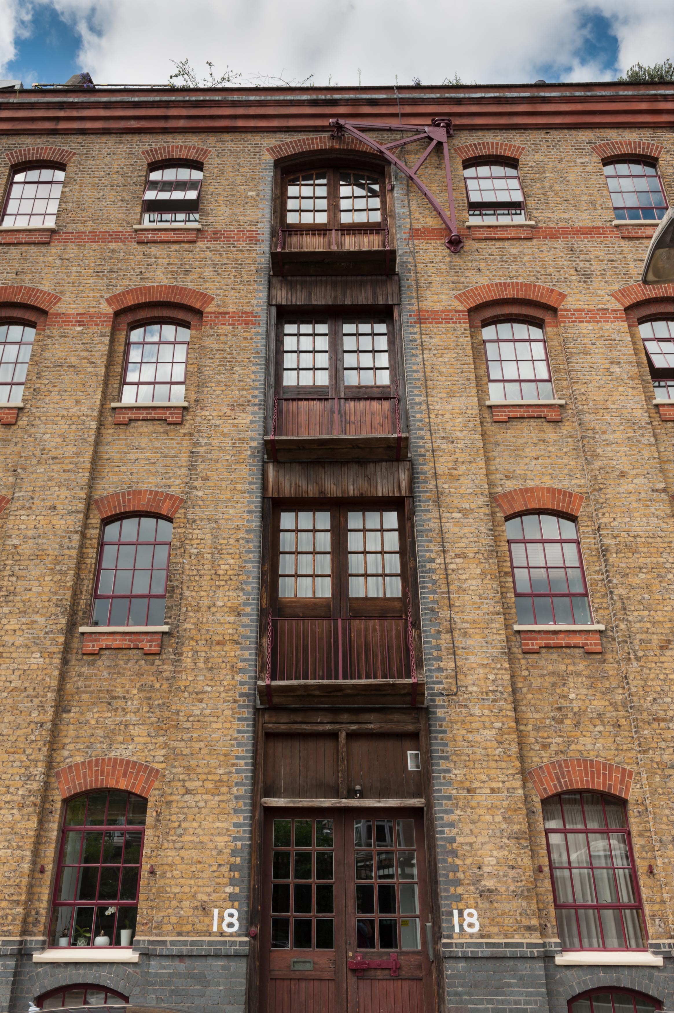
{
"id": 759,
"title": "Detail of warehouse loophole bays and wall-mounted crane. August 2017",
"author": {
"id": 27,
"username": "DerekKendall"
},
"feature": {
"id": 1445,
"type": "Feature",
"geometry": {
"type": "MultiPolygon",
"coordinates": [
[
[
[
-0.072200644138698,
51.51309341053552
],
[
-0.072031350878832,
51.513136000598124
],
[
-0.071952813923754,
51.51301978336744
],
[
-0.07213481269213,
51.51296291379047
],
[
-0.072200644138698,
51.51309341053552
]
]
]
]
},
"properties": {
"b_number": "18",
"b_name": "",
"street": "North Tenter Street",
"address": "18 North Tenter Street",
"feature_type": "WHITECHAPEL_BUILDING",
"count": 2,
"search_str": "18 North Tenter Street"
},
"tags": []
},
"file": "https://surveyoflondon.org/media/uploads/features/1445/SoL%20Whitechapel%20101248.jpg",
"description": "",
"copyright": true,
"created": "2017-09-12"
},
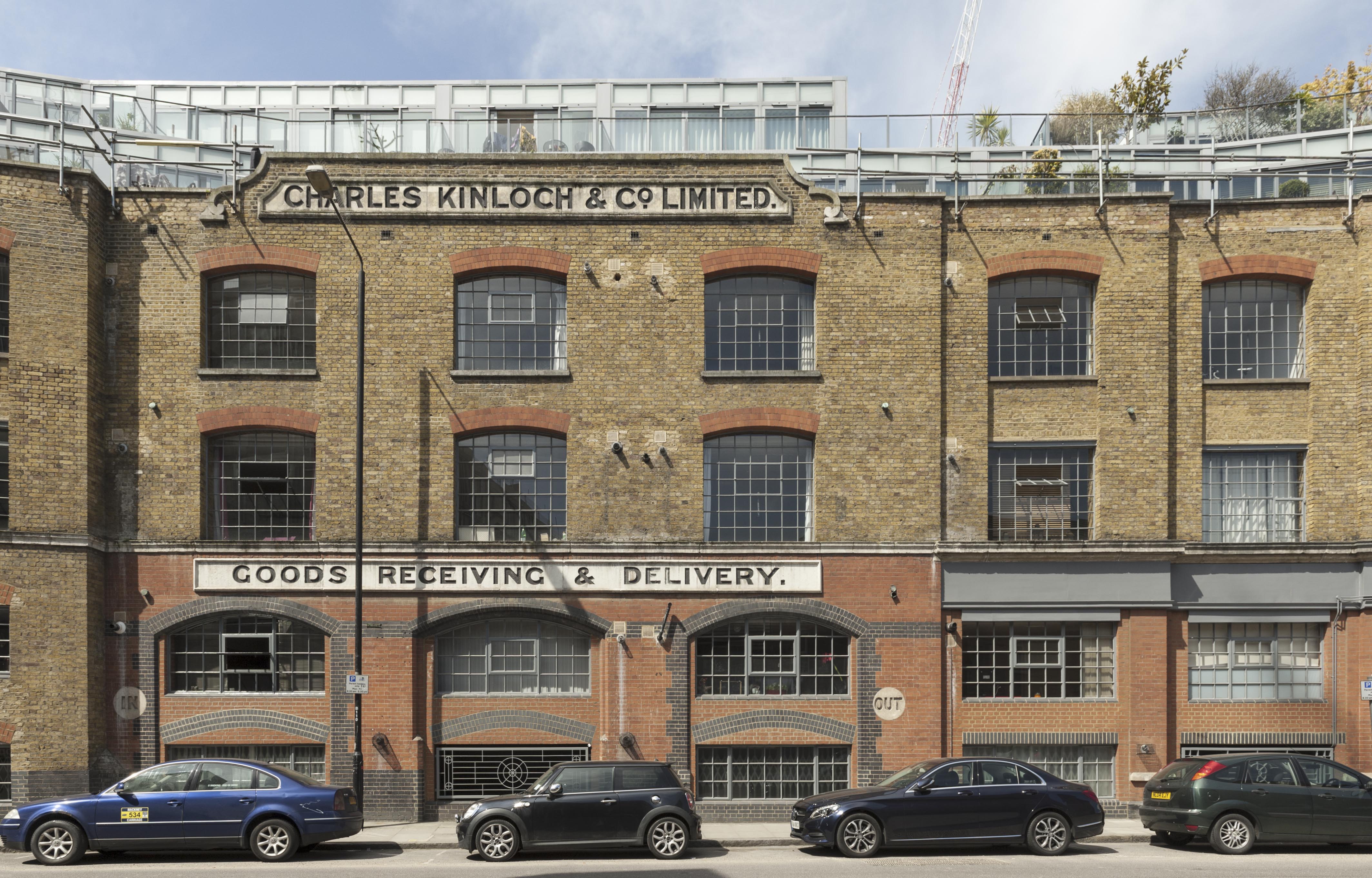
{
"id": 310,
"title": "former Charles Kinloch & Co. Ltd wine warehouse, now Chandlery House flats",
"author": {
"id": 27,
"username": "DerekKendall"
},
"feature": {
"id": 1005,
"type": "Feature",
"geometry": {
"type": "MultiPolygon",
"coordinates": [
[
[
[
-0.067180798939432,
51.512911920220176
],
[
-0.067624988998484,
51.51289617869746
],
[
-0.067674782792481,
51.51313629851437
],
[
-0.067721744056023,
51.51313289915908
],
[
-0.067755852211198,
51.51322248870878
],
[
-0.067682509657788,
51.51321710704479
],
[
-0.067654590885861,
51.513297328210555
],
[
-0.067516875836223,
51.51328532147534
],
[
-0.067468956763533,
51.51341668205499
],
[
-0.067277526303318,
51.51337909942833
],
[
-0.067137642973819,
51.51333104278721
],
[
-0.067188431523132,
51.51317071067776
],
[
-0.067203219362638,
51.51308470897374
],
[
-0.067183076322121,
51.51292857876673
],
[
-0.067180798939432,
51.512911920220176
]
],
[
[
-0.067402751092455,
51.513321694761274
],
[
-0.067420144835674,
51.51325312417157
],
[
-0.067384587480254,
51.51325045159809
],
[
-0.067384326780274,
51.51323027699892
],
[
-0.067335343500746,
51.513228774201664
],
[
-0.067319383083405,
51.513316147649554
],
[
-0.067402751092455,
51.513321694761274
]
],
[
[
-0.067492150220602,
51.51318475803046
],
[
-0.067522036285235,
51.513084399017174
],
[
-0.067453414453496,
51.51307283525235
],
[
-0.067418954868062,
51.51317590098832
],
[
-0.067492150220602,
51.51318475803046
]
],
[
[
-0.06747986041909,
51.51304058127036
],
[
-0.067475683647445,
51.51294174750583
],
[
-0.067394851036263,
51.51294215421109
],
[
-0.067401211342125,
51.51304206725618
],
[
-0.06747986041909,
51.51304058127036
]
]
]
]
},
"properties": {
"b_number": "40",
"b_name": "Chandlery House, 40 Gower's Walk",
"street": "Gower's Walk",
"address": "Chandlery House, 40 Gower's Walk",
"feature_type": "WHITECHAPEL_BUILDING",
"count": 11,
"search_str": "Chandlery House, 40 Gower's Walk"
},
"tags": []
},
"file": "https://surveyoflondon.org/media/uploads/features/1005/SoL%20Whitechapel100420.jpg",
"description": "photographed by Derek Kendall, 2016",
"copyright": true,
"created": "2016-08-31"
},
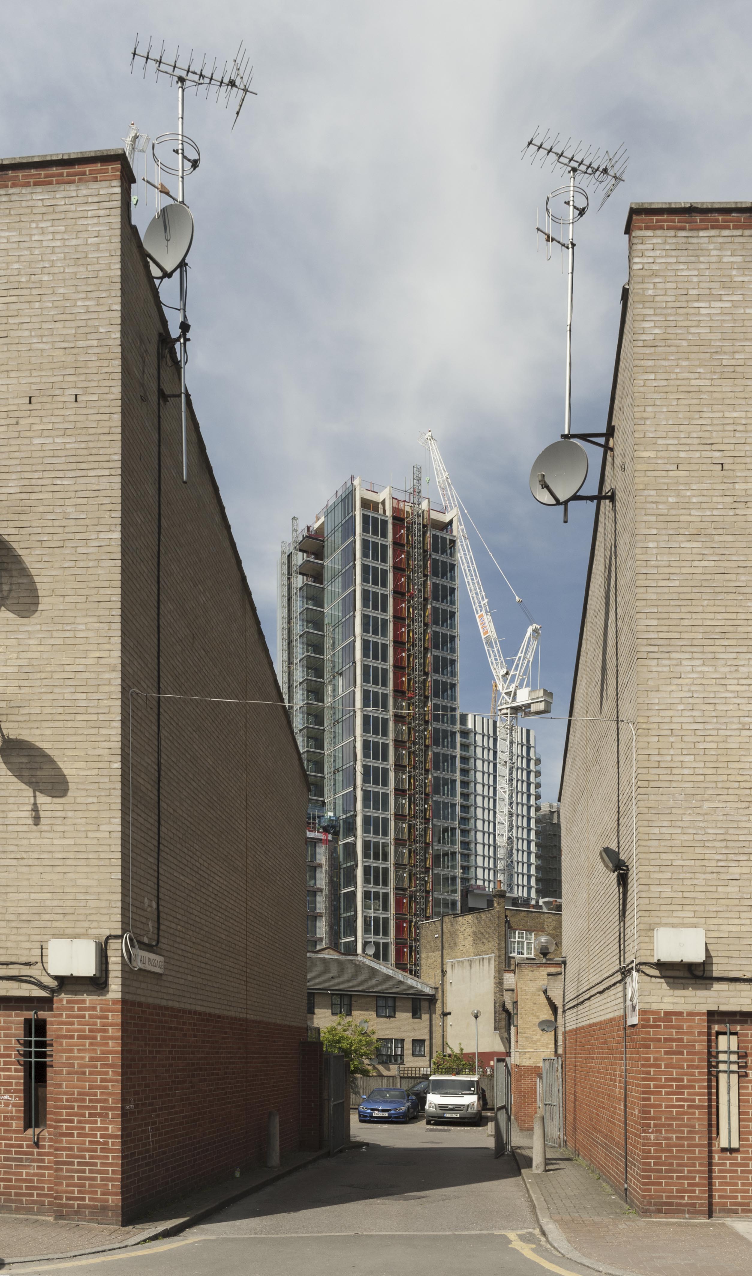
{
"id": 312,
"title": "View from Back Church Lane through Mitali Passage ",
"author": {
"id": 27,
"username": "DerekKendall"
},
"feature": {
"id": 1023,
"type": "Feature",
"geometry": {
"type": "MultiPolygon",
"coordinates": [
[
[
[
-0.067266234422343,
51.51368712861223
],
[
-0.067185099271762,
51.5137791835776
],
[
-0.067135150600664,
51.51376259133462
],
[
-0.067209027325379,
51.513676009268245
],
[
-0.067228173497233,
51.5136823693562
],
[
-0.067233414950339,
51.51367622645886
],
[
-0.067266234422343,
51.51368712861223
]
]
]
]
},
"properties": {
"b_number": "3",
"b_name": "3 Mitali Passage",
"street": "Mitali Passage",
"address": "3 Mitali Passage",
"feature_type": "WHITECHAPEL_BUILDING",
"count": 3,
"search_str": "3 Mitali Passage"
},
"tags": []
},
"file": "https://surveyoflondon.org/media/uploads/features/1023/SoL%20Whitechapel100426.jpg",
"description": "photographed by Derek Kendall, 2016",
"copyright": true,
"created": "2016-08-31"
},
{
"id": 270,
"title": "Exposed concrete frame of the Dental Hospital and Institute of Dentistry, 2016",
"author": {
"id": 27,
"username": "DerekKendall"
},
"feature": {
"id": 1166,
"type": "Feature",
"geometry": {
"type": "MultiPolygon",
"coordinates": [
[
[
[
-0.062351470894244,
51.51718815629615
],
[
-0.061292929801261,
51.51728379235413
],
[
-0.061222794483401,
51.51696856036261
],
[
-0.062282192019856,
51.516876806223415
],
[
-0.062351470894244,
51.51718815629615
]
]
]
]
},
"properties": {
"b_number": "",
"b_name": "",
"street": "Stepney Way",
"address": "Dental Hospital and Institute of Dentistry",
"feature_type": "WHITECHAPEL_BUILDING",
"count": 13,
"search_str": "Dental Hospital and Institute of Dentistry"
},
"tags": [
"Dental Institute",
"London Hospital",
"Royal London Hospital",
"Stephen Statham & Associates",
"Students' Union"
]
},
"file": "https://surveyoflondon.org/media/uploads/features/1166/SoL%20Whitechapel100145.jpg",
"description": "",
"copyright": true,
"created": "2016-08-17"
},
{
"id": 179,
"title": "Whitechapel Road either side of Court Street in 2016",
"author": {
"id": 27,
"username": "DerekKendall"
},
"feature": {
"id": 482,
"type": "Feature",
"geometry": {
"type": "MultiPolygon",
"coordinates": [
[
[
[
-0.061827120520907,
51.51907516384937
],
[
-0.061711209214386,
51.51910346447861
],
[
-0.061717737685342,
51.51911541982897
],
[
-0.061673248411225,
51.519127455753186
],
[
-0.061654676881271,
51.51909351284264
],
[
-0.061732040582857,
51.51907341986276
],
[
-0.061701309729407,
51.51902291286971
],
[
-0.061627152177638,
51.51904010908138
],
[
-0.061621779416406,
51.51904125458228
],
[
-0.061530437466549,
51.518879896569096
],
[
-0.061535850449336,
51.51887799011652
],
[
-0.061668902792321,
51.51884677475007
],
[
-0.061694748739827,
51.51885171742009
],
[
-0.061827120520907,
51.51907516384937
]
]
]
]
},
"properties": {
"b_number": "223-225",
"b_name": "",
"street": "Whitechapel Road",
"address": "223-225 Whitechapel Road with 2-6 Fulbourne Street",
"feature_type": "WHITECHAPEL_BUILDING",
"count": 4,
"search_str": "223-225 Whitechapel Road with 2-6 Fulbourne Street"
},
"tags": []
},
"file": "https://surveyoflondon.org/media/uploads/features/482/SoL%20Whitechapel100003.jpg",
"description": "",
"copyright": true,
"created": "2016-07-28"
},
{
"id": 256,
"title": "Floyer House from the south-west in 2016",
"author": {
"id": 27,
"username": "DerekKendall"
},
"feature": {
"id": 1056,
"type": "Feature",
"geometry": {
"type": "MultiPolygon",
"coordinates": [
[
[
[
-0.059263722432195,
51.5170504174262
],
[
-0.05844902615524,
51.517123873126295
],
[
-0.058429001918928,
51.51704425139911
],
[
-0.058539791655921,
51.51703426162738
],
[
-0.058495779438244,
51.516894701346835
],
[
-0.058661010499377,
51.5168776379586
],
[
-0.05870302857902,
51.51702305338288
],
[
-0.059049997696211,
51.51699054250981
],
[
-0.058993641915522,
51.516847722030604
],
[
-0.058915395385419,
51.51685268666606
],
[
-0.058912319350653,
51.51684637599849
],
[
-0.058396219583371,
51.5168976477387
],
[
-0.058372064688884,
51.51681030679901
],
[
-0.058895931974683,
51.516759859268696
],
[
-0.05889396995395,
51.51675356703994
],
[
-0.059125366976984,
51.51673861770239
],
[
-0.059263722432195,
51.5170504174262
]
]
]
]
},
"properties": {
"b_number": "60",
"b_name": "Floyer House",
"street": "Newark Street",
"address": "Floyer House",
"feature_type": "WHITECHAPEL_BUILDING",
"count": 3,
"search_str": "Floyer House"
},
"tags": [
"Edward Maufe"
]
},
"file": "https://surveyoflondon.org/media/uploads/features/1056/SoL%20Whitechapel100071.jpg",
"description": "",
"copyright": true,
"created": "2016-08-17"
},
{
"id": 147,
"title": "8 St Mark Street",
"author": {
"id": 27,
"username": "DerekKendall"
},
"feature": {
"id": 41,
"type": "Feature",
"geometry": {
"type": "MultiPolygon",
"coordinates": [
[
[
[
-0.071533549501504,
51.5132583622351
],
[
-0.071463624323068,
51.51328261614345
],
[
-0.071388847057103,
51.51319931242174
],
[
-0.071452512808187,
51.513174955618396
],
[
-0.071533549501504,
51.5132583622351
]
]
]
]
},
"properties": {
"b_number": "8",
"b_name": "",
"street": "St Mark Street",
"address": "8 St Mark Street",
"feature_type": "WHITECHAPEL_BUILDING",
"count": 3,
"search_str": "8 St Mark Street"
},
"tags": []
},
"file": "https://surveyoflondon.org/media/uploads/features/41/SoL%20Whitechapel100345.jpg",
"description": "",
"copyright": true,
"created": "2016-07-19"
},
{
"id": 804,
"title": "Facade, August 2017",
"author": {
"id": 27,
"username": "DerekKendall"
},
"feature": {
"id": 1290,
"type": "Feature",
"geometry": {
"type": "MultiPolygon",
"coordinates": [
[
[
[
-0.070515351299897,
51.511581845779865
],
[
-0.070458535269443,
51.51143123442822
],
[
-0.0705009342948,
51.51142400353988
],
[
-0.070490018512607,
51.51139399886158
],
[
-0.07051545384739,
51.51139090854125
],
[
-0.070583746192274,
51.51157127501072
],
[
-0.070564771642518,
51.51157434131644
],
[
-0.070561921194683,
51.511577641177794
],
[
-0.070540207323307,
51.51158137754552
],
[
-0.070534920857582,
51.51157895134292
],
[
-0.070515351299897,
51.511581845779865
]
]
]
]
},
"properties": {
"b_number": "15",
"b_name": "",
"street": "Prescot Street",
"address": "Princess Of Prussia, 15 Prescot Street",
"feature_type": "WHITECHAPEL_BUILDING",
"count": 7,
"search_str": "Princess Of Prussia, 15 Prescot Street"
},
"tags": []
},
"file": "https://surveyoflondon.org/media/uploads/features/1290/SoL%20Whitechapel%20101528.jpg",
"description": "",
"copyright": true,
"created": "2017-09-12"
},
{
"id": 311,
"title": "New Loom House",
"author": {
"id": 27,
"username": "DerekKendall"
},
"feature": {
"id": 1054,
"type": "Feature",
"geometry": {
"type": "MultiPolygon",
"coordinates": [
[
[
[
-0.067624988998484,
51.51289617869746
],
[
-0.067180798939432,
51.512911920220176
],
[
-0.067133711242303,
51.512567481740106
],
[
-0.067109487043094,
51.512455102488246
],
[
-0.067094022808022,
51.51237277531417
],
[
-0.067355415992025,
51.51233326528946
],
[
-0.067556363832002,
51.51229971390102
],
[
-0.067559932926382,
51.512347068603766
],
[
-0.067564604000022,
51.512473731628916
],
[
-0.06762108926581,
51.51287737297797
],
[
-0.067624988998484,
51.51289617869746
]
]
]
]
},
"properties": {
"b_number": "101",
"b_name": "The Loom, 101 Back Church Lane",
"street": "Back Church Lane",
"address": "The Loom, 101 Back Church Lane",
"feature_type": "WHITECHAPEL_BUILDING",
"count": 10,
"search_str": "The Loom, 101 Back Church Lane"
},
"tags": []
},
"file": "https://surveyoflondon.org/media/uploads/features/1054/SoL%20Whitechapel100418.jpg",
"description": "photographed by Derek Kendall, 2016",
"copyright": true,
"created": "2016-08-31"
},
{
"id": 222,
"title": "277-285 Whitechapel Road in 2016",
"author": {
"id": 27,
"username": "DerekKendall"
},
"feature": {
"id": 499,
"type": "Feature",
"geometry": {
"type": "MultiPolygon",
"coordinates": [
[
[
[
-0.0594203198542,
51.51936363764333
],
[
-0.059547104874583,
51.51956438824469
],
[
-0.059466693915525,
51.519584131648934
],
[
-0.059341723142481,
51.51938248751161
],
[
-0.0594203198542,
51.51936363764333
]
]
]
]
},
"properties": {
"b_number": "285",
"b_name": "",
"street": "Whitechapel Road",
"address": "Former Lord Rodney's Head public house, 285 Whitechapel Road",
"feature_type": "WHITECHAPEL_BUILDING",
"count": 2,
"search_str": "Former Lord Rodney's Head public house, 285 Whitechapel Road"
},
"tags": [
"music hall"
]
},
"file": "https://surveyoflondon.org/media/uploads/features/499/SoL%20Whitechapel100017.jpg",
"description": "",
"copyright": true,
"created": "2016-08-01"
},
{
"id": 261,
"title": "The Good Samaritan Public House from the south-east in 2016",
"author": {
"id": 27,
"username": "DerekKendall"
},
"feature": {
"id": 1168,
"type": "Feature",
"geometry": {
"type": "MultiPolygon",
"coordinates": [
[
[
[
-0.061267714228342,
51.51728570229591
],
[
-0.061211821751889,
51.51729102992391
],
[
-0.061212063460602,
51.517292046001835
],
[
-0.061212385738901,
51.51729340077238
],
[
-0.061213949668732,
51.51729997510807
],
[
-0.061054008753201,
51.51731478509992
],
[
-0.06102951561067,
51.5172118208613
],
[
-0.061079278348811,
51.51720721302223
],
[
-0.061169266511209,
51.51719888040671
],
[
-0.061174570672127,
51.51722117764948
],
[
-0.06125068758338,
51.51721412920907
],
[
-0.061267714228342,
51.51728570229591
]
]
]
]
},
"properties": {
"b_number": "87",
"b_name": "The Good Samaritan Public House",
"street": "Turner Street",
"address": "The Good Samaritan Public House, 87 Turner Street",
"feature_type": "WHITECHAPEL_BUILDING",
"count": 5,
"search_str": "The Good Samaritan Public House"
},
"tags": []
},
"file": "https://surveyoflondon.org/media/uploads/features/1168/SoL%20Whitechapel100100.jpg",
"description": "",
"copyright": true,
"created": "2016-08-17"
},
{
"id": 262,
"title": "The Good Samaritan Public House",
"author": {
"id": 27,
"username": "DerekKendall"
},
"feature": {
"id": 1168,
"type": "Feature",
"geometry": {
"type": "MultiPolygon",
"coordinates": [
[
[
[
-0.061267714228342,
51.51728570229591
],
[
-0.061211821751889,
51.51729102992391
],
[
-0.061212063460602,
51.517292046001835
],
[
-0.061212385738901,
51.51729340077238
],
[
-0.061213949668732,
51.51729997510807
],
[
-0.061054008753201,
51.51731478509992
],
[
-0.06102951561067,
51.5172118208613
],
[
-0.061079278348811,
51.51720721302223
],
[
-0.061169266511209,
51.51719888040671
],
[
-0.061174570672127,
51.51722117764948
],
[
-0.06125068758338,
51.51721412920907
],
[
-0.061267714228342,
51.51728570229591
]
]
]
]
},
"properties": {
"b_number": "87",
"b_name": "The Good Samaritan Public House",
"street": "Turner Street",
"address": "The Good Samaritan Public House, 87 Turner Street",
"feature_type": "WHITECHAPEL_BUILDING",
"count": 5,
"search_str": "The Good Samaritan Public House"
},
"tags": []
},
"file": "https://surveyoflondon.org/media/uploads/features/1168/SoL%20Whitechapel100101.jpg",
"description": "",
"copyright": true,
"created": "2016-08-17"
},
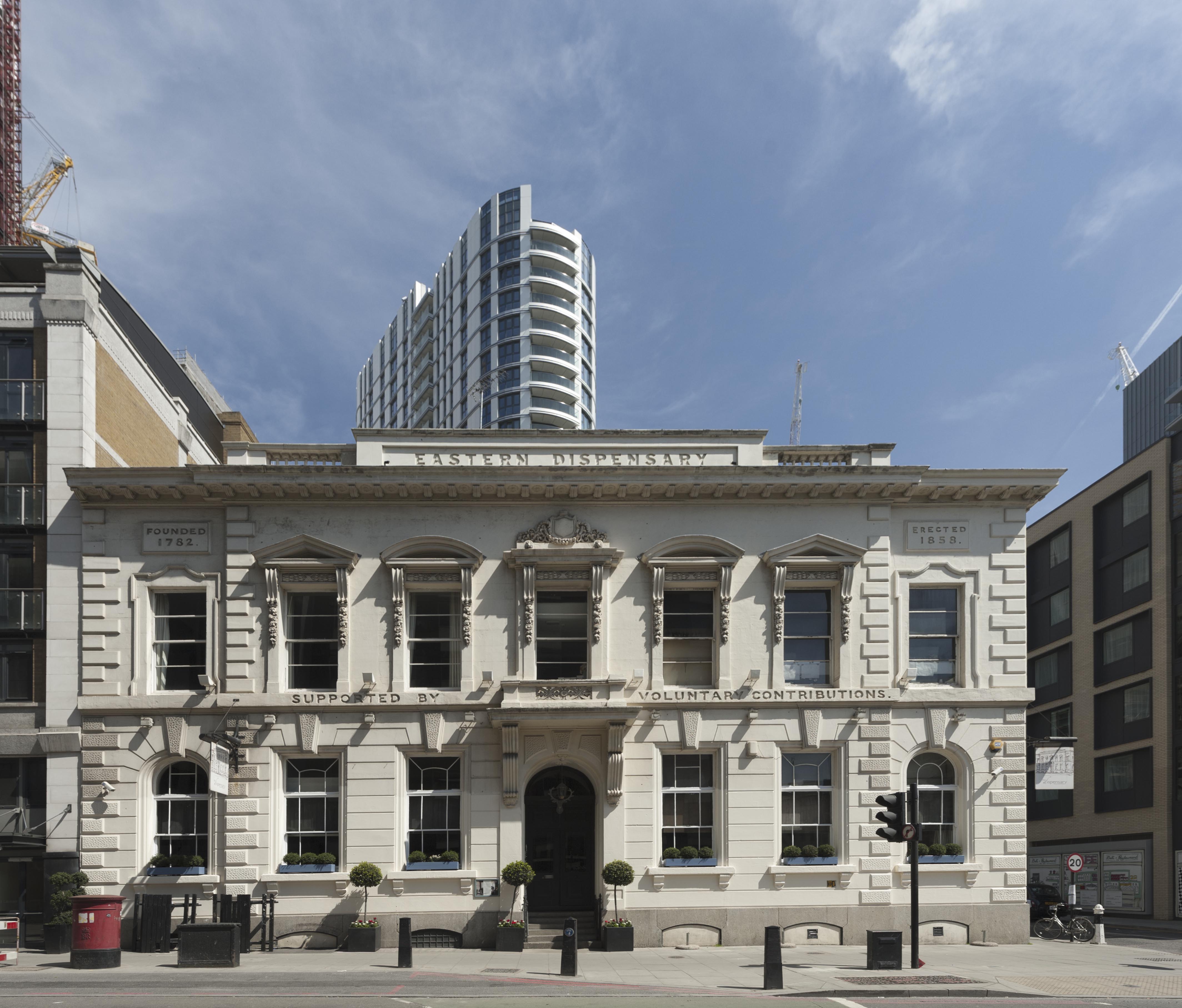
{
"id": 150,
"title": "The former Eastern Dispenary",
"author": {
"id": 27,
"username": "DerekKendall"
},
"feature": {
"id": 16,
"type": "Feature",
"geometry": {
"type": "MultiPolygon",
"coordinates": [
[
[
[
-0.07073271347526,
51.51412601920421
],
[
-0.07063554499044,
51.514165253062664
],
[
-0.070469168765051,
51.51398880154131
],
[
-0.07056792326348,
51.51394938941929
],
[
-0.07073271347526,
51.51412601920421
]
]
]
]
},
"properties": {
"b_number": "19a-19b",
"b_name": "The Dispensary",
"street": "Leman Street",
"address": "The Dispensary (former Eastern Dispensary), 19a-19b Leman Street",
"feature_type": "WHITECHAPEL_BUILDING",
"count": 7,
"search_str": "The Dispensary"
},
"tags": []
},
"file": "https://surveyoflondon.org/media/uploads/features/16/SoL%20Whitechapel100359_XkEdzOt.jpg",
"description": "",
"copyright": true,
"created": "2016-07-19"
},
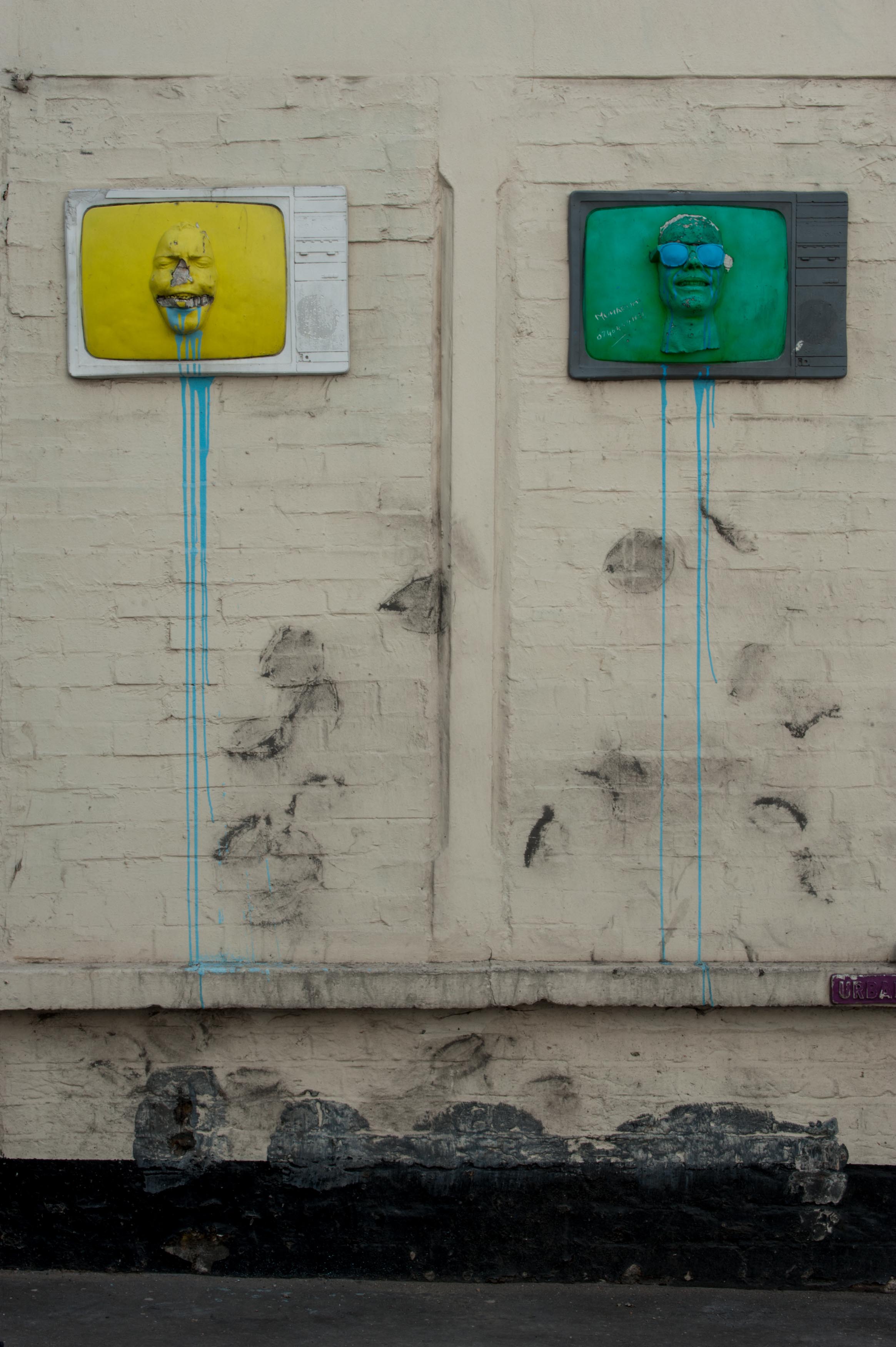
{
"id": 784,
"title": "Kirstein's Mansions, street art on north wall in 2017",
"author": {
"id": 27,
"username": "DerekKendall"
},
"feature": {
"id": 184,
"type": "Feature",
"geometry": {
"type": "MultiPolygon",
"coordinates": [
[
[
[
-0.068578857725277,
51.515058346172935
],
[
-0.068684010525248,
51.51517341266261
],
[
-0.068486063121396,
51.51522368270303
],
[
-0.068452900682943,
51.5151753964142
],
[
-0.068534791469645,
51.515150123741485
],
[
-0.06850924458504,
51.515123238092826
],
[
-0.068432210792558,
51.51514928400303
],
[
-0.068403530730357,
51.51511976827265
],
[
-0.068578857725277,
51.515058346172935
]
]
]
]
},
"properties": {
"b_number": "34-40",
"b_name": "Kirstein's Mansions",
"street": "White Church Lane",
"address": "Kirstein's Mansions, 34-40 White Church Lane",
"feature_type": "WHITECHAPEL_BUILDING",
"count": 5,
"search_str": "Kirstein's Mansions"
},
"tags": [
"David Abraham",
"Solomon Kirstein",
"street art"
]
},
"file": "https://surveyoflondon.org/media/uploads/features/184/SoL%20Whitechapel%20101417.jpg",
"description": "",
"copyright": true,
"created": "2017-09-12"
},
{
"id": 313,
"title": "129 Back Church Lane, looking north",
"author": {
"id": 27,
"username": "DerekKendall"
},
"feature": {
"id": 998,
"type": "Feature",
"geometry": {
"type": "MultiPolygon",
"coordinates": [
[
[
[
-0.066893958767139,
51.51426806642093
],
[
-0.066797876875784,
51.51426573798642
],
[
-0.06679738190094,
51.51430429969666
],
[
-0.066681747398618,
51.51429806267815
],
[
-0.066683310055163,
51.5142550769197
],
[
-0.066685583686015,
51.51419253338944
],
[
-0.066687970372702,
51.51412687964173
],
[
-0.066695104014657,
51.514075408815394
],
[
-0.06671207120888,
51.51407595530093
],
[
-0.066716636407902,
51.514026038289025
],
[
-0.066703162914349,
51.51402581638383
],
[
-0.066709339720193,
51.51397053911217
],
[
-0.066716193557121,
51.51392039542593
],
[
-0.066745209204843,
51.51385318604072
],
[
-0.066756021814729,
51.51382814057402
],
[
-0.066776583639756,
51.5137971457485
],
[
-0.066894602516304,
51.51382034156243
],
[
-0.06688766571661,
51.513843669205094
],
[
-0.066980251369364,
51.51386473735147
],
[
-0.066960729614859,
51.51389798104313
],
[
-0.066941369610032,
51.51394398141652
],
[
-0.06693761986278,
51.5139664373418
],
[
-0.066933735457684,
51.51403832533313
],
[
-0.066882570832413,
51.514036909651765
],
[
-0.066873592645445,
51.514086758634235
],
[
-0.066927404245299,
51.51408911557564
],
[
-0.066893958767139,
51.51426806642093
]
]
]
]
},
"properties": {
"b_number": "129",
"b_name": "129 Back Church Lane",
"street": "Back Church lane",
"address": "129 Back Church Lane",
"feature_type": "WHITECHAPEL_BUILDING",
"count": 5,
"search_str": "129 Back Church Lane"
},
"tags": [
"People's Arcade",
"Premierland"
]
},
"file": "https://surveyoflondon.org/media/uploads/features/998/SoL%20Whitechapel100431.jpg",
"description": "photographed by Derek Kendall, 2016, with Pure Aldgate, 60 Commercial Road, and Dryden Building, 37 Commercial Road, in the background",
"copyright": true,
"created": "2016-08-31"
},
{
"id": 30,
"title": "27 Commercial Road",
"author": {
"id": 27,
"username": "DerekKendall"
},
"feature": {
"id": 102,
"type": "Feature",
"geometry": {
"type": "MultiPolygon",
"coordinates": [
[
[
[
-0.068884991325227,
51.51509176890641
],
[
-0.068884964761477,
51.515091771690116
],
[
-0.068794658458709,
51.51512331365302
],
[
-0.068755208747082,
51.51507437068053
],
[
-0.068763951154488,
51.515060519662065
],
[
-0.06878690364361,
51.51504817492868
],
[
-0.068894901526045,
51.51504995339762
],
[
-0.068909858606256,
51.515082006494964
],
[
-0.068884991325227,
51.51509176890641
]
]
]
]
},
"properties": {
"b_number": "27",
"b_name": "",
"street": "Commercial Road",
"address": "27 Commercial Road",
"feature_type": "WHITECHAPEL_BUILDING",
"count": 10,
"search_str": "27 Commercial Road"
},
"tags": []
},
"file": "https://surveyoflondon.org/media/uploads/features/102/SoL%20Whitechapel100210.jpg",
"description": "",
"copyright": true,
"created": "2016-06-20"
}
]
}