HTTP 200 OK
Allow: GET, HEAD, OPTIONS
Content-Type: application/json
Vary: Accept
{
"count": 1747,
"next": "https://surveyoflondon.org/api/v1/images/?format=api&page=3",
"previous": "https://surveyoflondon.org/api/v1/images/?format=api",
"results": [
{
"id": 1219,
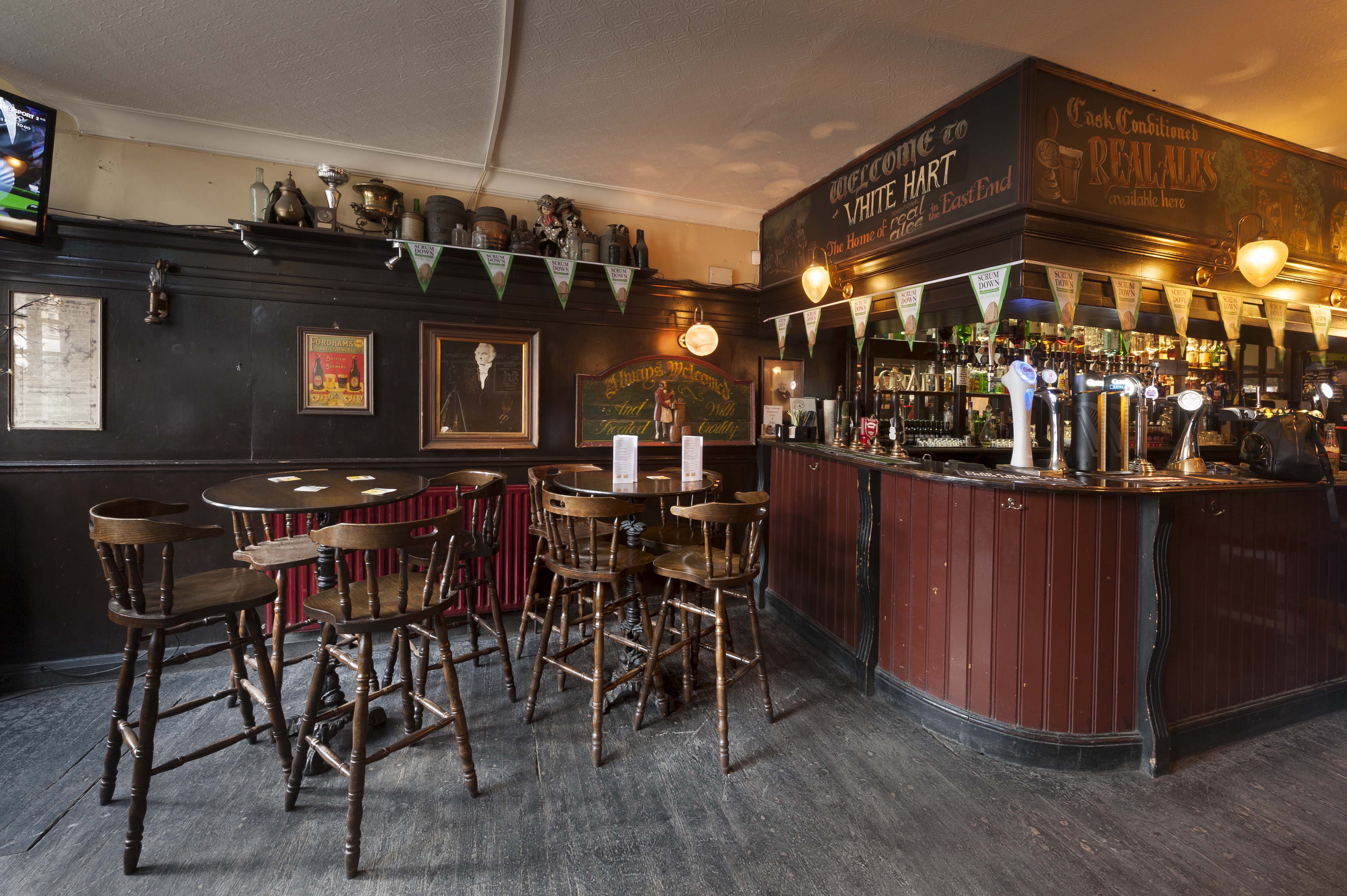
"title": "The front bar at the White Hart, Feb 2018",
"author": {
"id": 27,
"username": "DerekKendall"
},
"feature": {
"id": 321,
"type": "Feature",
"geometry": {
"type": "MultiPolygon",
"coordinates": [
[
[
[
-0.070851482033923,
51.51583890438921
],
[
-0.070769983901351,
51.515756150681995
],
[
-0.070826096590134,
51.51573168194945
],
[
-0.070910018893456,
51.51581372858656
],
[
-0.070987330377172,
51.51589641332654
],
[
-0.071038807895081,
51.515953523899796
],
[
-0.070962773338145,
51.515980152176006
],
[
-0.070839633171055,
51.51584349573393
],
[
-0.070851482033923,
51.51583890438921
]
]
]
]
},
"properties": {
"b_number": "89",
"b_name": "White Hart, 89 Whitechapel High Street",
"street": "Whitechapel High Street",
"address": "White Hart, 89 Whitechapel High Street, London E1",
"feature_type": "WHITECHAPEL_BUILDING",
"count": 9,
"search_str": "White Hart, 89 Whitechapel High Street"
},
"tags": []
},
"file": "https://surveyoflondon.org/media/uploads/features/321/SoL%20Whitechapel%20101864.jpg",
"description": "",
"copyright": true,
"created": "2018-03-22"
},
{
"id": 1220,
"title": "Sitting area and front bar at the White Hart, Feb 2018",
"author": {
"id": 27,
"username": "DerekKendall"
},
"feature": {
"id": 321,
"type": "Feature",
"geometry": {
"type": "MultiPolygon",
"coordinates": [
[
[
[
-0.070851482033923,
51.51583890438921
],
[
-0.070769983901351,
51.515756150681995
],
[
-0.070826096590134,
51.51573168194945
],
[
-0.070910018893456,
51.51581372858656
],
[
-0.070987330377172,
51.51589641332654
],
[
-0.071038807895081,
51.515953523899796
],
[
-0.070962773338145,
51.515980152176006
],
[
-0.070839633171055,
51.51584349573393
],
[
-0.070851482033923,
51.51583890438921
]
]
]
]
},
"properties": {
"b_number": "89",
"b_name": "White Hart, 89 Whitechapel High Street",
"street": "Whitechapel High Street",
"address": "White Hart, 89 Whitechapel High Street, London E1",
"feature_type": "WHITECHAPEL_BUILDING",
"count": 9,
"search_str": "White Hart, 89 Whitechapel High Street"
},
"tags": []
},
"file": "https://surveyoflondon.org/media/uploads/features/321/SoL%20Whitechapel%20101865.jpg",
"description": "",
"copyright": true,
"created": "2018-03-22"
},
{
"id": 1221,
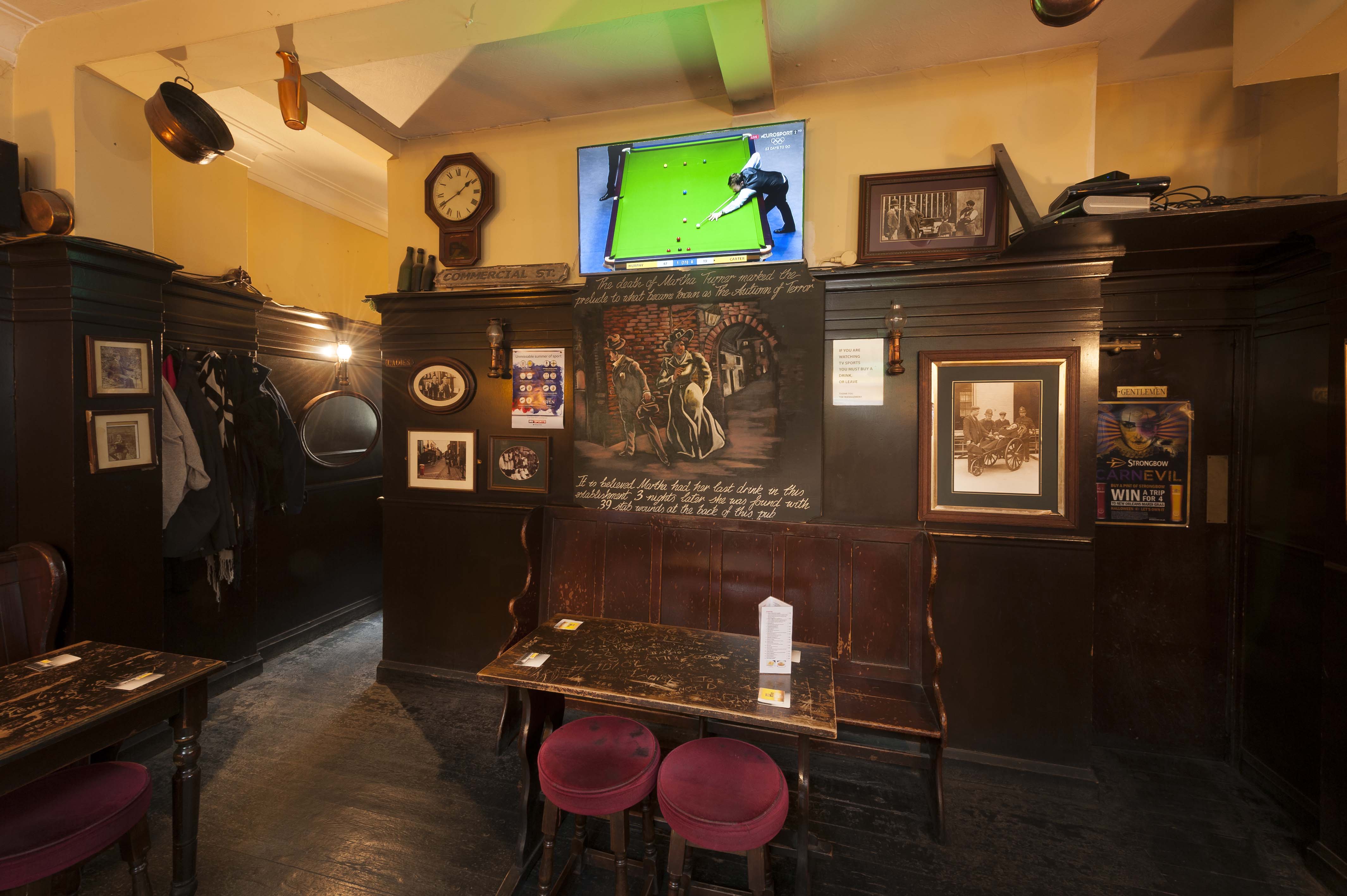
"title": "At the back of the White Hart",
"author": {
"id": 27,
"username": "DerekKendall"
},
"feature": {
"id": 321,
"type": "Feature",
"geometry": {
"type": "MultiPolygon",
"coordinates": [
[
[
[
-0.070851482033923,
51.51583890438921
],
[
-0.070769983901351,
51.515756150681995
],
[
-0.070826096590134,
51.51573168194945
],
[
-0.070910018893456,
51.51581372858656
],
[
-0.070987330377172,
51.51589641332654
],
[
-0.071038807895081,
51.515953523899796
],
[
-0.070962773338145,
51.515980152176006
],
[
-0.070839633171055,
51.51584349573393
],
[
-0.070851482033923,
51.51583890438921
]
]
]
]
},
"properties": {
"b_number": "89",
"b_name": "White Hart, 89 Whitechapel High Street",
"street": "Whitechapel High Street",
"address": "White Hart, 89 Whitechapel High Street, London E1",
"feature_type": "WHITECHAPEL_BUILDING",
"count": 9,
"search_str": "White Hart, 89 Whitechapel High Street"
},
"tags": []
},
"file": "https://surveyoflondon.org/media/uploads/features/321/SoL%20Whitechapel%20101866.jpg",
"description": "The rear bar has access to the WCs, and a small yard, since 2013 a smoking area",
"copyright": true,
"created": "2018-03-22"
},
{
"id": 1222,
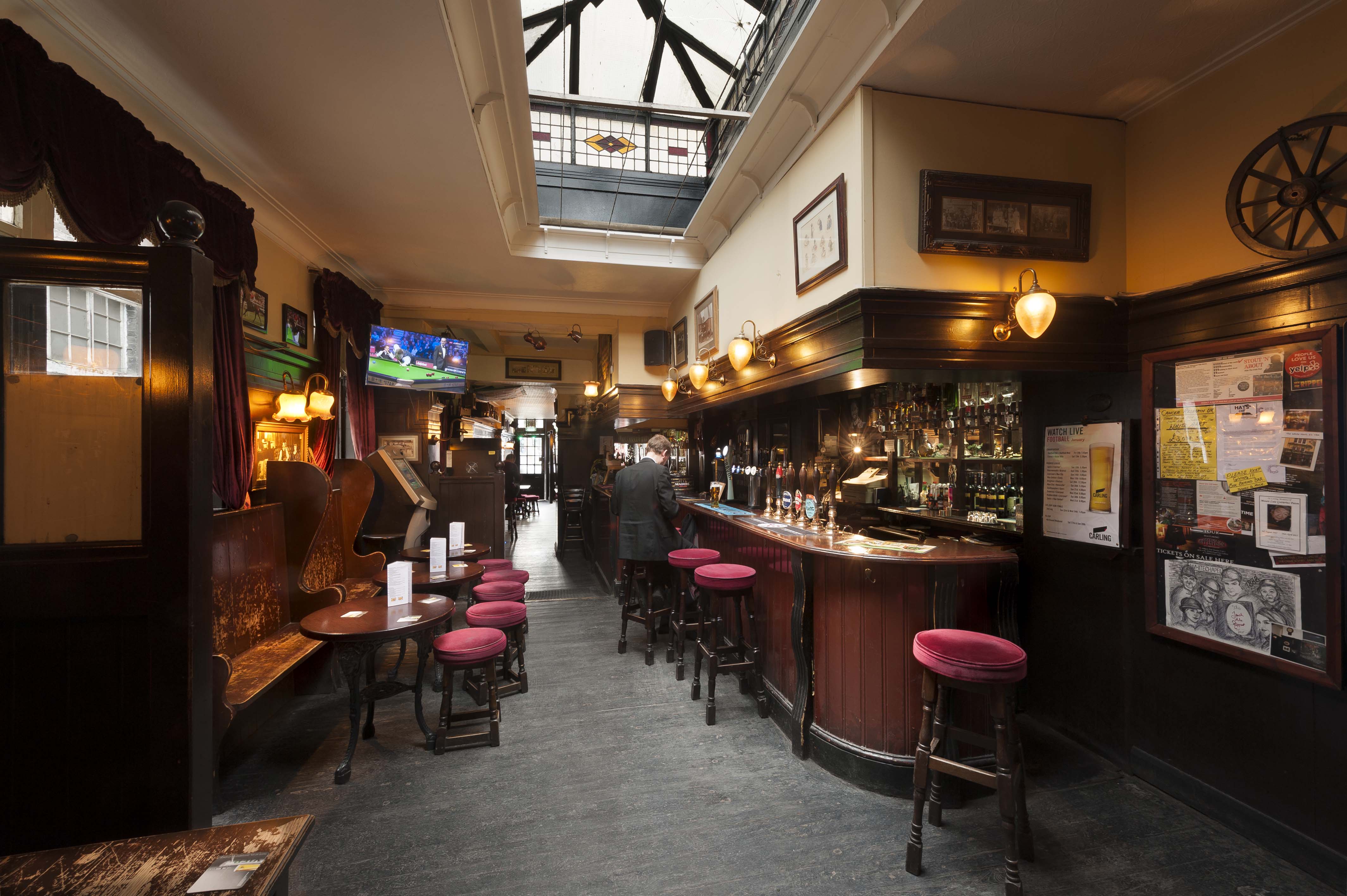
"title": "The rear bar at the White Hart, Feb 2018",
"author": {
"id": 27,
"username": "DerekKendall"
},
"feature": {
"id": 321,
"type": "Feature",
"geometry": {
"type": "MultiPolygon",
"coordinates": [
[
[
[
-0.070851482033923,
51.51583890438921
],
[
-0.070769983901351,
51.515756150681995
],
[
-0.070826096590134,
51.51573168194945
],
[
-0.070910018893456,
51.51581372858656
],
[
-0.070987330377172,
51.51589641332654
],
[
-0.071038807895081,
51.515953523899796
],
[
-0.070962773338145,
51.515980152176006
],
[
-0.070839633171055,
51.51584349573393
],
[
-0.070851482033923,
51.51583890438921
]
]
]
]
},
"properties": {
"b_number": "89",
"b_name": "White Hart, 89 Whitechapel High Street",
"street": "Whitechapel High Street",
"address": "White Hart, 89 Whitechapel High Street, London E1",
"feature_type": "WHITECHAPEL_BUILDING",
"count": 9,
"search_str": "White Hart, 89 Whitechapel High Street"
},
"tags": []
},
"file": "https://surveyoflondon.org/media/uploads/features/321/SoL%20Whitechapel%20101867.jpg",
"description": "",
"copyright": true,
"created": "2018-03-22"
},
{
"id": 1657,
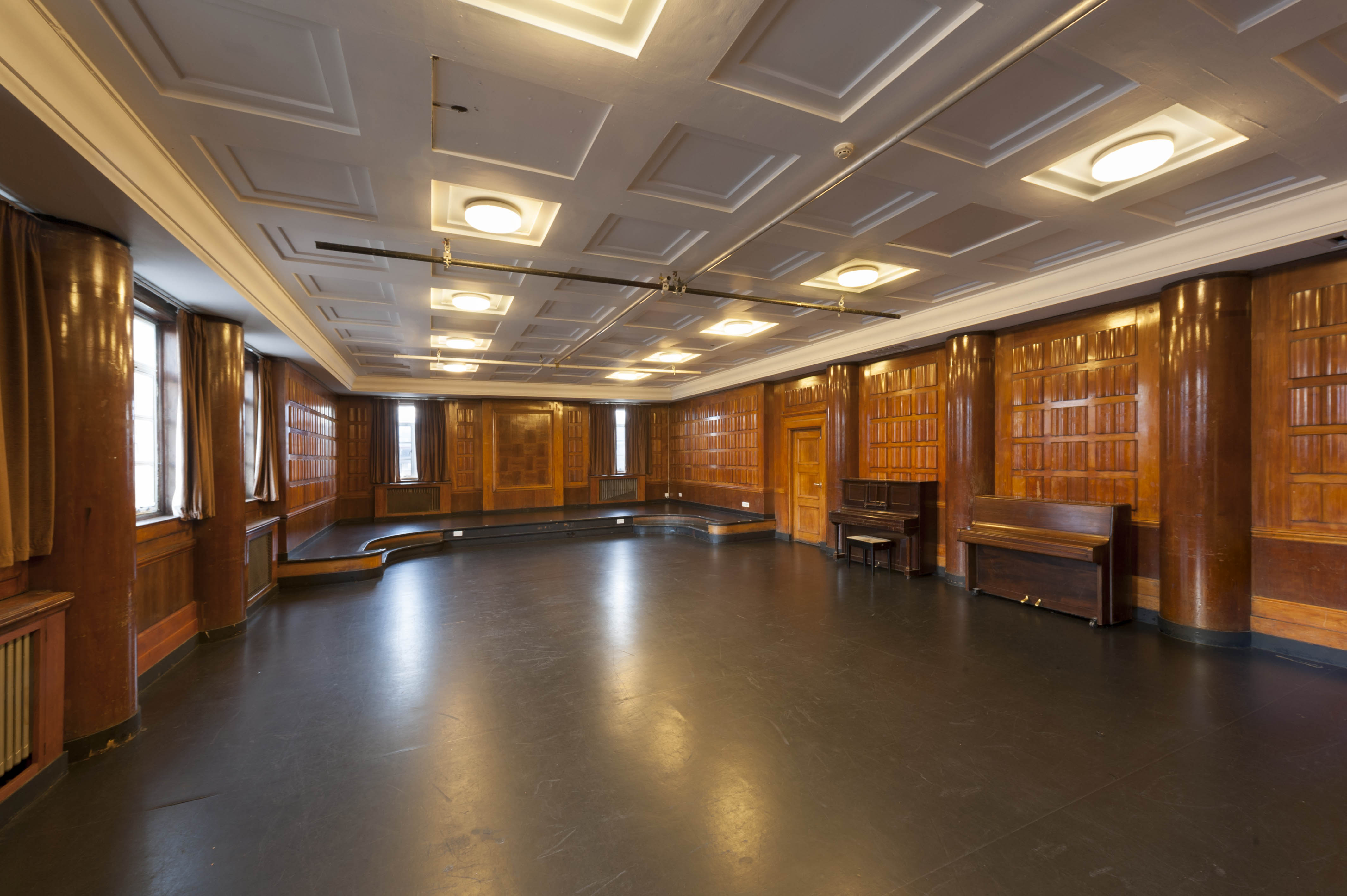
"title": "Toynbee Studios, music room in 2018",
"author": {
"id": 27,
"username": "DerekKendall"
},
"feature": {
"id": 363,
"type": "Feature",
"geometry": {
"type": "MultiPolygon",
"coordinates": [
[
[
[
-0.071925812853689,
51.51628044602403
],
[
-0.07209825445447,
51.51648373796319
],
[
-0.072014842692987,
51.51650807351777
],
[
-0.072028895096668,
51.516526827864084
],
[
-0.071985260710589,
51.51653955484268
],
[
-0.071954889431682,
51.51649902124257
],
[
-0.07174059591681,
51.51656152455521
],
[
-0.071639963606618,
51.51642721896221
],
[
-0.071877528223456,
51.51635792813221
],
[
-0.071838544476817,
51.51630589989327
],
[
-0.071925812853689,
51.51628044602403
]
]
]
]
},
"properties": {
"b_number": "28",
"b_name": "Toynbee Studios, 28 Commercial Street",
"street": "28 Commercial Street",
"address": "Toynbee Studios, 28 Commercial Street",
"feature_type": "WHITECHAPEL_BUILDING",
"count": 8,
"search_str": "Toynbee Studios, 28 Commercial Street"
},
"tags": []
},
"file": "https://surveyoflondon.org/media/uploads/features/363/SoL%20Whitechapel%20102583.jpg",
"description": "",
"copyright": true,
"created": "2019-09-03"
},
{
"id": 1658,
"title": "Toynbee Studios, music room, detail of panelling",
"author": {
"id": 27,
"username": "DerekKendall"
},
"feature": {
"id": 363,
"type": "Feature",
"geometry": {
"type": "MultiPolygon",
"coordinates": [
[
[
[
-0.071925812853689,
51.51628044602403
],
[
-0.07209825445447,
51.51648373796319
],
[
-0.072014842692987,
51.51650807351777
],
[
-0.072028895096668,
51.516526827864084
],
[
-0.071985260710589,
51.51653955484268
],
[
-0.071954889431682,
51.51649902124257
],
[
-0.07174059591681,
51.51656152455521
],
[
-0.071639963606618,
51.51642721896221
],
[
-0.071877528223456,
51.51635792813221
],
[
-0.071838544476817,
51.51630589989327
],
[
-0.071925812853689,
51.51628044602403
]
]
]
]
},
"properties": {
"b_number": "28",
"b_name": "Toynbee Studios, 28 Commercial Street",
"street": "28 Commercial Street",
"address": "Toynbee Studios, 28 Commercial Street",
"feature_type": "WHITECHAPEL_BUILDING",
"count": 8,
"search_str": "Toynbee Studios, 28 Commercial Street"
},
"tags": []
},
"file": "https://surveyoflondon.org/media/uploads/features/363/SoL%20Whitechapel%20102592.jpg",
"description": "",
"copyright": true,
"created": "2019-09-03"
},
{
"id": 1659,
"title": "Toynbee Studios, theatre in 2018",
"author": {
"id": 27,
"username": "DerekKendall"
},
"feature": {
"id": 363,
"type": "Feature",
"geometry": {
"type": "MultiPolygon",
"coordinates": [
[
[
[
-0.071925812853689,
51.51628044602403
],
[
-0.07209825445447,
51.51648373796319
],
[
-0.072014842692987,
51.51650807351777
],
[
-0.072028895096668,
51.516526827864084
],
[
-0.071985260710589,
51.51653955484268
],
[
-0.071954889431682,
51.51649902124257
],
[
-0.07174059591681,
51.51656152455521
],
[
-0.071639963606618,
51.51642721896221
],
[
-0.071877528223456,
51.51635792813221
],
[
-0.071838544476817,
51.51630589989327
],
[
-0.071925812853689,
51.51628044602403
]
]
]
]
},
"properties": {
"b_number": "28",
"b_name": "Toynbee Studios, 28 Commercial Street",
"street": "28 Commercial Street",
"address": "Toynbee Studios, 28 Commercial Street",
"feature_type": "WHITECHAPEL_BUILDING",
"count": 8,
"search_str": "Toynbee Studios, 28 Commercial Street"
},
"tags": []
},
"file": "https://surveyoflondon.org/media/uploads/features/363/SoL%20Whitechapel%20102595.jpg",
"description": "",
"copyright": true,
"created": "2019-09-03"
},
{
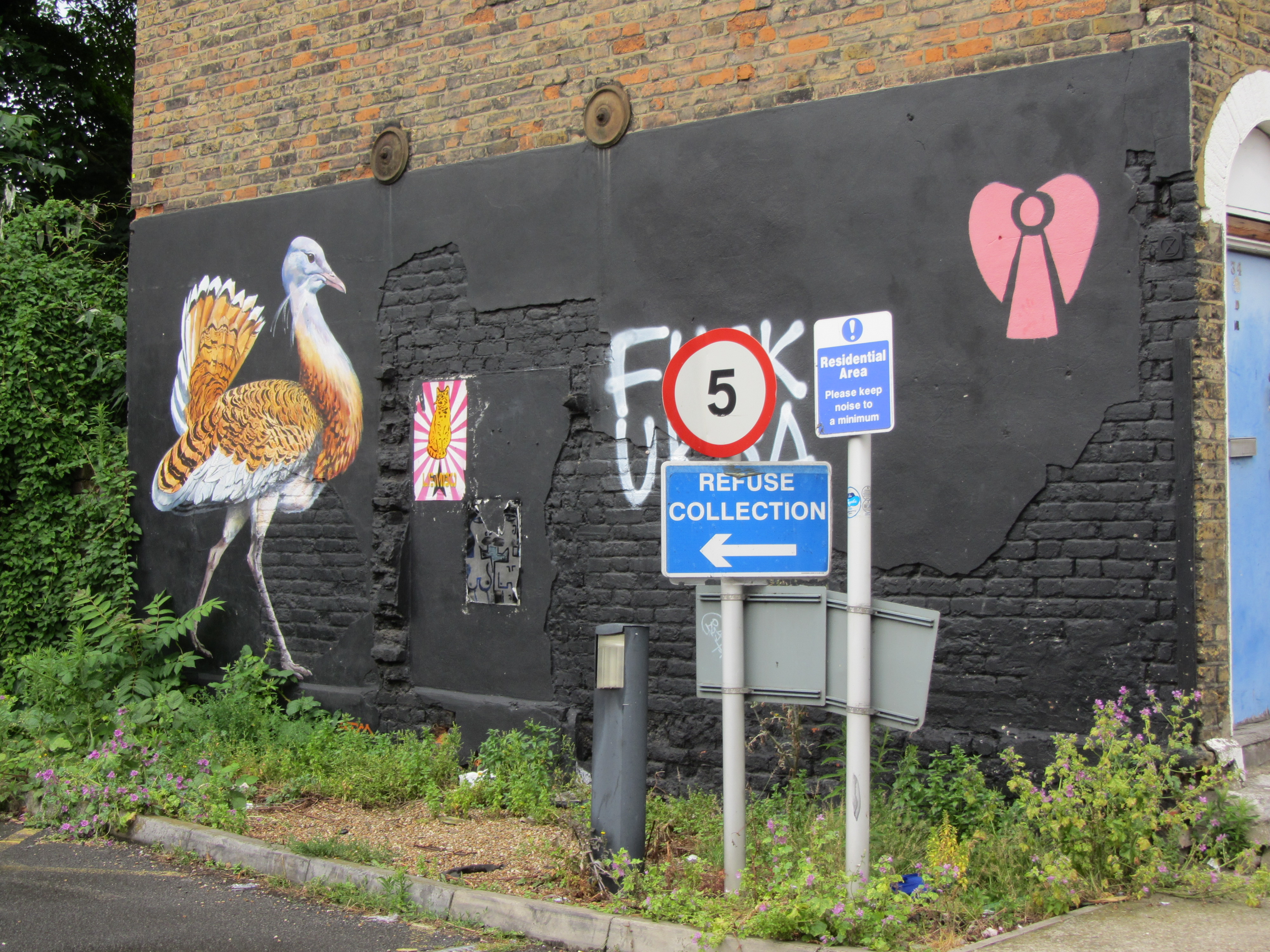
"id": 115,
"title": "West elevation of 34 Mount Terrace, July 2016",
"author": {
"id": 11,
"username": "amyspencer"
},
"feature": {
"id": 1170,
"type": "Feature",
"geometry": {
"type": "MultiPolygon",
"coordinates": [
[
[
[
-0.062372063176935,
51.51802687103117
],
[
-0.062336607235634,
51.51796409156185
],
[
-0.062401703003155,
51.517949893541626
],
[
-0.062451208807604,
51.51804425994197
],
[
-0.062419723501085,
51.51805057374879
],
[
-0.062403643402681,
51.51801997023266
],
[
-0.062372063176935,
51.51802687103117
]
]
]
]
},
"properties": {
"b_number": "34",
"b_name": "",
"street": "Mount Terrace",
"address": "34 Mount Terrace",
"feature_type": "WHITECHAPEL_BUILDING",
"count": 5,
"search_str": "34 Mount Terrace"
},
"tags": []
},
"file": "https://surveyoflondon.org/media/uploads/features/1170/IMG_8383.JPG",
"description": "",
"copyright": false,
"created": "2016-07-13"
},
{
"id": 48,
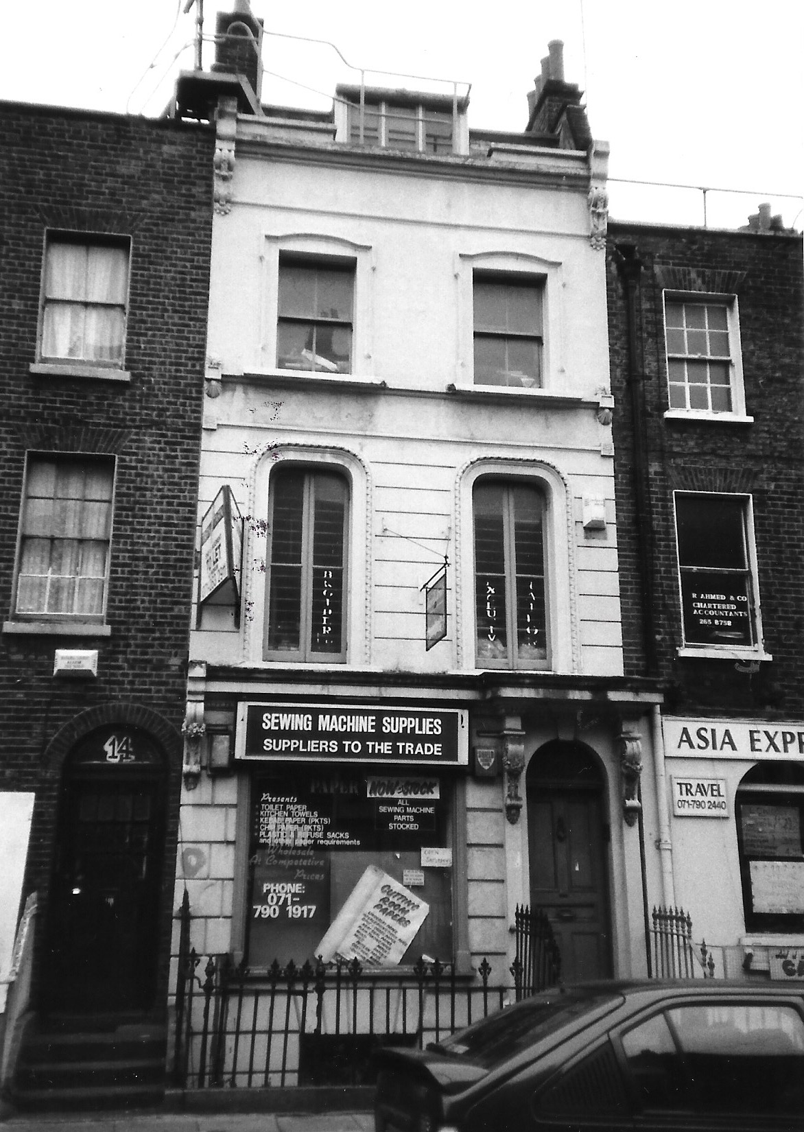
"title": "12 New Road March 1992",
"author": {
"id": 21,
"username": "IsobelWatson"
},
"feature": {
"id": 1136,
"type": "Feature",
"geometry": {
"type": "MultiPolygon",
"coordinates": [
[
[
[
-0.06193045363785,
51.51534015647431
],
[
-0.061819909564877,
51.515349190087086
],
[
-0.061811674690276,
51.51530755159443
],
[
-0.06192172131895,
51.515298558631365
],
[
-0.06193045363785,
51.51534015647431
]
]
]
]
},
"properties": {
"b_number": "12",
"b_name": "",
"street": "New Road",
"address": "12 New Road",
"feature_type": "WHITECHAPEL_BUILDING",
"count": 2,
"search_str": "12 New Road"
},
"tags": []
},
"file": "https://surveyoflondon.org/media/uploads/features/1135/12%20New%20Road%20March%201992.jpg",
"description": "",
"copyright": false,
"created": "2016-06-20"
},
{
"id": 49,
"title": "8-18 (even) New Road, March 1992",
"author": {
"id": 21,
"username": "IsobelWatson"
},
"feature": {
"id": 1132,
"type": "Feature",
"geometry": {
"type": "MultiPolygon",
"coordinates": [
[
[
[
-0.061956406812953,
51.51546378828541
],
[
-0.06180843280572,
51.51547588062743
],
[
-0.061800702181804,
51.51543679185386
],
[
-0.061948209172629,
51.51542473767456
],
[
-0.061956406812953,
51.51546378828541
]
]
]
]
},
"properties": {
"b_number": "18",
"b_name": "",
"street": "New Road",
"address": "18 New Road",
"feature_type": "WHITECHAPEL_BUILDING",
"count": 2,
"search_str": "18 New Road"
},
"tags": []
},
"file": "https://surveyoflondon.org/media/uploads/features/1132/8-18%20(even)%20New%20Road%2C%20March%201992.jpg",
"description": "",
"copyright": false,
"created": "2016-06-20"
},
{
"id": 39,
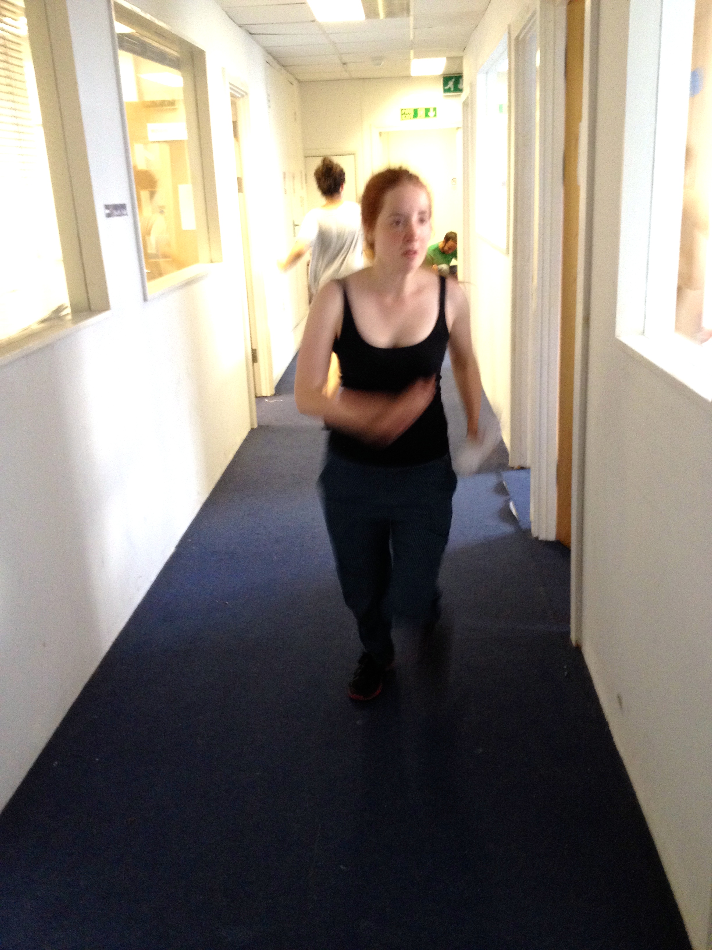
"title": "Theatre rehearsal at Frazer House, 2014",
"author": {
"id": 28,
"username": "jamie@hobotheatre.co.uk"
},
"feature": {
"id": 37,
"type": "Feature",
"geometry": {
"type": "MultiPolygon",
"coordinates": [
[
[
[
-0.071113759773247,
51.513989212236595
],
[
-0.07097765657936,
51.514031042914745
],
[
-0.070977656579359,
51.514031042914745
],
[
-0.070840916237889,
51.513863013080794
],
[
-0.071192934027189,
51.51374219365012
],
[
-0.071318896467733,
51.51389139371029
],
[
-0.071095239409909,
51.51396646699376
],
[
-0.071113759773247,
51.513989212236595
]
]
]
]
},
"properties": {
"b_number": "39-47",
"b_name": "Frazer House",
"street": "Alie Street",
"address": "Frazer House, 39-47 Alie Street (including 32-38 Leman Street)",
"feature_type": "WHITECHAPEL_BUILDING",
"count": 4,
"search_str": "Frazer House"
},
"tags": []
},
"file": "https://surveyoflondon.org/media/uploads/features/37/wh2bhw_3.jpg",
"description": "",
"copyright": false,
"created": "2016-06-20"
},
{
"id": 960,
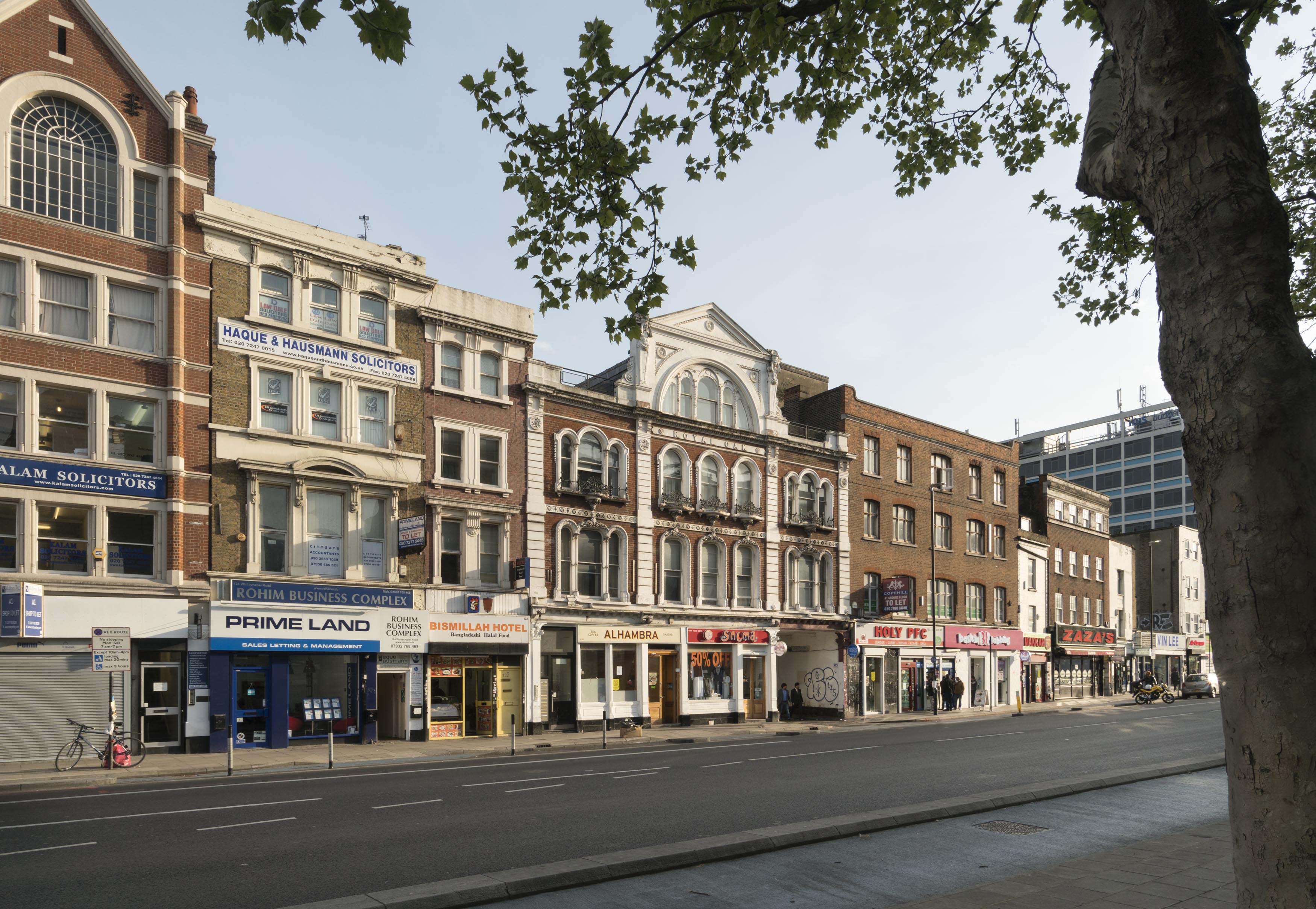
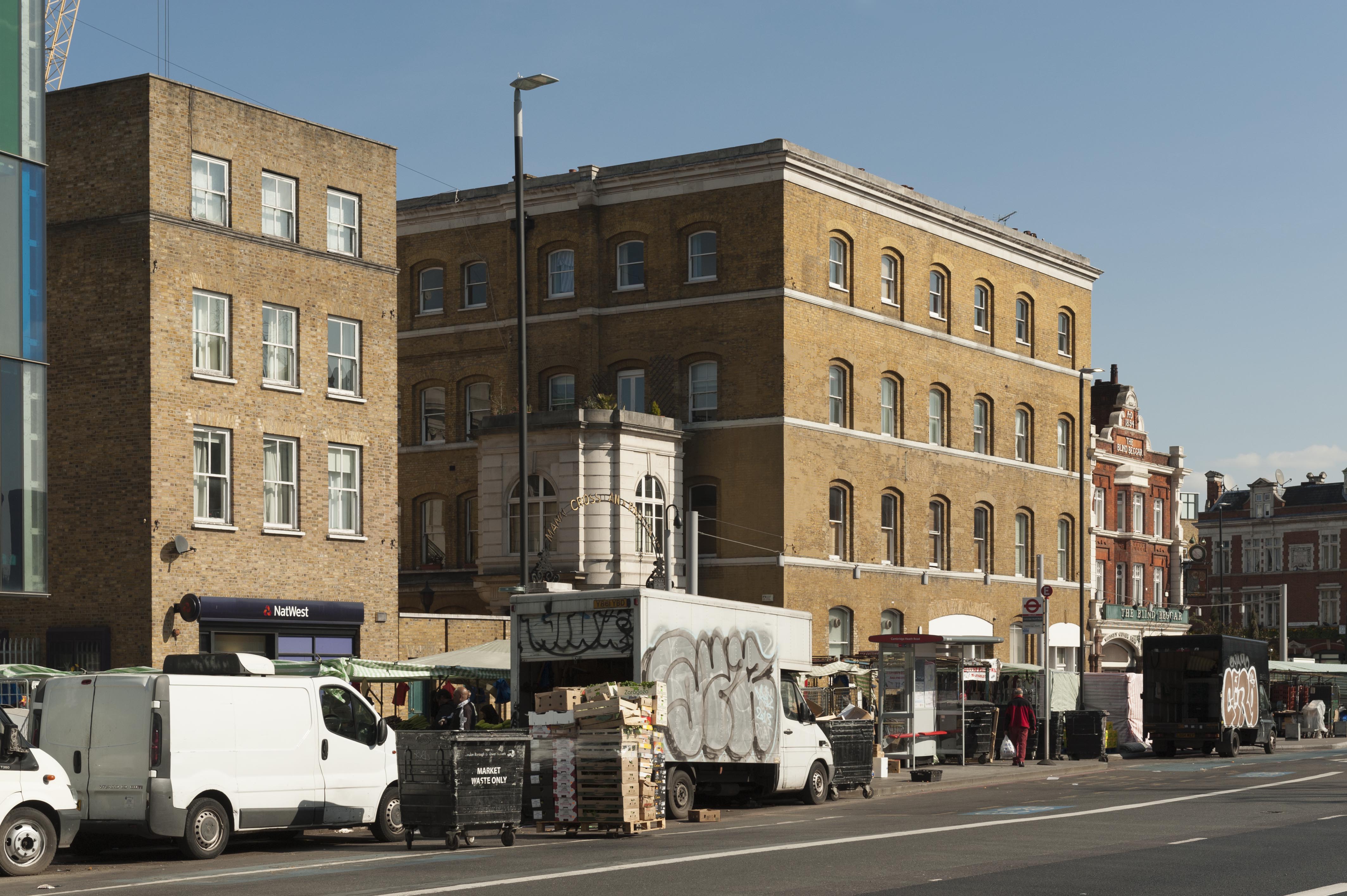
"title": "102-128 Whitechapel Road in March 2017",
"author": {
"id": 27,
"username": "DerekKendall"
},
"feature": {
"id": 873,
"type": "Feature",
"geometry": {
"type": "MultiPolygon",
"coordinates": [
[
[
[
-0.063739503777729,
51.51804861845898
],
[
-0.063683451117025,
51.51797300209851
],
[
-0.0637089382797,
51.51796483346984
],
[
-0.063836182144524,
51.51792452272944
],
[
-0.063835842009052,
51.51792462190747
],
[
-0.063877274830691,
51.51791330545044
],
[
-0.063934479931202,
51.51800468952643
],
[
-0.063739503777729,
51.51804861845898
]
]
]
]
},
"properties": {
"b_number": "118-120",
"b_name": "Former Royal Oak public house",
"street": "Whitechapel Road",
"address": "Former Royal Oak public house, 118-120 Whitechapel Road",
"feature_type": "WHITECHAPEL_BUILDING",
"count": 9,
"search_str": "Former Royal Oak public house"
},
"tags": [
"Royal Oak"
]
},
"file": "https://surveyoflondon.org/media/uploads/features/873/SoL%20Whitechapel%20100761.jpg",
"description": "",
"copyright": true,
"created": "2017-11-30"
},
{
"id": 803,
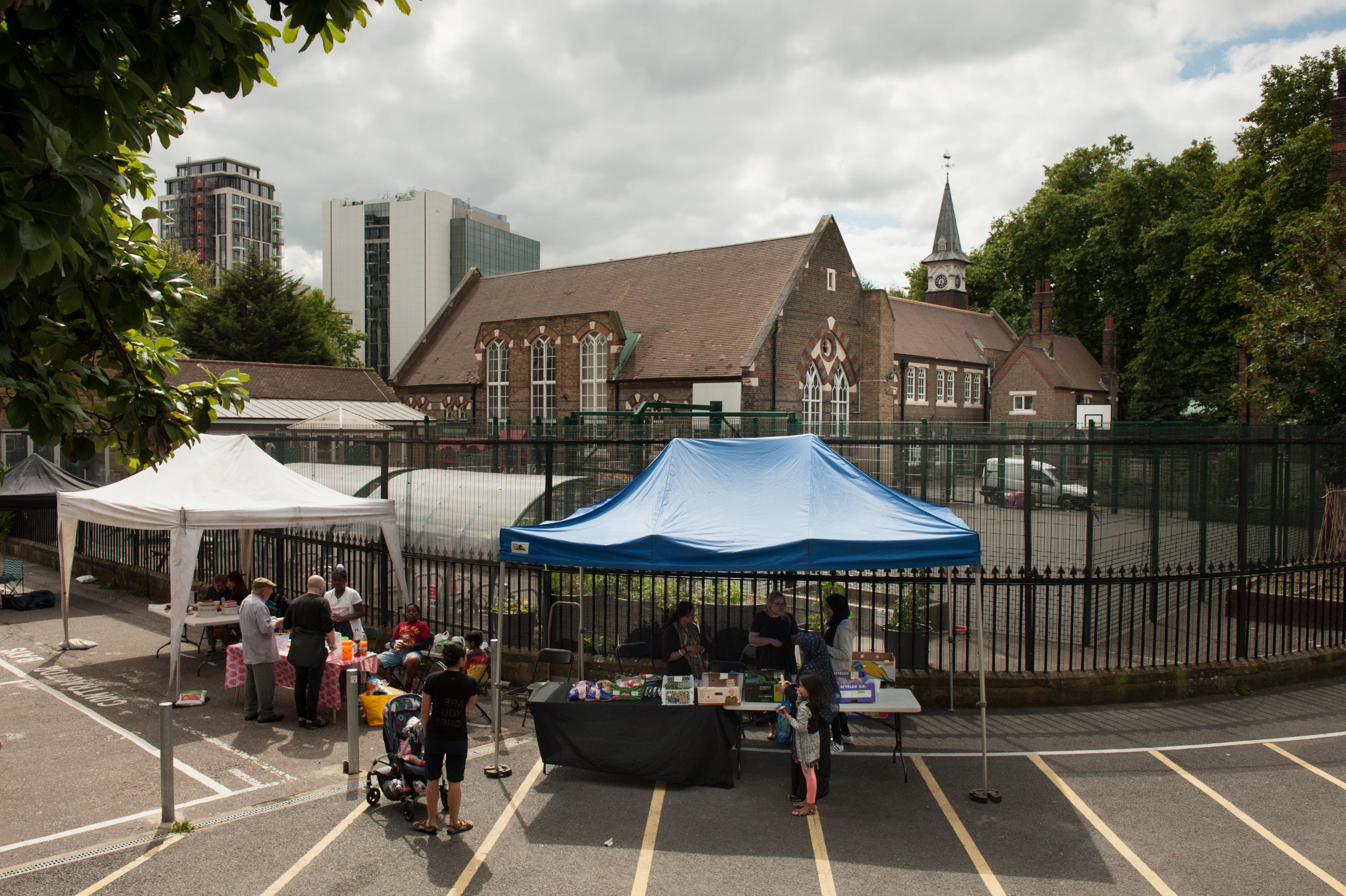
"title": "St Paul's School, Wellclose Square, with market in August 2017",
"author": {
"id": 27,
"username": "DerekKendall"
},
"feature": {
"id": 1399,
"type": "Feature",
"geometry": {
"type": "MultiPolygon",
"coordinates": [
[
[
[
-0.06624311370635,
51.51019072010641
],
[
-0.066077627531148,
51.510204269850675
],
[
-0.066069527116146,
51.510170337345684
],
[
-0.06611551384684,
51.51016638639934
],
[
-0.066109726117682,
51.51014703372793
],
[
-0.065814585354416,
51.5101673738921
],
[
-0.065821533323482,
51.51022330153386
],
[
-0.065683910471039,
51.51023360737856
],
[
-0.065657889334494,
51.51008339520407
],
[
-0.065349361164399,
51.51010853754948
],
[
-0.06532938777826,
51.510008209650636
],
[
-0.065633994165545,
51.509987653756085
],
[
-0.065620188745178,
51.50991765971934
],
[
-0.065722948991599,
51.50991121538507
],
[
-0.065716780377172,
51.509880881568165
],
[
-0.065901817537395,
51.50986765480321
],
[
-0.06593178354119,
51.50999605393065
],
[
-0.066038317356042,
51.509988508785376
],
[
-0.066023042932445,
51.50990918839897
],
[
-0.065998737156917,
51.50991111308007
],
[
-0.065980280001972,
51.50981894970597
],
[
-0.066320560006103,
51.50979200375635
],
[
-0.06632996113982,
51.50983401855985
],
[
-0.066268265775343,
51.50983881506029
],
[
-0.066265082872055,
51.50982597208467
],
[
-0.066214609325215,
51.509829790835916
],
[
-0.066234584593038,
51.50993011860635
],
[
-0.066179431061551,
51.509934441553284
],
[
-0.066189455574639,
51.5099837339709
],
[
-0.066197871962622,
51.509983000685985
],
[
-0.066205558541818,
51.510021498909204
],
[
-0.066199016557763,
51.510021972412325
],
[
-0.066209250254486,
51.51006632649741
],
[
-0.066216245469672,
51.51006615116071
],
[
-0.066221862792188,
51.51009851070753
],
[
-0.066214365136205,
51.51009954983773
],
[
-0.066220460291682,
51.51013162657133
],
[
-0.06623170678327,
51.51013006787535
],
[
-0.06624311370635,
51.51019072010641
]
]
]
]
},
"properties": {
"b_number": "",
"b_name": "St Paul's School",
"street": "Wellclose Square",
"address": "St Paul's School, Wellclose Square",
"feature_type": "WHITECHAPEL_BUILDING",
"count": 22,
"search_str": "St Paul's School"
},
"tags": [
"Rev. Dan Greatorex",
"Thomas F. Ford and Partners",
"Wilby & Burnett"
]
},
"file": "https://surveyoflondon.org/media/uploads/features/1399/SoL%20Whitechapel%20101234.jpg",
"description": "",
"copyright": true,
"created": "2017-09-12"
},
{
"id": 499,
"title": "Painting in the basement of the Garrod Building",
"author": {
"id": 11,
"username": "amyspencer"
},
"feature": {
"id": 1189,
"type": "Feature",
"geometry": {
"type": "MultiPolygon",
"coordinates": [
[
[
[
-0.060957318414032,
51.51782190843071
],
[
-0.060536358742238,
51.517916494366496
],
[
-0.06042382559955,
51.5177169757099
],
[
-0.060423392052643,
51.517716267459285
],
[
-0.06037583590265,
51.51772558880798
],
[
-0.060352091559155,
51.517682266082666
],
[
-0.060399184829325,
51.5176714337657
],
[
-0.060382136461735,
51.517636775872596
],
[
-0.060366794729858,
51.51763667842599
],
[
-0.060353568375337,
51.517633521256826
],
[
-0.060340249107007,
51.51762886391949
],
[
-0.060331431296148,
51.51762072004323
],
[
-0.060328691457909,
51.51761554771857
],
[
-0.060326999079391,
51.517611443342886
],
[
-0.060327382221525,
51.517606284181284
],
[
-0.060329047985828,
51.51760203725169
],
[
-0.060331232366157,
51.517597910289986
],
[
-0.060333234968373,
51.517593887621835
],
[
-0.0603394749266,
51.51758477508556
],
[
-0.060343650894546,
51.51757832358151
],
[
-0.060315667444656,
51.51752195768432
],
[
-0.060339055445574,
51.51749626222509
],
[
-0.06039972958586,
51.51748509401273
],
[
-0.060844270778094,
51.51743888994093
],
[
-0.060875340433462,
51.517555246058656
],
[
-0.060894657489377,
51.517564918111205
],
[
-0.060905236784801,
51.51757830806902
],
[
-0.060907454524091,
51.51759005281749
],
[
-0.060906490522428,
51.51760128121761
],
[
-0.060896928755295,
51.51761642472545
],
[
-0.060890333226028,
51.51762687042926
],
[
-0.060957318414032,
51.51782190843071
]
]
]
]
},
"properties": {
"b_number": "",
"b_name": "Garrod Building",
"street": "Stepney Way",
"address": "Garrod Building",
"feature_type": "WHITECHAPEL_BUILDING",
"count": 31,
"search_str": "Garrod Building"
},
"tags": []
},
"file": "https://surveyoflondon.org/media/uploads/features/1189/IMG_9938.JPG",
"description": "Painting on canvas in the basement of the Garrod Building, on the approach to the tunnel to the Outpatients Department. \nUnknown artist, c.1970s\nPhotographed in February 2017",
"copyright": false,
"created": "2017-02-21"
},
{
"id": 810,
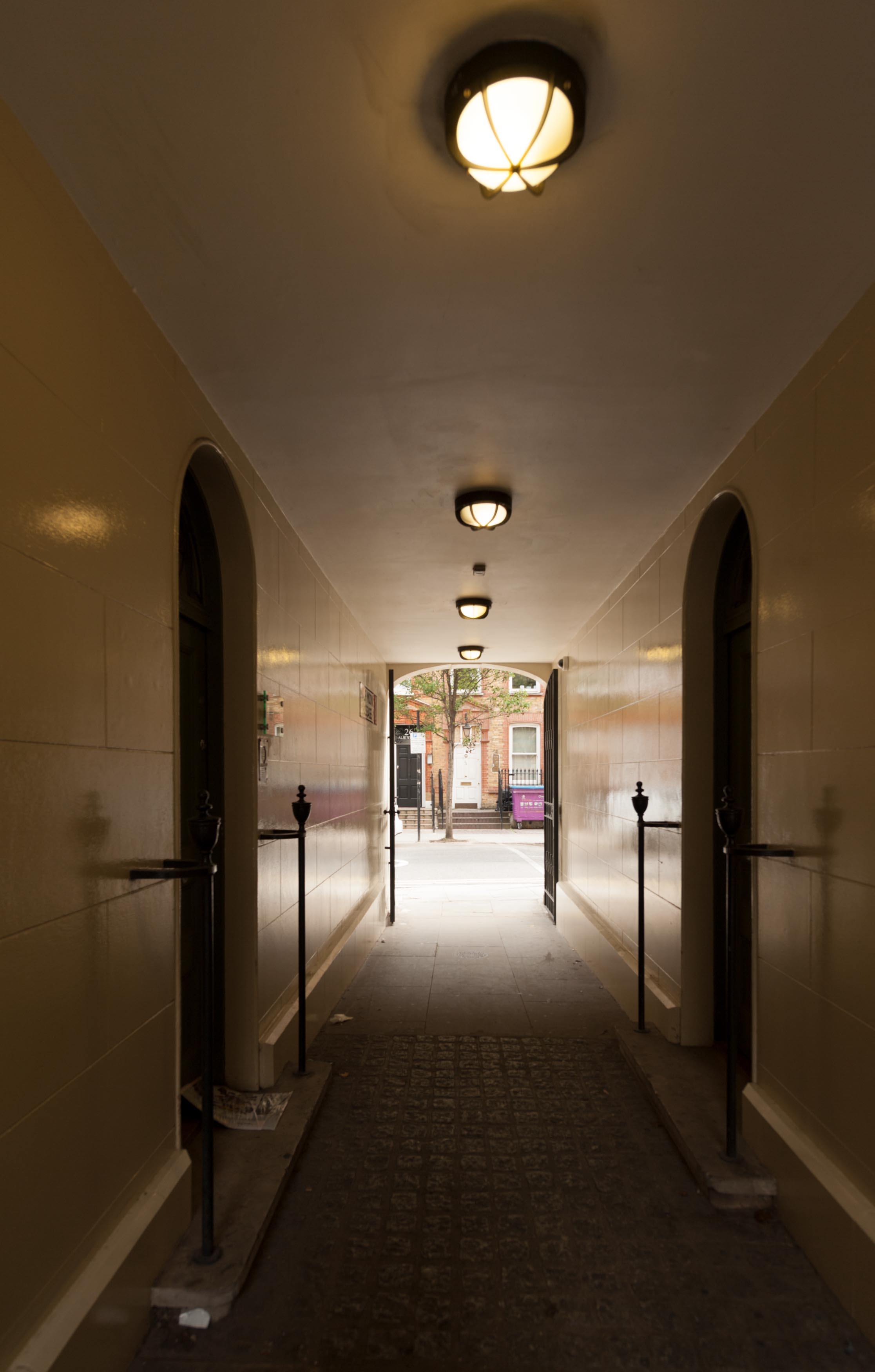
"title": "Half Moon Passage running between 17-19 Alie Street",
"author": {
"id": 27,
"username": "DerekKendall"
},
"feature": {
"id": 33,
"type": "Feature",
"geometry": {
"type": "MultiPolygon",
"coordinates": [
[
[
[
-0.071865525294463,
51.513635775949055
],
[
-0.071785458230957,
51.51353968533075
],
[
-0.071900260305993,
51.51350038640229
],
[
-0.07197326495485,
51.51359817527253
],
[
-0.071865525294463,
51.513635775949055
]
]
]
]
},
"properties": {
"b_number": "17-19",
"b_name": "",
"street": "Alie Street",
"address": "17-19 Alie Street",
"feature_type": "WHITECHAPEL_BUILDING",
"count": 5,
"search_str": "17-19 Alie Street"
},
"tags": []
},
"file": "https://surveyoflondon.org/media/uploads/features/33/SoL%20Whitechapel%20101552.jpg",
"description": "",
"copyright": true,
"created": "2017-09-12"
},
{
"id": 109,
"title": "65A-68 Whitechapel High Street in 2010",
"author": {
"id": 32,
"username": "JulianHarrap"
},
"feature": {
"id": 165,
"type": "Feature",
"geometry": {
"type": "MultiPolygon",
"coordinates": [
[
[
[
-0.069889119521129,
51.51579713749756
],
[
-0.069830541484445,
51.51582381203128
],
[
-0.069748230427938,
51.51575345083506
],
[
-0.069809844959613,
51.51573576424656
],
[
-0.069889119521129,
51.51579713749756
]
]
]
]
},
"properties": {
"b_number": "65",
"b_name": "",
"street": "Whitechapel High Street",
"address": "65 Whitechapel High Street",
"feature_type": "WHITECHAPEL_BUILDING",
"count": 4,
"search_str": "65 Whitechapel High Street"
},
"tags": []
},
"file": "https://surveyoflondon.org/media/uploads/features/165/65-68%20Whitechapel%20High%20Street%202010%20(Julian%20Harrap%20Architects).jpg",
"description": "",
"copyright": true,
"created": "2016-06-30"
},
{
"id": 236,
"title": "Albion Yard in 2016",
"author": {
"id": 27,
"username": "DerekKendall"
},
"feature": {
"id": 520,
"type": "Feature",
"geometry": {
"type": "MultiPolygon",
"coordinates": [
[
[
[
-0.057451908164031,
51.520162779025306
],
[
-0.057385151743417,
51.52014697732775
],
[
-0.057385151743417,
51.52014697732775
],
[
-0.057364829396847,
51.52012670800705
],
[
-0.057170213282674,
51.52016963984626
],
[
-0.057098750275007,
51.52004461290751
],
[
-0.057044351749301,
51.52005556326038
],
[
-0.056960904550882,
51.519899865751334
],
[
-0.057272372805932,
51.51983178447637
],
[
-0.057281839102929,
51.5198457992335
],
[
-0.057510183674525,
51.51979460999542
],
[
-0.057612401717062,
51.51977401899527
],
[
-0.057799568433219,
51.52008839297032
],
[
-0.057451908164031,
51.520162779025306
]
],
[
[
-0.057548041923775,
51.52000904200745
],
[
-0.05753215107996,
51.5199815011314
],
[
-0.057585595210164,
51.51996949919713
],
[
-0.057536388591122,
51.519884217752235
],
[
-0.057561162003418,
51.5198786543838
],
[
-0.05751392250335,
51.51979894591583
],
[
-0.057335517633486,
51.51983860864988
],
[
-0.057344903465109,
51.519858110469535
],
[
-0.057364830684365,
51.51985365150651
],
[
-0.057387997106671,
51.51989693261775
],
[
-0.05731968525021,
51.519912116173
],
[
-0.057400572419345,
51.52004119539844
],
[
-0.057548041923775,
51.52000904200745
]
]
]
]
},
"properties": {
"b_number": "331-335",
"b_name": "Albion Yard (formerly Albion Brewery)",
"street": "Whitechapel Road",
"address": "Albion Yard, 331-335 Whitechapel Road",
"feature_type": "WHITECHAPEL_BUILDING",
"count": 11,
"search_str": "Albion Yard (formerly Albion Brewery)"
},
"tags": []
},
"file": "https://surveyoflondon.org/media/uploads/features/520/SoL%20Whitechapel100036.jpg",
"description": "",
"copyright": true,
"created": "2016-08-01"
},
{
"id": 498,
"title": "Painting in the basement of the Garrod Building",
"author": {
"id": 11,
"username": "amyspencer"
},
"feature": {
"id": 1189,
"type": "Feature",
"geometry": {
"type": "MultiPolygon",
"coordinates": [
[
[
[
-0.060957318414032,
51.51782190843071
],
[
-0.060536358742238,
51.517916494366496
],
[
-0.06042382559955,
51.5177169757099
],
[
-0.060423392052643,
51.517716267459285
],
[
-0.06037583590265,
51.51772558880798
],
[
-0.060352091559155,
51.517682266082666
],
[
-0.060399184829325,
51.5176714337657
],
[
-0.060382136461735,
51.517636775872596
],
[
-0.060366794729858,
51.51763667842599
],
[
-0.060353568375337,
51.517633521256826
],
[
-0.060340249107007,
51.51762886391949
],
[
-0.060331431296148,
51.51762072004323
],
[
-0.060328691457909,
51.51761554771857
],
[
-0.060326999079391,
51.517611443342886
],
[
-0.060327382221525,
51.517606284181284
],
[
-0.060329047985828,
51.51760203725169
],
[
-0.060331232366157,
51.517597910289986
],
[
-0.060333234968373,
51.517593887621835
],
[
-0.0603394749266,
51.51758477508556
],
[
-0.060343650894546,
51.51757832358151
],
[
-0.060315667444656,
51.51752195768432
],
[
-0.060339055445574,
51.51749626222509
],
[
-0.06039972958586,
51.51748509401273
],
[
-0.060844270778094,
51.51743888994093
],
[
-0.060875340433462,
51.517555246058656
],
[
-0.060894657489377,
51.517564918111205
],
[
-0.060905236784801,
51.51757830806902
],
[
-0.060907454524091,
51.51759005281749
],
[
-0.060906490522428,
51.51760128121761
],
[
-0.060896928755295,
51.51761642472545
],
[
-0.060890333226028,
51.51762687042926
],
[
-0.060957318414032,
51.51782190843071
]
]
]
]
},
"properties": {
"b_number": "",
"b_name": "Garrod Building",
"street": "Stepney Way",
"address": "Garrod Building",
"feature_type": "WHITECHAPEL_BUILDING",
"count": 31,
"search_str": "Garrod Building"
},
"tags": []
},
"file": "https://surveyoflondon.org/media/uploads/features/1189/IMG_9939_ZzmRZl9.JPG",
"description": "Painting on canvas in the basement of the Garrod Building, on the approach to the tunnel to the Outpatients Department. \nUnknown artist, c.1970s\nPhotographed in February 2017",
"copyright": false,
"created": "2017-02-21"
},
{
"id": 741,
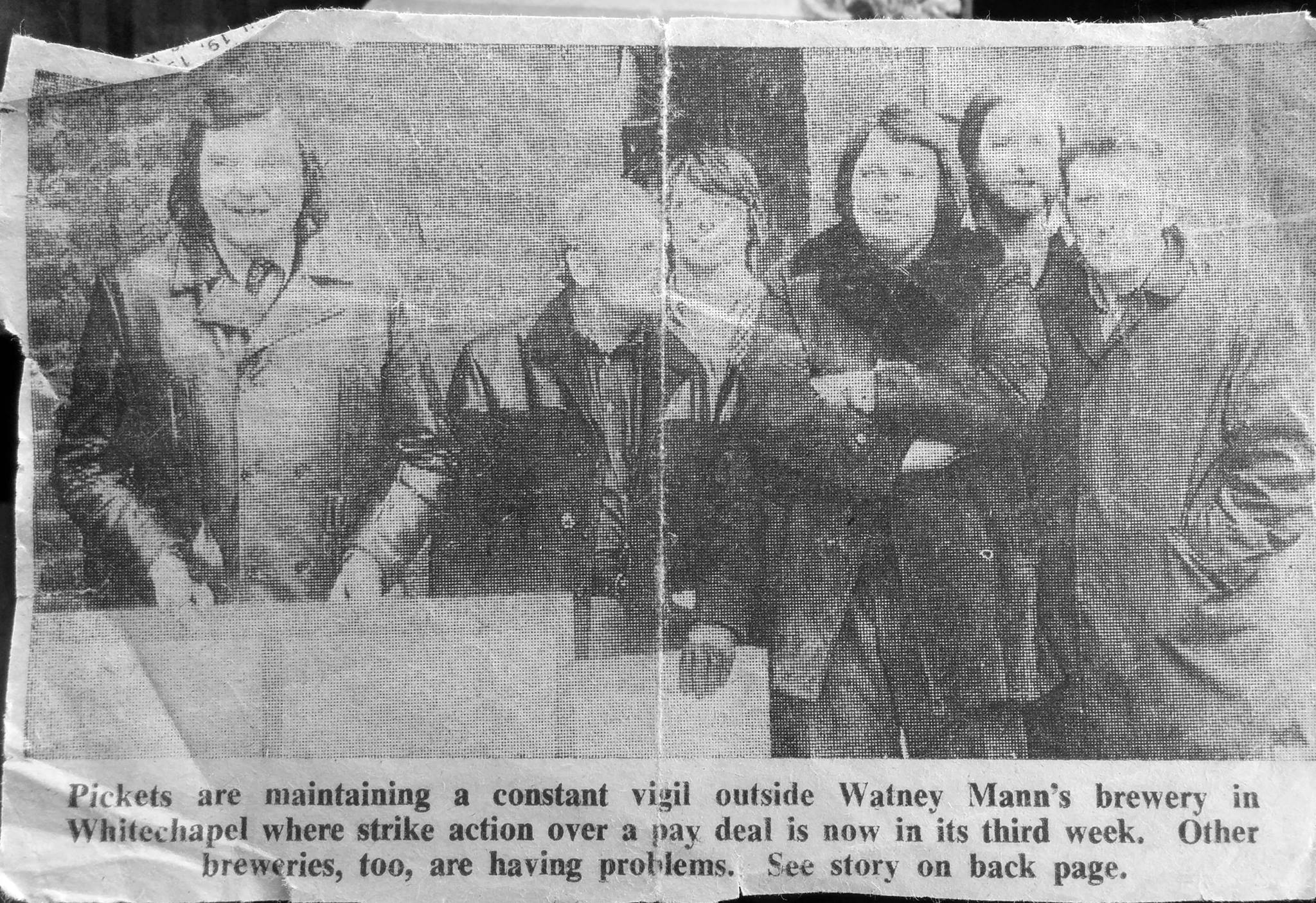
"title": "Watney Mann's workers on strike in the 1970s",
"author": {
"id": 181,
"username": "mick"
},
"feature": {
"id": 520,
"type": "Feature",
"geometry": {
"type": "MultiPolygon",
"coordinates": [
[
[
[
-0.057451908164031,
51.520162779025306
],
[
-0.057385151743417,
51.52014697732775
],
[
-0.057385151743417,
51.52014697732775
],
[
-0.057364829396847,
51.52012670800705
],
[
-0.057170213282674,
51.52016963984626
],
[
-0.057098750275007,
51.52004461290751
],
[
-0.057044351749301,
51.52005556326038
],
[
-0.056960904550882,
51.519899865751334
],
[
-0.057272372805932,
51.51983178447637
],
[
-0.057281839102929,
51.5198457992335
],
[
-0.057510183674525,
51.51979460999542
],
[
-0.057612401717062,
51.51977401899527
],
[
-0.057799568433219,
51.52008839297032
],
[
-0.057451908164031,
51.520162779025306
]
],
[
[
-0.057548041923775,
51.52000904200745
],
[
-0.05753215107996,
51.5199815011314
],
[
-0.057585595210164,
51.51996949919713
],
[
-0.057536388591122,
51.519884217752235
],
[
-0.057561162003418,
51.5198786543838
],
[
-0.05751392250335,
51.51979894591583
],
[
-0.057335517633486,
51.51983860864988
],
[
-0.057344903465109,
51.519858110469535
],
[
-0.057364830684365,
51.51985365150651
],
[
-0.057387997106671,
51.51989693261775
],
[
-0.05731968525021,
51.519912116173
],
[
-0.057400572419345,
51.52004119539844
],
[
-0.057548041923775,
51.52000904200745
]
]
]
]
},
"properties": {
"b_number": "331-335",
"b_name": "Albion Yard (formerly Albion Brewery)",
"street": "Whitechapel Road",
"address": "Albion Yard, 331-335 Whitechapel Road",
"feature_type": "WHITECHAPEL_BUILDING",
"count": 11,
"search_str": "Albion Yard (formerly Albion Brewery)"
},
"tags": []
},
"file": "https://surveyoflondon.org/media/uploads/features/611/12028727_10207341796292739_7793935160386972319_o.jpg",
"description": "East London Advertiser clipping",
"copyright": false,
"created": "2017-08-10"
},
{
"id": 773,
"title": "Looking north east from Central House",
"author": {
"id": 27,
"username": "DerekKendall"
},
"feature": {
"id": 13,
"type": "Feature",
"geometry": {
"type": "MultiPolygon",
"coordinates": [
[
[
[
-0.070300598211778,
51.51553175369474
],
[
-0.069909685041584,
51.51566601870094
],
[
-0.069762598214758,
51.51551508304666
],
[
-0.06980073408505,
51.51550203175569
],
[
-0.069734850402611,
51.515430598241764
],
[
-0.0696935021834,
51.515445550776434
],
[
-0.069553336995274,
51.515279095645894
],
[
-0.069960309630875,
51.51513532543541
],
[
-0.070300598211778,
51.51553175369474
]
]
]
]
},
"properties": {
"b_number": "59-63",
"b_name": "Central House, London Metropolitan University",
"street": "Whitechapel High Street",
"address": "Central House, 59-63 Whitechapel High Street",
"feature_type": "WHITECHAPEL_BUILDING",
"count": 18,
"search_str": "Central House, London Metropolitan University"
},
"tags": []
},
"file": "https://surveyoflondon.org/media/uploads/features/13/SoL%20Whitechapel%20101343.jpg",
"description": "",
"copyright": true,
"created": "2017-09-12"
}
]
}
%20New%20Road,%20March%201992.jpg)
.jpg)