HTTP 200 OK
Allow: GET, HEAD, OPTIONS
Content-Type: application/json
Vary: Accept
{
"count": 1747,
"next": "https://surveyoflondon.org/api/v1/images/?format=api&page=16",
"previous": "https://surveyoflondon.org/api/v1/images/?format=api&page=14",
"results": [
{
"id": 760,
"title": "North Tenter Street elevation, August 2017",
"author": {
"id": 27,
"username": "DerekKendall"
},
"feature": {
"id": 1444,
"type": "Feature",
"geometry": {
"type": "MultiPolygon",
"coordinates": [
[
[
[
-0.072200644138674,
51.51309341053558
],
[
-0.07228458102238,
51.5132597974323
],
[
-0.072207823789757,
51.51327929109372
],
[
-0.072105325991753,
51.51331187543613
],
[
-0.071986522447711,
51.513348991978994
],
[
-0.071970483076165,
51.51333036511169
],
[
-0.071769805434075,
51.51308311975936
],
[
-0.071952813923849,
51.5130197833674
],
[
-0.07203135087893,
51.513136000598074
],
[
-0.072200644138674,
51.51309341053558
]
]
]
]
},
"properties": {
"b_number": "16-20",
"b_name": "Lattice House",
"street": "Alie Street",
"address": "Lattice House, 16-20 Alie Street",
"feature_type": "WHITECHAPEL_BUILDING",
"count": 2,
"search_str": "Lattice House"
},
"tags": []
},
"file": "https://surveyoflondon.org/media/uploads/features/1444/SoL%20Whitechapel%20101250.jpg",
"description": "",
"copyright": true,
"created": "2017-09-12"
},
{
"id": 782,
"title": "Mansell Street facade, August 2017",
"author": {
"id": 27,
"username": "DerekKendall"
},
"feature": {
"id": 49,
"type": "Feature",
"geometry": {
"type": "MultiPolygon",
"coordinates": [
[
[
[
-0.072923062723342,
51.51243783318541
],
[
-0.072850201036746,
51.51244077684814
],
[
-0.072839975467023,
51.51239464172425
],
[
-0.073023989371249,
51.51238161262953
],
[
-0.073031917055091,
51.5124784765374
],
[
-0.072931301597456,
51.51248162939545
],
[
-0.072923062723342,
51.51243783318541
]
]
]
]
},
"properties": {
"b_number": "63",
"b_name": "",
"street": "Mansell Street",
"address": "63 Mansell Street",
"feature_type": "WHITECHAPEL_BUILDING",
"count": 4,
"search_str": "63 Mansell Street"
},
"tags": []
},
"file": "https://surveyoflondon.org/media/uploads/features/49/SoL%20Whitechapel%20101508.jpg",
"description": "",
"copyright": true,
"created": "2017-09-12"
},
{
"id": 467,
"title": "A sunny day in autumn, 8-10 North Tenter Street",
"author": {
"id": 86,
"username": "sarah"
},
"feature": {
"id": 42,
"type": "Feature",
"geometry": {
"type": "MultiPolygon",
"coordinates": [
[
[
[
-0.071601309427403,
51.513234025942786
],
[
-0.071533871561049,
51.51315267451502
],
[
-0.071619054706025,
51.51312934605446
],
[
-0.071679843692217,
51.51320581999659
],
[
-0.071601309427403,
51.513234025942786
]
]
]
]
},
"properties": {
"b_number": "10",
"b_name": "10 North Tenter Street",
"street": "North Tenter Street",
"address": "10 North Tenter Street",
"feature_type": "WHITECHAPEL_BUILDING",
"count": 4,
"search_str": "10 North Tenter Street"
},
"tags": []
},
"file": "https://surveyoflondon.org/media/uploads/features/42/North_Tenter.jpg",
"description": "",
"copyright": false,
"created": "2016-12-15"
},
{
"id": 831,
"title": "South side of Alie Street with nos 24-26 to the left, August 2017",
"author": {
"id": 27,
"username": "DerekKendall"
},
"feature": {
"id": 1400,
"type": "Feature",
"geometry": {
"type": "MultiPolygon",
"coordinates": [
[
[
[
-0.071680677693498,
51.5133248520648
],
[
-0.071753402355333,
51.513400450179596
],
[
-0.071664079468146,
51.51343051902844
],
[
-0.071598443192382,
51.51335322818265
],
[
-0.071680677693498,
51.5133248520648
]
]
]
]
},
"properties": {
"b_number": "26",
"b_name": "26 Alie Street",
"street": "Alie Street",
"address": "26 Alie Street",
"feature_type": "WHITECHAPEL_BUILDING",
"count": 2,
"search_str": "26 Alie Street"
},
"tags": []
},
"file": "https://surveyoflondon.org/media/uploads/features/1400/SoL%20Whitechapel%20101563.jpg",
"description": "",
"copyright": true,
"created": "2017-09-12"
},
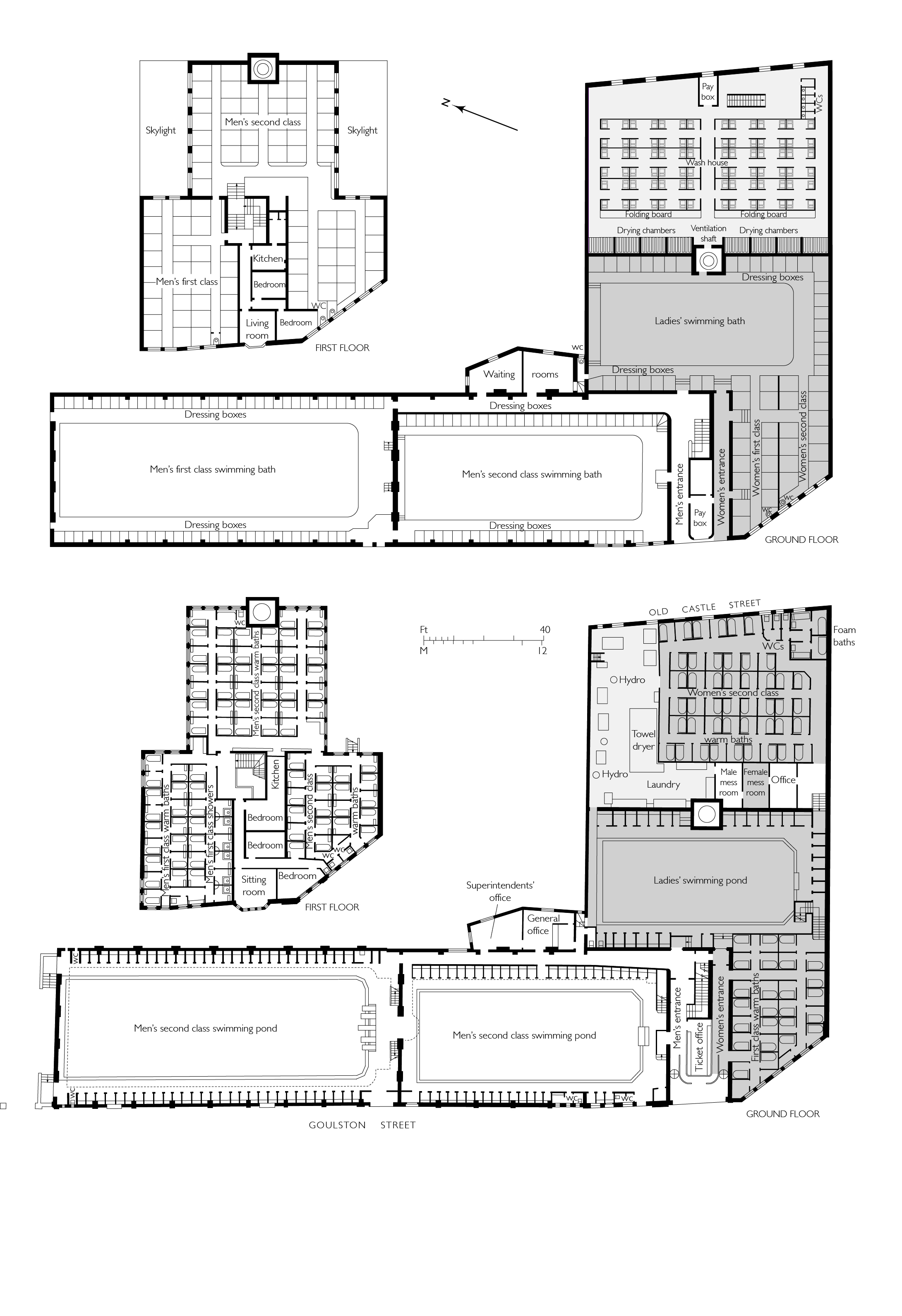
{
"id": 1621,
"title": "Plans of Whitechapel Baths, 1896 and 1938",
"author": {
"id": 2,
"username": "surveyoflondon"
},
"feature": {
"id": 1447,
"type": "Feature",
"geometry": {
"type": "MultiPolygon",
"coordinates": [
[
[
[
-0.073620345272929,
51.51568885255038
],
[
-0.073978291920849,
51.515581075868006
],
[
-0.074105154053684,
51.51572542989613
],
[
-0.073829058934223,
51.51581988475423
],
[
-0.073816416255057,
51.51580549883457
],
[
-0.073765536685163,
51.515822645959325
],
[
-0.073818338832879,
51.51587274604106
],
[
-0.073896057393162,
51.515850404112115
],
[
-0.073900642179228,
51.51585546922409
],
[
-0.073811510459007,
51.51588294615875
],
[
-0.073751379811388,
51.51582774828753
],
[
-0.073609777363084,
51.515693181519985
],
[
-0.073620345272929,
51.51568885255038
]
]
]
]
},
"properties": {
"b_number": "25",
"b_name": "The Wash Houses, London Metropolitan University, former Whitechapel Baths",
"street": "Old Castle Street",
"address": "The Wash Houses, London Metropolitan Univeristy, 25 Old Castle Street, London E1 7NT",
"feature_type": "WHITECHAPEL_BUILDING",
"count": 19,
"search_str": "The Wash Houses, London Metropolitan University, former Whitechapel Baths"
},
"tags": [
"cholera",
"library",
"swimming",
"washing",
"women"
]
},
"file": "https://surveyoflondon.org/media/uploads/features/1447/Whitechapel%20baths%20plan%201896%20and%201938.jpg",
"description": "",
"copyright": false,
"created": "2019-06-03"
},
{
"id": 785,
"title": "Mansell Street facade, August 2017",
"author": {
"id": 27,
"username": "DerekKendall"
},
"feature": {
"id": 52,
"type": "Feature",
"geometry": {
"type": "MultiPolygon",
"coordinates": [
[
[
[
-0.072522936465309,
51.51209913871823
],
[
-0.072966657695433,
51.51206015611643
],
[
-0.073023989371249,
51.51238161262953
],
[
-0.072581805485479,
51.51241248317473
],
[
-0.072522936465309,
51.51209913871823
]
]
]
]
},
"properties": {
"b_number": "69",
"b_name": "Mansell Court, 69 Mansell Street",
"street": "Mansell Street",
"address": "Mansell Court, 69 Mansell Street",
"feature_type": "WHITECHAPEL_BUILDING",
"count": 4,
"search_str": "Mansell Court, 69 Mansell Street"
},
"tags": []
},
"file": "https://surveyoflondon.org/media/uploads/features/52/SoL%20Whitechapel%20101510.jpg",
"description": "",
"copyright": true,
"created": "2017-09-12"
},
{
"id": 993,
"title": "2005: About 6 months into the renovation which commenced in the basements and worked upwards. Cafe Aura is being fitted out.",
"author": {
"id": 131,
"username": "Tomreed"
},
"feature": {
"id": 169,
"type": "Feature",
"geometry": {
"type": "MultiPolygon",
"coordinates": [
[
[
[
-0.069651046927799,
51.515906748996194
],
[
-0.069592567052389,
51.51593286484659
],
[
-0.069462353413791,
51.51582917877918
],
[
-0.069513217260896,
51.51581285271919
],
[
-0.069471535482955,
51.51577379234225
],
[
-0.069534270508602,
51.515757354492386
],
[
-0.069599774486383,
51.515845312065174
],
[
-0.069589679654299,
51.51585075075555
],
[
-0.069651046927799,
51.515906748996194
]
]
]
]
},
"properties": {
"b_number": "69",
"b_name": "",
"street": "Whitechapel High Street",
"address": "69 Whitechapel High Street",
"feature_type": "WHITECHAPEL_BUILDING",
"count": 11,
"search_str": "69 Whitechapel High Street"
},
"tags": []
},
"file": "https://surveyoflondon.org/media/uploads/features/169/Screen%20Shot%202017-12-20%20at%2015.49.16.png",
"description": "",
"copyright": false,
"created": "2017-12-20"
},
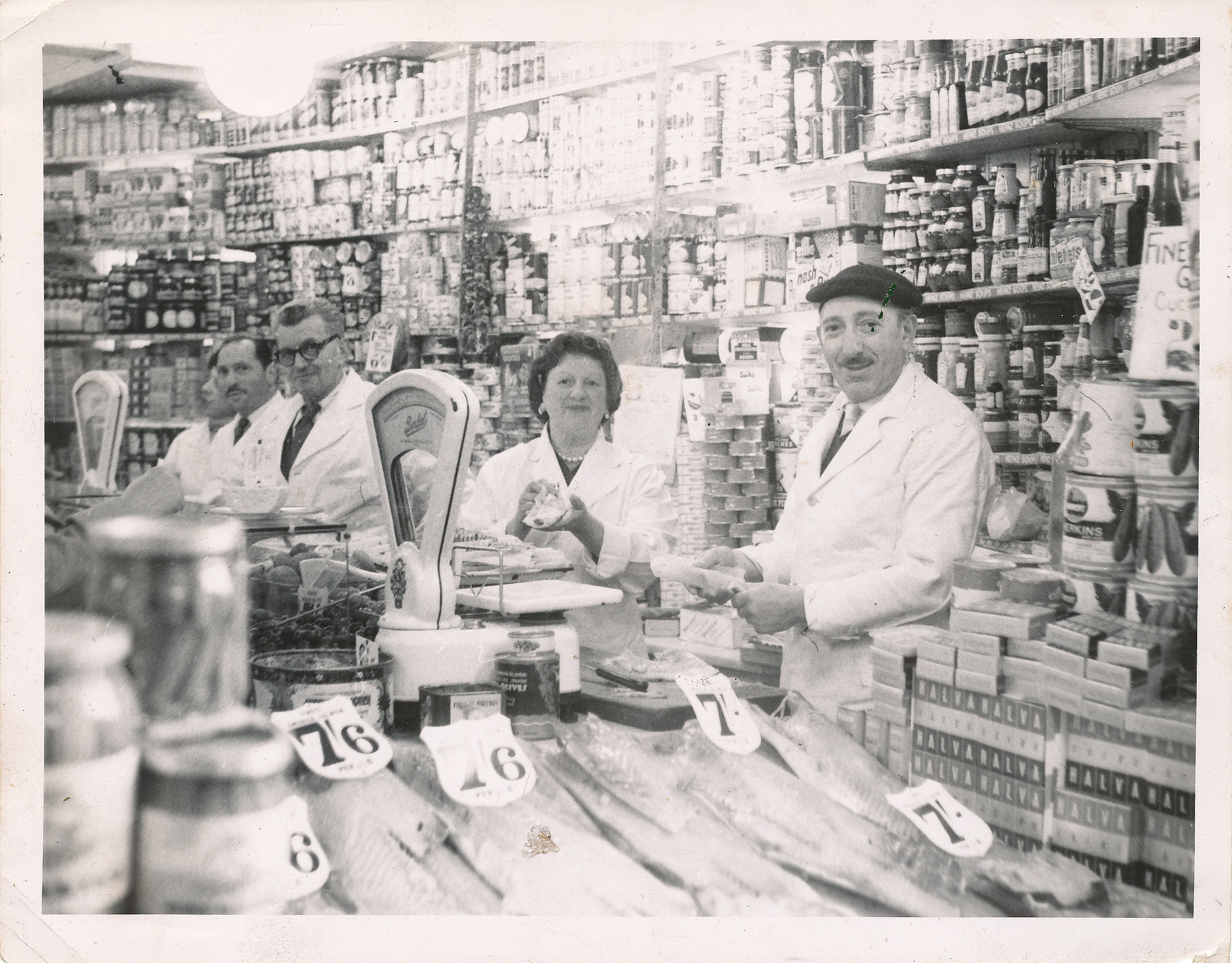
{
"id": 1382,
"title": "Marks of the Lane, 59 Wentworth Street, c. 1960",
"author": {
"id": 252,
"username": "mark3"
},
"feature": {
"id": 1742,
"type": "Feature",
"geometry": {
"type": "MultiPolygon",
"coordinates": [
[
[
[
-0.076387722492951,
51.516257872286374
],
[
-0.07580974439088,
51.51649846859169
],
[
-0.075744693982384,
51.51651411423466
],
[
-0.075332716624042,
51.51665341173461
],
[
-0.075277819023276,
51.516667372076085
],
[
-0.074429584483841,
51.51681699796736
],
[
-0.074402209988697,
51.516763242480046
],
[
-0.075229889371391,
51.51661092868018
],
[
-0.074836715281391,
51.516135055700595
],
[
-0.074917049606191,
51.51611135328064
],
[
-0.075312012611936,
51.51658616747119
],
[
-0.075695505281233,
51.51646463519818
],
[
-0.075779072585588,
51.51644696856364
],
[
-0.076328753388395,
51.516209038390684
],
[
-0.076387722492951,
51.516257872286374
]
]
]
]
},
"properties": {
"b_number": "",
"b_name": "",
"street": "",
"address": "Petticoat Lane Market",
"feature_type": "PLACE",
"count": 39,
"search_str": "Petticoat Lane Market"
},
"tags": []
},
"file": "https://surveyoflondon.org/media/uploads/features/1742/Mossy%20Mark%20at%20Marks%20of%20the%20Lane%20Wentworth%20St.jpg",
"description": "Mossy Marks (foreground), with Sally, Egon Zetner and Issy - working hard serving smoked salmon (from their own smoke hole).",
"copyright": false,
"created": "2018-10-28"
},
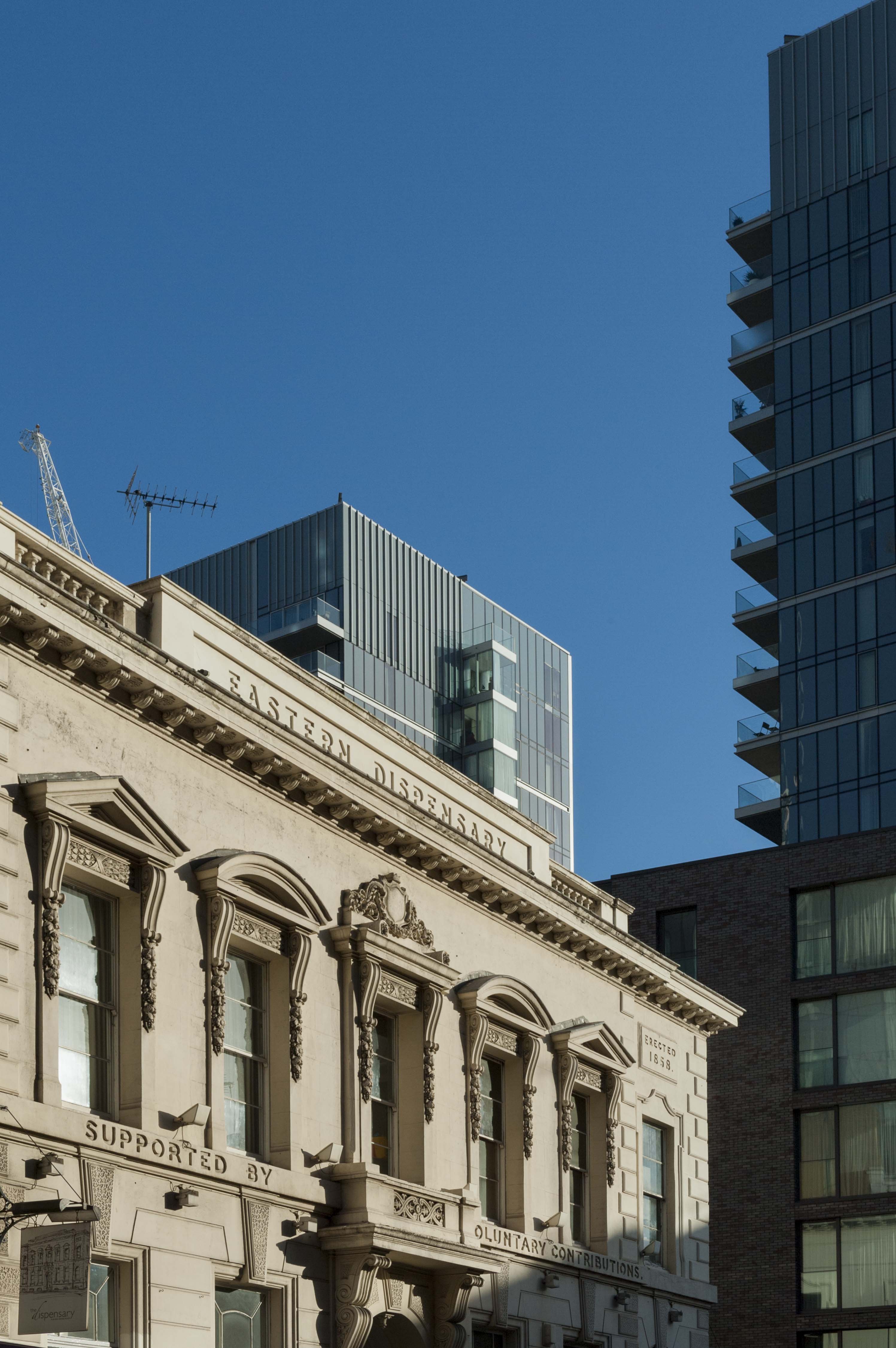
{
"id": 540,
"title": "The former Eastern Dispensary in context",
"author": {
"id": 27,
"username": "DerekKendall"
},
"feature": {
"id": 16,
"type": "Feature",
"geometry": {
"type": "MultiPolygon",
"coordinates": [
[
[
[
-0.07073271347526,
51.51412601920421
],
[
-0.07063554499044,
51.514165253062664
],
[
-0.070469168765051,
51.51398880154131
],
[
-0.07056792326348,
51.51394938941929
],
[
-0.07073271347526,
51.51412601920421
]
]
]
]
},
"properties": {
"b_number": "19a-19b",
"b_name": "The Dispensary",
"street": "Leman Street",
"address": "The Dispensary (former Eastern Dispensary), 19a-19b Leman Street",
"feature_type": "WHITECHAPEL_BUILDING",
"count": 7,
"search_str": "The Dispensary"
},
"tags": []
},
"file": "https://surveyoflondon.org/media/uploads/features/16/SoL%20Whitechapel%20100449.jpg",
"description": "",
"copyright": true,
"created": "2017-04-10"
},
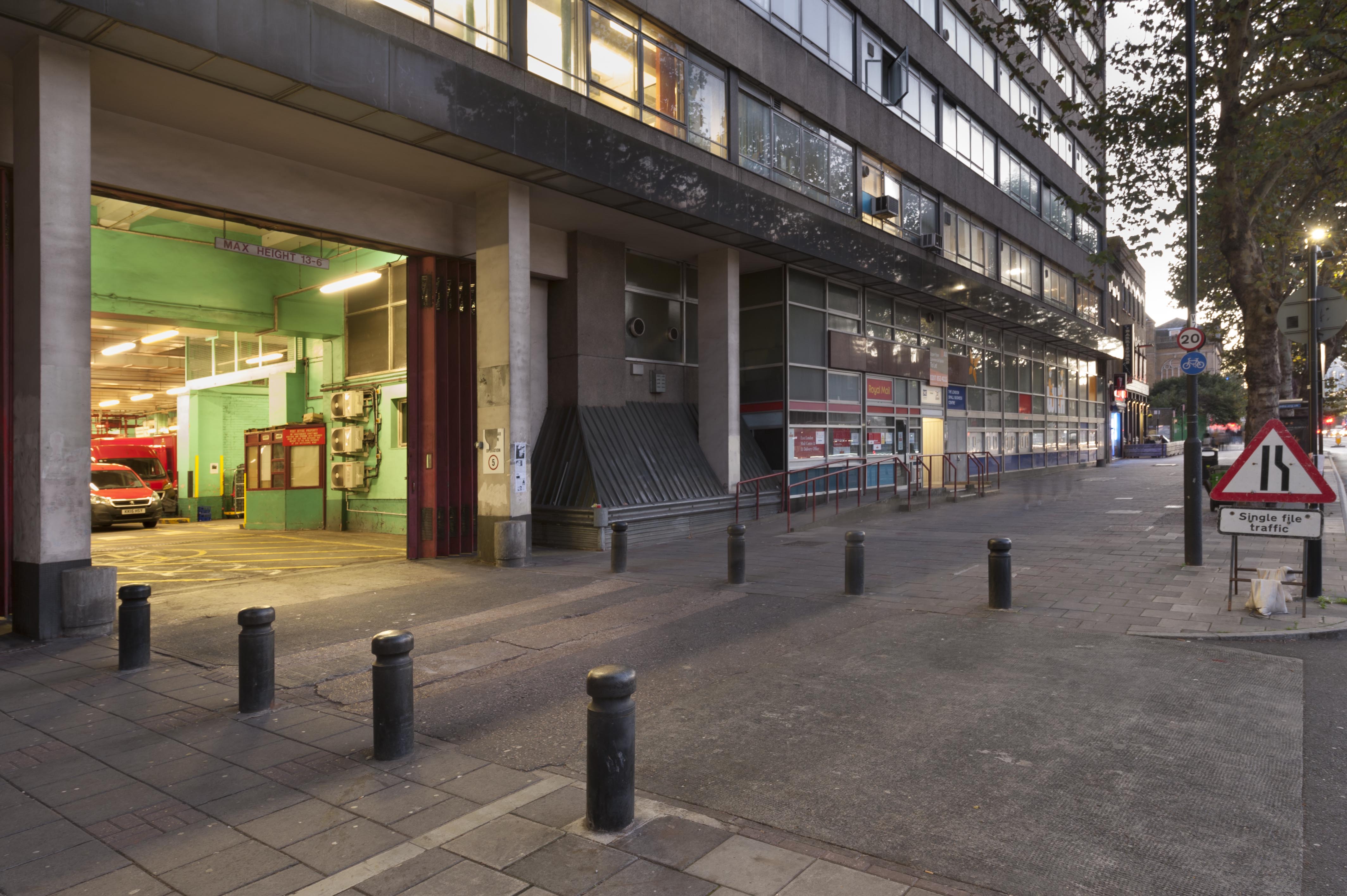
{
"id": 1418,
"title": "View along Cavell Street from the south in late 2018",
"author": {
"id": 27,
"username": "DerekKendall"
},
"feature": {
"id": 1227,
"type": "Feature",
"geometry": {
"type": "MultiPolygon",
"coordinates": [
[
[
[
-0.058796596412285,
51.51912310433929
],
[
-0.057896913703648,
51.51929776742821
],
[
-0.057646155790783,
51.51878891291734
],
[
-0.057726960269829,
51.518773414154225
],
[
-0.057663251646104,
51.51864413103036
],
[
-0.058003630287349,
51.51857884372657
],
[
-0.058058858263524,
51.51869091551577
],
[
-0.058183402152667,
51.518667026720365
],
[
-0.058192757854339,
51.51868601168758
],
[
-0.058228318266828,
51.5186791908066
],
[
-0.058378536493976,
51.518984017000164
],
[
-0.058419330251411,
51.51897619228836
],
[
-0.058450444692009,
51.51903932977383
],
[
-0.05871794555232,
51.51898801961153
],
[
-0.058796596412285,
51.51912310433929
]
]
]
]
},
"properties": {
"b_number": "180–206",
"b_name": "East London Mail Centre and E1 Delivery Office",
"street": "Whitechapel Road",
"address": "East London Mail Centre and E1 Delivery Office",
"feature_type": "WHITECHAPEL_BUILDING",
"count": 14,
"search_str": "East London Mail Centre and E1 Delivery Office"
},
"tags": []
},
"file": "https://surveyoflondon.org/media/uploads/features/1227/SoL%20Whitechapel%20102273.jpg",
"description": "",
"copyright": true,
"created": "2018-11-13"
},
{
"id": 1433,
"title": "St Paul's School from the northeast, October 2018",
"author": {
"id": 27,
"username": "DerekKendall"
},
"feature": {
"id": 1399,
"type": "Feature",
"geometry": {
"type": "MultiPolygon",
"coordinates": [
[
[
[
-0.06624311370635,
51.51019072010641
],
[
-0.066077627531148,
51.510204269850675
],
[
-0.066069527116146,
51.510170337345684
],
[
-0.06611551384684,
51.51016638639934
],
[
-0.066109726117682,
51.51014703372793
],
[
-0.065814585354416,
51.5101673738921
],
[
-0.065821533323482,
51.51022330153386
],
[
-0.065683910471039,
51.51023360737856
],
[
-0.065657889334494,
51.51008339520407
],
[
-0.065349361164399,
51.51010853754948
],
[
-0.06532938777826,
51.510008209650636
],
[
-0.065633994165545,
51.509987653756085
],
[
-0.065620188745178,
51.50991765971934
],
[
-0.065722948991599,
51.50991121538507
],
[
-0.065716780377172,
51.509880881568165
],
[
-0.065901817537395,
51.50986765480321
],
[
-0.06593178354119,
51.50999605393065
],
[
-0.066038317356042,
51.509988508785376
],
[
-0.066023042932445,
51.50990918839897
],
[
-0.065998737156917,
51.50991111308007
],
[
-0.065980280001972,
51.50981894970597
],
[
-0.066320560006103,
51.50979200375635
],
[
-0.06632996113982,
51.50983401855985
],
[
-0.066268265775343,
51.50983881506029
],
[
-0.066265082872055,
51.50982597208467
],
[
-0.066214609325215,
51.509829790835916
],
[
-0.066234584593038,
51.50993011860635
],
[
-0.066179431061551,
51.509934441553284
],
[
-0.066189455574639,
51.5099837339709
],
[
-0.066197871962622,
51.509983000685985
],
[
-0.066205558541818,
51.510021498909204
],
[
-0.066199016557763,
51.510021972412325
],
[
-0.066209250254486,
51.51006632649741
],
[
-0.066216245469672,
51.51006615116071
],
[
-0.066221862792188,
51.51009851070753
],
[
-0.066214365136205,
51.51009954983773
],
[
-0.066220460291682,
51.51013162657133
],
[
-0.06623170678327,
51.51013006787535
],
[
-0.06624311370635,
51.51019072010641
]
]
]
]
},
"properties": {
"b_number": "",
"b_name": "St Paul's School",
"street": "Wellclose Square",
"address": "St Paul's School, Wellclose Square",
"feature_type": "WHITECHAPEL_BUILDING",
"count": 22,
"search_str": "St Paul's School"
},
"tags": [
"Rev. Dan Greatorex",
"Thomas F. Ford and Partners",
"Wilby & Burnett"
]
},
"file": "https://surveyoflondon.org/media/uploads/features/1399/SoL%20Whitechapel%20102315.jpg",
"description": "",
"copyright": true,
"created": "2018-11-13"
},
{
"id": 247,
"title": "St Boniface RC Church, July 2014",
"author": {
"id": 29,
"username": "CRedgrave"
},
"feature": {
"id": 308,
"type": "Feature",
"geometry": {
"type": "MultiPolygon",
"coordinates": [
[
[
[
-0.067496567815311,
51.51589253877067
],
[
-0.067329816922355,
51.51592882147948
],
[
-0.067313994004403,
51.515903740519775
],
[
-0.067285655221522,
51.51591108028059
],
[
-0.067273890464753,
51.51588586669939
],
[
-0.067248552659892,
51.51589046902255
],
[
-0.067167351332256,
51.515743576397455
],
[
-0.067193642426533,
51.51573542676791
],
[
-0.06717129258716,
51.51569502690211
],
[
-0.067371819133296,
51.51564515293278
],
[
-0.067482004602165,
51.515831045103695
],
[
-0.067463735896854,
51.51583606330445
],
[
-0.067496567815311,
51.51589253877067
]
]
]
]
},
"properties": {
"b_number": "47",
"b_name": "",
"street": "Adler Street",
"address": "St Boniface German Church, 47 Adler Street",
"feature_type": "WHITECHAPEL_BUILDING",
"count": 14,
"search_str": "St Boniface German Church, 47 Adler Street"
},
"tags": [
"Catholic Church",
"Germans"
]
},
"file": "https://surveyoflondon.org/media/uploads/features/308/St%20Boniface%20RC%20Church%20CR%20July%202014.jpg",
"description": "",
"copyright": true,
"created": "2016-08-16"
},
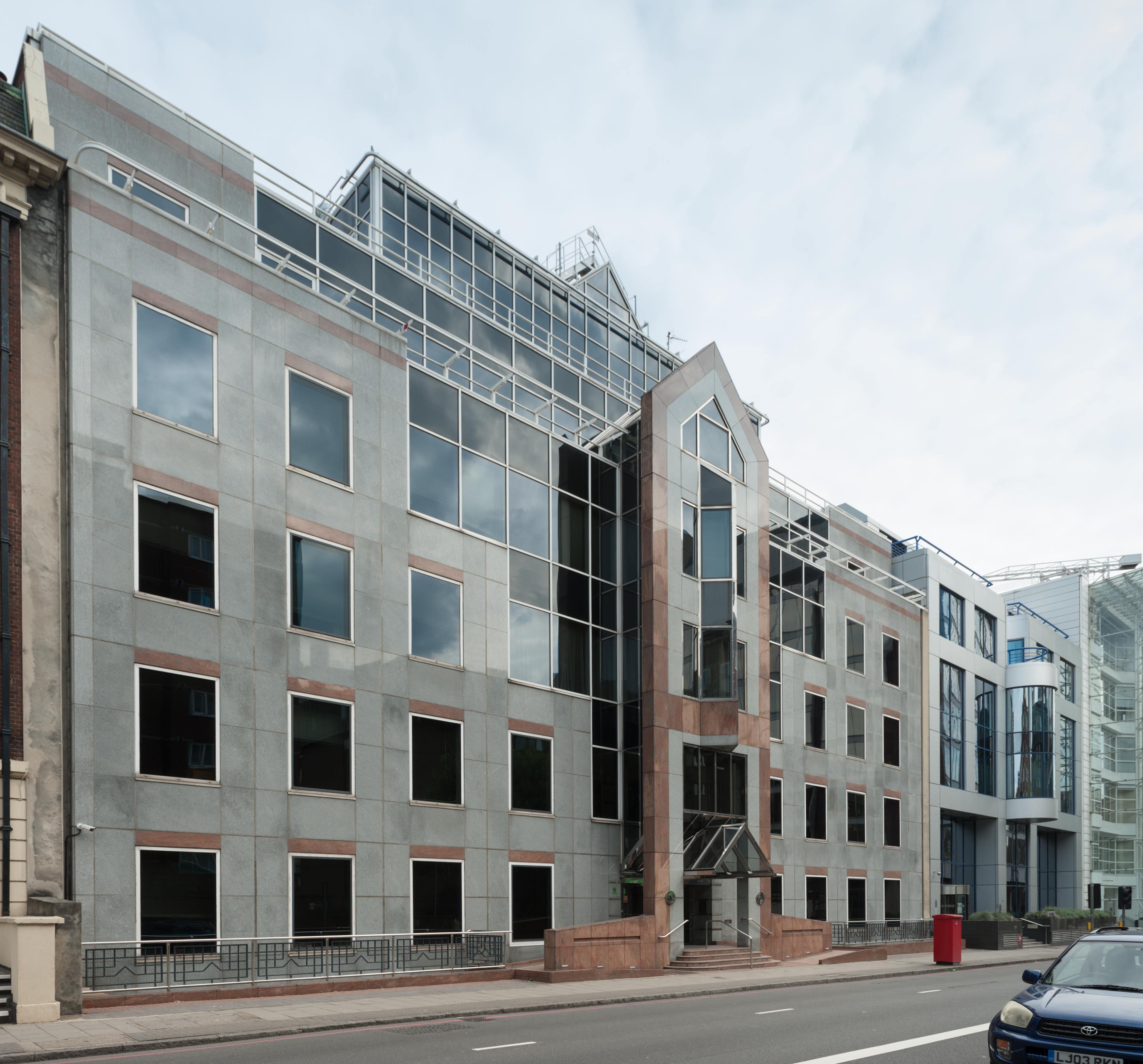
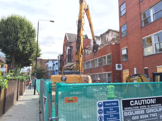
{
"id": 405,
"title": "Attlee House demolition",
"author": {
"id": 18,
"username": "shahedsaleem"
},
"feature": {
"id": 377,
"type": "Feature",
"geometry": {
"type": "MultiPolygon",
"coordinates": [
[
[
[
-0.072206188136682,
51.516932811098776
],
[
-0.07218344876033,
51.51684444436343
],
[
-0.072534379628222,
51.51681503305809
],
[
-0.072463253205899,
51.51672340265988
],
[
-0.072432640663459,
51.51673265247548
],
[
-0.072397829775652,
51.51669737370259
],
[
-0.072397829403071,
51.51669736298538
],
[
-0.072397841008699,
51.51669737693611
],
[
-0.072429357747769,
51.51668717081884
],
[
-0.072414770368513,
51.51666963593905
],
[
-0.07253836568263,
51.51662961174248
],
[
-0.072752431676864,
51.516890066256686
],
[
-0.07253987416195,
51.516903756002655
],
[
-0.072527329708454,
51.51684213583898
],
[
-0.072496607505859,
51.516845307720075
],
[
-0.072507737220554,
51.51690721964957
],
[
-0.072206188136682,
51.516932811098776
]
]
]
]
},
"properties": {
"b_number": "76",
"b_name": "Attlee House",
"street": "Wentworth Street",
"address": "Attlee House, 76 Wentworth Street",
"feature_type": "WHITECHAPEL_BUILDING",
"count": 3,
"search_str": "Attlee House"
},
"tags": []
},
"file": "https://surveyoflondon.org/media/uploads/features/377/IMG_3900.JPG",
"description": "The eastern part of Attlee House in the process of being demolished (03.09.16)",
"copyright": false,
"created": "2016-09-23"
},
{
"id": 406,
"title": "Attlee House demolished",
"author": {
"id": 18,
"username": "shahedsaleem"
},
"feature": {
"id": 377,
"type": "Feature",
"geometry": {
"type": "MultiPolygon",
"coordinates": [
[
[
[
-0.072206188136682,
51.516932811098776
],
[
-0.07218344876033,
51.51684444436343
],
[
-0.072534379628222,
51.51681503305809
],
[
-0.072463253205899,
51.51672340265988
],
[
-0.072432640663459,
51.51673265247548
],
[
-0.072397829775652,
51.51669737370259
],
[
-0.072397829403071,
51.51669736298538
],
[
-0.072397841008699,
51.51669737693611
],
[
-0.072429357747769,
51.51668717081884
],
[
-0.072414770368513,
51.51666963593905
],
[
-0.07253836568263,
51.51662961174248
],
[
-0.072752431676864,
51.516890066256686
],
[
-0.07253987416195,
51.516903756002655
],
[
-0.072527329708454,
51.51684213583898
],
[
-0.072496607505859,
51.516845307720075
],
[
-0.072507737220554,
51.51690721964957
],
[
-0.072206188136682,
51.516932811098776
]
]
]
]
},
"properties": {
"b_number": "76",
"b_name": "Attlee House",
"street": "Wentworth Street",
"address": "Attlee House, 76 Wentworth Street",
"feature_type": "WHITECHAPEL_BUILDING",
"count": 3,
"search_str": "Attlee House"
},
"tags": []
},
"file": "https://surveyoflondon.org/media/uploads/features/377/IMG_4179.JPG",
"description": "The cleared site where the eastern part of Attlee House once stood, revealing the northern wall of Toynbee Hall (23.09.16)",
"copyright": false,
"created": "2016-09-23"
},
{
"id": 505,
"title": "View of terraced houses on the east side of Cavell Street in 1956",
"author": {
"id": 37,
"username": "HistoricEngland"
},
"feature": {
"id": 1226,
"type": "Feature",
"geometry": {
"type": "MultiPolygon",
"coordinates": [
[
[
[
-0.057781597348087,
51.51931934049726
],
[
-0.057583510279063,
51.51936335562525
],
[
-0.057331742954463,
51.51892343874043
],
[
-0.057405984242291,
51.51890625776504
],
[
-0.057417150978354,
51.51892380850925
],
[
-0.057464414646317,
51.51891346295509
],
[
-0.057455443085981,
51.51889505673813
],
[
-0.057530567994777,
51.518878391257324
],
[
-0.057781597348087,
51.51931934049726
]
]
]
]
},
"properties": {
"b_number": "208-212",
"b_name": "Whitechapel Mission",
"street": "Whitechapel Road",
"address": "Whitechapel Mission",
"feature_type": "WHITECHAPEL_BUILDING",
"count": 5,
"search_str": "Whitechapel Mission"
},
"tags": [
"Whitechapel Mission"
]
},
"file": "https://surveyoflondon.org/media/uploads/features/1226/p_g06189_006.jpg",
"description": "Reproduced by permission of the Historic England Archive (see archive.HistoricEngland.org.uk)",
"copyright": false,
"created": "2017-03-08"
},
{
"id": 420,
"title": "Postcard showing the London Hospital",
"author": {
"id": 11,
"username": "amyspencer"
},
"feature": {
"id": 1233,
"type": "Feature",
"geometry": {
"type": "MultiPolygon",
"coordinates": [
[
[
[
-0.06071898744648,
51.51847914149303
],
[
-0.060500593175314,
51.518078725457706
],
[
-0.060677507453823,
51.51804024673126
],
[
-0.060671223402208,
51.51802540127174
],
[
-0.06085005314625,
51.51798836558531
],
[
-0.060812945436909,
51.517920331266545
],
[
-0.060917351413957,
51.51789816547845
],
[
-0.060931197156673,
51.517923550570345
],
[
-0.061010610691191,
51.51790669069574
],
[
-0.061049931220856,
51.51797878143679
],
[
-0.061137385429043,
51.517960214409946
],
[
-0.061165435766445,
51.51801164191679
],
[
-0.061088209745711,
51.51802803744632
],
[
-0.061113189374754,
51.51807608265291
],
[
-0.061137480851473,
51.51807171260715
],
[
-0.061278658301599,
51.518317481305246
],
[
-0.061327004153713,
51.518306671582295
],
[
-0.061361885271019,
51.51836739382176
],
[
-0.061297703445739,
51.518381744329986
],
[
-0.061323145093769,
51.518424980241626
],
[
-0.060865969954968,
51.518532183713546
],
[
-0.060820667002295,
51.51845590786164
],
[
-0.06071898744648,
51.51847914149303
]
]
]
]
},
"properties": {
"b_number": "",
"b_name": "",
"street": "Turner Street",
"address": "The Royal London Dental Hospital",
"feature_type": "WHITECHAPEL_BUILDING",
"count": 9,
"search_str": "The Royal London Dental Hospital"
},
"tags": []
},
"file": "https://surveyoflondon.org/media/uploads/features/1233/RP%20Postcard%20showing%20old%20Alexandra%20Wing.JPG",
"description": "View of the London Hospital, showing the old Alexandra Wing, and beyond the front block of the hospital after Rowland Plumbe's extensions of 1889–90. This photograph was probably dates to the early twentieth century.",
"copyright": false,
"created": "2016-10-11"
},
{
"id": 1297,
"title": "43 Royal Mint Street in 2018",
"author": {
"id": 27,
"username": "DerekKendall"
},
"feature": {
"id": 1338,
"type": "Feature",
"geometry": {
"type": "MultiPolygon",
"coordinates": [
[
[
[
-0.070472914260628,
51.51038614263684
],
[
-0.070363566738003,
51.51041356385847
],
[
-0.070313156041171,
51.51033194245296
],
[
-0.070424663845198,
51.51030404640742
],
[
-0.070472914260628,
51.51038614263684
]
]
]
]
},
"properties": {
"b_number": "41",
"b_name": "",
"street": "Royal Mint Street",
"address": "41 Royal Mint Street",
"feature_type": "WHITECHAPEL_BUILDING",
"count": 8,
"search_str": "41 Royal Mint Street"
},
"tags": []
},
"file": "https://surveyoflondon.org/media/uploads/features/1338/SoL%20Whitechapel%20102037.jpg",
"description": "",
"copyright": true,
"created": "2018-08-13"
},
{
"id": 456,
"title": "76 Whitechapel High Street in 2016",
"author": {
"id": 18,
"username": "shahedsaleem"
},
"feature": {
"id": 315,
"type": "Feature",
"geometry": {
"type": "MultiPolygon",
"coordinates": [
[
[
[
-0.070001262506134,
51.51611420182703
],
[
-0.069925683789541,
51.516033038765876
],
[
-0.069976822772036,
51.516012970027454
],
[
-0.070049788081591,
51.51609931840464
],
[
-0.070001262506134,
51.51611420182703
]
]
]
]
},
"properties": {
"b_number": "76",
"b_name": "76 Whitechapel High Street",
"street": "Whitechapel High Street",
"address": "76 Whitechapel High Street",
"feature_type": "WHITECHAPEL_BUILDING",
"count": 9,
"search_str": "76 Whitechapel High Street"
},
"tags": []
},
"file": "https://surveyoflondon.org/media/uploads/features/315/2016-09-29%2017.13.14.jpg",
"description": "",
"copyright": false,
"created": "2016-11-15"
},
{
"id": 444,
"title": "Jack Cohen, founder of Tesco",
"author": {
"id": 22,
"username": "sarahannmilne"
},
"feature": {
"id": 1480,
"type": "Feature",
"geometry": {
"type": "MultiPolygon",
"coordinates": [
[
[
[
-0.056491574103449,
51.517191420531816
],
[
-0.055437846796151,
51.51715614694095
],
[
-0.055445190568076,
51.51706157466045
],
[
-0.056346633329474,
51.517091806357556
],
[
-0.056340595508494,
51.51698649068408
],
[
-0.055443443823008,
51.51696046676313
],
[
-0.055451631178728,
51.51686977536651
],
[
-0.056466884700875,
51.51689110193226
],
[
-0.05648606158158,
51.516897714699276
],
[
-0.056511458918413,
51.51718140837163
],
[
-0.056491574103449,
51.517191420531816
]
]
]
]
},
"properties": {
"b_number": null,
"b_name": null,
"street": null,
"address": "Greater Whitechapel",
"feature_type": "GREATER_WHITECHAPEL",
"count": 1,
"search_str": "Greater Whitechapel"
},
"tags": []
},
"file": "https://surveyoflondon.org/media/uploads/features/1480/4868-20131-MA.jpg",
"description": "Blue Plaque commemorating Jack Cohen (1898-1979), entrepreneur and founder of Tesco Stores. Cohen lived in 91 Ashfield Street as a child. Further information can be found at: http://www.english-heritage.org.uk/visit/blue-plaques/cohen-sir-jack-1898-1979",
"copyright": false,
"created": "2016-11-10"
},
{
"id": 55,
"title": "9 Manningtree Street",
"author": {
"id": 27,
"username": "DerekKendall"
},
"feature": {
"id": 291,
"type": "Feature",
"geometry": {
"type": "MultiPolygon",
"coordinates": [
[
[
[
-0.069174688254967,
51.51539510349721
],
[
-0.069235098979938,
51.515371758905076
],
[
-0.069299048478491,
51.51545270234642
],
[
-0.06924049829651,
51.515471754128036
],
[
-0.069174688254967,
51.51539510349721
]
]
]
]
},
"properties": {
"b_number": "9",
"b_name": "",
"street": "Manningtree Street",
"address": "9 Manningtree Street",
"feature_type": "WHITECHAPEL_BUILDING",
"count": 2,
"search_str": "9 Manningtree Street"
},
"tags": []
},
"file": "https://surveyoflondon.org/media/uploads/features/291/SoL%20Whitechapel100233.jpg",
"description": "",
"copyright": true,
"created": "2016-06-22"
}
]
}