HTTP 200 OK
Allow: GET, HEAD, OPTIONS
Content-Type: application/json
Vary: Accept
{
"count": 1747,
"next": "https://surveyoflondon.org/api/v1/images/?format=api&page=15",
"previous": "https://surveyoflondon.org/api/v1/images/?format=api&page=13",
"results": [
{
"id": 608,
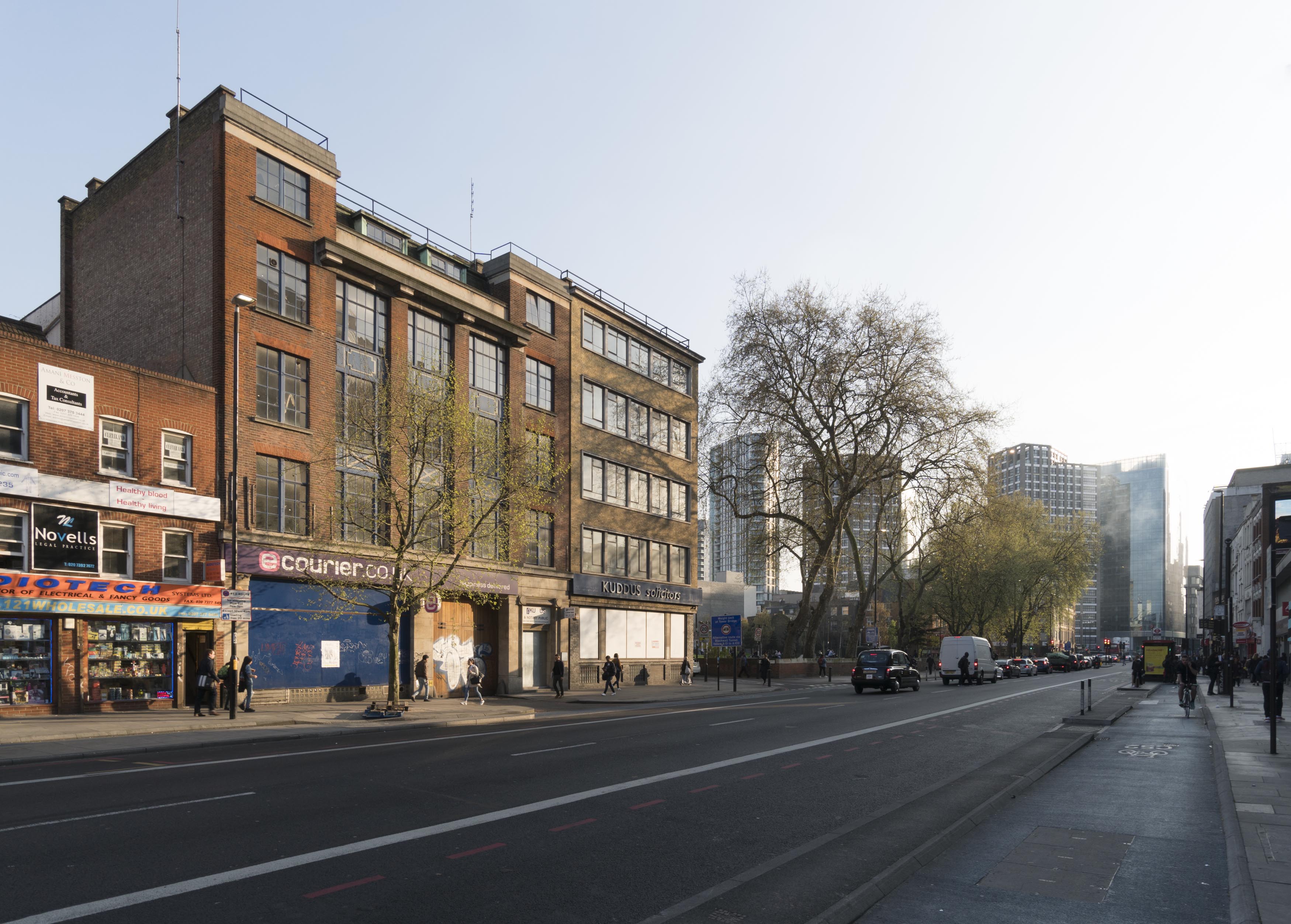
"title": "2 Whitechapel Road with 40 Adler Street from the west in April 2017",
"author": {
"id": 27,
"username": "DerekKendall"
},
"feature": {
"id": 145,
"type": "Feature",
"geometry": {
"type": "MultiPolygon",
"coordinates": [
[
[
[
-0.067438878078407,
51.51626048776608
],
[
-0.067736964788515,
51.51614633139776
],
[
-0.067736975376783,
51.51614633297866
],
[
-0.068162873880285,
51.516578971968116
],
[
-0.068015152398359,
51.5166409265401
],
[
-0.067898951070216,
51.516535567083395
],
[
-0.067749868829072,
51.51660024858242
],
[
-0.067727076343935,
51.516580194496996
],
[
-0.067678054021065,
51.51659801606037
],
[
-0.067602032053382,
51.516516614054154
],
[
-0.067658800891649,
51.51649597633206
],
[
-0.067438878078407,
51.51626048776608
]
]
]
]
},
"properties": {
"b_number": "2",
"b_name": "",
"street": "Whitechapel Road",
"address": "2 Whitechapel Road with 40 Adler Street",
"feature_type": "WHITECHAPEL_BUILDING",
"count": 7,
"search_str": "2 Whitechapel Road with 40 Adler Street"
},
"tags": [
"Buck & Hickman"
]
},
"file": "https://surveyoflondon.org/media/uploads/features/145/SoL%20Whitechapel%20100692.jpg",
"description": "",
"copyright": true,
"created": "2017-05-03"
},
{
"id": 615,
"title": "2-10 Whitechapel Road from the north-east in April 2017",
"author": {
"id": 27,
"username": "DerekKendall"
},
"feature": {
"id": 307,
"type": "Feature",
"geometry": {
"type": "MultiPolygon",
"coordinates": [
[
[
[
-0.067867860495883,
51.51670407080909
],
[
-0.067749868829072,
51.51660024858242
],
[
-0.067821722887779,
51.5165690655898
],
[
-0.067835512336948,
51.51658146785671
],
[
-0.067912792527021,
51.51654802076472
],
[
-0.068014414418927,
51.5166394132013
],
[
-0.068014406062226,
51.51663941256086
],
[
-0.068015152398358,
51.516640926540106
],
[
-0.067867860495883,
51.51670407080909
]
]
]
]
},
"properties": {
"b_number": "4-8",
"b_name": "",
"street": "Whitechapel Road",
"address": "4-8 Whitechapel Road",
"feature_type": "WHITECHAPEL_BUILDING",
"count": 5,
"search_str": "4-8 Whitechapel Road"
},
"tags": [
"Buck & Hickman",
"Prestige Co Ltd"
]
},
"file": "https://surveyoflondon.org/media/uploads/features/307/SoL%20Whitechapel%20100725.jpg",
"description": "",
"copyright": true,
"created": "2017-05-03"
},
{
"id": 595,
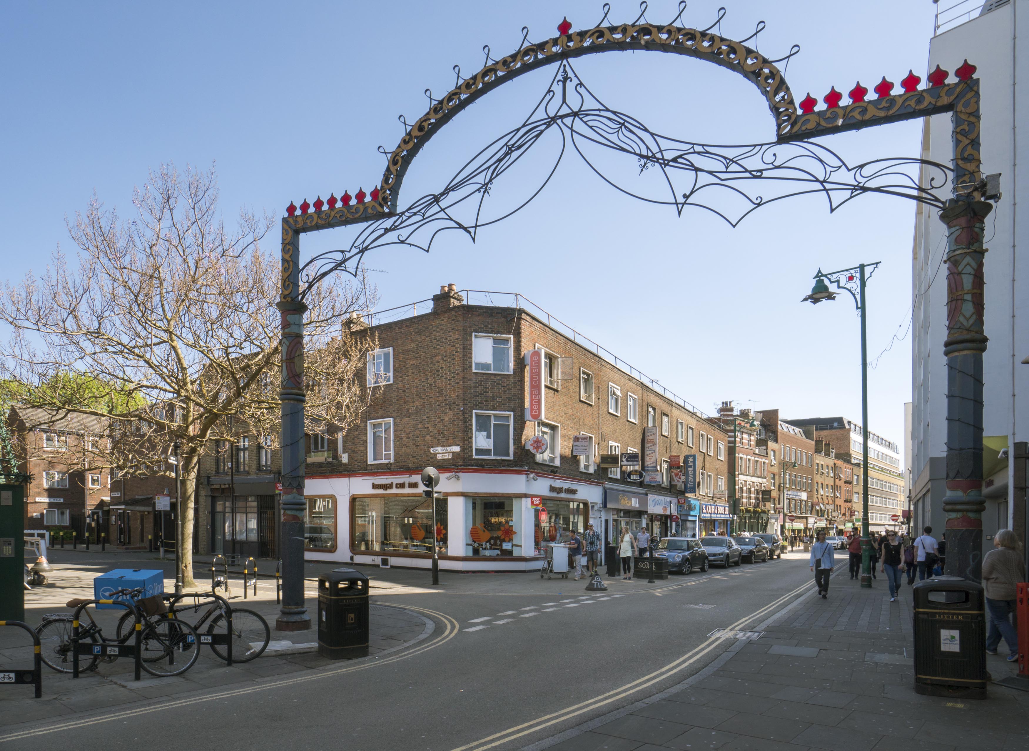
"title": "2-10 Brick Lane from the north-west in April 2017",
"author": {
"id": 27,
"username": "DerekKendall"
},
"feature": {
"id": 172,
"type": "Feature",
"geometry": {
"type": "MultiPolygon",
"coordinates": [
[
[
[
-0.070704837556147,
51.51752069992907
],
[
-0.070561428097562,
51.517566661036014
],
[
-0.070556217073703,
51.51756863539317
],
[
-0.070533352608772,
51.51754514468521
],
[
-0.070574425423854,
51.51752958325939
],
[
-0.070559656138893,
51.517514409502866
],
[
-0.070661249497964,
51.51747591830615
],
[
-0.070704837556147,
51.51752069992907
]
]
]
]
},
"properties": {
"b_number": "10",
"b_name": "",
"street": "Brick Lane",
"address": "William Hill, 10 Brick Lane",
"feature_type": "WHITECHAPEL_BUILDING",
"count": 1,
"search_str": "William Hill, 10 Brick Lane"
},
"tags": []
},
"file": "https://surveyoflondon.org/media/uploads/features/172/SoL%20Whitechapel%20100674.jpg",
"description": "",
"copyright": true,
"created": "2017-05-03"
},
{
"id": 616,
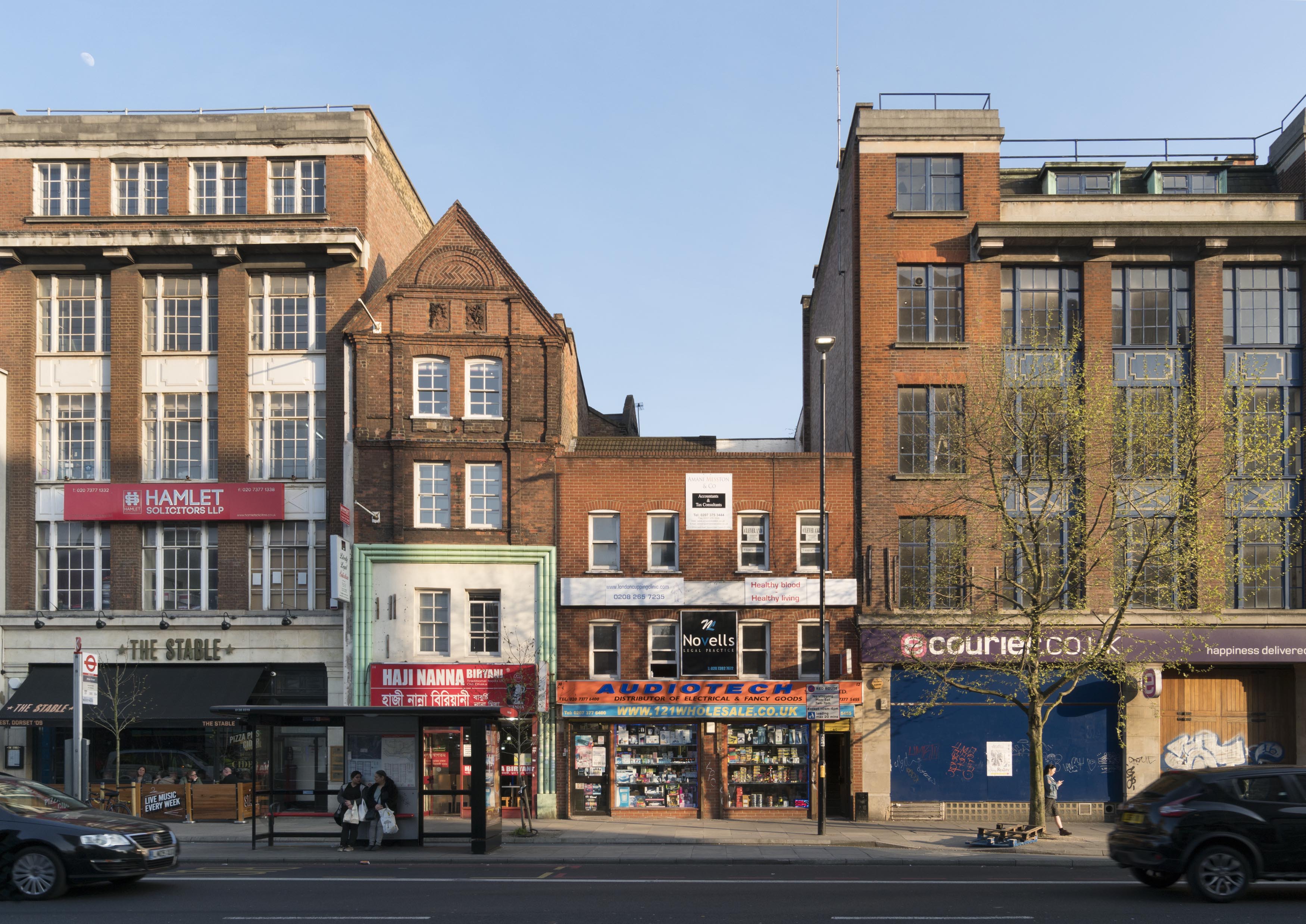
"title": "8-16 Whitechapel Road in April 2017",
"author": {
"id": 27,
"username": "DerekKendall"
},
"feature": {
"id": 146,
"type": "Feature",
"geometry": {
"type": "MultiPolygon",
"coordinates": [
[
[
[
-0.067867860495883,
51.51670407080909
],
[
-0.067828863322737,
51.5167206102403
],
[
-0.067711449192187,
51.51661339667722
],
[
-0.067749868829088,
51.51660024858239
],
[
-0.067867860495883,
51.51670407080909
]
]
]
]
},
"properties": {
"b_number": "10",
"b_name": "",
"street": "Whitechapel Road",
"address": "10 Whitechapel Road",
"feature_type": "WHITECHAPEL_BUILDING",
"count": 4,
"search_str": "10 Whitechapel Road"
},
"tags": [
"Buck & Hickman"
]
},
"file": "https://surveyoflondon.org/media/uploads/features/146/SoL%20Whitechapel%20100727.jpg",
"description": "",
"copyright": true,
"created": "2017-05-03"
},
{
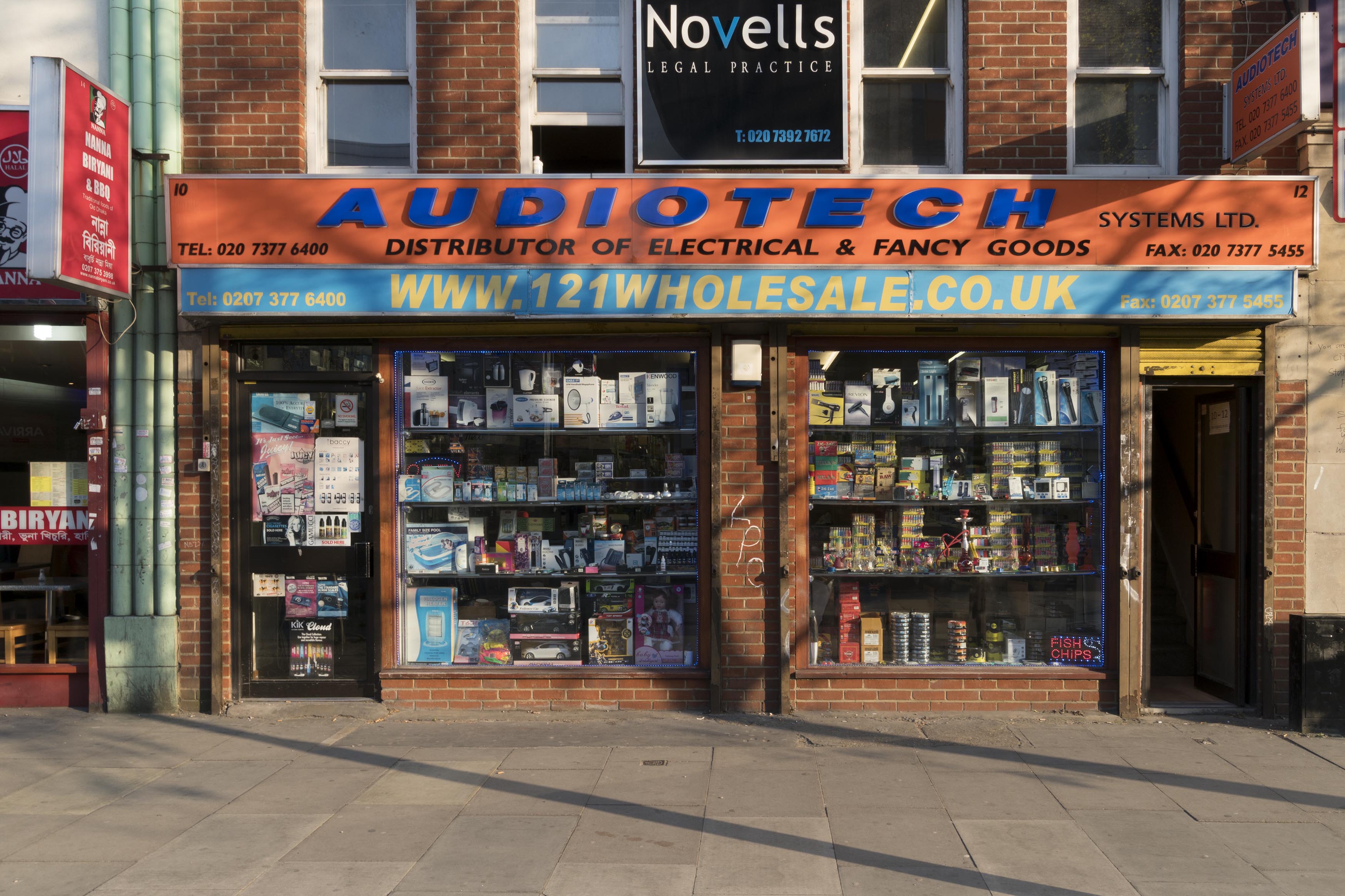
"id": 617,
"title": "shopfront at 10-12 Whitechapel Road, April 2017",
"author": {
"id": 27,
"username": "DerekKendall"
},
"feature": {
"id": 146,
"type": "Feature",
"geometry": {
"type": "MultiPolygon",
"coordinates": [
[
[
[
-0.067867860495883,
51.51670407080909
],
[
-0.067828863322737,
51.5167206102403
],
[
-0.067711449192187,
51.51661339667722
],
[
-0.067749868829088,
51.51660024858239
],
[
-0.067867860495883,
51.51670407080909
]
]
]
]
},
"properties": {
"b_number": "10",
"b_name": "",
"street": "Whitechapel Road",
"address": "10 Whitechapel Road",
"feature_type": "WHITECHAPEL_BUILDING",
"count": 4,
"search_str": "10 Whitechapel Road"
},
"tags": [
"Buck & Hickman"
]
},
"file": "https://surveyoflondon.org/media/uploads/features/146/SoL%20Whitechapel%20100730.jpg",
"description": "",
"copyright": true,
"created": "2017-05-03"
},
{
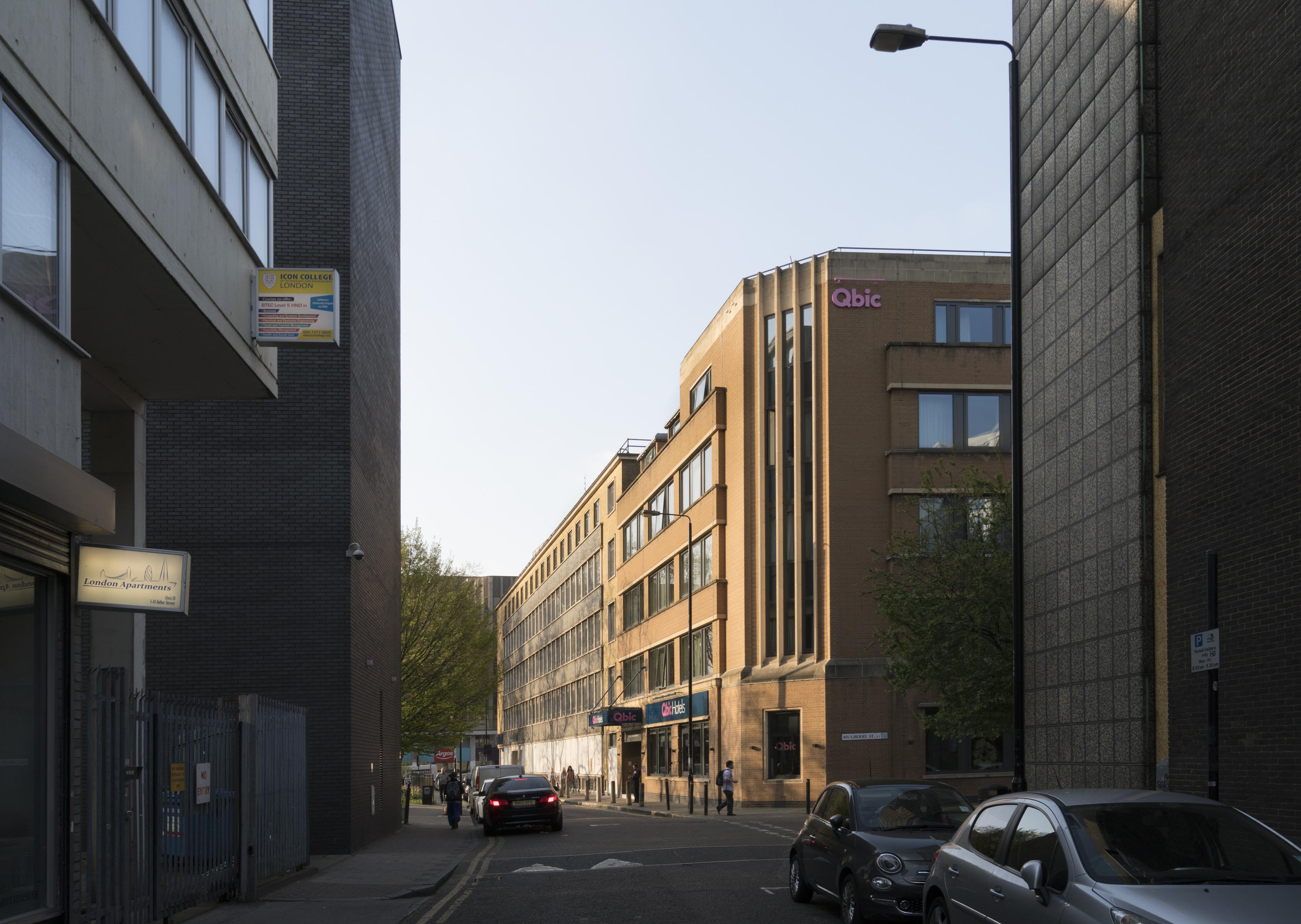
"id": 610,
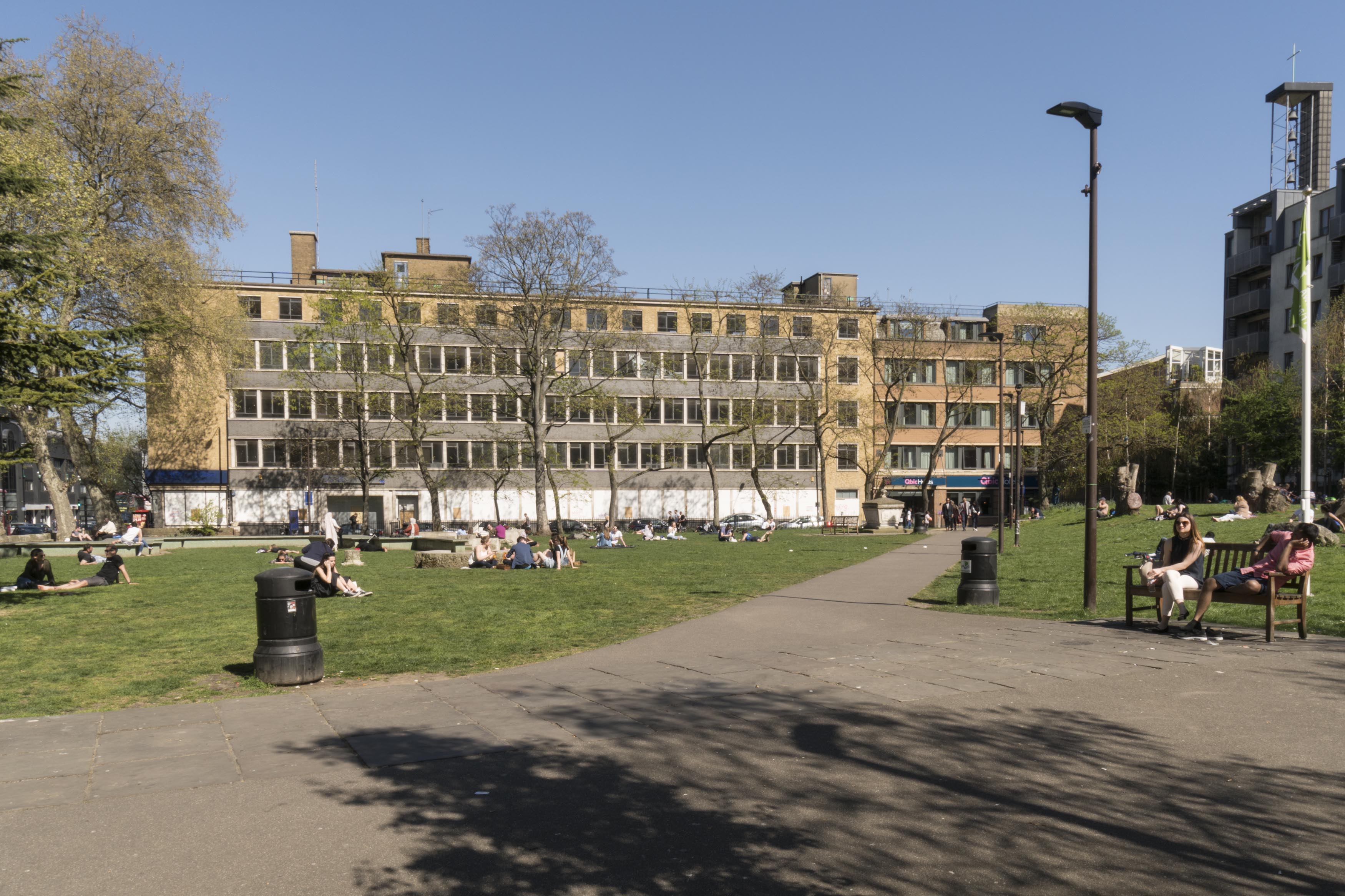
"title": "View up Adler's Street's north end from the south, showing 40 and 42 Adler Street on the east side, April 2017",
"author": {
"id": 27,
"username": "DerekKendall"
},
"feature": {
"id": 301,
"type": "Feature",
"geometry": {
"type": "MultiPolygon",
"coordinates": [
[
[
[
-0.067736975376783,
51.51614633297866
],
[
-0.067736964788515,
51.51614633139776
],
[
-0.067438878078407,
51.51626048776608
],
[
-0.067384045533061,
51.51620177426893
],
[
-0.06686585726795,
51.516354207114226
],
[
-0.066894961295245,
51.516392721034535
],
[
-0.066827400254887,
51.516412594884436
],
[
-0.066798572993988,
51.51637444713945
],
[
-0.066765252861003,
51.516384248613996
],
[
-0.066686306327938,
51.51627977648115
],
[
-0.06755668359082,
51.51602374125061
],
[
-0.067648667130944,
51.516056627121685
],
[
-0.067736975376783,
51.51614633297866
]
]
]
]
},
"properties": {
"b_number": "42",
"b_name": "",
"street": "Adler Street",
"address": "Qbic London City, 42 Adler Street",
"feature_type": "WHITECHAPEL_BUILDING",
"count": 6,
"search_str": "Qbic London City, 42 Adler Street"
},
"tags": [
"Buck & Hickman",
"George public house",
"hotel"
]
},
"file": "https://surveyoflondon.org/media/uploads/features/301/SoL%20Whitechapel%20100693_A5Rue8b.jpg",
"description": "",
"copyright": true,
"created": "2017-05-03"
},
{
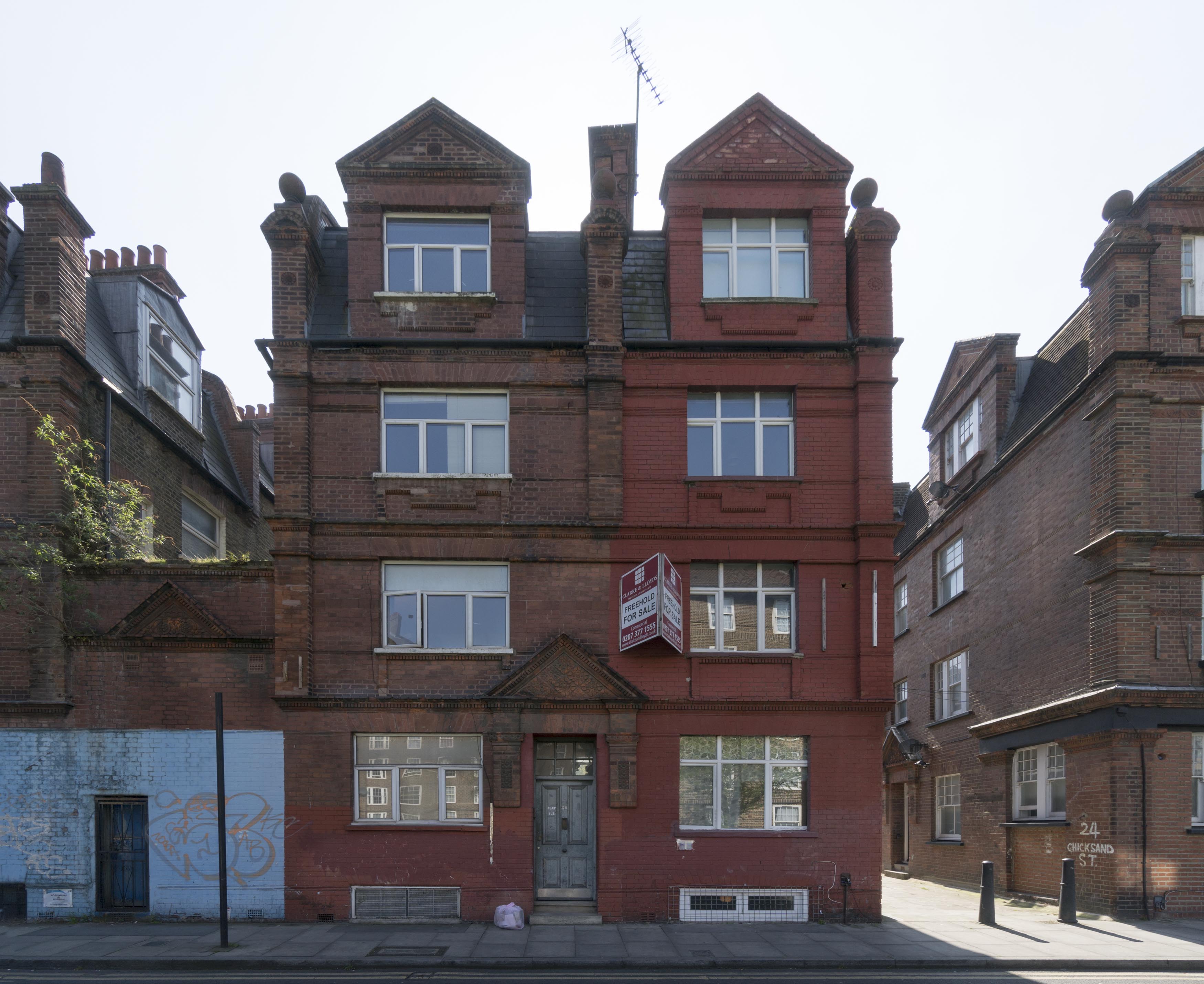
"id": 583,
"title": "22-24 Chicksand Street, April 2017",
"author": {
"id": 27,
"username": "DerekKendall"
},
"feature": {
"id": 201,
"type": "Feature",
"geometry": {
"type": "MultiPolygon",
"coordinates": [
[
[
[
-0.06881544266514,
51.51857834457567
],
[
-0.068779141672589,
51.51851529898357
],
[
-0.068845617115023,
51.51850234886143
],
[
-0.068876525745769,
51.5185641043041
],
[
-0.06881544266514,
51.51857834457567
]
]
]
]
},
"properties": {
"b_number": "22",
"b_name": "",
"street": "Chicksand Street",
"address": "22 Chicksand Street",
"feature_type": "WHITECHAPEL_BUILDING",
"count": 10,
"search_str": "22 Chicksand Street"
},
"tags": []
},
"file": "https://surveyoflondon.org/media/uploads/features/201/SoL%20Whitechapel%20100614.jpg",
"description": "",
"copyright": true,
"created": "2017-05-03"
},
{
"id": 438,
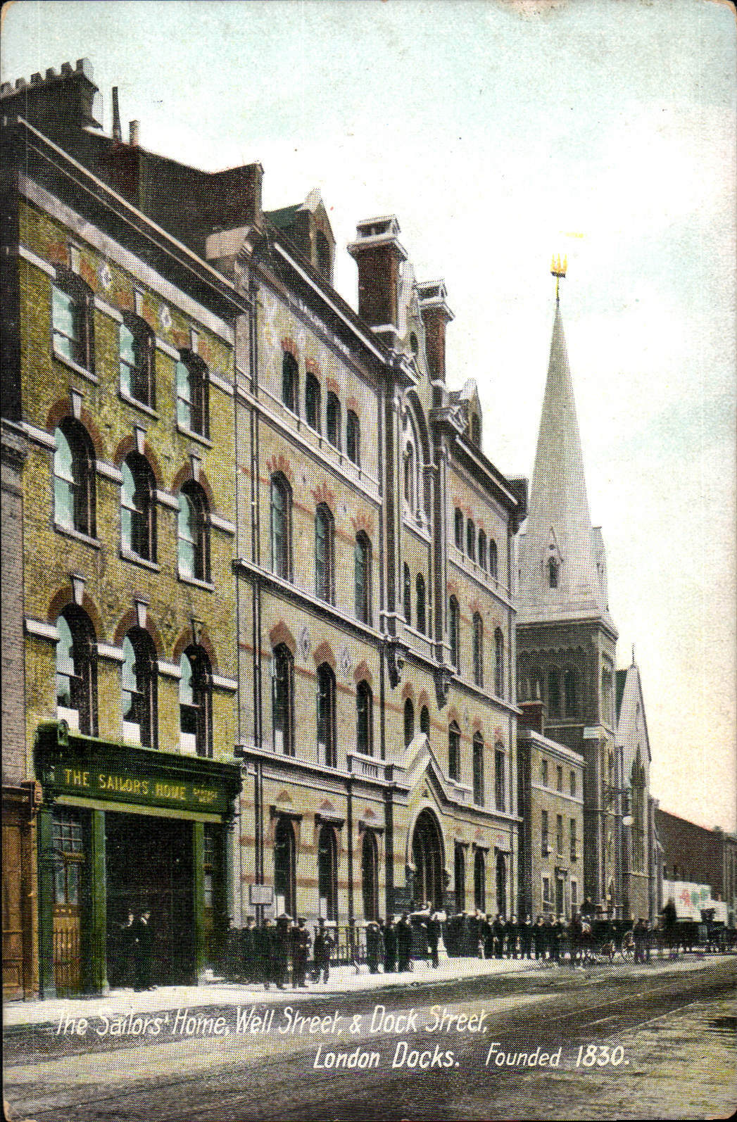
"title": "St Paul, Dock Street, c. 1905",
"author": {
"id": 25,
"username": "Aileen"
},
"feature": {
"id": 1371,
"type": "Feature",
"geometry": {
"type": "MultiPolygon",
"coordinates": [
[
[
[
-0.068057208494737,
51.50994707934026
],
[
-0.068128144074089,
51.510098245489516
],
[
-0.067833383002716,
51.510150364911766
],
[
-0.0678086195768,
51.51009705078618
],
[
-0.067791713048129,
51.51010026052854
],
[
-0.067768418439094,
51.51005627276704
],
[
-0.06778532495294,
51.510053063027875
],
[
-0.06776230081429,
51.510002684478415
],
[
-0.068057208494737,
51.50994707934026
]
]
]
]
},
"properties": {
"b_number": "",
"b_name": "St Paul's Church",
"street": "Dock Street",
"address": "Former Church of St Paul, Dock Street",
"feature_type": "WHITECHAPEL_BUILDING",
"count": 16,
"search_str": "St Paul's Church"
},
"tags": [
"Capt. Robert J. Elliot",
"Henry Roberts",
"James Pennethorne",
"Rev. Dan Greatorex",
"Rev. Joseph Williamson",
"William Cubitt"
]
},
"file": "https://surveyoflondon.org/media/uploads/features/1371/eBay%20postcard%20bought%201%20Nov%202016.jpg",
"description": "A coloured postcard showing St Paul and the Sailor's Home, since rebuilt",
"copyright": false,
"created": "2016-11-03"
},
{
"id": 819,
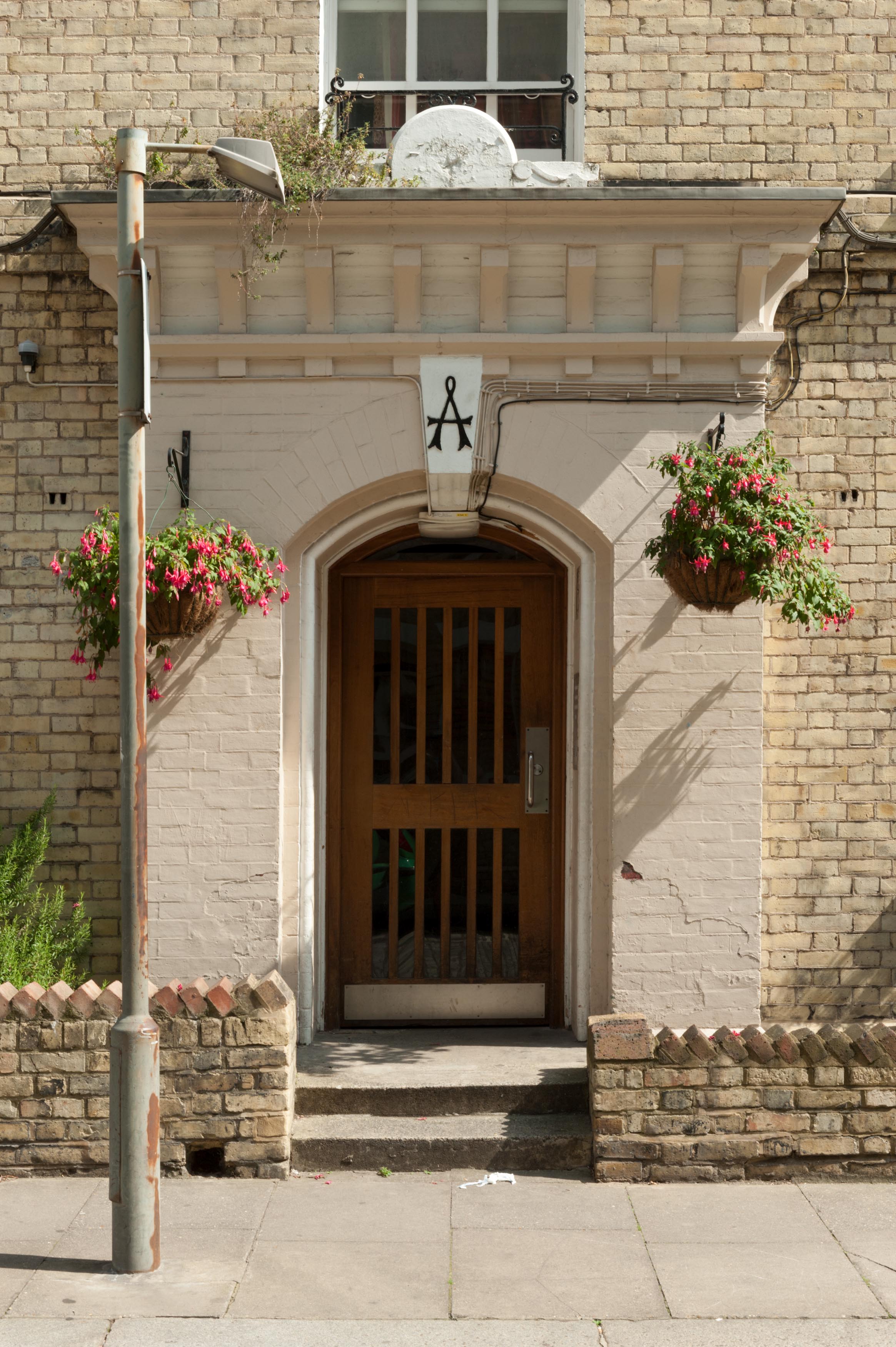
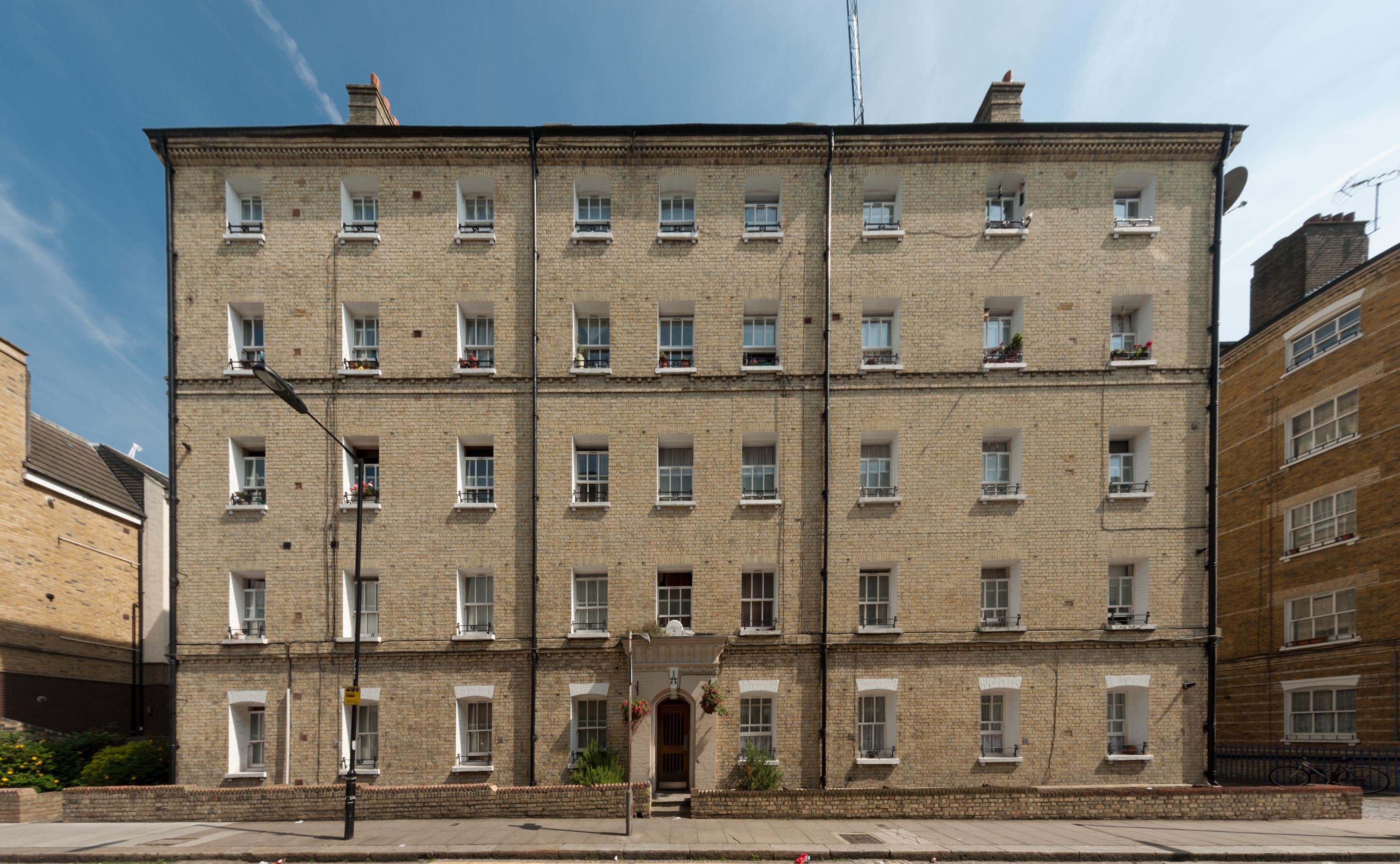
"title": "Block A, Peabody Estate Whitechapel, entrance in 2017",
"author": {
"id": 27,
"username": "DerekKendall"
},
"feature": {
"id": 1350,
"type": "Feature",
"geometry": {
"type": "MultiPolygon",
"coordinates": [
[
[
[
-0.069232175663529,
51.51046430830265
],
[
-0.069032508859417,
51.510505874761336
],
[
-0.069000503212806,
51.51044593058072
],
[
-0.069049530086345,
51.510434504947405
],
[
-0.068977295333485,
51.51031040352003
],
[
-0.068931067217321,
51.5103218752112
],
[
-0.068896263190324,
51.510261884916495
],
[
-0.069085913548265,
51.51021432855069
],
[
-0.069232175663529,
51.51046430830265
]
]
]
]
},
"properties": {
"b_number": "",
"b_name": "Block A",
"street": "John Fisher Street",
"address": "Block A, John Fisher Street, Peabody Estate Whitechapel",
"feature_type": "WHITECHAPEL_BUILDING",
"count": 15,
"search_str": "Block A"
},
"tags": []
},
"file": "https://surveyoflondon.org/media/uploads/features/1350/SoL%20Whitechapel%20101611.jpg",
"description": "",
"copyright": true,
"created": "2017-09-12"
},
{
"id": 1336,
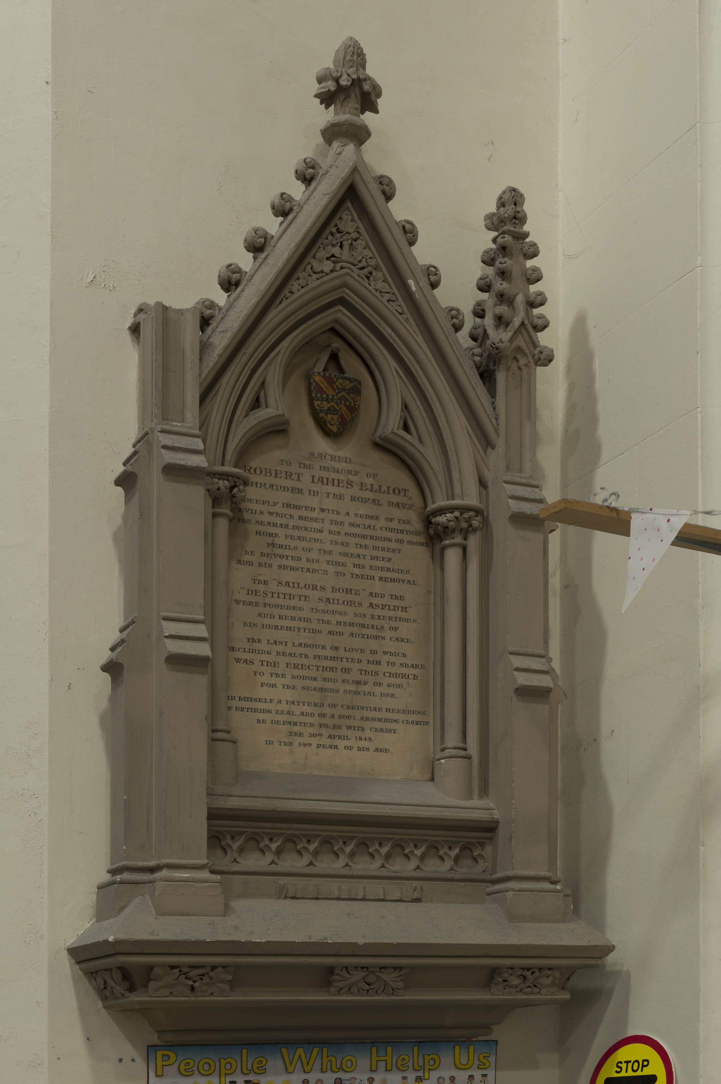
"title": "St Paul, Dock Street, Elliott monument, east wall, August 2018",
"author": {
"id": 27,
"username": "DerekKendall"
},
"feature": {
"id": 1371,
"type": "Feature",
"geometry": {
"type": "MultiPolygon",
"coordinates": [
[
[
[
-0.068057208494737,
51.50994707934026
],
[
-0.068128144074089,
51.510098245489516
],
[
-0.067833383002716,
51.510150364911766
],
[
-0.0678086195768,
51.51009705078618
],
[
-0.067791713048129,
51.51010026052854
],
[
-0.067768418439094,
51.51005627276704
],
[
-0.06778532495294,
51.510053063027875
],
[
-0.06776230081429,
51.510002684478415
],
[
-0.068057208494737,
51.50994707934026
]
]
]
]
},
"properties": {
"b_number": "",
"b_name": "St Paul's Church",
"street": "Dock Street",
"address": "Former Church of St Paul, Dock Street",
"feature_type": "WHITECHAPEL_BUILDING",
"count": 16,
"search_str": "St Paul's Church"
},
"tags": [
"Capt. Robert J. Elliot",
"Henry Roberts",
"James Pennethorne",
"Rev. Dan Greatorex",
"Rev. Joseph Williamson",
"William Cubitt"
]
},
"file": "https://surveyoflondon.org/media/uploads/features/1371/SoL%20Whitechapel%20102115.jpg",
"description": "",
"copyright": true,
"created": "2018-08-13"
},
{
"id": 1340,
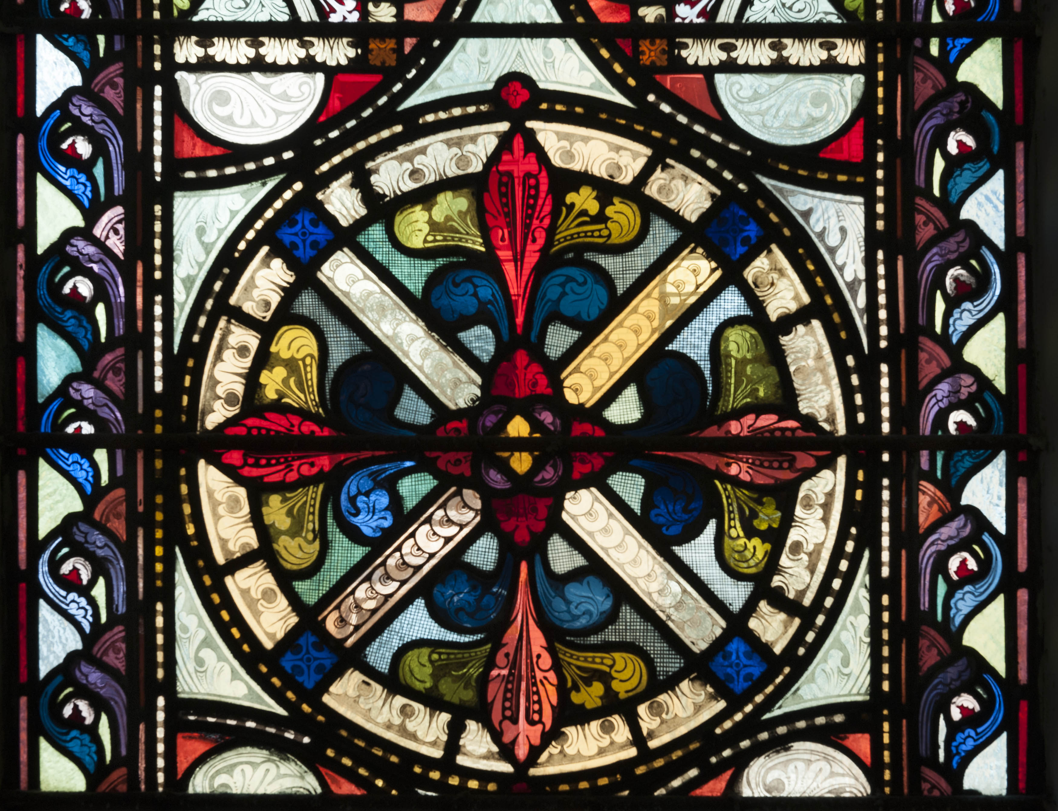
"title": "St Paul, Dock Street, detail from west window, August 2018",
"author": {
"id": 27,
"username": "DerekKendall"
},
"feature": {
"id": 1371,
"type": "Feature",
"geometry": {
"type": "MultiPolygon",
"coordinates": [
[
[
[
-0.068057208494737,
51.50994707934026
],
[
-0.068128144074089,
51.510098245489516
],
[
-0.067833383002716,
51.510150364911766
],
[
-0.0678086195768,
51.51009705078618
],
[
-0.067791713048129,
51.51010026052854
],
[
-0.067768418439094,
51.51005627276704
],
[
-0.06778532495294,
51.510053063027875
],
[
-0.06776230081429,
51.510002684478415
],
[
-0.068057208494737,
51.50994707934026
]
]
]
]
},
"properties": {
"b_number": "",
"b_name": "St Paul's Church",
"street": "Dock Street",
"address": "Former Church of St Paul, Dock Street",
"feature_type": "WHITECHAPEL_BUILDING",
"count": 16,
"search_str": "St Paul's Church"
},
"tags": [
"Capt. Robert J. Elliot",
"Henry Roberts",
"James Pennethorne",
"Rev. Dan Greatorex",
"Rev. Joseph Williamson",
"William Cubitt"
]
},
"file": "https://surveyoflondon.org/media/uploads/features/1371/SoL%20Whitechapel%20102122.jpg",
"description": "",
"copyright": true,
"created": "2018-08-13"
},
{
"id": 421,
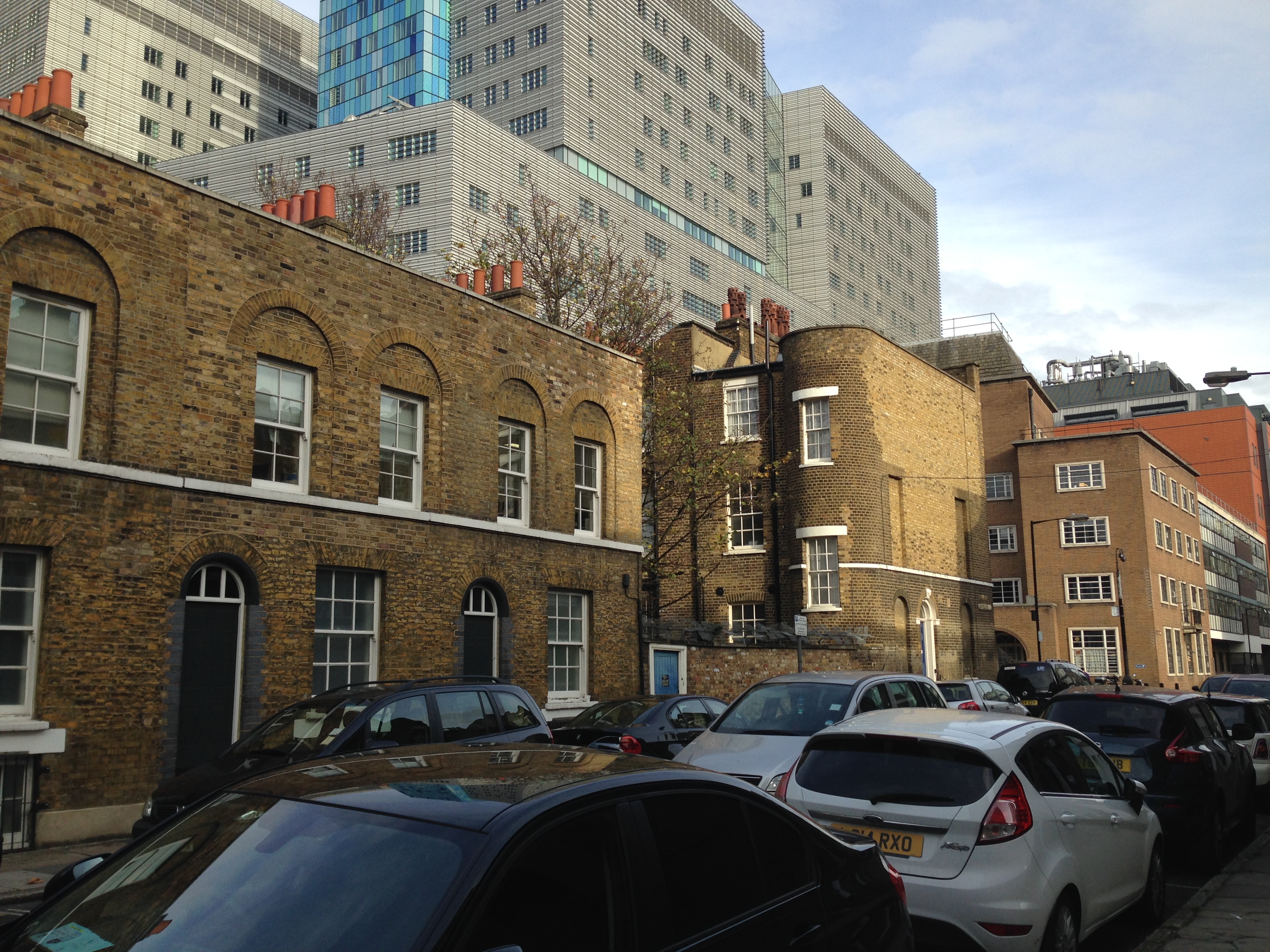
"title": "Rear of 57 Philpot Street, viewed from Ashfield Street in November 2015",
"author": {
"id": 11,
"username": "amyspencer"
},
"feature": {
"id": 1069,
"type": "Feature",
"geometry": {
"type": "MultiPolygon",
"coordinates": [
[
[
[
-0.059627888126023,
51.516734849955185
],
[
-0.059498810252679,
51.51674635816491
],
[
-0.059479105022686,
51.516702522607595
],
[
-0.059611433785659,
51.51669227965251
],
[
-0.059614945186086,
51.51669242650655
],
[
-0.059617088081992,
51.51669331335577
],
[
-0.059618774576033,
51.516694614716734
],
[
-0.059619558724101,
51.51669582184461
],
[
-0.0596200580208,
51.516697058057474
],
[
-0.05962025146307,
51.51669876233129
],
[
-0.059619659678475,
51.5167005481957
],
[
-0.059618979658118,
51.51670193261389
],
[
-0.059616537841932,
51.51670315466222
],
[
-0.059627888126023,
51.516734849955185
]
]
]
]
},
"properties": {
"b_number": "57",
"b_name": "",
"street": "",
"address": "57 Philpot Street",
"feature_type": "WHITECHAPEL_BUILDING",
"count": 5,
"search_str": "57 Philpot Street"
},
"tags": []
},
"file": "https://surveyoflondon.org/media/uploads/features/1069/IMG_0657.JPG",
"description": "",
"copyright": false,
"created": "2016-10-11"
},
{
"id": 423,
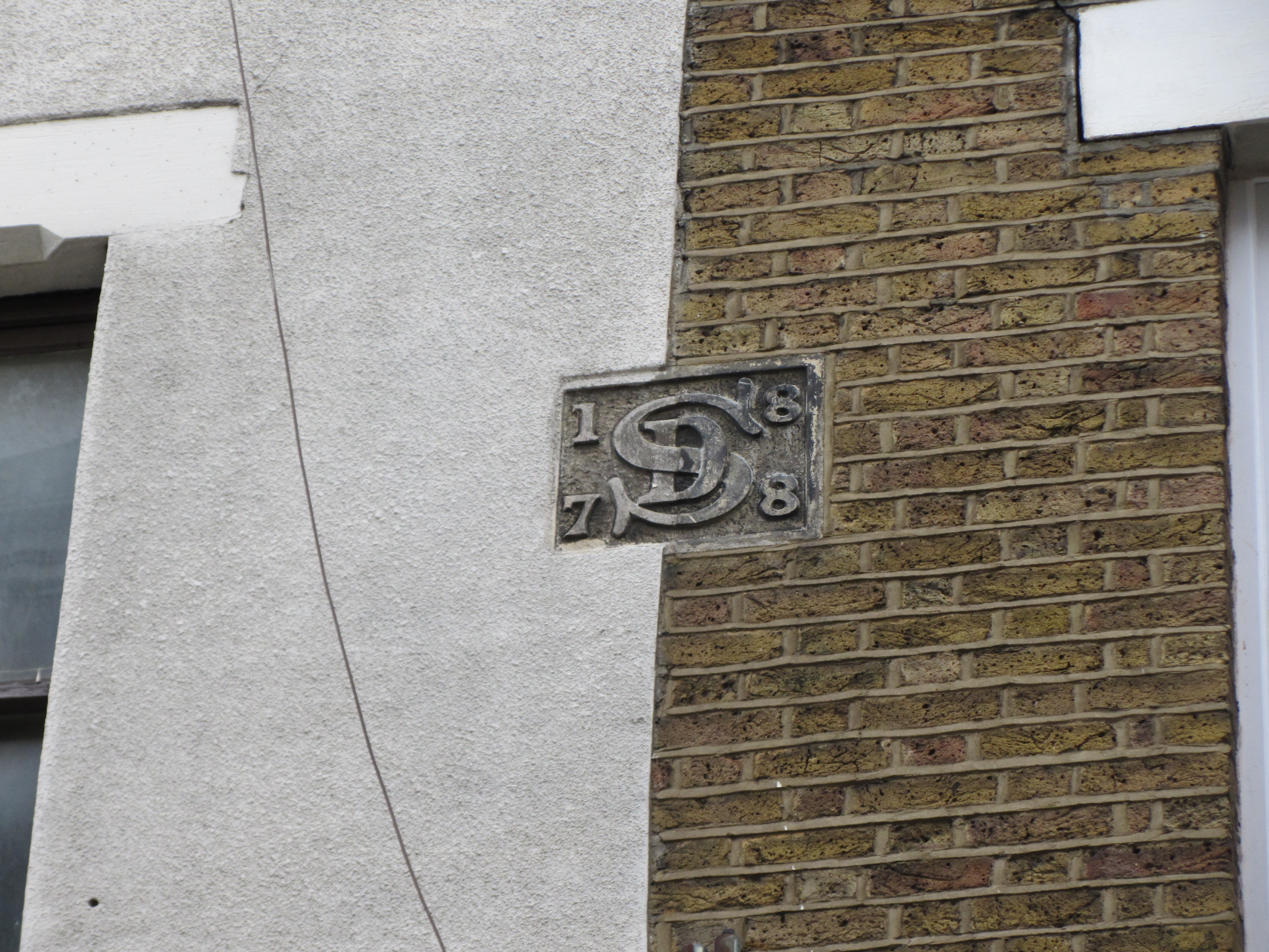
"title": "Plaque on west elevation of 1-2 East Mount Street bearing date and initials, photographed in November 2015",
"author": {
"id": 11,
"username": "amyspencer"
},
"feature": {
"id": 1229,
"type": "Feature",
"geometry": {
"type": "MultiPolygon",
"coordinates": [
[
[
[
-0.058860343544049,
51.51894097371194
],
[
-0.058860343558978,
51.51894097370836
],
[
-0.058975164006313,
51.51891348503083
],
[
-0.058999857002125,
51.518957100386174
],
[
-0.058889131635543,
51.518984974852245
],
[
-0.058860343544049,
51.51894097371194
]
]
]
]
},
"properties": {
"b_number": "1",
"b_name": "",
"street": "East Mount Street",
"address": "1 East Mount Street",
"feature_type": "WHITECHAPEL_BUILDING",
"count": 2,
"search_str": "1 East Mount Street"
},
"tags": []
},
"file": "https://surveyoflondon.org/media/uploads/features/1229/IMG_6302.JPG",
"description": "",
"copyright": false,
"created": "2016-10-11"
},
{
"id": 422,
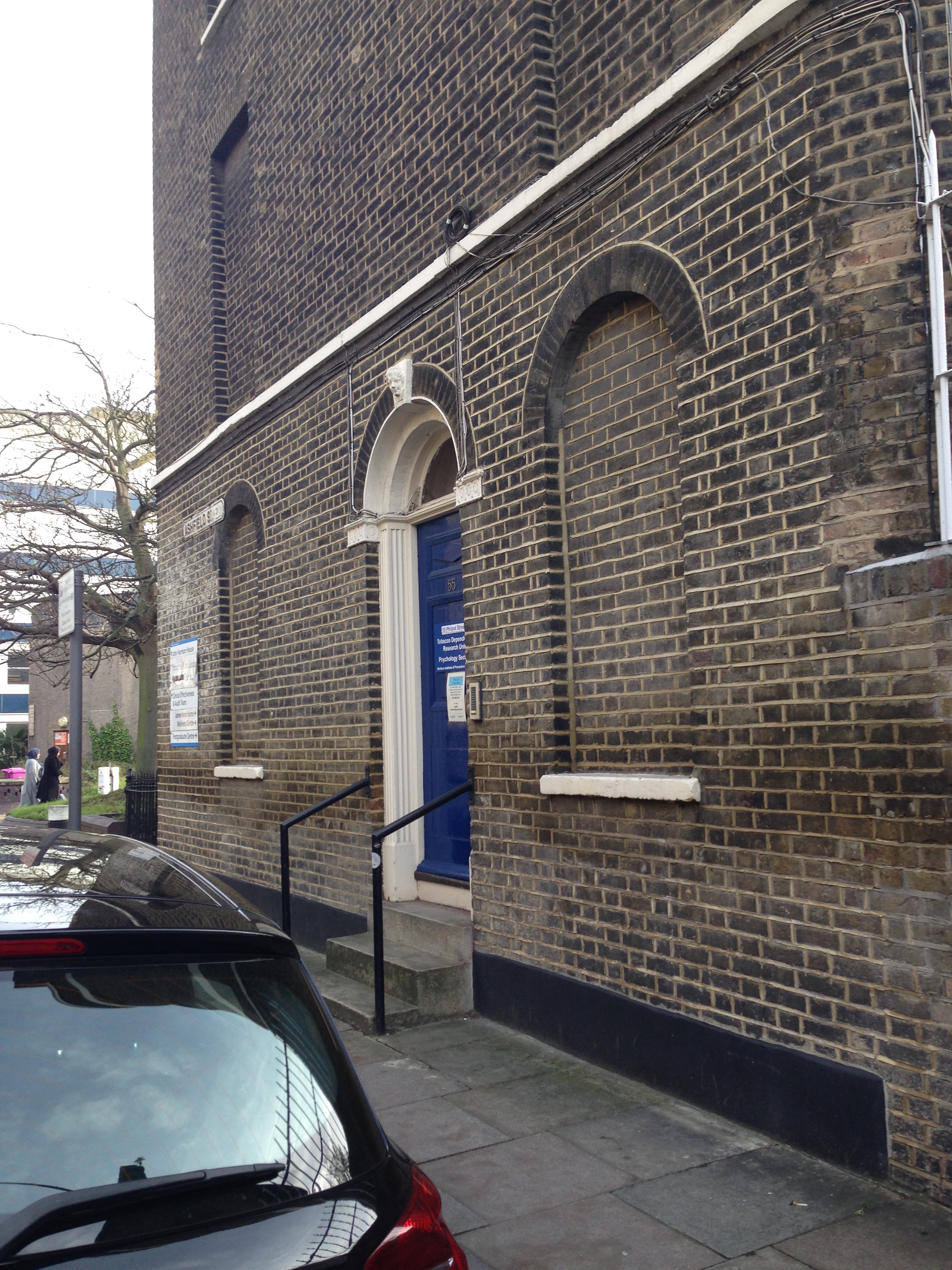
"title": "North elevation of 55 Philpot Street, photographed in 2015",
"author": {
"id": 11,
"username": "amyspencer"
},
"feature": {
"id": 1077,
"type": "Feature",
"geometry": {
"type": "MultiPolygon",
"coordinates": [
[
[
[
-0.059558018115802,
51.516589203750726
],
[
-0.059430414920481,
51.51660225639608
],
[
-0.059413033864943,
51.516563104635836
],
[
-0.059538817989633,
51.51655239660423
],
[
-0.059549821920541,
51.516573290696336
],
[
-0.059554340201974,
51.516573545671086
],
[
-0.0595576844378,
51.516574215269074
],
[
-0.059560144785485,
51.516575232091
],
[
-0.059562441268025,
51.516576409484024
],
[
-0.059564500729646,
51.51657844054839
],
[
-0.059565227015308,
51.516581733961985
],
[
-0.059564671688276,
51.51658410187855
],
[
-0.059563626300533,
51.516585990923744
],
[
-0.059561097096175,
51.516588122599146
],
[
-0.059558018115802,
51.516589203750726
]
]
]
]
},
"properties": {
"b_number": "55",
"b_name": "",
"street": "Philpot Street",
"address": "55 Philpot Street",
"feature_type": "WHITECHAPEL_BUILDING",
"count": 5,
"search_str": "55 Philpot Street"
},
"tags": []
},
"file": "https://surveyoflondon.org/media/uploads/features/1077/IMG_0659.JPG",
"description": "",
"copyright": false,
"created": "2016-10-11"
},
{
"id": 817,
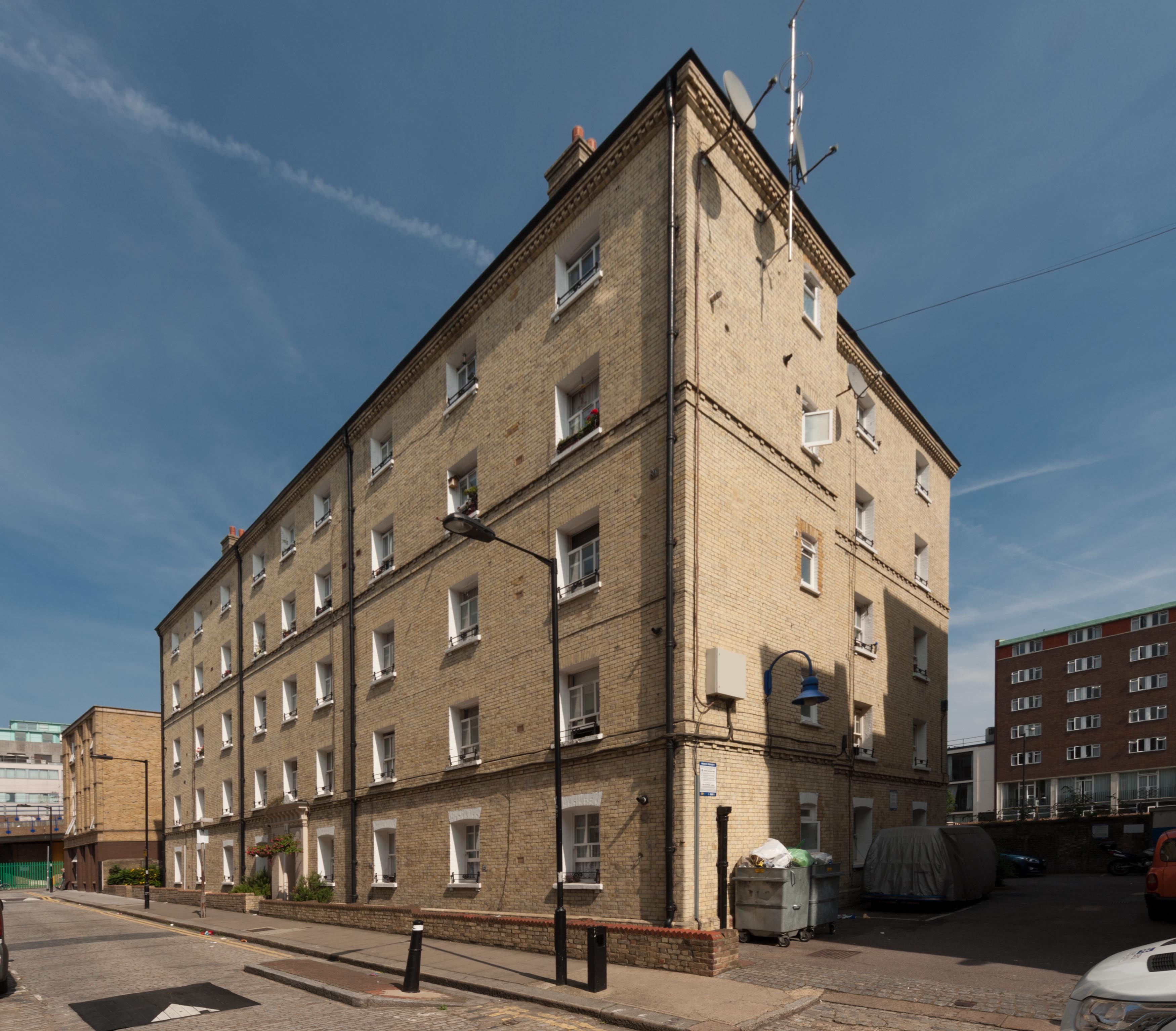
"title": "Block A, Peabody Estate Whitechapel, from the south-west in 2017",
"author": {
"id": 27,
"username": "DerekKendall"
},
"feature": {
"id": 1350,
"type": "Feature",
"geometry": {
"type": "MultiPolygon",
"coordinates": [
[
[
[
-0.069232175663529,
51.51046430830265
],
[
-0.069032508859417,
51.510505874761336
],
[
-0.069000503212806,
51.51044593058072
],
[
-0.069049530086345,
51.510434504947405
],
[
-0.068977295333485,
51.51031040352003
],
[
-0.068931067217321,
51.5103218752112
],
[
-0.068896263190324,
51.510261884916495
],
[
-0.069085913548265,
51.51021432855069
],
[
-0.069232175663529,
51.51046430830265
]
]
]
]
},
"properties": {
"b_number": "",
"b_name": "Block A",
"street": "John Fisher Street",
"address": "Block A, John Fisher Street, Peabody Estate Whitechapel",
"feature_type": "WHITECHAPEL_BUILDING",
"count": 15,
"search_str": "Block A"
},
"tags": []
},
"file": "https://surveyoflondon.org/media/uploads/features/1350/SoL%20Whitechapel%20101609.jpg",
"description": "",
"copyright": true,
"created": "2017-09-12"
},
{
"id": 818,
"title": "Block A, Peabody Estate Whitechapel, from the west in 2017",
"author": {
"id": 27,
"username": "DerekKendall"
},
"feature": {
"id": 1350,
"type": "Feature",
"geometry": {
"type": "MultiPolygon",
"coordinates": [
[
[
[
-0.069232175663529,
51.51046430830265
],
[
-0.069032508859417,
51.510505874761336
],
[
-0.069000503212806,
51.51044593058072
],
[
-0.069049530086345,
51.510434504947405
],
[
-0.068977295333485,
51.51031040352003
],
[
-0.068931067217321,
51.5103218752112
],
[
-0.068896263190324,
51.510261884916495
],
[
-0.069085913548265,
51.51021432855069
],
[
-0.069232175663529,
51.51046430830265
]
]
]
]
},
"properties": {
"b_number": "",
"b_name": "Block A",
"street": "John Fisher Street",
"address": "Block A, John Fisher Street, Peabody Estate Whitechapel",
"feature_type": "WHITECHAPEL_BUILDING",
"count": 15,
"search_str": "Block A"
},
"tags": []
},
"file": "https://surveyoflondon.org/media/uploads/features/1350/SoL%20Whitechapel%20101610.jpg",
"description": "",
"copyright": true,
"created": "2017-09-12"
},
{
"id": 541,
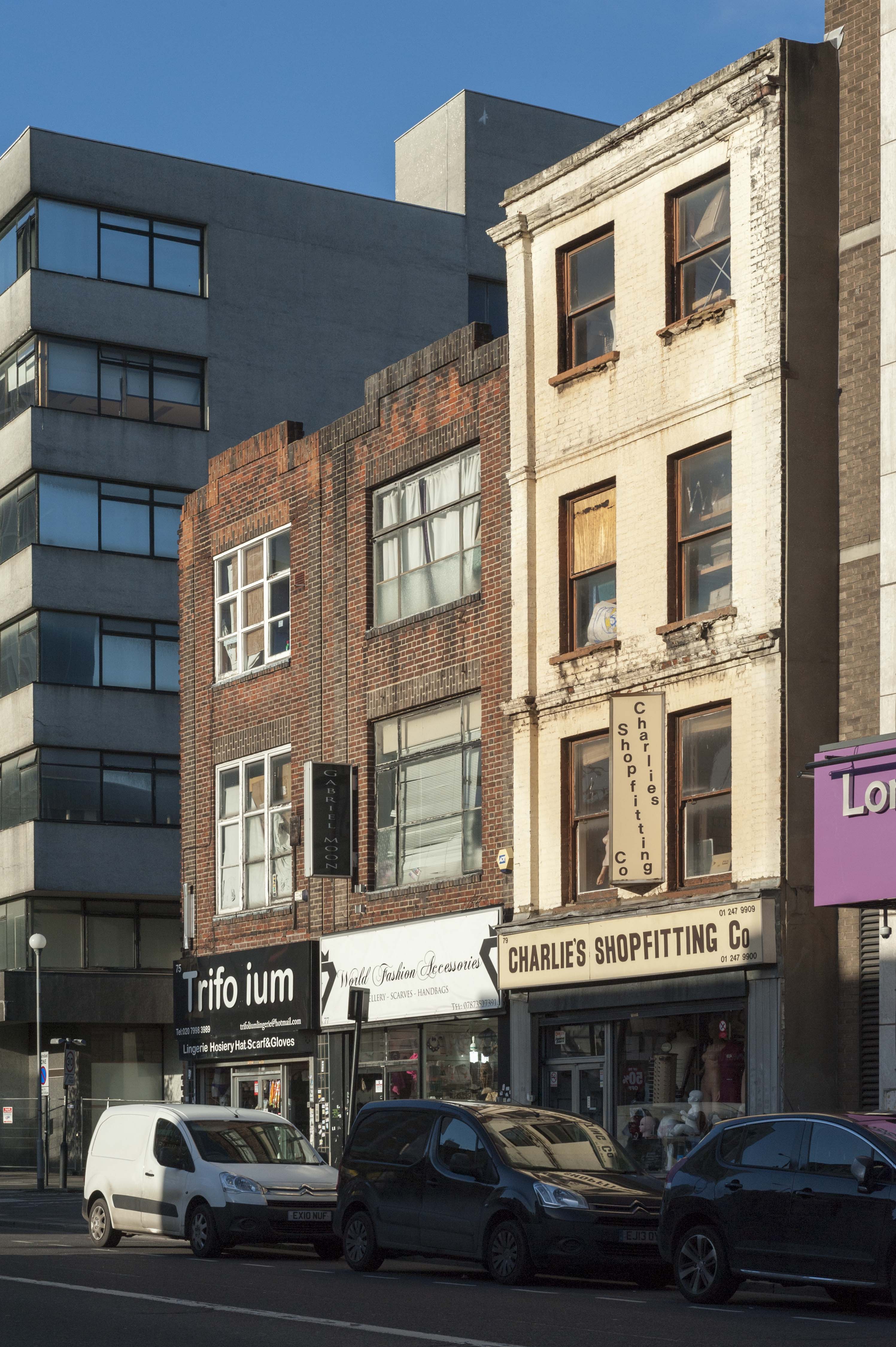
"title": "75-79 Commercial Road in early 2017",
"author": {
"id": 27,
"username": "DerekKendall"
},
"feature": {
"id": 961,
"type": "Feature",
"geometry": {
"type": "MultiPolygon",
"coordinates": [
[
[
[
-0.064939198733176,
51.51489703806239
],
[
-0.064939186263775,
51.514897045213466
],
[
-0.064944736900347,
51.51497645648691
],
[
-0.064868285369096,
51.51497796151573
],
[
-0.064861371491825,
51.51484928856817
],
[
-0.064944417363844,
51.51485313116477
],
[
-0.064939198733176,
51.51489703806239
]
]
]
]
},
"properties": {
"b_number": "75",
"b_name": "",
"street": "Commercial Road",
"address": "75 Commercial Road",
"feature_type": "WHITECHAPEL_BUILDING",
"count": 1,
"search_str": "75 Commercial Road"
},
"tags": []
},
"file": "https://surveyoflondon.org/media/uploads/features/961/SoL%20Whitechapel%20100444.jpg",
"description": "",
"copyright": true,
"created": "2017-04-10"
},
{
"id": 781,
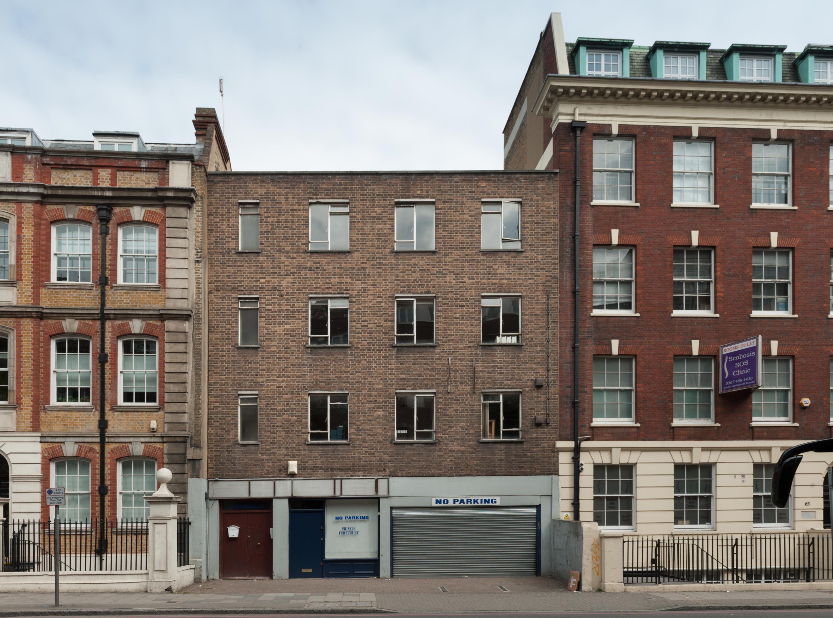
"title": "Elevation, August 2017",
"author": {
"id": 27,
"username": "DerekKendall"
},
"feature": {
"id": 47,
"type": "Feature",
"geometry": {
"type": "MultiPolygon",
"coordinates": [
[
[
[
-0.072943416435696,
51.51258063569251
],
[
-0.072931301597456,
51.51248162939545
],
[
-0.073031917055091,
51.5124784765374
],
[
-0.073049810679383,
51.512574442709884
],
[
-0.072943416435696,
51.51258063569251
]
]
]
]
},
"properties": {
"b_number": "61",
"b_name": "",
"street": "Mansell Street",
"address": "61 Mansell Street",
"feature_type": "WHITECHAPEL_BUILDING",
"count": 3,
"search_str": "61 Mansell Street"
},
"tags": []
},
"file": "https://surveyoflondon.org/media/uploads/features/47/SoL%20Whitechapel%20101506.jpg",
"description": "",
"copyright": true,
"created": "2017-09-12"
},
{
"id": 559,
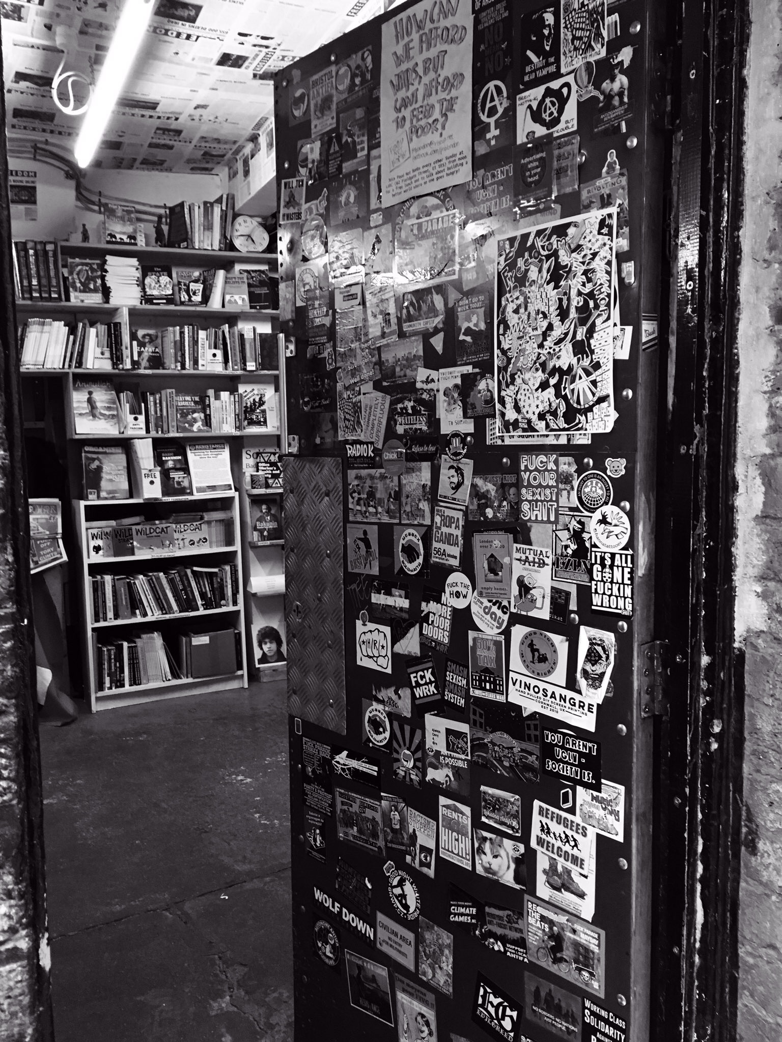
"title": "Free to read",
"author": {
"id": 125,
"username": "Rrudall1"
},
"feature": {
"id": 397,
"type": "Feature",
"geometry": {
"type": "MultiPolygon",
"coordinates": [
[
[
[
-0.070631734980517,
51.516055421900404
],
[
-0.070694810837976,
51.5160316148736
],
[
-0.070694812656241,
51.51603160856848
],
[
-0.070694822071344,
51.51603161810757
],
[
-0.070705382817133,
51.51602803925736
],
[
-0.070776774733246,
51.516123324187696
],
[
-0.070694983149094,
51.516128965932744
],
[
-0.070631734980517,
51.516055421900404
]
]
]
]
},
"properties": {
"b_number": "84B",
"b_name": "84B Whitechapel High Street",
"street": "Angel Alley, Whitechapel High Street",
"address": " 84B Whitechapel High Street",
"feature_type": "WHITECHAPEL_BUILDING",
"count": 10,
"search_str": "84B Whitechapel High Street"
},
"tags": []
},
"file": "https://surveyoflondon.org/media/uploads/features/397/image.jpg",
"description": "Taken outside Freedom bookshop, down Angel Alley at the side of the Whitechapel Gallery, spring 2017 ",
"copyright": false,
"created": "2017-05-02"
},
{
"id": 553,
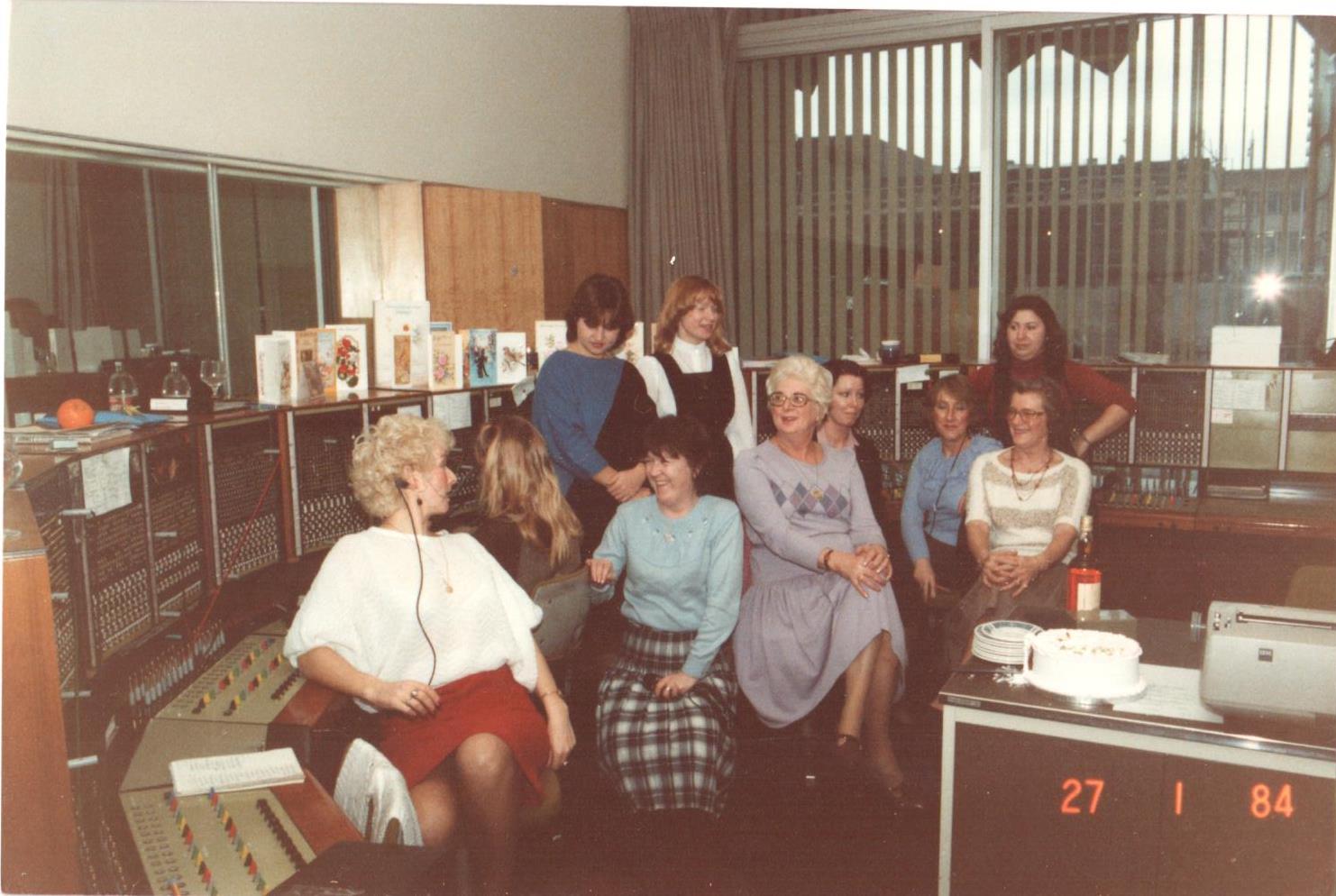
"title": "Beagle House telephone switchboard team in 1984",
"author": {
"id": 22,
"username": "sarahannmilne"
},
"feature": {
"id": 31,
"type": "Feature",
"geometry": {
"type": "MultiPolygon",
"coordinates": [
[
[
[
-0.071887127893096,
51.51411332216963
],
[
-0.071969571208431,
51.51419942371175
],
[
-0.071924976063445,
51.5142326534243
],
[
-0.071948658834375,
51.51426657781599
],
[
-0.071835003267539,
51.5143227101345
],
[
-0.071686234045495,
51.5143855464125
],
[
-0.071543425125636,
51.514422007266134
],
[
-0.071435516621411,
51.51444471123646
],
[
-0.071395570736125,
51.51440565693606
],
[
-0.07134776228325,
51.51441310661883
],
[
-0.0712722588033,
51.51434177428325
],
[
-0.071303428297817,
51.51432370241673
],
[
-0.071263213192454,
51.5142868603796
],
[
-0.071374185885124,
51.514224080818835
],
[
-0.071528097019019,
51.51416207230522
],
[
-0.071692419185678,
51.51411901969061
],
[
-0.071795120500786,
51.514091351954804
],
[
-0.071848759931576,
51.5141216554061
],
[
-0.071887127893096,
51.51411332216963
]
]
]
]
},
"properties": {
"b_number": "1",
"b_name": "Maersk House",
"street": "Braham Street",
"address": "Maersk House (formerly Beagle House), 1 Braham Street",
"feature_type": "WHITECHAPEL_BUILDING",
"count": 20,
"search_str": "Maersk House"
},
"tags": []
},
"file": "https://surveyoflondon.org/media/uploads/features/31/Scan11.jpg",
"description": "Photograph courtesy of Yvonne hall",
"copyright": false,
"created": "2017-04-25"
}
]
}