HTTP 200 OK
Allow: GET, HEAD, OPTIONS
Content-Type: application/json
Vary: Accept
{
"count": 1747,
"next": "https://surveyoflondon.org/api/v1/images/?format=api&page=13",
"previous": "https://surveyoflondon.org/api/v1/images/?format=api&page=11",
"results": [
{
"id": 443,
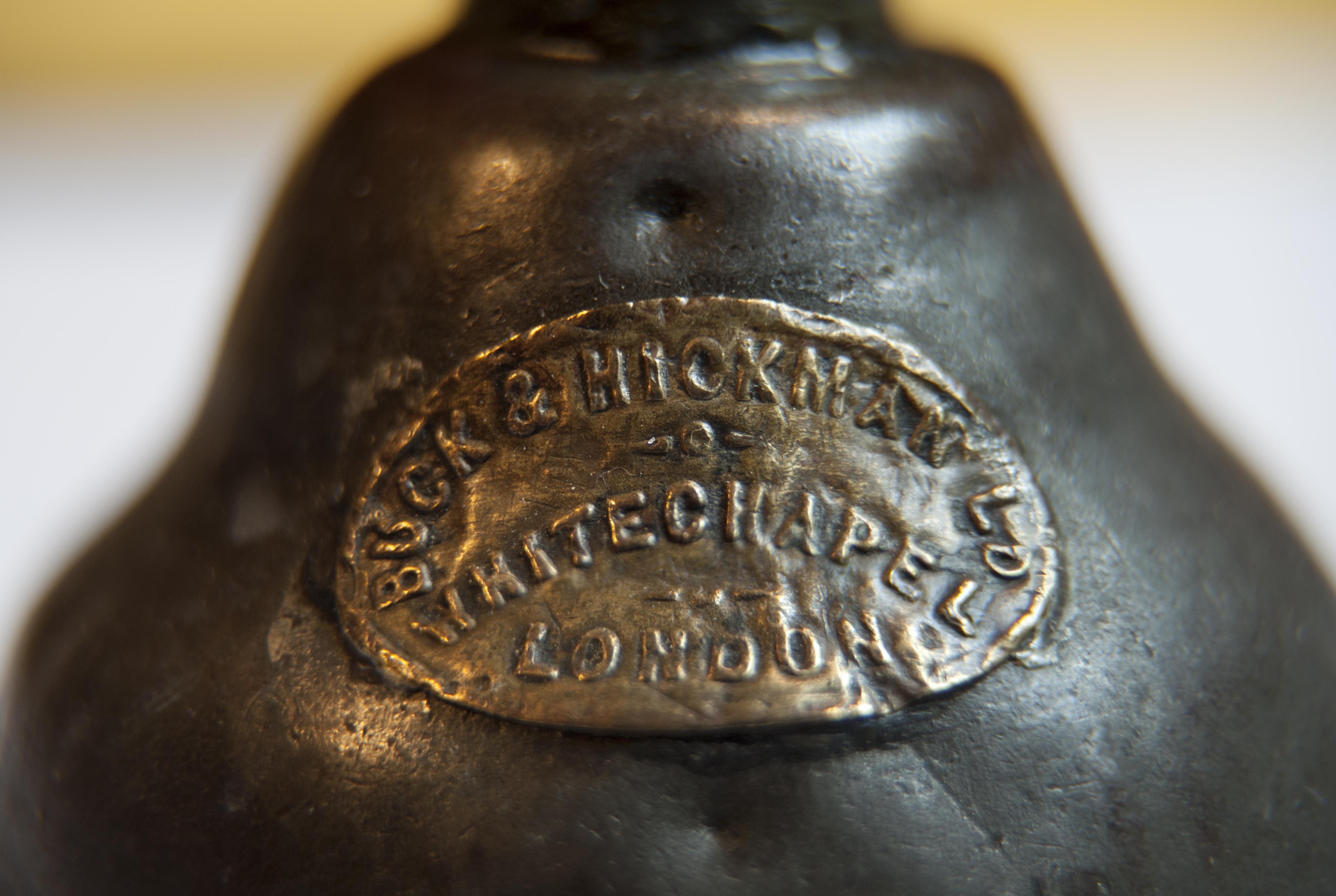
"title": "Buck & Hickman oil can- showing maker's plate",
"author": {
"id": 27,
"username": "DerekKendall"
},
"feature": {
"id": 145,
"type": "Feature",
"geometry": {
"type": "MultiPolygon",
"coordinates": [
[
[
[
-0.067438878078407,
51.51626048776608
],
[
-0.067736964788515,
51.51614633139776
],
[
-0.067736975376783,
51.51614633297866
],
[
-0.068162873880285,
51.516578971968116
],
[
-0.068015152398359,
51.5166409265401
],
[
-0.067898951070216,
51.516535567083395
],
[
-0.067749868829072,
51.51660024858242
],
[
-0.067727076343935,
51.516580194496996
],
[
-0.067678054021065,
51.51659801606037
],
[
-0.067602032053382,
51.516516614054154
],
[
-0.067658800891649,
51.51649597633206
],
[
-0.067438878078407,
51.51626048776608
]
]
]
]
},
"properties": {
"b_number": "2",
"b_name": "",
"street": "Whitechapel Road",
"address": "2 Whitechapel Road with 40 Adler Street",
"feature_type": "WHITECHAPEL_BUILDING",
"count": 7,
"search_str": "2 Whitechapel Road with 40 Adler Street"
},
"tags": [
"Buck & Hickman"
]
},
"file": "https://surveyoflondon.org/media/uploads/features/145/Buck%20%26%20Hickman%20oil%20can%2002.jpg",
"description": "",
"copyright": true,
"created": "2016-11-10"
},
{
"id": 210,
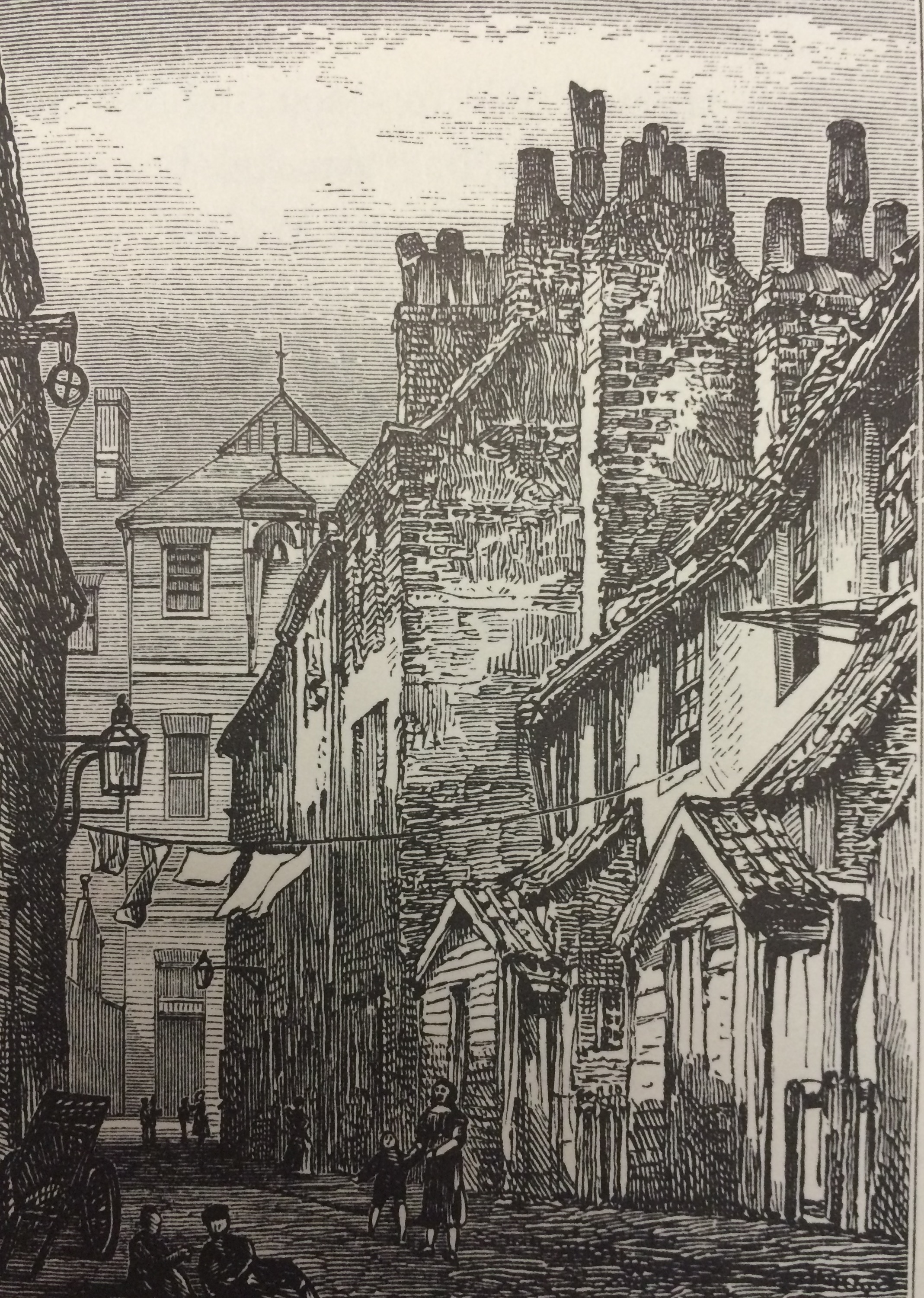
"title": "Castle Alley (approx site of Bradbury Court) looking north towards Old Castle Street school (site of Herbert House), c. 1873",
"author": {
"id": 25,
"username": "Aileen"
},
"feature": {
"id": 420,
"type": "Feature",
"geometry": {
"type": "MultiPolygon",
"coordinates": [
[
[
[
-0.073255698509161,
51.51591574342781
],
[
-0.07310819850918,
51.5157573434277
],
[
-0.07336639850931,
51.515683843427674
],
[
-0.073521398509294,
51.51584454342777
],
[
-0.073255698509161,
51.51591574342781
]
]
]
]
},
"properties": {
"b_number": "24",
"b_name": "Bradbury Court, 24 Old Castle Street",
"street": "Old Castle Street",
"address": "Bradbury Court, 24 Old Castle Street. London E1 7AH",
"feature_type": "WHITECHAPEL_BUILDING",
"count": 4,
"search_str": "Bradbury Court, 24 Old Castle Street"
},
"tags": []
},
"file": "https://surveyoflondon.org/media/uploads/features/420/Castle%20Alley%20early%201870s.jpg",
"description": "",
"copyright": false,
"created": "2016-07-31"
},
{
"id": 572,
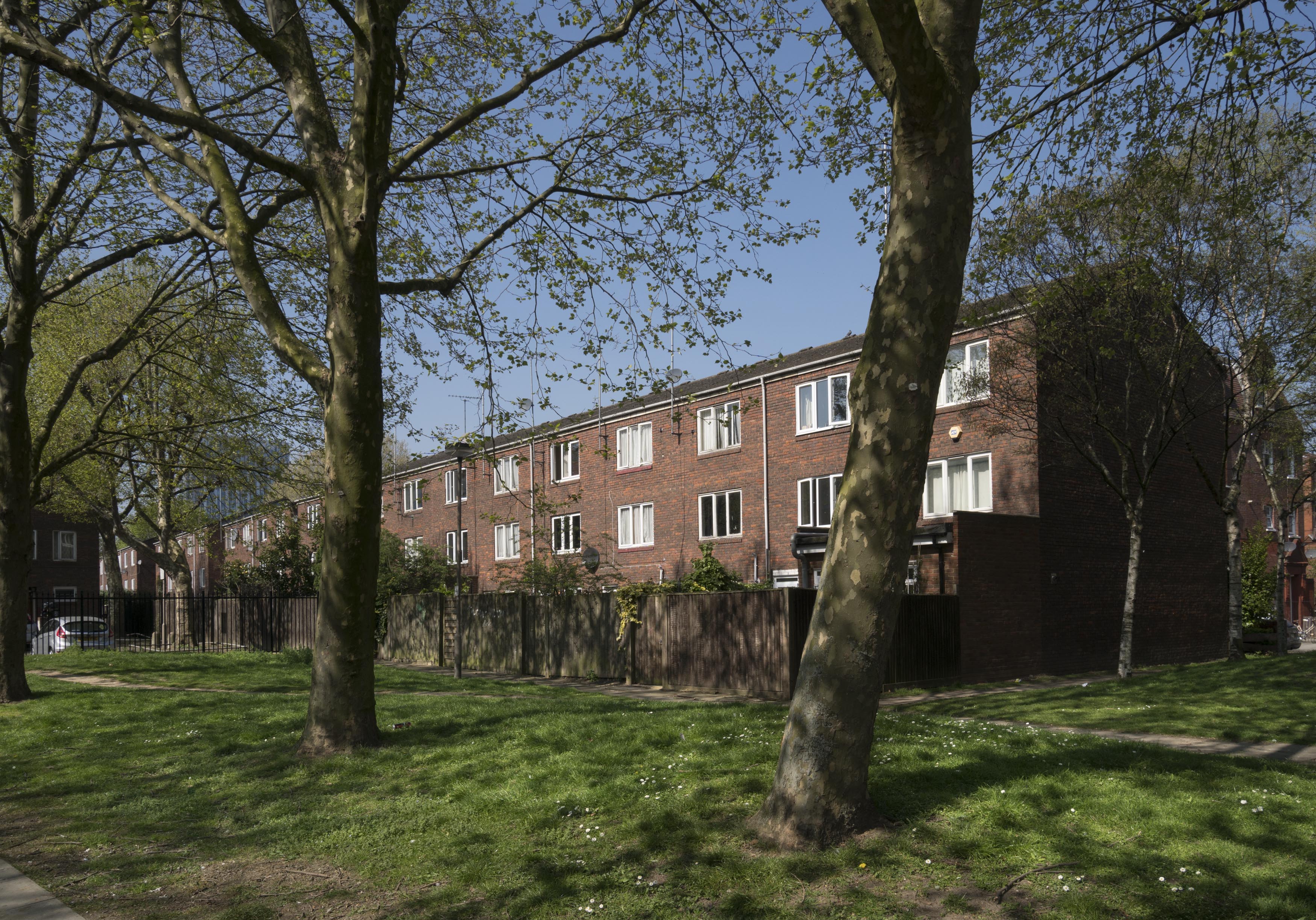
"title": "Hopetown Estate - view to backs of houses on Chicksand Street in April 2017",
"author": {
"id": 27,
"username": "DerekKendall"
},
"feature": {
"id": 242,
"type": "Feature",
"geometry": {
"type": "MultiPolygon",
"coordinates": [
[
[
[
-0.069759187517722,
51.5182086130277
],
[
-0.069799049632978,
51.51828931844235
],
[
-0.069799058912781,
51.518289321951585
],
[
-0.069756180782696,
51.51829715621699
],
[
-0.069716292689891,
51.51821691263275
],
[
-0.069759187517722,
51.5182086130277
]
]
]
]
},
"properties": {
"b_number": "20",
"b_name": "",
"street": "Chicksand Street",
"address": "20 Chicksand Street",
"feature_type": "WHITECHAPEL_BUILDING",
"count": 14,
"search_str": "20 Chicksand Street"
},
"tags": []
},
"file": "https://surveyoflondon.org/media/uploads/features/242/SoL%20Whitechapel%20100590.jpg",
"description": "",
"copyright": true,
"created": "2017-05-03"
},
{
"id": 581,
"title": "View to the Casson Street and Chicksand Street corner from the north-east in April 2017",
"author": {
"id": 27,
"username": "DerekKendall"
},
"feature": {
"id": 206,
"type": "Feature",
"geometry": {
"type": "MultiPolygon",
"coordinates": [
[
[
[
-0.068440273800361,
51.51861864564887
],
[
-0.068543681220409,
51.51859620342785
],
[
-0.06856079328264,
51.51863527571528
],
[
-0.068457031879541,
51.51866026914361
],
[
-0.068440273800361,
51.51861864564887
]
]
]
]
},
"properties": {
"b_number": "29",
"b_name": "",
"street": "Casson Street",
"address": "29 Casson Street",
"feature_type": "WHITECHAPEL_BUILDING",
"count": 10,
"search_str": "29 Casson Street"
},
"tags": []
},
"file": "https://surveyoflondon.org/media/uploads/features/206/SoL%20Whitechapel%20100610.jpg",
"description": "",
"copyright": true,
"created": "2017-05-03"
},
{
"id": 478,
"title": "Former Nottingham Place",
"author": {
"id": 21,
"username": "IsobelWatson"
},
"feature": {
"id": 774,
"type": "Feature",
"geometry": {
"type": "MultiPolygon",
"coordinates": [
[
[
[
-0.06379468827245,
51.51684278519736
],
[
-0.063916334138354,
51.516827664082804
],
[
-0.063925975276417,
51.516869900662776
],
[
-0.063824313187808,
51.516881772952146
],
[
-0.063804810211653,
51.516884132047046
],
[
-0.06379468827245,
51.51684278519736
]
]
]
]
},
"properties": {
"b_number": "58",
"b_name": null,
"street": "Parfett Street",
"address": "34-60 Parfett Street",
"feature_type": "WHITECHAPEL_BUILDING",
"count": 1,
"search_str": "34-60 Parfett Street"
},
"tags": []
},
"file": "https://surveyoflondon.org/media/uploads/features/774/Parfett%20St%20NE%20side%20(former%20Nottingham%20Place)%201992.jpg",
"description": "This appears to have escaped redevelopment as it was found in better condition than the southern arm, originally the only part called Parfett Street (see LH/A/9/41, Estates Sub-Committee Minutes 1886-1903).",
"copyright": false,
"created": "2017-01-09"
},
{
"id": 495,
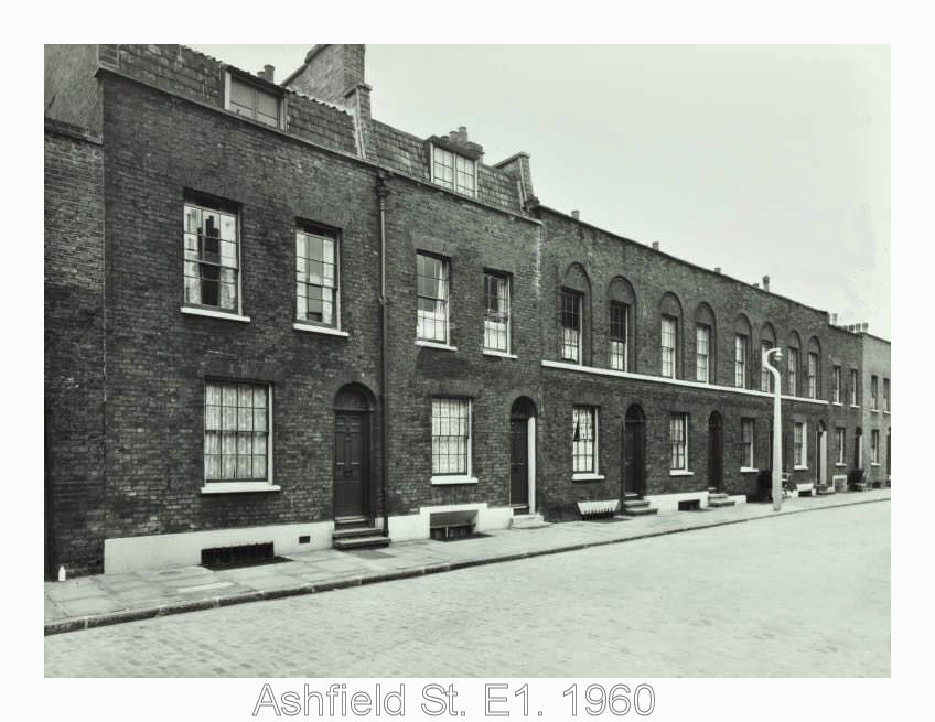
"title": "Ashfield Street in 1960",
"author": {
"id": 100,
"username": "GaryH"
},
"feature": {
"id": 1197,
"type": "Feature",
"geometry": {
"type": "MultiPolygon",
"coordinates": [
[
[
[
-0.059778776497228,
51.51656932193162
],
[
-0.059758743173601,
51.516505269265906
],
[
-0.059823801551261,
51.51649800255089
],
[
-0.059842249886436,
51.516562296344475
],
[
-0.059778776497228,
51.51656932193162
]
]
]
]
},
"properties": {
"b_number": "46",
"b_name": "",
"street": "Ashfield Street",
"address": "46 Ashfield Street",
"feature_type": "WHITECHAPEL_BUILDING",
"count": 2,
"search_str": "46 Ashfield Street"
},
"tags": []
},
"file": "https://surveyoflondon.org/media/uploads/features/1197/ashfield%20st1960.jpg",
"description": "1960's",
"copyright": false,
"created": "2017-02-17"
},
{
"id": 487,
"title": "Walden Street (south side)",
"author": {
"id": 21,
"username": "IsobelWatson"
},
"feature": {
"id": 1257,
"type": "Feature",
"geometry": {
"type": "MultiPolygon",
"coordinates": [
[
[
[
-0.061379221561462,
51.51592493195014
],
[
-0.061397058351041,
51.5159973079162
],
[
-0.061328769815982,
51.51600382343807
],
[
-0.061310941705599,
51.51593148241871
],
[
-0.061379221561462,
51.51592493195014
]
]
]
]
},
"properties": {
"b_number": "16",
"b_name": "",
"street": "Walden Street",
"address": "16 Walden Street",
"feature_type": "WHITECHAPEL_BUILDING",
"count": 4,
"search_str": "16 Walden Street"
},
"tags": []
},
"file": "https://surveyoflondon.org/media/uploads/features/1257/Walden%20St%206-%20(even)%201992.jpg",
"description": "This shot is dated 1992. ",
"copyright": false,
"created": "2017-01-23"
},
{
"id": 780,
"title": "61-61 Mansell Street, August 2017",
"author": {
"id": 27,
"username": "DerekKendall"
},
"feature": {
"id": 47,
"type": "Feature",
"geometry": {
"type": "MultiPolygon",
"coordinates": [
[
[
[
-0.072943416435696,
51.51258063569251
],
[
-0.072931301597456,
51.51248162939545
],
[
-0.073031917055091,
51.5124784765374
],
[
-0.073049810679383,
51.512574442709884
],
[
-0.072943416435696,
51.51258063569251
]
]
]
]
},
"properties": {
"b_number": "61",
"b_name": "",
"street": "Mansell Street",
"address": "61 Mansell Street",
"feature_type": "WHITECHAPEL_BUILDING",
"count": 3,
"search_str": "61 Mansell Street"
},
"tags": []
},
"file": "https://surveyoflondon.org/media/uploads/features/47/SoL%20Whitechapel%20101505.jpg",
"description": "",
"copyright": true,
"created": "2017-09-12"
},
{
"id": 840,
"title": "Elevation, August 2017",
"author": {
"id": 27,
"username": "DerekKendall"
},
"feature": {
"id": 50,
"type": "Feature",
"geometry": {
"type": "MultiPolygon",
"coordinates": [
[
[
[
-0.072839975467023,
51.51239464172425
],
[
-0.072850201036746,
51.51244077684814
],
[
-0.072778305495331,
51.51244384940853
],
[
-0.072784806840901,
51.51248564187995
],
[
-0.072596217058645,
51.51249938474546
],
[
-0.072581805485479,
51.51241248317473
],
[
-0.072839975467023,
51.51239464172425
]
]
]
]
},
"properties": {
"b_number": "23",
"b_name": "",
"street": "West Tenter Street",
"address": "23 West Tenter Street",
"feature_type": "WHITECHAPEL_BUILDING",
"count": 4,
"search_str": "23 West Tenter Street"
},
"tags": []
},
"file": "https://surveyoflondon.org/media/uploads/features/50/SoL%20Whitechapel%20101575.jpg",
"description": "",
"copyright": true,
"created": "2017-09-12"
},
{
"id": 325,
"title": "34 Whitechapel Road in 2010",
"author": {
"id": 37,
"username": "HistoricEngland"
},
"feature": {
"id": 155,
"type": "Feature",
"geometry": {
"type": "MultiPolygon",
"coordinates": [
[
[
[
-0.067279828395434,
51.51695705948158
],
[
-0.067093469618443,
51.517032789909806
],
[
-0.067051200483431,
51.516996757810816
],
[
-0.067090391118988,
51.51698039038376
],
[
-0.06706090910812,
51.51695688633854
],
[
-0.067015052606677,
51.51697914860705
],
[
-0.067015052606682,
51.516979148607064
],
[
-0.067015052606675,
51.51697914860705
],
[
-0.066983358160437,
51.516951324364136
],
[
-0.066904378563551,
51.516904192470385
],
[
-0.066814855785544,
51.516858952938556
],
[
-0.066749004017844,
51.51678511344983
],
[
-0.066726651062502,
51.51660623379854
],
[
-0.066916087304028,
51.516542881724156
],
[
-0.067063145906456,
51.51668871217051
],
[
-0.067018758534236,
51.51670613616749
],
[
-0.067108196018859,
51.516794826264736
],
[
-0.067132918133769,
51.516785121743794
],
[
-0.067195489248199,
51.51684716970448
],
[
-0.06716822056742,
51.5168577515391
],
[
-0.067184699138495,
51.51687146748573
],
[
-0.067279828395434,
51.51695705948158
]
],
[
[
-0.067093263845335,
51.516893872671716
],
[
-0.067031009970172,
51.516845232635745
],
[
-0.066988676105,
51.51686586339187
],
[
-0.067034303634964,
51.51688439111608
],
[
-0.067057406216514,
51.51690729267392
],
[
-0.067093263845335,
51.516893872671716
]
]
]
]
},
"properties": {
"b_number": "32-34",
"b_name": "Whitechapel Bell Foundry, 32–34 Whitechapel Road",
"street": "Whitechapel Road",
"address": "32-34 Whitechapel Road",
"feature_type": "WHITECHAPEL_BUILDING",
"count": 26,
"search_str": "Whitechapel Bell Foundry, 32–34 Whitechapel Road"
},
"tags": [
"bells",
"foundry"
]
},
"file": "https://surveyoflondon.org/media/uploads/features/155/DP130806_cNUzddN.jpg",
"description": "Photograph by Derek Kendall. Copyright Historic England Archive (see archive.HistoricEngland.org.uk)",
"copyright": true,
"created": "2016-09-02"
},
{
"id": 841,
"title": "Looking south west down West Tenter Street, August 2017",
"author": {
"id": 27,
"username": "DerekKendall"
},
"feature": {
"id": 50,
"type": "Feature",
"geometry": {
"type": "MultiPolygon",
"coordinates": [
[
[
[
-0.072839975467023,
51.51239464172425
],
[
-0.072850201036746,
51.51244077684814
],
[
-0.072778305495331,
51.51244384940853
],
[
-0.072784806840901,
51.51248564187995
],
[
-0.072596217058645,
51.51249938474546
],
[
-0.072581805485479,
51.51241248317473
],
[
-0.072839975467023,
51.51239464172425
]
]
]
]
},
"properties": {
"b_number": "23",
"b_name": "",
"street": "West Tenter Street",
"address": "23 West Tenter Street",
"feature_type": "WHITECHAPEL_BUILDING",
"count": 4,
"search_str": "23 West Tenter Street"
},
"tags": []
},
"file": "https://surveyoflondon.org/media/uploads/features/50/SoL%20Whitechapel%20101573.jpg",
"description": "",
"copyright": true,
"created": "2017-09-12"
},
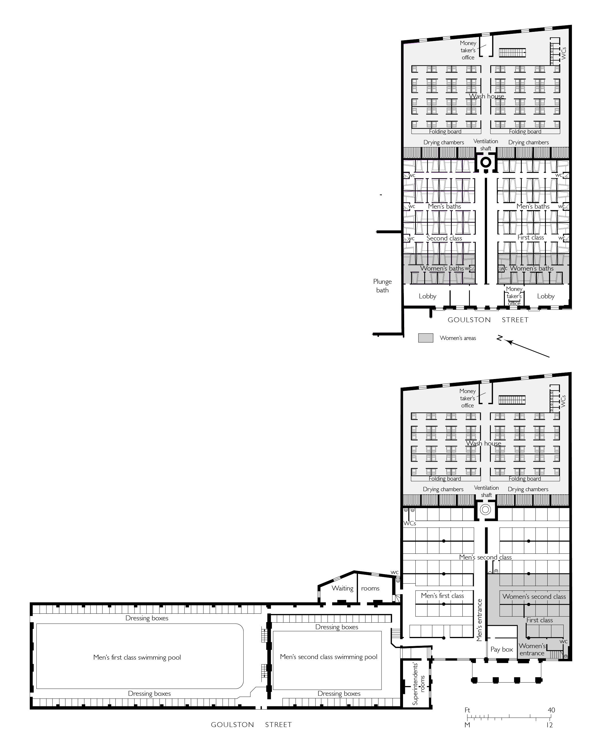
{
"id": 1620,
"title": "Plans of Whitechapel Baths, c.1845 and 1886",
"author": {
"id": 2,
"username": "surveyoflondon"
},
"feature": {
"id": 1447,
"type": "Feature",
"geometry": {
"type": "MultiPolygon",
"coordinates": [
[
[
[
-0.073620345272929,
51.51568885255038
],
[
-0.073978291920849,
51.515581075868006
],
[
-0.074105154053684,
51.51572542989613
],
[
-0.073829058934223,
51.51581988475423
],
[
-0.073816416255057,
51.51580549883457
],
[
-0.073765536685163,
51.515822645959325
],
[
-0.073818338832879,
51.51587274604106
],
[
-0.073896057393162,
51.515850404112115
],
[
-0.073900642179228,
51.51585546922409
],
[
-0.073811510459007,
51.51588294615875
],
[
-0.073751379811388,
51.51582774828753
],
[
-0.073609777363084,
51.515693181519985
],
[
-0.073620345272929,
51.51568885255038
]
]
]
]
},
"properties": {
"b_number": "25",
"b_name": "The Wash Houses, London Metropolitan University, former Whitechapel Baths",
"street": "Old Castle Street",
"address": "The Wash Houses, London Metropolitan Univeristy, 25 Old Castle Street, London E1 7NT",
"feature_type": "WHITECHAPEL_BUILDING",
"count": 19,
"search_str": "The Wash Houses, London Metropolitan University, former Whitechapel Baths"
},
"tags": [
"cholera",
"library",
"swimming",
"washing",
"women"
]
},
"file": "https://surveyoflondon.org/media/uploads/features/1447/Whitechapel%20baths%20early%20phase%20and%201886.jpg",
"description": "",
"copyright": false,
"created": "2019-06-03"
},
{
"id": 830,
"title": "South side of Alie Street with nos 24-26 to the left, August 2017",
"author": {
"id": 27,
"username": "DerekKendall"
},
"feature": {
"id": 40,
"type": "Feature",
"geometry": {
"type": "MultiPolygon",
"coordinates": [
[
[
[
-0.071753402355333,
51.513400450179596
],
[
-0.071680677693498,
51.5133248520648
],
[
-0.071670342300762,
51.51330119243993
],
[
-0.071737220427377,
51.51327856588721
],
[
-0.071740009764108,
51.513277773607975
],
[
-0.071757540929407,
51.513298329289285
],
[
-0.071824157910109,
51.51337643899112
],
[
-0.071753402355333,
51.513400450179596
]
]
]
]
},
"properties": {
"b_number": "24",
"b_name": "24 Alie Street",
"street": "Alie Street",
"address": "24 Alie Street",
"feature_type": "WHITECHAPEL_BUILDING",
"count": 2,
"search_str": "24 Alie Street"
},
"tags": []
},
"file": "https://surveyoflondon.org/media/uploads/features/40/SoL%20Whitechapel%20101563.jpg",
"description": "",
"copyright": true,
"created": "2017-09-12"
},
{
"id": 1572,
"title": "Gallery looking north",
"author": {
"id": 27,
"username": "DerekKendall"
},
"feature": {
"id": 1297,
"type": "Feature",
"geometry": {
"type": "MultiPolygon",
"coordinates": [
[
[
[
-0.071935648282288,
51.51134524228436
],
[
-0.071874729442993,
51.51121363108998
],
[
-0.071816144948546,
51.51122339231668
],
[
-0.071776588646252,
51.51120578254433
],
[
-0.071762024560661,
51.51117337877791
],
[
-0.07177649375904,
51.511141452410264
],
[
-0.071834141993347,
51.51113011940239
],
[
-0.071816329795347,
51.51108571239466
],
[
-0.072075019832766,
51.51104549229583
],
[
-0.072193056743033,
51.51130853787665
],
[
-0.072151551976597,
51.51131487321276
],
[
-0.072147312228886,
51.51132649961524
],
[
-0.072142333320455,
51.51133343542439
],
[
-0.072015847069243,
51.5113547481352
],
[
-0.071996105248008,
51.51135617797319
],
[
-0.071982278923131,
51.511350687404345
],
[
-0.071975230627282,
51.51134004502751
],
[
-0.071935648282288,
51.51134524228436
]
]
]
]
},
"properties": {
"b_number": "",
"b_name": "Roman Catholic Church of the English Martyrs",
"street": "Prescot Street",
"address": "Roman Catholic Church of the English Martyrs",
"feature_type": "WHITECHAPEL_BUILDING",
"count": 20,
"search_str": "Roman Catholic Church of the English Martyrs"
},
"tags": []
},
"file": "https://surveyoflondon.org/media/uploads/features/1297/SoL%20Whitechapel%20101940.jpg",
"description": "",
"copyright": false,
"created": "2019-04-03"
},
{
"id": 1295,
"title": "23–29 Royal Mint Street in 2018",
"author": {
"id": 27,
"username": "DerekKendall"
},
"feature": {
"id": 1700,
"type": "Feature",
"geometry": {
"type": "MultiPolygon",
"coordinates": [
[
[
[
-0.070945132337544,
51.51021419997014
],
[
-0.070951067578723,
51.5102277140376
],
[
-0.070898811199882,
51.51023714629324
],
[
-0.070917381971465,
51.51027716141803
],
[
-0.070881130885056,
51.51028295731296
],
[
-0.070862738106381,
51.510248608310874
],
[
-0.070769476297735,
51.51026743533961
],
[
-0.070788252129627,
51.510301925514284
],
[
-0.070753203361862,
51.51030775757811
],
[
-0.070735310409513,
51.51027458406735
],
[
-0.07068160237232,
51.51028211859123
],
[
-0.070640721365031,
51.51018467843966
],
[
-0.070890187021744,
51.510140890147795
],
[
-0.070889379574192,
51.510138140235156
],
[
-0.070901160084848,
51.510135712013096
],
[
-0.070945132337544,
51.51021419997014
]
]
]
]
},
"properties": {
"b_number": "23-29",
"b_name": "",
"street": "Royal Mint Street",
"address": "23-29 Royal Mint Street, Royal Mint Estate",
"feature_type": "WHITECHAPEL_BUILDING",
"count": 7,
"search_str": "23-29 Royal Mint Street, Royal Mint Estate"
},
"tags": []
},
"file": "https://surveyoflondon.org/media/uploads/features/1700/SoL%20Whitechapel%20102031.jpg",
"description": "",
"copyright": true,
"created": "2018-08-13"
},
{
"id": 472,
"title": "Maersk (formerly Beagle) House in 2015, detail of north elevation",
"author": {
"id": 31,
"username": "LucyMW"
},
"feature": {
"id": 31,
"type": "Feature",
"geometry": {
"type": "MultiPolygon",
"coordinates": [
[
[
[
-0.071887127893096,
51.51411332216963
],
[
-0.071969571208431,
51.51419942371175
],
[
-0.071924976063445,
51.5142326534243
],
[
-0.071948658834375,
51.51426657781599
],
[
-0.071835003267539,
51.5143227101345
],
[
-0.071686234045495,
51.5143855464125
],
[
-0.071543425125636,
51.514422007266134
],
[
-0.071435516621411,
51.51444471123646
],
[
-0.071395570736125,
51.51440565693606
],
[
-0.07134776228325,
51.51441310661883
],
[
-0.0712722588033,
51.51434177428325
],
[
-0.071303428297817,
51.51432370241673
],
[
-0.071263213192454,
51.5142868603796
],
[
-0.071374185885124,
51.514224080818835
],
[
-0.071528097019019,
51.51416207230522
],
[
-0.071692419185678,
51.51411901969061
],
[
-0.071795120500786,
51.514091351954804
],
[
-0.071848759931576,
51.5141216554061
],
[
-0.071887127893096,
51.51411332216963
]
]
]
]
},
"properties": {
"b_number": "1",
"b_name": "Maersk House",
"street": "Braham Street",
"address": "Maersk House (formerly Beagle House), 1 Braham Street",
"feature_type": "WHITECHAPEL_BUILDING",
"count": 20,
"search_str": "Maersk House"
},
"tags": []
},
"file": "https://surveyoflondon.org/media/uploads/features/31/DP180234.jpg",
"description": "",
"copyright": true,
"created": "2017-01-03"
},
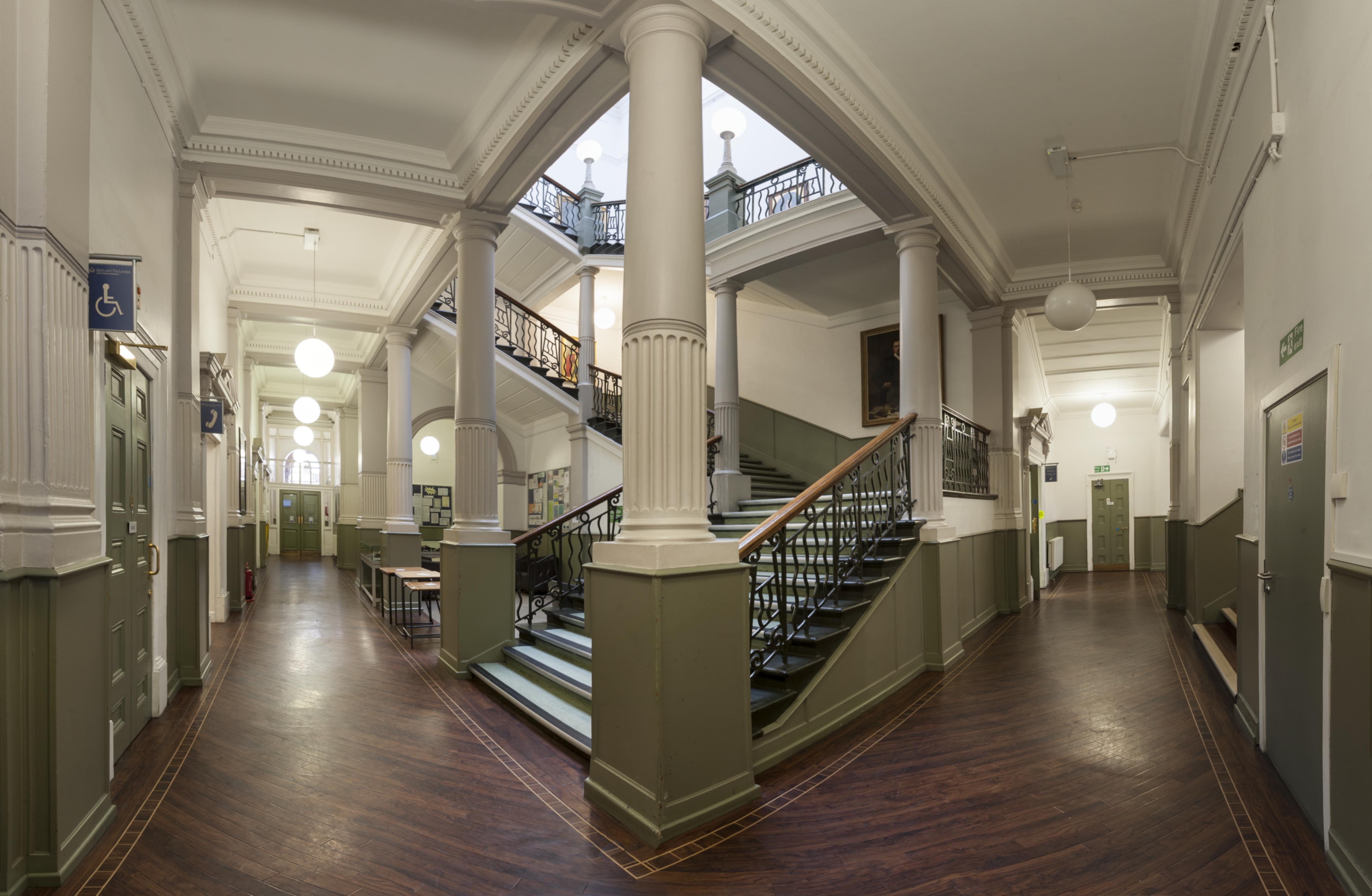
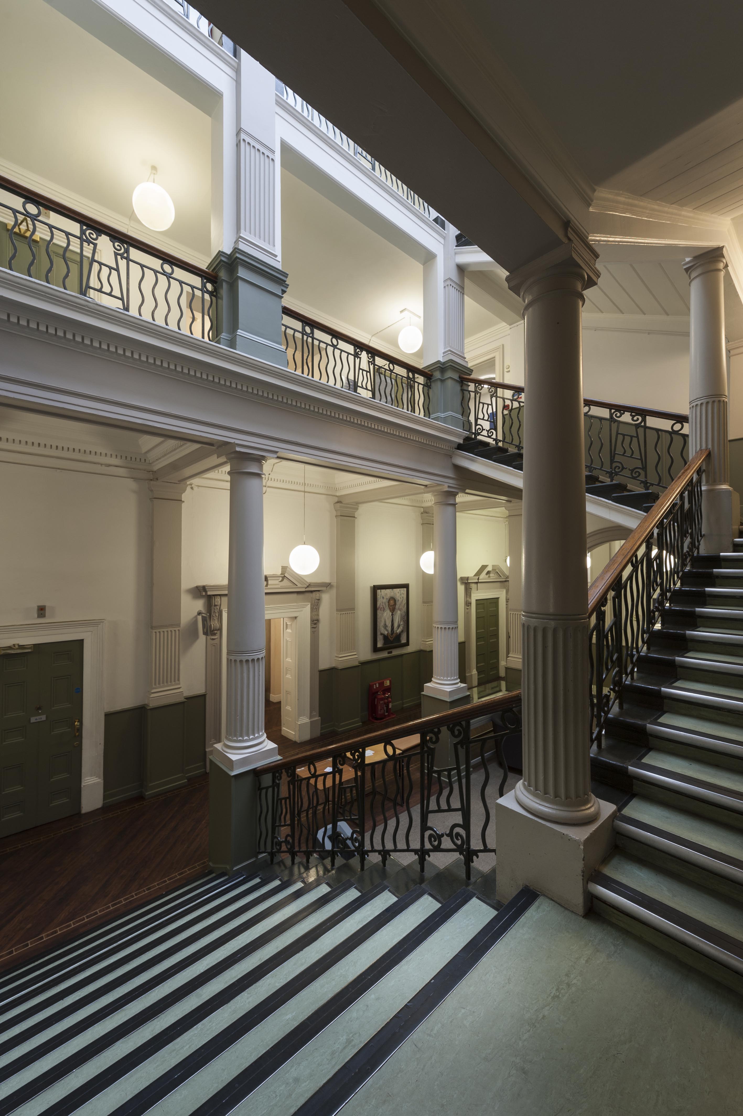
{
"id": 512,
"title": "Garrod Building, view of the main staircase",
"author": {
"id": 27,
"username": "DerekKendall"
},
"feature": {
"id": 1189,
"type": "Feature",
"geometry": {
"type": "MultiPolygon",
"coordinates": [
[
[
[
-0.060957318414032,
51.51782190843071
],
[
-0.060536358742238,
51.517916494366496
],
[
-0.06042382559955,
51.5177169757099
],
[
-0.060423392052643,
51.517716267459285
],
[
-0.06037583590265,
51.51772558880798
],
[
-0.060352091559155,
51.517682266082666
],
[
-0.060399184829325,
51.5176714337657
],
[
-0.060382136461735,
51.517636775872596
],
[
-0.060366794729858,
51.51763667842599
],
[
-0.060353568375337,
51.517633521256826
],
[
-0.060340249107007,
51.51762886391949
],
[
-0.060331431296148,
51.51762072004323
],
[
-0.060328691457909,
51.51761554771857
],
[
-0.060326999079391,
51.517611443342886
],
[
-0.060327382221525,
51.517606284181284
],
[
-0.060329047985828,
51.51760203725169
],
[
-0.060331232366157,
51.517597910289986
],
[
-0.060333234968373,
51.517593887621835
],
[
-0.0603394749266,
51.51758477508556
],
[
-0.060343650894546,
51.51757832358151
],
[
-0.060315667444656,
51.51752195768432
],
[
-0.060339055445574,
51.51749626222509
],
[
-0.06039972958586,
51.51748509401273
],
[
-0.060844270778094,
51.51743888994093
],
[
-0.060875340433462,
51.517555246058656
],
[
-0.060894657489377,
51.517564918111205
],
[
-0.060905236784801,
51.51757830806902
],
[
-0.060907454524091,
51.51759005281749
],
[
-0.060906490522428,
51.51760128121761
],
[
-0.060896928755295,
51.51761642472545
],
[
-0.060890333226028,
51.51762687042926
],
[
-0.060957318414032,
51.51782190843071
]
]
]
]
},
"properties": {
"b_number": "",
"b_name": "Garrod Building",
"street": "Stepney Way",
"address": "Garrod Building",
"feature_type": "WHITECHAPEL_BUILDING",
"count": 31,
"search_str": "Garrod Building"
},
"tags": []
},
"file": "https://surveyoflondon.org/media/uploads/features/1189/SoL%20Whitechapel%20100490.jpg",
"description": "",
"copyright": true,
"created": "2017-03-09"
},
{
"id": 513,
"title": "Garrod Building, view of the main staircase",
"author": {
"id": 27,
"username": "DerekKendall"
},
"feature": {
"id": 1189,
"type": "Feature",
"geometry": {
"type": "MultiPolygon",
"coordinates": [
[
[
[
-0.060957318414032,
51.51782190843071
],
[
-0.060536358742238,
51.517916494366496
],
[
-0.06042382559955,
51.5177169757099
],
[
-0.060423392052643,
51.517716267459285
],
[
-0.06037583590265,
51.51772558880798
],
[
-0.060352091559155,
51.517682266082666
],
[
-0.060399184829325,
51.5176714337657
],
[
-0.060382136461735,
51.517636775872596
],
[
-0.060366794729858,
51.51763667842599
],
[
-0.060353568375337,
51.517633521256826
],
[
-0.060340249107007,
51.51762886391949
],
[
-0.060331431296148,
51.51762072004323
],
[
-0.060328691457909,
51.51761554771857
],
[
-0.060326999079391,
51.517611443342886
],
[
-0.060327382221525,
51.517606284181284
],
[
-0.060329047985828,
51.51760203725169
],
[
-0.060331232366157,
51.517597910289986
],
[
-0.060333234968373,
51.517593887621835
],
[
-0.0603394749266,
51.51758477508556
],
[
-0.060343650894546,
51.51757832358151
],
[
-0.060315667444656,
51.51752195768432
],
[
-0.060339055445574,
51.51749626222509
],
[
-0.06039972958586,
51.51748509401273
],
[
-0.060844270778094,
51.51743888994093
],
[
-0.060875340433462,
51.517555246058656
],
[
-0.060894657489377,
51.517564918111205
],
[
-0.060905236784801,
51.51757830806902
],
[
-0.060907454524091,
51.51759005281749
],
[
-0.060906490522428,
51.51760128121761
],
[
-0.060896928755295,
51.51761642472545
],
[
-0.060890333226028,
51.51762687042926
],
[
-0.060957318414032,
51.51782190843071
]
]
]
]
},
"properties": {
"b_number": "",
"b_name": "Garrod Building",
"street": "Stepney Way",
"address": "Garrod Building",
"feature_type": "WHITECHAPEL_BUILDING",
"count": 31,
"search_str": "Garrod Building"
},
"tags": []
},
"file": "https://surveyoflondon.org/media/uploads/features/1189/SoL%20Whitechapel%20100492.jpg",
"description": "",
"copyright": true,
"created": "2017-03-09"
},
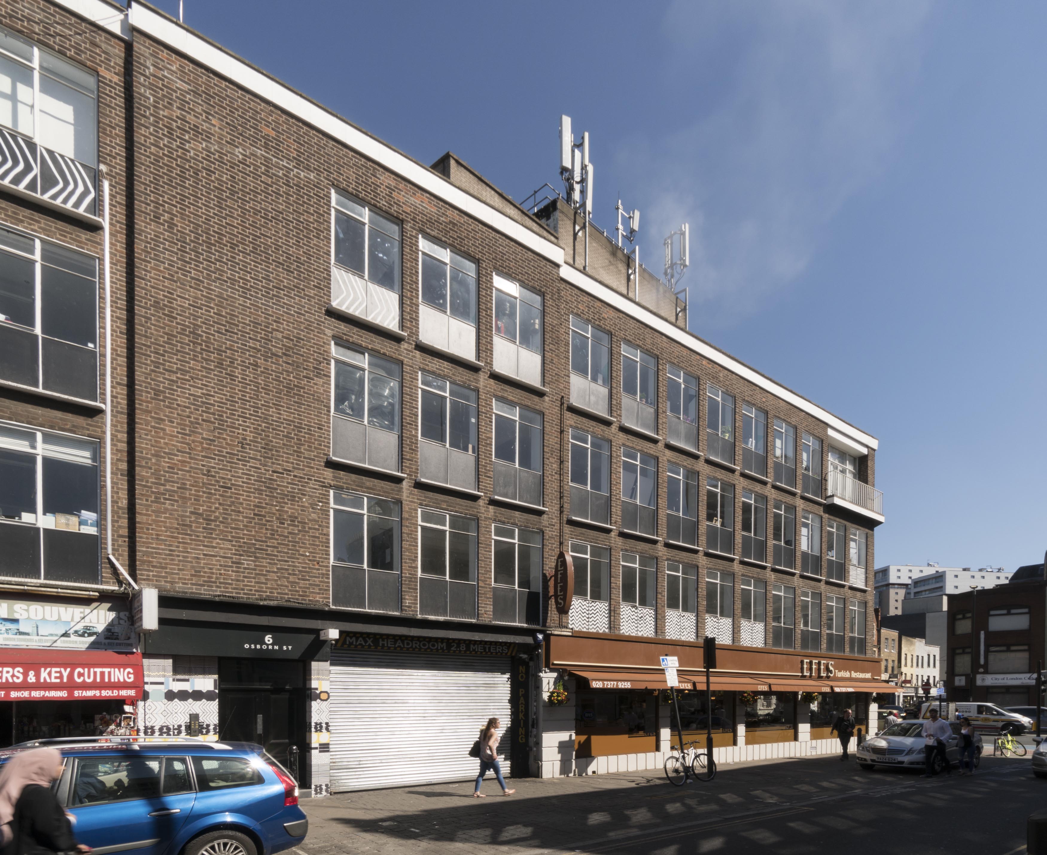
{
"id": 603,
"title": "! Whitechapel Road and 2-8 Osborn Street from the north-west in April 2017",
"author": {
"id": 27,
"username": "DerekKendall"
},
"feature": {
"id": 125,
"type": "Feature",
"geometry": {
"type": "MultiPolygon",
"coordinates": [
[
[
[
-0.069835601234806,
51.51642388297715
],
[
-0.069691489123815,
51.51646510616357
],
[
-0.069648951818143,
51.516403156027266
],
[
-0.069708999041939,
51.516378147386284
],
[
-0.069672953134854,
51.516324856599205
],
[
-0.069672936003738,
51.51632486398551
],
[
-0.06967294190097,
51.51632485336538
],
[
-0.069556671088283,
51.51621233474082
],
[
-0.069649318122499,
51.51616689221756
],
[
-0.069672053598476,
51.516170597728355
],
[
-0.069835601234806,
51.51642388297715
]
]
]
]
},
"properties": {
"b_number": "1",
"b_name": "",
"street": "Whitechapel Road",
"address": "1 Whitechapel Road (including 2-8 Osborn Street)",
"feature_type": "WHITECHAPEL_BUILDING",
"count": 4,
"search_str": "1 Whitechapel Road (including 2-8 Osborn Street)"
},
"tags": []
},
"file": "https://surveyoflondon.org/media/uploads/features/125/SoL%20Whitechapel%20100687.jpg",
"description": "",
"copyright": true,
"created": "2017-05-03"
},
{
"id": 243,
"title": "Whitechapel Market, view to the Royal London Hospital",
"author": {
"id": 36,
"username": "JuditFerencz"
},
"feature": {
"id": 1698,
"type": "Feature",
"geometry": {
"type": "MultiPolygon",
"coordinates": [
[
[
[
-0.062755898137067,
51.51857235799611
],
[
-0.058216859270041,
51.51960039921044
],
[
-0.058148482851386,
51.51948612756745
],
[
-0.061091729886378,
51.51883423152082
],
[
-0.061616259170046,
51.51871888429734
],
[
-0.06270768344222,
51.51847582817058
],
[
-0.062755898137067,
51.51857235799611
]
]
]
]
},
"properties": {
"b_number": "",
"b_name": "",
"street": "Whitechapel Road",
"address": "Whitechapel Market, Whitechapel Road",
"feature_type": "PLACE",
"count": 48,
"search_str": "Whitechapel Market, Whitechapel Road"
},
"tags": []
},
"file": "https://surveyoflondon.org/media/uploads/features/1230/Market2_w.jpg",
"description": "",
"copyright": true,
"created": "2016-08-15"
}
]
}
%201992.jpg)
%201992.jpg)