HTTP 200 OK
Allow: GET, HEAD, OPTIONS
Content-Type: application/json
Vary: Accept
{
"count": 1747,
"next": "https://surveyoflondon.org/api/v1/images/?format=api&page=12",
"previous": "https://surveyoflondon.org/api/v1/images/?format=api&page=10",
"results": [
{
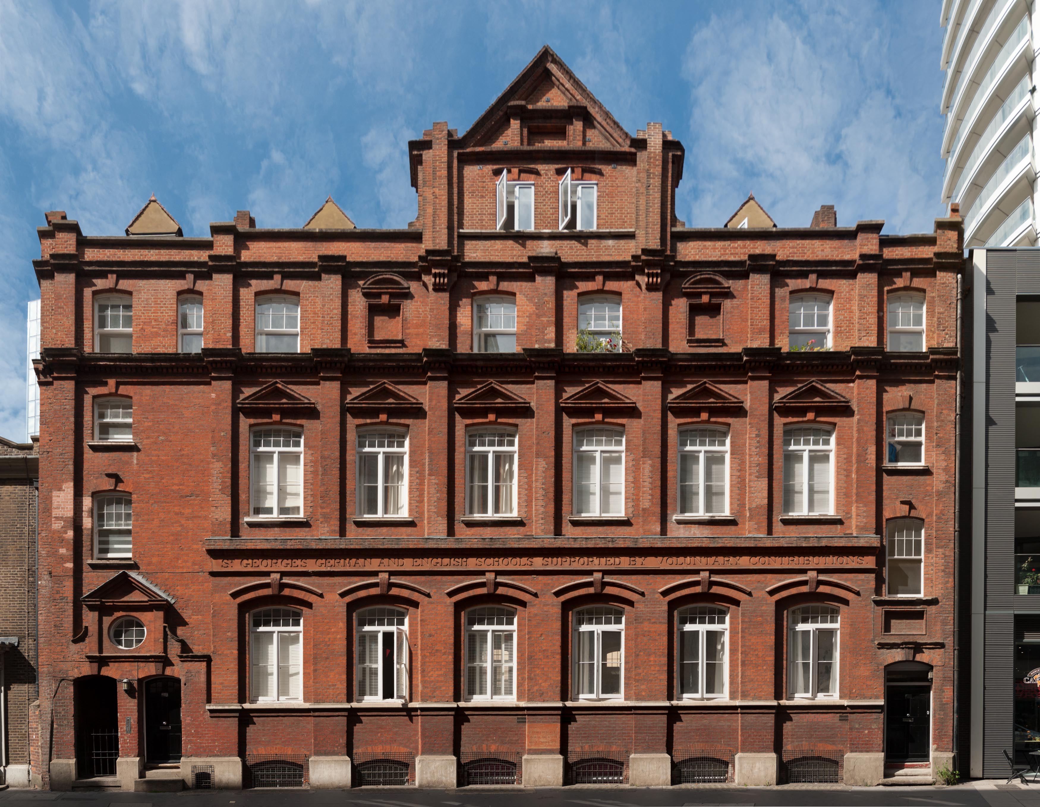
"id": 857,
"title": "Elevation, August 2017",
"author": {
"id": 27,
"username": "DerekKendall"
},
"feature": {
"id": 18,
"type": "Feature",
"geometry": {
"type": "MultiPolygon",
"coordinates": [
[
[
[
-0.070376872840044,
51.51411288775777
],
[
-0.070160905948437,
51.51421296101531
],
[
-0.070191890237181,
51.51424342945293
],
[
-0.070147651440662,
51.51426163662261
],
[
-0.070061827306772,
51.5141696705794
],
[
-0.070313812852204,
51.514054169773665
],
[
-0.070376872840044,
51.51411288775777
]
]
]
]
},
"properties": {
"b_number": "55-57",
"b_name": "St George's German and English School",
"street": "Alie Street",
"address": "St George's Schools, 55-57 Alie Street",
"feature_type": "WHITECHAPEL_BUILDING",
"count": 9,
"search_str": "St George's German and English School"
},
"tags": []
},
"file": "https://surveyoflondon.org/media/uploads/features/18/SoL%20Whitechapel%20101626.jpg",
"description": "",
"copyright": true,
"created": "2017-09-12"
},
{
"id": 601,
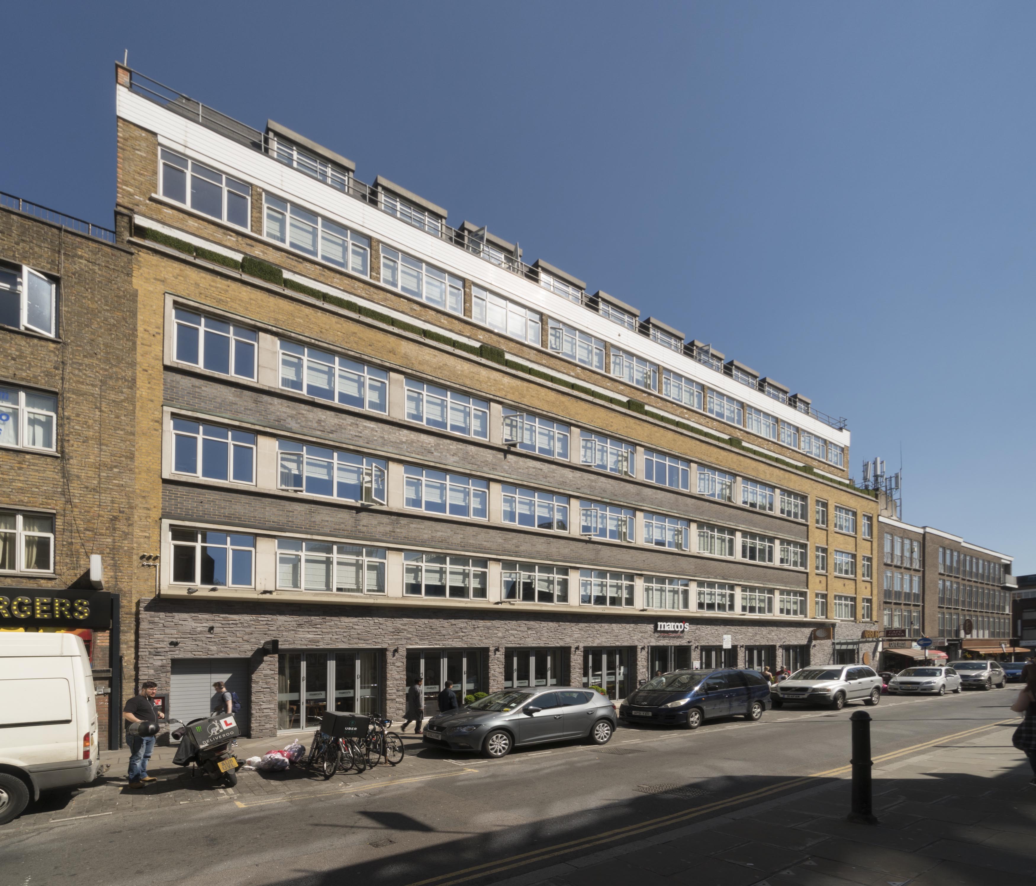
"title": "12-20 Osborn Street, from the north-west in April 2017",
"author": {
"id": 27,
"username": "DerekKendall"
},
"feature": {
"id": 105,
"type": "Feature",
"geometry": {
"type": "MultiPolygon",
"coordinates": [
[
[
[
-0.070065621617059,
51.51678224032084
],
[
-0.069967253218652,
51.51680966491183
],
[
-0.069986073792892,
51.51683594289044
],
[
-0.069929332859543,
51.5168517618956
],
[
-0.069908557891993,
51.516822755068496
],
[
-0.069872598030862,
51.51683278043064
],
[
-0.069872596565606,
51.51683278080442
],
[
-0.069791299084404,
51.51685351965192
],
[
-0.069714791133048,
51.51673394440634
],
[
-0.06975393887805,
51.51672441059794
],
[
-0.069600487037771,
51.51649542041513
],
[
-0.069691492553569,
51.516465111629685
],
[
-0.069691489123815,
51.51646510616357
],
[
-0.069835601234806,
51.51642388297715
],
[
-0.069841700470821,
51.516433232652595
],
[
-0.070065621617059,
51.51678224032084
]
]
]
]
},
"properties": {
"b_number": "12-20",
"b_name": "",
"street": "Osborn Street",
"address": "12-20 Osborn Street (Arbor City Hotel)",
"feature_type": "WHITECHAPEL_BUILDING",
"count": 5,
"search_str": "12-20 Osborn Street (Arbor City Hotel)"
},
"tags": []
},
"file": "https://surveyoflondon.org/media/uploads/features/105/SoL%20Whitechapel%20100685.jpg",
"description": "",
"copyright": true,
"created": "2017-05-03"
},
{
"id": 319,
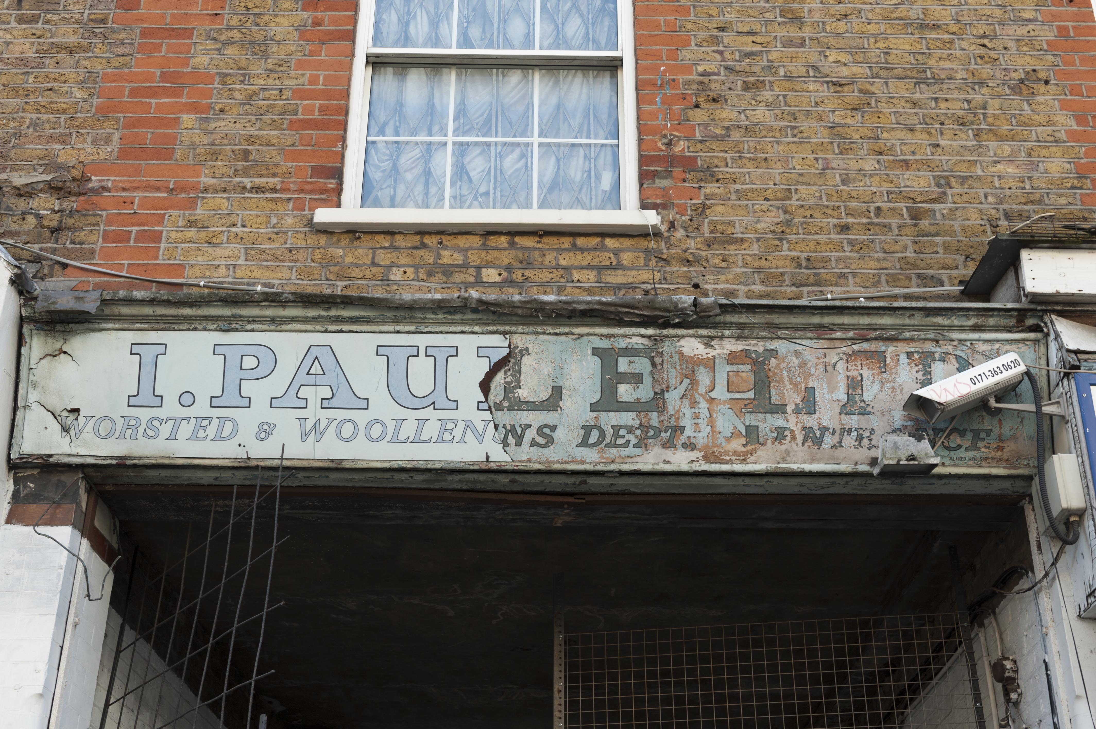
"title": "Old painted shop sign on the Wentworth Street frontage of Merchant House",
"author": {
"id": 27,
"username": "DerekKendall"
},
"feature": {
"id": 341,
"type": "Feature",
"geometry": {
"type": "MultiPolygon",
"coordinates": [
[
[
[
-0.075756372497918,
51.51630759829701
],
[
-0.075832492907812,
51.516372453749725
],
[
-0.075832505230203,
51.51637245650548
],
[
-0.075832504139434,
51.51637245698336
],
[
-0.075533462327354,
51.5164803330596
],
[
-0.075322584851544,
51.51654791373257
],
[
-0.075291822527191,
51.51651052117704
],
[
-0.075307258436179,
51.51650390031411
],
[
-0.075148856743073,
51.51630578374059
],
[
-0.075319288269409,
51.51625050513857
],
[
-0.075502354572911,
51.51619182998281
],
[
-0.075633380984274,
51.51634962782128
],
[
-0.075756372497918,
51.51630759829701
]
]
]
]
},
"properties": {
"b_number": "39",
"b_name": "Merchant House, 39 Goulston Street",
"street": "Goulston Street",
"address": "Merchant House",
"feature_type": "WHITECHAPEL_BUILDING",
"count": 7,
"search_str": "Merchant House, 39 Goulston Street"
},
"tags": []
},
"file": "https://surveyoflondon.org/media/uploads/features/341/SoL%20Whitechapel100273.jpg",
"description": "Photographed by Derek Kendall, May 2016",
"copyright": true,
"created": "2016-09-01"
},
{
"id": 237,
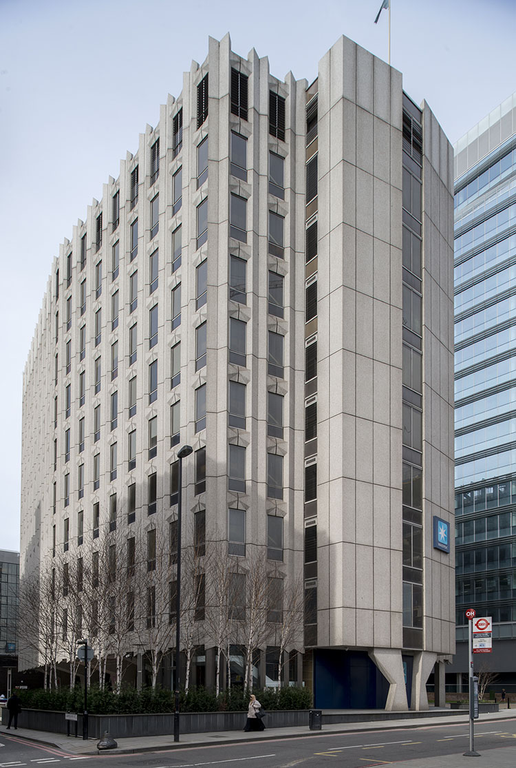
"title": "Maersk (formerly Beagle) House, from the south-east in 2015",
"author": {
"id": 31,
"username": "LucyMW"
},
"feature": {
"id": 31,
"type": "Feature",
"geometry": {
"type": "MultiPolygon",
"coordinates": [
[
[
[
-0.071887127893096,
51.51411332216963
],
[
-0.071969571208431,
51.51419942371175
],
[
-0.071924976063445,
51.5142326534243
],
[
-0.071948658834375,
51.51426657781599
],
[
-0.071835003267539,
51.5143227101345
],
[
-0.071686234045495,
51.5143855464125
],
[
-0.071543425125636,
51.514422007266134
],
[
-0.071435516621411,
51.51444471123646
],
[
-0.071395570736125,
51.51440565693606
],
[
-0.07134776228325,
51.51441310661883
],
[
-0.0712722588033,
51.51434177428325
],
[
-0.071303428297817,
51.51432370241673
],
[
-0.071263213192454,
51.5142868603796
],
[
-0.071374185885124,
51.514224080818835
],
[
-0.071528097019019,
51.51416207230522
],
[
-0.071692419185678,
51.51411901969061
],
[
-0.071795120500786,
51.514091351954804
],
[
-0.071848759931576,
51.5141216554061
],
[
-0.071887127893096,
51.51411332216963
]
]
]
]
},
"properties": {
"b_number": "1",
"b_name": "Maersk House",
"street": "Braham Street",
"address": "Maersk House (formerly Beagle House), 1 Braham Street",
"feature_type": "WHITECHAPEL_BUILDING",
"count": 20,
"search_str": "Maersk House"
},
"tags": []
},
"file": "https://surveyoflondon.org/media/uploads/features/31/DP180233_OZOy0dw.jpg",
"description": "",
"copyright": true,
"created": "2016-08-09"
},
{
"id": 848,
"title": "Looking north east from South Tenter Street, August 2017",
"author": {
"id": 27,
"username": "DerekKendall"
},
"feature": {
"id": 25,
"type": "Feature",
"geometry": {
"type": "MultiPolygon",
"coordinates": [
[
[
[
-0.072224142932504,
51.51204117669345
],
[
-0.07219173055747,
51.511959798664655
],
[
-0.072247981809045,
51.511951551759914
],
[
-0.072275814795124,
51.51203408325769
],
[
-0.072224142932504,
51.51204117669345
]
]
]
]
},
"properties": {
"b_number": "2",
"b_name": "",
"street": "Scarborough Street",
"address": "2 Scarborough Street",
"feature_type": "WHITECHAPEL_BUILDING",
"count": 3,
"search_str": "2 Scarborough Street"
},
"tags": []
},
"file": "https://surveyoflondon.org/media/uploads/features/25/SoL%20Whitechapel%20101585.jpg",
"description": "",
"copyright": true,
"created": "2017-09-12"
},
{
"id": 244,
"title": "Whitechapel Market",
"author": {
"id": 36,
"username": "JuditFerencz"
},
"feature": {
"id": 1698,
"type": "Feature",
"geometry": {
"type": "MultiPolygon",
"coordinates": [
[
[
[
-0.062755898137067,
51.51857235799611
],
[
-0.058216859270041,
51.51960039921044
],
[
-0.058148482851386,
51.51948612756745
],
[
-0.061091729886378,
51.51883423152082
],
[
-0.061616259170046,
51.51871888429734
],
[
-0.06270768344222,
51.51847582817058
],
[
-0.062755898137067,
51.51857235799611
]
]
]
]
},
"properties": {
"b_number": "",
"b_name": "",
"street": "Whitechapel Road",
"address": "Whitechapel Market, Whitechapel Road",
"feature_type": "PLACE",
"count": 48,
"search_str": "Whitechapel Market, Whitechapel Road"
},
"tags": []
},
"file": "https://surveyoflondon.org/media/uploads/features/1230/Market1_w.jpg",
"description": "",
"copyright": true,
"created": "2016-08-15"
},
{
"id": 248,
"title": "Brooke Bond welfare centre, 1932",
"author": {
"id": 25,
"username": "Aileen"
},
"feature": {
"id": 358,
"type": "Feature",
"geometry": {
"type": "MultiPolygon",
"coordinates": [
[
[
[
-0.073301292007031,
51.515600211929396
],
[
-0.073213962675441,
51.51562715962755
],
[
-0.072840800408787,
51.51522217894418
],
[
-0.072928318212048,
51.515190753173876
],
[
-0.073311908683853,
51.51555288300189
],
[
-0.073274093329402,
51.51556391347805
],
[
-0.073282787850232,
51.515575537325454
],
[
-0.073437843405707,
51.51551488351492
],
[
-0.073453284587191,
51.5155300897566
],
[
-0.073295938983894,
51.5155923860951
],
[
-0.073301292007031,
51.515600211929396
]
]
]
]
},
"properties": {
"b_number": "",
"b_name": "Calcutta House annexe, Old Castle Street",
"street": "Old Castle Street",
"address": "Calcutta House Annexe, Old Castle Street",
"feature_type": "WHITECHAPEL_BUILDING",
"count": 8,
"search_str": "Calcutta House annexe, Old Castle Street"
},
"tags": []
},
"file": "https://surveyoflondon.org/media/uploads/features/358/Brooke%20Bond%20welfare%20centre%201932.jpg",
"description": "A photograph of the Calcutta House Annexe as it was when newly built as a welfare, or social centre, for workers and managers at the Brooke Bond offices and packing warehouses opposite, from 'The Builder', 28 Oct 1932, p. 729",
"copyright": false,
"created": "2016-08-17"
},
{
"id": 492,
"title": "Toni Hermann's model for St Boniface, Whitechapel, in 2017",
"author": {
"id": 94,
"username": "StBonifaceWhitechapel"
},
"feature": {
"id": 308,
"type": "Feature",
"geometry": {
"type": "MultiPolygon",
"coordinates": [
[
[
[
-0.067496567815311,
51.51589253877067
],
[
-0.067329816922355,
51.51592882147948
],
[
-0.067313994004403,
51.515903740519775
],
[
-0.067285655221522,
51.51591108028059
],
[
-0.067273890464753,
51.51588586669939
],
[
-0.067248552659892,
51.51589046902255
],
[
-0.067167351332256,
51.515743576397455
],
[
-0.067193642426533,
51.51573542676791
],
[
-0.06717129258716,
51.51569502690211
],
[
-0.067371819133296,
51.51564515293278
],
[
-0.067482004602165,
51.515831045103695
],
[
-0.067463735896854,
51.51583606330445
],
[
-0.067496567815311,
51.51589253877067
]
]
]
]
},
"properties": {
"b_number": "47",
"b_name": "",
"street": "Adler Street",
"address": "St Boniface German Church, 47 Adler Street",
"feature_type": "WHITECHAPEL_BUILDING",
"count": 14,
"search_str": "St Boniface German Church, 47 Adler Street"
},
"tags": [
"Catholic Church",
"Germans"
]
},
"file": "https://surveyoflondon.org/media/uploads/features/308/P1180814.JPG",
"description": "",
"copyright": false,
"created": "2017-01-30"
},
{
"id": 277,
"title": "South elevation of the Outpatients Department in 2016",
"author": {
"id": 27,
"username": "DerekKendall"
},
"feature": {
"id": 1188,
"type": "Feature",
"geometry": {
"type": "MultiPolygon",
"coordinates": [
[
[
[
-0.062135521845015,
51.51764176709899
],
[
-0.061842202698012,
51.517670085745486
],
[
-0.061848902036134,
51.51769938896618
],
[
-0.061550919793822,
51.51772590607731
],
[
-0.061559977080333,
51.51776552415219
],
[
-0.061447064288193,
51.51777557192973
],
[
-0.061449635978695,
51.51778682104097
],
[
-0.06118390946889,
51.51781046681395
],
[
-0.061173470769467,
51.517768252329546
],
[
-0.0611656045837,
51.517762055237526
],
[
-0.061159583649328,
51.517735562574764
],
[
-0.061165991378992,
51.51772693239806
],
[
-0.061115835114599,
51.517494904849876
],
[
-0.061108055251476,
51.51749055594055
],
[
-0.061100533853466,
51.51745850319045
],
[
-0.061102936626612,
51.5174532736114
],
[
-0.061094280097356,
51.517413095299034
],
[
-0.061827243127089,
51.517348112870636
],
[
-0.061830552360161,
51.517362587728314
],
[
-0.062066885754417,
51.51734155598123
],
[
-0.062135521845015,
51.51764176709899
]
]
]
]
},
"properties": {
"b_number": "",
"b_name": "",
"street": "Stepney Way",
"address": "Outpatients Department",
"feature_type": "WHITECHAPEL_BUILDING",
"count": 9,
"search_str": "Outpatients Department"
},
"tags": []
},
"file": "https://surveyoflondon.org/media/uploads/features/1188/SoL%20Whitechapel100110.jpg",
"description": "",
"copyright": true,
"created": "2016-08-17"
},
{
"id": 359,
"title": "34-44 John Fisher Street from the south-east in 2015",
"author": {
"id": 31,
"username": "LucyMW"
},
"feature": {
"id": 1329,
"type": "Feature",
"geometry": {
"type": "MultiPolygon",
"coordinates": [
[
[
[
-0.068909857894843,
51.50954216800575
],
[
-0.069011382227905,
51.50952453372587
],
[
-0.069102342103053,
51.5097125177921
],
[
-0.068998326488535,
51.509731187571624
],
[
-0.068909857894843,
51.50954216800575
]
]
]
]
},
"properties": {
"b_number": "34-42",
"b_name": "",
"street": "John Fisher Street",
"address": "34-42 John Fisher Street on the Royal Mint Estate",
"feature_type": "WHITECHAPEL_BUILDING",
"count": 7,
"search_str": "34-42 John Fisher Street on the Royal Mint Estate"
},
"tags": []
},
"file": "https://surveyoflondon.org/media/uploads/features/1329/DP179975%20-%2034-44%20John%20Fisher%20Street.jpg",
"description": "",
"copyright": true,
"created": "2016-09-05"
},
{
"id": 360,
"title": "34-44 John Fisher Street from the south-east in 2015",
"author": {
"id": 31,
"username": "LucyMW"
},
"feature": {
"id": 1726,
"type": "Feature",
"geometry": {
"type": "MultiPolygon",
"coordinates": [
[
[
[
-0.069011382227905,
51.50952453372587
],
[
-0.068991279026173,
51.509481311285114
],
[
-0.068948193310938,
51.50941002367335
],
[
-0.068856478692691,
51.50942811946926
],
[
-0.068909857894843,
51.50954216800575
],
[
-0.069011382227905,
51.50952453372587
]
]
]
]
},
"properties": {
"b_number": "",
"b_name": "",
"street": "",
"address": "Royal Mint Estate",
"feature_type": "WHITECHAPEL_BUILDING",
"count": 10,
"search_str": "Royal Mint Estate"
},
"tags": []
},
"file": "https://surveyoflondon.org/media/uploads/features/1726/DP179975%20-%2034-44%20John%20Fisher%20Street.jpg",
"description": "",
"copyright": true,
"created": "2016-09-05"
},
{
"id": 361,
"title": "20-44 John Fisher Street from the south-east in 2015",
"author": {
"id": 31,
"username": "LucyMW"
},
"feature": {
"id": 1330,
"type": "Feature",
"geometry": {
"type": "MultiPolygon",
"coordinates": [
[
[
[
-0.069005472759751,
51.50938026837764
],
[
-0.069053096852981,
51.509470005368065
],
[
-0.068991279026173,
51.509481311285114
],
[
-0.068948193310938,
51.50941002367335
],
[
-0.068938930057064,
51.509394019057204
],
[
-0.069005472759751,
51.50938026837764
]
]
]
]
},
"properties": {
"b_number": "20-24",
"b_name": "",
"street": "John Fisher Street",
"address": "20-24 John Fisher Street on the Royal Mint Estate",
"feature_type": "WHITECHAPEL_BUILDING",
"count": 7,
"search_str": "20-24 John Fisher Street on the Royal Mint Estate"
},
"tags": []
},
"file": "https://surveyoflondon.org/media/uploads/features/1330/DP179975%20-%2034-44%20John%20Fisher%20Street.jpg",
"description": "",
"copyright": true,
"created": "2016-09-05"
},
{
"id": 362,
"title": "20-44 John Fisher Street from the south-east in 2015",
"author": {
"id": 31,
"username": "LucyMW"
},
"feature": {
"id": 1332,
"type": "Feature",
"geometry": {
"type": "MultiPolygon",
"coordinates": [
[
[
[
-0.06907578220669,
51.509346437352704
],
[
-0.069123162955108,
51.50942448558495
],
[
-0.069130969728118,
51.50943801658826
],
[
-0.069083980967299,
51.50944779072346
],
[
-0.069103803066324,
51.509487895322714
],
[
-0.069069787074853,
51.50949352446264
],
[
-0.069053916856552,
51.50946951998855
],
[
-0.069005472759751,
51.50938026837764
],
[
-0.068996418940301,
51.509363932121026
],
[
-0.06907578220669,
51.509346437352704
]
]
]
]
},
"properties": {
"b_number": "21-25",
"b_name": "",
"street": "John Fisher Street",
"address": "21-25 John Fisher Street on the Royal Mint Estate",
"feature_type": "WHITECHAPEL_BUILDING",
"count": 7,
"search_str": "21-25 John Fisher Street on the Royal Mint Estate"
},
"tags": []
},
"file": "https://surveyoflondon.org/media/uploads/features/1332/DP179975%20-%2034-44%20John%20Fisher%20Street.jpg",
"description": "",
"copyright": true,
"created": "2016-09-05"
},
{
"id": 355,
"title": "The Alexandra Wing of the London Hospital, as depicted in The Illustrated London News on 11 March 1876",
"author": {
"id": 37,
"username": "HistoricEngland"
},
"feature": {
"id": 1233,
"type": "Feature",
"geometry": {
"type": "MultiPolygon",
"coordinates": [
[
[
[
-0.06071898744648,
51.51847914149303
],
[
-0.060500593175314,
51.518078725457706
],
[
-0.060677507453823,
51.51804024673126
],
[
-0.060671223402208,
51.51802540127174
],
[
-0.06085005314625,
51.51798836558531
],
[
-0.060812945436909,
51.517920331266545
],
[
-0.060917351413957,
51.51789816547845
],
[
-0.060931197156673,
51.517923550570345
],
[
-0.061010610691191,
51.51790669069574
],
[
-0.061049931220856,
51.51797878143679
],
[
-0.061137385429043,
51.517960214409946
],
[
-0.061165435766445,
51.51801164191679
],
[
-0.061088209745711,
51.51802803744632
],
[
-0.061113189374754,
51.51807608265291
],
[
-0.061137480851473,
51.51807171260715
],
[
-0.061278658301599,
51.518317481305246
],
[
-0.061327004153713,
51.518306671582295
],
[
-0.061361885271019,
51.51836739382176
],
[
-0.061297703445739,
51.518381744329986
],
[
-0.061323145093769,
51.518424980241626
],
[
-0.060865969954968,
51.518532183713546
],
[
-0.060820667002295,
51.51845590786164
],
[
-0.06071898744648,
51.51847914149303
]
]
]
]
},
"properties": {
"b_number": "",
"b_name": "",
"street": "Turner Street",
"address": "The Royal London Dental Hospital",
"feature_type": "WHITECHAPEL_BUILDING",
"count": 9,
"search_str": "The Royal London Dental Hospital"
},
"tags": []
},
"file": "https://surveyoflondon.org/media/uploads/features/1233/Alexandra%20Wing%2C%20Royal%20London%20Hospital%2C%20ILN%2C%2011-3-1876%2C%20p%20259.jpg",
"description": "Historic England London Region",
"copyright": true,
"created": "2016-09-05"
},
{
"id": 163,
"title": "Davenant School before rebuilding from Wilkinson's 'Londina Illustrata'",
"author": {
"id": 2,
"username": "surveyoflondon"
},
"feature": {
"id": 452,
"type": "Feature",
"geometry": {
"type": "MultiPolygon",
"coordinates": [
[
[
[
-0.06408176276412,
51.518388594133064
],
[
-0.064079076989357,
51.518451921601226
],
[
-0.064014118536147,
51.518467104995885
],
[
-0.063936244085074,
51.51842608315136
],
[
-0.06387175509906,
51.51844488660313
],
[
-0.063789009522268,
51.51833442643744
],
[
-0.063997611137361,
51.51827758805008
],
[
-0.06408176276412,
51.518388594133064
]
]
]
]
},
"properties": {
"b_number": "179",
"b_name": "Davenant Youth Centre (former Davenant School)",
"street": "Whitechapel Road",
"address": "Davenant Youth Centre, 179 Whitechapel Road",
"feature_type": "WHITECHAPEL_BUILDING",
"count": 18,
"search_str": "Davenant Youth Centre (former Davenant School)"
},
"tags": [
"Davenant",
"school"
]
},
"file": "https://surveyoflondon.org/media/uploads/features/452/Davenant%20School%20-%20Wilkinson.jpg",
"description": "",
"copyright": false,
"created": "2016-07-22"
},
{
"id": 571,
"title": "Hopetown Estate from Old Montague Street in April 2017",
"author": {
"id": 27,
"username": "DerekKendall"
},
"feature": {
"id": 273,
"type": "Feature",
"geometry": {
"type": "MultiPolygon",
"coordinates": [
[
[
[
-0.068974291434595,
51.51766597962726
],
[
-0.068974283222104,
51.51766598158452
],
[
-0.068834913599773,
51.517699196814895
],
[
-0.068812439942397,
51.517664497623926
],
[
-0.068952655404238,
51.51762914864754
],
[
-0.068974291434595,
51.51766597962726
]
]
]
]
},
"properties": {
"b_number": "21",
"b_name": "",
"street": "Old Montague Street",
"address": "21 Old Montague Street",
"feature_type": "WHITECHAPEL_BUILDING",
"count": 14,
"search_str": "21 Old Montague Street"
},
"tags": []
},
"file": "https://surveyoflondon.org/media/uploads/features/273/SoL%20Whitechapel%20100588.jpg",
"description": "",
"copyright": true,
"created": "2017-05-03"
},
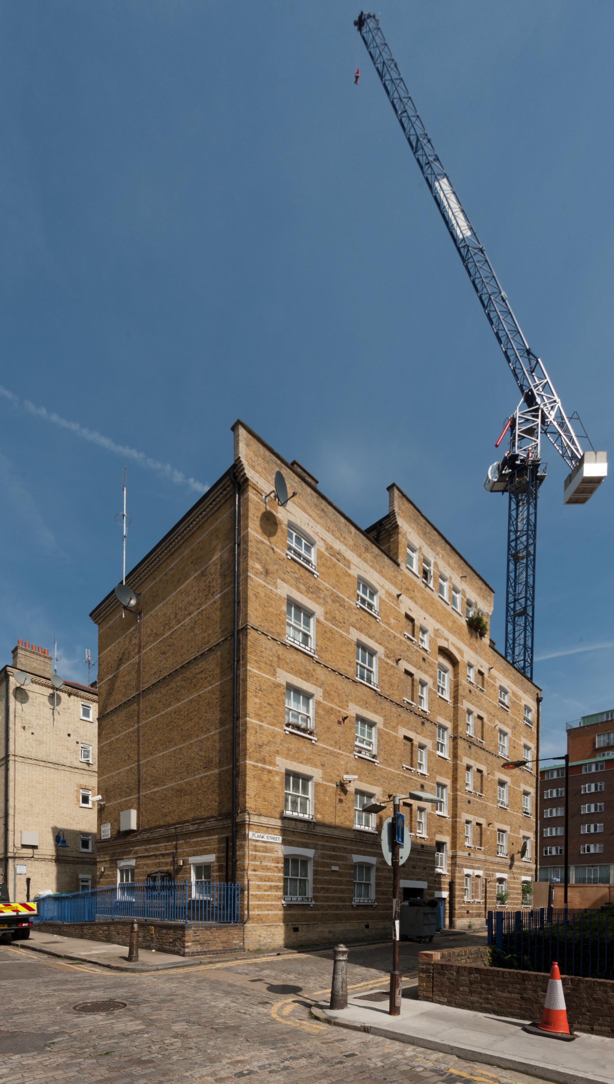
{
"id": 815,
"title": "Block L, Peabody Estate Whitechapel, from the south-west in 2017",
"author": {
"id": 27,
"username": "DerekKendall"
},
"feature": {
"id": 1351,
"type": "Feature",
"geometry": {
"type": "MultiPolygon",
"coordinates": [
[
[
[
-0.069038442998586,
51.51014480938986
],
[
-0.068939604683521,
51.510164152577474
],
[
-0.06894561783058,
51.51017648454218
],
[
-0.068842041161542,
51.510197497183086
],
[
-0.068836960917325,
51.5101851805763
],
[
-0.068739006068636,
51.510205703187175
],
[
-0.068696531769367,
51.51013259199606
],
[
-0.068838272513179,
51.51010341079487
],
[
-0.06883947246546,
51.510105579081475
],
[
-0.068854082593701,
51.51010258276088
],
[
-0.06885246896814,
51.5101007152338
],
[
-0.068996766785625,
51.51007072545442
],
[
-0.069038442998586,
51.51014480938986
]
]
]
]
},
"properties": {
"b_number": "",
"b_name": "Block L",
"street": "John Fisher Street",
"address": "Block L, Peabody Estate Whitechapel, John Fisher Street",
"feature_type": "WHITECHAPEL_BUILDING",
"count": 11,
"search_str": "Block L"
},
"tags": []
},
"file": "https://surveyoflondon.org/media/uploads/features/1351/SoL%20Whitechapel%20101612.jpg",
"description": "",
"copyright": true,
"created": "2017-09-12"
},
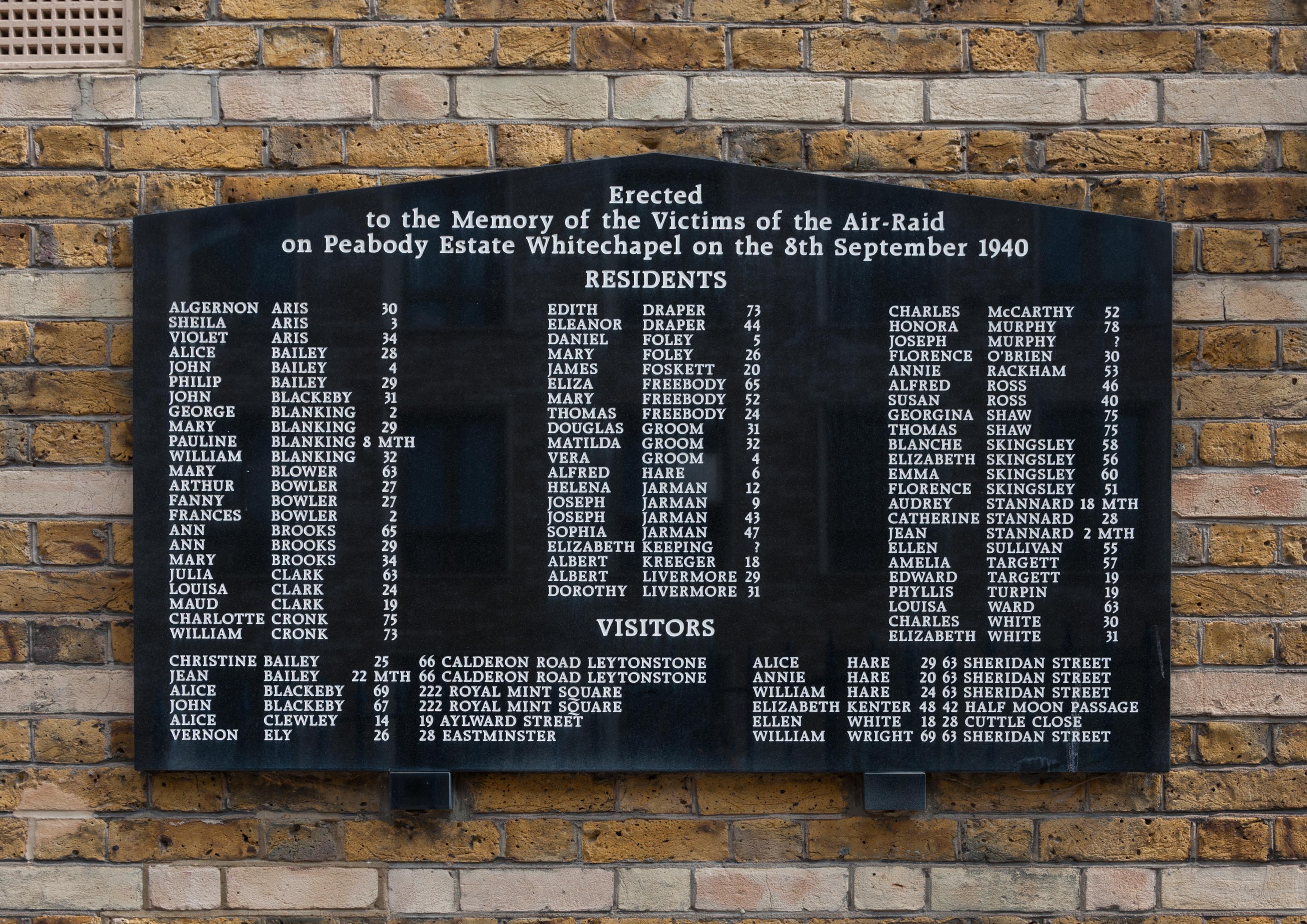
{
"id": 816,
"title": "War Memorial, Block L, Peabody Estate Whitechapel, 2017",
"author": {
"id": 27,
"username": "DerekKendall"
},
"feature": {
"id": 1351,
"type": "Feature",
"geometry": {
"type": "MultiPolygon",
"coordinates": [
[
[
[
-0.069038442998586,
51.51014480938986
],
[
-0.068939604683521,
51.510164152577474
],
[
-0.06894561783058,
51.51017648454218
],
[
-0.068842041161542,
51.510197497183086
],
[
-0.068836960917325,
51.5101851805763
],
[
-0.068739006068636,
51.510205703187175
],
[
-0.068696531769367,
51.51013259199606
],
[
-0.068838272513179,
51.51010341079487
],
[
-0.06883947246546,
51.510105579081475
],
[
-0.068854082593701,
51.51010258276088
],
[
-0.06885246896814,
51.5101007152338
],
[
-0.068996766785625,
51.51007072545442
],
[
-0.069038442998586,
51.51014480938986
]
]
]
]
},
"properties": {
"b_number": "",
"b_name": "Block L",
"street": "John Fisher Street",
"address": "Block L, Peabody Estate Whitechapel, John Fisher Street",
"feature_type": "WHITECHAPEL_BUILDING",
"count": 11,
"search_str": "Block L"
},
"tags": []
},
"file": "https://surveyoflondon.org/media/uploads/features/1351/SoL%20Whitechapel%20101614.jpg",
"description": "",
"copyright": true,
"created": "2017-09-12"
},
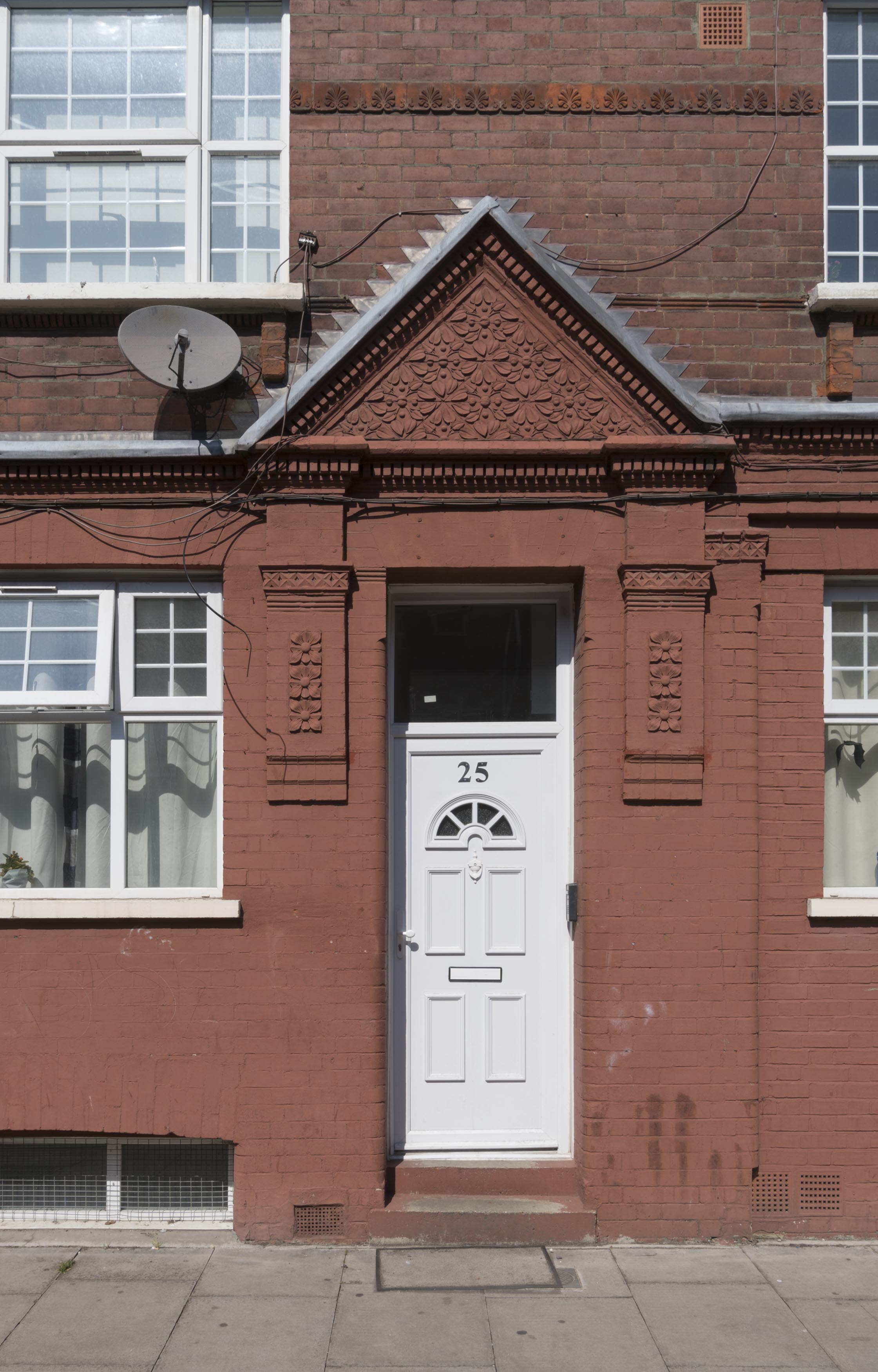
{
"id": 580,
"title": "25 Monthorpe Road, doorway detail, April 2017",
"author": {
"id": 27,
"username": "DerekKendall"
},
"feature": {
"id": 196,
"type": "Feature",
"geometry": {
"type": "MultiPolygon",
"coordinates": [
[
[
[
-0.068661003896266,
51.51821579429266
],
[
-0.068624445428856,
51.51814822608852
],
[
-0.068680283840279,
51.51813737569416
],
[
-0.068714496840026,
51.518205907778125
],
[
-0.068661003896266,
51.51821579429266
]
]
]
]
},
"properties": {
"b_number": "25",
"b_name": "",
"street": "Monthorpe Road",
"address": "25 Monthorpe Road",
"feature_type": "WHITECHAPEL_BUILDING",
"count": 10,
"search_str": "25 Monthorpe Road"
},
"tags": []
},
"file": "https://surveyoflondon.org/media/uploads/features/196/SoL%20Whitechapel%20100607.jpg",
"description": "",
"copyright": true,
"created": "2017-05-03"
},
{
"id": 363,
"title": "20-44 John Fisher Street from the south-east in 2015",
"author": {
"id": 31,
"username": "LucyMW"
},
"feature": {
"id": 1331,
"type": "Feature",
"geometry": {
"type": "MultiPolygon",
"coordinates": [
[
[
[
-0.069149831016424,
51.50931545434316
],
[
-0.069215937967207,
51.509432857185416
],
[
-0.069191300937416,
51.5094381050952
],
[
-0.069177476757805,
51.50941393696845
],
[
-0.069123162955108,
51.50942448558495
],
[
-0.06907578220669,
51.509346437352704
],
[
-0.069067451959494,
51.509332840283555
],
[
-0.069149831016424,
51.50931545434316
]
]
]
]
},
"properties": {
"b_number": "28",
"b_name": "",
"street": "John Fisher Street",
"address": "28 John Fisher Street on the Royal Mint Estate",
"feature_type": "WHITECHAPEL_BUILDING",
"count": 7,
"search_str": "28 John Fisher Street on the Royal Mint Estate"
},
"tags": []
},
"file": "https://surveyoflondon.org/media/uploads/features/1331/DP179975%20-%2034-44%20John%20Fisher%20Street.jpg",
"description": "",
"copyright": true,
"created": "2016-09-05"
}
]
}