HTTP 200 OK
Allow: GET, HEAD, OPTIONS
Content-Type: application/json
Vary: Accept
{
"count": 1712,
"next": "https://surveyoflondon.org/api/v1/features/?format=api&page=79",
"previous": "https://surveyoflondon.org/api/v1/features/?format=api&page=77",
"results": {
"type": "FeatureCollection",
"features": [
{
"id": 998,
"type": "Feature",
"geometry": {
"type": "MultiPolygon",
"coordinates": [
[
[
[
-0.066893958767139,
51.51426806642093
],
[
-0.066797876875784,
51.51426573798642
],
[
-0.06679738190094,
51.51430429969666
],
[
-0.066681747398618,
51.51429806267815
],
[
-0.066683310055163,
51.5142550769197
],
[
-0.066685583686015,
51.51419253338944
],
[
-0.066687970372702,
51.51412687964173
],
[
-0.066695104014657,
51.514075408815394
],
[
-0.06671207120888,
51.51407595530093
],
[
-0.066716636407902,
51.514026038289025
],
[
-0.066703162914349,
51.51402581638383
],
[
-0.066709339720193,
51.51397053911217
],
[
-0.066716193557121,
51.51392039542593
],
[
-0.066745209204843,
51.51385318604072
],
[
-0.066756021814729,
51.51382814057402
],
[
-0.066776583639756,
51.5137971457485
],
[
-0.066894602516304,
51.51382034156243
],
[
-0.06688766571661,
51.513843669205094
],
[
-0.066980251369364,
51.51386473735147
],
[
-0.066960729614859,
51.51389798104313
],
[
-0.066941369610032,
51.51394398141652
],
[
-0.06693761986278,
51.5139664373418
],
[
-0.066933735457684,
51.51403832533313
],
[
-0.066882570832413,
51.514036909651765
],
[
-0.066873592645445,
51.514086758634235
],
[
-0.066927404245299,
51.51408911557564
],
[
-0.066893958767139,
51.51426806642093
]
]
]
]
},
"properties": {
"b_name": "129 Back Church Lane",
"address": "129 Back Church Lane",
"postcode": "E1 1LS",
"street": "Back Church lane",
"categories": [
{
"id": 8,
"name": "Entertainment",
"description": "",
"thumbnail": "https://surveyoflondon.org/media/wiltons_music_hall.png"
},
{
"id": 6,
"name": "Housing",
"description": "",
"thumbnail": "https://surveyoflondon.org/media/SoL-Whitechapel100082.jpg"
},
{
"id": 4,
"name": "Commerce",
"description": "",
"thumbnail": "https://surveyoflondon.org/media/SoL-Whitechapel100156.jpg"
}
],
"count": 5,
"current": 1996,
"site": {
"id": 122,
"name": "109–129 Back Church Lane"
},
"feature_type": "WHITECHAPEL_BUILDING",
"documents": [
{
"id": 283,
"title": "Premierland to Fairclough's Garage",
"author": {
"id": 72,
"username": "eric"
}
},
{
"id": 1083,
"title": "109–129 Back Church Lane (on the site of the People's Arcade, later Premierland)",
"author": {
"id": 2,
"username": "surveyoflondon"
}
}
],
"images": [
{
"id": 313,
"title": "129 Back Church Lane, looking north",
"author": {
"id": 27,
"username": "DerekKendall"
}
},
{
"id": 1797,
"title": "People's Arcade, ground-floor plan in 1904 - drawing by Helen Jones",
"author": {
"id": 2,
"username": "surveyoflondon"
}
}
],
"media": []
}
},
{
"id": 1019,
"type": "Feature",
"geometry": {
"type": "MultiPolygon",
"coordinates": [
[
[
[
-0.066987160336869,
51.513752480410815
],
[
-0.066845975599452,
51.51370645448363
],
[
-0.066880587713507,
51.513661218305494
],
[
-0.06702239884915,
51.51370744842763
],
[
-0.066987160336869,
51.513752480410815
]
]
]
]
},
"properties": {
"b_name": "123 Back Church Lane",
"address": "123 Back Church Lane",
"postcode": "E1 1LT",
"street": "Back Church Lane",
"categories": [
{
"id": 6,
"name": "Housing",
"description": "",
"thumbnail": "https://surveyoflondon.org/media/SoL-Whitechapel100082.jpg"
}
],
"count": 2,
"current": 1996,
"site": {
"id": 122,
"name": "109–129 Back Church Lane"
},
"feature_type": "WHITECHAPEL_BUILDING",
"documents": [],
"images": [],
"media": []
}
},
{
"id": 1021,
"type": "Feature",
"geometry": {
"type": "MultiPolygon",
"coordinates": [
[
[
[
-0.067053633349533,
51.513667533164444
],
[
-0.066911266990511,
51.51362112204925
],
[
-0.066938668286034,
51.51358530988042
],
[
-0.067083457779187,
51.51362941978749
],
[
-0.067053633349533,
51.513667533164444
]
]
]
]
},
"properties": {
"b_name": "119 Back Church Lane",
"address": "119 Back Church Lane",
"postcode": "E1 1LT",
"street": "Back Church Lane",
"categories": [
{
"id": 6,
"name": "Housing",
"description": "",
"thumbnail": "https://surveyoflondon.org/media/SoL-Whitechapel100082.jpg"
}
],
"count": 2,
"current": 1996,
"site": {
"id": 122,
"name": "109–129 Back Church Lane"
},
"feature_type": "WHITECHAPEL_BUILDING",
"documents": [],
"images": [
{
"id": 396,
"title": "119-127 Backchurch Lane in 2016",
"author": {
"id": 27,
"username": "DerekKendall"
}
}
],
"media": []
}
},
{
"id": 1020,
"type": "Feature",
"geometry": {
"type": "MultiPolygon",
"coordinates": [
[
[
[
-0.06702239884915,
51.51370744842763
],
[
-0.066880587713507,
51.513661218305494
],
[
-0.066911266990511,
51.51362112204925
],
[
-0.067053633349533,
51.513667533164444
],
[
-0.06702239884915,
51.51370744842763
]
]
]
]
},
"properties": {
"b_name": "121 Back Church Lane",
"address": "121 Back Church Lane",
"postcode": "E1 1LT",
"street": "Back Church Lane",
"categories": [
{
"id": 6,
"name": "Housing",
"description": "",
"thumbnail": "https://surveyoflondon.org/media/SoL-Whitechapel100082.jpg"
}
],
"count": 2,
"current": 1996,
"site": {
"id": 122,
"name": "109–129 Back Church Lane"
},
"feature_type": "WHITECHAPEL_BUILDING",
"documents": [],
"images": [],
"media": []
}
},
{
"id": 90,
"type": "Feature",
"geometry": {
"type": "MultiPolygon",
"coordinates": [
[
[
[
-0.070392617547194,
51.513051214743115
],
[
-0.070236734466932,
51.51309567357582
],
[
-0.070212927713261,
51.5130643426255
],
[
-0.070370487777156,
51.513019950696446
],
[
-0.070392617547194,
51.513051214743115
]
]
]
]
},
"properties": {
"b_name": "",
"address": "68 Leman Street",
"postcode": "E1 8EU",
"street": "Leman Street",
"categories": [
{
"id": 6,
"name": "Housing",
"description": "",
"thumbnail": "https://surveyoflondon.org/media/SoL-Whitechapel100082.jpg"
},
{
"id": 4,
"name": "Commerce",
"description": "",
"thumbnail": "https://surveyoflondon.org/media/SoL-Whitechapel100156.jpg"
}
],
"count": 3,
"current": 1690,
"site": null,
"feature_type": "WHITECHAPEL_BUILDING",
"documents": [
{
"id": 1057,
"title": "68 Leman Street",
"author": {
"id": 2,
"username": "surveyoflondon"
}
}
],
"images": [
{
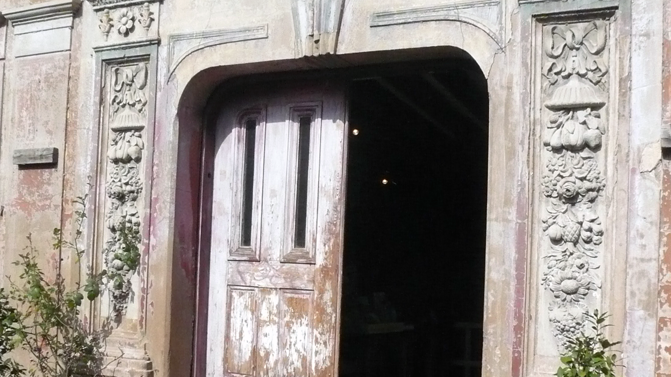
"id": 1281,
"title": "Door detail, March 2018",
"author": {
"id": 27,
"username": "DerekKendall"
}
},
{
"id": 1282,
"title": "Elevation looking north west, March 2018",
"author": {
"id": 27,
"username": "DerekKendall"
}
},
{
"id": 1280,
"title": "Elevation, March 2018",
"author": {
"id": 27,
"username": "DerekKendall"
}
}
],
"media": []
}
},
{
"id": 59,
"type": "Feature",
"geometry": {
"type": "MultiPolygon",
"coordinates": [
[
[
[
-0.071619495367887,
51.51213103204083
],
[
-0.071587254527213,
51.5120581593278
],
[
-0.071666614755396,
51.51204707731263
],
[
-0.071699691964301,
51.512118339685756
],
[
-0.071619495367887,
51.51213103204083
]
]
]
]
},
"properties": {
"b_name": "",
"address": "18 Scarborough Street",
"postcode": "E1 8DR",
"street": "18 Scarborough Street",
"categories": [
{
"id": 6,
"name": "Housing",
"description": "",
"thumbnail": "https://surveyoflondon.org/media/SoL-Whitechapel100082.jpg"
}
],
"count": 3,
"current": 1985,
"site": {
"id": 49,
"name": "Scarborough Street"
},
"feature_type": "WHITECHAPEL_BUILDING",
"documents": [],
"images": [],
"media": []
}
},
{
"id": 25,
"type": "Feature",
"geometry": {
"type": "MultiPolygon",
"coordinates": [
[
[
[
-0.072224142932504,
51.51204117669345
],
[
-0.07219173055747,
51.511959798664655
],
[
-0.072247981809045,
51.511951551759914
],
[
-0.072275814795124,
51.51203408325769
],
[
-0.072224142932504,
51.51204117669345
]
]
]
]
},
"properties": {
"b_name": "",
"address": "2 Scarborough Street",
"postcode": "E1 8DR",
"street": "Scarborough Street",
"categories": [
{
"id": 6,
"name": "Housing",
"description": "",
"thumbnail": "https://surveyoflondon.org/media/SoL-Whitechapel100082.jpg"
}
],
"count": 3,
"current": 1985,
"site": {
"id": 49,
"name": "Scarborough Street"
},
"feature_type": "WHITECHAPEL_BUILDING",
"documents": [
{
"id": 1136,
"title": "2–32 Scarborough Street ",
"author": {
"id": 2,
"username": "surveyoflondon"
}
}
],
"images": [
{
"id": 847,
"title": "Looking north from South Tenter Street, August 2017",
"author": {
"id": 27,
"username": "DerekKendall"
}
},
{
"id": 848,
"title": "Looking north east from South Tenter Street, August 2017",
"author": {
"id": 27,
"username": "DerekKendall"
}
}
],
"media": []
}
},
{
"id": 66,
"type": "Feature",
"geometry": {
"type": "MultiPolygon",
"coordinates": [
[
[
[
-0.07219173055747,
51.511959798664655
],
[
-0.072224142932504,
51.51204117669345
],
[
-0.072165982231018,
51.51205066271014
],
[
-0.072132514070443,
51.51196871869184
],
[
-0.07219173055747,
51.511959798664655
]
]
]
]
},
"properties": {
"b_name": "",
"address": "4 Scarborough Street",
"postcode": "E1 8DR",
"street": "Scarborough Street",
"categories": [
{
"id": 6,
"name": "Housing",
"description": "",
"thumbnail": "https://surveyoflondon.org/media/SoL-Whitechapel100082.jpg"
}
],
"count": 3,
"current": 1985,
"site": {
"id": 49,
"name": "Scarborough Street"
},
"feature_type": "WHITECHAPEL_BUILDING",
"documents": [],
"images": [],
"media": []
}
},
{
"id": 60,
"type": "Feature",
"geometry": {
"type": "MultiPolygon",
"coordinates": [
[
[
[
-0.07150447228727,
51.51207104537865
],
[
-0.071535826944687,
51.5121442738001
],
[
-0.071453217690807,
51.5121573478638
],
[
-0.071421844103379,
51.51208452864499
],
[
-0.07150447228727,
51.51207104537865
]
]
]
]
},
"properties": {
"b_name": "",
"address": "22 Scarborough Street",
"postcode": "E1 8DR",
"street": "Scarborough Street",
"categories": [
{
"id": 6,
"name": "Housing",
"description": "",
"thumbnail": "https://surveyoflondon.org/media/SoL-Whitechapel100082.jpg"
}
],
"count": 3,
"current": 1985,
"site": {
"id": 49,
"name": "Scarborough Street"
},
"feature_type": "WHITECHAPEL_BUILDING",
"documents": [],
"images": [],
"media": []
}
},
{
"id": 26,
"type": "Feature",
"geometry": {
"type": "MultiPolygon",
"coordinates": [
[
[
[
-0.071850869969412,
51.51209407803037
],
[
-0.071819183977455,
51.51202439270103
],
[
-0.071894664381378,
51.512012183877175
],
[
-0.071922991549849,
51.51208299873576
],
[
-0.071850869969412,
51.51209407803037
]
]
]
]
},
"properties": {
"b_name": "",
"address": "12 Scarborough Street",
"postcode": "E1 8DR",
"street": "Scarborough Street",
"categories": [
{
"id": 6,
"name": "Housing",
"description": "",
"thumbnail": "https://surveyoflondon.org/media/SoL-Whitechapel100082.jpg"
}
],
"count": 3,
"current": 1985,
"site": {
"id": 49,
"name": "Scarborough Street"
},
"feature_type": "WHITECHAPEL_BUILDING",
"documents": [],
"images": [],
"media": []
}
},
{
"id": 925,
"type": "Feature",
"geometry": {
"type": "MultiPolygon",
"coordinates": [
[
[
[
-0.06229920642667,
51.51543563376635
],
[
-0.062181823614174,
51.515444742358376
],
[
-0.062169988208296,
51.515396042814615
],
[
-0.062286767646562,
51.51538698104335
],
[
-0.06229920642667,
51.51543563376635
]
]
]
]
},
"properties": {
"b_name": "",
"address": "27 New Road",
"postcode": "E1 1HL",
"street": "New Road",
"categories": [
{
"id": 6,
"name": "Housing",
"description": "",
"thumbnail": "https://surveyoflondon.org/media/SoL-Whitechapel100082.jpg"
}
],
"count": 5,
"current": 1795,
"site": {
"id": 62,
"name": "11-47 New Road"
},
"feature_type": "WHITECHAPEL_BUILDING",
"documents": [],
"images": [],
"media": []
}
},
{
"id": 921,
"type": "Feature",
"geometry": {
"type": "MultiPolygon",
"coordinates": [
[
[
[
-0.062351880962828,
51.515641663585505
],
[
-0.06223194304587,
51.51565097047436
],
[
-0.062220220817965,
51.51560273662782
],
[
-0.062339561134197,
51.51559347612627
],
[
-0.062351880962828,
51.515641663585505
]
]
]
]
},
"properties": {
"b_name": "",
"address": "35 New Road",
"postcode": "E1 1HL",
"street": "New Road",
"categories": [
{
"id": 6,
"name": "Housing",
"description": "",
"thumbnail": "https://surveyoflondon.org/media/SoL-Whitechapel100082.jpg"
}
],
"count": 5,
"current": 1795,
"site": {
"id": 62,
"name": "11-47 New Road"
},
"feature_type": "WHITECHAPEL_BUILDING",
"documents": [],
"images": [],
"media": []
}
},
{
"id": 916,
"type": "Feature",
"geometry": {
"type": "MultiPolygon",
"coordinates": [
[
[
[
-0.062288435312376,
51.515883421108654
],
[
-0.062495632136836,
51.51587062770287
],
[
-0.062507189857639,
51.515915834273294
],
[
-0.062299150399299,
51.515927510838225
],
[
-0.062288435312376,
51.515883421108654
]
]
]
]
},
"properties": {
"b_name": "",
"address": "47 New Road",
"postcode": "E1 1HL",
"street": "New Road",
"categories": [
{
"id": 6,
"name": "Housing",
"description": "",
"thumbnail": "https://surveyoflondon.org/media/SoL-Whitechapel100082.jpg"
},
{
"id": 5,
"name": "Restaurants",
"description": "",
"thumbnail": "https://surveyoflondon.org/media/SoL_Whitechapel100308.jpg"
}
],
"count": 6,
"current": 1795,
"site": {
"id": 62,
"name": "11-47 New Road"
},
"feature_type": "WHITECHAPEL_BUILDING",
"documents": [],
"images": [
{
"id": 1076,
"title": "37-47 New Road, December 2017",
"author": {
"id": 27,
"username": "DerekKendall"
}
}
],
"media": []
}
},
{
"id": 27,
"type": "Feature",
"geometry": {
"type": "MultiPolygon",
"coordinates": [
[
[
[
-0.070847219200287,
51.512268537022415
],
[
-0.07075580052742,
51.512282666205856
],
[
-0.070692936909363,
51.51210772743656
],
[
-0.070788923731445,
51.51209170520483
],
[
-0.070847219200287,
51.512268537022415
]
]
]
]
},
"properties": {
"b_name": "",
"address": "1 South Tenter Street",
"postcode": "E1 8DW",
"street": "South Tenter Street",
"categories": [
{
"id": 6,
"name": "Housing",
"description": "",
"thumbnail": "https://surveyoflondon.org/media/SoL-Whitechapel100082.jpg"
}
],
"count": 1,
"current": 1989,
"site": {
"id": 131,
"name": "34–60 Scarborough Street and 1 South Tenter Street"
},
"feature_type": "WHITECHAPEL_BUILDING",
"documents": [],
"images": [],
"media": []
}
},
{
"id": 94,
"type": "Feature",
"geometry": {
"type": "MultiPolygon",
"coordinates": [
[
[
[
-0.070151719826271,
51.512989193779966
],
[
-0.070290186868449,
51.51294878984353
],
[
-0.070349984351699,
51.513025727473
],
[
-0.070212927713261,
51.5130643426255
],
[
-0.070151719826271,
51.512989193779966
]
]
]
]
},
"properties": {
"b_name": "",
"address": "The Oliver Conquest, 70 Leman Street",
"postcode": "E1 8EU",
"street": "Leman Street",
"categories": [
{
"id": 8,
"name": "Entertainment",
"description": "",
"thumbnail": "https://surveyoflondon.org/media/wiltons_music_hall.png"
},
{
"id": 11,
"name": "Public Houses",
"description": "",
"thumbnail": "https://surveyoflondon.org/media/SoL-Whitechapel100233.jpg"
}
],
"count": 5,
"current": 1830,
"site": null,
"feature_type": "WHITECHAPEL_BUILDING",
"documents": [
{
"id": 258,
"title": "Some notes on the Oliver Conquest",
"author": {
"id": 85,
"username": "stephen.r.harris"
}
},
{
"id": 1058,
"title": "The Oliver Conquest, formerly the Garrick Tavern and Theatre, 70 Leman Street",
"author": {
"id": 2,
"username": "surveyoflondon"
}
}
],
"images": [
{
"id": 1279,
"title": "Elevation, March 2018",
"author": {
"id": 27,
"username": "DerekKendall"
}
},
{
"id": 1670,
"title": "The Garrick Tavern, undated sketch",
"author": {
"id": 2,
"username": "surveyoflondon"
}
},
{
"id": 1772,
"title": "The Garrick Theatre, plans as in 1884, drawing for the Survey of London by Helen Jones",
"author": {
"id": 2,
"username": "surveyoflondon"
}
}
],
"media": []
}
},
{
"id": 928,
"type": "Feature",
"geometry": {
"type": "MultiPolygon",
"coordinates": [
[
[
[
-0.062260421303245,
51.5152839306371
],
[
-0.062144919860463,
51.515292893238296
],
[
-0.062135247422249,
51.515253093730564
],
[
-0.062250255760455,
51.5152441693958
],
[
-0.062260421303245,
51.5152839306371
]
]
]
]
},
"properties": {
"b_name": "",
"address": "21 New Road",
"postcode": "E1 1HL",
"street": "New Road",
"categories": [
{
"id": 6,
"name": "Housing",
"description": "",
"thumbnail": "https://surveyoflondon.org/media/SoL-Whitechapel100082.jpg"
},
{
"id": 4,
"name": "Commerce",
"description": "",
"thumbnail": "https://surveyoflondon.org/media/SoL-Whitechapel100156.jpg"
}
],
"count": 6,
"current": 1795,
"site": {
"id": 62,
"name": "11-47 New Road"
},
"feature_type": "WHITECHAPEL_BUILDING",
"documents": [],
"images": [
{
"id": 41,
"title": "21 New Road, March 1992",
"author": {
"id": 21,
"username": "IsobelWatson"
}
}
],
"media": []
}
},
{
"id": 47,
"type": "Feature",
"geometry": {
"type": "MultiPolygon",
"coordinates": [
[
[
[
-0.072943416435696,
51.51258063569251
],
[
-0.072931301597456,
51.51248162939545
],
[
-0.073031917055091,
51.5124784765374
],
[
-0.073049810679383,
51.512574442709884
],
[
-0.072943416435696,
51.51258063569251
]
]
]
]
},
"properties": {
"b_name": "",
"address": "61 Mansell Street",
"postcode": "E1 8AN",
"street": "Mansell Street",
"categories": [
{
"id": 4,
"name": "Commerce",
"description": "",
"thumbnail": "https://surveyoflondon.org/media/SoL-Whitechapel100156.jpg"
}
],
"count": 3,
"current": 1961,
"site": null,
"feature_type": "WHITECHAPEL_BUILDING",
"documents": [
{
"id": 1021,
"title": "61 Mansell Street",
"author": {
"id": 2,
"username": "surveyoflondon"
}
}
],
"images": [
{
"id": 780,
"title": "61-61 Mansell Street, August 2017",
"author": {
"id": 27,
"username": "DerekKendall"
}
},
{
"id": 781,
"title": "Elevation, August 2017",
"author": {
"id": 27,
"username": "DerekKendall"
}
}
],
"media": []
}
},
{
"id": 926,
"type": "Feature",
"geometry": {
"type": "MultiPolygon",
"coordinates": [
[
[
[
-0.062286767646562,
51.51538698104335
],
[
-0.062169988208296,
51.515396042814615
],
[
-0.062159734501735,
51.5153538515424
],
[
-0.062275991200477,
51.51534483033068
],
[
-0.062286767646562,
51.51538698104335
]
]
]
]
},
"properties": {
"b_name": "",
"address": "25 New Road",
"postcode": "E1 1HL",
"street": "New Road",
"categories": [
{
"id": 6,
"name": "Housing",
"description": "",
"thumbnail": "https://surveyoflondon.org/media/SoL-Whitechapel100082.jpg"
},
{
"id": 4,
"name": "Commerce",
"description": "",
"thumbnail": "https://surveyoflondon.org/media/SoL-Whitechapel100156.jpg"
}
],
"count": 6,
"current": 1795,
"site": {
"id": 62,
"name": "11-47 New Road"
},
"feature_type": "WHITECHAPEL_BUILDING",
"documents": [],
"images": [
{
"id": 43,
"title": "25-47 New Road, March 1992",
"author": {
"id": 21,
"username": "IsobelWatson"
}
}
],
"media": []
}
},
{
"id": 28,
"type": "Feature",
"geometry": {
"type": "MultiPolygon",
"coordinates": [
[
[
[
-0.070746567118032,
51.512256971279314
],
[
-0.070642208152165,
51.512274381065765
],
[
-0.070657544948748,
51.51231036182919
],
[
-0.070312500716001,
51.51236037753558
],
[
-0.070276888364067,
51.51227674046933
],
[
-0.070730286268123,
51.51221166451678
],
[
-0.070746567118032,
51.512256971279314
]
]
]
]
},
"properties": {
"b_name": "",
"address": "34–60 Scarborough Street",
"postcode": "E1 8DR",
"street": "Scarborough Street",
"categories": [
{
"id": 6,
"name": "Housing",
"description": "",
"thumbnail": "https://surveyoflondon.org/media/SoL-Whitechapel100082.jpg"
}
],
"count": 1,
"current": 1989,
"site": {
"id": 131,
"name": "34–60 Scarborough Street and 1 South Tenter Street"
},
"feature_type": "WHITECHAPEL_BUILDING",
"documents": [
{
"id": 1137,
"title": "34–60 Scarborough Street and 1 South Tenter Street",
"author": {
"id": 2,
"username": "surveyoflondon"
}
}
],
"images": [],
"media": []
}
},
{
"id": 1370,
"type": "Feature",
"geometry": {
"type": "MultiPolygon",
"coordinates": [
[
[
[
-0.067783647338447,
51.51017527172947
],
[
-0.067575803709333,
51.51021492278667
],
[
-0.067558594183028,
51.510218286467044
],
[
-0.067466520880171,
51.51002935056337
],
[
-0.06767269738543,
51.509992670709266
],
[
-0.067723633842387,
51.510108640950456
],
[
-0.067752148490552,
51.510104986424565
],
[
-0.067783647338447,
51.51017527172947
]
]
]
]
},
"properties": {
"b_name": "",
"address": "18 Ensign Street",
"postcode": "E1 8JG",
"street": "Ensign Street",
"categories": [
{
"id": 4,
"name": "Commerce",
"description": "",
"thumbnail": "https://surveyoflondon.org/media/SoL-Whitechapel100156.jpg"
},
{
"id": 13,
"name": "Transport",
"description": "",
"thumbnail": "https://surveyoflondon.org/media/SoL-Whitechapel100014-cropped.jpg"
},
{
"id": 12,
"name": "Public Buildings",
"description": "",
"thumbnail": "https://surveyoflondon.org/media/SoL-Whitechapel100221-cropped.jpg"
}
],
"count": 8,
"current": 1894,
"site": null,
"feature_type": "WHITECHAPEL_BUILDING",
"documents": [
{
"id": 839,
"title": "Former Mercantile Marine Office, 18 Ensign Street",
"author": {
"id": 2,
"username": "surveyoflondon"
}
},
{
"id": 601,
"title": "Mr Maud's Sugar House",
"author": {
"id": 69,
"username": "bryan_mawer"
}
}
],
"images": [
{
"id": 729,
"title": "Bollards on Ensign Street marking the site of the Royal Brunswick Theatre, in 2017",
"author": {
"id": 27,
"username": "DerekKendall"
}
},
{
"id": 1615,
"title": "18 Ensign Street from the southeast in 2019",
"author": {
"id": 27,
"username": "DerekKendall"
}
},
{
"id": 1616,
"title": "18 Ensign Street in 2019",
"author": {
"id": 27,
"username": "DerekKendall"
}
},
{
"id": 1617,
"title": "18 Ensign Street from the northeast in 2019",
"author": {
"id": 27,
"username": "DerekKendall"
}
},
{
"id": 450,
"title": "18 Ensign Street in 2015",
"author": {
"id": 18,
"username": "shahedsaleem"
}
},
{
"id": 1791,
"title": "Marine Engineer's Certificate ",
"author": {
"id": 321,
"username": "stephen2"
}
}
],
"media": []
}
}
]
}
}